
Search for another town





Free U.S. delivery 7 to 10 days after you order
Scottdale, Georgia Map Art
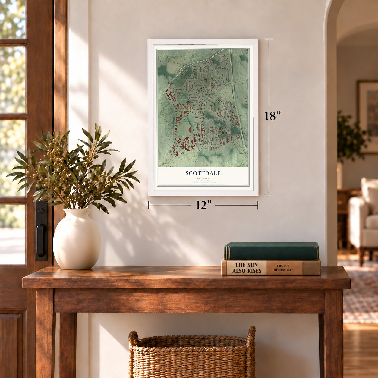
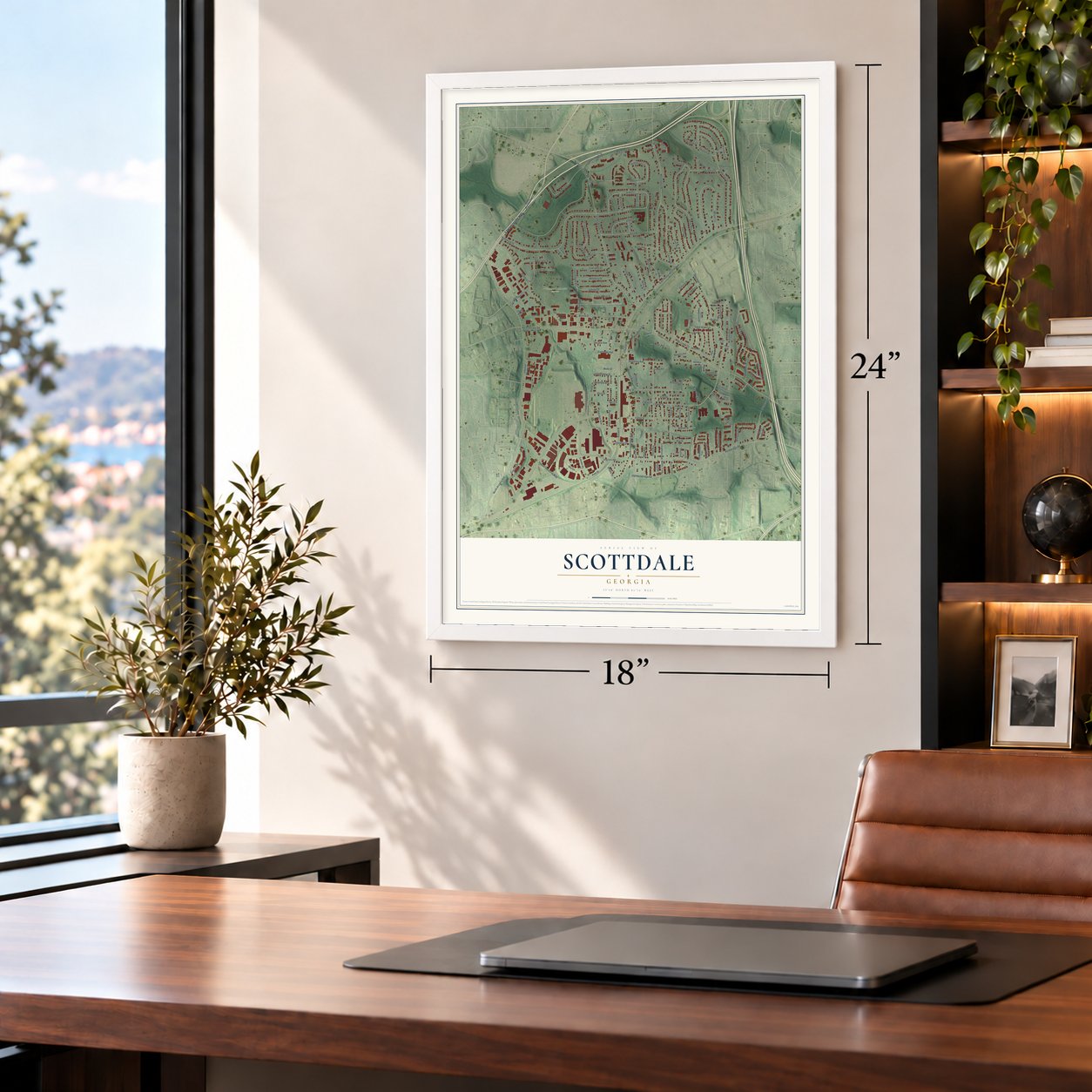
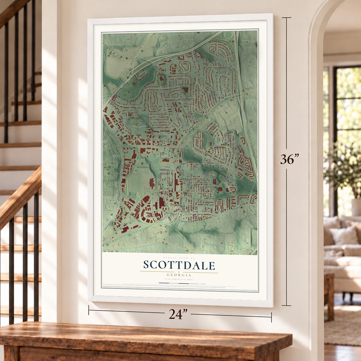
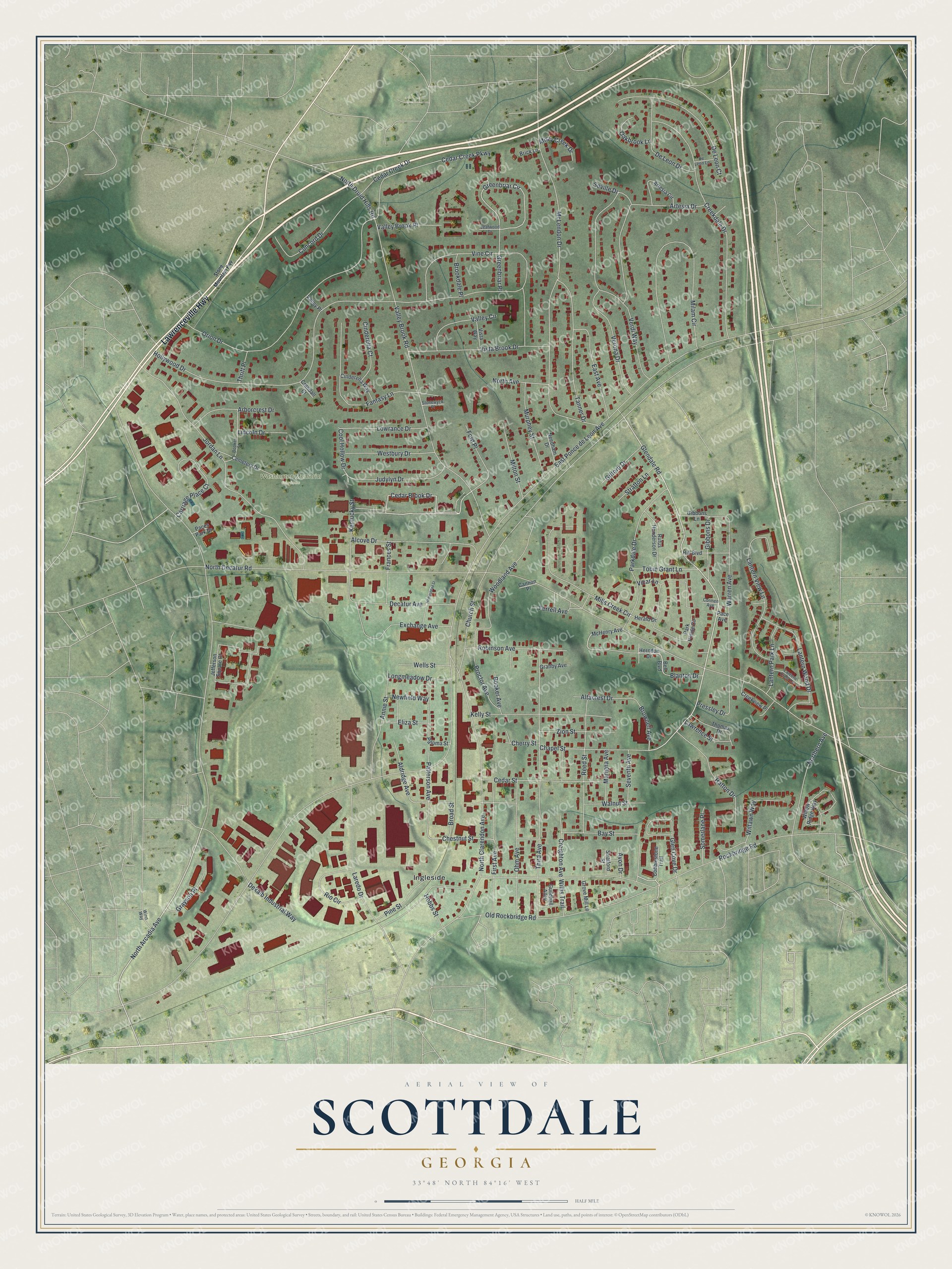
A new map of Scottdale, Georgia, made in 2026 and printed to order on thick archival matte paper.
12" x 18" Archival Matte Print
A Map of Home. A Work of Art.
Explore Scottdale, Georgia from a whole new perspective. Created using aerial imagery and detailed geographic data, this map captures Scottdale building by building, with labeled streets, familiar landmarks, and shaded topographical relief that highlights the natural contours of the landscape.
Combining modern data with the timeless character of a vintage atlas, this map is just as interesting up close as it is beautiful on the wall. Whether you grew up in Scottdale, spent memorable years there, or call it home today, this unique map is a great way to celebrate a place that means something to you. Zoom in on the preview to look for your street, and then order a print to put your memories on the wall.
Three ways to hang it
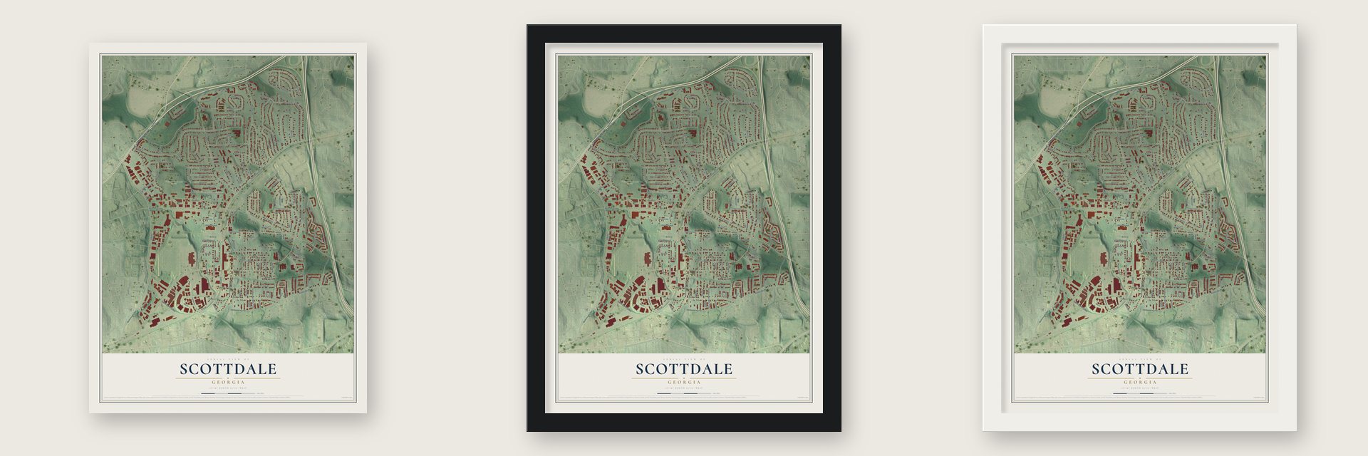
Unframed archival matte, a black wood frame or a white wood frame.
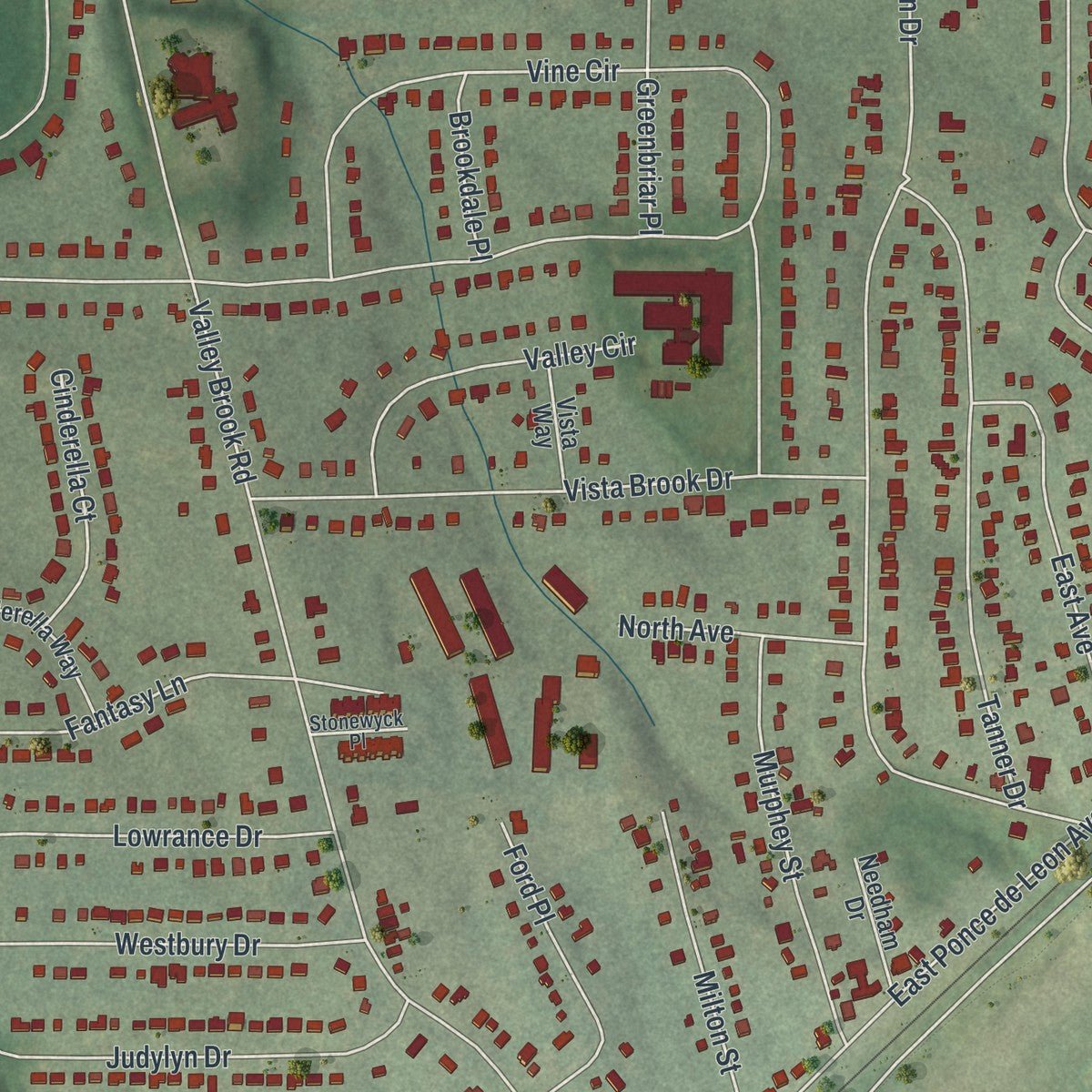
Up close
Geography Worth Displaying
This map was created using accurate cartographic data and authoritative geographic sources, including the U.S. Geological Survey (USGS) and FEMA. The map brings together terrain, waterways, roads, and building detail. The majority of the streets are labeled, houses are accurately depicted, and the topography is derived from government sources. Combining local data with carefully composed color and shading leads to this beautifully detailed Scottdale artwork for your wall.
Rather than simply showing street outlines, we’ve included as many of the street names as we could reasonably fit on the map while keeping their names legible. Zoom in on the high resolution preview to see exactly what’s on the map. We truly set out to create a statement piece for anyone who loves Scottdale. So whether it’s for you, or a gift for someone you love, we hope this map of Scottdale brings back fond memories.
Explore the full map of Scottdale, Georgia and read about the local places it shows.
About Scottdale, Georgia
Scottdale is an unincorporated community of 10,698 people in DeKalb County, about 7 miles east of downtown Atlanta. It takes its name from Colonel George Washington Scott, who came to DeKalb County from Florida and opened the Scottdale Cotton Mill in the late 1800s. The mill and the houses built around it for the people who worked there became the core of the community.
For generations the mill set the rhythm of life in Scottdale, from the work shifts to the weekend ball games. It finally closed in 1982, and its workers moved on to jobs in other parts of metro Atlanta. Today the community's business district runs along East Ponce de Leon Avenue, which cuts across Scottdale from southwest to northeast.
- Colonel Scott's road to DeKalbBefore he founded the mill, George Washington Scott owned a plantation in Florida, fought for the Confederate Army and lost a race for governor. After he settled in DeKalb County he also gave money to a female seminary, and that school grew into Agnes Scott College.
- A mill with a ball teamThe Scottdale Manufacturing Company sponsored a baseball team of its own from the 1920s into the 1940s. The mill closed in 1982.
- The Tobie Grant communityThe philanthropist Tobie Grant gave several acres of land to African Americans who had been shut out of voting and had no work, and the neighborhood that grew there was named for her. Oak Forest Apartments opened with the same purpose in 1968, and Tobie Grant Park, with its pool and recreation center, still carries her name.
- East Ponce de Leon AvenueScottdale's main commercial street is home to Your DeKalb Farmers Market, antique shops, auto body shops and industrial buildings. Work to rehabilitate the avenue began in 2007.
Find your street
Names on the Scottdale map
Every name below is printed on this map. Look for your street, your school, the park where you played, or the pond down the road.
Places and landmarks2
- Washington Memorial Gardens
- Ingleside
Streets and roads152
- Lawrenceville Highway
- North Arcadia Avenue
- Glendale Road
- Cedar Brook Drive
- Reed Street
- Walnut Street
- Greenbriar Circle
- Chestnut Street
- Brownell Avenue
- East Ponce de Leon Avenue
- North Decatur Road
- Dekalb Industrial Way
- Hollywood Drive
- Rockbridge Road
- McLendon Drive
- Valley Brook Road
- North Clarendon Avenue
- Jordan Lane
- Orion Drive
- Third Avenue
- Milam Circle
- Creekdale Drive
- Vine Circle
- Verdi Way
- Warren Avenue
- Old Rockbridge Road
- Robinson Avenue
- Lantern View Lane
- Mills Creek Circle
- Fantasy Lane
Show all 152 streets
- Parkdale Drive
- Laredo Drive
- Tanner Drive
- Ohm Avenue
- Seville Drive
- De Leon Court
- Cedar Street
- Vista Brook Drive
- Kelly Street
- Woodland Avenue
- Cedar Creek Parkway
- Alcove Drive
- Lantern Wood Drive
- Patterson Avenue
- Kentucky Street
- Concord Drive
- Verona Drive
- First Avenue
- Glen Cove Drive
- Hatton Drive
- Annie Street
- Chapel Street
- Northern Avenue
- Exchange Avenue
- Judylyn Drive
- Church Street
- East Avenue
- Wells Street
- Carriage Place Court
- De Leon Drive
- Decatur Avenue
- Murphey Street
- Creighton Avenue
- Proctor Avenue
- Westbury Drive
- Rio Circle
- Lowrance Drive
- Aldridge Avenue
- Arborcrest Drive
- Wilfawn Way
- Valley Circle
- Cedar Creek Drive
- Ford Place
- Milton Street
- Bay Street
- Zion Street
- Artesia Drive
- Pine Street
- Lantern Park Lane
- Gifford Drive
- Altacrest Drive
- Grayson Place
- Greenbriar Place
- Tobie Grant Lane
- Gibbons Drive
- Valley Brook Place
- Longmeadow Drive
- Cinderella Court
- Frances Street
- Somerlane Place
- North Avenue
- Booker Avenue
- Oakbrook Lane
- Marigna Avenue
- North Druid Hills Road
- Ferrell Avenue
- Seventh Avenue
- Lawrence Street
- Cool Hollow Drive
- Stratton Lane
- Lincoln Drive
- Misty Creek Drive
- Eliza Street
- Brookdale Place
- Newfield Way
- Cherry Street
- Blanton Drive
- Willis Trail
- Hobbs Street
- Broad Street
- Pressley Drive
- Thrift Place
- Avon Drive
- Vicar Lane
- Cobblestone Trail
- Herndon Drive
- Bell Boulevard
- Willow Ridge Way
- McHenry Avenue
- Park Pointe Circle
- Jefferson Square Court
- Cemetery Drive
- Artesia Circle
- Rufus Henderson Drive
- Gibbons Lane
- Cinderella Way
- Hill Boulevard
- Creekview Place
- Thomas Drive
- Grove Mill Lane
- Needham Drive
- Vista Way
- Granby Avenue
- Paloma Street
- Herald Drive
- Stratford Street
- Paces Park Drive
- Guildhall Alley
- Brick Lane
- Valley Place
- Crandall Court
- Cannon Place
- Pace Avenue
- Lantern Crest Cv
- Booker Street
- De Leon Lane
- Stonewyck Place
- Leafwood Drive
- Winn Way
- Cormen Avenue
- Stone Mountain Fwy
- Hempstead Street
Names are listed as they appear on the printed map. Zoom into the product photos to find them.
The art of mapping a place
How This Map Was Made
Real places. Remarkable detail. Discover the layers that turn geographic data into a map of home.

The view from above
Aerial imagery reveals the character of the land: woodland, open fields, and the patterns of a place.

The shape of the land
Elevation data brings hills, valleys, and subtle changes in the landscape into view.

The details of home
Roads, waterways, and building footprints come together to make the map feel unmistakably local.

Geography becomes art
Considered color, shading, and typography bring the layers together in a map made for your wall.


Process illustrated with Mendon, Massachusetts. Aerial imagery: USDA NAIP. Terrain: USGS 3D Elevation Program. Map details and finished artwork: KNOWOL.
The Details
About This Print
Choose an archival matte print, or a black or white Ayous wood frame. The archival matte print is unframed.
Select your size and finish above to see the matching product image and price.
Materials & Craftsmanship
A contemporary map with the character of a classic atlas, printed on archival matte paper. Optional frames are made from Ayous wood.
Your printed map does not include the watermark shown in the full-map preview.
Shipping & Delivery
Free shipping within the United States. Every print is made to order in the USA.
Buying a gift? Add a note in your cart and we'll include it. We never put prices in the package.
Prints ship within 2 to 3 business days. Allow 7 to 10 days total from ordering for delivery. Timing may vary during holidays or periods of high order volume.
Read our shipping policy.
Returns and damaged prints
Each print is made to order. Change-of-mind refunds are not available after production.
If your print arrives damaged, misprinted or incorrect, contact support@knowol.com within 30 days of receiving it. Include your order number, photos and a description of the issue.
Read our full refund and replacement policy. For questions about your order, email support@knowol.com.
Find your town
Looking for another city?
Find a map of home in our Georgia collection, or any town in the country.
Nearby
Maps of towns near Scottdale
Know someone from one of these towns? Their map makes a great gift.
 North Decatur
, Georgia
From $39.99See the map
 Avondale Estates
, Georgia
From $39.99See the map
 Clarkston
, Georgia
From $39.99See the map
More maps nearby: Decatur, Belvedere Park, Emory, Pine Lake and Druid Hills.