
Search for another town



Free U.S. delivery 7 to 10 days after you order
Oro Valley, Arizona Map Art
Building by building, with labeled streets and shaded relief.
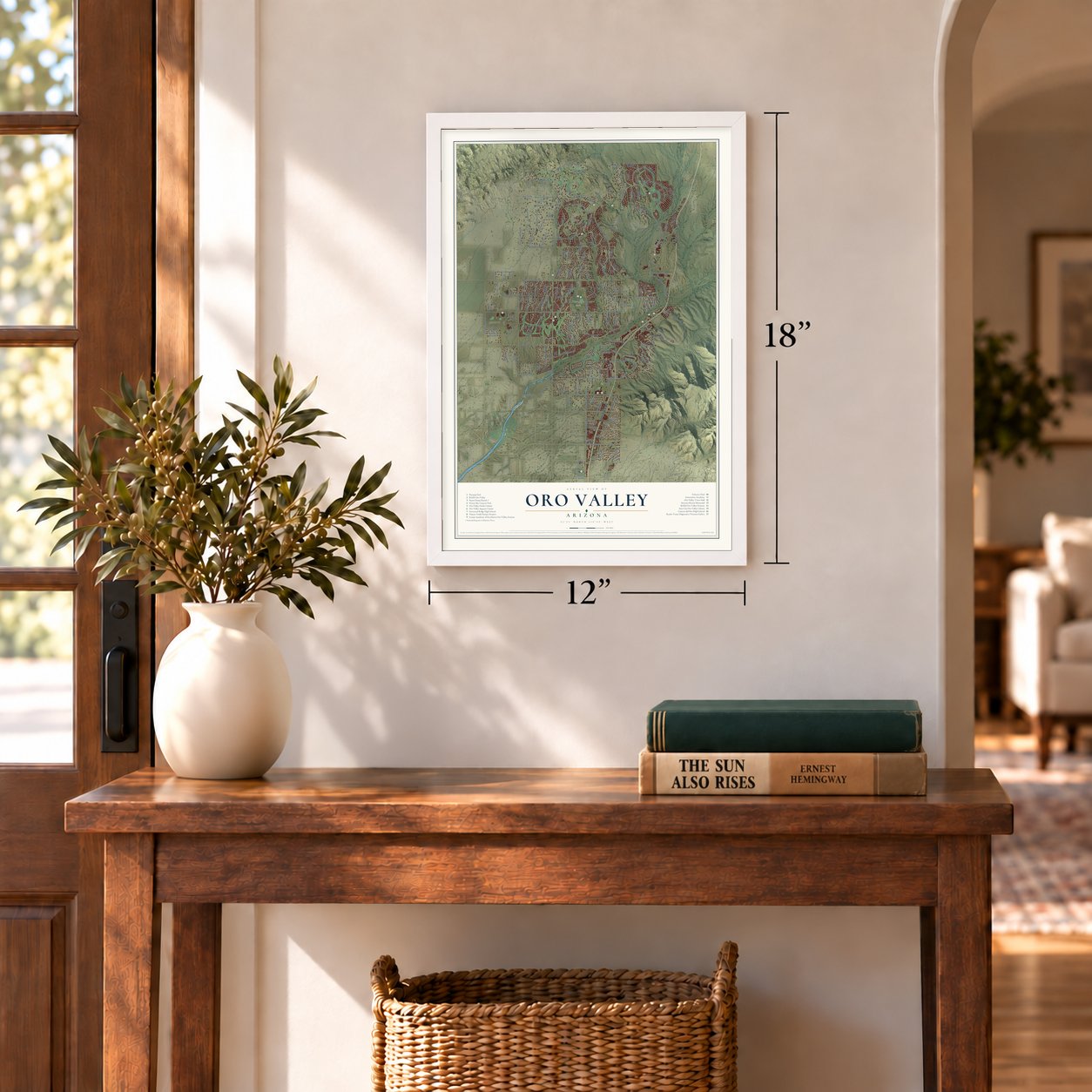
12" x 18" Archival Matte Print
A Map of Home. A Work of Art.
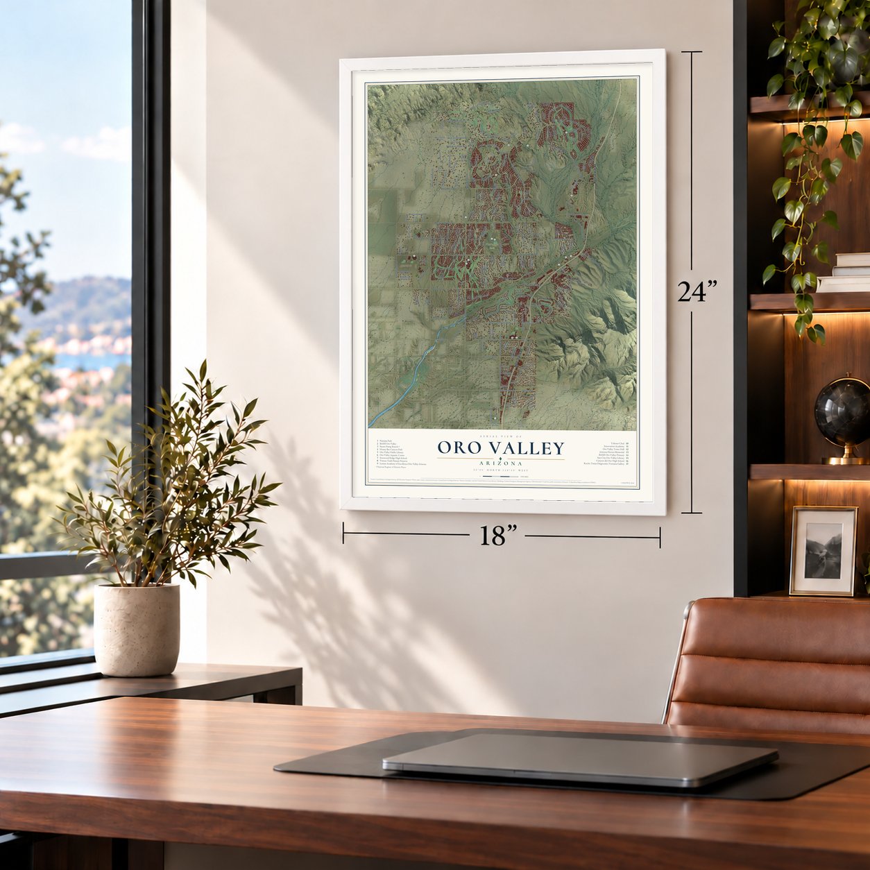
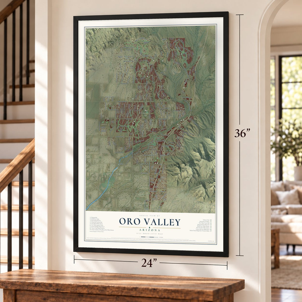
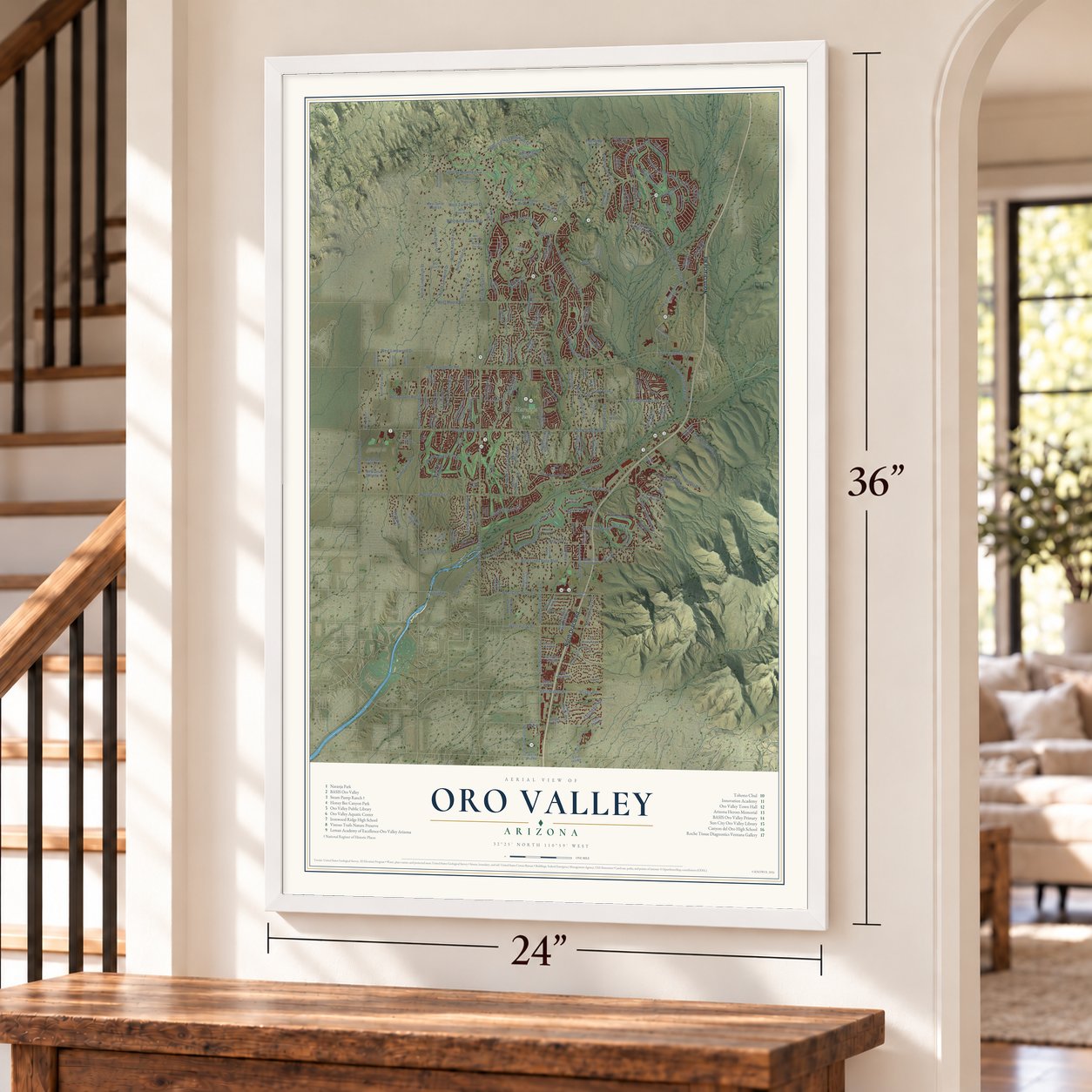
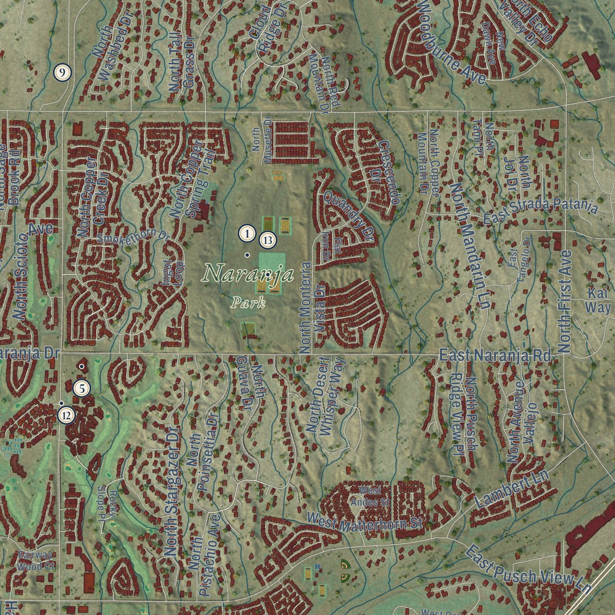
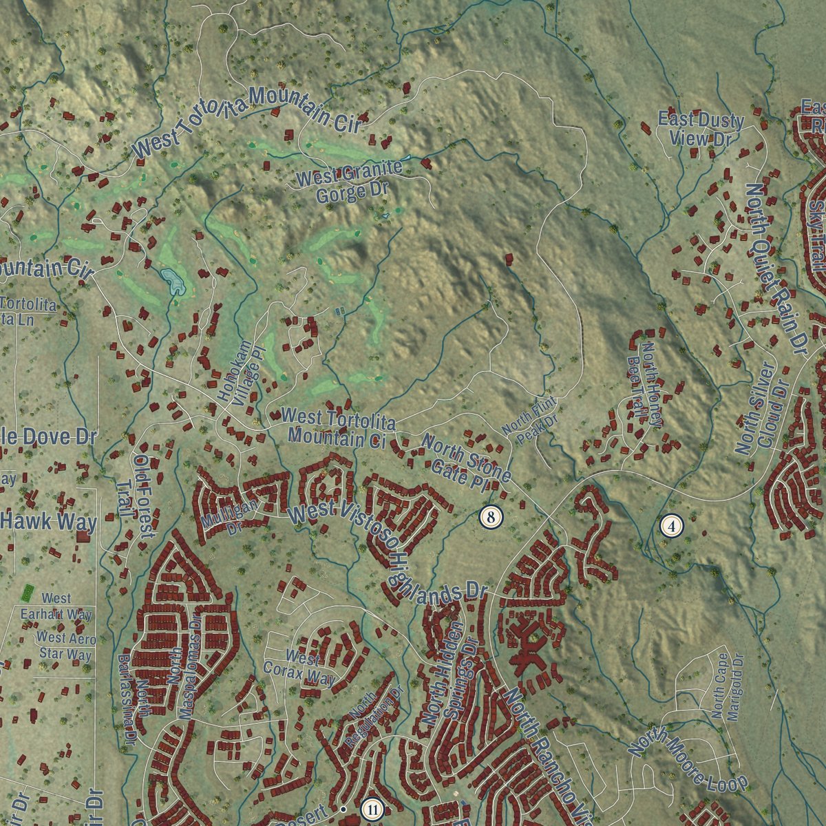
Explore Oro Valley, Arizona from a whole new perspective. Created using aerial imagery and detailed geographic data, this map captures Oro Valley building by building, with labeled streets, familiar landmarks, and shaded topographical relief that highlights the natural contours of the landscape.
Combining modern data with the timeless character of a vintage atlas, this map is just as interesting up close as it is beautiful on the wall. Whether you grew up in Oro Valley, spent memorable years there, or call it home today, this unique map is a great way to celebrate a place that means something to you. Zoom in on the preview to look for your street, and then order a print to put your memories on the wall.

Three ways to hang it
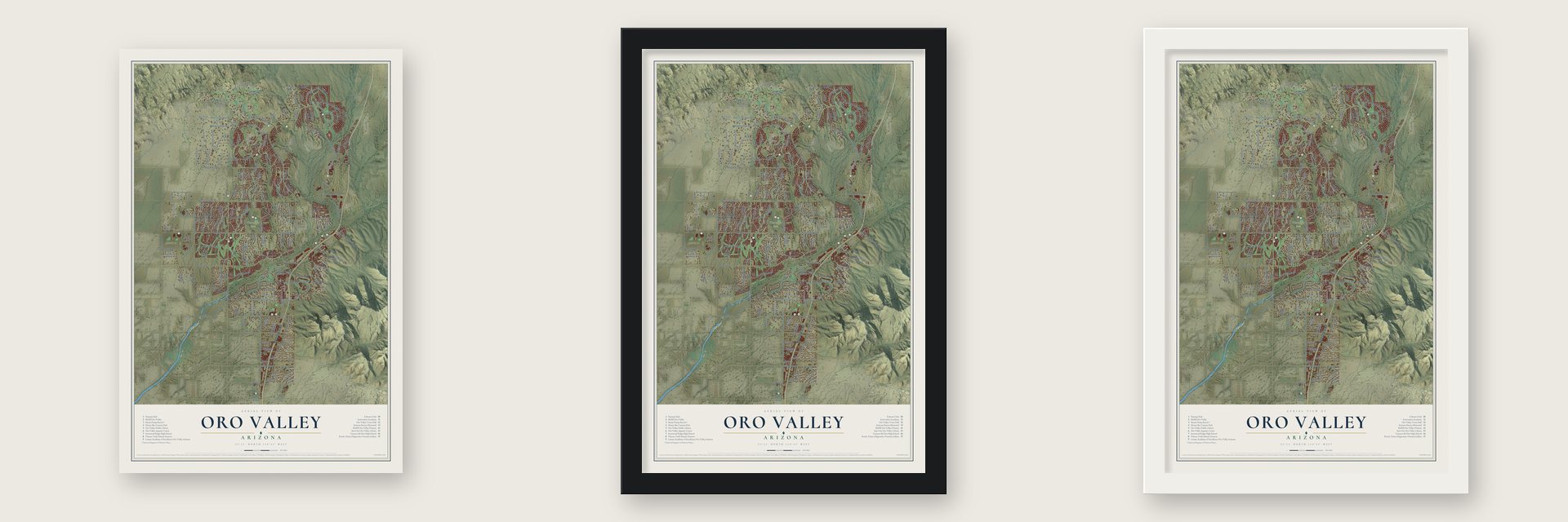
Unframed archival matte, a black wood frame or a white wood frame.
Up close
Geography Worth Displaying
This map was created using accurate cartographic data and authoritative geographic sources, including the U.S. Geological Survey (USGS) and FEMA. The map brings together terrain, waterways, roads, and building detail. The majority of the streets are labeled, houses are accurately depicted, and the topography is derived from government sources. Combining local data with carefully composed color and shading leads to this beautifully detailed Oro Valley artwork for your wall.
Rather than simply showing street outlines, we’ve included as many of the street names as we could reasonably fit on the map while keeping their names legible. Zoom in on the high resolution preview to see exactly what’s on the map. We truly set out to create a statement piece for anyone who loves Oro Valley. So whether it’s for you, or a gift for someone you love, we hope this map of Oro Valley brings back fond memories.
Explore the full map of Oro Valley, Arizona and read about the local places it shows.
Find your street
Names on the Oro Valley map
Every name below is printed on this map. Look for your street, your school, the park where you played, or the pond down the road.
Places and landmarks1
- Naranja Park
Streets and roads213
- North Oracle Road
- North Verch Way
- West Magee Road
- Magee Road
- East Naranja Road
- North La Canada Drive
- East Rancho Vistoso Boulevard
- North La Cholla Boulevard
- West Tortolita Mountain Circle
- West Naranja Drive
- West Tangerine Road
- West Lambert Lane
- West Moore Road
- North First Avenue
- East Tangerine Road
- North Rancho Vistoso Boulevard
- North Shannon Road
- North Woodburne Avenue
- North La Reserve Drive
- North Northern Avenue
- North Del Webb Boulevard
- North Kingair Drive
- Tortolita Mountain Circle
- West Cll Concordia
- West Vistoso Highlands Drive
- West Canada Hills Drive
- North Calle Buena Vis
- West Linda Vista Boulevard
- West Glover Road
- North Lindbergh Drive
Show all 213 streets
- East Ponticello Bl
- North Stargazer Drive
- West Limewood Drive
- West Hardy Road
- North Innovation Market Drive
- West Kitty Hawk Way
- North Mandarin Lane
- West Turtle Dove Drive
- West Golf View Drive
- East Palisades Road
- East El Conquistador Way
- Hacienda Hermosa Drive
- Cam Diestro
- North Kachina Drive
- North Sun City Boulevard
- Congressional Way
- Lambert Lane
- North Pilot Drive
- North Quiet Rain Drive
- North Piper Drive
- North Cross Road
- East Suffolk Drive
- West Greenock Drive
- North Scioto Avenue
- East Buck Ridge Place
- East Pusch View Lane
- North Tailwind Drive
- North Egleston Drive
- La Tanya Drive
- North Riviera Drive
- West Lucero Road
- Eagleview Drive
- West Valle del Oro Road
- East Innovation Park Drive
- North Village Avenue
- West Tortolita Mountain Ci
- North Copper Spring Trail
- North Cll Loma Linda
- North Monterra Vista Drive
- North Copper Creek Drive
- West Turtle Dove Lane
- North Mountain Breeze Drive
- North Vis del Sol
- North Canada Drive
- East Strada Patania
- North Lobelia Way
- North Silver Cloud Drive
- North Moore Loop
- North Poinsettia Drive
- North Cll el Milagro
- North Rancho Feliz Drive
- East Crown Ridge Drive
- North Hidden Springs Drive
- North Shadow Mountain Drive
- North Avenue Vallejo
- Old Forest Trail
- North Lost Arrow Drive
- North Labyrinth Drive
- East Pushwilderness Drive
- North Piping Rock Road
- West Atua Place
- North Guava Drive
- West Granite Gorge Drive
- North Wild Creek Drive
- North Charoleau Drive
- Cloud Ridge Drive
- West Desert Fairway Drive
- East Linda Vista Boulevard
- North Wide View Drive
- North Buckingham Drive
- North Desert Whisper Way
- West Matterhorn Street
- North Pso del Norte
- North Tall Grass Drive
- North Washbed Drive
- Arrowsmith Drive
- West Saddlehorn Drive
- North Corsair Drive
- East Pla Meseta Dorada
- North Flying Bird Drive
- North Pusch Ridge View Place
- North Stone Gate Place
- West Owl Vista Place
- North Raleigh Drive
- North Sage Brook Road
- North Fawnbrooke Drive
- North Morgan Ranch Road
- West Desert Splendor Court
- North Copperstone Drive
- North Luzon Court
- East Dusty View Drive
- North Joi Drive
- North Cll Solano
- North La Quinta Drive
- North Echo Valley Drive
- North Sky Trail
- Vistoso Village Drive
- West Overton Road
- East Mellow Trail
- North Pistachio Avenue
- Bighorn Butte Drive
- West Cam Cortaro
- North Overlook Drive
- Crescendo Drive
- West Ina Road
- Quandry Drive
- West Owl Head Place
- West Cool Drive
- Cll Almendra
- East Eton Drive
- Vis Mountain
- Cactus Rose Drive
- East Ina Road
- Kai Way
- Par Drive
- Anly Boulevard
- Valle del Oro Road
- North Barlassina Drive
- North Rancho Catalina Avenue
- North Coyote Blue Court
- North Copper Mountain Drive
- North Cassiopeia Drive
- North Via de la Verbenita
- North Red Mountain Drive
- West Oak Shadows Drive
- North Honey Bee Trail
- North Choctaw Drive
- East Linda Vista Road
- East Ruellia Drive
- North Pso Corona
- Buck Ridge Drive
- Smokethorn Drive
- North Hawk Canyon Trail
- North Maspalomas Drive
- West Tortolita Vista Lane
- East Stone Stable Drive
- West Sculptor Street
- West Suffolk Drive
- East Cliff Dweller Drive
- East Glenhurst Drive
- North Engle Hill Drive
- North Como Drive
- North Cam del Fierro
- North Korte Lane
- West Niner Way
- Running Coyote Drive
- West Corax Way
- Hohokam Village Place
- North Red Eagle Drive
- North Tami Place
- Ingot Loop
- Mulligan Drive
- West Oro Valley Drive
- North Trade Winds Way
- North Westward Look Drive
- East Tangelo Drive
- West Cessna Way
- East Cll Concordia
- North Vistoso Park Road
- West Earhart Way
- North Ridge Shadow Place
- North Broadstone Drive
- North Cape Marigold Drive
- North Yellow Bird Road
- New Dawn Avenue
- Pla Meseta de Oro
- Rocky Slope Place
- North Regulation Drive
- North Cam del Plata
- West Cam Fairhaven
- West Chapala Drive
- West Valoro Drive
- North Cam Valdeflores
- Ironwood Canyon Place
- North Musette Drive
- North Flint Peak Drive
- West Aero Star Way
- Rimrock Place
- North Colony Drive
- Fairway Wood Court
- West Andes Street
- Nine Iron Drive
- Flat Iron Drive
Names are listed as they appear on the printed map. Zoom into the product photos to find them.
About Oro Valley, Arizona
Oro Valley is a town of 47,070 people in Pima County, 6 miles north of Tucson, in the foothills on the western side of the Santa Catalina Mountains, below Pusch Ridge. In the late 1960s Tucson Mayor James M. Corbett Jr. wanted to push his city's limits north, and he promised to bring the valley into Tucson "kicking and screaming." Residents who wanted local control answered with a petition to incorporate in 1968.
The Pima County Board of Supervisors turned the petition down, so the residents sued, and the Arizona Supreme Court sided with them. The founders had planned to call the town Palo Verde, but they chose Oro Valley instead to gain the support of the powerful residents around the Oro Valley Country Club. The town was incorporated in 1974 on 2.4 square miles with nearly 1,200 people. It had 6,670 people by 1990 and 29,700 by 2000, and for several years in the 1990s no municipality in Arizona grew faster.
- Steam Pump Ranch, 1874German immigrant George Pusch founded a cattle ranch in 1874. A steam engine, one of just two in the Arizona Territory, pumped its water and gave the ranch its name. His family came by often but never lived there, leaving hired caretakers in charge, and travelers on the Tucson road stopped to rest. Pusch later served in the Arizona legislature and the 1910 constitutional convention. Pusch Ridge bears his name, and his family's company kept the ranch until 1925.
- Honeybee VillageAround AD 450 the Hohokam built Honeybee Village at the town's northern edge, in the Tortolita foothills, and lived there for nearly 800 years. Archaeologists worldwide still study its artifacts. Today the site is a historical park, managed jointly by the town, Pima County and the Oro Valley Historical Society.
- Francisco Romero's ranchIn 1869 Francisco Romero, whose Hispanic family had lived in Tucson since the early 1800s, set up a ranch in what is now Catalina State Park. He raised his ranch buildings on the foundations of a Hohokam ruin that also holds a Mesoamerican ballcourt. Romero lived there off and on until his death in 1905, and his family kept land in the area until 1930.
- The Canyon of GoldThe Cañada del Oro, whose Spanish name means "Canyon of Gold," cuts through the center of town, and most of the time no water runs in its bed. As early as the 17th century, Spanish explorers came looking for gold along it. Later prospectors went hunting for the Lost Mine with the Iron Door, a legend Harold Bell Wright turned into a 1923 novel, but little gold ever turned up here.
- A countess's winter homeOnce federal land surveys were complete, homesteaders filed claims here between 1903 and the 1940s. In 1937 Margaret Howard, Countess of Suffolk, built a house for her winters in the area later known as the Suffolk Hills neighborhood. Her former mansion now houses Immaculate Heart Preparatory School.
Keep exploring Arizona
Oro Valley is one of 525 Arizona towns we've mapped. Every dot on the map is a print of its own.
The search covers every state, Arizona first.
Near Oro Valley
Order 2 or more town maps and save 10%. Shown in the size and finish you picked above, so they hang as a set.
- Casas Adobes 12" x 18" / Archival Matte Print $39.99
- Catalina 12" x 18" / Archival Matte Print $39.99
- Tortolita 12" x 18" / Archival Matte Print $39.99
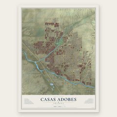

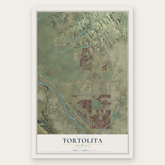
More maps nearby: Flowing Wells, Marana, Catalina Foothills, Rillito and Saddlebrooke.
The art of mapping a place
How This Map Was Made
Real places. Remarkable detail. Discover the layers that turn geographic data into a map of home.

The view from above
Aerial imagery reveals the character of the land: woodland, open fields, and the patterns of a place.

The shape of the land
Elevation data brings hills, valleys, and subtle changes in the landscape into view.

The details of home
Roads, waterways, and building footprints come together to make the map feel unmistakably local.

Geography becomes art
Considered color, shading, and typography bring the layers together in a map made for your wall.


Process illustrated with Mendon, Massachusetts. Aerial imagery: USDA NAIP. Terrain: USGS 3D Elevation Program. Map details and finished artwork: KNOWOL.
The Details
About This Print
Choose an archival matte print, or a black or white Ayous wood frame. The archival matte print is unframed.
Select your size and finish above to see the matching product image and price.
Materials & Craftsmanship
A contemporary map with the character of a classic atlas, printed on archival matte paper. Optional frames are made from Ayous wood.
Your printed map does not include the watermark shown in the full-map preview.
Shipping & Delivery
Free shipping within the United States. Every print is made to order in the USA.
Buying a gift? Add a note in your cart and we'll include it. We never put prices in the package.
Prints ship within 2 to 3 business days. Allow 7 to 10 days total from ordering for delivery. Timing may vary during holidays or periods of high order volume.
Read our shipping policy.
Returns and damaged prints
Each print is made to order. Change-of-mind refunds are not available after production.
If your print arrives damaged, misprinted or incorrect, contact support@knowol.com within 30 days of receiving it. Include your order number, photos and a description of the issue.
Read our full refund and replacement policy. For questions about your order, email support@knowol.com.