


Search for another town





Free U.S. delivery 7 to 10 days after you order
Pacific Grove, California Map Art
Building by building, with labeled streets and shaded relief.
12" x 18" Archival Matte Print
A Map of Home. A Work of Art.
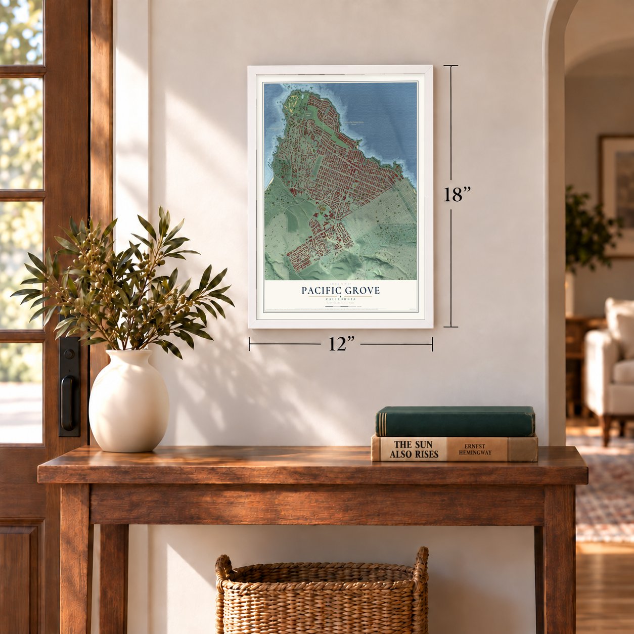
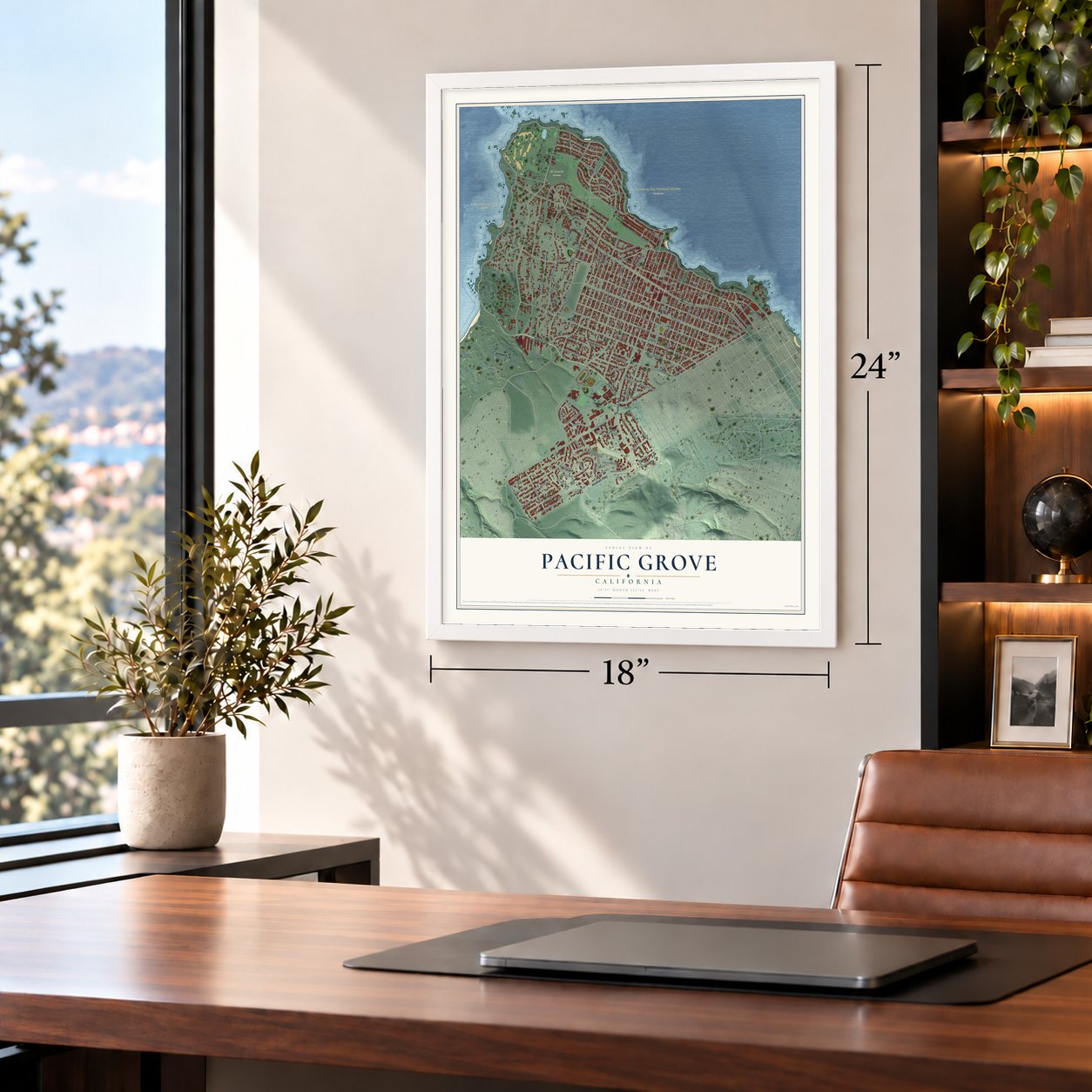
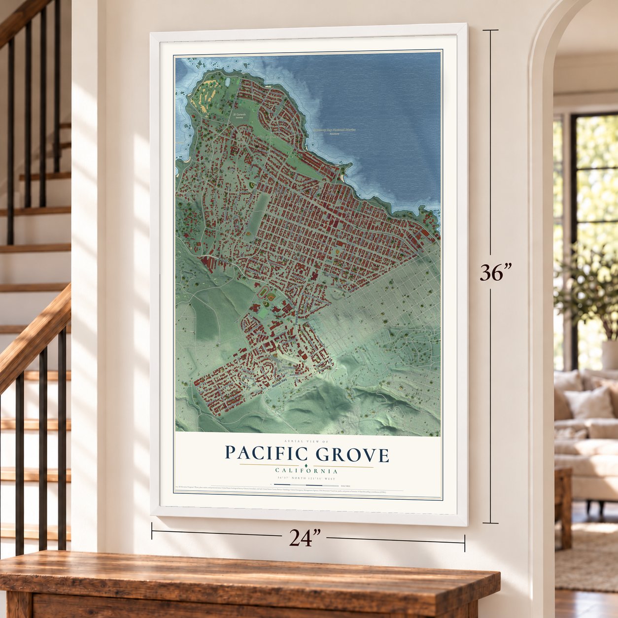
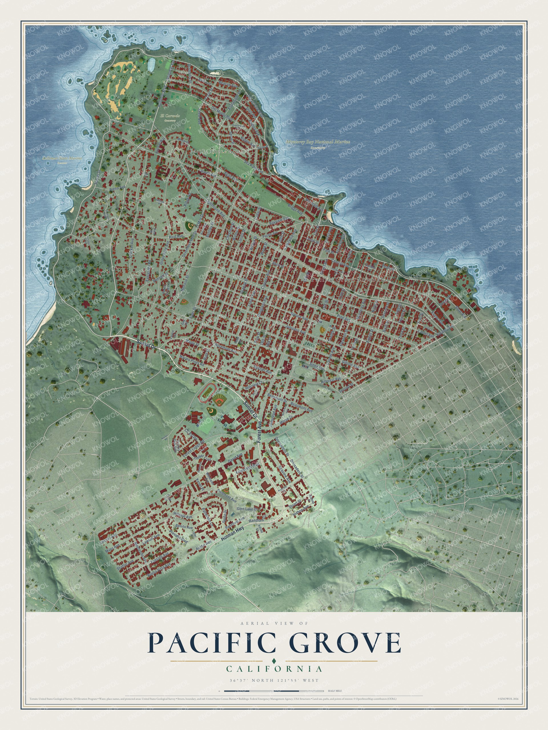
Explore Pacific Grove, California from a whole new perspective. Created using aerial imagery and detailed geographic data, this map captures Pacific Grove building by building, with labeled streets, familiar landmarks, and shaded topographical relief that highlights the natural contours of the landscape.
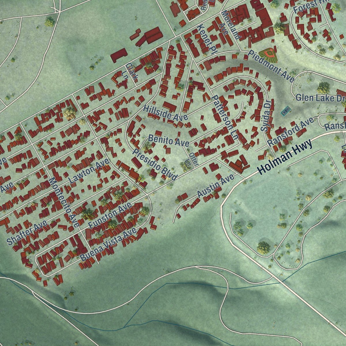
Combining modern data with the timeless character of a vintage atlas, this map is just as interesting up close as it is beautiful on the wall. Whether you grew up in Pacific Grove, spent memorable years there, or call it home today, this unique map is a great way to celebrate a place that means something to you. Zoom in on the preview to look for your street, and then order a print to put your memories on the wall.
Three ways to hang it
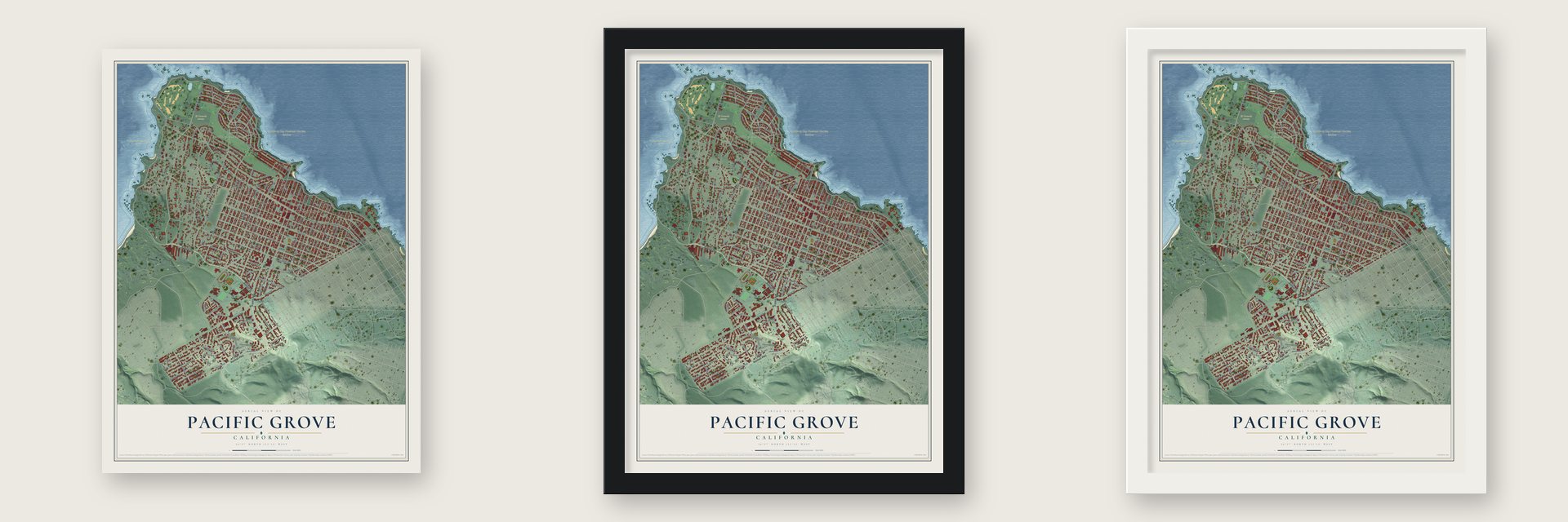
Unframed archival matte, a black wood frame or a white wood frame.
Up close
Geography Worth Displaying
This map was created using accurate cartographic data and authoritative geographic sources, including the U.S. Geological Survey and the Census Bureau. The map brings together terrain, waterways, roads, and building detail. The majority of the streets are labeled, houses are accurately depicted, and the topography is derived from government sources. Combining local data with carefully composed color and shading leads to this beautifully detailed Pacific Grove artwork for your wall.
Rather than simply showing street outlines, we’ve included as many of the street names as we could reasonably fit on the map while keeping their names legible. Zoom in on the high resolution preview to see exactly what’s on the map. We truly set out to create a statement piece for anyone who loves Pacific Grove. So whether it’s for you, or a gift for someone you love, we hope this map of Pacific Grove brings back fond memories.
Read the story behind this map of Pacific Grove, California from 2026.

Find your street
Names on the Pacific Grove map
Every name below is printed on this map. Look for your street, your school, the park where you played, or the pond down the road.
Places and landmarks5
- Pacific Grove Town Hall
- Pacific Grove Acres
- Asilomar State Marine Reserve
- El Carmelo Cemetery
- Monterey Bay National Marine Sanctuary
Streets and roads156
- Sunset Drive
- Forest Avenue
- Holman Highway
- Ocean View Boulevard
- Asilomar Avenue
- Asilomar Boulevard
- Sinex Avenue
- Spruce Avenue
- 20th Street
- Lighthouse Avenue
- Funston Avenue
- Balboa Avenue
- Pine Avenue
- Central Avenue
- 17 Mile Drive
- Seventeen Mile Drive
- Congress Avenue
- Laurel Avenue
- Jewell Avenue
- David Avenue
- Junipero Avenue
- Del Monte Boulevard
- Crocker Avenue
- Gibson Avenue
- Grove Acre Avenue
- 19th Street
- Cedar Street
- Fountain Avenue
- Walnut Street
- Carmel Avenue
Show all 156 streets
- Second Street
- Short Street
- Pico Avenue
- Eardley Avenue
- 16th Street
- 17th Street
- 18th Street
- Grand Avenue
- Hillcrest Avenue
- Ransford Avenue
- 14th Street
- Monterey Avenue
- Shell Avenue
- Bayview Avenue
- Forest Lodge Road
- Ninth Street
- Buena Vista Avenue
- Alder Street
- Chestnut Street
- Locust Street
- Willow Street
- Granite Street
- Seventh Street
- Wood Street
- Lobos Avenue
- Crest Avenue
- Cypress Avenue
- Park Street
- Twelfth Street
- Lincoln Avenue
- Tenth Street
- Eleventh Street
- Eighth Street
- Presidio Boulevard
- Fourth Street
- Piedmont Avenue
- 13th Street
- Sixth Street
- Ripple Avenue
- Surf Avenue
- Patterson Lane
- Mermaid Avenue
- Miles Avenue
- Seaview Avenue
- 15th Street
- Montecito Avenue
- Devisadero Street
- Divisadero Street
- Forest Hill Boulevard
- Melrose Street
- Maple Street
- First Street
- Marino Pines Road
- Egan Avenue
- Caledonia Avenue
- Glen Lake Drive
- Third Street
- Esplanade Street
- Dennett Street
- Syida Drive
- Fifth Street
- Shafter Avenue
- Morse Drive
- Lawton Avenue
- Sea Palm Avenue
- Evergreen Road
- Beaumont Avenue
- Beaumont Drive
- Evans Avenue
- Sloat Avenue
- Benito Avenue
- Coral Street
- Timber Trail
- Union Street
- Bishop Avenue
- Ridge Road
- Austin Avenue
- Stuart Street
- Hillside Avenue
- Acropolis Street
- Arena Avenue
- Olmstead Avenue
- Rosemont Avenue
- Bentley Street
- Dewey Street
- Spray Street
- Spazier Avenue
- Briggs Avenue
- Hillcrest Court
- Beacon Avenue
- Ransford Circle
- Pearl Street
- Ruth Court
- CC Estate
- Park Place
- Kenet Place
- Country Club Gate
- Pacific Grove Lane
- Pacific Avenue
- Monarch Lane
- Siren Street
- Railroad Way
- Moreland Avenue
- Bishop Place
- Todd Lane
- Garden Lane
- Adobe Lane
- Clark Lane
- Pico Place
- Laurie Circle
- Day Circle
- Redwood Lane
- Prescott Lane
- Petra Lane
- Otter Lane
- Melton Place
- Oak Place
- Quarterdeck Way
- Doc Ricketts Row
- Acacia Street
- McFarland Avenue
- Cll de Los Amigos
- Sage Court
- Walcott Way
- La Calle Corte
- Navajo Road
Names are listed as they appear on the printed map. Zoom into the product photos to find them.
About Pacific Grove, California
Pacific Grove is a city of 15,090 people in Monterey County, at the southern edge of Monterey Bay. Rumsen Ohlone people lived here first, and their grinding stones can still be found in town. In 1833 Governor José Figueroa granted the land to José Abrego, a local merchant, as part of Rancho Punta de Pinos, and Chinese fishermen had settled at Point Alones by 1853.
The town itself began as a Methodist retreat. Reverend J. W. Ross and his wife visited in 1874 and judged the pines, oaks and cypress perfect for camping. Backers then gathered in San Francisco and, on June 1, 1875, organized a group they named the Pacific Grove Retreat Association, which ran a seaside Christian resort on land from the Pacific Improvement Company and David Jacks. In June 1879 the retreat hosted the first Chautauqua in the West, with concerts and "moral attractions." The post office opened for good in 1887, and Pacific Grove was incorporated in 1889.
“I have never been in any place so dreamlike. Indeed, it was not so much like a deserted town as like a scene upon the stage by daylight, and with no one on the boards.”
- A fishing village from 1853Chinese immigrants built a fishing village at Point Alones, between Lover's Point and Monterey, and were the first to see the bay's commercial value. Pushed off the daytime grounds by rivals, they fished for squid at night and started one of California's largest fisheries. The Pacific Improvement Company tried to remove the village in 1905; in 1906 it burned after a fire hose was suspiciously cut. The families scattered, and each May a Walk of Remembrance marks the loss.
- A hotel that became a lodgePacific Grove's first hotel, the El Carmelo, took its first guests on May 20, 1887, on Lighthouse Avenue between Fountain and Grand. The Pacific Improvement Company owned it and renamed it the Pacific Grove Hotel in 1907. After The Lodge at Pebble Beach burned on December 17, 1917, the company took the hotel apart and used its wood to rebuild the lodge. W. R. Holman bought the empty block in 1919 and opened the Holman Department Store there.
- Julia Morgan's AsilomarAsilomar, on the town's western edge, opened in 1913 as a summer retreat for the YWCA. Julia Morgan, the architect of Hearst Castle, designed thirteen of its buildings, and the grounds are now part of the California State Park System.
- Dry until 1969Because of its religious and gated beginnings, Pacific Grove was the last town in California to stay dry. Alcohol was first served to the public on July 4, 1969, at the opening of the Pacific Grove Art Center, months before the change was due to take effect in November. The center's founder, ElMarie Dyke, had herself fought to keep the town dry. Pacific Grove still has no stand-alone bars.
- The monarchs come backMonarch butterflies fly 1,200 miles from the Rocky Mountains to spend the fall and winter in Pacific Grove's pines and eucalyptus, many of them in the Monarch Grove Sanctuary. The city fines anyone $1000 for bothering them, and it celebrates their return with a Butterfly Parade in early October.
Keep exploring California
Pacific Grove is one of 1,990 California towns we've mapped. Every dot on the map is a print of its own.
The search covers every state, California first.
Near Pacific Grove
Order 2 or more town maps and save 10%. Shown in the size and finish you picked above, so they hang as a set.
- Monterey 12" x 18" / Archival Matte Print $39.99
- Del Monte Forest 12" x 18" / Archival Matte Print $39.99
- Sand City 12" x 18" / Archival Matte Print $39.99


More maps nearby: Carmel-by-the-Sea, Del Rey Oaks, Seaside, Marina and Carmel Valley Village.
The art of mapping a place
How This Map Was Made
Real places. Remarkable detail. Discover the layers that turn geographic data into a map of home.

The view from above
Aerial imagery reveals the character of the land: woodland, open fields, and the patterns of a place.

The shape of the land
Elevation data brings hills, valleys, and subtle changes in the landscape into view.

The details of home
Roads, waterways, and building footprints come together to make the map feel unmistakably local.

Geography becomes art
Considered color, shading, and typography bring the layers together in a map made for your wall.


Process illustrated with Mendon, Massachusetts. Aerial imagery: USDA NAIP. Terrain: USGS 3D Elevation Program. Map details and finished artwork: KNOWOL.
The Details
About This Print
Choose an archival matte print, or a black or white Ayous wood frame. The archival matte print is unframed.
Select your size and finish above to see the matching product image and price.
Materials & Craftsmanship
A contemporary map with the character of a classic atlas, printed on archival matte paper. Optional frames are made from Ayous wood.
Your printed map does not include the watermark shown in the full-map preview.
Shipping & Delivery
Free shipping within the United States. Every print is made to order in the USA.
Buying a gift? Add a note in your cart and we'll include it. We never put prices in the package.
Prints ship within 2 to 3 business days. Allow 7 to 10 days total from ordering for delivery. Timing may vary during holidays or periods of high order volume.
Read our shipping policy.
Returns and damaged prints
Each print is made to order. Change-of-mind refunds are not available after production.
If your print arrives damaged, misprinted or incorrect, contact support@knowol.com within 30 days of receiving it. Include your order number, photos and a description of the issue.
Read our full refund and replacement policy. For questions about your order, email support@knowol.com.