
Search for another town



Free U.S. delivery 7 to 10 days after you order
Peabody, Massachusetts Map Art
Building by building, with labeled streets and shaded relief.
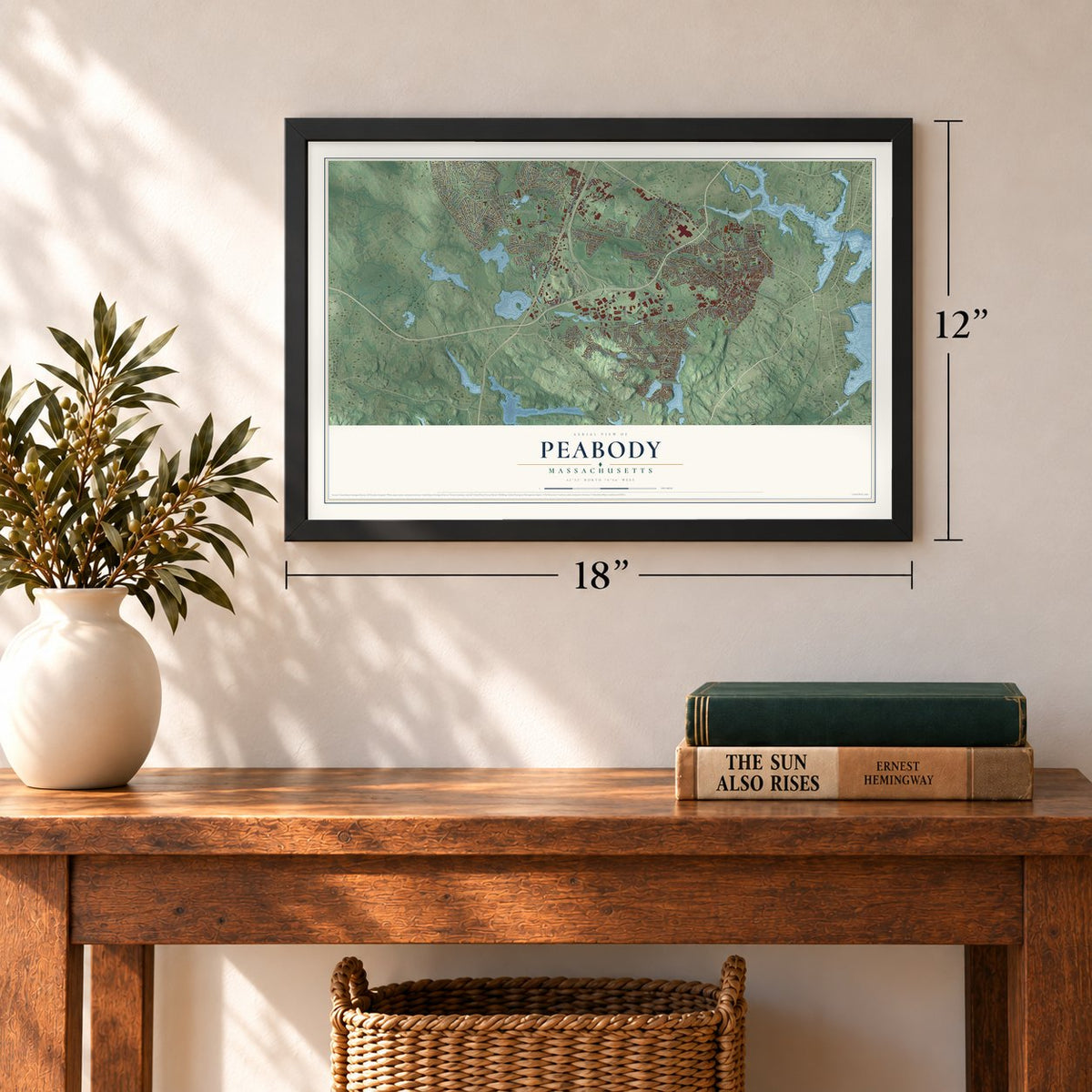
12" x 18" Archival Matte Print
A Map of Home. A Work of Art.
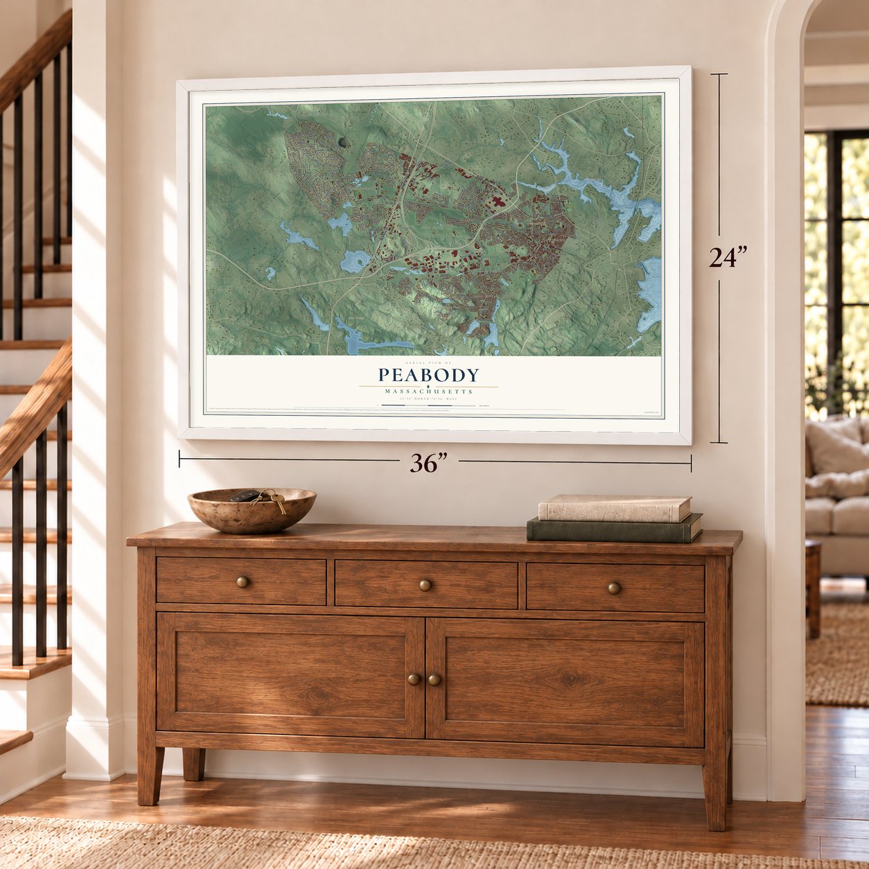
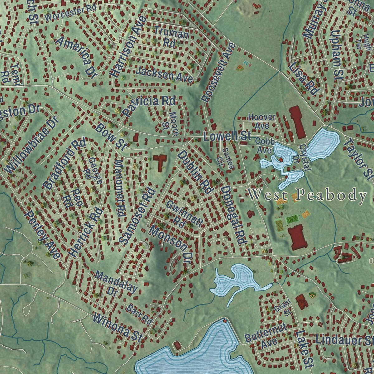
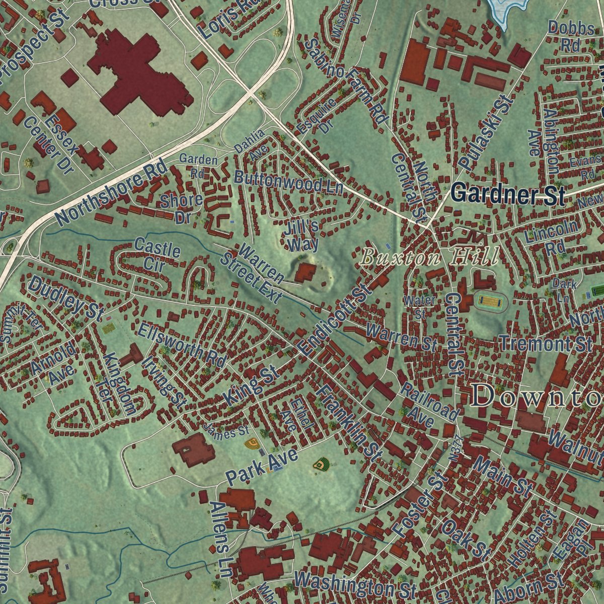
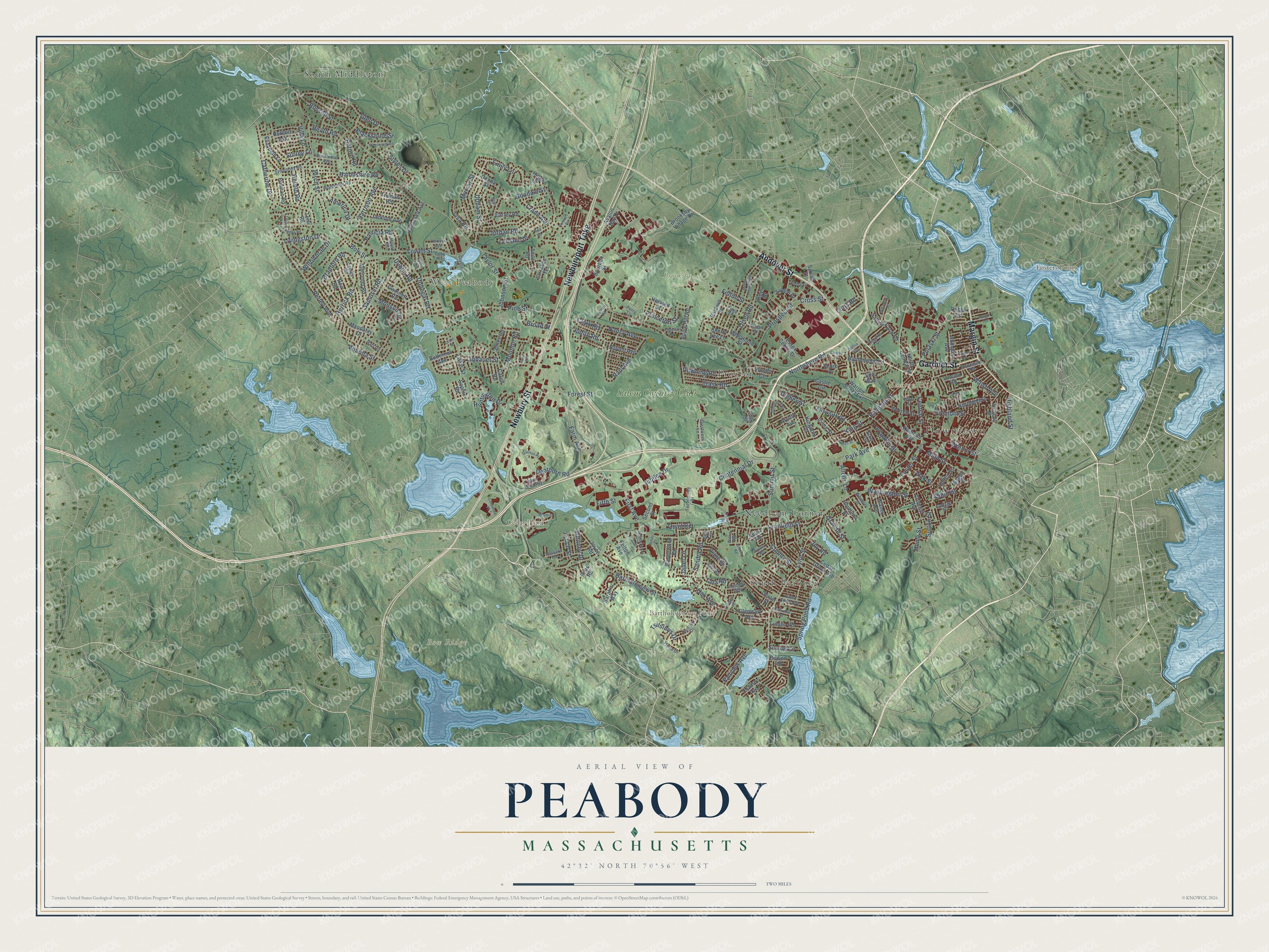
Explore Peabody, Massachusetts from a whole new perspective. Created using aerial imagery and detailed geographic data, this map captures Peabody building by building, with labeled streets, familiar landmarks, and shaded topographical relief that highlights the natural contours of the landscape.
Combining modern data with the timeless character of a vintage atlas, this map is just as interesting up close as it is beautiful on the wall. Whether you grew up in Peabody, spent memorable years there, or call it home today, this unique map is a great way to celebrate a place that means something to you. Zoom in on the preview to look for your street, and then order a print to put your memories on the wall.
Three ways to hang it
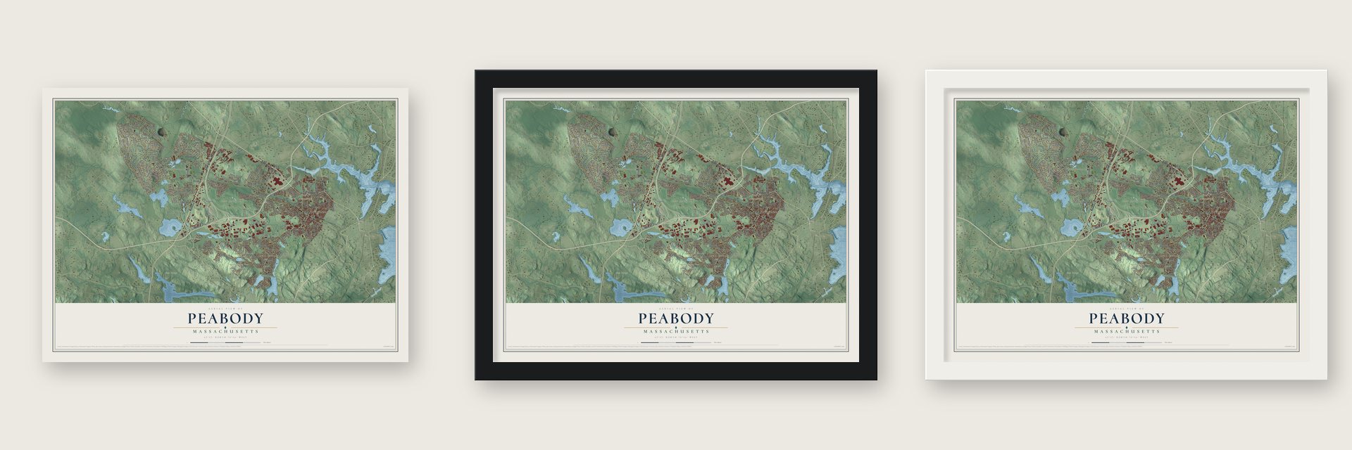
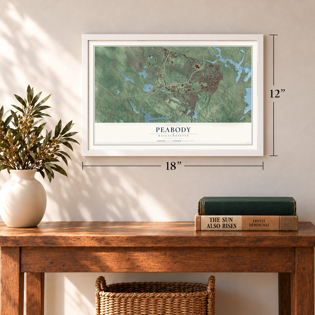
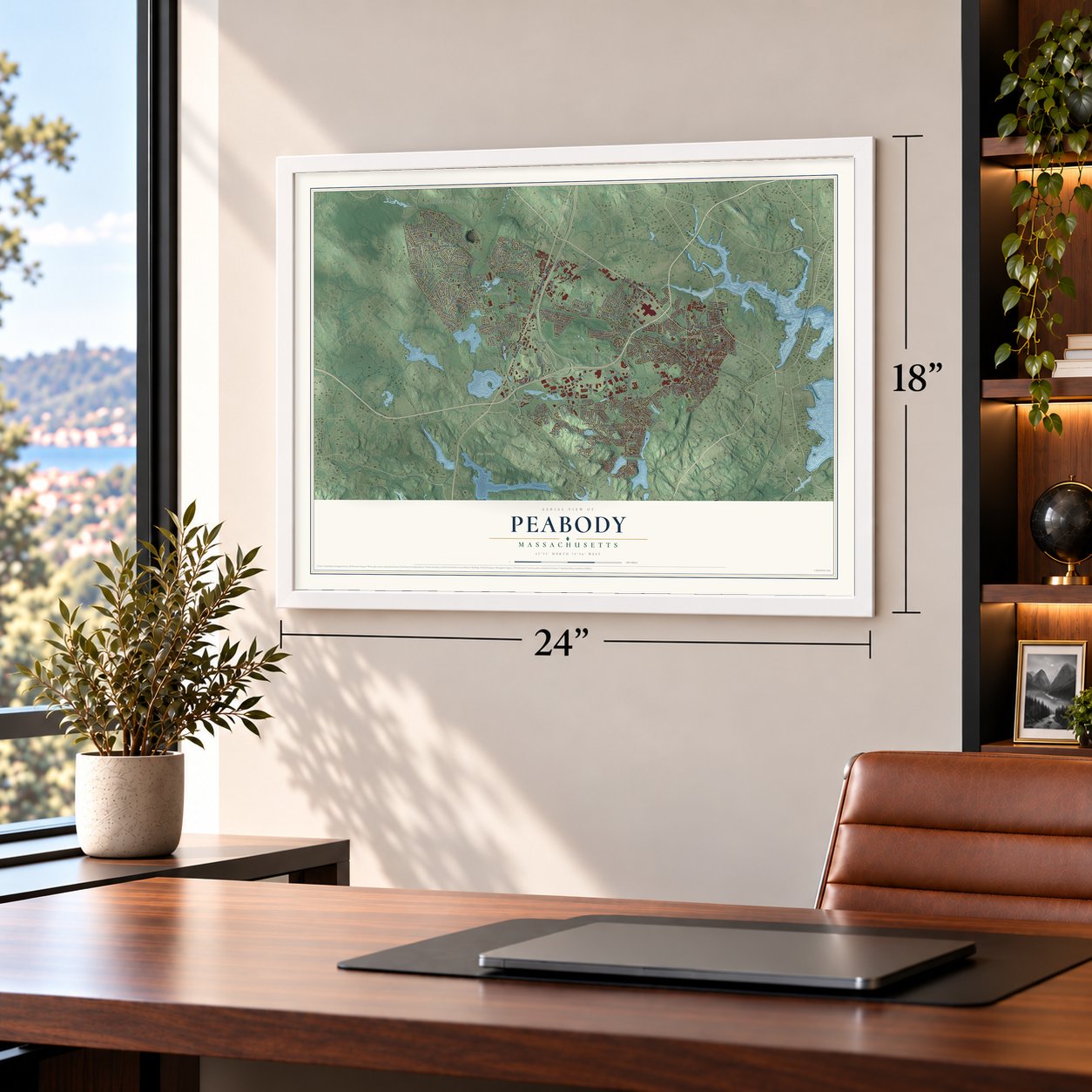
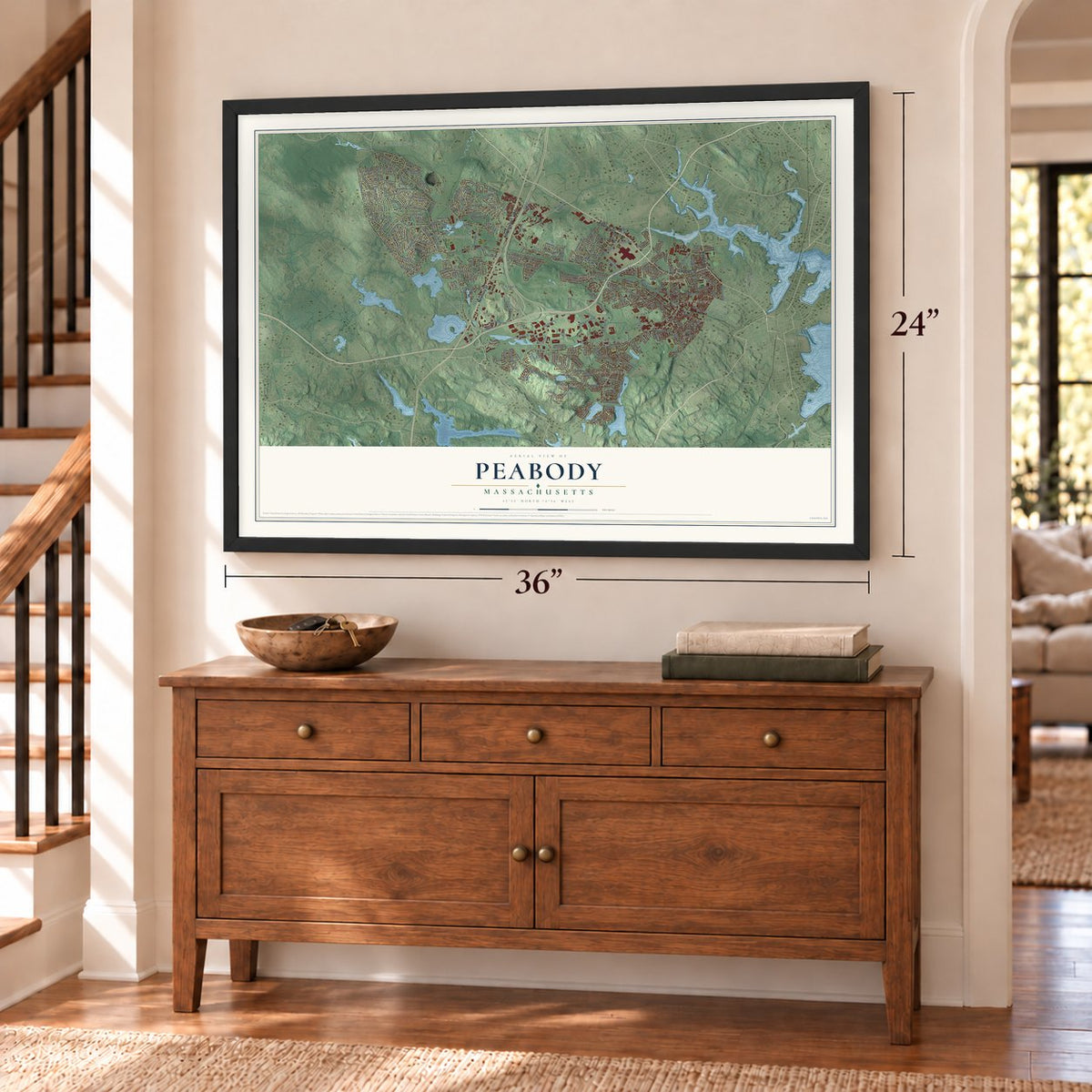
Unframed archival matte, a black wood frame or a white wood frame.
Up close
Geography Worth Displaying
This map was created using accurate cartographic data and authoritative geographic sources, including the U.S. Geological Survey (USGS) and FEMA. The map brings together terrain, waterways, roads, and building detail. The majority of the streets are labeled, houses are accurately depicted, and the topography is derived from government sources. Combining local data with carefully composed color and shading leads to this beautifully detailed Peabody artwork for your wall.
Rather than simply showing street outlines, we’ve included as many of the street names as we could reasonably fit on the map while keeping their names legible. Zoom in on the high resolution preview to see exactly what’s on the map. We truly set out to create a statement piece for anyone who loves Peabody. So whether it’s for you, or a gift for someone you love, we hope this map of Peabody brings back fond memories.
Explore the full map of Peabody, Massachusetts and read about the local places it shows.

Find your street
Names on the Peabody map
Every name below is printed on this map. Look for your street, your school, the park where you played, or the pond down the road.
Places and landmarks13
- Downtown
- West Peabody
- Bow Ridge
- Buxton Hill
- Fosters Point
- Bartholowmew Pond
- Cedar Pond
- Brooksby Farm
- South Middleton
- Needham Corner
- Proctor
- South Peabody
Show all 13 places
- Salem Country Club
Streets and roads237
- Andover Street
- Margin Street
- Newbury Street
- Newburyport Turnpike
- Gardner Street
- Main Street
- Endicott Street
- Foster Street
- King Street
- Russell Street
- Park Avenue
- Dearborn Road
- Lowell Street
- Pulaski Street
- Forest Street
- Lynnfield Street
- Lake Street
- Winona Street
- Lynn Street
- Bartholomew Street
- Goodale Street
- Summit Street
- Washington Street
- Centennial Drive
- Birch Street
- Catherine Drive
- Harrison Avenue
- Jubilee Drive
- Pine Street
- Glen Drive
Show all 237 streets
- Prospect Street
- Felton Street
- Spring Pond Road
- Nancy Avenue
- Perley Avenue
- Samoset Road
- Herrick Road
- Huntington Drive
- Bradford Road
- Northshore Road
- Tremont Street
- Central Street
- Bow Street
- Farm Avenue
- Trask Road
- Donegal Road
- Paul Avenue
- Murray Street
- Hampshire Road
- Fairview Avenue
- Surrey Lane
- Jordan Road
- Downing Road
- Walnut Street
- Patricia Road
- Johnson Street
- Cross Street
- Franklin Street
- Aborn Street
- County Street
- Sandra Road
- Emily Lane
- Oak Avenue
- Livingston Drive
- First Avenue
- Styles Drive
- Princeton Street
- Clark Road
- America Drive
- Willowbrae Drive
- Upham Street
- Dublin Road
- Sutton Street
- Crane Avenue
- Walsh Avenue
- Blackstone Street
- Broad Street
- Quail Road
- Tsitsinos Drive
- Lisa Road
- Tara Road
- Lindauer Street
- Taylor Street
- Leblanc Drive
- Allens Lane
- Olsen Road
- Herold Road
- Moulton Road
- Highland Street
- Monson Drive
- Heath Road
- Buford Road
- Judith Road
- Granite Street
- Home Street
- Whitney Drive
- Sunset Drive
- Villa Lane
- Lynch Street
- Fifth Street
- Oak Street
- Janet Lane
- Loris Road
- Dudley Street
- Joy Road
- North Central Street
- Brooksby Village Drive
- Railroad Avenue
- Donna Street
- Ellsworth Road
- Baldwin Street
- Jackson Avenue
- Elizabeth Lane
- Proctor Circle
- Essex Center Drive
- Keys Drive
- Roosevelt Avenue
- Northend Street
- Avalon Drive
- Shore Drive
- Warren Street Extension
- Bourbon Street
- Manomet Road
- Raylen Avenue
- Sabino Farm Road
- Truman Road
- Castle Circle
- Diane Road
- Warren Street
- Cedar Grove Avenue
- Dexter Street
- Driscoll Street
- Buttonwood Lane
- Reo Road
- Wheatland Street
- Linden Road
- Apple Hill Road
- Blaney Avenue
- Abington Avenue
- Holten Street
- Clement Avenue
- Kingdom Terrace
- Joyce Road
- Butternut Avenue
- Gwinnett Road
- Ravenwood Road
- Glenway Avenue
- Mandalay Drive
- Herbert Avenue
- Pontiac Road
- Second Street
- Lincoln Road
- Arnold Avenue
- Earley Road
- Larrabee Terrace
- Carell Road
- Sarah's Way
- Hourihan Street
- Jones Road
- Avalon Bay Drive
- Felton Avenue
- Irving Street
- Sylvan Street
- Elaine Avenue
- Eagan Place
- Alden Road
- Bowen Road
- Helen Drive
- Harvard Street
- Dobbs Road
- Sherry Lee Lane
- Jill's Way
- Sophie Road
- Temi Road
- Anita Road
- Pearl Road
- Ellis Street
- Silver Leaf Way
- Gedney Drive
- Newcastle Road
- Worcester Road
- Symphony Road
- Saint Ann's Avenue
- George Road
- Vieira Drive
- Page Street
- Summit Terrace
- John Road
- Birchwood Avenue
- Esquire Drive
- Blair Terrace
- Technology Drive
- Crestwood Lane
- Cobb Avenue
- Sylvia Road
- Tomah Drive
- Hoover Avenue
- Amanda Way
- Crystal Drive
- Leonard Road
- Moore Street
- Barr Road
- Wheeler Street
- Cottage Street
- Ethel Avenue
- Ferry Lane
- Willis Road
- Salem Street
- Mount Pleasant Drive
- Garden Road
- James Street
- Lone Pine Lane
- Wentworth Road
- Wiseman Drive
- Boulderbrook Drive
- Evans Road
- Dahlia Avenue
- Edgehill Road
- Grant Street
- Rita Road
- Peabody Road
- Penn Road
- Margin Terrace
- Macarthur Road
- Samos Circle
- Doulton Place
- Corporate Place
- Kyleigh Lane
- Emery Street
- Honey Lane
- Connors Road
- Water Street
- Dark Lane
- Stacia Road
- Corwin Street
- Hugh Terrace
- Hazel Street
Names are listed as they appear on the printed map. Zoom into the product photos to find them.
About Peabody, Massachusetts
Peabody is a city of 54,481 people in Essex County, 2 miles from the center of Salem. The Naumkeag lived here first, and in 1626 Roger Conant led a small band of English colonists down from Cape Ann to settle the land as part of Salem. Over the next century the farms here went by the Northfields, Salem Farms and Brooksby.
In 1752 the area left Salem to become part of the district of Danvers, and people called it the South Parish after its church, which stood where Peabody Square is now. The parish split from Danvers in 1855 as the town of South Danvers. On April 30, 1868, it took the name Peabody to honor George Peabody, the banker and philanthropist born here, and it became a city in 1916.
“I am still, in heart, the humble boy who left yonder unpretending dwelling.”
- Sixteen miles in four hoursWord of the British march came around nine on April 19, 1775. The South Parish minutemen assembled by the South Church, close to the Bell Tavern. Their captain, Gideon Foster, was 26 and had been chosen only ten days earlier. Cutting over fences and fields, they covered sixteen miles to West Cambridge in four hours. Five of them died there, and Dennison Wallis survived thirteen bullets. In 1835 a granite monument by Asher Benjamin rose where they had gathered.
- From bean pots to leatherJoseph Southwick, a Quaker, opened a tannery in 1739, and it stayed in his family for over a hundred years. Along what are now Central and Lowell Streets stood more than thirty potteries, and their brown bean pots and jugs sold widely during the War of 1812. By 1855 South Danvers had 27 tanneries handling 131,000 hides a year. In 1909 a trade book named the A. C. Lawrence Leather Company New England's largest tannery.
- George Peabody's free libraryGeorge Peabody, born on Washington Street in 1795, took a job at twelve in Captain Sylvester Proctor's grocery, sleeping in its attic. He made his fortune banking in London. At the Danvers centennial dinner of 1852, a sealed envelope from him was opened, and inside was a gift of $20,000 to found a lyceum and a free library.
- John Proctor's farmIn 1638 Emanuel Downing bought a farm in Brooksby, and his son George, later the namesake of London's Downing Street, grew up there. John Proctor later farmed the old Downing land, and in 1692 he was executed in the Salem witch trials. Local tradition made the John Proctor House his home, but tree-ring dating shows his son Thorndike built it about 1727. It joined the National Register in 1990.
- The St. Johns School fireOn the morning of October 28, 1915, fire swept the St. Johns School on Chestnut Street downtown, and twenty-one young children died. They were found huddled together near the entrance, only steps from safety. Peabody then passed the first law in any American city requiring that doors in public buildings push open instead of turning on a handle or knob.
Keep exploring Massachusetts
Peabody is one of 466 Massachusetts towns we've mapped. Every dot on the map is a print of its own.
The search covers every state, Massachusetts first.
Near Peabody
Order 2 or more town maps and save 10%. Shown in the size and finish you picked above, so they hang as a set.
- Danvers 12" x 18" / Archival Matte Print $39.99
- Lynnfield 12" x 18" / Archival Matte Print $39.99
- Lynn 12" x 18" / Archival Matte Print $39.99


More maps nearby: Salem, Saugus, Howe, Wakefield and Middleton.
The art of mapping a place
How This Map Was Made
Real places. Remarkable detail. Discover the layers that turn geographic data into a map of home.

The view from above
Aerial imagery reveals the character of the land: woodland, open fields, and the patterns of a place.

The shape of the land
Elevation data brings hills, valleys, and subtle changes in the landscape into view.

The details of home
Roads, waterways, and building footprints come together to make the map feel unmistakably local.

Geography becomes art
Considered color, shading, and typography bring the layers together in a map made for your wall.


Process illustrated with Mendon, Massachusetts. Aerial imagery: USDA NAIP. Terrain: USGS 3D Elevation Program. Map details and finished artwork: KNOWOL.
The Details
About This Print
Choose an archival matte print, or a black or white Ayous wood frame. The archival matte print is unframed.
Select your size and finish above to see the matching product image and price.
Materials & Craftsmanship
A contemporary map with the character of a classic atlas, printed on archival matte paper. Optional frames are made from Ayous wood.
Your printed map does not include the watermark shown in the full-map preview.
Shipping & Delivery
Free shipping within the United States. Every print is made to order in the USA.
Buying a gift? Add a note in your cart and we'll include it. We never put prices in the package.
Prints ship within 2 to 3 business days. Allow 7 to 10 days total from ordering for delivery. Timing may vary during holidays or periods of high order volume.
Read our shipping policy.
Returns and damaged prints
Each print is made to order. Change-of-mind refunds are not available after production.
If your print arrives damaged, misprinted or incorrect, contact support@knowol.com within 30 days of receiving it. Include your order number, photos and a description of the issue.
Read our full refund and replacement policy. For questions about your order, email support@knowol.com.