
Search for another town





Free U.S. delivery 7 to 10 days after you order
Lynnfield, Massachusetts Map Art
Building by building, with labeled streets and shaded relief.
12" x 18" Archival Matte Print
A Map of Home. A Work of Art.
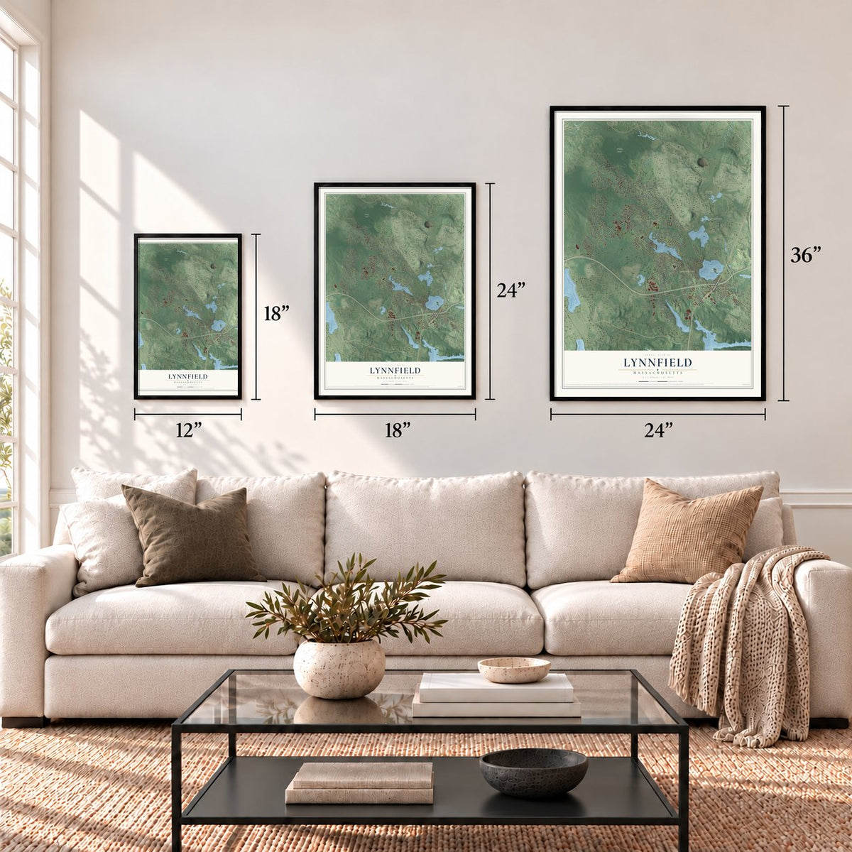
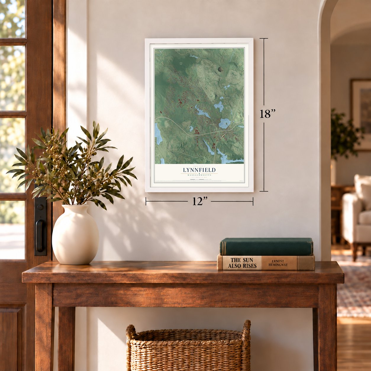
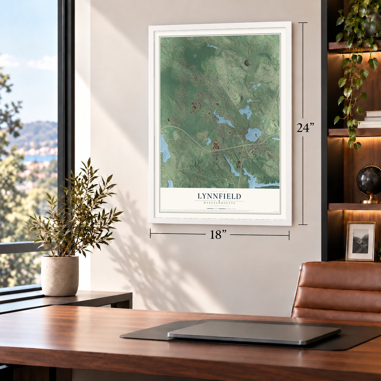
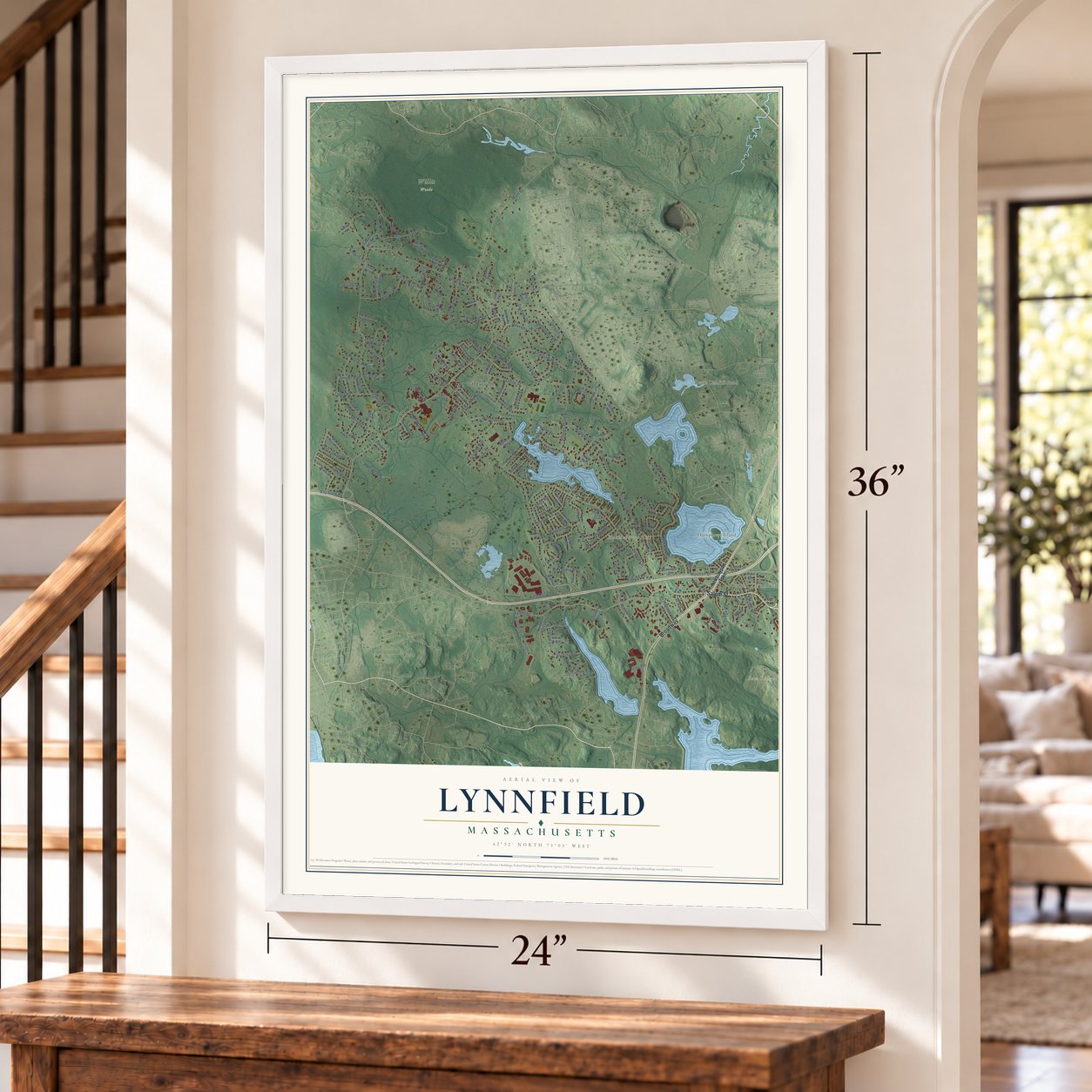
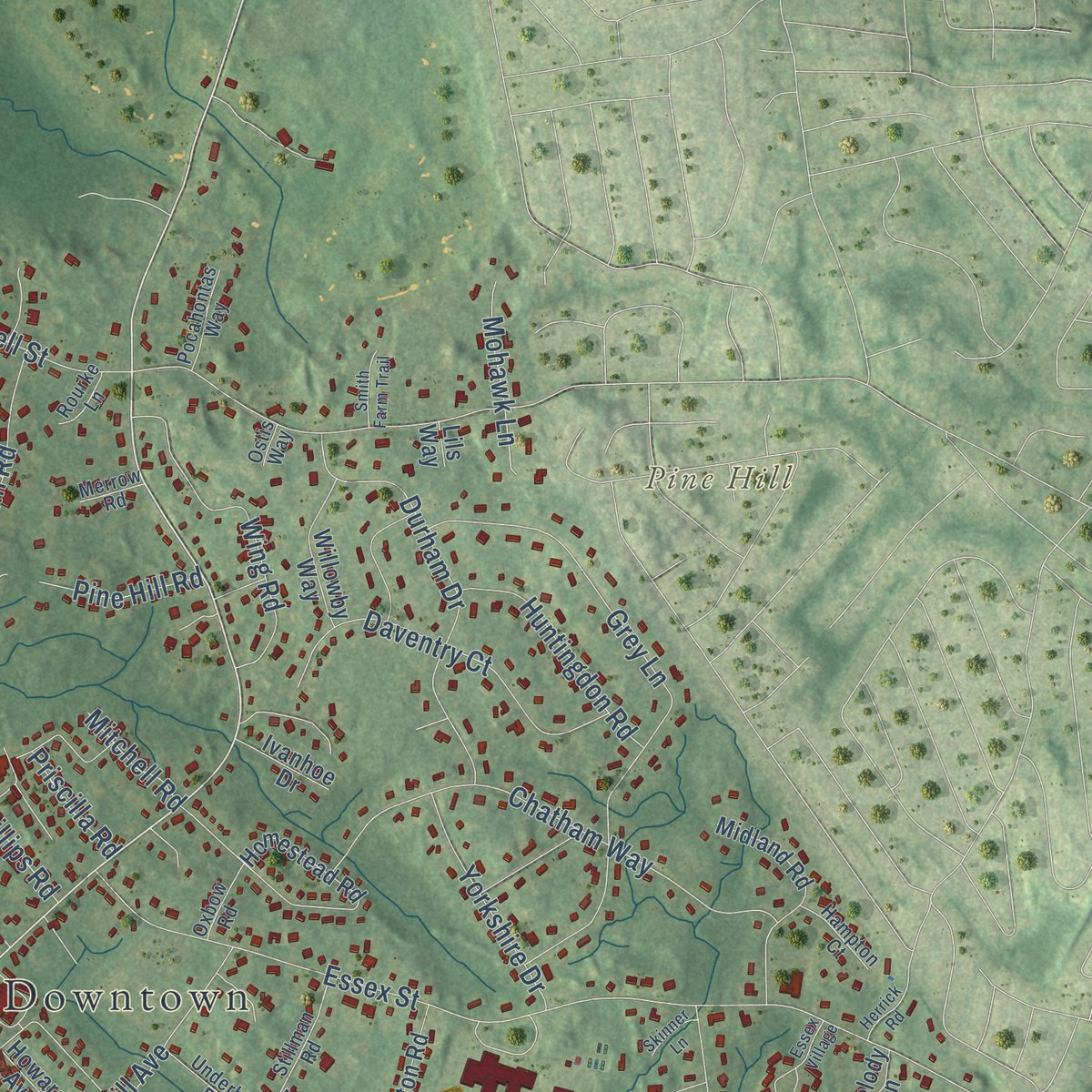
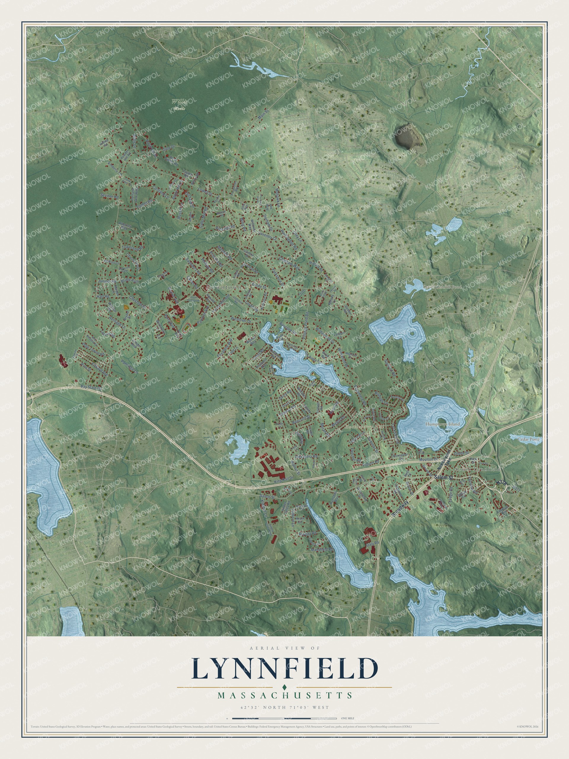
Explore Lynnfield, Massachusetts from a whole new perspective. Created using aerial imagery and detailed geographic data, this map captures Lynnfield building by building, with labeled streets, familiar landmarks, and shaded topographical relief that highlights the natural contours of the landscape.
Combining modern data with the timeless character of a vintage atlas, this map is just as interesting up close as it is beautiful on the wall. Whether you grew up in Lynnfield, spent memorable years there, or call it home today, this unique map is a great way to celebrate a place that means something to you. Zoom in on the preview to look for your street, and then order a print to put your memories on the wall.
Three ways to hang it
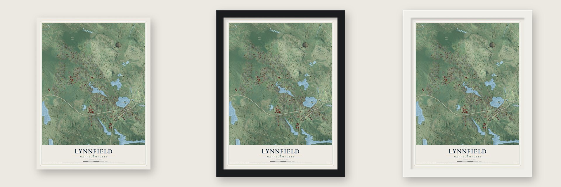
Unframed archival matte, a black wood frame or a white wood frame.
Up close
Geography Worth Displaying
This map was created using accurate cartographic data and authoritative geographic sources, including the U.S. Geological Survey (USGS) and FEMA. The map brings together terrain, waterways, roads, and building detail. The majority of the streets are labeled, houses are accurately depicted, and the topography is derived from government sources. Combining local data with carefully composed color and shading leads to this beautifully detailed Lynnfield artwork for your wall.
Rather than simply showing street outlines, we’ve included as many of the street names as we could reasonably fit on the map while keeping their names legible. Zoom in on the high resolution preview to see exactly what’s on the map. We truly set out to create a statement piece for anyone who loves Lynnfield. So whether it’s for you, or a gift for someone you love, we hope this map of Lynnfield brings back fond memories.
Explore the full map of Lynnfield, Massachusetts and read about the local places it shows.
Find your street
Names on the Lynnfield map
Every name below is printed on this map. Look for your street, your school, the park where you played, or the pond down the road.
Places and landmarks9
- Downtown
- South Lynnfield
- Bow Ridge
- Huckleberry Hill
- Humphreys Island
- Pine Hill
- Cedar Pond
- Devils Dishfull Pond
- Willis Woods
Streets and roads175
- Salem Street
- Broadway
- Main Street
- Green Street
- Summer Street
- Lowell Street
- Walnut Street
- Chestnut Street
- Essex Street
- King Rail Drive
- Locksley Road
- Edgemere Road
- Grey Lane
- Pillings Pond Road
- Apple Hill Lane
- Chatham Way
- Edward Avenue
- North Hill Drive
- Moulton Drive
- Heritage Lane
- Cortland Lane
- Durham Drive
- Glen Drive
- Wildwood Drive
- Daventry Court
- Wing Road
- Bishops Lane
- Tophet Road
- Fletcher Road
- Alexandra Road
Show all 175 streets
- Partridge Lane
- Thomas Road
- Willis Lane
- Westover Drive
- Forest Hill Avenue
- Bourque Road
- Olde Towne Road
- Melch Road
- Orchard Lane
- Wildewood Drive
- Phillips Road
- Pine Street
- Huntingdon Road
- Fernway
- Townsend Road
- Hart Road
- Yorkshire Drive
- Cider Mill Road
- Bancroft Street
- Juniper Road
- Beaver Avenue
- Bluejay Road
- Saunders Road
- Tedford Lane
- Lovell Road
- Russet Lane
- Crest Road
- Carter Road
- Ledge Road
- Moran Road
- Pine Hill Road
- Mohawk Lane
- Elizabeth Way
- Mansfield Road
- Kimball Lane
- Stafford Road
- Bay State Road
- Fairview Road
- Parsons Avenue
- Gerry Road
- Perry Avenue
- Pyburn Road
- Priscilla Road
- Mitchell Road
- Brook Drive
- Sevinor Road
- Grove Street
- Daly Road
- Bridle Path
- Knoll Road
- Newburyport Turnpike
- Trickett Road
- Crescent Avenue
- Homestead Road
- Doncaster Circle
- Midland Road
- Robin Road
- Ramsdell Way
- Oak Ridge Terrace
- Hidden Valley Road
- Wymon Way
- Charing Cross
- Cortland Lane West
- Sylvan Circle
- Village Row
- Carpenter Road
- Keniston Road
- Tappan Way
- Lookout Terrace
- Todd Lane
- Willowby Way
- West Tapley Road
- Prospect Avenue
- Kimberly Terrace
- Maiden Lane
- Lantern Lane
- Williams Road
- Windsor Road
- Timberhill Lane
- Ford Avenue
- Liberty Lane
- Winchester Drive
- Howard Avenue
- Wirthmore Lane
- Alderney Way
- Powder Hill Road
- Bryant Street
- Jordan Road
- Perkins Lane
- Putney Lane
- Drury Lane
- Ivanhoe Drive
- Norris Road
- Tapley Road
- Hilltop Road
- Heath Circle
- Lander Road
- Melody Lane
- Oak Street
- Park Street
- Birch Road
- Ryan Road
- Ross Drive
- Lils Way
- Lynnfield Cmns
- Hidden Valley Farm
- Longbow Circle
- New Meadow Road
- Sparhawk Drive
- Underhill Road
- Dunstan Road
- Magnolia Drive
- Stillman Road
- Cooks Farm Lane
- Baldwin Lane
- Pocahontas Way
- Hunting Lane
- Hampton Court
- Grayland Road
- Oxbow Road
- Lakeview Avenue
- Jensen Street
- Haywood Farm
- Pizzuti Way
- Rourke Lane
- Merrow Road
- Island Road
- Fall Way
- Fern Lane
- Ostis Way
- Lara Lane
- Old Pillings Pond Road
- Essex Village
- Goldenrod Lane
- Archer Lane
- Debston Lane
- South Common Street
- Smith Farm Trail
- Clark Road
- Sigmund Street
- Herrick Road
- Skinner Lane
- Dewing Road
- Thistle Lane
- Lee Road
Names are listed as they appear on the printed map. Zoom into the product photos to find them.
About Lynnfield, Massachusetts
Lynnfield is a town of 13,000 people in Essex County, 14 miles north of Boston, with the Ipswich River along its northern edge. It began as Lynn End, the outlying farms of Lynn, where Europeans settled in 1638. For decades its families went six or eight miles to church on Lynn Common, and when a committee chose a hill halfway between, Lynn refused to move its meetinghouse.
So on November 17, 1712, the north end became a parish of its own. In 1714 the parish voted to buy the land that is now the common and build a meetinghouse there, and in 1720 it organized the First Church of Lynnfield, with Rev. Nathaniel Sparhawk as minister. On July 3, 1782, Lynn End was made the district of Lynnfield, and on February 28, 1814, it was incorporated as a town. The old meetinghouse still stands on the common.
“The town is free from debt, and is a most desirable place of residence for those who would enjoy, in the vicinity of cities, the quiet delights of rural life.”
- Pewter bullets in 1775As the story goes, Lynn End neighbors packed Daniel Townsend's kitchen on the eve of the Battle of Lexington, bringing old pewter and bullet molds to cast bullets. Townsend and his wife, Zerviah, lived near today's Pillings Pond. He died on April 19, 1775, as the British retreated toward Boston, and was buried at home under a stone carved with lines about him. In 1922 one mold remained at the Perkins family's old homestead on Chestnut Street.
- The summer of 1850The county history of 1888 records a crowded year. On August 1 a tornado cut a narrow path across the west part of town in midafternoon but missed every building. On August 15 a big flat-bottomed boat carrying a church picnic party from Lynn overturned on Lynnfield Pond, now Suntaug Lake, drowning thirteen people. The railroad through South Lynnfield opened on August 31, and Lynnfield Centre got its own line in 1854.
- Camp StantonCamp Stanton was set up in the Civil War years on the Newburyport Turnpike near the Peabody line, its tents and cook houses lining the road on either side toward Suntaug Lake. In 1861 and 1862 it trained ten infantry regiments from Massachusetts, along with four batteries of light artillery, and Henry Wilson and Nelson A. Miles drilled at the camp. Lynnfield itself sent 76 men to the war, three more than all its quotas required.
- The gold spike of 1869David Hewes, born in Lynnfield, provided the gold spike that finished the transcontinental railroad in 1869. Ten years later, in 1879, President and Mrs. Hayes stayed with him as his guests at his home in Oakland, California.
- Saltboxes from about 1700Two First Period saltbox houses with central chimneys survive in town. The Henfield House began about 1700, gained its left side early in the 1700s, and is named for the Henfield family, its owners for much of the 18th century. The Hart House was probably built by John Perkins, who held the land from 1695 to 1719. The Hart family owned it from 1838, when John Hart purchased it, until 1945. They joined the National Register in 1991 and 1990.
Keep exploring Massachusetts
Lynnfield is one of 467 Massachusetts towns we've mapped. Every dot on the map is a print of its own.
The search covers every state, Massachusetts first.
Near Lynnfield
Order 2 or more town maps and save 10%. Shown in the size and finish you picked above, so they hang as a set.
- Wakefield 12" x 18" / Archival Matte Print $39.99
- Reading 12" x 18" / Archival Matte Print $39.99
- Peabody 12" x 18" / Archival Matte Print $39.99


More maps nearby: North Reading, Saugus, Howe, Stoneham and Danvers.
The art of mapping a place
How This Map Was Made
Real places. Remarkable detail. Discover the layers that turn geographic data into a map of home.

The view from above
Aerial imagery reveals the character of the land: woodland, open fields, and the patterns of a place.

The shape of the land
Elevation data brings hills, valleys, and subtle changes in the landscape into view.

The details of home
Roads, waterways, and building footprints come together to make the map feel unmistakably local.

Geography becomes art
Considered color, shading, and typography bring the layers together in a map made for your wall.


Process illustrated with Mendon, Massachusetts. Aerial imagery: USDA NAIP. Terrain: USGS 3D Elevation Program. Map details and finished artwork: KNOWOL.
The Details
About This Print
Choose an archival matte print, or a black or white Ayous wood frame. The archival matte print is unframed.
Select your size and finish above to see the matching product image and price.
Materials & Craftsmanship
A contemporary map with the character of a classic atlas, printed on archival matte paper. Optional frames are made from Ayous wood.
Your printed map does not include the watermark shown in the full-map preview.
Shipping & Delivery
Free shipping within the United States. Every print is made to order in the USA.
Buying a gift? Add a note in your cart and we'll include it. We never put prices in the package.
Prints ship within 2 to 3 business days. Allow 7 to 10 days total from ordering for delivery. Timing may vary during holidays or periods of high order volume.
Read our shipping policy.
Returns and damaged prints
Each print is made to order. Change-of-mind refunds are not available after production.
If your print arrives damaged, misprinted or incorrect, contact support@knowol.com within 30 days of receiving it. Include your order number, photos and a description of the issue.
Read our full refund and replacement policy. For questions about your order, email support@knowol.com.