
Search for another town



Free U.S. delivery 7 to 10 days after you order
Pine Forest, Florida Map Art
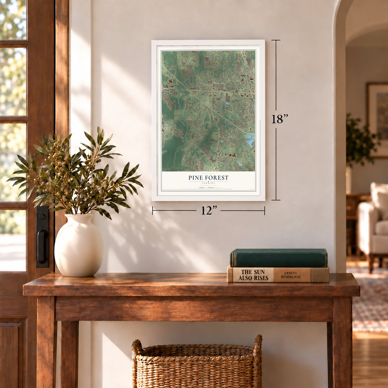
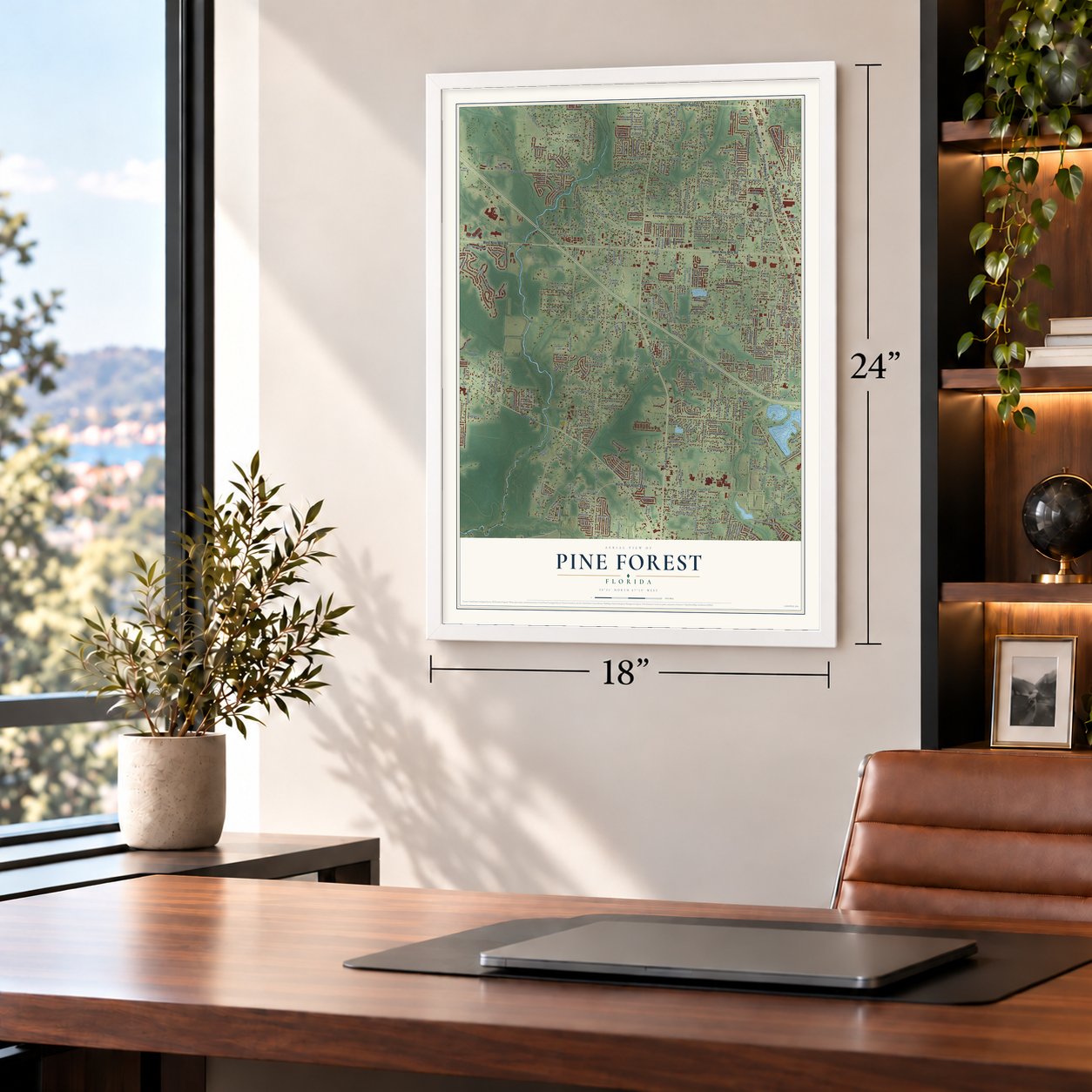
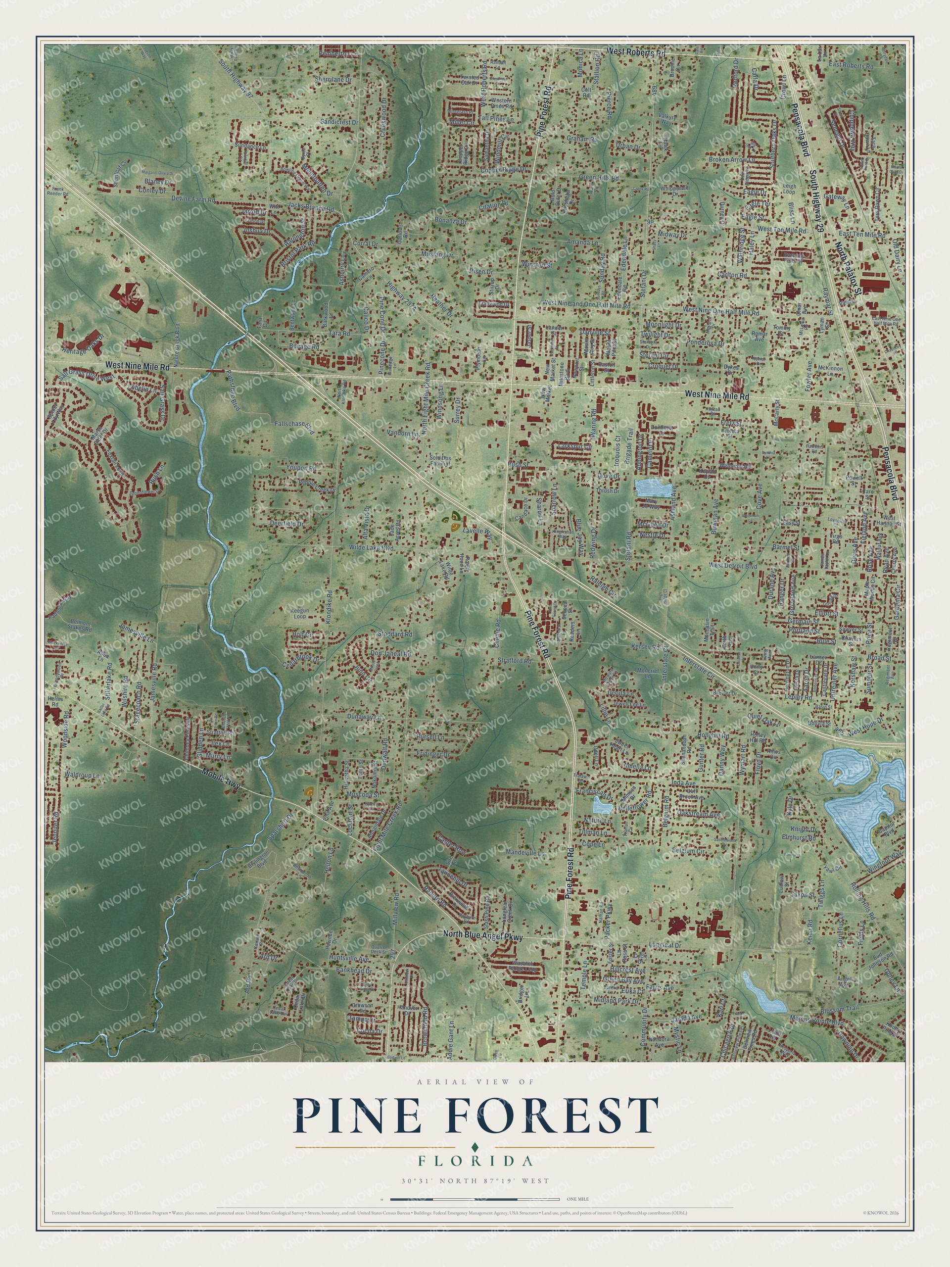
A new map of Pine Forest, Florida, made in 2026 and printed to order on thick archival matte paper.
12" x 18" Archival Matte Print
A Map of Home. A Work of Art.
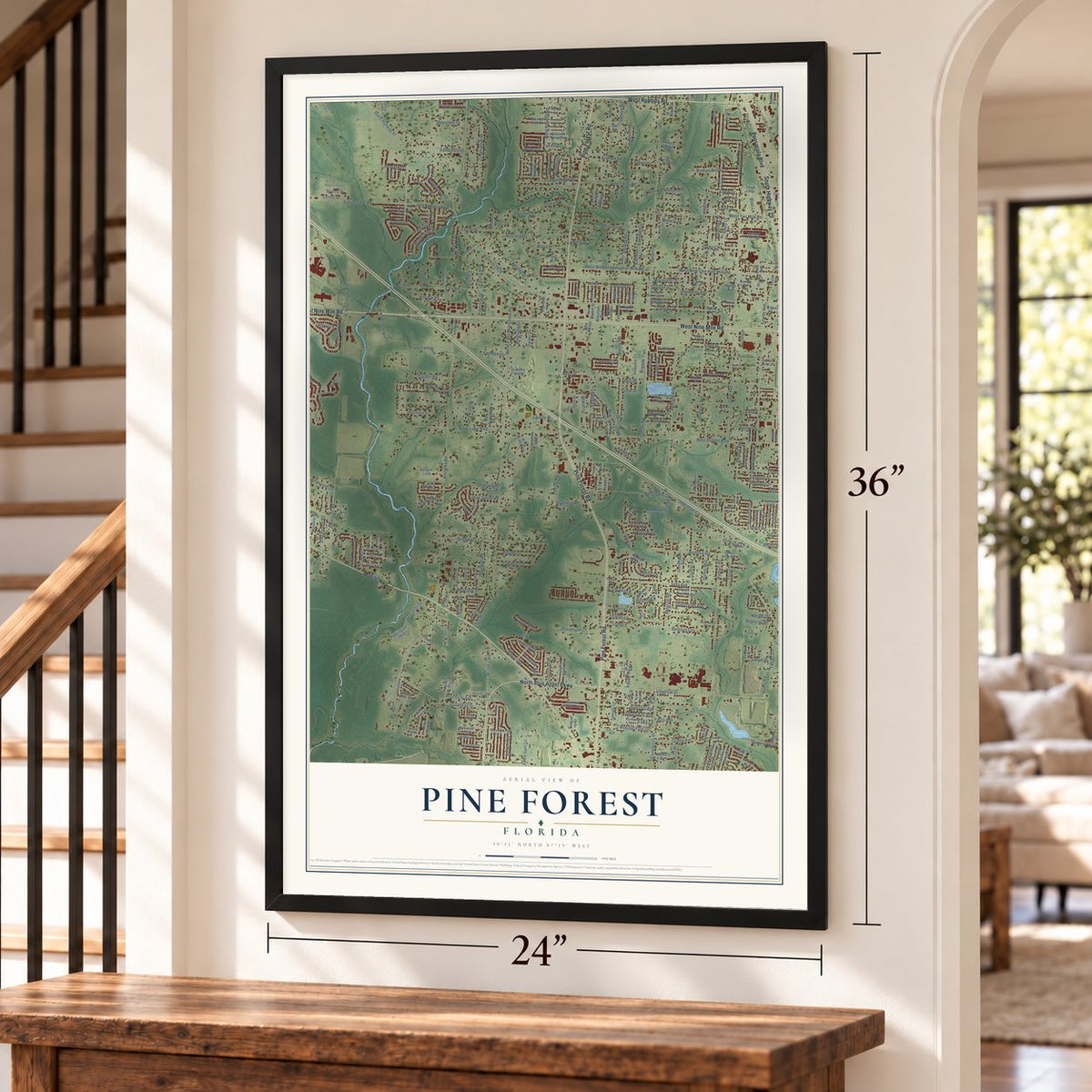
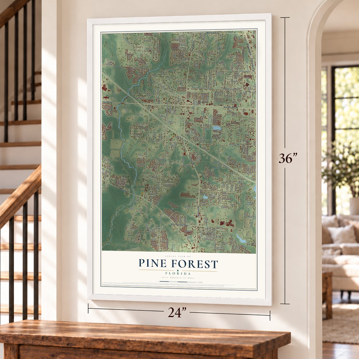
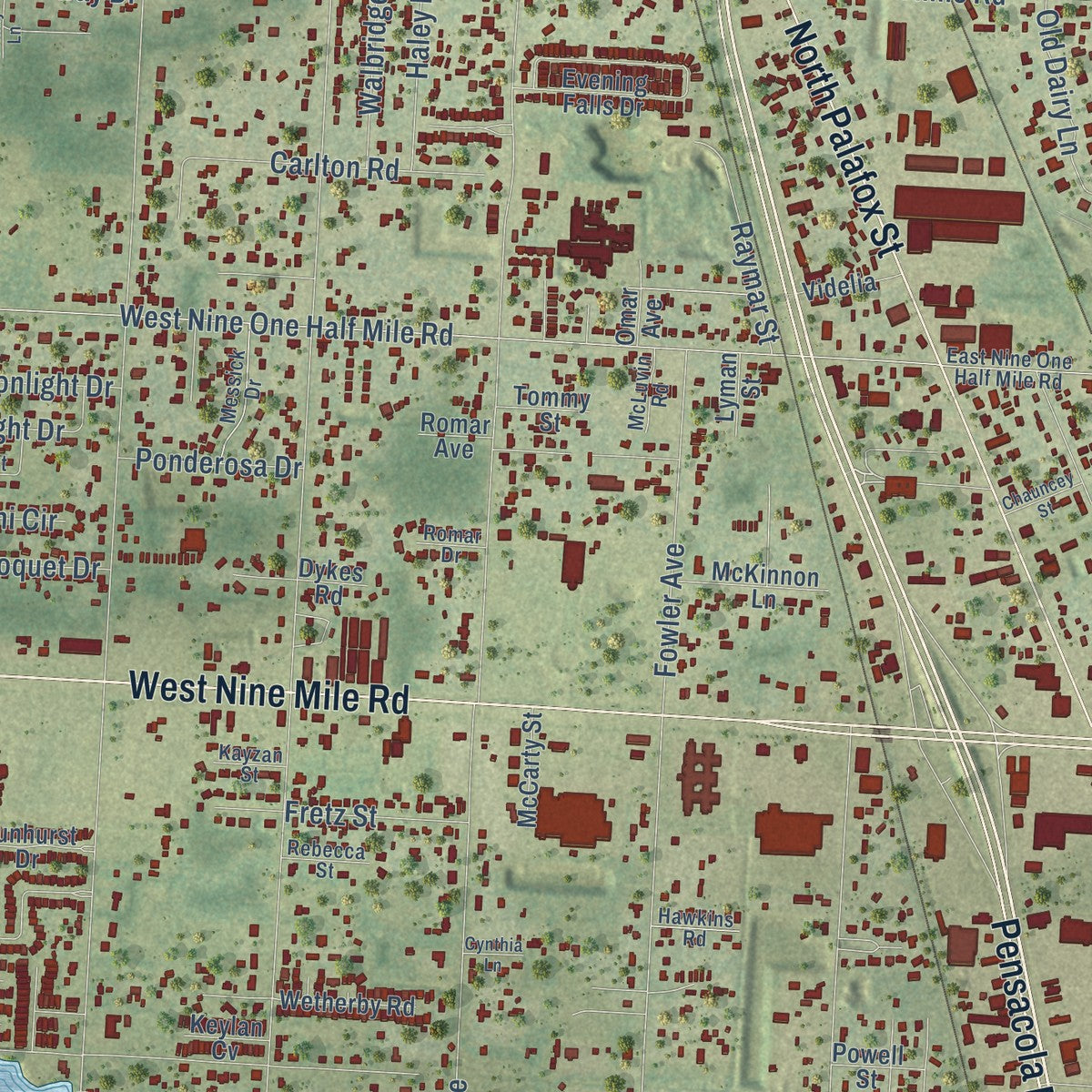
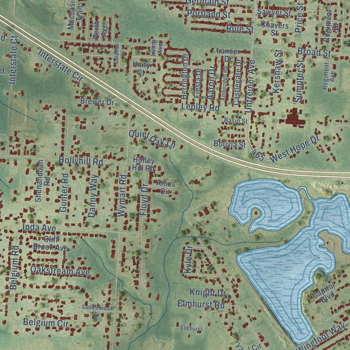
Explore Pine Forest, Florida from a whole new perspective. Created using aerial imagery and detailed geographic data, this map captures Pine Forest building by building, with labeled streets, familiar landmarks, and shaded topographical relief that highlights the natural contours of the landscape.
Combining modern data with the timeless character of a vintage atlas, this map is just as interesting up close as it is beautiful on the wall. Whether you grew up in Pine Forest, spent memorable years there, or call it home today, this unique map is a great way to celebrate a place that means something to you. Zoom in on the preview to look for your street, and then order a print to put your memories on the wall.
Three ways to hang it
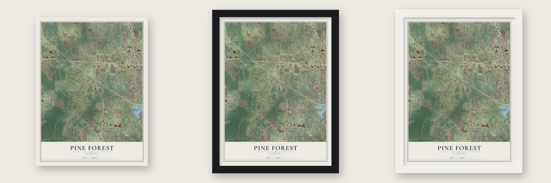
Unframed archival matte, a black wood frame or a white wood frame.
Up close
Geography Worth Displaying
This map was created using accurate cartographic data and authoritative geographic sources, including the U.S. Geological Survey and the Census Bureau. The map brings together terrain, waterways, roads, and building detail. The majority of the streets are labeled, houses are accurately depicted, and the topography is derived from government sources. Combining local data with carefully composed color and shading leads to this beautifully detailed Pine Forest artwork for your wall.
Rather than simply showing street outlines, we’ve included as many of the street names as we could reasonably fit on the map while keeping their names legible. Zoom in on the high resolution preview to see exactly what’s on the map. We truly set out to create a statement piece for anyone who loves Pine Forest. So whether it’s for you, or a gift for someone you love, we hope this map of Pine Forest brings back fond memories.
Read the story behind this map: Detailed Map of Pine Forest, Florida.

Find your street
Names on the Pine Forest map
Every name below is printed on this map. Look for your street, your school, the park where you played, or the pond down the road.
Streets and roads432
- Pine Forest Road
- West Roberts Road
- West Nine Mile Road
- Pensacola Boulevard
- Mobile Highway
- South Highway 29
- North Palafox Street
- North Blue Angel Parkway
- Jacks Branch Road
- West Hope Drive
- Stillerlake Road
- Salt Grass Drive
- Crowl Lane
- Pinecone Drive
- Danville Street
- Klondike Road
- Stefani Road
- Ashland Avenue
- West Detroit Boulevard
- Eight Mile Creek Road
- West Nine One Half Mile Road
- West Nine and One Half Mile Road
- Bowman Avenue
- Stefani Drive
- Cove Avenue
- Untreiner Avenue
- Interstate Circle
- Fowler Avenue
- Devine Farm Road
- South Highway 97
Show all 432 streets
- Wymart Road
- Rolling Hills Road
- Longleaf Drive
- Lepley Road
- Wilde Lake Boulevard
- West Ten Mile Road
- Bush Street
- Creekwood Drive
- Southern Oaks Drive
- Marcus Pointe Boulevard
- Inda Avenue
- Sandicrest Drive
- Dunaway Lane
- Deerfield Drive
- North Eight Mile Creek Road
- Hillcrest Avenue
- Jamesville Lane
- Kersey Road
- Chellie Road
- Copper Ridge Drive
- Jamesville Road
- Sherrilane Drive
- Brownfield Road
- Woodside Road
- Community Drive
- Green Hills Road
- Belgium Circle
- Hollyhill Road
- Gunter Road
- Joshua Drive
- East Roberts Road
- Senegal Drive
- Tara Road
- Millet Circle
- Risen Drive
- Ashbury Lane
- Tannehill Drive
- Figland Avenue
- Doris Avenue
- Pine Cone Drive
- Bristol Park Road
- Blossom Trail
- Kemp Road
- Belgium Road
- Gardenia Circle
- Juno Circle
- Tillman Lane
- Heather Drive
- Sharon Lane
- Fields Lane
- Harlington Street
- Floyd Drive
- Fridinger Drive
- Raleigh Circle
- Raburn Road
- Chippewa Way
- Redwing Drive
- Cornelius Lane
- Stagecoach Road
- Wilshire Road
- Farris Avenue
- Bankhead Drive
- Holt Circle
- Eagle Drive
- Ard Road
- Edendale Lane
- Millview Road
- Bonanza Drive
- Sparshott Drive
- Lillie Lane
- Pathstone Boulevard
- Amanda Lane
- Larkspur Circle
- Helton Lane
- Waring Road
- Kershaw Street
- Elliott Street
- Rose Avenue
- Conley Drive
- Windmill Circle
- Redford Drive
- Huntsville Avenue
- Mandeville Lane
- Bocage Road
- East Ten Mile Road
- Monica Lane
- Broad Street
- Downing Drive
- Germain Street
- Carlton Road
- Salt Grass Drive West
- Corral Drive
- Midland Park Drive
- Dunwalt Road
- Kyle Drive
- Citation Drive
- Groveland Avenue
- Pursell Lane
- Broken Arrow Lane
- Wingfoot Way
- Amelia Lane
- Eagle Street
- Sunday Road
- Heritage Oaks Drive
- Youpon Road
- Graham Road
- Chicago Avenue
- Winston Street
- Haley Lane
- Franciscan Drive
- Mountbatten Drive
- Aaron Drive
- Jarada Avenue
- Durand Avenue
- Mystic Lane
- Jennifer Road
- Glidden Lane
- Temple Lane
- Stratford Road
- Green Bay Avenue
- Raymar Street
- Ryan Avenue
- Lavelle Way
- Cocoa Drive
- Fallschase Boulevard
- Sparrow Lane
- Belleflower Road
- Portland Street
- Ard Drive
- Danny Way
- Packer Parkway
- Walbridge Street
- Old Dairy Lane
- Ilex Lane
- Cedarbrook Drive
- Carla Drive
- Price Street
- Iroquois Court
- Ursula Lane
- Stallion Road
- Rule Street
- Pierce Road
- Oakstream Avenue
- Mustang Drive
- Waldroup Lane
- Twiggs Lane
- Elmhurst Road
- Addie Gant Lane
- Gulley Lane
- Twilight Drive
- Ranger Drive
- Pemberton Lane
- Moonlight Drive
- Barmel Street
- Ponderosa Drive
- Croquet Drive
- Alta Vista Drive
- Fretz Street
- Lockhart Street
- Erika Court
- Don Janeal Road
- Surrey Drive
- Stoddard Road
- Cope Lane
- Blue Jay Way
- Interstate Court
- Abbington Drive
- Brigade Trail
- Nature Lane
- Urban Drive
- Canter Row
- Tall Pines Lane
- Calico Drive
- Camelot Place
- Windsong Lane
- Gateway Lane
- Tampa Drive
- Lobelia Lane
- Quiet Oak Lane
- Vandorn Lane
- Saxon Street
- Blaney Drive
- Nestle Drive
- Sumpter Street
- Muscoda Street
- McGhee Drive
- Eagle Terrace
- Murry Lane
- Stefani Circle
- Midway Drive
- Knight Drive
- Rush Lane
- Jarrod Drive
- Bliss Lane
- Dove Drive
- Kari Court
- Milestone Boulevard
- Alysheba Drive
- Lander Street
- Foxtail Loop
- Tara Dawn Circle
- Cedar Lake Drive
- Nature Creek Boulevard
- Brylington Boulevard
- Wasatch Range Loop
- Maple Woods Circle
- Mary Jo Way
- Trailwood Drive
- Pebble Creek Drive
- Evening Falls Drive
- Edendale Road
- Marsh Elder Drive
- Belmont Stakes Road
- Copper Ridge Circle
- Keegun Loop
- Chimney Pines Drive
- Sundance Lane
- West Hannah Street
- Yawl Circle
- Crowson Road
- Rickwood Drive
- Leigh Loop
- Stratton Place
- Walnut Avenue
- Jasper Street
- Annandale Drive
- Tara Dawn Lane
- Wilde Lake Road
- Nandora Avenue
- Spider Lily Way
- Herrington Drive
- Samantha Drive
- Jewell Lee Lane
- Whipporwill Drive
- Liana Lane
- Valkyry Way
- Longleaf Creek Drive
- Slash Pine Road
- Bellview Pines Road
- Bud Johnson Road
- Paddock Way
- Pawnee Drive
- Castlegate Drive
- Twisted Oak Drive
- McKinnon Lane
- Nokomis Street
- Hiawatha Street
- Hanover Drive
- Newport Street
- Sweet Heart Lane
- Jade Acres Road
- Barkwood Lane
- Hawk Lane
- Shenandoah Road
- Mimosa Drive
- Wetherby Road
- Western Pines Road
- Durney Drive
- Bentwood Lane
- Candace Drive
- Chavers Street
- Sawyer Street
- Bold Ruler Drive
- Moccasin Trail
- Moncrief Lane
- Regiment Drive
- Holley Hill Road
- Capitol Boulevard
- Dunhurst Drive
- Shortleaf Court
- Solo Dos Familiaf
- New Market Street
- Littleton Street
- Fiesta Drive
- McCarty Street
- Mount Airy Street
- Lancer Drive
- Cherry Avenue
- Bolivia Street
- Stirrup Drive
- Cliff Brook Avenue
- Foster Street
- Plymouth Lane
- Robin Hood Lane
- Brewer Drive
- Knotty Pine Drive
- Gallows Road
- Sire Lane
- Videlia
- Broome Circle
- Bridget Lane
- Thrush Drive
- Cycle Drive
- Caro Street
- Mount Pilot Street
- Camero Lane
- Ludlow Street
- Easton Street
- Helms Road
- Amos Circle
- Tommy Street
- Powell Street
- Pine Avenue
- Tonto Street
- Reeders Lane
- Angel Avenue
- La Rosa Street
- Odell Lane
- Seneca Street
- Easy Street
- Omar Avenue
- Keylan Cv
- Abba Lane
- Lyman Street
- Tara Circle
- La Lar Lane
- Romar Avenue
- New Market
- Perth Avenue
- Unity Court
- Dykes Road
- Colt Road
- Virgo Road
- Witt Lane
- Rayburn Road
- Bowling Green Way
- Cedar Lake Circle
- Kingfisher Way
- Kanard Road
- Deer Ridge Road
- Spoonflower Drive
- Eureka Lane
- Lovebird Court
- Nathan Road
- Bellview Pines Place
- Resmondo Lane
- East Nine One Half Mile Road
- Messick Drive
- Starlight Drive
- Wiregrass Place
- Hesperia Way
- Quarter Deck Street
- Byron Place
- Brandywood Drive
- North Klondike Road
- Tortuga Drive
- Regiment Avenue
- Howard Dean Lane
- Frank Reeder Road
- Gulledge Lane
- Randall Lane
- Tralawn Drive
- Church Hill Place
- Jarmen Lane
- Rebecca Street
- Hawkins Road
- Jason Drive
- McLuvin Road
- James Taylor Lane
- Ware Road
- Cdear Lake Drive
- Basin Street
- Kayzan Street
- Tillman Circle
- Romar Drive
- Irving Avenue
- Flintlock Drive
- Godwin Lane
- Sundays Road
- Stiller Lake Road
- Margaret Olivia Drive
- Blackhorse Circle
- Sundial Circle
- Cedar Ridge Drive
- Mossy Creek
- Pine Forest Drive
- Amberidge Road
- Elmhurst
- Shear Street
- Stallworth Lane
- Nowak Dairy Road
- Gwen Circle
- Shady Lane
- Rockland Street
- Cool Creek Road
- Crestfield Circle
- Saddlebrook Drive
- Berrydale Road
- River Birch Drive
- Harding Drive
- High Ridge Court
- Sir Eden Road
- Chauncey Street
- Trestle Way
- Workman Lane
- Calahan Place
- Maple Oaks Drive
- Cynthia Lane
- Franks Court
- Big Oak Lane
- Tuttle Lane
- Tate Road
Names are listed as they appear on the printed map. Zoom into the product photos to find them.
The art of mapping a place
How This Map Was Made
Real places. Remarkable detail. Discover the layers that turn geographic data into a map of home.

The view from above
Aerial imagery reveals the character of the land: woodland, open fields, and the patterns of a place.

The shape of the land
Elevation data brings hills, valleys, and subtle changes in the landscape into view.

The details of home
Roads, waterways, and building footprints come together to make the map feel unmistakably local.

Geography becomes art
Considered color, shading, and typography bring the layers together in a map made for your wall.


Process illustrated with Mendon, Massachusetts. Aerial imagery: USDA NAIP. Terrain: USGS 3D Elevation Program. Map details and finished artwork: KNOWOL.
The Details
About This Print
Choose an archival matte print, or a black or white Ayous wood frame. The archival matte print is unframed.
Select your size and finish above to see the matching product image and price.
Materials & Craftsmanship
A contemporary map with the character of a classic atlas, printed on archival matte paper. Optional frames are made from Ayous wood.
Your printed map does not include the watermark shown in the full-map preview.
Shipping & Delivery
Free shipping within the United States. Every print is made to order in the USA.
Buying a gift? Add a note in your cart and we'll include it. We never put prices in the package.
Prints ship within 2 to 3 business days. Allow 7 to 10 days total from ordering for delivery. Timing may vary during holidays or periods of high order volume.
Read our shipping policy.
Returns and damaged prints
Each print is made to order. Change-of-mind refunds are not available after production.
If your print arrives damaged, misprinted or incorrect, contact support@knowol.com within 30 days of receiving it. Include your order number, photos and a description of the issue.
Read our full refund and replacement policy. For questions about your order, email support@knowol.com.
Find your town
Looking for another city?
Find a map of home in our Florida collection, or any town in the country.
Nearby
Maps of towns near Pine Forest
Know someone from one of these towns? Their map makes a great gift.
 Ensley
, Florida
From $39.99See the map
 Beulah
, Florida
From $39.99See the map
 Bellview
, Florida
From $39.99See the map
More maps nearby: Gonzalez, Brent, West Pensacola, Myrtle Grove and Goulding.