
Search for another town




Free U.S. delivery 7 to 10 days after you order
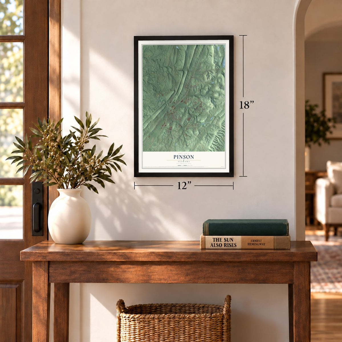
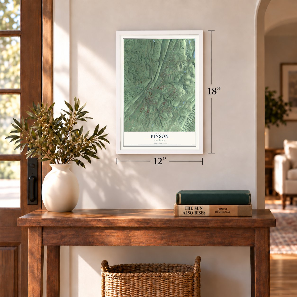
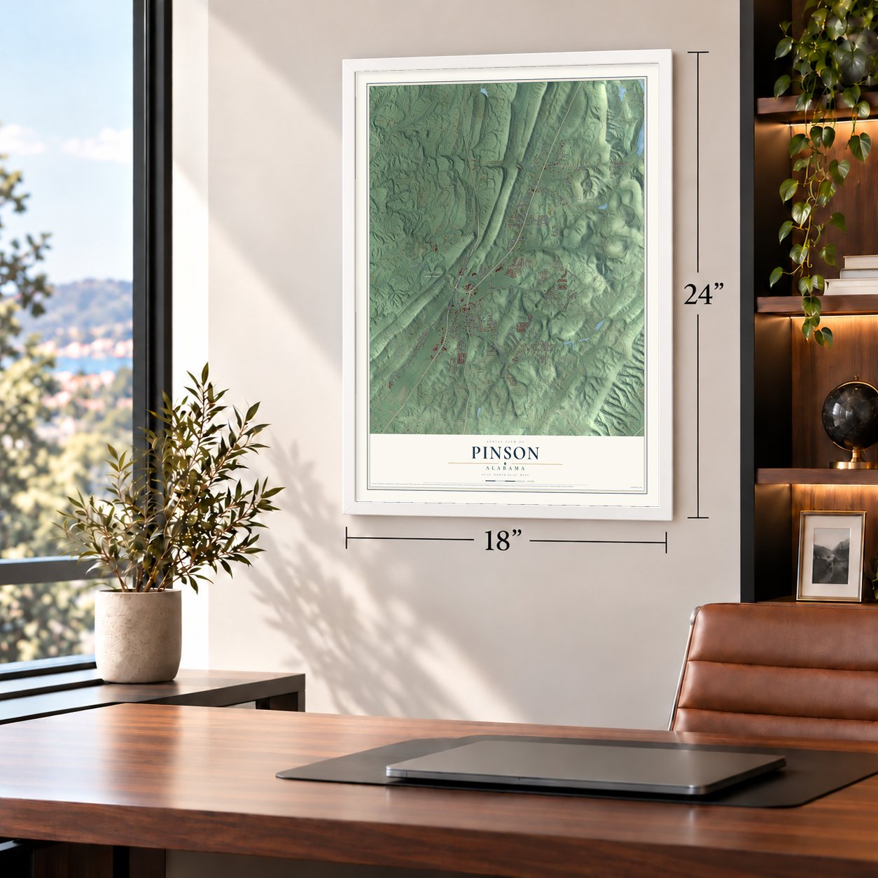
Pinson, Alabama Map Art
A new map of Pinson, Alabama, made in 2026 and printed to order on thick archival matte paper.
12" x 18" Archival Matte Print
A Map of Home. A Work of Art.
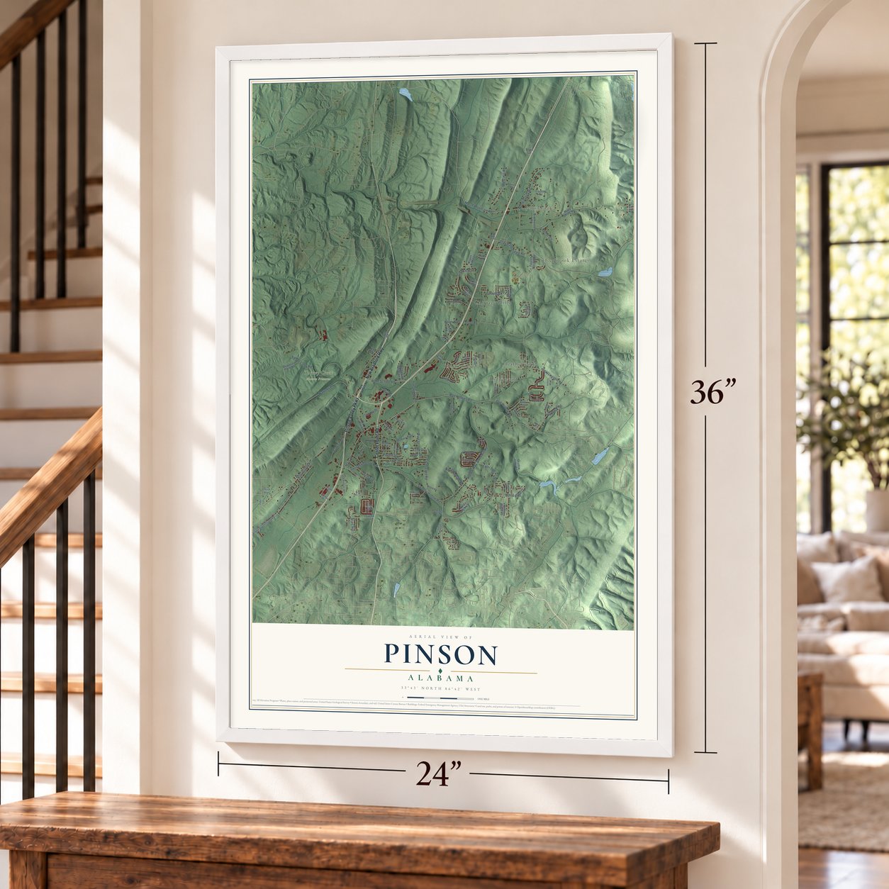
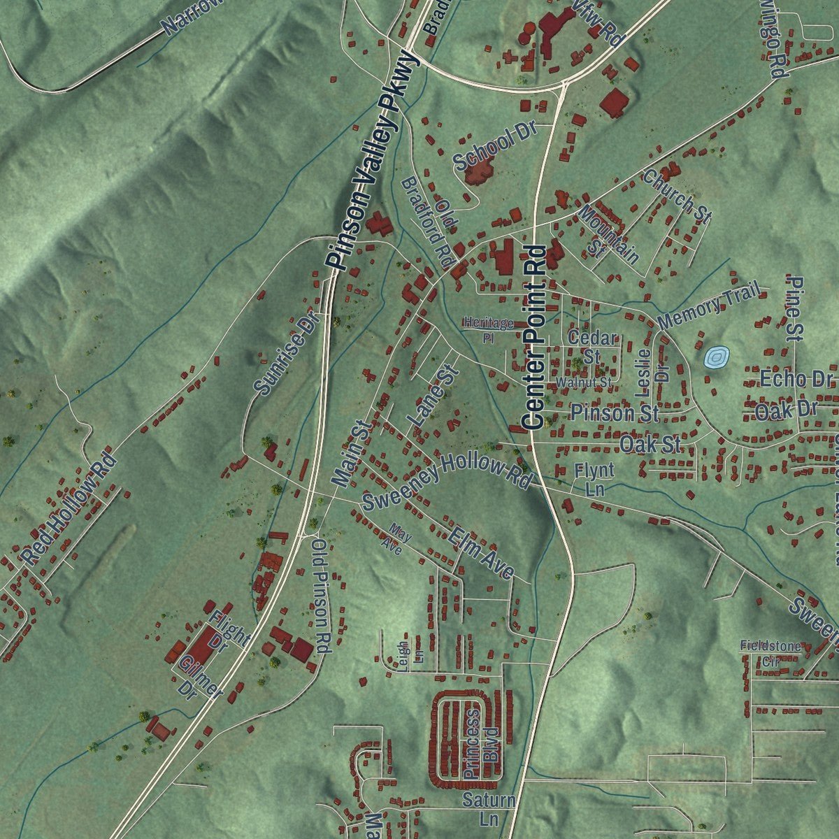
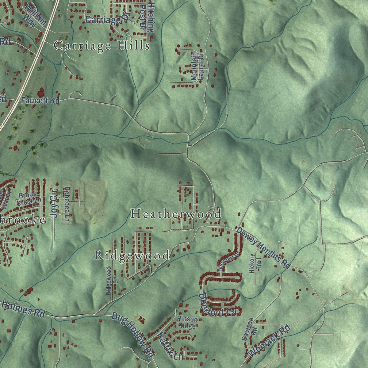
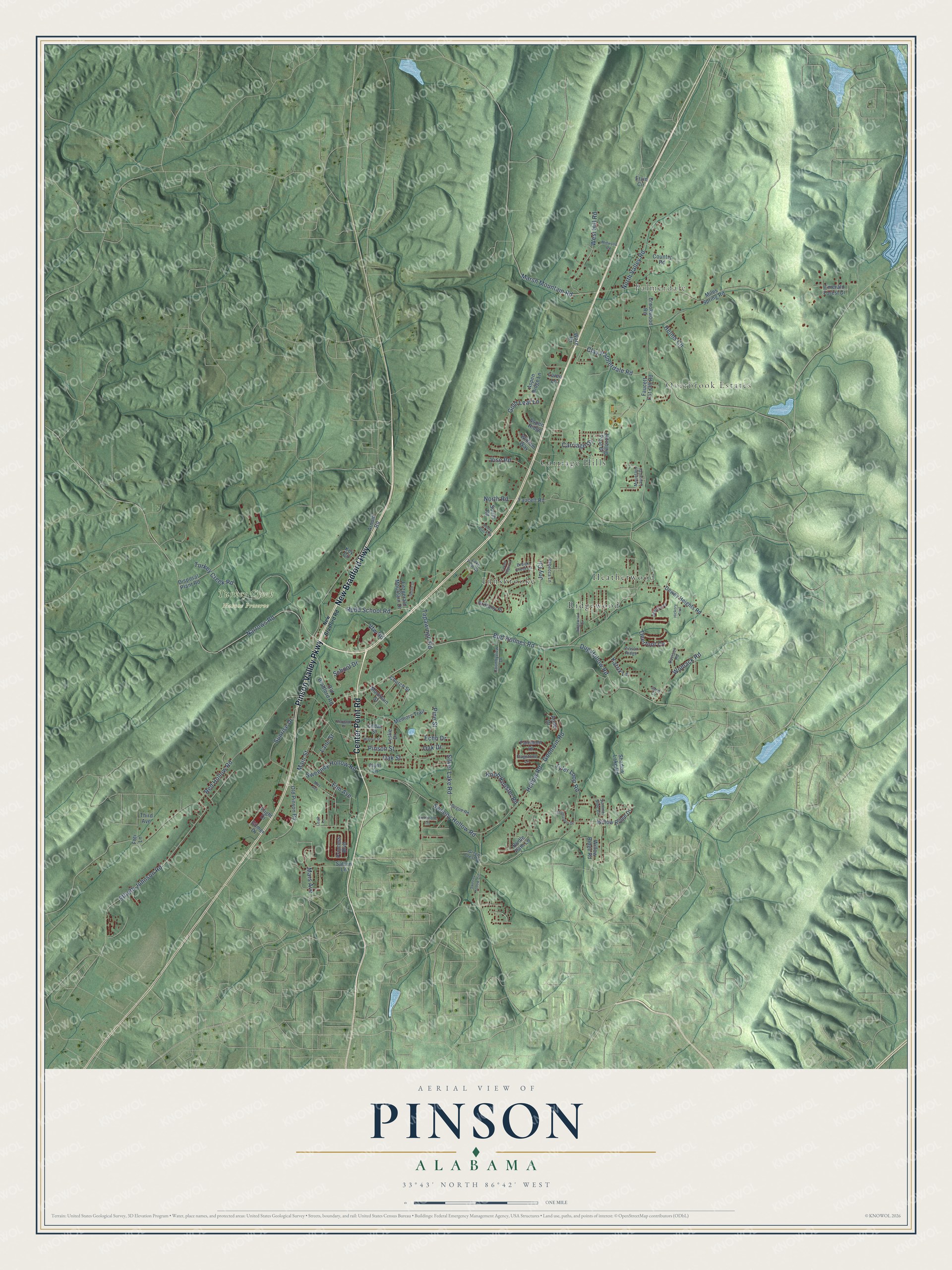
Explore Pinson, Alabama from a whole new perspective. Created using aerial imagery and detailed geographic data, this map captures Pinson building by building, with labeled streets, familiar landmarks, and shaded topographical relief that highlights the natural contours of the landscape.
Combining modern data with the timeless character of a vintage atlas, this map is just as interesting up close as it is beautiful on the wall. Whether you grew up in Pinson, spent memorable years there, or call it home today, this unique map is a great way to celebrate a place that means something to you. Zoom in on the preview to look for your street, and then order a print to put your memories on the wall.
Three ways to hang it
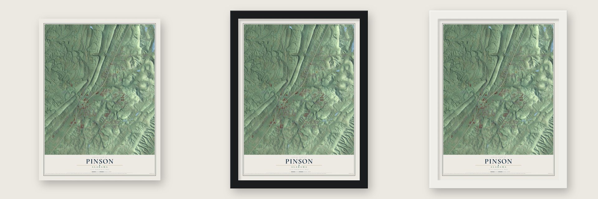
Unframed archival matte, a black wood frame or a white wood frame.
Up close
Geography Worth Displaying
This map was created using accurate cartographic data and authoritative geographic sources, including the U.S. Geological Survey and the Census Bureau. The map brings together terrain, waterways, roads, and building detail. The majority of the streets are labeled, houses are accurately depicted, and the topography is derived from government sources. Combining local data with carefully composed color and shading leads to this beautifully detailed Pinson artwork for your wall.
Rather than simply showing street outlines, we’ve included as many of the street names as we could reasonably fit on the map while keeping their names legible. Zoom in on the high resolution preview to see exactly what’s on the map. We truly set out to create a statement piece for anyone who loves Pinson. So whether it’s for you, or a gift for someone you love, we hope this map of Pinson brings back fond memories.
Read the story behind this map of Pinson, Alabama from 2026.

About Pinson, Alabama
Pinson is a city of 7,215 people in northeastern Jefferson County, near Birmingham. Its first settlers arrived early in the nineteenth century, and tradition holds that some were soldiers of Gen. Andrew Jackson who had marched through during the Creek War of 1813-14 and came back to claim homesteads. The settlement was first called Hagood's Crossroads, for a family of early settlers, and later Mount Pinson, after a town in Tennessee. When its first post office opened in 1837, the name was shortened to Pinson.
The Louisville & Nashville Railroad built a line through town in 1889, and Pinson became a shipping point for coal from the nearby mines. By 1910 it had 125 residents, ten stores and a flour mill. In March 2004, Pinson joined with Palmerdale and several neighboring communities to incorporate as one city, the City of Pinson.
- The Jefferson WarriorsIn mid-July 1861, men from Mount Pinson formed a company they called the Jefferson Warriors. They marched to Huntsville, and on August 12 they were mustered into Confederate service as Company C of the 19th Alabama Infantry, led by Col. Joseph Wheeler. The regiment fought at Shiloh, Chickamauga, Murfreesboro, Missionary Ridge, Atlanta, Nashville and Bentonville, N.C., and its losses were so heavy that only 76 men were left to surrender in April 1865.
- Horseshoes for the ConfederacyStarting in 1863, the Mount Pinson Ironworks made horseshoes for the Confederate army. It kept working until federal troops under Gen. John T. Croxton destroyed it. Its remains now lie in the Turkey Creek Nature Preserve, just minutes from town.
- Palmerdale Homesteads, 1935During the Great Depression, Franklin Roosevelt's New Deal built five farm resettlement communities in Alabama, and Palmerdale was the first. The program moved poor families out of cities and onto farms where they could raise their own food. The first of Palmerdale's 102 homesteads were finished in 1935, and a community store and an elementary school that also served as a community center followed in 1937. Palmerdale now lies inside the Pinson city limits.
- Darters found only hereThree species of endangered fish swim in Turkey Creek. The vermillion darter and the rush darter are two of them, and neither one lives anywhere else in the world.
Find your street
Names on the Pinson map
Every name below is printed on this map. Look for your street, your school, the park where you played, or the pond down the road.
Places and landmarks7
- Palmerdale
- Overbrook Estates
- Turkey Creek Nature Preserve
- Carriage Hills
- Heatherwood
- Innsbrooke
- Ridgewood
Streets and roads110
- New Bradford Highway
- Center Point Road
- Pinson Valley Parkway
- Narrows Road
- Rudd School Road
- School Drive
- Goodwin Road
- Red Hollow Road
- Turkey Creek Road
- Silver Lake Road
- Sweeny Hollow Road
- Tyler Loop Road
- Bud Holmes Road
- Main Street
- Clay Palmerdale Road
- Elfreth Johnson Road
- Gold Leaf Lane
- West Hill Road
- North Valley Road
- Marsh Mountain Road
- Dug Hollow Road
- Tapawingo Road
- Sunrise Drive
- Womack Road
- Deerfoot Cv
- Sweeney Hollow Road
- Elm Avenue
- Vise Road
- Oak Street
- Pinson Street
Show all 110 streets
- Knob Knoster Road
- Pine Street
- North Road
- Hollow Road
- Carriage Drive
- Joy Circle
- Helms Circle
- Mars Avenue
- Katrix Lane
- Oak Drive
- Lane Street
- Echo Drive
- Vfw Road
- Old Bradford Road
- Miles Spring Road
- Dewey Heights Road
- Faucett Cut-Off Road
- Brookwood Road
- Disposal Plant Road
- Shadow Lake Road
- Faucett Road
- Princess Boulevard
- Old Pinson Road
- Brittany Place
- Willow Ridge Drive
- Saturn Lane
- South Road
- Aspen Ridge
- Fitzgerald Mountain Drive
- Memory Trail
- Key Circle
- Bridle Path Lane
- Gilmer Drive
- Country Road
- Aspen Ridge Lane
- Hitching Post Drive
- Mountain Street
- Fairmont Drive
- Willow Ridge Road
- William Way
- Cedar Street
- Leslie Drive
- Church Street
- Emerald Forest Drive
- Third Avenue
- Loren Lane
- Foti Lane
- Ware Drive
- Arnold Road
- Ervin Circle
- Anne Drive
- Flight Drive
- Flynt Lane
- Mountain Laurel Drive
- Davison Road
- Countryview Drive
- Bogue Road
- Rebecca Lane
- Flagstone Lane
- Brook Crest Lane
- Green Crest Drive
- Pinson Ridge
- Summer Side Circle
- Lake View Drive
- New Bradford Road
- May Avenue
- Stonearbor Drive
- Deerfoot Drive
- Midwood Road
- Henry Black Drive
- Ridgewood Drive
- Sweeny Hollow Circle
- Walnut Street
- South Drive
- Lakes Edge Lane
- Heritage Place
- Hickory Trail
- Fieldstone Circle
- Sandi Circle
- Leigh Lane
Names are listed as they appear on the printed map. Zoom into the product photos to find them.
The art of mapping a place
How This Map Was Made
Real places. Remarkable detail. Discover the layers that turn geographic data into a map of home.

The view from above
Aerial imagery reveals the character of the land: woodland, open fields, and the patterns of a place.

The shape of the land
Elevation data brings hills, valleys, and subtle changes in the landscape into view.

The details of home
Roads, waterways, and building footprints come together to make the map feel unmistakably local.

Geography becomes art
Considered color, shading, and typography bring the layers together in a map made for your wall.


Process illustrated with Mendon, Massachusetts. Aerial imagery: USDA NAIP. Terrain: USGS 3D Elevation Program. Map details and finished artwork: KNOWOL.
The Details
About This Print
Choose an archival matte print, or a black or white Ayous wood frame. The archival matte print is unframed.
Select your size and finish above to see the matching product image and price.
Materials & Craftsmanship
A contemporary map with the character of a classic atlas, printed on archival matte paper. Optional frames are made from Ayous wood.
Your printed map does not include the watermark shown in the full-map preview.
Shipping & Delivery
Free shipping within the United States. Every print is made to order in the USA.
Buying a gift? Add a note in your cart and we'll include it. We never put prices in the package.
Prints ship within 2 to 3 business days. Allow 7 to 10 days total from ordering for delivery. Timing may vary during holidays or periods of high order volume.
Read our shipping policy.
Returns and damaged prints
Each print is made to order. Change-of-mind refunds are not available after production.
If your print arrives damaged, misprinted or incorrect, contact support@knowol.com within 30 days of receiving it. Include your order number, photos and a description of the issue.
Read our full refund and replacement policy. For questions about your order, email support@knowol.com.
Find your town
Looking for another city?
Find a map of home in our Alabama collection, or any town in the country.
Nearby
Maps of towns near Pinson
Know someone from one of these towns? Their map makes a great gift.
 Clay
Clay, Alabama
From $39.99See the map
 Grayson Valley
, Alabama
From $39.99See the map
 Center Point
, Alabama
From $39.99See the map
More maps nearby: Trussville, Remlap, County Line, Morris and Gardendale.