


Search for another town


Free U.S. delivery 7 to 10 days after you order
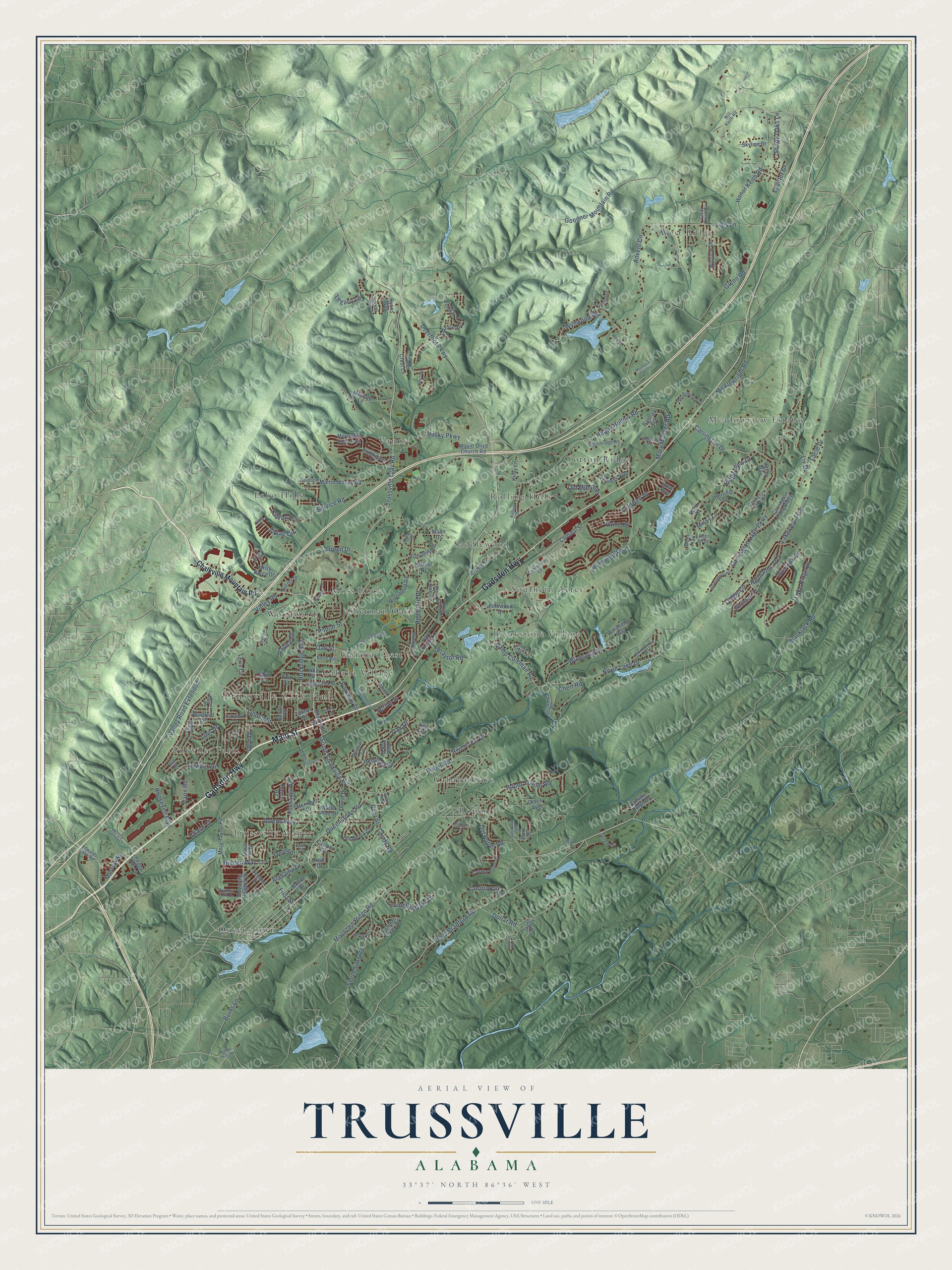
Trussville, Alabama Map Art
Building by building, with labeled streets and shaded relief.
12" x 18" Archival Matte Print
A Map of Home. A Work of Art.
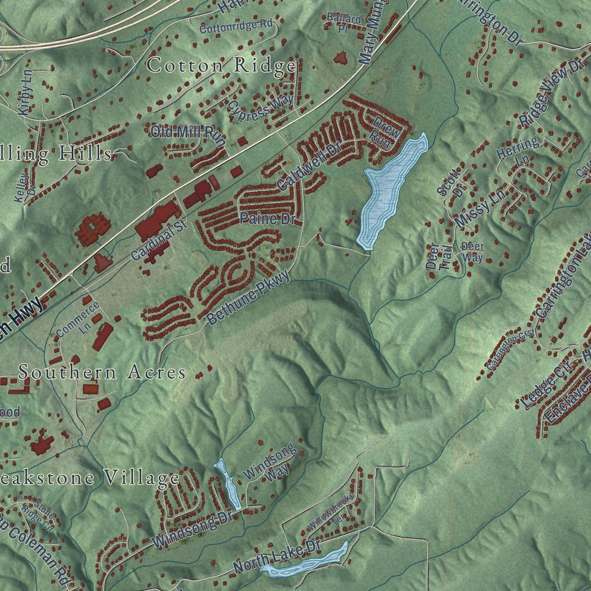
Explore Trussville, Alabama from a whole new perspective. Created using aerial imagery and detailed geographic data, this map captures Trussville building by building, with labeled streets, familiar landmarks, and shaded topographical relief that highlights the natural contours of the landscape.
Combining modern data with the timeless character of a vintage atlas, this map is just as interesting up close as it is beautiful on the wall. Whether you grew up in Trussville, spent memorable years there, or call it home today, this unique map is a great way to celebrate a place that means something to you. Zoom in on the preview to look for your street, and then order a print to put your memories on the wall.
Three ways to hang it

Unframed archival matte, a black wood frame or a white wood frame.
Up close
Geography Worth Displaying
This map was created using accurate cartographic data and authoritative geographic sources, including the U.S. Geological Survey and the Census Bureau. The map brings together terrain, waterways, roads, and building detail. The majority of the streets are labeled, houses are accurately depicted, and the topography is derived from government sources. Combining local data with carefully composed color and shading leads to this beautifully detailed Trussville artwork for your wall.
Rather than simply showing street outlines, we’ve included as many of the street names as we could reasonably fit on the map while keeping their names legible. Zoom in on the high resolution preview to see exactly what’s on the map. We truly set out to create a statement piece for anyone who loves Trussville. So whether it’s for you, or a gift for someone you love, we hope this map of Trussville brings back fond memories.
Read the story behind this map of Trussville, Alabama from 2026.

Find your street
Names on the Trussville map
Every name below is printed on this map. Look for your street, your school, the park where you played, or the pond down the road.
Places and landmarks20
- Trussville City Hall
- Breakstone Village
- Cahaba Cove
- Cahaba Crest
- Cahaba Village
- Cotton Ridge
- Echo Hills
- Meadowview Estates
- Moss Rock
- Queenstown
- Rolling Hills
- Roper
Show all 20 places
- Saddlewood
- Sherman Oaks
- Southern Acres
- Trussville Manor
- Tutwiler Farm
- Vanns
- West Ridge
- Woodward
Streets and roads197
- Gadsden Highway
- Main Street
- Deerfoot Parkway
- Roper Road
- Trussville Clay Road
- Linden Street
- South Chalkville Road
- Happy Hollow Road
- Carrington Drive
- Camp Coleman Road
- Poplar Street
- Oak Drive
- North Lake Drive
- First Street
- Advent Circle
- Floyd Bradford Road
- Service Road
- Carrington Lake Parkway
- Smith Sims Road
- Queenstown Road
- Bethune Parkway
- Valley Road Extended
- Roosevelt Boulevard
- Caldwell Drive
- Honor Keith Road
- Dollar Road
- Roper Tunnel Road
- Liles Lane
- Green Drive
- Parkway Drive
Show all 197 streets
- Husky Parkway
- Valley Road
- Mountain Ridge Road
- Goodner Mountain Road
- Blackjack Road
- Wynwood Road
- Lake Ridge Drive
- Missy Lane
- Windsong Drive
- Glenn Road
- Tutwiler Drive
- Burns Lane
- Mary Munger Road
- Palace Drive
- Liv Drive
- Dawns Way
- Rockridge Avenue
- Lexington Oaks Drive
- Hemlock Street
- Rivercrest Drive
- Chert Road
- Spring Street
- Redwood Drive
- Highlands Trce
- Overlook Drive
- Coody Road
- Hidden Way Lane
- Lakeview Trce
- Old Roper Road
- Ridge View Drive
- Morrow Road
- Micklewright Road
- Shady Oaks Lane
- Alabama Drive
- Old Mill Run
- Chase Court
- Legacy Lane
- Ziklag Circle
- Praytor Road
- Pear Street
- Scooter Drive
- Ledge Circle
- Vann Road
- Oak Street
- Lacie Drive
- Linn Drive
- Enclave Place
- Kidron Place
- Paine Drive
- Dew Drive
- Chalkville Mountain Road
- Talley Street
- Chalkville Road
- Skyline Drive
- Martin Wilson Road
- Riverbend Road
- Lake Street
- Memory Lane
- Misty Ridge Drive
- Hawkridge Road
- Magnolia Street
- Carrington Lake Ridge
- Winslow Drive
- Herring Lane
- Magnolia Heights Drive
- Mary Taylor Road
- Mountain View Trce
- Forest Drive
- Second Street
- Cahaba Park Drive
- Crown Lane
- Trace Way
- Hunters Creek Drive
- Mermont Drive
- Mount Olive Church Road
- White Pine Street
- Barclay Terrace
- Post Oak Drive
- Windsong Way
- York Street
- Cypress Way
- Cardinal Street
- Clubhouse Drive
- Harrier Road
- Grace Avenue
- Pinewood Drive
- Cahaba Ridge Drive
- Houser Drive
- Kirby Lane
- Scott Drive
- Reid Drive
- Deer Crest Lane
- Mobile Drive
- Yvonne Street
- Parc Brook Lane
- Valley Way
- Bradford Circle
- Willow Lane
- Norrel Drive
- Lexie Circle
- Ryans Way
- Cooper Avenue
- Drew Run
- Peggy Lee Lane
- Mann Drive
- Red Oak Drive
- Chris Court
- Deer Trail
- Park Street
- Ash Circle
- Will Keith Road
- Cottonridge Road
- Wimberly Drive
- Girlscout Road
- Commerce Lane
- Cedarbrook Circle
- Edwards Lake Road
- Branchville Road
- Lake Vista Drive
- Cahaba Manor Drive
- Pump House Road
- Kelley Drive
- Meadowview Drive
- Maplewood Drive
- Carrington Lake Cv
- Fox Branch
- Boulder Drive
- Rock Creek Circle
- Delane Drive
- North Mall
- Fairway Drive
- Vick Circle
- Ballard Place
- Grand Oak Trail
- Ashwood Lane
- Chris Drive
- Clear Creek Circle
- Quail Run
- Patriots Pass
- Jackson Street
- Nichols Way
- Deer Way
- Cherokee Drive
- Pineview Road
- Watterson Parkway
- Vann Circle
- Willowbrooke Terrace
- Mohawk Drive
- Mountain Top Circle
- Carrington Crst
- Magnolia South Drive
- Cook Road
- Morris Springs Lane
- Mountain Court
- Massey Lane
- Amber Hills Road
- Woodfield Lane
- Stone Ridge Circle
- Fox Creek Drive
- Third Street
- Chatham Drive
- Deerfoot Court
- Ole Mill Road
- Ziklag Place
- Dawn Circle
- Post Circle
- Cove Circle
Names are listed as they appear on the printed map. Zoom into the product photos to find them.
About Trussville, Alabama
Trussville is a city of 26,123 people in Jefferson and St. Clair counties, about 15 miles northeast of downtown Birmingham. The land was part of the Creek Nation before Alabama became a territory. In the early 1820s Warren Truss, a North Carolina man of English descent, came with his brothers and built a grist mill on the Cahaba River. Good soil and plenty of water drew other settlers, and the farm settlement that grew up a few miles south was first known simply as Truss.
Its families raised livestock, cotton, grain and vegetables, and many landowners worked their farms with enslaved African Americans. Most residents sided with the Confederacy in the Civil War. After the war the Alabama-Chattanooga Railway was laid through town, and by 1886 a blast furnace stood where Cahaba Elementary School is today. Trussville stayed small while Birmingham boomed, until Interstates 59 and 459 were finished in the 1980s and made it easier to reach. In the mid-1980s the city grew to three times its old size in area, and its population doubled.
“The fighting took place far from Truss, however, until April 1865, when federal soldiers pillaged and burned a Confederate storehouse there.”
- A New Deal village of 1936Franklin D. Roosevelt's Resettlement Administration first planned small potato and vegetable farms, but chose a Trussville site so residents could take transit to Birmingham jobs. Landscape architect W. H. Kestler grouped the homes around a green called The Mall, and his plan won approval in 1936. Crews built 243 houses and 44 duplexes for $2,661,981.26, renting them to families for $14 to $23 a month, each with electricity, running water and two oak saplings.
- Roper Hill and The FortiesAbout 60 houses were torn down to make room for the Cahaba Project. White residents were moved to Roper Hill, and African American families got cottages on a 40-acre tract to the northwest, called Washington Heights or The Forties. Inside the project, residents ran the Cahaba Association, published the Cahaba Hub and played softball under lights on The Mall, while many Old Trussville families still had no electricity or indoor plumbing, and resentment grew between the two.
- One town in 1947The Cahaba Project and the older town stayed apart until Trussville incorporated on June 10, 1947. The next year the government sold the town all of the park land for one dollar, handed over the water system it had built and sold the houses to residents and other buyers, with veterans getting first choice of open lots at 10 percent down. Trussville became a city on May 31, 1957.
- First Baptist, since 1821The First Baptist Church of Trussville was organized at Cahawba Baptist Church in 1821, with Elder Sission Blythe as pastor and Anderson Robertson and Sherwood Holley as deacons. It has belonged to the Canaan Baptist Association, now the Birmingham association, since that group began in 1833. Its historical marker was dedicated at the church's 140th anniversary, on July 16, 1961.
- Its own schools in 2005R. G. Hewitt founded Trussville Academy, the town's first school, in 1869, and it drew 100 students in its first year. Local schools later belonged to Jefferson County. When a financial crisis in 2000 cut county money for teachers and the city wasn't allowed to make up the difference, the council created the Trussville Board of Education in 2004, and Trussville City Schools broke away in 2005.
Keep exploring Alabama
Trussville is one of 675 Alabama towns we've mapped. Every dot on the map is a print of its own.
The search covers every state, Alabama first.
Near Trussville
Order 2 or more town maps and save 10%. Shown in the size and finish you picked above, so they hang as a set.
- Clay 12" x 18" / Archival Matte Print $39.99
- Argo 12" x 18" / Archival Matte Print $39.99
- Grayson Valley 12" x 18" / Archival Matte Print $39.99
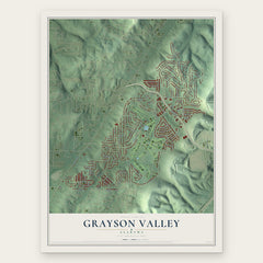
More maps nearby: Moody, Margaret, Pinson, Center Point and Springville.
The art of mapping a place
How This Map Was Made
Real places. Remarkable detail. Discover the layers that turn geographic data into a map of home.

The view from above
Aerial imagery reveals the character of the land: woodland, open fields, and the patterns of a place.

The shape of the land
Elevation data brings hills, valleys, and subtle changes in the landscape into view.

The details of home
Roads, waterways, and building footprints come together to make the map feel unmistakably local.

Geography becomes art
Considered color, shading, and typography bring the layers together in a map made for your wall.


Process illustrated with Mendon, Massachusetts. Aerial imagery: USDA NAIP. Terrain: USGS 3D Elevation Program. Map details and finished artwork: KNOWOL.
The Details
About This Print
Choose an archival matte print, or a black or white Ayous wood frame. The archival matte print is unframed.
Select your size and finish above to see the matching product image and price.
Materials & Craftsmanship
A contemporary map with the character of a classic atlas, printed on archival matte paper. Optional frames are made from Ayous wood.
Your printed map does not include the watermark shown in the full-map preview.
Shipping & Delivery
Free shipping within the United States. Every print is made to order in the USA.
Buying a gift? Add a note in your cart and we'll include it. We never put prices in the package.
Prints ship within 2 to 3 business days. Allow 7 to 10 days total from ordering for delivery. Timing may vary during holidays or periods of high order volume.
Read our shipping policy.
Returns and damaged prints
Each print is made to order. Change-of-mind refunds are not available after production.
If your print arrives damaged, misprinted or incorrect, contact support@knowol.com within 30 days of receiving it. Include your order number, photos and a description of the issue.
Read our full refund and replacement policy. For questions about your order, email support@knowol.com.