
Search for another town





Free U.S. delivery 7 to 10 days after you order
Puyallup, Washington Map Art
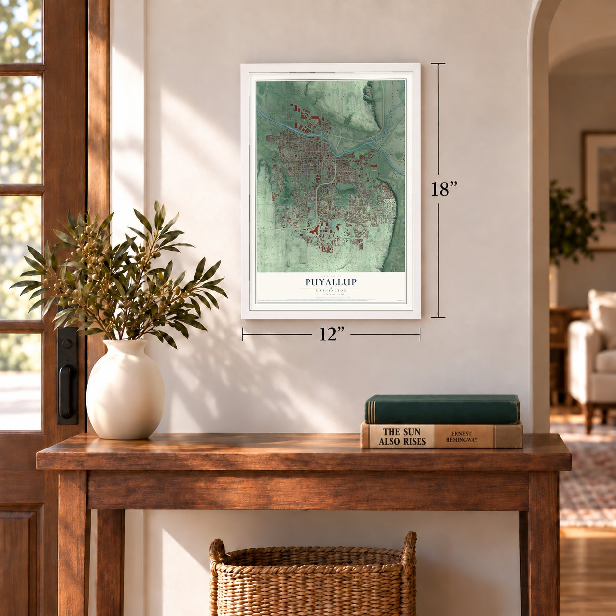
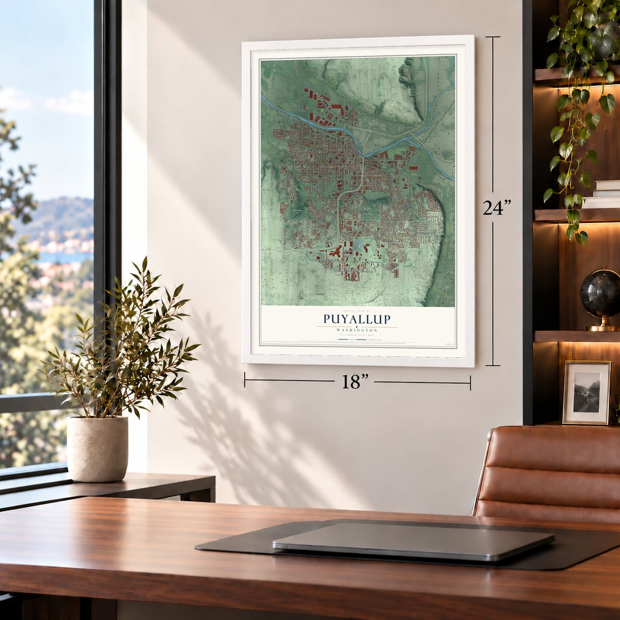
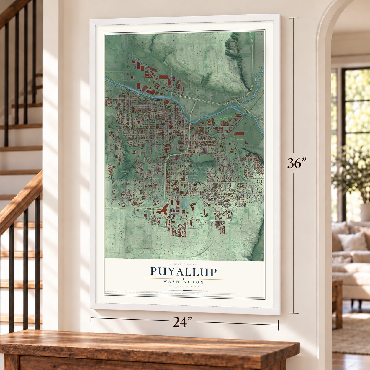
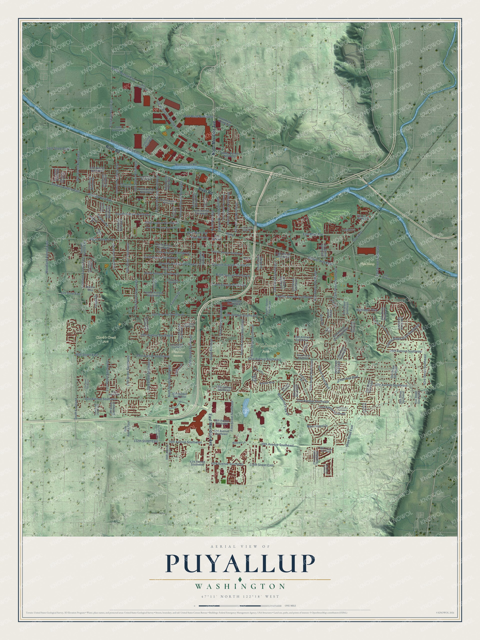
A new map of Puyallup, Washington, made in 2026 and printed to order on thick archival matte paper.
12" x 18" Archival Matte Print
A Map of Home. A Work of Art.
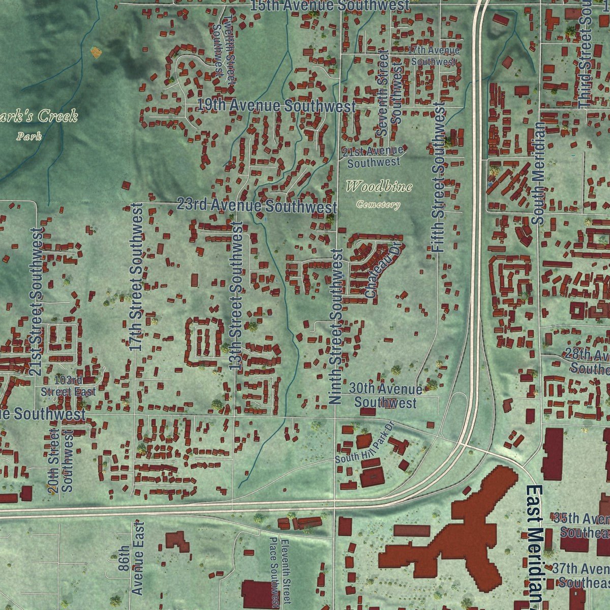
Explore Puyallup, Washington from a whole new perspective. Created using aerial imagery and detailed geographic data, this map captures Puyallup building by building, with labeled streets, familiar landmarks, and shaded topographical relief that highlights the natural contours of the landscape.
Combining modern data with the timeless character of a vintage atlas, this map is just as interesting up close as it is beautiful on the wall. Whether you grew up in Puyallup, spent memorable years there, or call it home today, this unique map is a great way to celebrate a place that means something to you. Zoom in on the preview to look for your street, and then order a print to put your memories on the wall.
Three ways to hang it
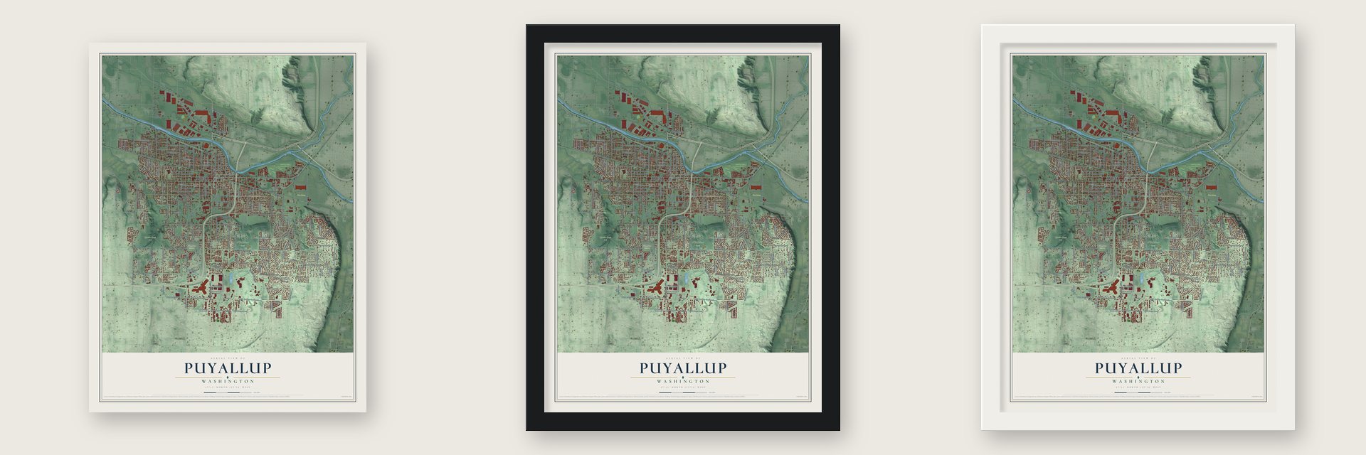
Unframed archival matte, a black wood frame or a white wood frame.
Up close
Geography Worth Displaying
This map was created using accurate cartographic data and authoritative geographic sources, including the U.S. Geological Survey and the Census Bureau. The map brings together terrain, waterways, roads, and building detail. The majority of the streets are labeled, houses are accurately depicted, and the topography is derived from government sources. Combining local data with carefully composed color and shading leads to this beautifully detailed Puyallup artwork for your wall.
Rather than simply showing street outlines, we’ve included as many of the street names as we could reasonably fit on the map while keeping their names legible. Zoom in on the high resolution preview to see exactly what’s on the map. We truly set out to create a statement piece for anyone who loves Puyallup. So whether it’s for you, or a gift for someone you love, we hope this map of Puyallup brings back fond memories.
Read the story behind this map of Puyallup, Washington from 2026.

About Puyallup, Washington
Puyallup is a city of 42,973 people in Pierce County, on the Puyallup River. This valley has long been the homeland of the Puyallup Tribe, and the city's name means "the generous people." White settlers began staking claims here after 1850, but the Indian War of 1855-1856 sent them fleeing to Fort Steilacoom, and few came back before 1859.
Families farmed only to feed themselves until 1865, when Olympia brewer Charles Wood brought hop roots over from England. Ezra Meeker planted some of them, and in 1877 he set aside 20 acres of his farm as a townsite. By 1884 more than 100 growers worked the valley, and Meeker alone had over 500 acres of vines. An 1888 incorporation was struck down by the state Supreme Court, so on August 16, 1890, the town's 1,500 citizens voted again and chose Meeker as their mayor.
“a thrifty, neat little place, growing steadily, and looking forward to doubling or trebling its present population of five hundred when the rich loam soils of the valley are more extensively cleared.”
- The Hop King goes brokeMeeker built kilns to dry hops, started a hop brokerage and sailed often to Britain, where he was called "The Hop King of the World." In 1892 hop lice swept the fields and ended the boom, taking his fortune with it. Berries became the main cash crop, then flower bulbs. Meeker later tried a store in Dawson City during the Klondike rush, found no gold and lost his money again.
- A shotgun quarantineWhen smallpox spread around Puget Sound in 1891-1892, frightened families from Tacoma tried to escape to the valley. The town council ordered every Tacoman kept out at gunpoint. Tacoma and Seattle suffered through the epidemic, but Puyallup stayed healthy.
- Camp HarmonyUnder Executive Order 9066, early in World War II, the fairgrounds were turned into a temporary camp for more than 7,000 Japanese Americans, most of them American citizens. Later they were moved again, this time to Idaho and the Minidoka relocation center outside Twin Falls.
- Do the PuyallupThe fairgrounds were built so valley farmers could show off their crops and livestock. Known as the Puyallup Fair until 2013, when it became the Washington State Fair, it now draws over one million visitors a year. The city also hosts part of the Daffodil Parade each spring.
Find your street
Names on the Puyallup map
Every name below is printed on this map. Look for your street, your school, the park where you played, or the pond down the road.
Places and landmarks6
- City of Puyallup City Hall
- Meeker
- Clark's Creek Park
- Van Lierop
- Wildwood Park
- Woodbine Cemetery
Streets and roads185
- North Meridian Avenue
- River Road
- East Meridian Avenue
- Ninth Street Southwest
- Fifth Street Southeast
- South Meridian
- East Main Avenue
- Valley Avenue Northwest
- Fairview Drive
- Fifth Street Northeast
- North Meridian
- Fifth Street Southwest
- North Levee Road East
- 23rd Avenue Southeast
- North Levee Road
- 39th Avenue Southwest
- Pioneer Way East
- Shaw Road East
- Seventh Street Southeast
- Seventh Avenue Southwest
- 39th Avenue Southeast
- 13th Street Southwest
- West Stewart Avenue
- West Pioneer Avenue
- 27th Avenue Southeast
- 31st Avenue Southwest
- 21st Street Southeast
- Wildwood Park Drive
- Fruitland Avenue East
- Third Street Southeast
Show all 185 streets
- Fifth Avenue Southwest
- 13th Street Southeast
- Ninth Avenue Southwest
- 15th Avenue Southeast
- 17th Street Southwest
- Seventh Avenue Southeast
- Twelfth Avenue Southeast
- 25th Street Southeast
- 14th Street Southwest
- Ninth Street Southeast
- Tenth Avenue Southeast
- 15th Avenue Southwest
- West Main Avenue
- 31st Avenue Southeast
- Seventh Street Northwest
- Ninth Avenue Southeast
- 18th Street Northwest
- Highlands Boulevard
- 21st Street Southwest
- Fourth Avenue Northwest
- Freeman Road East
- 15th Street Northwest
- Crystal Ridge Drive Southeast
- Sixth Avenue Southwest
- Third Avenue Northwest
- 116th Street East
- Forest Green Boulevard
- Inter Avenue
- South Fruitland
- 23rd Avenue Southwest
- 43rd Avenue Southeast
- Eleventh Street Northwest
- 20th Street Southeast
- 19th Avenue Southwest
- 16th Street Southwest
- 20th Avenue Southeast
- 43rd Street Southeast
- Woodland Avenue East
- Manorwood Drive
- Valley Avenue East
- Tacoma Road
- Fourth Street Northeast
- Second Street Northeast
- 112th Street East
- 26th Street Northwest
- 96th Street East
- Firland Drive
- Stewart Avenue East
- 56th Street East
- 33rd Street Southeast
- Vista Drive
- Todd Road Northwest
- West Meeker
- Cherokee Boulevard
- Valley Avenue Northeast
- 94th Avenue East
- Rainier Boulevard
- 23rd Street Southeast
- 27th Street Southeast
- 43rd Avenue Southwest
- Todd Road Northeast
- Seventh Street Southwest
- Fifth Avenue Northwest
- 15th Street Southeast
- Fourth Avenue Southwest
- 34th Street Southeast
- 17th Street Southeast
- 18th Street Southeast
- 19th Avenue Southeast
- 22nd Street Southeast
- 37th Avenue Southeast
- Twelfth Street Southeast
- 13th Avenue Northwest
- Tenth Street Southeast
- 21st Street Northwest
- Fourth Street Northwest
- 36th Street Southeast
- 33rd Avenue Southeast
- Ninth Street Northwest
- 35th Avenue Southeast
- Third Street Southwest
- 39th Street Southeast
- 17th Street Northwest
- 23rd Street Northwest
- Fourth Avenue Southeast
- 18th Street Southwest
- Brookmonte Drive Southeast
- 28th Avenue Southeast
- 41st Street Southeast
- Twelfth Avenue Southwest
- Second Avenue Northwest
- 26th Street Southeast
- 86th Avenue East
- Ninth Avenue Northwest
- McElroy Place
- Larkspur Drive
- Third Street Northeast
- 27th Place Southeast
- 30th Avenue Southwest
- Fifth Avenue Southeast
- 19th Street Northwest
- Valley View Drive
- 13th Avenue Southeast
- 84th Street East
- Industrial Park Way
- 31st Street Southeast
- Olympic Boulevard
- Historic Way
- 38th Street Southeast
- Friutland Avenue East
- 20th Street Southwest
- 31st Street Northwest
- 52nd Street East
- Chateau Drive
- Willows Lane
- Linden Lane
- Rose Place
- East Meeker
- Spring Street
- Kilt Court
- 44th Street East
- Seventh Avenue Northwest
- Twelfth Avenue Northwest
- 21st Avenue Southwest
- Twelfth Street Southwest
- Fifth Avenue Northeast
- 28th Street Southeast
- 22nd Avenue Southeast
- 23rd Street Southwest
- 22nd Street Southwest
- 40th Avenue Southeast
- 29th Street Northwest
- 103rd Street East
- Terrace Drive
- Marion Court
- Tenth Avenue Northwest
- Eleventh Street Southwest
- Eleventh Street Place Southwest
- Parkwood Boulevard
- Eighth Street Northwest
- Second Avenue Northeast
- 17th Avenue Southwest
- Tenth Avenue Southwest
- 24th Street Southeast
- Amber Boulevard Southeast
- Second Street Northwest
- Eighth Avenue Southwest
- 20th Street Northwest
- 80th Street East
- 32nd Avenue Southeast
- 19th Street Southeast
- South Hill Park Drive
- 30th Street Southeast
- 28th Place Southeast
- 25th Street Southwest
Names are listed as they appear on the printed map. Zoom into the product photos to find them.
The art of mapping a place
How This Map Was Made
Real places. Remarkable detail. Discover the layers that turn geographic data into a map of home.

The view from above
Aerial imagery reveals the character of the land: woodland, open fields, and the patterns of a place.

The shape of the land
Elevation data brings hills, valleys, and subtle changes in the landscape into view.

The details of home
Roads, waterways, and building footprints come together to make the map feel unmistakably local.

Geography becomes art
Considered color, shading, and typography bring the layers together in a map made for your wall.


Process illustrated with Mendon, Massachusetts. Aerial imagery: USDA NAIP. Terrain: USGS 3D Elevation Program. Map details and finished artwork: KNOWOL.
The Details
About This Print
Choose an archival matte print, or a black or white Ayous wood frame. The archival matte print is unframed.
Select your size and finish above to see the matching product image and price.
Materials & Craftsmanship
A contemporary map with the character of a classic atlas, printed on archival matte paper. Optional frames are made from Ayous wood.
Your printed map does not include the watermark shown in the full-map preview.
Shipping & Delivery
Free shipping within the United States. Every print is made to order in the USA.
Buying a gift? Add a note in your cart and we'll include it. We never put prices in the package.
Prints ship within 2 to 3 business days. Allow 7 to 10 days total from ordering for delivery. Timing may vary during holidays or periods of high order volume.
Read our shipping policy.
Returns and damaged prints
Each print is made to order. Change-of-mind refunds are not available after production.
If your print arrives damaged, misprinted or incorrect, contact support@knowol.com within 30 days of receiving it. Include your order number, photos and a description of the issue.
Read our full refund and replacement policy. For questions about your order, email support@knowol.com.
Find your town
Looking for another city?
Find a map of home in our Washington collection, or any town in the country.
Nearby
Maps of towns near Puyallup
Know someone from one of these towns? Their map makes a great gift.
 North Puyallup
, Washington
From $39.99See the map
 Alderton
, Washington
From $39.99See the map
 Summit
, Washington
From $39.99See the map
More maps nearby: Edgewood, Waller, South Hill, Summit View and Sumner.