
Search for another town



Free U.S. delivery 7 to 10 days after you order
Sandwich, Massachusetts Map Art
Building by building, with labeled streets and shaded relief.
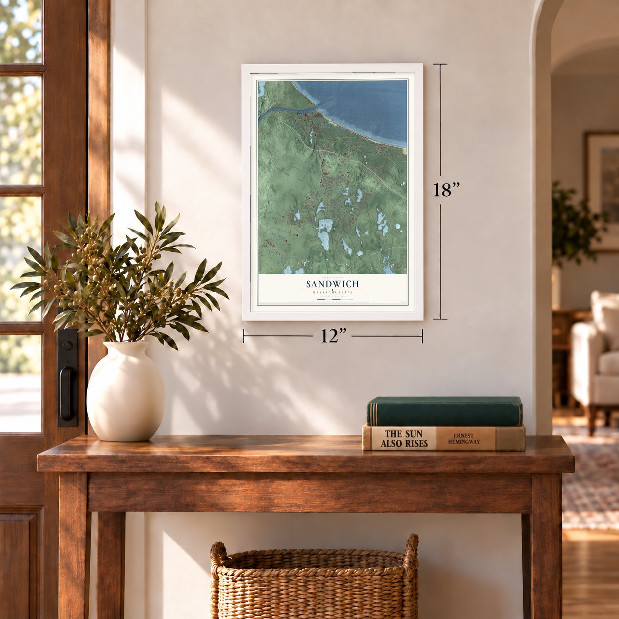
12" x 18" Archival Matte Print
A Map of Home. A Work of Art.
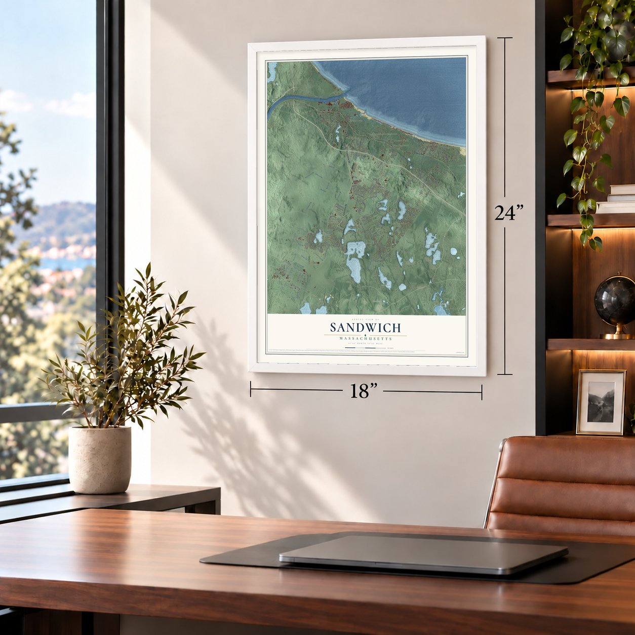
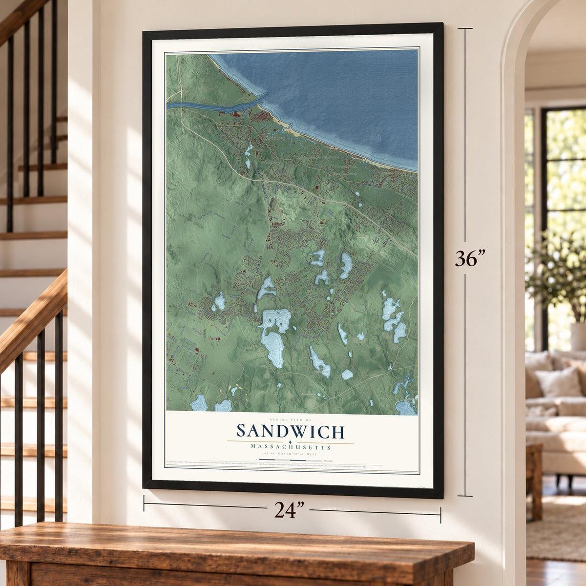
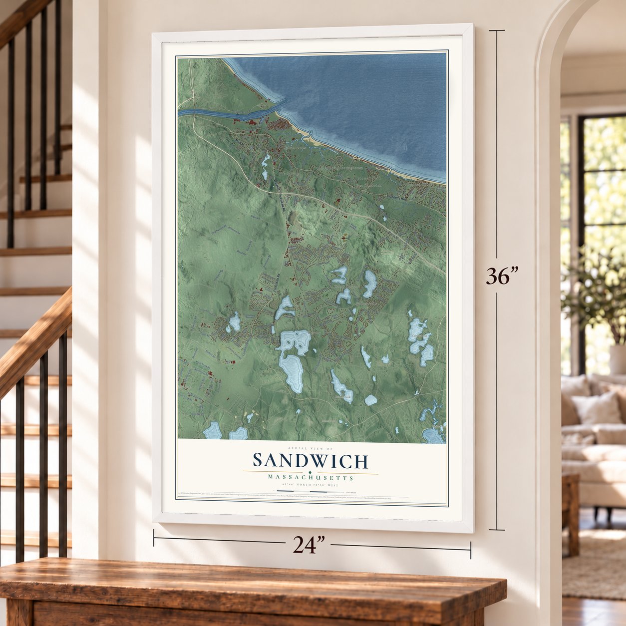
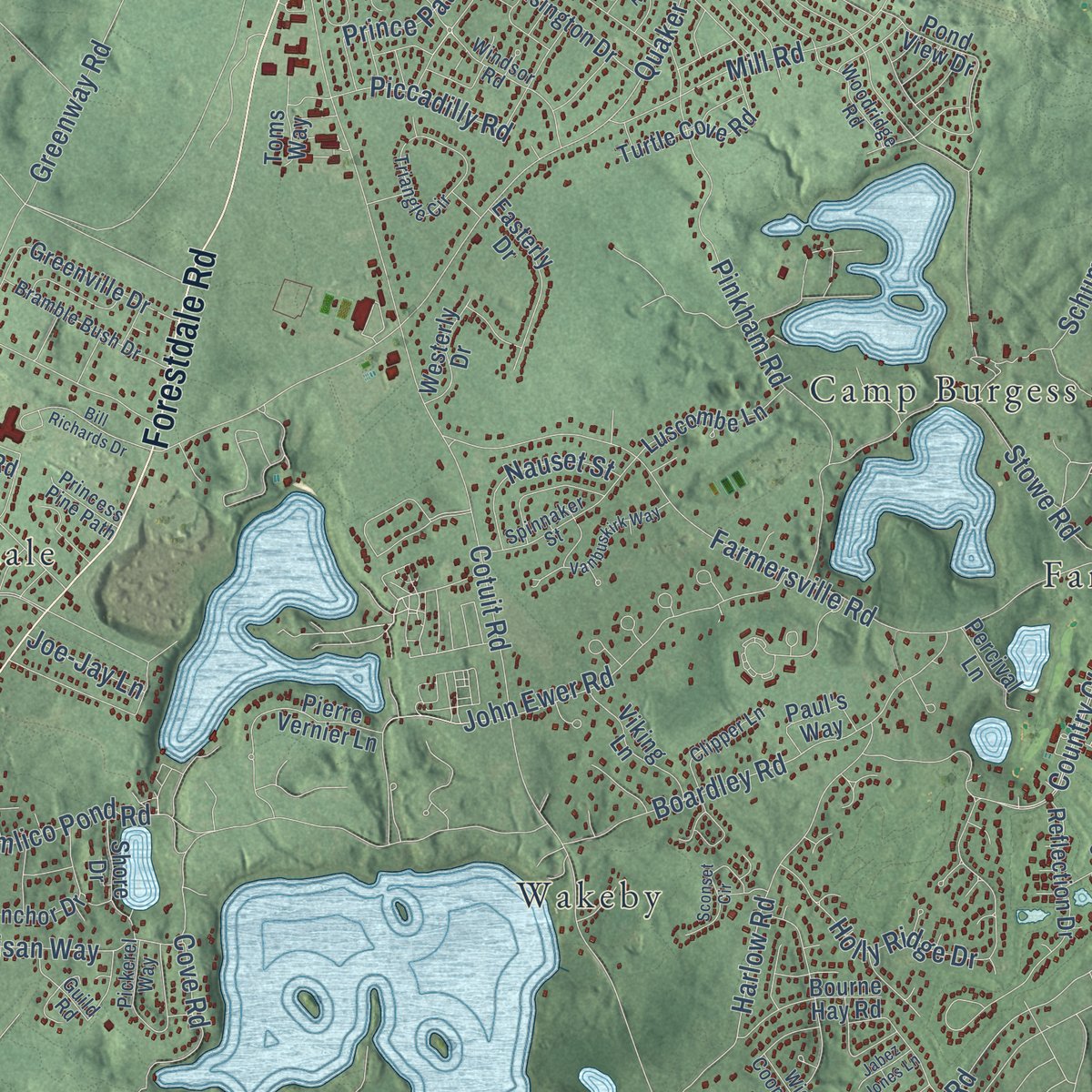
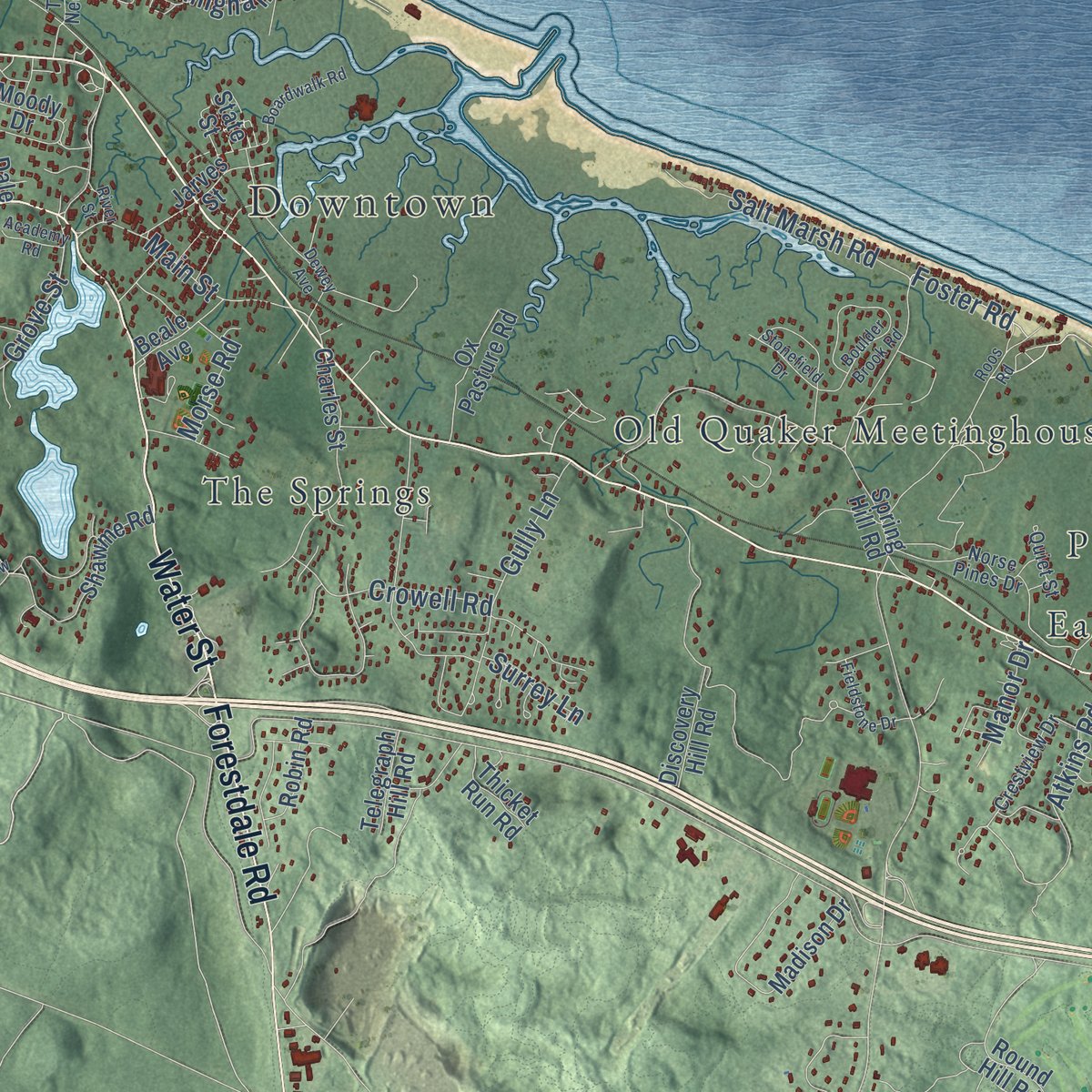
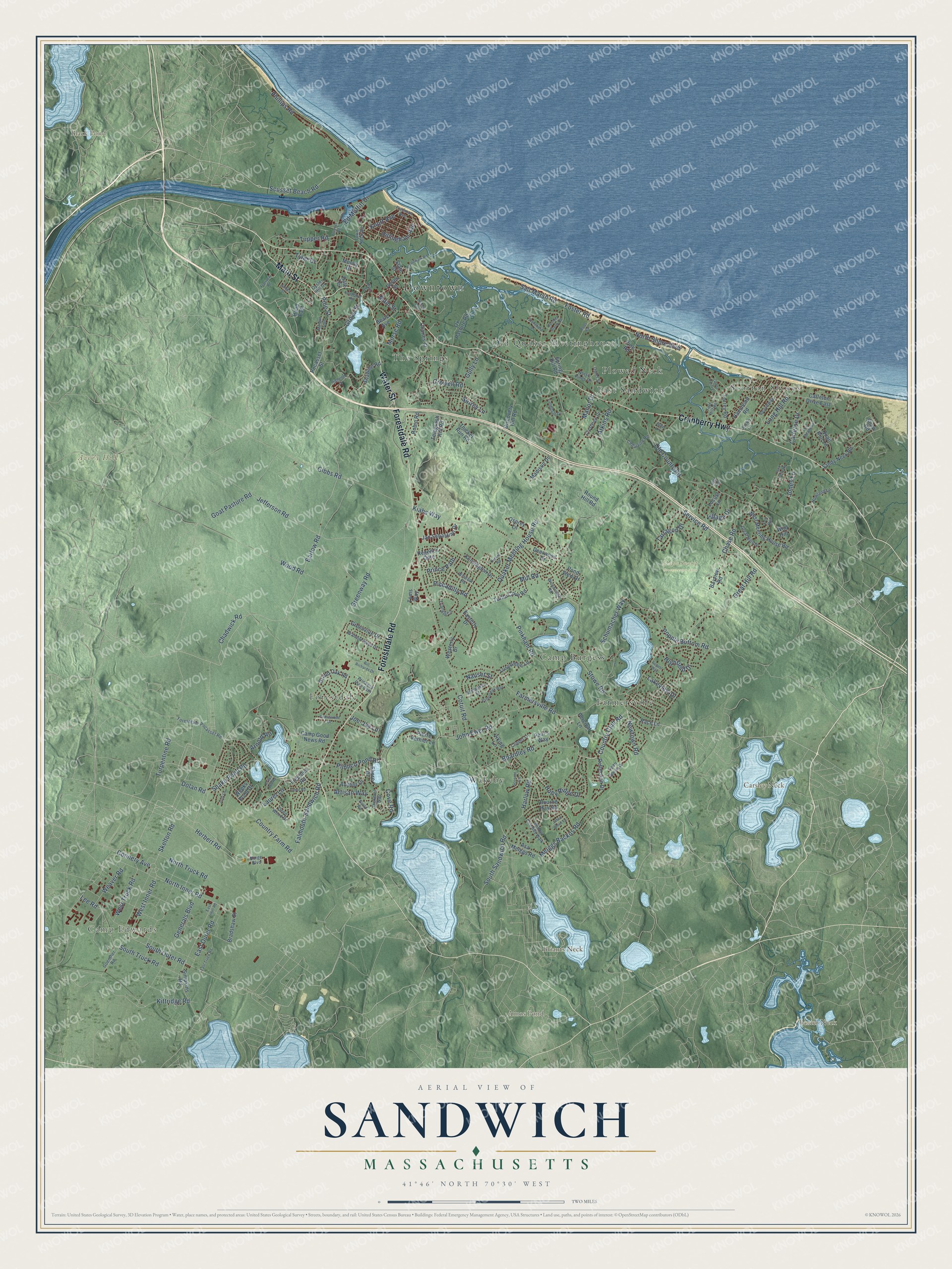
Explore Sandwich, Massachusetts from a whole new perspective. Created using aerial imagery and detailed geographic data, this map captures Sandwich building by building, with labeled streets, familiar landmarks, and shaded topographical relief that highlights the natural contours of the landscape.
Combining modern data with the timeless character of a vintage atlas, this map is just as interesting up close as it is beautiful on the wall. Whether you grew up in Sandwich, spent memorable years there, or call it home today, this unique map is a great way to celebrate a place that means something to you. Zoom in on the preview to look for your street, and then order a print to put your memories on the wall.
Three ways to hang it
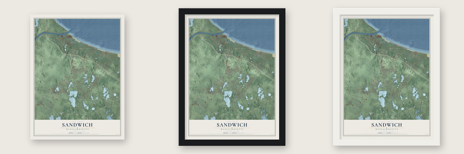
Unframed archival matte, a black wood frame or a white wood frame.
Up close
Geography Worth Displaying
This map was created using accurate cartographic data and authoritative geographic sources, including the U.S. Geological Survey (USGS) and FEMA. The map brings together terrain, waterways, roads, and building detail. The majority of the streets are labeled, houses are accurately depicted, and the topography is derived from government sources. Combining local data with carefully composed color and shading leads to this beautifully detailed Sandwich artwork for your wall.
Rather than simply showing street outlines, we’ve included as many of the street names as we could reasonably fit on the map while keeping their names legible. Zoom in on the high resolution preview to see exactly what’s on the map. We truly set out to create a statement piece for anyone who loves Sandwich. So whether it’s for you, or a gift for someone you love, we hope this map of Sandwich brings back fond memories.
Explore the full map of Sandwich, Massachusetts and read about the local places it shows.

Find your street
Names on the Sandwich map
Every name below is printed on this map. Look for your street, your school, the park where you played, or the pond down the road.
Places and landmarks18
- Downtown
- Camp Edwards
- Avery Hill
- Baxter Neck
- Briants Neck
- Carsley Neck
- Amos Pond
- Black Pond
- Maple Swamp Conservation Area
- Scorton Shores
- Forestdale
- Camp Burgess
Show all 18 places
- East Sandwich
- Wakeby
- The Springs
- Plowed Neck
- Farmersville
- Old Quaker Meetinghouse
Streets and roads199
- Cranberry Highway
- Forestdale Road
- Main Street
- Water Street
- Scusset Beach Road
- Barlow Road
- Farmersville Road
- Chadwick Road
- Country Club Road
- North Inner Road
- Jefferson Road
- Tupper Road
- Connery Avenue
- Herbert Road
- North Truck Road
- Grove Street
- Kiahs Way
- South Outer Road
- Popple Bottom Road
- Kittridge Road
- Turpentine Road
- Service Road
- Quaker Meeting House Road
- Greenway Road
- Cotuit Road
- Old County Road
- Great Hill Road
- Mill Road
- Wood Road
- Gibbs Road
Show all 199 streets
- Falmouth-Sandwich Road
- Snake Pond Road
- Generals Boulevard
- Stowe Road
- Country Farm Road
- Pinkham Road
- Harlow Road
- Chase Road
- North Shore Boulevard
- John Ewer Road
- Boardley Road
- Holly Ridge Drive
- Salt Marsh Road
- Phillips Road
- Meiggs Backus Road
- Foster Road
- East Outer Road
- Village Drive
- Knott Avenue
- Gully Lane
- South Truck Road
- West Inner Road
- Atkins Road
- Dillingham Avenue
- Artisan Way
- Highfield Drive
- Goat Pasture Road
- Pimlico Pond Road
- South Sandwich Road
- Schumacher Way
- Long Hill Road
- West Truck Road
- Carleton Drive
- Tyler Drive
- Pine Street
- Lee Road
- Newtown Road
- Crowell Road
- Weaver Road
- Skelton Road
- Cove Road
- Tarragon Drive
- Dolan Road
- Nauset Street
- Morse Road
- Piccadilly Road
- Ed Moffitt Drive
- Lakeview Drive
- Jones Lane
- Prince Path
- Manor Drive
- Joe-Jay Lane
- Arnold Road
- Surrey Lane
- Laurel Lane
- Race Lane
- Jan Sebastian Drive
- Bradshaw Street
- Spring Hill Road
- Greenville Drive
- Grand Oak Road
- Shawme Road
- Reflection Drive
- Camp Good News Road
- Torrey Road
- Discovery Hill Road
- Kensington Drive
- Madison Drive
- Charles Street
- Simpkins Road
- West Meeting House Road
- Anchor Drive
- Sandy Neck Road
- Moody Drive
- Hammond Road
- Round Hill Road
- Asa Meiggs Road
- Wolf Hill
- Turtle Cove Road
- Pond View Drive
- Regent's Gate
- Luscombe Lane
- Road East
- Easterly Drive
- Bourne Hay Road
- Viking Lane
- Pierre Vernier Lane
- Ox Pasture Road
- Bayview Road
- Jarves Street
- Westerly Drive
- Freedom Road
- Robin Road
- Paul's Way
- Deerwood Drive
- Locust Lane
- Osprey Lane
- Carleton Drive East
- Toms Way
- Beale Avenue
- Weeks Pond Drive
- Percival Lane
- Telegraph Hill Road
- Thicket Run Road
- Pocasset Street
- Shore Drive
- Shaw Road
- Pine Road
- Quail Run Lane
- State Street
- Dale Terrace
- Crestview Drive
- Windsor Road
- Woodridge Road
- Town Neck Road
- Triangle Circle
- Great Hills Drive
- Forestdale-Pocasset Road
- Open Space Drive
- Pickerel Way
- Spinnaker Street
- Bramble Bush Drive
- Beachway
- Deep Wood Drive
- Freeman Avenue
- Norse Pines Drive
- Goenther Road
- Widow Coombs Walk
- Fox Run
- June Lane
- Cedarville Road
- Clipper Lane
- Fort Hill Road
- Howland Lane
- Guild Road
- Oyster Hill Drive
- Princess Pine Path
- Joslin Lane
- Quiet Street
- Burge Boulevard
- Flatrock Road
- East Inner Road
- Boulder Brook Road
- Roos Road
- East Truck Road
- Stonefield Drive
- Vanbuskirk Way
- Oxford Road
- Lost Meadows
- Dewey Avenue
- Goose Point Lane
- Sconset Circle
- Highview Drive
- Boardwalk Road
- Bill Richards Drive
- Freezer Road
- Fieldstone Drive
- Tabor Road
- Grandwood Drive
- Jack Kelly Road
- Jody Lane
- Morgan Trail
- Jabez Jones Lane
- Academy Road
- Cross Hill Road
- August Way
- James Street
- River Street
- Holt Road
Names are listed as they appear on the printed map. Zoom into the product photos to find them.
About Sandwich, Massachusetts
Sandwich is a town of 20,259 people in Barnstable County, on Cape Cod. Settlers came down from Saugus in 1637 with Plymouth Colony's permission, and the next year the colony sent John Alden and Miles Standish to mark out the bounds of their grant. Sandwich was incorporated in 1639, which makes it Cape Cod's oldest town, a title it shares with Yarmouth.
During the winter of 1824 and 1825, Jabez Dame quietly bought a factory site for Deming Jarves, and on July 4, 1825, workers started making glass in a small building on the site. Fifty pairs of oxen, some owned by the company and some by nearby farmers, hauled the wood. The works had 500 hands during the Civil War years. When it shut down on January 1, 1888, the company still employed 276 men, and ten of them built a shop of their own and went on making glass.
“By the location of the Sandwich glass works here was created a home market for the sale of the surplus produce of our farmers. Those were indeed the palmy days of Sandwich”
- Quakers in Christopher's HollowThe Quaker preachers Christopher Holder and John Copeland came in 1657, and within a year eighteen local families had joined the Society of Friends. They met in William Allen's Spring Hill home and in a deep wooded glen southeast of the village, where flat stones are thought to have served as seats. In three years the colony fined them at least a thousand pounds, eighty-seven from Allen alone. The country's oldest continuous Quaker meeting still gathers today.
- Blackbirds, whales and wolvesThe early town meeting handed out unusual orders. In 1702 the minister, Roland Cotton, was given every drift whale that came ashore while he served. When smallpox struck in 1778, the town built a pest-house and fenced off the roads, and in 1790 it offered 25 pounds, later 30, for the wolf, catamount or tiger that was killing its sheep.
- The Wing Fort House, 1641Stephen Wing, whose father was the Rev. John Wing, settled on this homestead around the time he first married, in 1646. Tradition holds that it served as a fort for the first settlers. Wing descendants kept the house for generations, and in 1942 the last of the family sold it to the Wing Family of America, which runs it as a museum. It joined the National Register in 1976.
- The Benjamin Nye HomesteadBenjamin Nye built the oldest part of this house in 1678, a date that a tree-ring study confirmed in 2012. The state bought the property in 1924, and by 1962 the house faced demolition. The Nye Family Association bought it, restored it and opened it as a museum, and it was added to the National Register in 1992.
- Forestdale's one-room schoolThe town built 21 district schools in the 1800s, and the Forestdale School of 1878 has changed the least of those still standing. It served the farming village of Greenville, which took the name Forestdale when it got a post office around 1887. Classes met in its one room until 1927, and it joined the National Register in 1997.
Keep exploring Massachusetts
Sandwich is one of 468 Massachusetts towns we've mapped. Every dot on the map is a print of its own.
The search covers every state, Massachusetts first.
Near Sandwich
Order 2 or more town maps and save 10%. Shown in the size and finish you picked above, so they hang as a set.
- Forestdale 12" x 18" / Archival Matte Print $39.99
- East Sandwich 12" x 18" / Archival Matte Print $39.99
- Sagamore 12" x 18" / Archival Matte Print $39.99


More maps nearby: Bourne, Bournedale, Monument Beach, Mashpee and Mashpee Neck.
The art of mapping a place
How This Map Was Made
Real places. Remarkable detail. Discover the layers that turn geographic data into a map of home.

The view from above
Aerial imagery reveals the character of the land: woodland, open fields, and the patterns of a place.

The shape of the land
Elevation data brings hills, valleys, and subtle changes in the landscape into view.

The details of home
Roads, waterways, and building footprints come together to make the map feel unmistakably local.

Geography becomes art
Considered color, shading, and typography bring the layers together in a map made for your wall.


Process illustrated with Mendon, Massachusetts. Aerial imagery: USDA NAIP. Terrain: USGS 3D Elevation Program. Map details and finished artwork: KNOWOL.
The Details
About This Print
Choose an archival matte print, or a black or white Ayous wood frame. The archival matte print is unframed.
Select your size and finish above to see the matching product image and price.
Materials & Craftsmanship
A contemporary map with the character of a classic atlas, printed on archival matte paper. Optional frames are made from Ayous wood.
Your printed map does not include the watermark shown in the full-map preview.
Shipping & Delivery
Free shipping within the United States. Every print is made to order in the USA.
Buying a gift? Add a note in your cart and we'll include it. We never put prices in the package.
Prints ship within 2 to 3 business days. Allow 7 to 10 days total from ordering for delivery. Timing may vary during holidays or periods of high order volume.
Read our shipping policy.
Returns and damaged prints
Each print is made to order. Change-of-mind refunds are not available after production.
If your print arrives damaged, misprinted or incorrect, contact support@knowol.com within 30 days of receiving it. Include your order number, photos and a description of the issue.
Read our full refund and replacement policy. For questions about your order, email support@knowol.com.