
Search for another town




Free U.S. delivery 7 to 10 days after you order
Simsbury, Connecticut Map Art
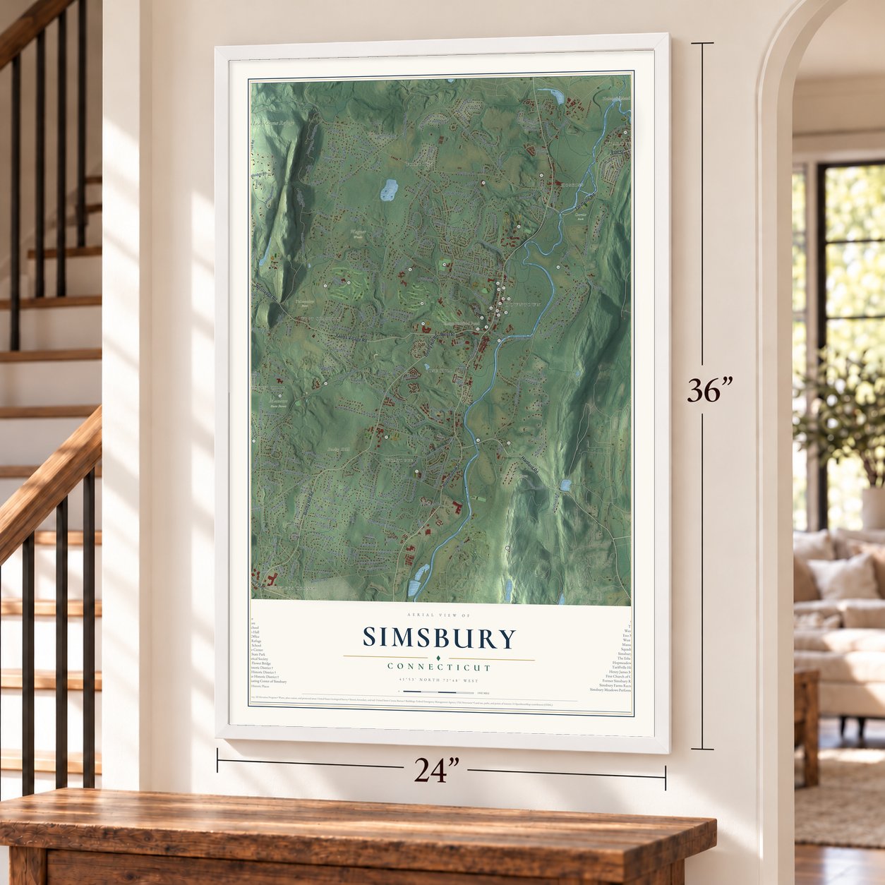
A new map of Simsbury, Connecticut, made in 2026 and printed to order on thick archival matte paper.
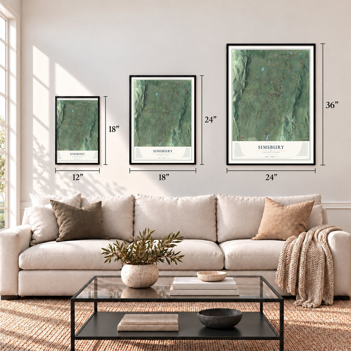
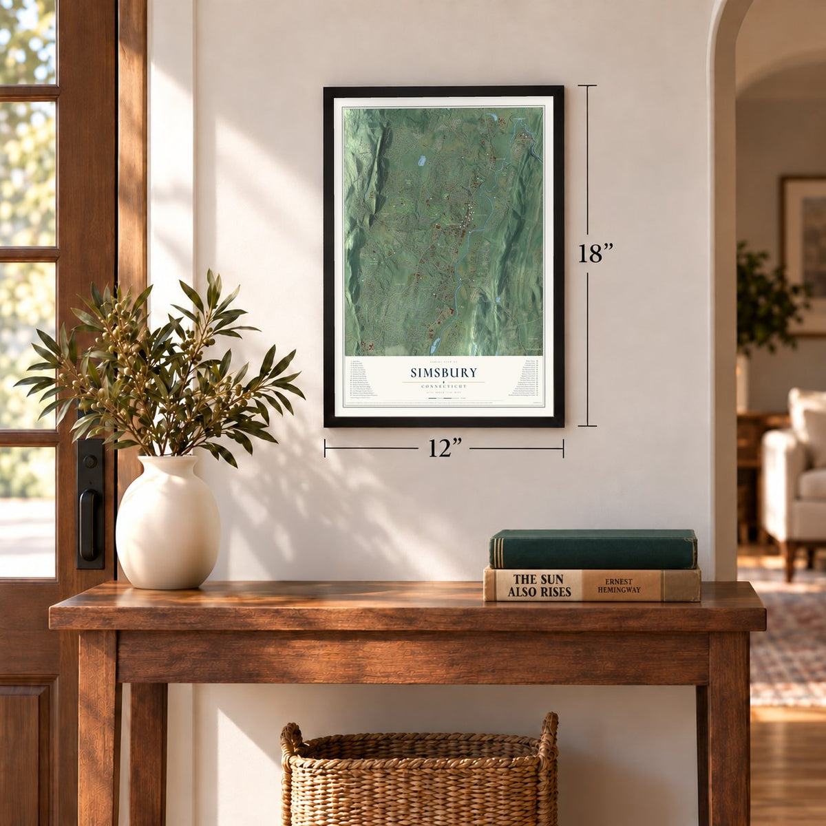
12" x 18" Archival Matte Print
A Map of Home. A Work of Art.
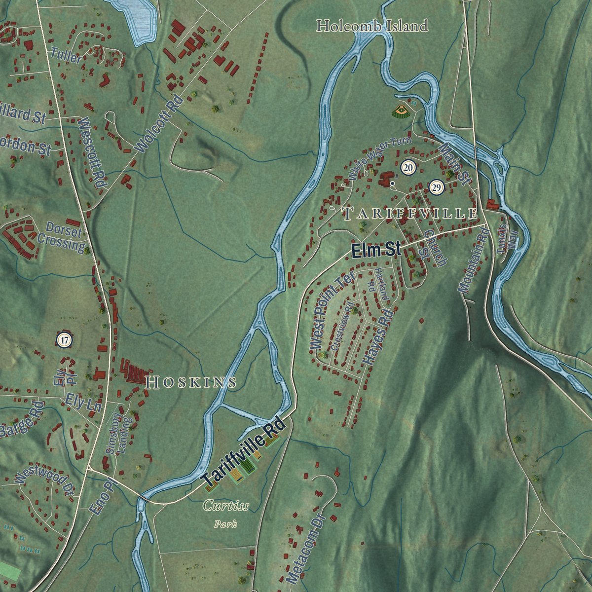
Explore Simsbury, Connecticut from a whole new perspective. Created using aerial imagery and detailed geographic data, this map captures Simsbury building by building, with labeled streets, familiar landmarks, and shaded topographical relief that highlights the natural contours of the landscape.
Combining modern data with the timeless character of a vintage atlas, this map is just as interesting up close as it is beautiful on the wall. Whether you grew up in Simsbury, spent memorable years there, or call it home today, this unique map is a great way to celebrate a place that means something to you. Zoom in on the preview to look for your street, and then order a print to put your memories on the wall.

Three ways to hang it
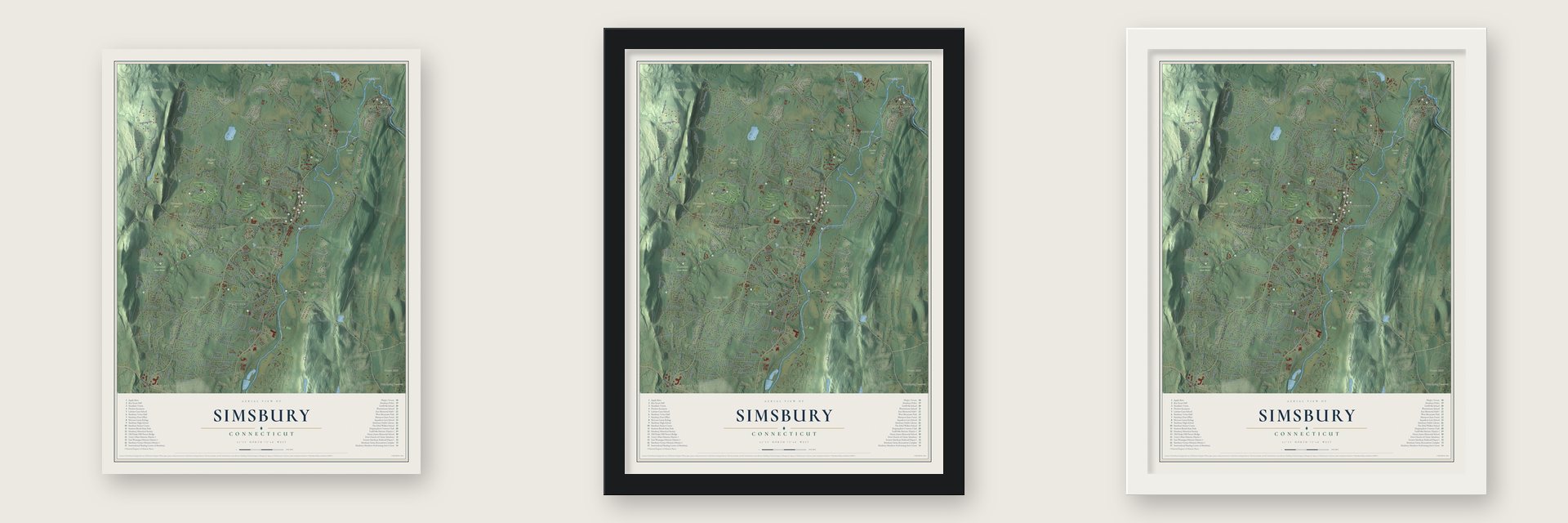
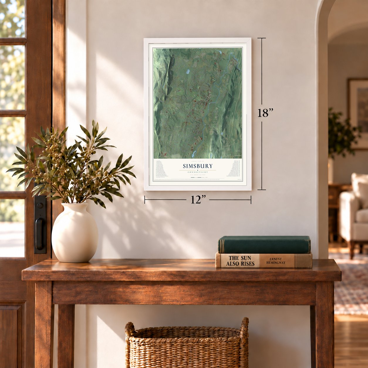
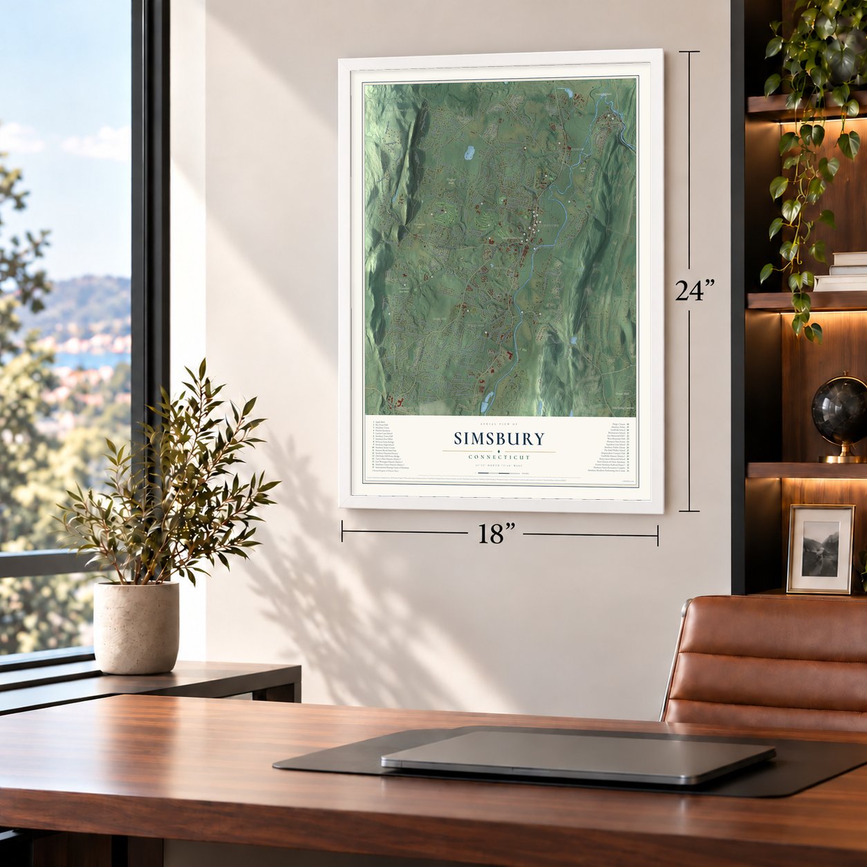
Unframed archival matte, a black wood frame or a white wood frame.
Up close
Geography Worth Displaying
This map was created using accurate cartographic data and authoritative geographic sources, including the U.S. Geological Survey (USGS) and FEMA. The map brings together terrain, waterways, roads, and building detail. The majority of the streets are labeled, houses are accurately depicted, and the topography is derived from government sources. Combining local data with carefully composed color and shading leads to this beautifully detailed Simsbury artwork for your wall.
Rather than simply showing street outlines, we’ve included as many of the street names as we could reasonably fit on the map while keeping their names legible. Zoom in on the high resolution preview to see exactly what’s on the map. We truly set out to create a statement piece for anyone who loves Simsbury. So whether it’s for you, or a gift for someone you love, we hope this map of Simsbury brings back fond memories.
Explore the full map of Simsbury, Connecticut and read about the local places it shows.
About Simsbury, Connecticut
Simsbury is a town of 24,517 people in Hartford County, in the Farmington River valley below Talcott Mountain. The Massaco, a Wappinger band, lived here first, and for years settlers from Windsor came only to farm and cut timber. Captain Aaron Cook put up the first house at Terry's Plain around 1660. John Case, Joshua Holcomb and Thomas Barber then asked the General Court to make Massaco a town, and on May 12, 1670, it agreed, naming Connecticut's 21st town Simmsbury.
Five years later King Philip's War reached this frontier settlement. On October 14, 1675, the court told the settlers to leave for Windsor, so about forty families buried what they owned and went. In March 1676 their empty houses were burned. Most came back in the spring of 1677 and started again along Hop Meadow, where Barber built the first gristmill, sawmill and meetinghouse. Within twelve years, by 1689, settlers had fenced the meadows along each bank into two common fields about seven miles long.
“In the War of the Revolution, few, if any, of the towns of the State furnished a larger number of enlisted men than Simsbury.”
- America's first safety fuseSafety fuse, a slow-burning cord used in blasting, was first made in America at East Weatogue in 1836. In 1839 Joseph Toy came from Cornwall to work at the factory. When fire destroyed that plant, the business moved into Simsbury village as Toy, Bickford and Company. The work stayed dangerous, and on December 20, 1859, the factory blew up, killing seven women and one man. The company, now Ensign-Bickford, still keeps its headquarters in town.
- From Ticonderoga to tavernDavid Phelps built a house on Hopmeadow Street in 1711, and his son Elisha made it larger in 1771. In 1775 Elisha and his brother Noah helped take Fort Ticonderoga. From 1786 to 1849 three generations of the family ran the house as an inn for travelers arriving by horse, stagecoach and canal boat. The Capt. Elisha Phelps House joined the National Register in 1972 and is now the Phelps Tavern Museum.
- Carpet looms at TariffvilleWhere the Farmington cuts through the ridge, the Tariff Manufacturing Company built a carpet mill and named itself for the Tariff Act of 1824. By 1827 H. K. Knight was running the company, and its looms turned out ingrain carpets and shawls. Four years later it employed 95 male weavers, many from overseas.
- Captured and carried to CanadaIn 1707 Daniel Hayes, twenty-two years old, was seized and taken to Canada, a trip of thirty days with him tied to saplings each night. Forced to run the gauntlet, he ducked into a wigwam, and the woman there, who had lost a husband and son to war, adopted him. Later he was sold to a Frenchman who put him to work weaving. Hayes earned his freedom after two years, came home to Simsbury and farmed.
- A string of town hallsThe Congregational church refused to hold town meetings in its new building, so in 1839 Simsbury built the Simsbury Townhouse, which served as town hall until 1931. In 1932 Antoinette Eno Wood, daughter of Simsbury native Amos Eno, gave the town Eno Memorial Hall, with an auditorium for about 600, and the offices stayed there until 1969. That year the town bought the Simsbury Bank and Trust Company Building, which held the town offices into the 1980s.
Find your street
Names on the Simsbury map
Every name below is printed on this map. Look for your street, your school, the park where you played, or the pond down the road.
Places and landmarks34
- Hoskins
- Apple Barn
- Boy Scout Hall
- East Weatogue Historic District
- Eno Memorial Hall
- Henry James Memorial School
- Heublein Tower
- Hopmeadow Country Club
- International Skating Center of Simsbury
- Latimer Lane School
- Massacoe State Forest
- McLean Game Refuge
Show all 34 places
- Pine Hill
- Simsbury Center Historic District
- Simsbury Farms Recreation Complex
- Simsbury High School
- Simsbury Historical Society
- Simsbury Meadows Performing Arts Center
- Simsbury Police
- Simsbury Public Library
- Simsbury Railroad Depot
- Simsbury Senior Center
- Simsbury Town Hall
- Squadron Line School
- Stratton Brook State Park Pond
- Tariffville Historic District
- Tariffville School
- Terry's Plain Historic District
- Tootin' Hills
- Town Forest
- West Ledge
- West Mountain Park
- West Mountains
- West Simsbury
Streets and roads17
- Holcomb St
- Saddle Rdg
- Willard St
- Elm St
- Quarry Rd
- Metacomet Dr
- Stratton Ct
- Forest Dr
- Wildwood Rd
- Lincoln Ln
- Castlewood Dr
- Evas Dr
- Canton Rd
- Plains Rd
- Wheeler Rd
- Park Rd
- Stafford Rd
Names are listed as they appear on the printed map. Zoom into the product photos to find them.
The art of mapping a place
How This Map Was Made
Real places. Remarkable detail. Discover the layers that turn geographic data into a map of home.

The view from above
Aerial imagery reveals the character of the land: woodland, open fields, and the patterns of a place.

The shape of the land
Elevation data brings hills, valleys, and subtle changes in the landscape into view.

The details of home
Roads, waterways, and building footprints come together to make the map feel unmistakably local.

Geography becomes art
Considered color, shading, and typography bring the layers together in a map made for your wall.


Process illustrated with Mendon, Massachusetts. Aerial imagery: USDA NAIP. Terrain: USGS 3D Elevation Program. Map details and finished artwork: KNOWOL.
The Details
About This Print
Choose an archival matte print, or a black or white Ayous wood frame. The archival matte print is unframed.
Select your size and finish above to see the matching product image and price.
Materials & Craftsmanship
A contemporary map with the character of a classic atlas, printed on archival matte paper. Optional frames are made from Ayous wood.
Your printed map does not include the watermark shown in the full-map preview.
Shipping & Delivery
Free shipping within the United States. Every print is made to order in the USA.
Buying a gift? Add a note in your cart and we'll include it. We never put prices in the package.
Prints ship within 2 to 3 business days. Allow 7 to 10 days total from ordering for delivery. Timing may vary during holidays or periods of high order volume.
Read our shipping policy.
Returns and damaged prints
Each print is made to order. Change-of-mind refunds are not available after production.
If your print arrives damaged, misprinted or incorrect, contact support@knowol.com within 30 days of receiving it. Include your order number, photos and a description of the issue.
Read our full refund and replacement policy. For questions about your order, email support@knowol.com.
Find your town
Looking for another city?
Find a map of home in our Connecticut collection, or any town in the country.
Nearby
Maps of towns near Simsbury
Know someone from one of these towns? Their map makes a great gift.
 West Simsbury
, Connecticut
From $39.99See the map
 Simsbury Center
, Connecticut
From $39.99See the map
 Tootin' Hills
, Connecticut
From $39.99See the map
More maps nearby: Weatogue, Tariffville, Canton, Canton Valley and Bloomfield.