
Drag to look around. The digital watermark does not appear on printed maps.




Free U.S. delivery 7 to 10 days after you order
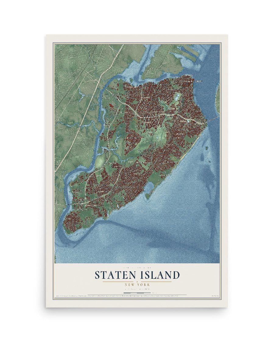
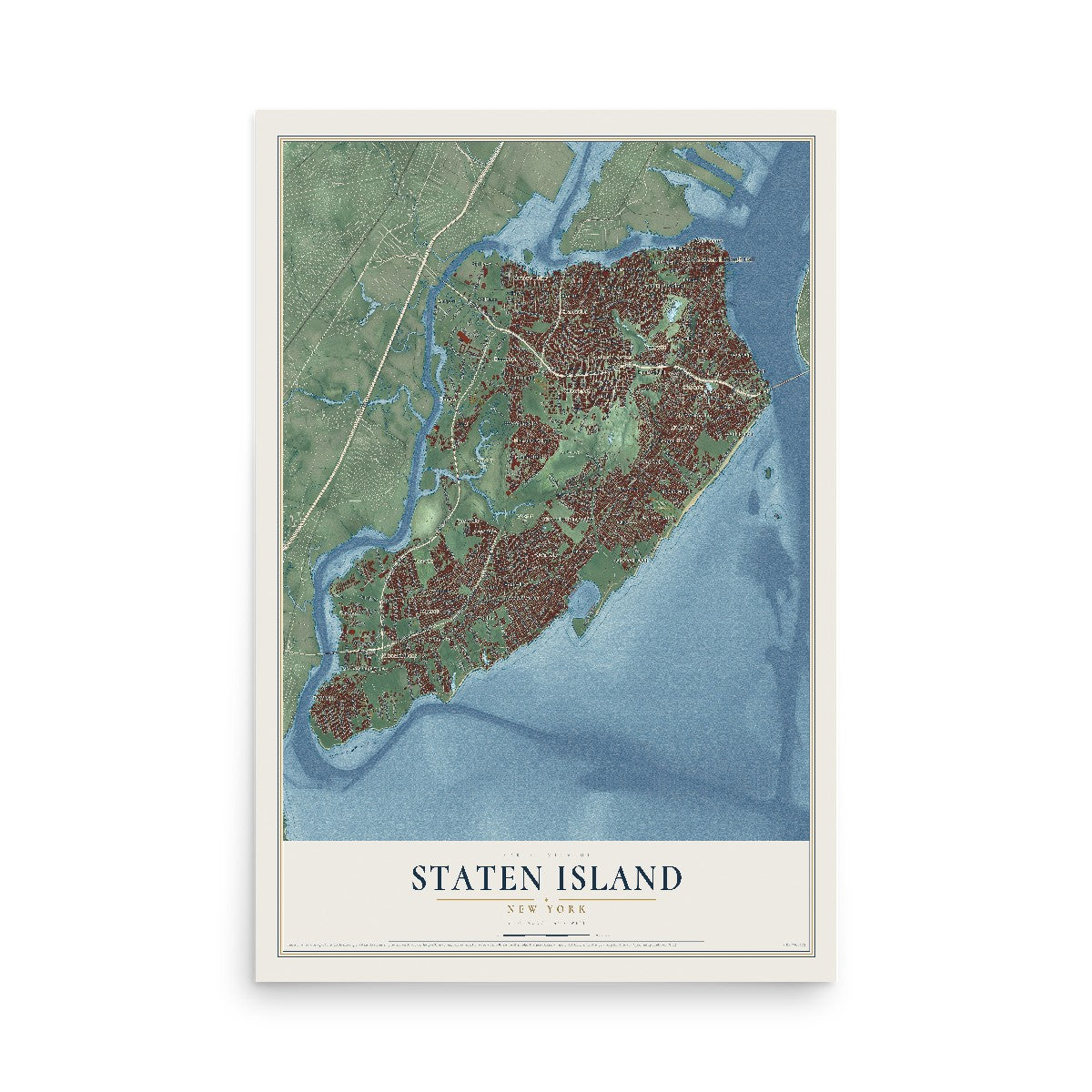
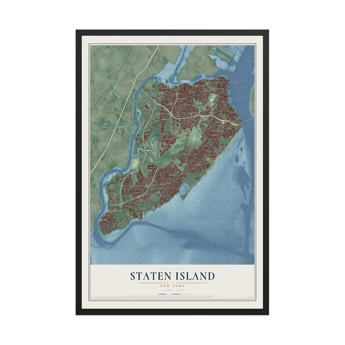
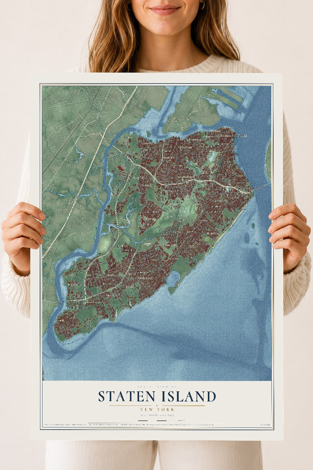
Staten Island, New York Map Art
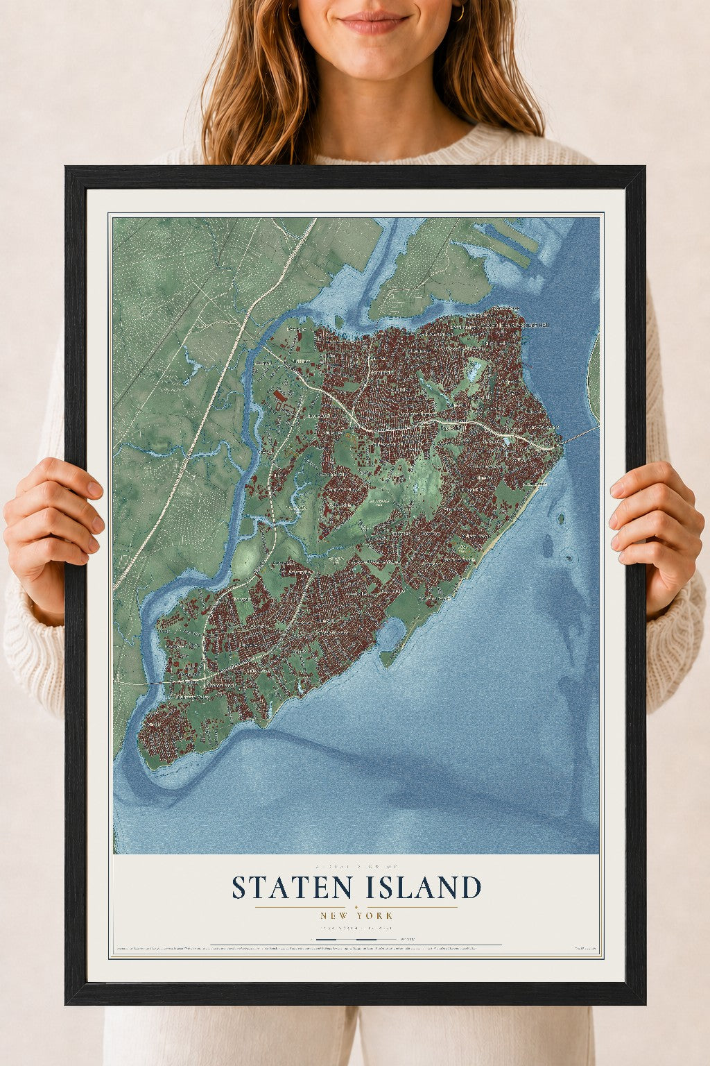
A new map of Staten Island, New York, made in 2026 and printed to order on thick archival matte paper.
12" x 18" Archival Matte Print
A Map of Home. A Work of Art.
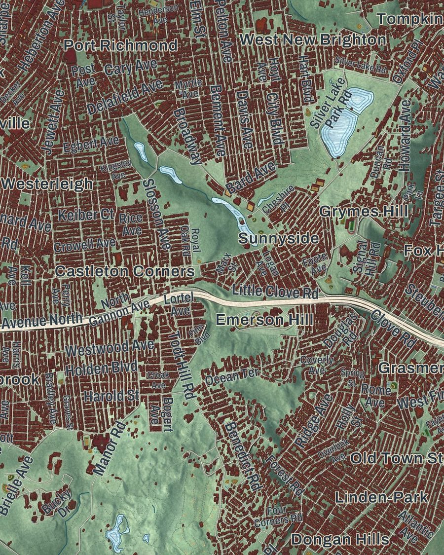
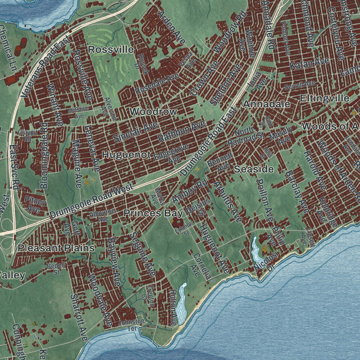
Explore Staten Island, New York from a whole new perspective. Created using aerial imagery and detailed geographic data, this map captures Staten Island building by building, with labeled streets, familiar landmarks, and shaded topographical relief that highlights the natural contours of the landscape.
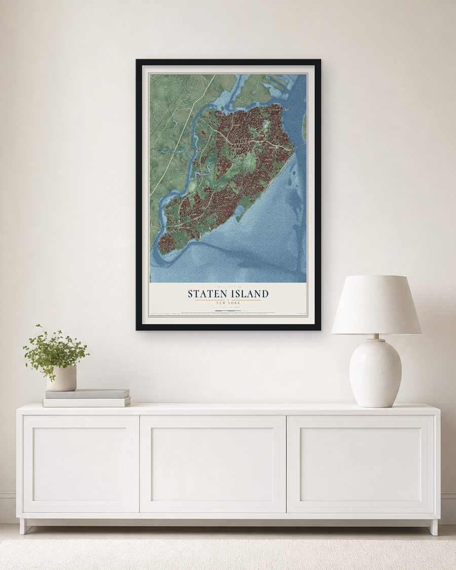
Combining modern data with the timeless character of a vintage atlas, this map is just as interesting up close as it is beautiful on the wall. Whether you grew up in Staten Island, spent memorable years there, or call it home today, this unique map is a great way to celebrate a place that means something to you. Zoom in on the preview to look for your street, and then order a print to put your memories on the wall.

Geography Worth Displaying
This map was created using accurate cartographic data and authoritative geographic sources, including the U.S. Geological Survey (USGS) and FEMA. The map brings together terrain, waterways, roads, and building detail. The majority of the streets are labeled, houses are accurately depicted, and the topography is derived from government sources. Combining local data with carefully composed color and shading leads to this beautifully detailed Staten Island artwork for your wall.
Rather than simply showing street outlines, we’ve included as many of the street names as we could reasonably fit on the map while keeping their names legible. Zoom in on the high resolution preview to see exactly what’s on the map. We truly set out to create a statement piece for anyone who loves Staten Island. So whether it’s for you, or a gift for someone you love, we hope this map of Staten Island brings back fond memories.
Explore the full map of Staten Island, New York and read about the local places it shows.
About Staten Island, New York
Staten Island is the southernmost of New York City's five boroughs, with 495,747 people in the 2020 census, and it shares its borders with Richmond County. The Raritan band of the Lenape lived here when Giovanni da Verrazzano sailed through the Narrows in 1524 and stayed one night. The Dutch named the island for the Staten Generaal, their parliament. Cornelis Melyn and David de Vries tried three times between 1639 and 1655 to plant a settlement, and fighting with the local tribe wiped out each one.
In 1661 a few families of Dutch, Walloon and French Huguenot origin finally built a lasting village, Oude Dorp, near South Beach, and the neighborhood of Old Town still carries its name. England took over in 1667, and in 1683 the island became Richmond County, named for Charles Lennox, 1st Duke of Richmond. It had 727 people in 1698 and 2,847 by 1771. The county seat moved to Richmond Town in 1729. The island joined New York City as a borough in 1898, and it was legally the Borough of Richmond until 1975.
“our most inveterate enemies”
- Clovis tools, 14,000 years oldIn 1917 diggers in the Charleston section turned up tools left by Clovis people about 14,000 years ago, and more have surfaced there since. Later hunters left a style of arrowhead, used from about 1500 to 100 BC, that archaeologists first found near the old Rossville Post Office, so the points are called Rossville points.
- Burial Ridge in TottenvilleOn a bluff above Raritan Bay, the Lenape buried their dead in what became the city's biggest burial ground from before Europeans arrived. Bodies were reported dug up there from 1858 on, and in 1895 the American Museum of Natural History hired archaeologist George H. Pepper to study the site. Today it lies unmarked inside Conference House Park.
- Captain Billopp's legendChristopher Billopp, a Royal Navy veteran, arrived in 1674 with Governor Sir Edmund Andros and a year later received a patent for 932 acres on the island. Legend says New York won Staten Island because Billopp sailed all the way around it in a single day. Historian Roswell S. Coles found no proof in 1948, and no written version of the tale is known before 1873.
- A Loyalist island in 1776Most islanders sided with the Crown. Richmond was the only New York county that sent no one to the First Continental Congress, and in response islanders faced a boycott from Elizabethport, Woodbridge, Dover and other towns in New Jersey. In the summer of 1776, over 140 British ships anchored offshore, and Sir William Howe used the island as his staging ground for the attack on New York City.
Find your street
Names on the Staten Island Borough map
Every name below is printed on this map. Look for your street, your school, the park where you played, or the pond down the road.
Places and landmarks68
- Staten Island Borough Hall
- Tottenville
- Brookfield Park
- Freshkills Park
- La Tourette Park
- Miller Field
- Annadale
- Arlington
- Arrochar
- Bay Terrace
- Bloomfield
- Bulls Head
Show all 68 places
- Castleton Corners
- Charleston
- Chelsea
- Clifton
- Concord
- Dongan Hills
- Edwin Markham Gardens
- Elm Park
- Eltingville
- Emerson Hill
- Fort Wadsworth
- Fox Hills
- Fresh Kills
- Graniteville
- Grant City
- Grasmere
- Great Kills
- Greenridge
- Grymes Hill
- Gulfport
- Hamilton Park
- Heartland Village
- Huguenot
- Linden-Park
- Mariners Harbor
- Midland Beach
- New Brighton
- New Dorp
- New Dorp Beach
- New Springville
- Oakwood
- Oakwood Beach
- Oakwood Heights Station
- Old Place
- Old Town Station
- Pleasant Plains
- Port Ivory
- Port Richmond
- Princes Bay
- Richmond
- Richmond Valley
- Rosebank
- Rossville
- Saint George
- Seaside
- South Beach
- Stapleton
- Staten Island
- Sunnyside
- Tompkinsville
- Travis
- West New Brighton
- Westerleigh
- Willowbrook
- Woodrow
- Woods of Arden
Streets and roads345
- Watchogue Road
- Xenia Street
- Ward Avenue
- Hylan Boulevard
- Amboy Road
- Arthur Kill Road
- Victory Boulevard
- Richmond Avenue
- Forest Avenue
- Richmond Road
- Clove Road
- Drumgoole Road West
- Drumgoole Road East
- South Avenue
- Woodrow Road
- Manor Road
- Arden Avenue
- South Railroad Avenue
- Forest Hill Road
- Loop Road
- Bay Street
- Rockland Avenue
- Buffalo Street
- Huguenot Avenue
- Father Capodanno Boulevard
- Todt Hill Road
- Veterans Road West
- Travis Avenue
- Veterans Road East
- Targee Street
Show all 345 streets
- Annadale Road
- Bard Avenue
- Armstrong Avenue
- Van Duzer Street
- Rathbun Avenue
- Bloomingdale Road
- Goethals Road North
- Jewett Avenue
- Sheldon Avenue
- Sinclair Avenue
- Olympia Boulevard
- Gannon Avenue North
- Howard Avenue
- Gulf Avenue
- Westwood Avenue
- Tysens Lane
- Clawson Street
- Davis Avenue
- Ring Road
- Mason Avenue
- Page Avenue
- Pelton Avenue
- Bement Avenue
- Katan Avenue
- Barlow Avenue
- East Svc Road
- Lincoln Avenue
- Leverett Avenue
- Delafield Avenue
- Craig Avenue
- Brielle Avenue
- Maguire Avenue
- Glen Street
- Willow Road West
- Chelsea Road
- Broadway
- Hunter Avenue
- Lamoka Avenue
- Barclay Avenue
- Fifth Street
- West Fingerboard Road
- Seguine Avenue
- Yetman Avenue
- Arbutus Avenue
- Main Street
- Oakdale Street
- Harold Street
- McClean Avenue
- Durant Avenue
- Slosson Avenue
- Rossville Avenue
- Poillon Avenue
- Guyon Avenue
- Clarke Avenue
- Fingerboard Road
- Wild Avenue
- Crystal Avenue
- Retford Avenue
- Sharrott Avenue
- Crown Avenue
- Cortelyou Avenue
- Muldoon Avenue
- Harold Avenue
- Bayview Avenue
- Steuben Street
- Major Avenue
- Mosel Avenue
- Seaver Avenue
- Van Name Avenue
- Cunningham Road
- Joline Avenue
- Sixth Avenue
- Edinboro Road
- Woods of Arden Road
- Little Clove Road
- Nelson Avenue
- Woodvale Avenue
- Lenevar Avenue
- Riedel Avenue
- Tennyson Drive
- Ebbitts Street
- Flagg Place
- Western Avenue
- Merrill Avenue
- First Avenue
- Caswell Avenue
- Lake Avenue
- Heberton Avenue
- Sprague Avenue
- King Street
- Corbin Avenue
- Fourth Avenue
- Cary Avenue
- Union Avenue
- Leonard Avenue
- Front Street
- Hillside Terrace
- Benedict Road
- Prospect Avenue
- Ada Drive
- Winant Avenue
- Kenny Road
- Clay Pit Road
- Ellis Street
- Park Street
- Lamberts Lane
- Holland Avenue
- Holden Boulevard
- Signs Road
- City Boulevard
- Elm Street
- Aspinwall Street
- Chemical Lane
- Sharpe Avenue
- River Road
- Coke Street
- Ellis Road
- Ridge Avenue
- Auburn Avenue
- Industry Road
- Hudson Road
- Keiber Court
- Robin Road
- David Street
- 8 Avenue
- Bogert Avenue
- Richmond Terrace
- Richmond Hill Road
- Edgegrove Avenue
- Ionia Avenue
- North Gannon Avenue
- Tompkins Avenue
- Ocean Terrace
- New Dorp Lane
- Sharrotts Road
- Greeley Avenue
- Douglas Road
- Mill Road
- Buel Avenue
- Teleport Drive
- Clifton Avenue
- Morningstar Road
- Purdy Avenue
- Slater Boulevard
- Atlantic Avenue
- North Railroad Street
- Montreal Avenue
- Holton Avenue
- Mosely Avenue
- Silver Lake Park Road
- Water Street
- Uss North Carolina Road
- Post Avenue
- Tenth Street
- Otis Avenue
- Gurley Avenue
- Meredith Avenue
- Nicholas Avenue
- Granite Avenue
- Philip Avenue
- Ilyssa Way
- Mohr Street
- Graham Avenue
- Kell Avenue
- Marsh Avenue
- Signal Hill Road
- Mallory Avenue
- Fahy Avenue
- Edgewater Street
- Egbert Avenue
- Holdridge Avenue
- Woehrle Avenue
- Freedom Avenue
- Rice Avenue
- Hamilton Avenue
- Canal Street
- Rosedale Avenue
- Forest Road
- Bennett Avenue
- Benziger Avenue
- Hopkins Avenue
- Beacon Avenue
- Boscombe Avenue
- Bloomfield Avenue
- Crowell Avenue
- Hart Boulevard
- Rome Avenue
- Yukon Avenue
- Walcott Avenue
- Kissam Avenue
- Cornelia Avenue
- Fields Avenue
- Wemple Street
- Deisius Street
- Oxford Place
- Goff Avenue
- Nicolosi Drive
- Lisk Avenue
- Pitney Avenue
- Hoyt Avenue
- Holly Street
- Bucky Drive
- Ninth Street
- Akron Street
- Lortel Avenue
- Drum Avenue
- Dale Avenue
- Pilot Lane
- 3 Avenue
- 13th Avenue
- Willowbrook Road
- Seaview Avenue
- Midland Avenue
- Bradley Avenue
- Alverson Avenue
- Bank Street
- Arlene Street
- Pompey Avenue
- Marcy Avenue
- Bedell Avenue
- Lyndale Avenue
- Stobe Avenue
- Oak Avenue
- Netherland Avenue
- Chelsea Street
- Fillmore Street
- Ardsley Street
- Ashworth Avenue
- Amber Street
- Four Corners Road
- Wiman Avenue
- Myrtle Avenue
- Taylor Street
- Osgood Avenue
- Albourne Avenue
- Bancroft Avenue
- Nugent Street
- Tenth Avenue
- Natick Street
- Martin Avenue
- Park Drive North
- Northfield Avenue
- Johnston Terrace
- Nevada Avenue
- Coverly Avenue
- John Street
- Satterlee Street
- Perry Avenue
- Sleight Avenue
- Villa Avenue
- Exeter Street
- Lewiston Street
- Serrell Avenue
- Logan Avenue
- Claypit Road
- Hannah Street
- Essex Drive
- Lipsett Avenue
- Cedar Avenue
- Trenton Court
- Royal Oak Road
- Russek Drive
- Central Avenue
- Duncan Road
- School Road
- Cheshire Place
- Storer Avenue
- Vespa Avenue
- 1 Avenue
- Dent Road
- Butler Boulevard
- Renee Place
- Bedell Street
- Harris Avenue
- Marx Street
- Cable Way
- Foote Avenue
- Lilac Court
- Eton Place
- Fine Boulevard
- Henderson Avenue
- Eighth Street
- Harbor Road
- Saint George Road
- Klondike Avenue
- Industrial Loop
- Eylandt Street
- Decker Avenue
- Edward Curry Avenue
- Cedar Grove Avenue
- Englewood Avenue
- Park Hill Avenue
- McBaine Avenue
- Kelly Boulevard
- Kingsley Avenue
- West Shore Exwy State Route West
- Graves Street
- Platinum Avenue
- Cedar Grove Beach
- Foch Avenue
- Overlook Avenue
- Monahan Avenue
- Spring Street
- Silver Lake Road
- Greaves Lane
- Fayette Avenue
- Croak Avenue
- Park Lane
- Fairlawn Avenue
- Cliff Street
- Latimer Avenue
- Jay Street
- Hillis Street
- Post Lane
- Barb Street
Names are listed as they appear on the printed map. Zoom into the product photos to find them.
The art of mapping a place
How This Map Was Made
Real places. Remarkable detail. Discover the layers that turn geographic data into a map of home.

The view from above
Aerial imagery reveals the character of the land: woodland, open fields, and the patterns of a place.

The shape of the land
Elevation data brings hills, valleys, and subtle changes in the landscape into view.

The details of home
Roads, waterways, and building footprints come together to make the map feel unmistakably local.

Geography becomes art
Considered color, shading, and typography bring the layers together in a map made for your wall.


Process illustrated with Mendon, Massachusetts. Aerial imagery: USDA NAIP. Terrain: USGS 3D Elevation Program. Map details and finished artwork: KNOWOL.
The Details
About This Print
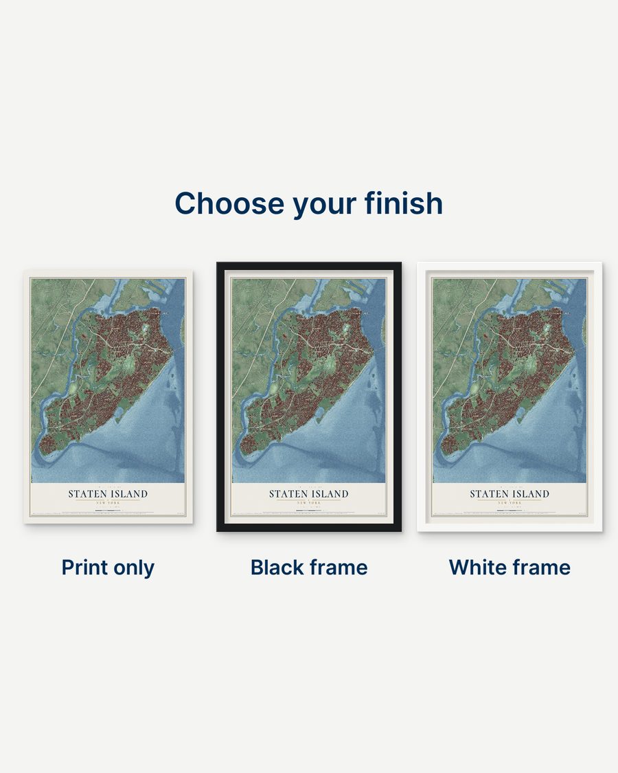
Choose an archival matte print, or a black or white Ayous wood frame. The archival matte print is unframed.
Select your size and finish above to see the matching product image and price.
Materials & Craftsmanship
A contemporary map with the character of a classic atlas, printed on archival matte paper. Optional frames are made from Ayous wood.
Your printed map does not include the watermark shown in the full-map preview.
Shipping & Delivery
Free shipping within the United States. Every print is made to order in the USA.
Buying a gift? Add a note in your cart and we'll include it. We never put prices in the package.
Prints ship within 2 to 3 business days. Allow 7 to 10 days total from ordering for delivery. Timing may vary during holidays or periods of high order volume.
Read our shipping policy.
Returns and damaged prints
Each print is made to order. Change-of-mind refunds are not available after production.
If your print arrives damaged, misprinted or incorrect, contact support@knowol.com within 30 days of receiving it. Include your order number, photos and a description of the issue.
Read our full refund and replacement policy. For questions about your order, email support@knowol.com.
Find your town
Looking for another city?
Find a map of home in our New York collection, or any town in the country.
Nearby
Maps of towns near Staten Island
Know someone from one of these towns? Their map makes a great gift.
 Brooklyn
, New York
From $39.99See the map
 New York
, New York
From $39.99See the map
 Queens
, New York
From $39.99See the map
More maps nearby: Manhattan, Inwood, Atlantic Beach, Cedarhurst and East Atlantic Beach.