


Search for another town





Free U.S. delivery 7 to 10 days after you order
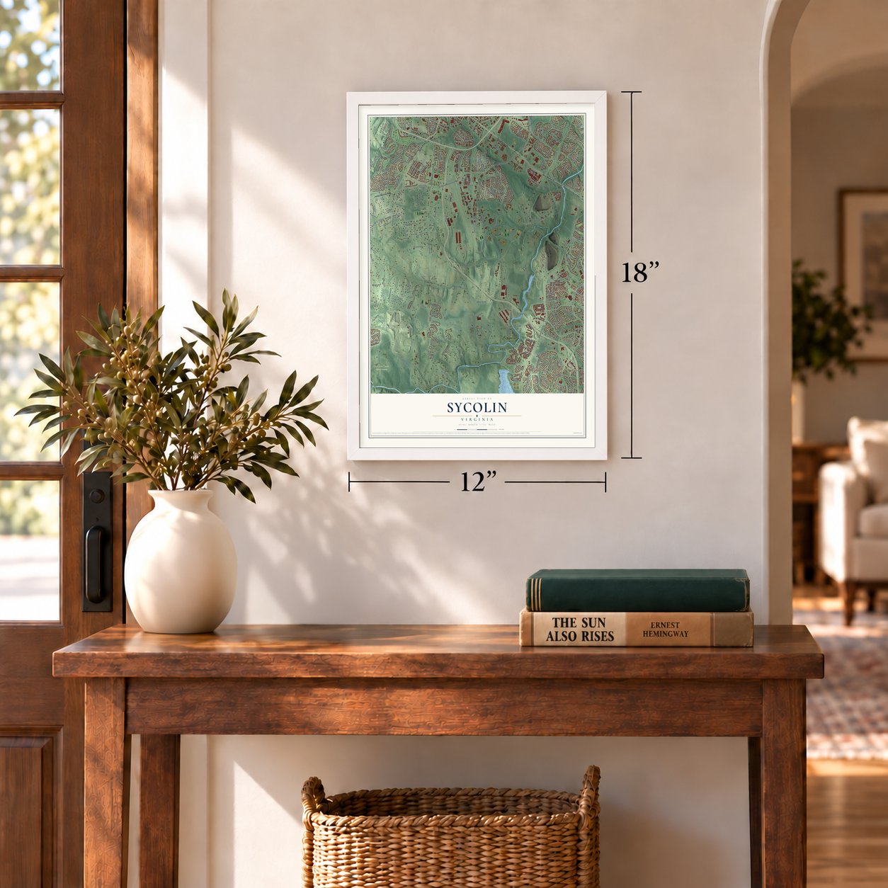
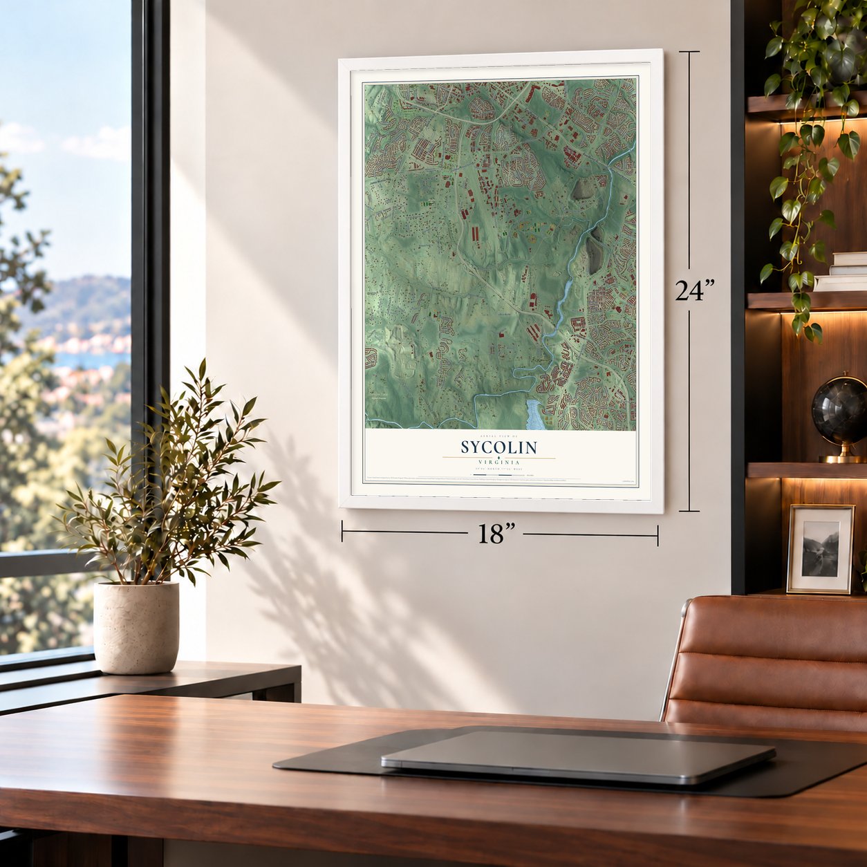
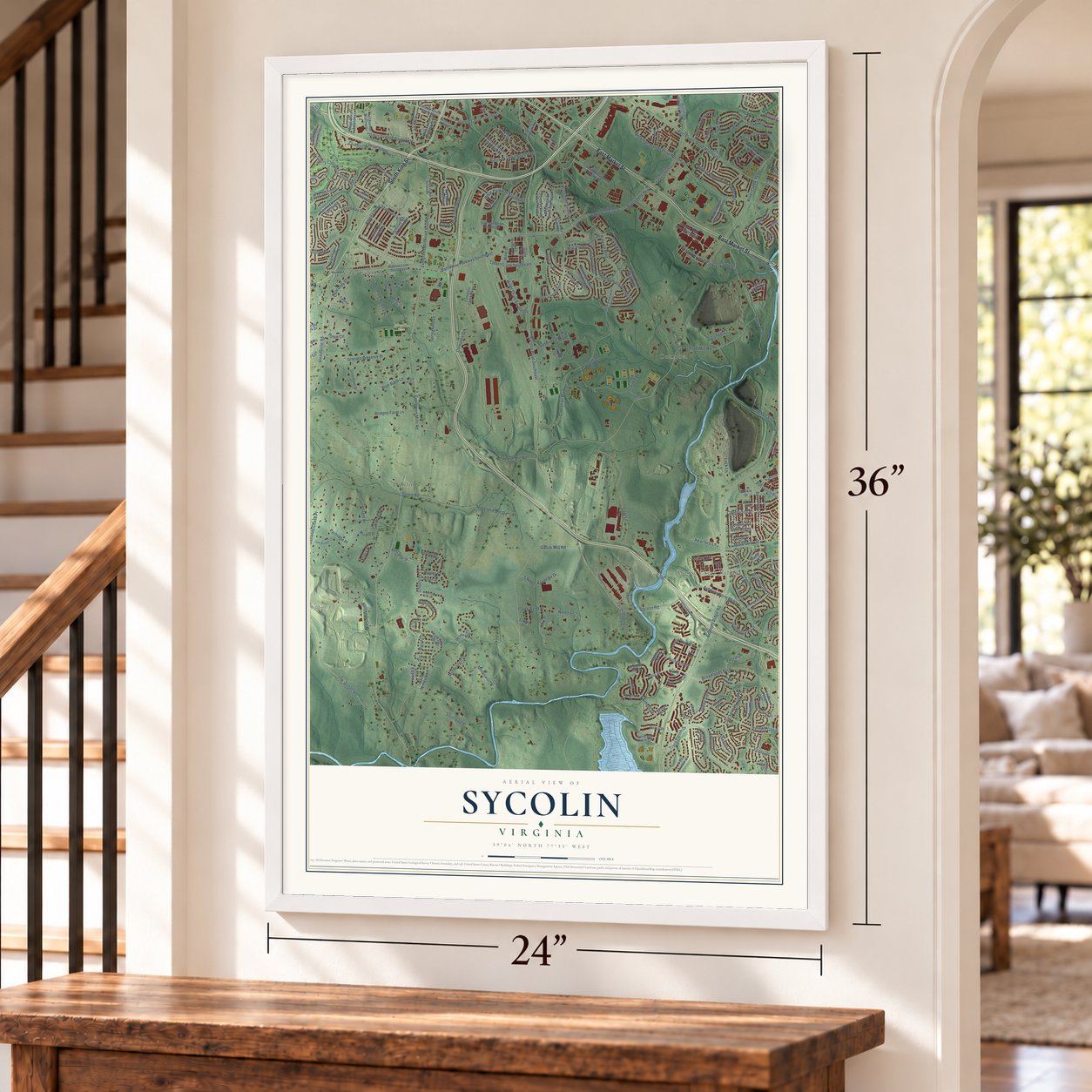
Sycolin, Virginia Map Art
Building by building, with labeled streets and shaded relief.
12" x 18" Archival Matte Print
A Map of Home. A Work of Art.
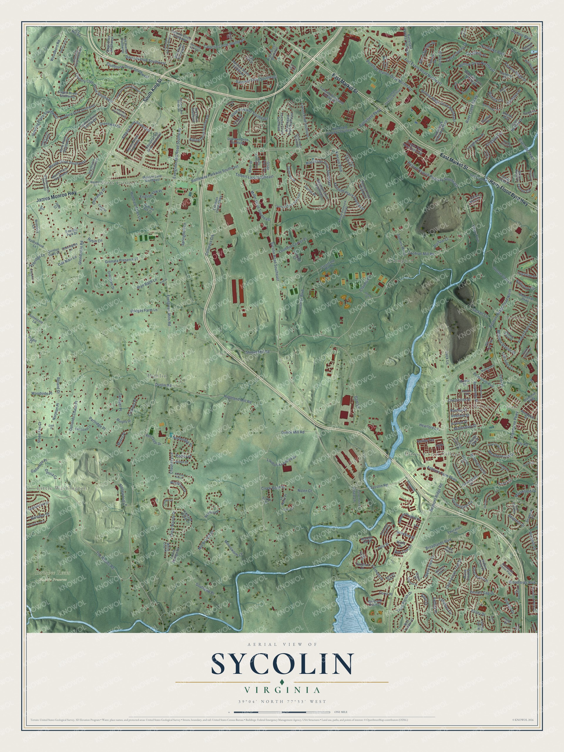
Explore Sycolin, Virginia from a whole new perspective. Created using aerial imagery and detailed geographic data, this map captures Sycolin building by building, with labeled streets, familiar landmarks, and shaded topographical relief that highlights the natural contours of the landscape.
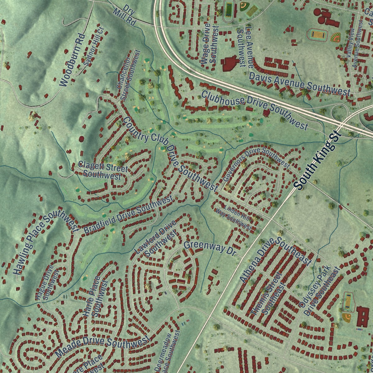
Combining modern data with the timeless character of a vintage atlas, this map is just as interesting up close as it is beautiful on the wall. Whether you grew up in Sycolin, spent memorable years there, or call it home today, this unique map is a great way to celebrate a place that means something to you. Zoom in on the preview to look for your street, and then order a print to put your memories on the wall.
Three ways to hang it
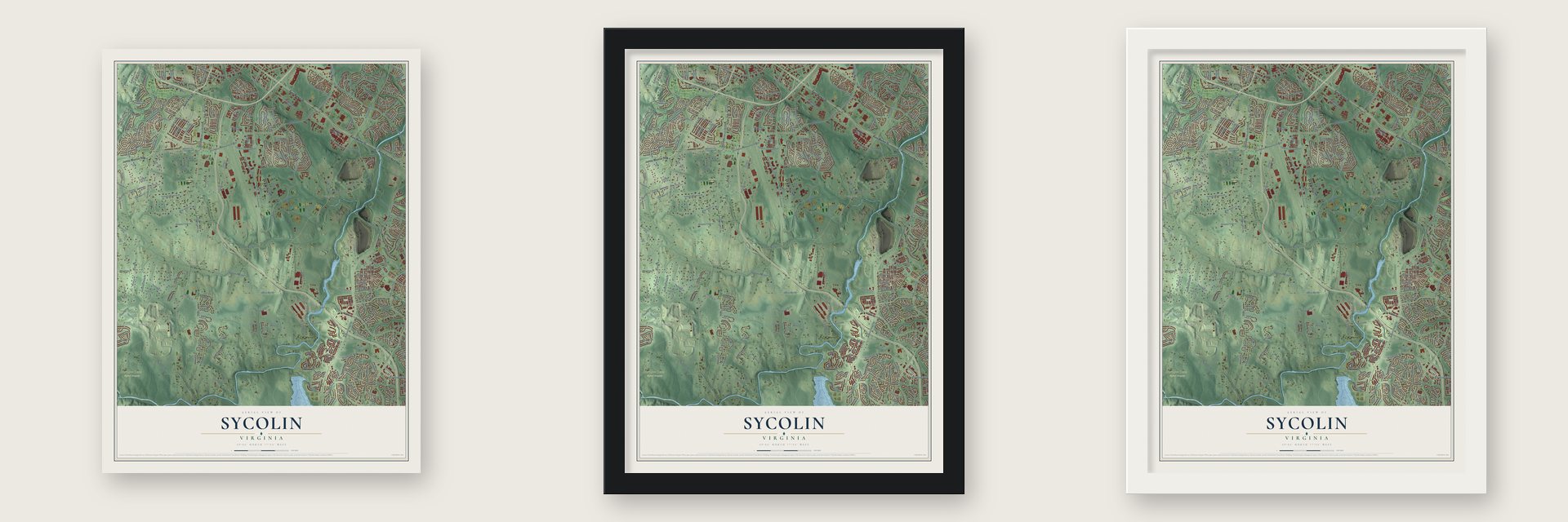
Unframed archival matte, a black wood frame or a white wood frame.
Up close
Geography Worth Displaying
This map was created using accurate cartographic data and authoritative geographic sources, including the U.S. Geological Survey and the Census Bureau. The map brings together terrain, waterways, roads, and building detail. The majority of the streets are labeled, houses are accurately depicted, and the topography is derived from government sources. Combining local data with carefully composed color and shading leads to this beautifully detailed Sycolin artwork for your wall.
Rather than simply showing street outlines, we’ve included as many of the street names as we could reasonably fit on the map while keeping their names legible. Zoom in on the high resolution preview to see exactly what’s on the map. We truly set out to create a statement piece for anyone who loves Sycolin. So whether it’s for you, or a gift for someone you love, we hope this map of Sycolin brings back fond memories.
Read the story behind this map: Detailed Map of Sycolin, Virginia.
Find your street
Names on the Sycolin map
Every name below is printed on this map. Look for your street, your school, the park where you played, or the pond down the road.
Places and landmarks9
- Little Washington
- Belmont
- Belmont Greene
- Banshee Reeks Nature Preserve
- RavenTek Park
- Dunlin
- Goose Creek Village
- Compher
- Virts Corner
Streets and roads300
- South King Street
- East Market Street
- Harry Flood Byrd Highway
- James Monroe Highway
- Country Club Drive Southwest
- Battlefield Parkway
- Sycolin Road
- Chauncey Lane
- Cochran Mill Road
- Wintergrove Drive
- Demott Drive
- Ivybridge Lane
- Sycolin Road Southeast
- Battleway Parkway Southeast
- Bowfonds Street
- Clairborne Parkway
- River Creek Parkway
- Fort Evans Road Northeast
- Russell Branch Parkway Southeast
- Kincaid Boulevard
- Evergreen Mills Road
- Belmont Ridge Road North
- Ashburn Farm Parkway
- Gleedsville Road
- Potomac Station Drive Northeast
- Belmont Ridge Road
- The Woods Road
- Grenata Preserve Place
- Gulick Mill Road
- Broadlands Boulevard
Show all 300 streets
- Claudia Drive
- Shreve Mill Road
- Meade Drive Southwest
- Mill Branch Drive
- Alpine Drive Southeast
- Hay Road
- Great Woods Drive
- Crosstrail Boulevard
- Truro Parish Drive
- Gant Lane
- Glebe View Drive
- Middlebury Street
- Dunlin Road
- Hogeland Mill Road
- Chickacoan Trail Drive
- Evergreen Mill Road Southeast
- Tanager Place
- Riverside Parkway
- Vestals Gap Drive
- Oak Marr Lane
- Athena Drive Southeast
- Hope Parkway Southeast
- Bonnie Ridge Drive Northeast
- Fairhunt Drive
- Catoctin Circle Southeast
- Woodburn Road
- Southpaw Place
- Woodside Place
- Tolbert Lane Southeast
- Davis Avenue Southwest
- Hawling Place Southwest
- Menlow Drive Northeast
- Banshee Drive
- Crimson Place
- Clubhouse Drive Southwest
- Luck Lane
- Chesterton Street
- Compass Crk
- Forest Farm Lane
- Jackpit Lane
- Macalister Drive Southeast
- Robin Circle
- Orchid Drive
- Baltusrol Terrace
- Loudoun Center Place
- Northlake Boulevard
- Greenway Drive
- Nashua Street
- Kenneth Place Southeast
- Springfield Lane
- Belmont Station Drive
- Goose Glen Lane
- Norman Place
- Stonewood Lane
- Morrisworth Lane
- Parkers Ridge Drive
- Rosalind Street
- Gateway Drive Southeast
- Broadlords Boulevard
- Sierra Springs Square
- Durham Court
- Belgreen Drive
- Ellzey Drive
- Hundred Acres Lane
- Oatlands Chase Place
- Gardengate Circle
- Loudon Academy Drive
- Stone Fox Court
- English Yew Place
- Cisco Lane
- Bridges Farm Lane
- Miller Drive Southeast
- Longhouse Place
- Weatherwood Drive
- Creek Bend Place
- Bryn Bach Lane
- Gallorette Place
- Cattail Spring Drive
- Tithables Circle
- Leier Place
- Awbrey Place
- Kingsport Drive
- Partridge Place
- Nolen Court
- Northridge Place
- Windmill Drive
- Coralbells Place
- Olympic Boulevard
- Hagley Place
- Dahlia Court
- Hearford Lane
- Tall Pines Court
- Marshfield Drive
- Duncan Place
- Lecroy Circle
- Keiller Terrace
- Julia Street
- Charandy Drive
- Binkley Circle
- Cardston Place
- Basil Court
- Redfield Street
- Myers Place
- Corro Place
- Ash Tree Drive
- Curtin Place
- Roland Court
- Charter Oak Drive
- Masons Lane Southeast
- Lawson Road Southeast
- Red Cedar Drive
- Plaza Street Southeast
- Battlefield Parkway Northeast
- Gloucester Parkway
- Compass Creek Parkway
- Santmyer Drive Southeast
- Ashburn Heights Drive
- Beauregard Drive Southeast
- Portsmouth Boulevard
- Harrison Street Southeast
- Battlefield Parkway Southeast
- Emerald Park Drive
- Odyssey Park Drive Southeast
- Upper Meadow Drive
- Samuels Mill Court
- Lawford Drive Southwest
- Moore Place Southwest
- Rhonda Place Southeast
- Bradfield Drive Southwest
- Potomac Trail Circle
- McIntosh Place
- Clagett Street Southwest
- Golf Club Road
- Catoctin Circle Southwest
- Highland Creek Drive
- Walkley Hill Place
- Trailview Boulevard Southeast
- Windybush Drive
- Fortress Circle Southeast
- Themis Street Southeast
- Oaklawn Drive Southeast
- Winkle Drive
- Harle Place Southwest
- Guildhall Drive
- Kittery Point
- Overland Park Drive
- Belleville Drive Northeast
- Wild Timber Court
- Kirkland Street
- Citation Drive
- Wrenbury Lane
- Marsh Creek Drive
- Greenham Drive
- Dry Mill Road
- Glade Fern Terrace
- Valleybrook Lane
- Claiborne Parkway
- Courage Court
- Teaberry Drive
- Classic Path Way Southeast
- Laurel Springs Road
- Farmingdale Drive
- Saddleback Place Northeast
- Wage Drive Southwest
- Spotted Owl Drive
- Quinton Oaks Drive
- Small Branch Place
- Education Court
- Moreland Point Court
- Miller Drive
- White Clay Place
- Eckbo Drive
- Shadow Terrace
- Breezyhill Drive
- Canal Creek Place
- Chevington Lane
- Hidden Pond Place
- Wilton Drive
- Lee Avenue Southwest
- Augustine Place
- Summit Ash Court
- Greenfield Mill Drive
- Le Notre Place
- Hill Head Place
- Cattail Marsh Place
- Lefevre Inn Drive
- Dalton Points Place
- Wirt Street Southwest
- Strawrick Terrace
- Somercote Lane
- Roy Court Southeast
- Pineview Square
- Old Line Terrace
- Murphy Drive
- Jade Court
- Scara Place
- Allenby Way
- Wildly Terrace
- Diggin Court
- Fling Court
- Houseman Terrace
- Masons Lane
- Broadlands Center Plaza
- Patrice Drive Southeast
- Tavistock Drive Southeast
- Battelfield Parkway Northeast
- Kincaid Boulevard Southeast
- Governors Drive Southwest
- Hague Drive Southwest
- Gatwick Square
- Rocky Creek Drive
- Deermeadow Place Southwest
- Oak Bucket Lane
- Belmont Glen Place
- Sydnor Hill Court
- Meadow Grove Drive
- Woodlea Drive Southwest
- Chancellor Street Southwest
- Trenton Circle
- Turner Farm Lane
- Churchill Downs Drive
- Sherbrooke Terrace
- Camelot Place
- Nightwatch Street
- Stowers Lane Southeast
- Deer Run Way
- Hollyberry Court
- Deepwood Terrace
- Sturman Place
- Fieldsview Court
- Shiloh Place Southeast
- Lady Fern Place
- Vermeer Street
- Warwick Hills Court
- Snowpine Place
- Prairie Dunes Terrace
- Opal Court
- Frame Square
- Meadow Field Court
- Oak View Drive
- Lauder Terrace
- Haupt Square
- Whipp Drive Southeast
- Rim Rock Circle
- Cross Timber Drive
- Hooded Crow Drive
- Valley View Avenue Southwest
- Brookton Way
- Kinnaird Te Northeast
- Middle Ridge Place
- Battery Point Place
- First Street Southeast
- Lilac Terrace Northeast
- Linden Hill Way Southwest
- Wayside Circle
- Hawks View Square
- Coton Reserve Drive
- Virginia Wildflower Terrace
- Stonecottage Place
- Bellingham Lane
- Silverside Side Drive
- Halprin Court
- Shreve Drive
- Trask Place
- Keturah Lane
- Ebaugh Drive
- Malloch Place
- Avens Court
- Cope Drive
- Aden Terrace
Names are listed as they appear on the printed map. Zoom into the product photos to find them.
Keep exploring Virginia
Sycolin is one of 862 Virginia towns we've mapped. Every dot on the map is a print of its own.
The search covers every state, Virginia first.
Near Sycolin
Order 2 or more town maps and save 10%. Shown in the size and finish you picked above, so they hang as a set.
- Goose Creek Village 12" x 18" / Archival Matte Print $39.99
- Belmont 12" x 18" / Archival Matte Print $39.99
- Leesburg 12" x 18" / Archival Matte Print $39.99

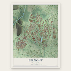

More maps nearby: Broadlands, Lansdowne, Ashburn, One Loudoun and Watson.
The art of mapping a place
How This Map Was Made
Real places. Remarkable detail. Discover the layers that turn geographic data into a map of home.

The view from above
Aerial imagery reveals the character of the land: woodland, open fields, and the patterns of a place.

The shape of the land
Elevation data brings hills, valleys, and subtle changes in the landscape into view.

The details of home
Roads, waterways, and building footprints come together to make the map feel unmistakably local.

Geography becomes art
Considered color, shading, and typography bring the layers together in a map made for your wall.


Process illustrated with Mendon, Massachusetts. Aerial imagery: USDA NAIP. Terrain: USGS 3D Elevation Program. Map details and finished artwork: KNOWOL.
The Details
About This Print
Choose an archival matte print, or a black or white Ayous wood frame. The archival matte print is unframed.
Select your size and finish above to see the matching product image and price.
Materials & Craftsmanship
A contemporary map with the character of a classic atlas, printed on archival matte paper. Optional frames are made from Ayous wood.
Your printed map does not include the watermark shown in the full-map preview.
Shipping & Delivery
Free shipping within the United States. Every print is made to order in the USA.
Buying a gift? Add a note in your cart and we'll include it. We never put prices in the package.
Prints ship within 2 to 3 business days. Allow 7 to 10 days total from ordering for delivery. Timing may vary during holidays or periods of high order volume.
Read our shipping policy.
Returns and damaged prints
Each print is made to order. Change-of-mind refunds are not available after production.
If your print arrives damaged, misprinted or incorrect, contact support@knowol.com within 30 days of receiving it. Include your order number, photos and a description of the issue.
Read our full refund and replacement policy. For questions about your order, email support@knowol.com.