
Search for another town





Free U.S. delivery 7 to 10 days after you order
Vernon, Connecticut Map Art
Building by building, with labeled streets and shaded relief.
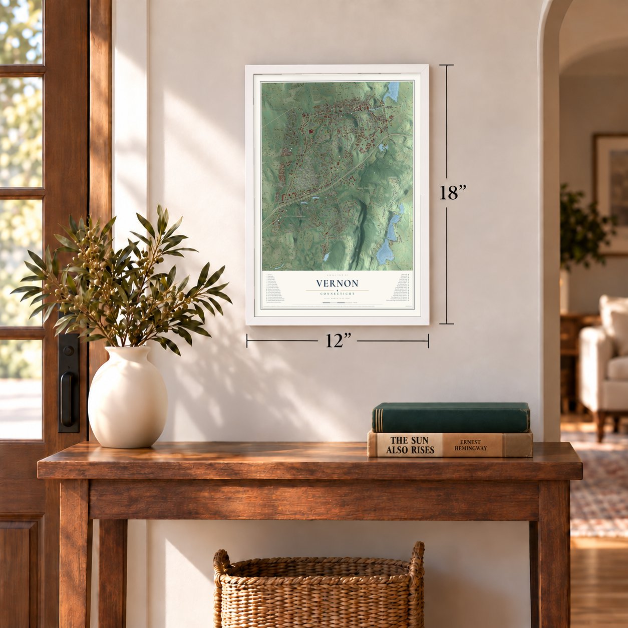
12" x 18" Archival Matte Print
A Map of Home. A Work of Art.
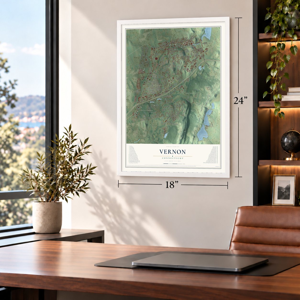
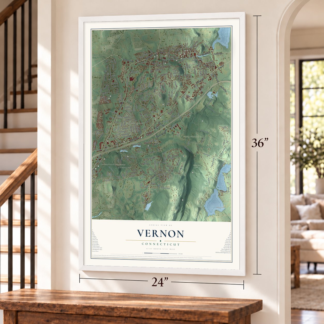
Explore Vernon, Connecticut from a whole new perspective. Created using aerial imagery and detailed geographic data, this map captures Vernon building by building, with labeled streets, familiar landmarks, and shaded topographical relief that highlights the natural contours of the landscape.
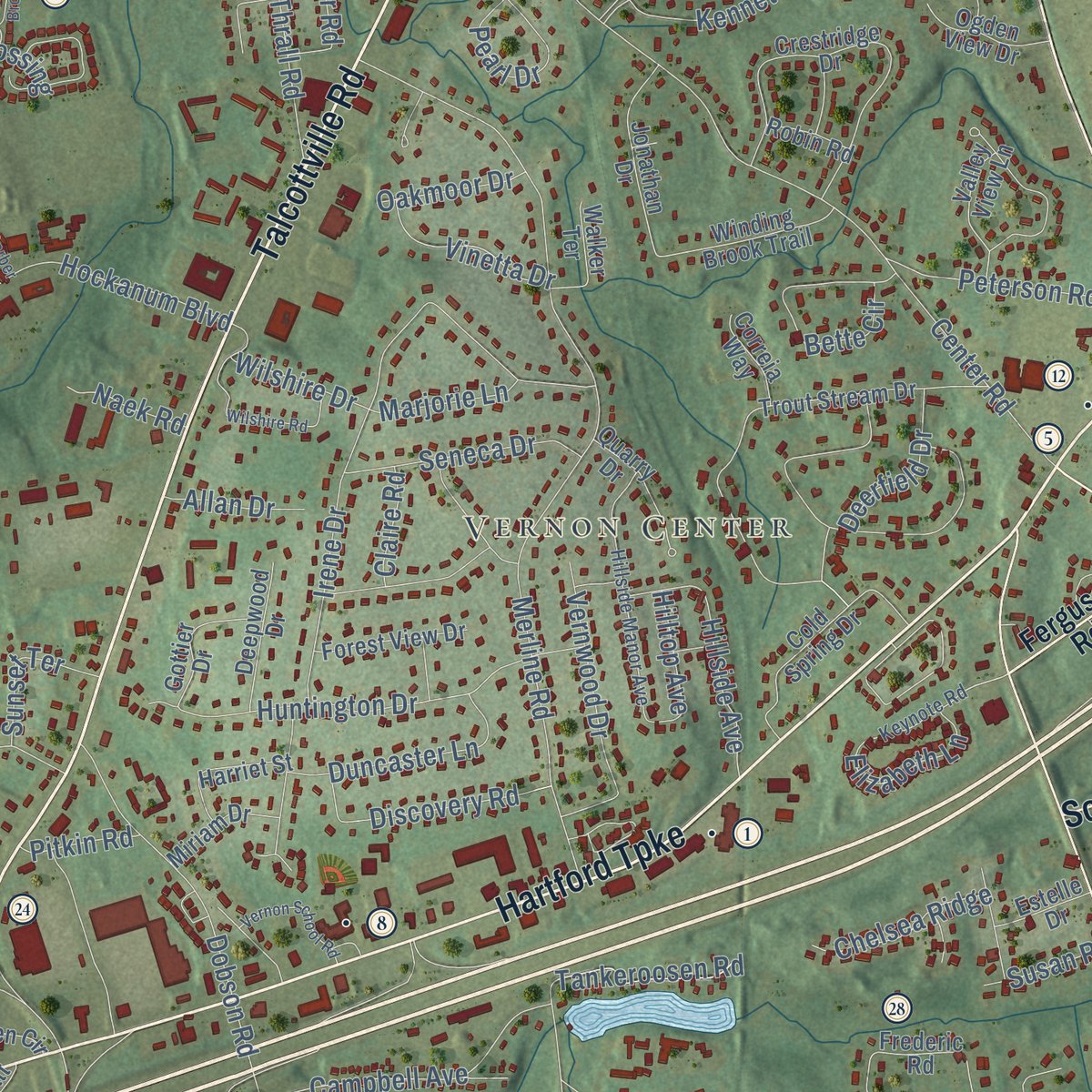
Combining modern data with the timeless character of a vintage atlas, this map is just as interesting up close as it is beautiful on the wall. Whether you grew up in Vernon, spent memorable years there, or call it home today, this unique map is a great way to celebrate a place that means something to you. Zoom in on the preview to look for your street, and then order a print to put your memories on the wall.

Three ways to hang it
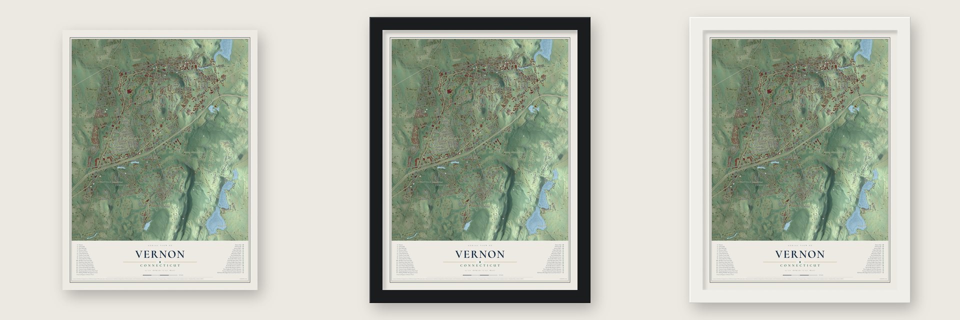
Unframed archival matte, a black wood frame or a white wood frame.
Up close
Geography Worth Displaying
This map was created using accurate cartographic data and authoritative geographic sources, including the U.S. Geological Survey (USGS) and FEMA. The map brings together terrain, waterways, roads, and building detail. The majority of the streets are labeled, houses are accurately depicted, and the topography is derived from government sources. Combining local data with carefully composed color and shading leads to this beautifully detailed Vernon artwork for your wall.
Rather than simply showing street outlines, we’ve included as many of the street names as we could reasonably fit on the map while keeping their names legible. Zoom in on the high resolution preview to see exactly what’s on the map. We truly set out to create a statement piece for anyone who loves Vernon. So whether it’s for you, or a gift for someone you love, we hope this map of Vernon brings back fond memories.
Explore the full map of Vernon, Connecticut and read about the local places it shows.

Find your street
Names on the Vernon map
Every name below is printed on this map. Look for your street, your school, the park where you played, or the pond down the road.
Places and landmarks11
- Downtown
- Talcottville
- Rockville
- Vernon Center
- Box Hill
- Fox Hill
- Aldon Mill Pond
- Bolton Lake
- Belding Wildlife Area
- Henry Park
- Valley Falls Park
Streets and roads289
- Hartford Turnpike
- Talcottville Road
- Union Street
- East Main Street
- Windsorville Road
- Tolland Avenue
- Hyde Avenue
- West Street
- Windsor Avenue
- Tunnel Road
- Lake Street
- Grove Street
- Reservoir Road
- South Frontage Road
- Bolton Road
- Mile Hill Road
- East Street
- Washington Street
- Regan Road
- Lynwood Drive
- Ridgewood Drive
- South Street
- Vernon Avenue
- Merline Road
- Valley Falls Road
- Center Road
- Box Mountain Drive
- Phoenix Street
- Taylor Street
- Bamforth Road
Show all 289 streets
- Hatch Hill Road
- Skinner Road
- Brandy Hill Road
- Hany Lane
- Irene Drive
- Dobson Road
- West Main Street
- Risley Road
- Warren Avenue
- Grand Avenue
- Prospect Street
- Grier Road
- Elm Hill Road
- Dart Hill Road
- Tracey Drive
- Tallwood Drive
- High Street
- Hockanum Boulevard
- Baker Road
- Franklin Street
- Blue Ridge Drive
- Evergreen Road
- Echo Drive
- Dockeral Road
- Sutton Drive
- Cemetery Road
- Brookview Drive
- Montauk Drive
- Huntington Drive
- Rainbow Trail
- Wildwood Road
- Old Town Road
- Loveland Hill Road
- Gerald Drive
- Brooklyn Street
- Hartl Drive
- Meadow Lark Road
- Rolling View Drive
- Reed Street
- Scott Drive
- Main Street
- Butternut Lane
- Campbell Avenue
- Range Hill Drive
- Hansen Drive
- Spring Street
- Vernwood Drive
- Maple Avenue
- Snipsic Street
- Riverside Road
- Lawrence Street
- Bette Circle
- Talcott Avenue
- Fox Hill Drive
- Glenstone Drive
- Industrial Park Road
- Davis Avenue
- Thrall Road
- Pearl Drive
- Kenneth Drive
- Brent Drive
- Hillside Avenue
- Rambling Road
- Daryl Drive
- Orchard Street
- George Drive
- Discovery Road
- Overbrook Drive
- Richard Road
- Diane Drive
- Quail Crossing
- Duncaster Lane
- Legion Drive
- Burke Road
- Kelly Road
- Hublard Drive
- Birch Road
- Seneca Drive
- Hale Street
- Welles Road
- Mary Lane
- Peterson Road
- Ravens Croft Road
- Highland Avenue
- Echo Ridge Drive
- Wilson Lane
- Brimwood Drive
- Neill Road
- Hillcrest Drive
- Knollwood Drive
- Indian Trail
- White Street
- Worcester Road
- Terrace Drive
- Cubles Drive
- Hammond Street
- Rockledge Drive
- Valerie Drive
- Wilshire Drive
- Mountain Street
- Zoey Drive
- Tankeroosen Road
- Elizabeth Lane
- Vinetta Drive
- Village Street
- Chelsea Ridge
- Sunny View Drive
- Country Lane
- Kevin Drive
- Grant Street
- Grady Road
- Deerfield Drive
- Hilltop Avenue
- Hayes Drive
- Donnel Road
- Danny Trail
- Sunset Terrace
- Jeff Road
- Earl Street
- Pinewood Drive
- Wheeler Road
- Forest Drive
- Janet Lane
- Emma Lane
- Marjorie Lane
- Oakmoor Drive
- Russell Drive
- Brighton Lane
- Crown Street
- Allan Drive
- Barbara Road
- Haylin Drive
- Spruce Street
- Susan Road
- Miller Road
- River Street
- Naek Road
- Jen Drive
- Eliot Drive
- Pitkin Road
- Claire Road
- Eva Circle
- Lily Lane
- Ferguson Road
- Carol Drive
- Tracy Drive
- Fish and Game Road
- Trout Stream Drive
- Crestridge Drive
- Frederic Road
- School Brook Lane
- Hale Street Extended
- Berkeley Drive
- Boulder Crest Lane
- Cold Spring Drive
- Oakview Place
- Dailey Circle
- Ward Street
- Mount Vernon Drive
- Westwood Drive
- Willow Stream Drive
- Center Street
- Rau Street
- Gaynor Place
- Maple Street
- Winding Brook Trail
- Pinnacle Road
- Valley View Lane
- Jonathan Drive
- Edith Road
- Forest View Drive
- Gottier Drive
- Middle Terrace
- Parkwest Drive
- Ironwood Drive
- Deepwood Drive
- New Marker Road
- School Street
- Kenwood Drive
- Elm Street
- Olson Drive
- Robin Road
- Harriet Street
- Quarry Drive
- Ogden View Drive
- Bancroft Road
- Emily Drive
- Alpert Road
- Eastview Drive
- King Street
- Sun Valley Drive
- Walker Terrace
- Boxwood Drive
- Heidi Drive
- Chestnut Street
- Nye Street
- Wayne Road
- Cemetery Avenue
- Kristyn Drive
- Rosewood Drive
- Lawler Road
- Miriam Drive
- Correia Way
- Timber Lane
- Estelle Drive
- Driggs Road
- Werner Drive
- Green Circle
- John Drive
- Court Street
- Tiffin Drive
- Green Road
- Garden Drive
- Inland Drive
- Cedar Street
- Olive Lane
- Oviatt Street
- Leona Drive
- Clavet Place
- Eric Circle
- Dart Road
- Pine Street
- Ann Street
- Keynote Road
- Millstream Drive
- Pillsbury Hill
- Hillside Manor Avenue
- Church Street
- Oxbow Drive
- Bread and Milk Road
- Morrison Street
- Pine View Drive
- Michael Drive
- Oak Street
- Thomas Street
- Midland Drive
- Jan Drive
- Hemlock Drive
- Ellington Avenue
- Linden Place
- Luta Circle
- Stonewood Terrace
- Wilshire Road
- Vernon School Road
- McLean Street
- Liberty Street
- Windermere Avenue
- Allison Road
- Carolyn Drive
- Christopher Drive
- Llynwood Drive
- Shady Brook Lane
- North Park Street
- Gardner Road
- Bridle Path Lane
- Vassar Street
- Tunnel View Terrace
- Janoski Drive
- Gerber Boulevard
Names are listed as they appear on the printed map. Zoom into the product photos to find them.
About Vernon, Connecticut
Vernon is a town of 30,215 people in Tolland County, on the Hockanum River. It began as the north parish of Bolton, where in 1726 Samuel Grant traded his Bolton farm of about a hundred acres for 500 acres of rough land in the north of the township. Families there, far from the Bolton meetinghouse, won the right to hold their own winter services in 1749, and in October 1808 the parish was set off as a town named for Mount Vernon.
Below Shenipsit Lake the Hockanum loses 254 feet over a mile and a half, and that fall built the town. In 1821 Col. Francis McLean dammed the river beside a natural stone ledge known as the Rock and put up the Rock Mill. Woolen mills spread along the stream, and in 1837 the mill village chose the name Rockville so it could have a post office of its own. Rockville became a city in January 1889 and was folded back into the town in January 1965.
“Rockville is set, not on a single hill, nor on seven hills, like ancient Rome, but upon a series of hills.”
- Smuggled out in a hogsheadPeter Dobson, born in Preston, England, in 1784, learned the cotton trade while England guarded its skilled mill men. A 1908 history says he escaped hidden in a hogshead drilled with gimlet holes for air. By 1810 he and partners ran a cotton mill in south Vernon, later Dobsonville. When Hartford merchants refused American goods during the War of 1812, he sold yarn to peddlers. He also built the machinery Delano Abbott used in 1812 for Vernon's first satinet.
- Waiting up for LafayetteStagecoaches running from New York to Boston swapped teams in Vernon, and about 1820 King's Stage House was built there of brick made nearby. Lafayette was expected in 1824, and the militia kept firing its cannon all day, from sunrise until sunset. After midnight they finally quit waiting, and only then did he reach the tavern, where a room at King's had been decorated in his honor. The tavern closed in 1847, after the stage lines stopped running.
- America's biggest envelope factoryThe Florence Mill rose on West Main Street in 1864 to replace a mill lost to fire, with a mansard roof and a tower in the Italianate style. In 1881 the firm of White & Corbin took it over and kept adding on until no envelope factory in the United States was bigger. Its lines made envelopes until 1975, and the building now holds 113 apartments for older residents.
- Talcottville's cotton millIn 1802 John Warburton, an English immigrant, dammed the Tankerhoosen River and built a cotton mill, said to be Connecticut's first financially successful one. In 1856 the mills were bought by two brothers, Charles and Horace Talcott, and the village became Talcottville. In 1870 they raised the big wood-frame mill that still stands, and they built houses and a school for their workers. The mills kept running until 1940.
Keep exploring Connecticut
Vernon is one of 375 Connecticut towns we've mapped. Every dot on the map is a print of its own.
The search covers every state, Connecticut first.
Near Vernon
Order 2 or more town maps and save 10%. Shown in the size and finish you picked above, so they hang as a set.
- Vernon Center 12" x 18" / Archival Matte Print $39.99
- Rockville 12" x 18" / Archival Matte Print $39.99
- Windermere 12" x 18" / Archival Matte Print $39.99


More maps nearby: Bolton, Highland Park, Ellington, Manchester and Tolland.
The art of mapping a place
How This Map Was Made
Real places. Remarkable detail. Discover the layers that turn geographic data into a map of home.

The view from above
Aerial imagery reveals the character of the land: woodland, open fields, and the patterns of a place.

The shape of the land
Elevation data brings hills, valleys, and subtle changes in the landscape into view.

The details of home
Roads, waterways, and building footprints come together to make the map feel unmistakably local.

Geography becomes art
Considered color, shading, and typography bring the layers together in a map made for your wall.


Process illustrated with Mendon, Massachusetts. Aerial imagery: USDA NAIP. Terrain: USGS 3D Elevation Program. Map details and finished artwork: KNOWOL.
The Details
About This Print
Choose an archival matte print, or a black or white Ayous wood frame. The archival matte print is unframed.
Select your size and finish above to see the matching product image and price.
Materials & Craftsmanship
A contemporary map with the character of a classic atlas, printed on archival matte paper. Optional frames are made from Ayous wood.
Your printed map does not include the watermark shown in the full-map preview.
Shipping & Delivery
Free shipping within the United States. Every print is made to order in the USA.
Buying a gift? Add a note in your cart and we'll include it. We never put prices in the package.
Prints ship within 2 to 3 business days. Allow 7 to 10 days total from ordering for delivery. Timing may vary during holidays or periods of high order volume.
Read our shipping policy.
Returns and damaged prints
Each print is made to order. Change-of-mind refunds are not available after production.
If your print arrives damaged, misprinted or incorrect, contact support@knowol.com within 30 days of receiving it. Include your order number, photos and a description of the issue.
Read our full refund and replacement policy. For questions about your order, email support@knowol.com.