
Search for another town





Free U.S. delivery 7 to 10 days after you order
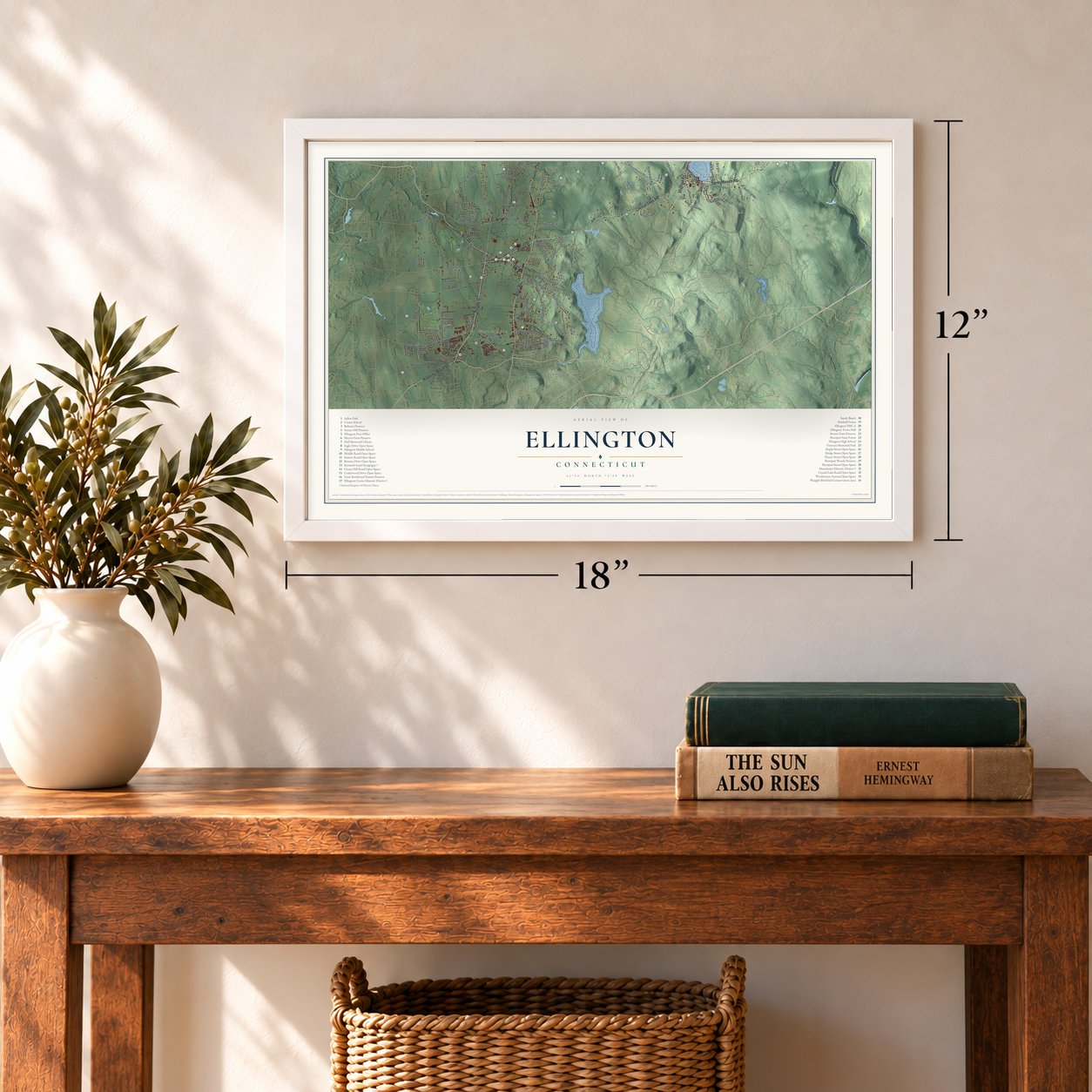
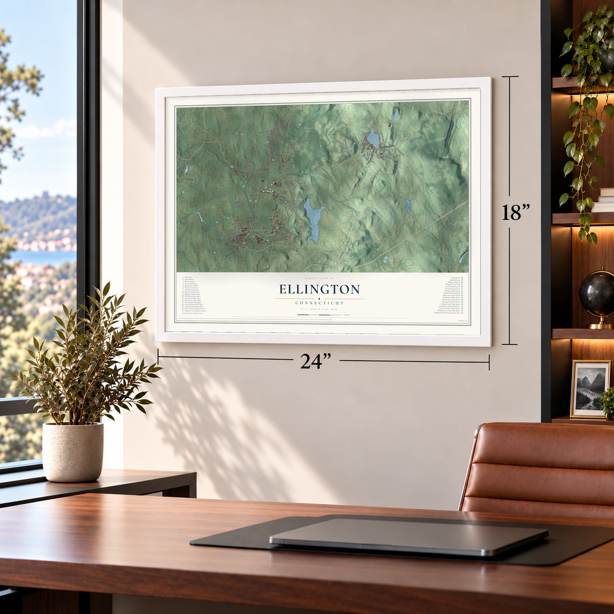
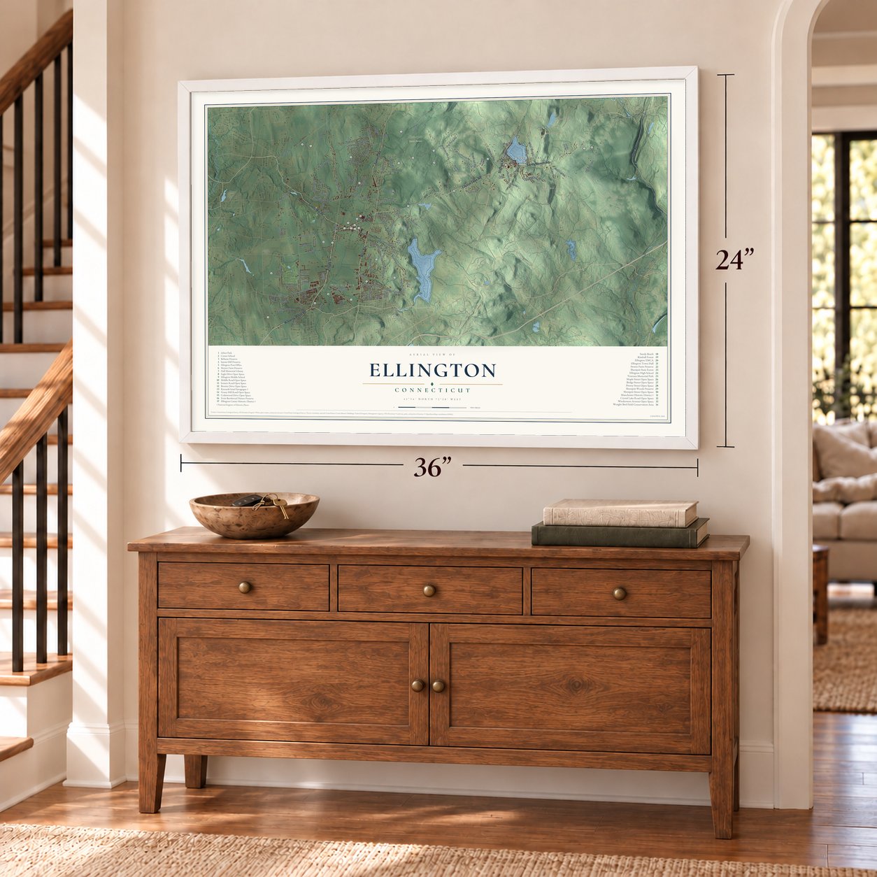
Ellington, Connecticut Map Art
Building by building, with labeled streets and shaded relief.
12" x 18" Archival Matte Print
A Map of Home. A Work of Art.
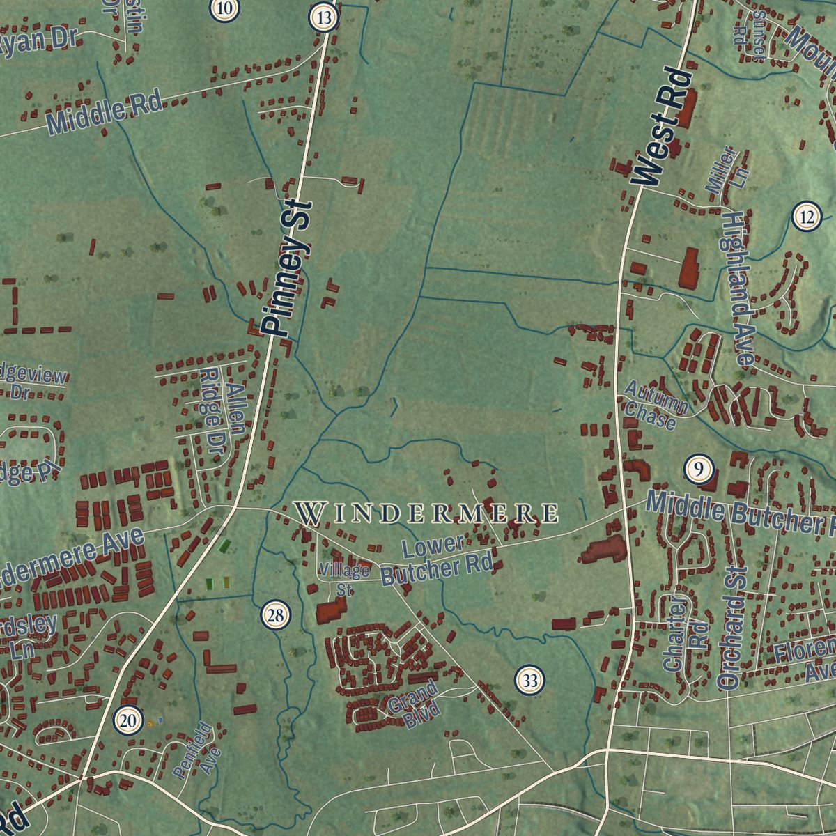
Explore Ellington, Connecticut from a whole new perspective. Created using aerial imagery and detailed geographic data, this map captures Ellington building by building, with labeled streets, familiar landmarks, and shaded topographical relief that highlights the natural contours of the landscape.
Combining modern data with the timeless character of a vintage atlas, this map is just as interesting up close as it is beautiful on the wall. Whether you grew up in Ellington, spent memorable years there, or call it home today, this unique map is a great way to celebrate a place that means something to you. Zoom in on the preview to look for your street, and then order a print to put your memories on the wall.

Three ways to hang it
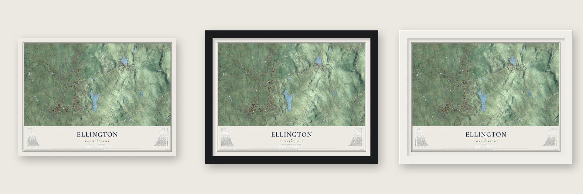
Unframed archival matte, a black wood frame or a white wood frame.
Up close
Geography Worth Displaying
This map was created using accurate cartographic data and authoritative geographic sources, including the U.S. Geological Survey (USGS) and FEMA. The map brings together terrain, waterways, roads, and building detail. The majority of the streets are labeled, houses are accurately depicted, and the topography is derived from government sources. Combining local data with carefully composed color and shading leads to this beautifully detailed Ellington artwork for your wall.
Rather than simply showing street outlines, we’ve included as many of the street names as we could reasonably fit on the map while keeping their names legible. Zoom in on the high resolution preview to see exactly what’s on the map. We truly set out to create a statement piece for anyone who loves Ellington. So whether it’s for you, or a gift for someone you love, we hope this map of Ellington brings back fond memories.
Explore the full map of Ellington, Connecticut and read about the local places it shows.

Find your street
Names on the Ellington map
Every name below is printed on this map. Look for your street, your school, the park where you played, or the pond down the road.
Places and landmarks9
- Crystal Lake
- Buff Cap Hill
- Fox Hill
- Kendall Hill
- Murry Hill
- Bradway Pond
- Charters Pond
- Shenipsit State Forest
- Windermere
Streets and roads125
- Sadds Mill Road
- Pinney Street
- West Road
- Wapping Wood Road
- Stafford Road
- Somers Road
- Maple Street
- Crystal Lake Road
- Sandy Beach Road
- River Road
- Windsorville Road
- Tolland Turnpike
- Abbott Road
- Jobs Hill Road
- Frog Hollow Road
- Burbank Road
- Meadow Brook Road
- Webster Road
- Sykes Road
- Snipsic Lake Road
- Green Road
- Middle Road
- Windermere Avenue
- Hoffman Road
- Mountain Street
- Ellington Avenue
- Kibbe Road
- Reeves Road
- Hopkins Road
- Tripp Road
Show all 125 streets
- Muddy Brook Road
- Crane Road
- Newell Hill Road
- Crystal Ridge Drive
- Highland Avenue
- Egypt Road
- Shenipsit Street
- Schoolhouse Road
- Broad Brook Road
- Ellsworth Lane
- Hayes Avenue
- Minor Hill Road
- Cider Mill Road
- Mountain Road
- Middle Butcher Road
- South Road
- Upper Butcher Road
- Buff Cap Road
- Porter Road
- Ladd Road
- Birchview Drive
- Lanz Lane
- Hubbard Road
- Orchard Street
- Standish Road
- Bridge Street
- Dogwood Lane
- Ryan Drive
- Stein Road
- Tree Top Road
- Ridge Road
- Pine Street
- Hare Road
- Main Street
- Tomoka Avenue
- East Shore Road
- Pinnacle Road
- Hillside Drive
- West Shore Road
- Windmill Road
- Blueberry Circle
- Lower Butcher Road
- Ellridge Place
- Angel Trce Road
- Charter Road
- East Porter Road
- Hunters Run
- Ardsley Lane
- White Road
- Florence Avenue
- Lookout Landing
- Allen Ridge Drive
- Jacobs Hill Road
- Cindy Road
- Tyler Drive
- Virginia Drive
- North Park Street
- Pinney Road
- Grassy Hill Road
- Lord Road
- Punkin Drive
- Rothe Lane
- Laurel Road
- Justin Drive
- Daisy Lane
- Hall Road
- Autumn Chase
- Grand Boulevard
- Ridgeview Drive
- Overhill Road
- Jonathan Drive
- Amy Lane
- Grant Road
- Sugar Hill Road
- Miller Lane
- Abbey Brook
- Field Drive
- Wells Road
- Maplewood Drive
- Brockway Road
- Hatheway Road
- Wheelock Road
- Setting Sun Trail
- Village Street
- Glenwood Road
- Sunset Road
- Cranberry Lane
- Quarter Horse Drive
- Pioneer Drive
- Maria Drive
- Hawks Nest Trail
- Foster Drive
- Penfield Avenue
- Leila Lane
- Eagle Drive
Names are listed as they appear on the printed map. Zoom into the product photos to find them.
About Ellington, Connecticut
Ellington is a town of 16,426 people in Tolland County, Connecticut. Native people called the place Weexskashuck, the Great Marsh, and Windsor bought the land in 1671. For decades, settlers from Windsor walked past the marsh because they believed the low, wet ground was unhealthy. Samuel Pinney, a surveyor, finally settled there in 1717, and in 1730 the settlement still had only eleven families.
Rev. John McKinstry, a graduate of Edinburgh, came as the first minister in 1733 and was paid forty pounds a year plus his firewood. When the parish raised its first meetinghouse in 1739, people said every man in Ellington could sit on the frame's east sill at once. Ellington went with East Windsor when that town split from Windsor in 1768, and in May 1786 it was incorporated as a town of its own.
“Ellington is beautiful. It might be just a little quiet in winter, but at this season it is great. There's a glorious silence there.”
- Father Brockway's fallCol. Samuel Belcher of Hartford built Ellington's second church in 1804 for about $7,000. During construction its pastor, Rev. Diodate Brockway, fell sixty-five feet climbing toward the cupola, leaving him lame for life. He preached the 1806 dedication sermon from a chair and served the church fifty years.
- From rye fields to the ShulEarly Ellington grew rye for nearby distilleries, sometimes in hundred-acre fields, and by the 1890s farmers turned to tobacco, corn, potatoes and fruit. In 1906 Yiddish-speaking Jewish farmers from Russia and Eastern Europe, settled by Baron Maurice de Hirsch's Jewish Colonization Association, founded Congregation Knesseth Israel. The association helped pay for their Colonial Revival synagogue in 1913.
- Headlights at Hyde FieldOn New Year's Day 1967, a pilot with engine trouble couldn't find a runway in fog so thick that people could see only 200 feet. Resident State Trooper Lionel Labreche of the Connecticut State Police gathered dozens of residents at Hyde Field, the town's airstrip, which had no lights. They lined the runway with their cars and switched on the headlights, the pilot came down safely, and the rescue made national news.
- A boy's roadside stoneA stone in the southwest corner of town is one of the oldest roadside memorials in America. It marks where nine-year-old Samuel Knight died on Nov 8, 1812, when a cart wheel rolled over his head. It wasn't Ellington's first marker of its kind: after John Aborns was killed by lightning in 1768, his brother set up a slab at the spot.
Keep exploring Connecticut
Ellington is one of 375 Connecticut towns we've mapped. Every dot on the map is a print of its own.
The search covers every state, Connecticut first.
Near Ellington
Order 2 or more town maps and save 10%. Shown in the size and finish you picked above, so they hang as a set.
- Windermere 12" x 18" / Archival Matte Print $39.99
- Rockville 12" x 18" / Archival Matte Print $39.99
- Crystal Lake 12" x 18" / Archival Matte Print $39.99


More maps nearby: Broad Brook, Tolland, Vernon, Somers and Vernon Center.
The art of mapping a place
How This Map Was Made
Real places. Remarkable detail. Discover the layers that turn geographic data into a map of home.

The view from above
Aerial imagery reveals the character of the land: woodland, open fields, and the patterns of a place.

The shape of the land
Elevation data brings hills, valleys, and subtle changes in the landscape into view.

The details of home
Roads, waterways, and building footprints come together to make the map feel unmistakably local.

Geography becomes art
Considered color, shading, and typography bring the layers together in a map made for your wall.


Process illustrated with Mendon, Massachusetts. Aerial imagery: USDA NAIP. Terrain: USGS 3D Elevation Program. Map details and finished artwork: KNOWOL.
The Details
About This Print
Choose an archival matte print, or a black or white Ayous wood frame. The archival matte print is unframed.
Select your size and finish above to see the matching product image and price.
Materials & Craftsmanship
A contemporary map with the character of a classic atlas, printed on archival matte paper. Optional frames are made from Ayous wood.
Your printed map does not include the watermark shown in the full-map preview.
Shipping & Delivery
Free shipping within the United States. Every print is made to order in the USA.
Buying a gift? Add a note in your cart and we'll include it. We never put prices in the package.
Prints ship within 2 to 3 business days. Allow 7 to 10 days total from ordering for delivery. Timing may vary during holidays or periods of high order volume.
Read our shipping policy.
Returns and damaged prints
Each print is made to order. Change-of-mind refunds are not available after production.
If your print arrives damaged, misprinted or incorrect, contact support@knowol.com within 30 days of receiving it. Include your order number, photos and a description of the issue.
Read our full refund and replacement policy. For questions about your order, email support@knowol.com.