


Search for another town



Free U.S. delivery 7 to 10 days after you order
Wethersfield, Connecticut Map Art
Building by building, with labeled streets and shaded relief.
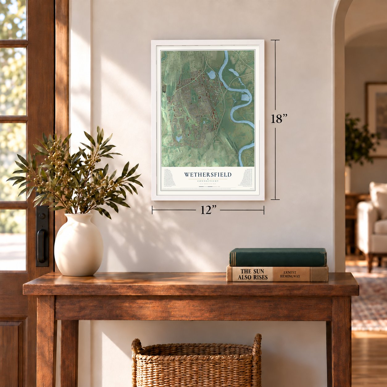
12" x 18" Archival Matte Print
A Map of Home. A Work of Art.
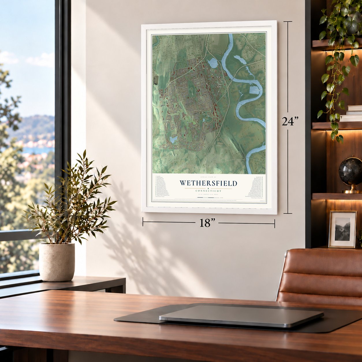
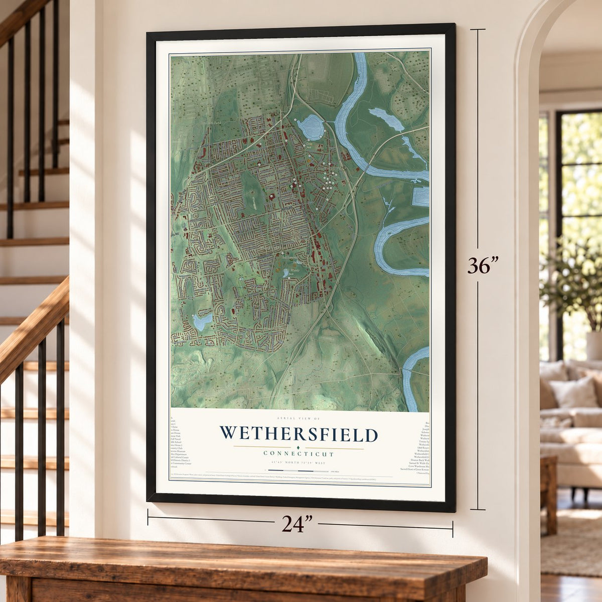
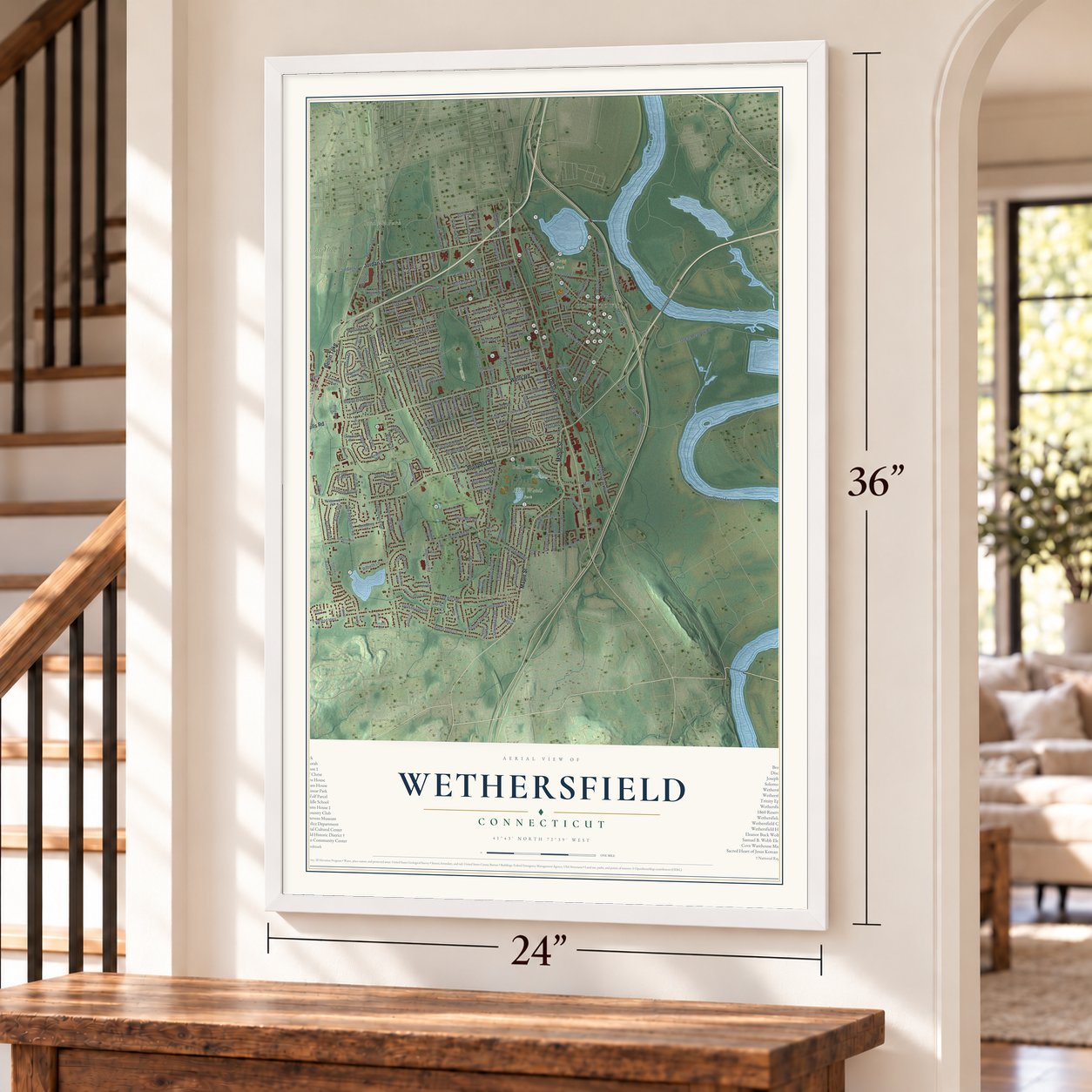
Explore Wethersfield, Connecticut from a whole new perspective. Created using aerial imagery and detailed geographic data, this map captures Wethersfield building by building, with labeled streets, familiar landmarks, and shaded topographical relief that highlights the natural contours of the landscape.
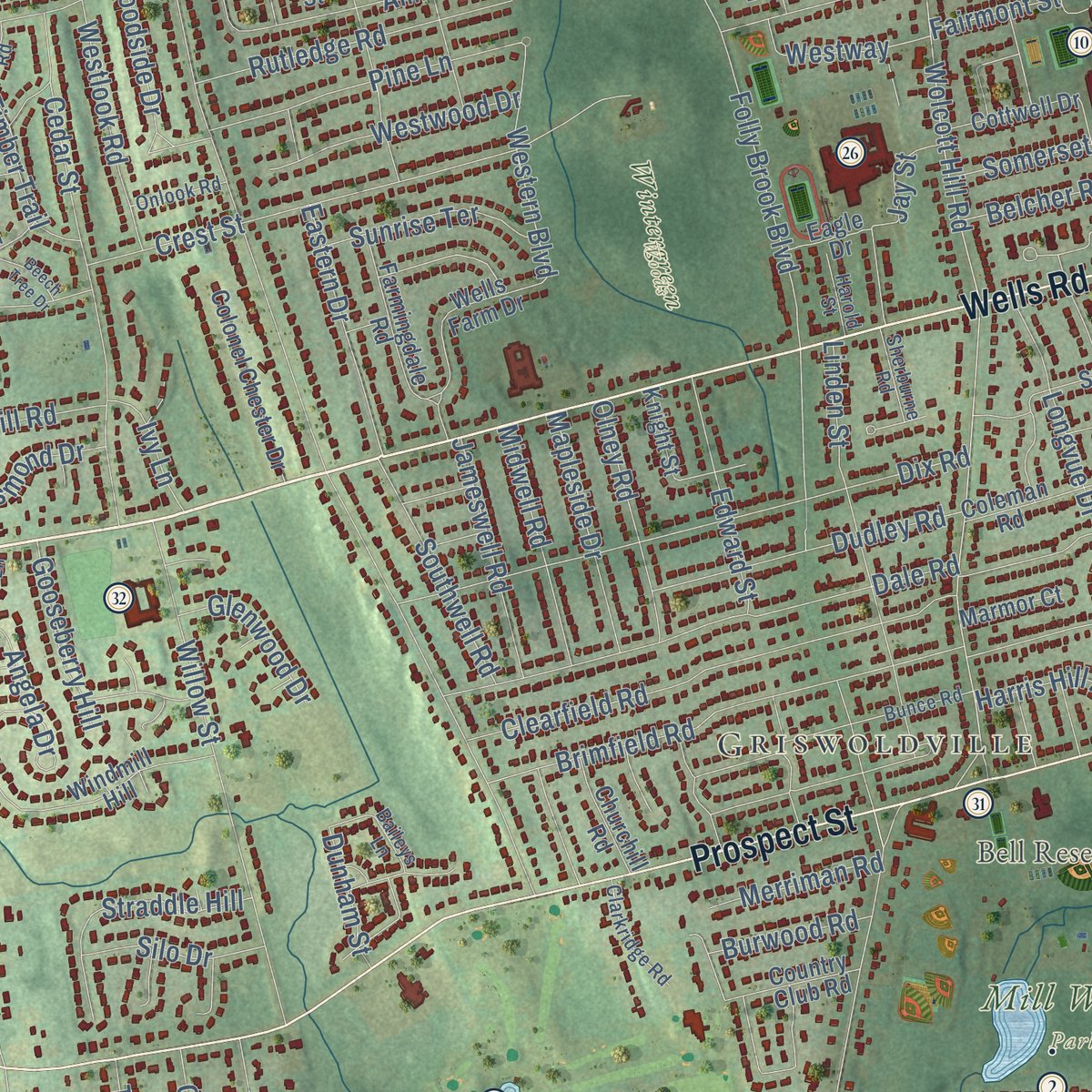
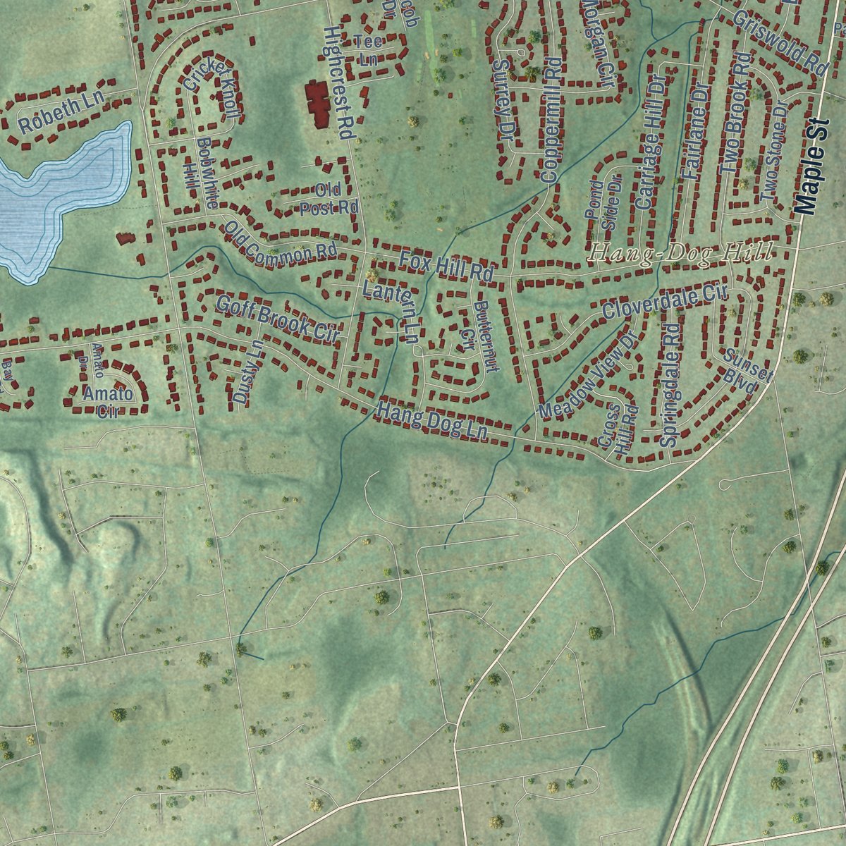
Combining modern data with the timeless character of a vintage atlas, this map is just as interesting up close as it is beautiful on the wall. Whether you grew up in Wethersfield, spent memorable years there, or call it home today, this unique map is a great way to celebrate a place that means something to you. Zoom in on the preview to look for your street, and then order a print to put your memories on the wall.

Three ways to hang it
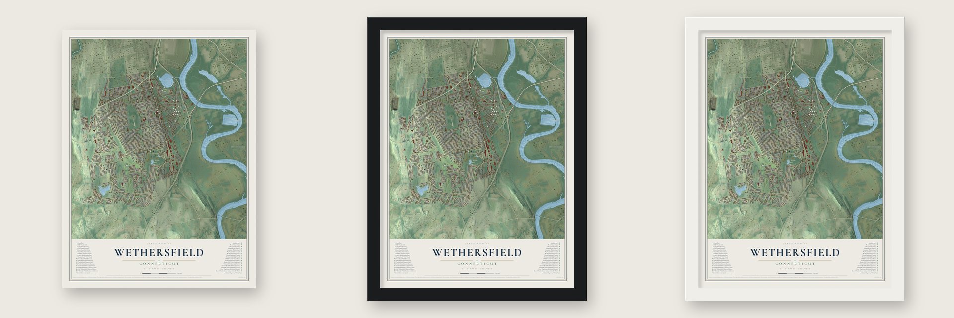
Unframed archival matte, a black wood frame or a white wood frame.
Up close
Geography Worth Displaying
This map was created using accurate cartographic data and authoritative geographic sources, including the U.S. Geological Survey (USGS) and FEMA. The map brings together terrain, waterways, roads, and building detail. The majority of the streets are labeled, houses are accurately depicted, and the topography is derived from government sources. Combining local data with carefully composed color and shading leads to this beautifully detailed Wethersfield artwork for your wall.
Rather than simply showing street outlines, we’ve included as many of the street names as we could reasonably fit on the map while keeping their names legible. Zoom in on the high resolution preview to see exactly what’s on the map. We truly set out to create a statement piece for anyone who loves Wethersfield. So whether it’s for you, or a gift for someone you love, we hope this map of Wethersfield brings back fond memories.
Explore the full map of Wethersfield, Connecticut and read about the local places it shows.

Find your street
Names on the Wethersfield map
Every name below is printed on this map. Look for your street, your school, the park where you played, or the pond down the road.
Places and landmarks13
- Downtown
- Griswoldville
- Crow Point
- Glastonbury Meadows
- Hang-Dog Hill
- Bell Pond
- Bell Reservoir
- Goodwin Park
- Cedar Hill Cemetery
- Cove Park
- Mill Woods Park
- Wintergreen Woods
Show all 13 places
- Meggat Park
Streets and roads238
- Wells Road
- Maple Street
- Berlin Turnpike
- Jordan Lane
- Silas Deane Highway
- Prospect Street
- Russell Road
- Church Street
- Marsh Street
- Wolcott Hill Road
- Elm Street Extended
- Spring Street
- Highland Street
- Goff Road
- Two Rod Highway
- Lantern Lane
- Ridge Road
- Folly Brook Boulevard
- Nott Street
- Great Meadow Road
- Main Street
- Middletown Avenue
- Hartford Avenue
- Griswold Road
- Elm Street
- Hang Dog Lane
- Broad Street
- Coppermill Road
- Garden Street
- Brimfield Road
Show all 238 streets
- Cumberland Avenue
- Second Lane
- Dix Road
- Cloverdale Circle
- Fox Hill Road
- Back Lane
- Dale Road
- Forest Drive
- Willow Street
- Cedar Street
- Clearfield Road
- Highcrest Road
- Old Reservoir Road
- Longvue Drive
- Crest Street
- Thornbush Road
- Linden Street
- Edward Street
- Olney Road
- Amherst Street
- Fairway Drive
- Clovercrest Road
- Ridge Crest Circle
- Two Brook Road
- Burbank Road
- Fairlane Drive
- Beverly Road
- Charter Road
- Rutledge Road
- Collier Road
- Morgan Circle
- Pine Lane
- Dudley Road
- Carriage Hill Drive
- Robeth Lane
- Timber Trail
- Boulter Road
- Valley Crest Drive
- Straddle Hill
- Mill Street
- Surrey Drive
- State Street
- Eastern Drive
- Westwood Drive
- Randy Lane
- Westlook Road
- Southwell Road
- Mapleside Drive
- Midwell Road
- Jameswell Road
- Robbins Drive
- Apple Hill
- Black Birch
- Western Boulevard
- Mohawk Lane
- Sunrise Terrace
- Somerset Street
- Jay Street
- Goodwin Park Road
- Waters View Drive
- McMullen Avenue
- Desmond Drive
- Springdale Road
- Greenfield Street
- Woodside Drive
- Crystal Street
- Round Hill Road
- Goodwin Avenue
- Oakdale Street
- Morrison Avenue
- Hillcrest Avenue
- Hillsdale Avenue
- Fairview Drive
- Gooseberry Hill
- Oxford Street
- Parkview Drive
- Harris Hill Road
- Goodrich Drive
- Westway
- Village Drive
- Center Street
- Lexington Street
- Silo Drive
- Grist Mill Road
- Tobler Terrace
- Booth Avenue
- Merriman Road
- Glenwood Drive
- Goff Brook Circle
- Albert Avenue
- Orchard Hill Drive
- Belcher Road
- Angela Drive
- Burwood Road
- Harmund Place
- Stillman Road
- Hewitt Street
- Wright Road
- Spruce Street
- Dunham Street
- Ivy Lane
- Barstow Drive
- Treat Road
- Fairmont Street
- Hart Street
- Buckland Road
- Cricket Knoll
- Windmill Hill
- Old Common Road
- Stillwold Drive
- Coleman Road
- Brookside Circle
- Two Stone Drive
- Cider Brook Drive
- Wells Farm Drive
- Wilmont Street
- Butternut Circle
- Yale Street
- Harding Street
- Colonel Chester Drive
- Meadow View Drive
- Park Avenue
- Farmingdale Road
- Baneberry Lane
- Wildwood Road
- Pond Side Drive
- Saxon Road
- Highview Avenue
- Sunset Boulevard
- Tinsmith Crossing
- Amato Circle
- River Road
- Town Line Road
- Cottwell Drive
- Country Club Road
- Cross Hill Road
- Dusty Lane
- Dogwood Road
- Sharon Lane
- Churchill Road
- Arrow Road
- Luca Lane
- Oldham Road
- Colonial Drive
- Stonegate Drive
- Progress Drive
- Wilcox Street
- Marmor Court
- Kimball Road
- Bobwhite Hill
- Old Post Road
- Knight Street
- Olesen Road
- Cranston Avenue
- Holly Lane
- Eagle Drive
- Hubbard Place
- Byrd Road
- Toll Gate Road
- Cheston Circle
- Savage Road
- Francis Street
- Tee Lane
- Lille Street
- Patriot Lane
- Jacob Drive
- Knoll Street
- Bunce Road
- Whippoorwill Way
- Concord Circle
- Chamberlain Road
- Palmer Drive
- Brussels Avenue
- Reed Drive
- Clarkridge Road
- Old Pewter Lane
- Montague Street
- Lancaster Road
- Baileys Lane
- Onlook Road
- Sherburne Road
- Harold Street
- Orchard Brook Drive
- Kenwood Road
- Tifton Road
- Kimberly Lane
- Laconia Road
- Great Plain Lane
- Liberty Hl
- Trivet Lane
- Kelley Avenue
- Stockingmill Road
- Beaver Road
- Judd Road
- Barrington Drive
- Beech Tree Drive
- Rosedale Street
- Flower Street
- Amato Drive
- Executive Square
- Victory Lane
- Belmont Street
- Harvard Street
- Bay Roc Road
- Heather Drive
- Lincoln Road
- Morris Street
- Dorlen Circle
Names are listed as they appear on the printed map. Zoom into the product photos to find them.
About Wethersfield, Connecticut
Wethersfield traces its English settlement to 1634 and ranks among Connecticut's three oldest towns. River trade, shipbuilding and red onions supported its early economy. Old Wethersfield preserves a remarkably broad collection of historic streets and buildings.
- Settled in 1634A Puritan party established the community then known as Watertown.
- 27,298 peopleCounted in the 2020 census.
- OniontownWethersfield served as New England's red-onion trading center for more than a century.
- Washington met RochambeauThe commanders planned the campaign that ended at Yorktown in the Webb House in May 1781.
- The TryallThomas Deming launched the vessel at Wethersfield Cove in 1649; it is called Connecticut's first locally built ship.
Keep exploring Connecticut
Wethersfield is one of 382 Connecticut towns we've mapped. Every dot on the map is a print of its own.
The search covers every state, Connecticut first.
Near Wethersfield
Order 2 or more town maps and save 10%. Shown in the size and finish you picked above, so they hang as a set.
- Rocky Hill 12" x 18" / Archival Matte Print $39.99
- Newington 12" x 18" / Archival Matte Print $39.99
- Glastonbury Center 12" x 18" / Archival Matte Print $39.99


More maps nearby: South Green, Parkville, Frog Hollow, Hartford and East Hartford.
The art of mapping a place
How This Map Was Made
Real places. Remarkable detail. Discover the layers that turn geographic data into a map of home.

The view from above
Aerial imagery reveals the character of the land: woodland, open fields, and the patterns of a place.

The shape of the land
Elevation data brings hills, valleys, and subtle changes in the landscape into view.

The details of home
Roads, waterways, and building footprints come together to make the map feel unmistakably local.

Geography becomes art
Considered color, shading, and typography bring the layers together in a map made for your wall.


Process illustrated with Mendon, Massachusetts. Aerial imagery: USDA NAIP. Terrain: USGS 3D Elevation Program. Map details and finished artwork: KNOWOL.
The Details
About This Print
Choose an archival matte print, or a black or white Ayous wood frame. The archival matte print is unframed.
Select your size and finish above to see the matching product image and price.
Materials & Craftsmanship
A contemporary map with the character of a classic atlas, printed on archival matte paper. Optional frames are made from Ayous wood.
Your printed map does not include the watermark shown in the full-map preview.
Shipping & Delivery
Free shipping within the United States. Every print is made to order in the USA.
Buying a gift? Add a note in your cart and we'll include it. We never put prices in the package.
Prints ship within 2 to 3 business days. Allow 7 to 10 days total from ordering for delivery. Timing may vary during holidays or periods of high order volume.
Read our shipping policy.
Returns and damaged prints
Each print is made to order. Change-of-mind refunds are not available after production.
If your print arrives damaged, misprinted or incorrect, contact support@knowol.com within 30 days of receiving it. Include your order number, photos and a description of the issue.
Read our full refund and replacement policy. For questions about your order, email support@knowol.com.