


Search for another town





Free U.S. delivery 7 to 10 days after you order
Winter Park, Florida Map Art
Building by building, with labeled streets and shaded relief.
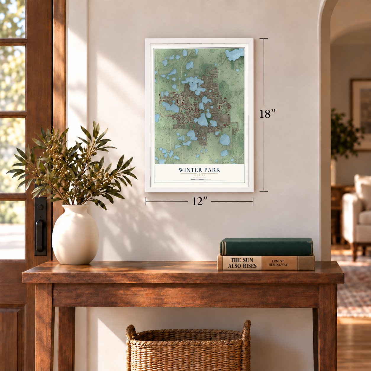
12" x 18" Archival Matte Print
A Map of Home. A Work of Art.
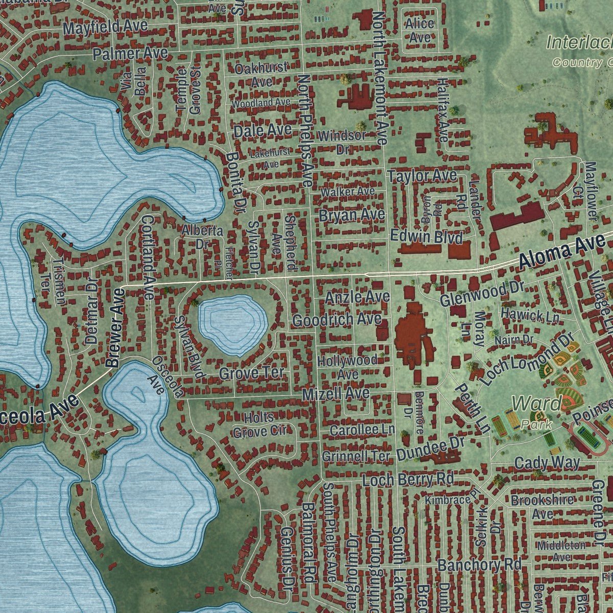
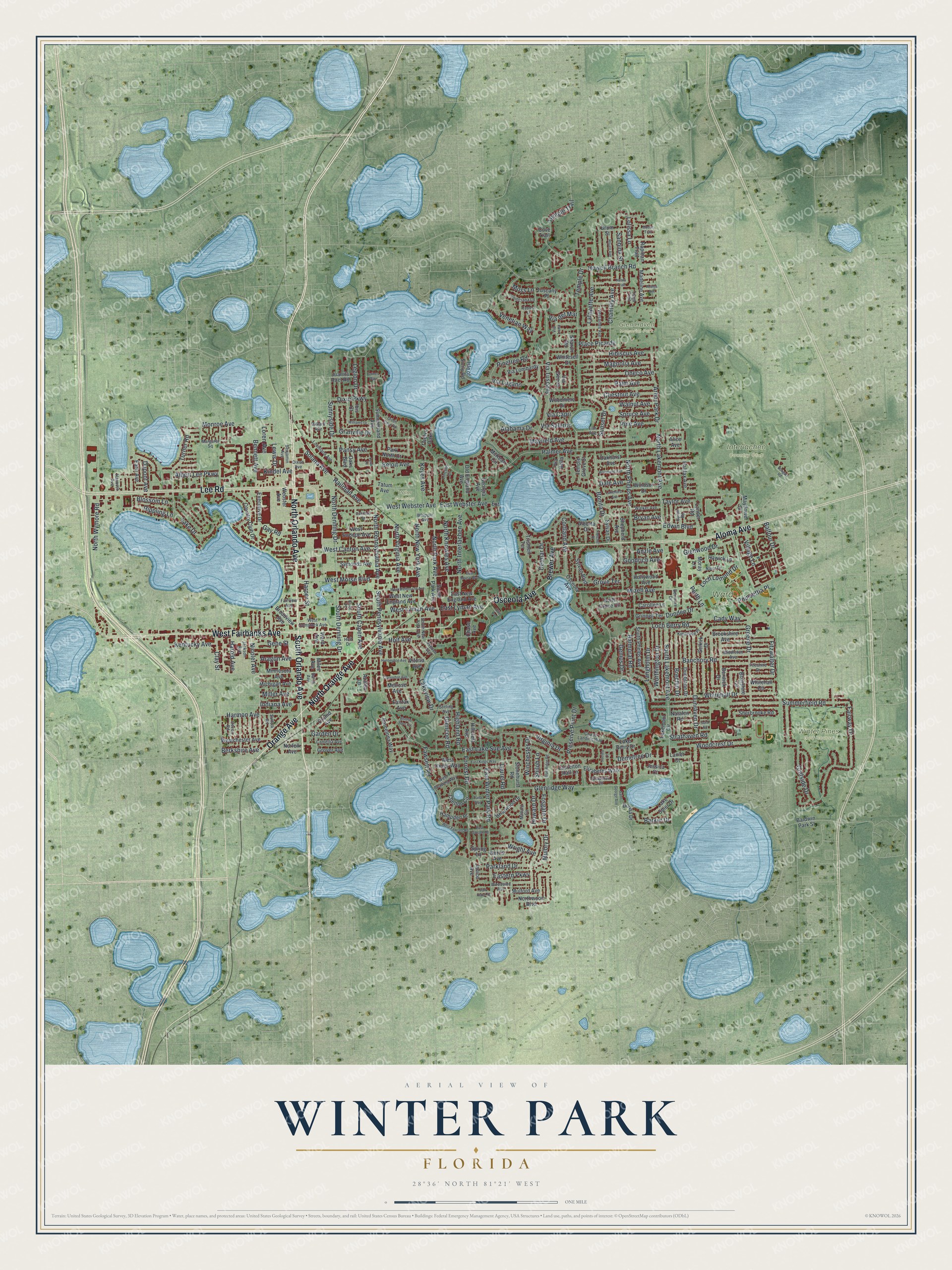
Explore Winter Park, Florida from a whole new perspective. Created using aerial imagery and detailed geographic data, this map captures Winter Park building by building, with labeled streets, familiar landmarks, and shaded topographical relief that highlights the natural contours of the landscape.
Combining modern data with the timeless character of a vintage atlas, this map is just as interesting up close as it is beautiful on the wall. Whether you grew up in Winter Park, spent memorable years there, or call it home today, this unique map is a great way to celebrate a place that means something to you. Zoom in on the preview to look for your street, and then order a print to put your memories on the wall.
Three ways to hang it
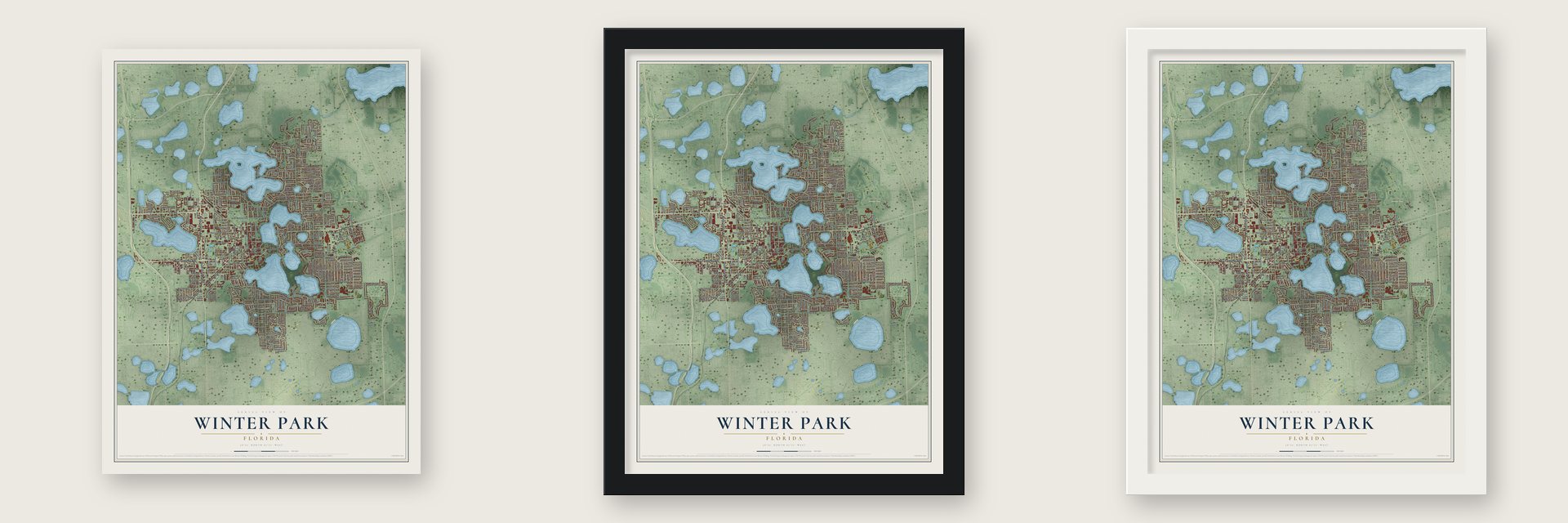
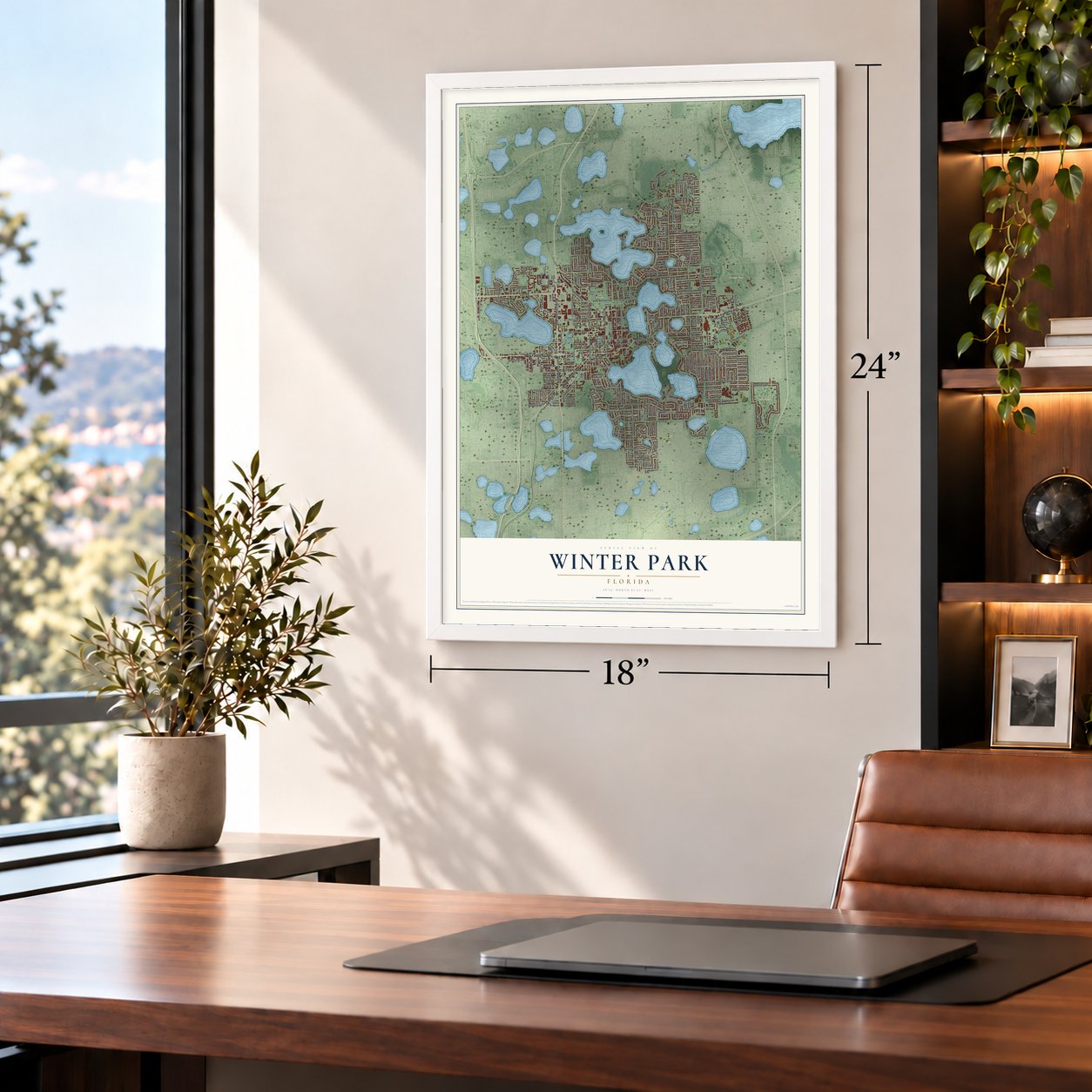
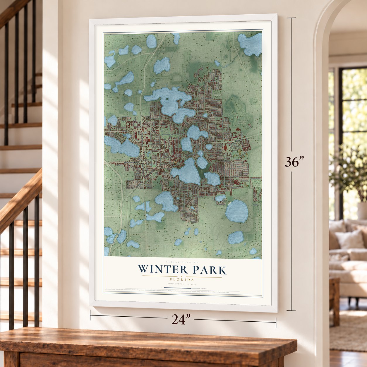
Unframed archival matte, a black wood frame or a white wood frame.
Up close
Geography Worth Displaying
This map was created using accurate cartographic data and authoritative geographic sources, including the U.S. Geological Survey (USGS) and FEMA. The map brings together terrain, waterways, roads, and building detail. The majority of the streets are labeled, houses are accurately depicted, and the topography is derived from government sources. Combining local data with carefully composed color and shading leads to this beautifully detailed Winter Park artwork for your wall.
Rather than simply showing street outlines, we’ve included as many of the street names as we could reasonably fit on the map while keeping their names legible. Zoom in on the high resolution preview to see exactly what’s on the map. We truly set out to create a statement piece for anyone who loves Winter Park. So whether it’s for you, or a gift for someone you love, we hope this map of Winter Park brings back fond memories.
Explore the full map of Winter Park, Florida and read about the local places it shows.

Find your street
Names on the Winter Park map
Every name below is printed on this map. Look for your street, your school, the park where you played, or the pond down the road.
Places and landmarks5
- Glen Haven Memorial Park
- Interlachen Country Club
- Palm Cemetery
- Ward Park
- Winter Pines Golf Course
Streets and roads308
- North Orlando Avenue
- South Orlando Avenue
- North Orange Avenue
- Orange Avenue
- Lee Road
- West Fairbanks Avenue
- Aloma Avenue
- Osceola Avenue
- West Morse Boulevard
- South Lakemont Avenue
- Sunnyside Drive
- North Lakemont Avenue
- North Phelps Avenue
- East Winter Park Road
- North Denning Drive
- North Park Avenue
- Palmer Avenue
- Glenridge Way
- Genius Drive
- Summerfield Road
- Temple Drive
- South Pennsylvania Avenue
- Golfside Drive
- South Denning Drive
- Via Tuscany
- North New York Avenue
- West Webster Avenue
- Howell Branch Road
- North Pennsylvania Avenue
- West Canton Avenue
Show all 308 streets
- Mizell Avenue
- Mayfield Avenue
- Banchory Road
- Alabama Drive
- Harmon Avenue
- Howard Drive
- Via Lugano
- Temple Trail
- Sunset Drive
- North Wymore Road
- East Lake Sue Avenue
- Glencoe Road
- Venetian Way
- Virginia Drive
- West Lyman Avenue
- Dunraven Drive
- Holt Avenue
- Greene Drive
- Forrest Road
- Whitehall Drive
- Aragon Avenue
- Chantilly Avenue
- Preserve Point Drive
- Clay Street
- Turner Road
- Balmoral Road
- Poinsettia Place
- Magnolia Avenue
- Loch Lomond Drive
- Lake Drive
- Monroe Avenue
- Woodcrest Drive
- Blossom Lane
- North Interlachen Avenue
- Oneco Avenue
- Fawsett Road
- Balfour Drive
- Chestnut Avenue
- Lafayette Avenue
- Parkland Drive
- Palm Avenue
- Arbor Park Drive
- Cady Way
- Hibiscus Avenue
- South Capen Avenue
- Loch Berry Road
- Railroad Avenue
- Albert Lee Parkway
- Village Lane
- Edwin Boulevard
- Bonita Drive
- Worthington Drive
- Harper Street
- Bennett Avenue
- Beloit Avenue
- Loren Avenue
- Lewis Drive
- Fairway Drive
- Kentucky Avenue
- Taylor Avenue
- Brechin Drive
- Lakeview Drive
- Cortland Avenue
- Glenwood Drive
- Perth Lane
- Granville Drive
- Demetree Drive
- Solana Avenue
- Langholm Drive
- East Webster Avenue
- Laurel Road
- North Knowles Avenue
- Bryan Avenue
- North Virginia Avenue
- Pinetree Road
- Grove Terrace
- Strathaven Road
- Pine Avenue
- Wright Avenue
- Barker Drive
- Gene Street
- East Lyman Avenue
- Kindel Avenue
- Gay Road
- Keyes Avenue
- Legion Drive
- Winchester Drive
- Indiana Avenue
- Place Picardy
- Berkshire Avenue
- Goodrich Avenue
- Spruce Avenue
- Detmar Drive
- Harold Avenue
- Pansy Avenue
- Nicolet Avenue
- Miller Avenue
- Walnut Avenue
- Highland Road
- Eastern Parkway
- Garden Drive
- Dundee Drive
- Mulbry Drive
- Rippling Lane
- Sanbina Street
- Dixie Parkway
- Fosgate Drive
- Fitzwalter Drive
- Lolissa Lane
- Dupont Avenue
- Via del Mar
- Dale Avenue
- Via Salerno
- Anzle Avenue
- Shiloh Lane
- Via Capri
- Moss Lane
- Brewer Avenue
- Juanita Rael Road
- Minnesota Avenue
- West New England Avenue
- Oakhurst Avenue
- West Swoope Avenue
- Summerland Avenue
- South Phelps Avenue
- Holts Grove Circle
- Westchester Avenue
- Alberta Drive
- Selkirk Drive
- Berwick Drive
- Sylvan Drive
- Dunblane Drive
- South Park Avenue
- Hampden Place
- Brookshire Avenue
- Country Club Drive
- Northwood Boulevard
- Chelton Circle
- East New England Avenue
- Whitehall Circle
- Elizabeths Walk
- Symonds Avenue
- Blairshire Circle
- Lakemont Circle
- Melrose Avenue
- Orchid Avenue
- Trismen Terrace
- Barcelona Way
- Old England Avenue
- McKean Circle
- Sylvan Boulevard
- Twelve Oaks
- Via Lombardy
- Michigan Avenue
- Natalen Road
- Lander Road
- Madeline Avenue
- West Kings Way
- Sherbrooke Road
- Tatum Avenue
- Park North Court
- Executive Drive
- Rapidan Trail
- Laurelton Hall Lane
- Isle of Sicily Road
- Norris Avenue
- Chase Avenue
- Mayflower Court
- Lake Berry Drive
- Temple Grove Street
- Moray Lane
- Briarwood Drive
- Lake Spier Drive
- Hawick Lane
- Broadview Avenue
- Windsor Drive
- Whitesell Drive
- Hollywood Avenue
- Grinnell Terrace
- Carollee Lane
- Woodmere Drive
- Halifax Avenue
- Georgia Avenue
- Donna Drive
- Drum Street
- Oaks Boulevard
- Mulford Avenue
- Hillcrest Avenue
- Stonehurst Road
- Shepherd Avenue
- Grover Avenue
- Ward Avenue
- Sharon Road
- Tuscany Place
- Baldwin Park Street
- Cove Trail
- Spring Lane
- Via Genoa
- Webster Avenue
- Early Avenue
- Fairfax Avenue
- Janice Avenue
- Norfolk Avenue
- Azalea Lane
- Vitoria Avenue
- Via Bella
- Jessica Court
- Lanier Court
- Ibis Court
- Miles Avenue
- Alice Avenue
- Extension
- West Comstock Avenue
- South New York Avenue
- Margaret Square
- Middleton Avenue
- Balch Avenue
- Mallard Circle
- Chapman Circle
- Woodside Avenue
- Holt Drive
- Elm Avenue
- Lincoln Circle
- West Reading Way
- Versailles Avenue
- Nairn Drive
- Stirling Avenue
- Byron Road
- Walker Avenue
- Chase Landing Way
- Dixon Avenue
- Louisiana Avenue
- Poinciana Lane
- Jackson Avenue
- Camellia Avenue
- French Avenue
- Benjamin Avenue
- Kimbrace Place
- Devon Road
- Suffolk Road
- Fifeshire Drive
- Benmore Drive
- Tioga Trail
- Willard Avenue
- Hanover Avenue
- Fairview Avenue
- Whipple Avenue
- Via Luna
- Penn Place
- West Fawsett Road
- Blue Ridge Road
- Williams Drive
- East Kings Way
- West Welbourne Avenue
- Huntington Avenue
- East Morse Boulevard
- Green Cove Road
- Woodland Avenue
- Dana Way
- Gunn Road
- Bonnie Burn Circle
- Lakehurst Avenue
- Rouen Avenue
- Clarendon Avenue
- Joeline Court
- Cypress Lane
- Callahan Street
- Saint George Avenue
- East Fawsett Road
- Fletcher Place
- Ollie Avenue
- Azalea Avenue
- Park Place Drive
- Neola Trail
- Bongart Road
- Gaines Way
- Modac Trail
- Bruce Place
Names are listed as they appear on the printed map. Zoom into the product photos to find them.
About Winter Park, Florida
Winter Park is a city of 29,795 people in Orange County. The first settler of European descent was David Mizell Jr., who in 1858 bought a homestead of 8 acres among Lakes Virginia, Mizell and Berry. A small settlement grew around his land. Its people called it Lake View until 1870, when it got a post office and the name Osceola.
Growth came after 1880, when the South Florida Railroad laid its line from Orlando to Sanford, passing a few miles west of Osceola. Loring Chase had come from Chicago to recover from a lung disease, and he found a cluster of lakes east of the tracks. With Oliver E. Chapman, a wealthy New Englander, he bought a large tract for $13,000 on July 4, 1881. During the next four years the two men mapped a street grid, put up a town hall and a store, set out orange trees and wrote design rules for every building. They sold the town to the new Winter Park Company in 1885, and it was incorporated on October 21, 1887.
“the prettiest place I have seen in Florida”
- Rollins College, 1885The Congregational Assembly of Florida founded Rollins College here in 1885, and it became the first four-year college in the state. In March 1936, Franklin D. Roosevelt came to Winter Park and received an honorary degree in literature from the college.
- The Seminole HotelIn 1886 the Seminole Hotel opened on Lake Osceola. Guests had gas lights and steam heat, music from a string orchestra and formal meals, along with bowling and wide porches under a roof that ran the length of the building. On February 23, 1888, the hotel held a huge reception for President Grover Cleveland, and for the next four years the hotel and the town drew fashionable northern visitors every winter.
- A town of peacocksCharles Hosmer Morse became Winter Park's biggest landowner in 1904. In the 1920s he bought 200 acres lying between Lakes Virginia, Berry and Mizell. His granddaughter Jeannette and her husband, Hugh McKean, moved there in 1945 and soon brought in peacocks. The land is now a nature preserve with an orange grove and over 30 peacocks, and the bird appears on the city seal.
- The sinkhole of 1981On the evening of May 8, 1981, with groundwater at record lows, a sinkhole opened beside Mae Rose Williams's house near Denning Drive and Fairbanks Avenue. Her house fell in by the next afternoon. Growing to 320 feet wide and 90 feet deep, the hole took five Porsches, the deep end of the municipal pool and parts of Denning Drive, causing $2 million to $4 million in damage. Engineers later sealed its bottom, and it became a lake.
- Birthplace of the temple orangeThe temple orange first grew in the old Wyeth grove on Palmer Avenue, later called the Temple Grove. Louis A. Hakes owned the grove, and his son was the first to tell W. C. Temple that the new fruit was different. Buckeye Nursery introduced and cataloged the orange in 1917, the same year Temple died.
Keep exploring Florida
Winter Park is one of 1,067 Florida towns we've mapped. Every dot on the map is a print of its own.
The search covers every state, Florida first.
Near Winter Park
Order 2 or more town maps and save 10%. Shown in the size and finish you picked above, so they hang as a set.
- Maitland 12" x 18" / Archival Matte Print $39.99
- Eatonville 12" x 18" / Archival Matte Print $39.99
- Fairview Shores 12" x 18" / Archival Matte Print $39.99


More maps nearby: Aloma, Goldenrod, Fern Park, Lake Eola Heights and Azalea Park.
The art of mapping a place
How This Map Was Made
Real places. Remarkable detail. Discover the layers that turn geographic data into a map of home.

The view from above
Aerial imagery reveals the character of the land: woodland, open fields, and the patterns of a place.

The shape of the land
Elevation data brings hills, valleys, and subtle changes in the landscape into view.

The details of home
Roads, waterways, and building footprints come together to make the map feel unmistakably local.

Geography becomes art
Considered color, shading, and typography bring the layers together in a map made for your wall.


Process illustrated with Mendon, Massachusetts. Aerial imagery: USDA NAIP. Terrain: USGS 3D Elevation Program. Map details and finished artwork: KNOWOL.
The Details
About This Print
Choose an archival matte print, or a black or white Ayous wood frame. The archival matte print is unframed.
Select your size and finish above to see the matching product image and price.
Materials & Craftsmanship
A contemporary map with the character of a classic atlas, printed on archival matte paper. Optional frames are made from Ayous wood.
Your printed map does not include the watermark shown in the full-map preview.
Shipping & Delivery
Free shipping within the United States. Every print is made to order in the USA.
Buying a gift? Add a note in your cart and we'll include it. We never put prices in the package.
Prints ship within 2 to 3 business days. Allow 7 to 10 days total from ordering for delivery. Timing may vary during holidays or periods of high order volume.
Read our shipping policy.
Returns and damaged prints
Each print is made to order. Change-of-mind refunds are not available after production.
If your print arrives damaged, misprinted or incorrect, contact support@knowol.com within 30 days of receiving it. Include your order number, photos and a description of the issue.
Read our full refund and replacement policy. For questions about your order, email support@knowol.com.