
Search for another town




Free U.S. delivery 7 to 10 days after you order
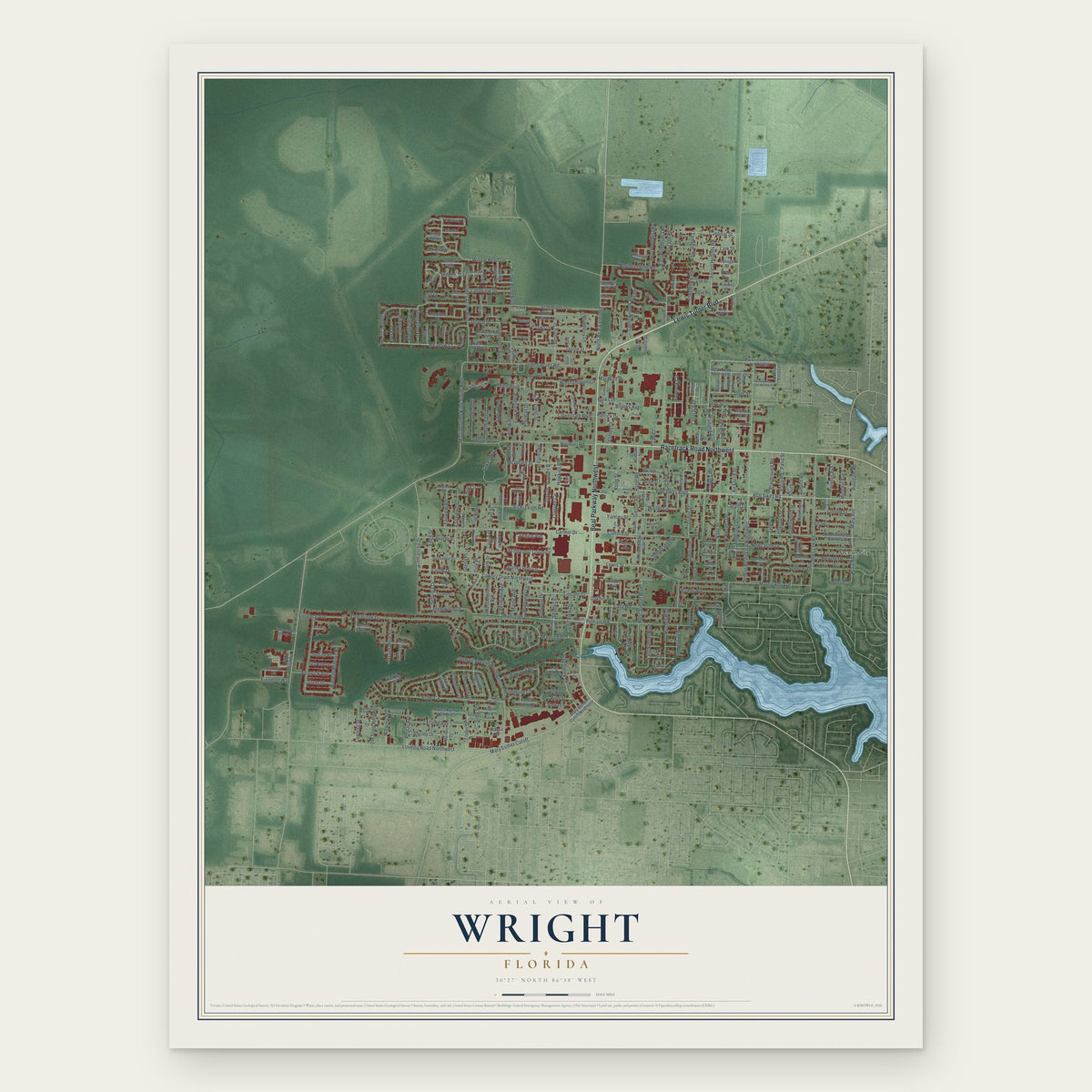
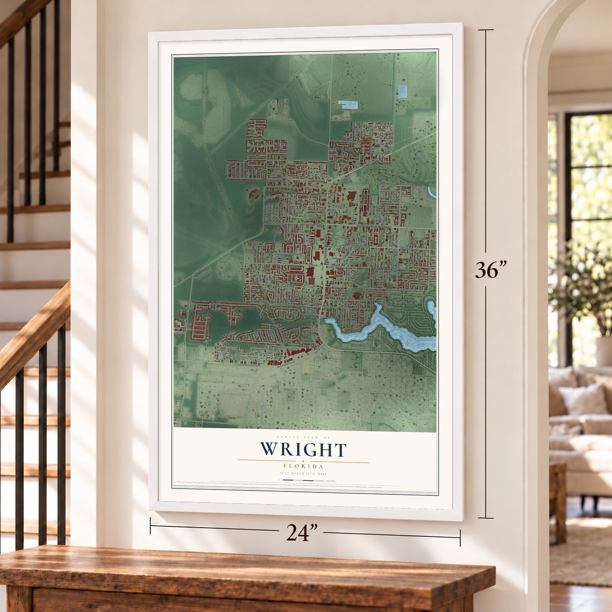
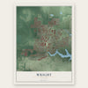
Wright, Florida Map Art
A new map of Wright, Florida, made in 2026 and printed to order on thick archival matte paper.
12" x 18" Archival Matte Print
A Map of Home. A Work of Art.
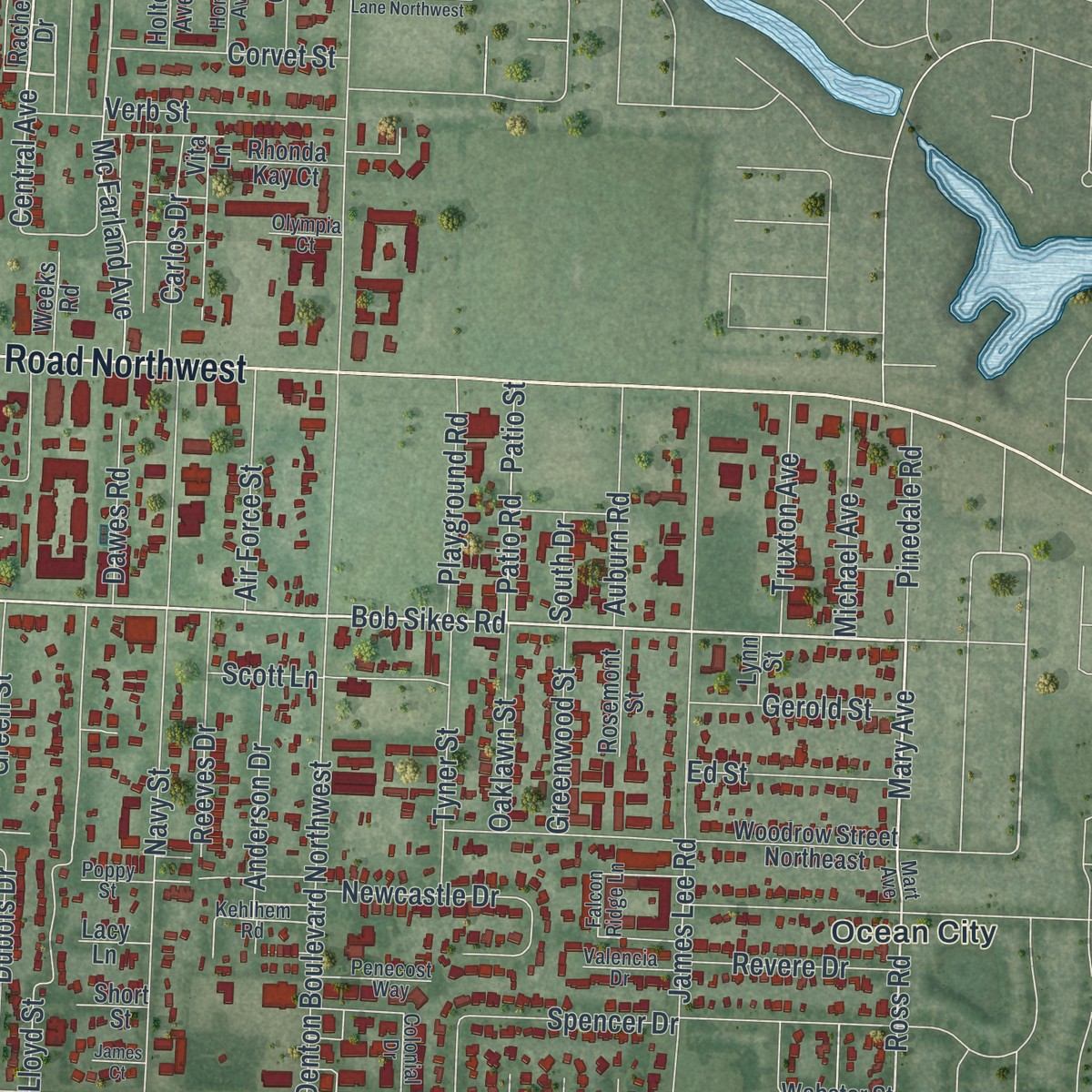
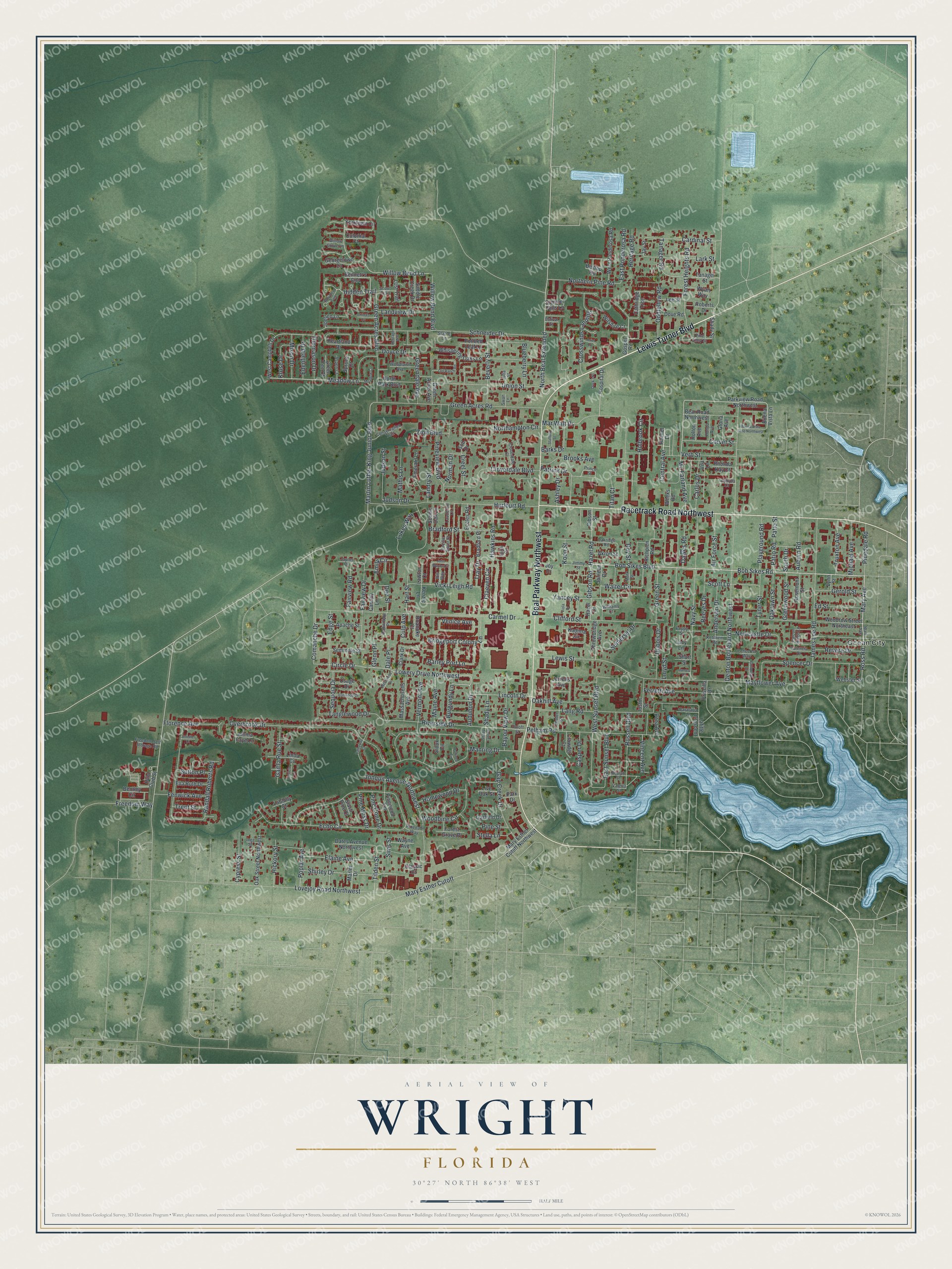
This beautifully detailed map of Wright, Florida was created in 2026 using aerial imagery combined with modern topographical, census, street and landmark data. It's a modern aerial view of Wright in Okaloosa County, Florida, that combines modern data with a vintage aesthetic. Zoom in on the preview and look for your block.
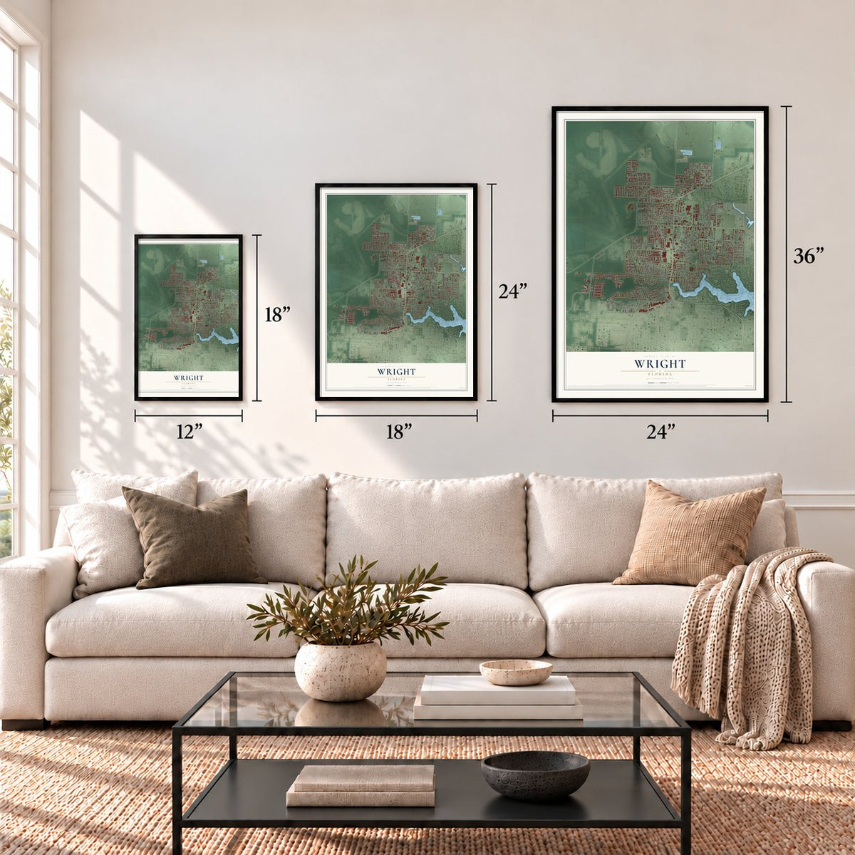
Three ways to hang it
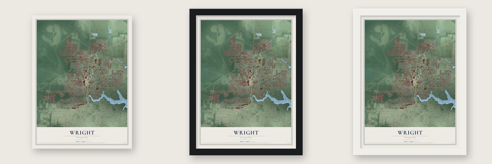
Unframed archival matte, a black wood frame or a white wood frame.
Up close
Real geography. Art worth displaying.
This map was created using accurate cartographic data and authoritative geographic sources, including the U.S. Geological Survey and the Census Bureau. The map brings together terrain, waterways, roads, and building detail. The majority of the streets are labeled, houses are accurately depicted, and the topography is derived from government sources. Combining local data with carefully composed color and shading leads to this beautifully detailed Wright artwork for your wall.
Rather than simply showing street outlines, we’ve included as many of the street names as we could reasonably fit on the map while keeping their names legible. Zoom in on the high resolution preview to see exactly what’s on the map. We truly set out to create a statement piece for anyone who loves Wright. So whether it’s for you, or a gift for someone you love, we hope this map of Wright brings back fond memories.
Read the story behind this map of Wright, Florida from 2026.
Find your street
Names on the Wright map
Every name below is printed on this map. Look for your street, your school, the park where you played, or the pond down the road.
Places and landmarks1
- Ocean City
Streets and roads312
- Lewis Turner Boulevard
- Beal Parkway Northwest
- Racetrack Road Northwest
- Bob Sikes Boulevard
- Bob Sikes Road
- Lowery Drive Northwest
- Meadow Lane
- North Beal Extended
- Michael Avenue
- Central Avenue
- Mary Avenue
- Martin Luther King Junior Boulevard
- Ross Road
- Hidden Trail
- Poplar Avenue
- Tilden Street
- Overbrook Drive
- Echo Circle
- Denton Boulevard Northwest
- Schneider Drive
- Carmel Drive
- Randall Roberts Road
- Willow Bend Boulevard
- Mar Walt Drive
- Lang Road
- Green Acres Road
- Hurlburt Road
- Navy Street
- Mayflower Avenue
- James Lee Road
Show all 312 streets
- Mary Esther Cutoff
- Lovejoy Road Northwest
- Jonquil Avenue Northwest
- Riverside Drive
- Pelham Road
- Gibson Road
- West Sunset Boulevard
- Northampton Circle
- Willow Bend Lane
- Lukes Way
- Clifford Street
- Spencer Drive
- Lloyd Street
- Holbrook Circle
- Lewis Street
- Claeven Circle
- Hazel Road
- Green Acres Boulevard
- Patrick Drive
- Cloverdale Boulevard
- Union Street
- Fairview Drive
- Shirley Drive
- Doyce Drive
- Newcastle Drive
- Venice Avenue
- Forest Heights Road
- Lincoln Drive
- Comanche Drive
- Tanager Road
- Crosswinds Landing
- Gap Creek Drive
- Lark Street
- Yancey Street
- Pineview Boulevard
- Blueberry Lane
- Beverly Street
- Bayou View Drive
- Bridgeport Colony Lane
- Russell Boulevard
- Elaine Avenue
- Shady Lane
- Vicki Leigh Road
- Verb Street
- Northern Pine Road
- Barks Drive
- Woodbine Circle
- Cardinal Street
- Barley Port Lane
- Florence Avenue
- Freedom Way
- Vincent Avenue
- Bradford Street
- Ferretti Avenue
- Tanglewood Drive
- Tyner Street
- Oakhill Avenue
- Walter Circle
- Vermont Avenue
- Mc Farland Avenue
- Creel Street
- Koon Street
- Gail la Rue Street
- Dubois Drive
- Green Street
- Reeves Drive
- Landview Drive
- Anderson Drive
- Brooks Avenue
- Mathis Lane
- East Ponderosa Road
- Scott Lane
- Air Force Street
- Playground Road
- Truxton Avenue
- Patio Road
- Patio Street
- Hawkins Road
- Emily Circle
- East Sunset Boulevard
- Corvet Street
- Oddfellow Road
- Edge Street
- Manring Drive
- Fenwick Avenue
- Cypress Street
- Somerset Drive
- Pinedale Road
- Carlos Drive
- Homewood Drive
- Judson Street
- Fairview Road
- Greendale Avenue
- Revere Drive
- Burgundy Lane
- Sequoia Drive
- Gerold Street
- Maine Avenue
- Ed Street
- Oaklawn Street
- Greenwood Street
- Hickory Street
- Titan Court
- Circle Drive
- Mixon Drive
- Edenfield Drive
- Thomason Drive
- Kruse Drive
- Dawes Road
- Heritage Road
- Pine Cone Drive
- Pine Moss Drive
- Hart Street
- Stella Lane
- Judson Drive
- Dee Street
- Ashley Drive
- Casper Drive
- Trent Street
- Sutton Place
- Zion Boulevard
- Norman Drive
- Audubon Drive
- Pine Street
- Auburn Road
- Landry Street
- Sims Street
- Roy Street
- Dale Place
- Culp Avenue
- Tray Drive
- South Drive
- Glenn Place
- Hunt Club Street
- Gospel Road
- Parkview Road Northwest
- West Campbell Drive
- Rachel Drive
- Buena Vista Lane
- Kenzie Lane
- Shady Street
- Mary Esther Cutoff Northwest
- Woodrow Street Northeast
- Heartland Drive
- Tanager Street
- Kadima Circle
- West Ponderosa Road
- Bentley Circle
- Richpien Road
- Yorktown Circle
- Bennett's End
- Scenic Oak Lane
- North Park Boulevard
- Jerrells Avenue
- Whispering Oaks Lane
- Jonleen Drive
- Oak Street Northwest
- Massachusetts Avenue
- Emerald Lane
- Bear Road Northwest
- Apache Street
- Saddle Creek Drive
- Dates Avenue Northwest
- Vita Lane
- Webster Street
- Clark Drive
- Throwbridge Avenue
- Pinewood Terrace
- Classic Court
- Cathridge Trce
- Lost Trail
- Justin Street
- Osage Drive
- Ella Ruth Drive
- Marler Drive
- Lafitte Crescent
- Joellen Lane
- Seminole Street
- Georgetown Lane
- Hospital Drive
- Rosemont Street
- Witshire Court
- Forest Grove Place
- Pointed Leaf Lane
- Crowder Court
- Bishop Road
- Garfield Drive
- Aloma Faye Lane
- Green Acres Avenue
- Bradford Place
- Dove Road
- Wyatt Way
- Akron Street
- Roanoke Court
- Dona Avenue
- Eccles Road
- Holton Avenue
- Gloria Avenue
- Lee Street
- Wayne Avenue
- Colonial Court
- Priscilla Drive
- Green Tree Court
- Spruce Court
- Weeks Road
- Rhonda Kay Court
- Lawton Court
- Linda Cv
- Summer Hills Lane
- Gibson Street
- Hazel Drive
- Live Oak Street
- Park Drive
- Loblolly Court
- Joy Drive
- Sioux Circle
- Canopy Lane
- Roberts Drive
- Slash Pine Court
- Lacy Lane
- Short Street
- Lynn Street
- Jay Street
- Sod Drive
- Colonial Drive
- Falcon Ridge Lane
- Oakridge Road
- Duloft Street
- Cloverdale Court
- Estival Street
- Pacific Silver Court
- Conservation Trail
- Brick Circle
- Pine Alley Street
- Kehlhem Road
- Freedom Self Storage Road
- Center Street
- Prince Street
- Woodlawn Avenue
- Penecost Way
- Lauderhill Lane
- Hondo Avenue
- Jimmy Street
- Aspen Court
- Dunwoody Place
- Valencia Drive
- Barataria Lane
- Mark Street
- Beulah Street
- Stable Lane
- Scout Trail
- Pinedale Way
- Willow Grove Lane
- Olympia Court
- Williams Court
- Poppy Street
- Joyner Drive
- Julia Street
- Mart Avenue
- Valeria Street
- Ibis Way
- Inez Street
- Swan Lane
- John Wayne Circle
- Old Ranch Road
- Shady Lane Drive
- Ironwood Drive
- Heritage Way
- Buena Vista Lane Northwest
- Woodfern Path
- Stafford Street
- Meadow Court
- Catherine Court
- Patricia Lane
- Viola Drive
- Westwood Drive
- Ariel Lane
- China's Cv
- Dock's Place
- Pawnee Circle
- Jennifer Court
- James Court
Names are listed as they appear on the printed map. Zoom into the product photos to find them.
The art of mapping a place
How This Map Was Made
Real places. Remarkable detail. Discover the layers that turn geographic data into a map of home.

The view from above
Aerial imagery reveals the character of the land: woodland, open fields, and the patterns of a place.

The shape of the land
Elevation data brings hills, valleys, and subtle changes in the landscape into view.

The details of home
Roads, waterways, and building footprints come together to make the map feel unmistakably local.

Geography becomes art
Considered color, shading, and typography bring the layers together in a map made for your wall.


Process illustrated with Mendon, Massachusetts. Aerial imagery: USDA NAIP. Terrain: USGS 3D Elevation Program. Map details and finished artwork: KNOWOL.
The Details
About This Print
Choose an archival matte print, or a black or white Ayous wood frame. The archival matte print is unframed.
Select your size and finish above to see the matching product image and price.
Materials & Craftsmanship
A contemporary map with the character of a classic atlas, printed on archival matte paper. Optional frames are made from Ayous wood.
Your printed map does not include the watermark shown in the full-map preview.
Shipping & Delivery
Free shipping within the United States. Every print is made to order in the USA.
Buying a gift? Add a note in your cart and we'll include it. We never put prices in the package.
Prints ship within 2 to 3 business days. Allow 7 to 10 days total from ordering for delivery. Timing may vary during holidays or periods of high order volume.
Read our shipping policy.
Returns and damaged prints
Each print is made to order. Change-of-mind refunds are not available after production.
If your print arrives damaged, misprinted or incorrect, contact support@knowol.com within 30 days of receiving it. Include your order number, photos and a description of the issue.
Read our full refund and replacement policy. For questions about your order, email support@knowol.com.
Find your town
Looking for another city?
Find a map of home in our Florida collection.
Nearby
Maps of towns near Wright
Know someone from one of these towns? Their map makes a great gift.
 Fort Walton Beach
, Florida
From $39.99See the map
 Ocean City
, Florida
From $39.99See the map
 Cinco Bayou
, Florida
From $39.99See the map
More maps nearby: Mary Esther, Shalimar, Lake Lorraine, Hurlburt Field and Eglin AFB.