
Search for another town



Free U.S. delivery 7 to 10 days after you order
Yuba City, California Map Art
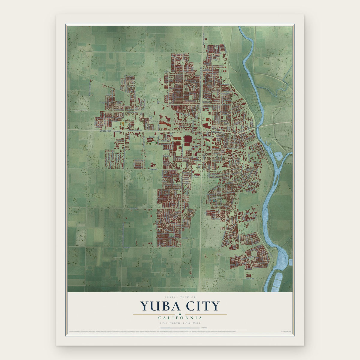
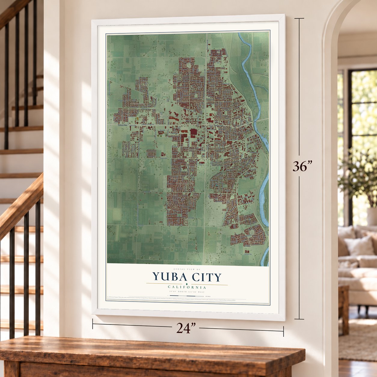
A new map of Yuba City, California, made in 2026 and printed to order on thick archival matte paper.
12" x 18" Archival Matte Print
A Map of Home. A Work of Art.
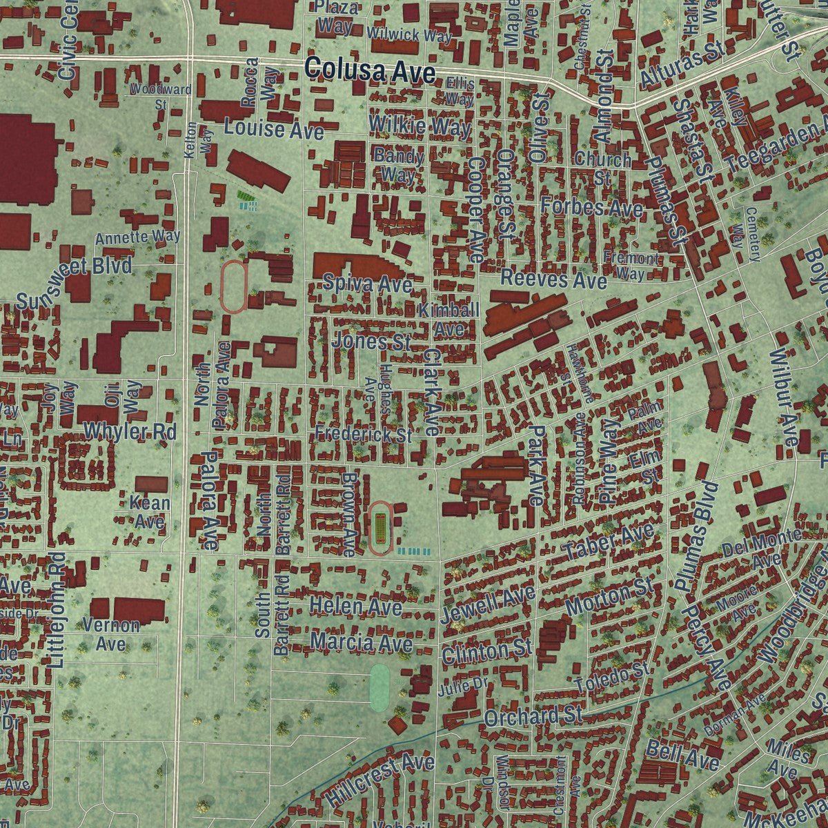
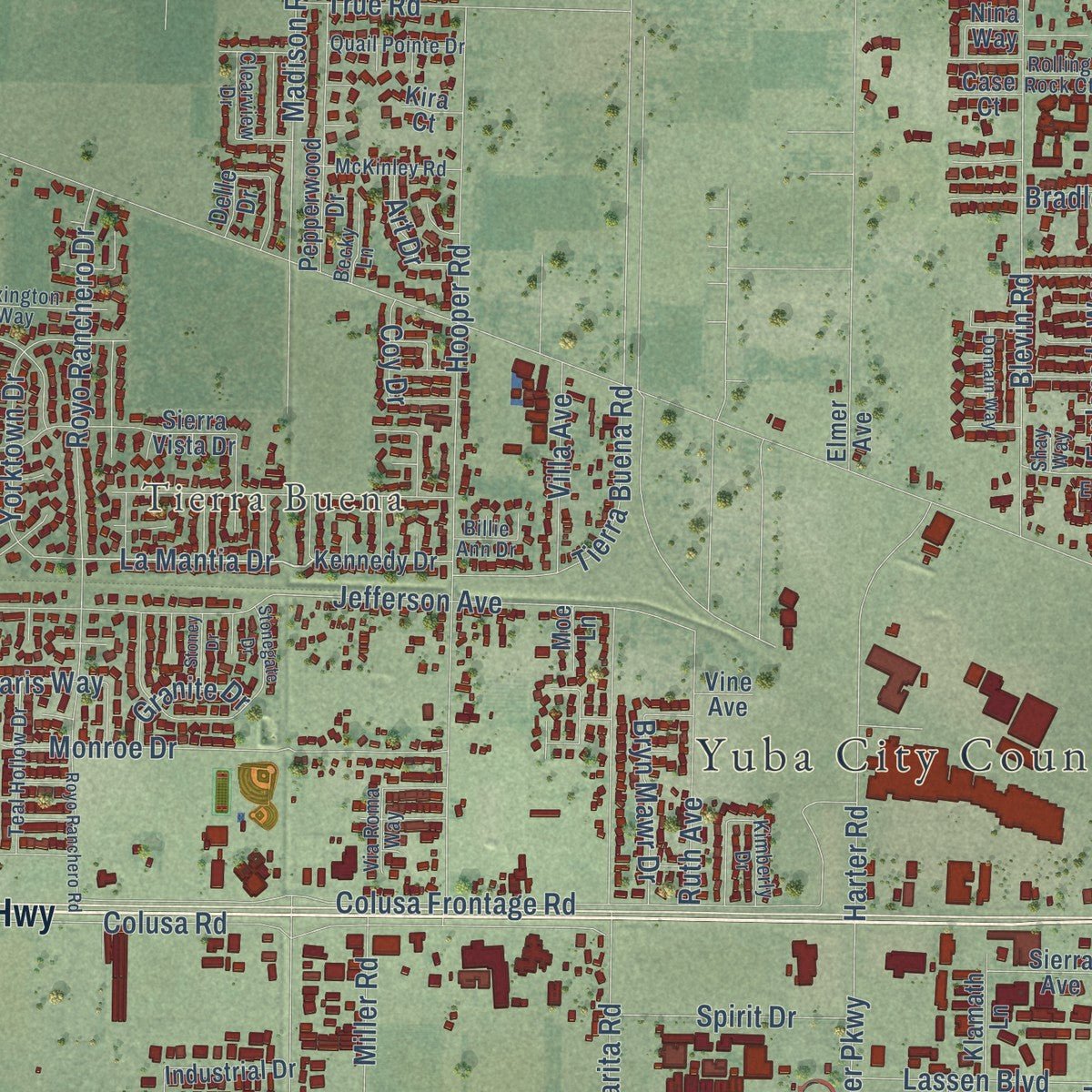
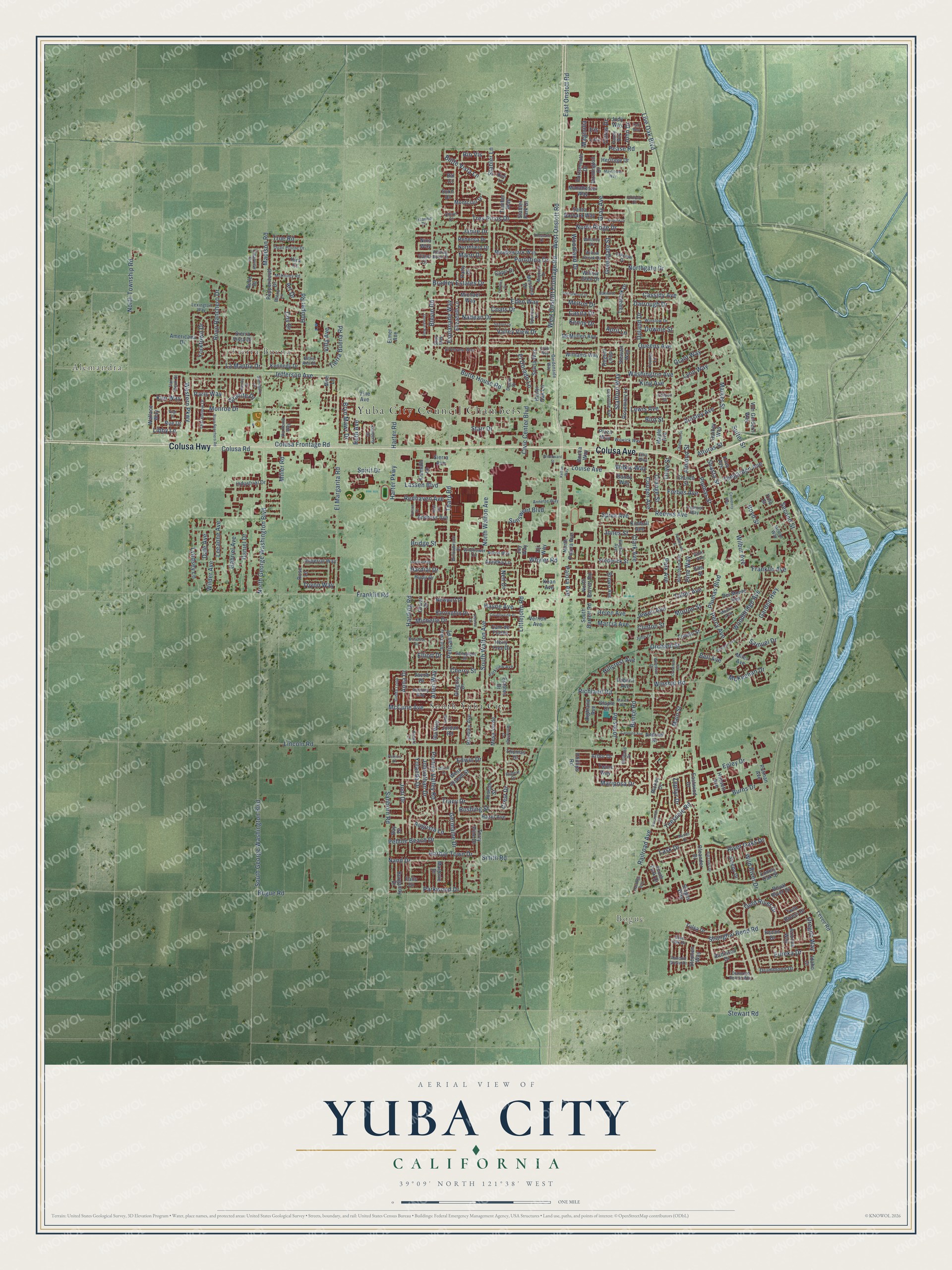
Explore Yuba City, California from a whole new perspective. Created using aerial imagery and detailed geographic data, this map captures Yuba City building by building, with labeled streets, familiar landmarks, and shaded topographical relief that highlights the natural contours of the landscape.
Combining modern data with the timeless character of a vintage atlas, this map is just as interesting up close as it is beautiful on the wall. Whether you grew up in Yuba City, spent memorable years there, or call it home today, this unique map is a great way to celebrate a place that means something to you. Zoom in on the preview to look for your street, and then order a print to put your memories on the wall.
Three ways to hang it
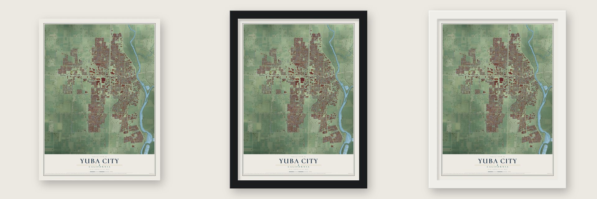
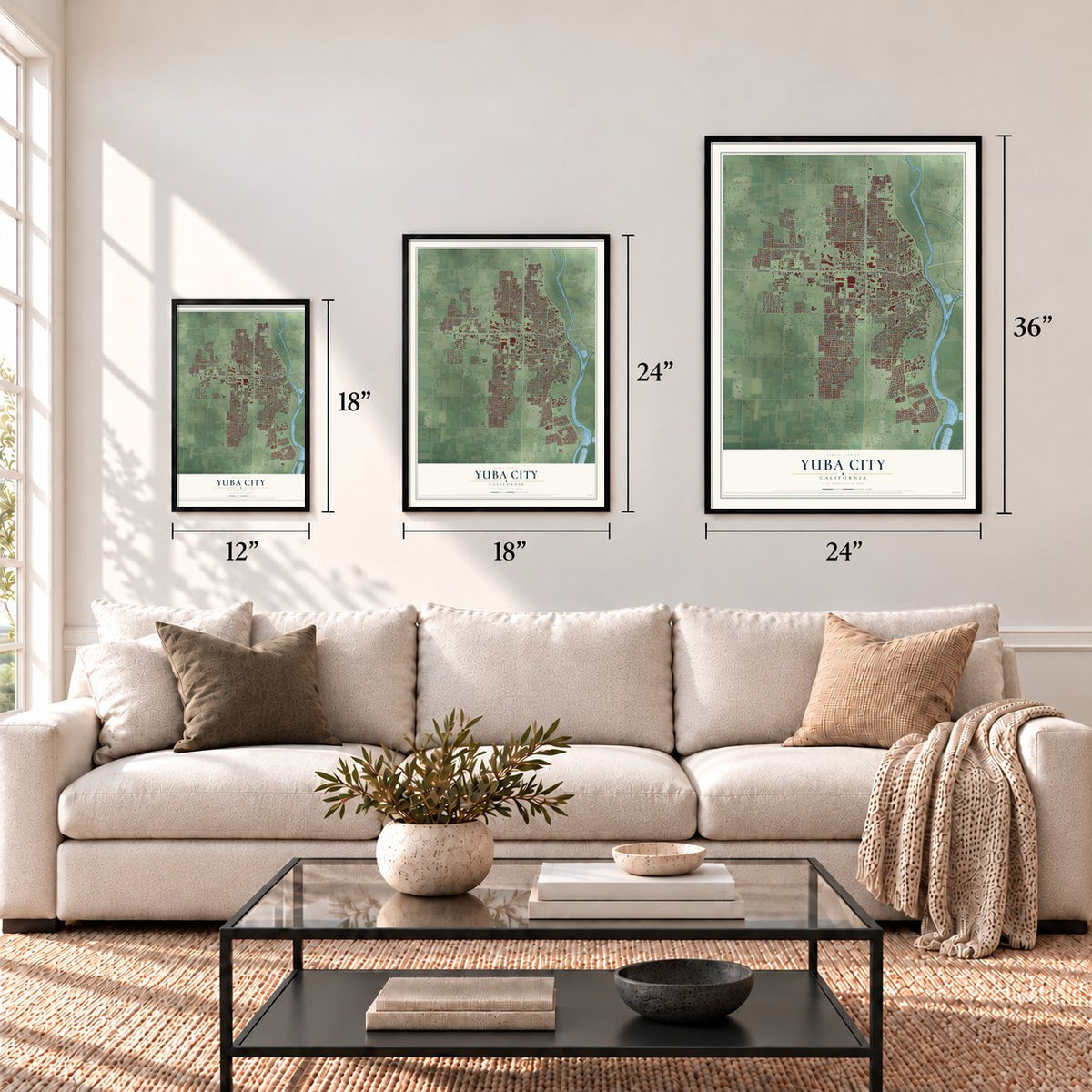
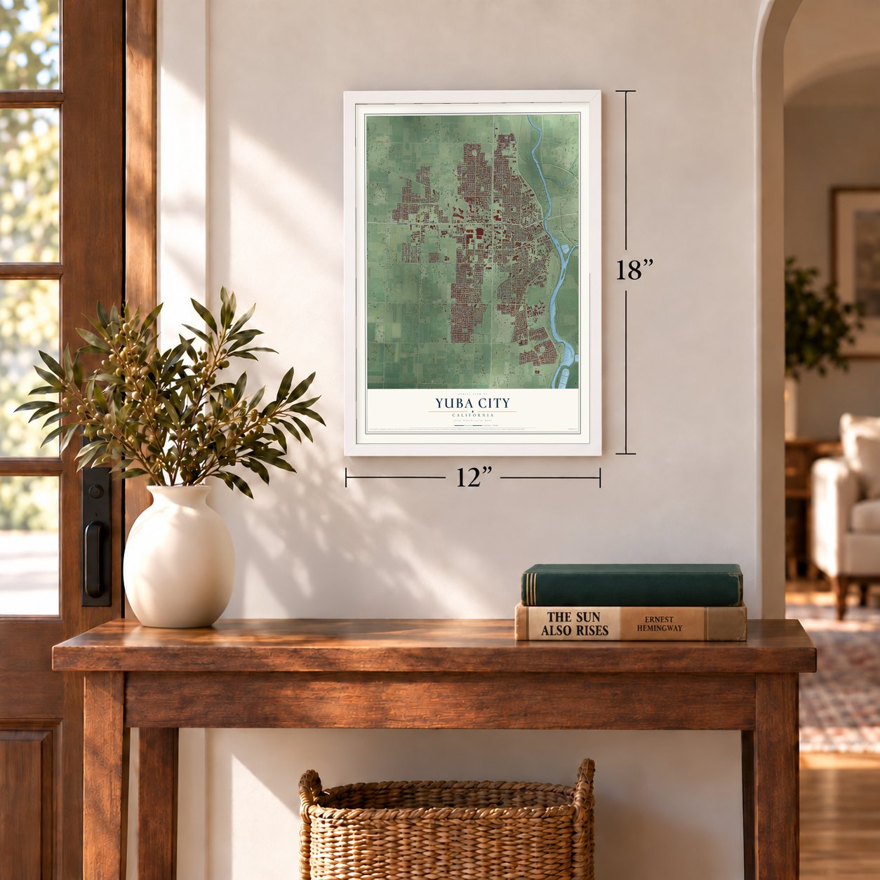
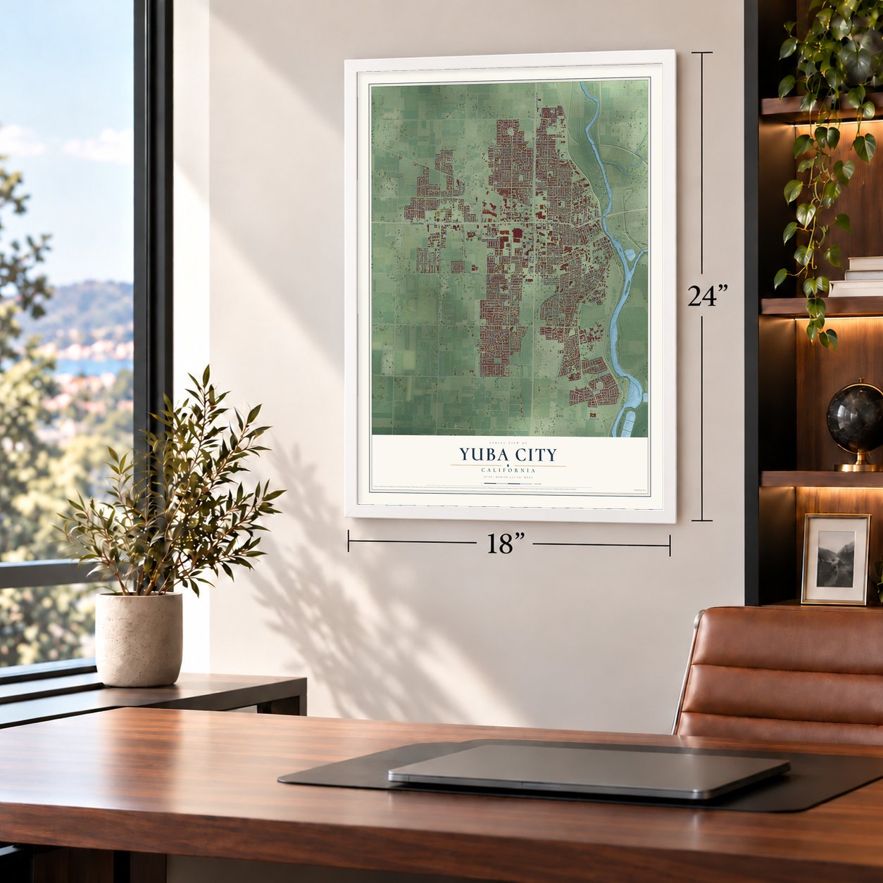
Unframed archival matte, a black wood frame or a white wood frame.
Up close
Geography Worth Displaying
This map was created using accurate cartographic data and authoritative geographic sources, including the U.S. Geological Survey and the Census Bureau. The map brings together terrain, waterways, roads, and building detail. The majority of the streets are labeled, houses are accurately depicted, and the topography is derived from government sources. Combining local data with carefully composed color and shading leads to this beautifully detailed Yuba City artwork for your wall.
Rather than simply showing street outlines, we’ve included as many of the street names as we could reasonably fit on the map while keeping their names legible. Zoom in on the high resolution preview to see exactly what’s on the map. We truly set out to create a statement piece for anyone who loves Yuba City. So whether it’s for you, or a gift for someone you love, we hope this map of Yuba City brings back fond memories.
Read the story behind this map of Yuba City, California from 2026.
About Yuba City, California
Yuba City developed near the meeting of the Yuba and Feather rivers as a commercial stop for miners heading toward the gold fields. By 1852, it had a steamboat landing, hotel, grocery, post office and about 20 homes. It became the Sutter County seat in 1854, lost that role briefly, and regained it permanently in 1856.
- Maidu homelandMaidu people lived in the region before Spanish and Mexican scouting expeditions arrived.
- Steamboat landingBy 1852, Yuba City served river traffic and had about 150 residents.
- Sutter County seatCounty voters returned the seat to Yuba City in 1856.
- Unofficial chicken mascotsFeral chickens near Franklin Road and Highway 99 became familiar unofficial symbols of the city.
- 70,117 peopleThe 2020 census counted 70,117 residents.
Find your street
Names on the Yuba City map
Every name below is printed on this map. Look for your street, your school, the park where you played, or the pond down the road.
Places and landmarks5
- Yuba City Council Chambers
- Alemandra
- Bogue
- Tierra Buena
- South Yuba City
Streets and roads395
- Colusa Highway
- Colusa Avenue
- Colusa Frontage Road
- Plumas Street
- North Walton Avenue
- Market Street
- Wilbur Avenue
- Eureka Drive
- La Mantia Drive
- Garden Highway
- Bogue Road
- Butte House Road
- Bridge Street
- Clark Avenue
- Gray Avenue
- Lincoln Road
- South Walton Avenue
- East Onstott Road
- Franklin Road
- Live Oak Boulevard
- West Onstott Road
- West Onstott Frontage Road
- Stabler Lane
- Queens Avenue
- Railroad Avenue
- Franklin Avenue
- Tharp Road
- El Margarita Road
- Pease Road
- Hooper Road
Show all 395 streets
- Sanborn Road
- Tres Picos Drive
- Jefferson Avenue
- North Township Road
- Stafford Way
- Monroe Drive
- Shanghai Bend Road
- South George Washington Boulevard
- North George Washington Boulevard
- Blevin Road
- Richland Road
- Stewart Road
- Main Street
- Ainsley Avenue
- Jamie Drive
- Shasta Street
- Jones Road
- Park Avenue
- Percy Avenue
- Colusa Road
- Cooper Avenue
- Hillcrest Avenue
- Second Street
- Washington Avenue
- Forbes Avenue
- Portola Valley Road
- Harding Road
- Sutter Street
- Woodbridge Avenue
- Northgate Drive
- Harter Road
- Littlejohn Road
- Madison Road
- Bunce Road
- Portofino Drive
- Royo Ranchero Drive
- Germaine Drive
- Pebble Beach Drive
- Cherry Street
- McCune Avenue
- Lassen Boulevard
- Bird Street
- Jones Street
- Edwin Drive
- Almond Street
- Yorktown Drive
- Louise Avenue
- Johnathan Drive
- Orange Street
- Butte Vista Lane
- Winship Road
- Sunsweet Boulevard
- Valley View Drive
- Teesdale Road
- Allen Way
- Augusta Lane
- Plumas Boulevard
- Gold River Drive
- Bradley Estates Drive
- Tierra Buena Road
- Neil Drive
- Yolanda Drive
- Miller Road
- Taber Avenue
- Jewell Avenue
- Morton Street
- Lyndsey Lane
- Whyler Road
- Upland Drive
- Western Parkway
- King Avenue
- River Oaks Drive
- Burns Drive
- Gabriel Avenue
- Harbor Town Drive
- Nand Drive
- Eden Way
- Michelle Drive
- Reeves Avenue
- Teegarden Avenue
- Jodi Drive
- Lask Drive
- Daniel Drive
- Tracy Drive
- Crest Drive
- Epley Drive
- Libby Lane
- Zephyr Drive
- Lynn Way
- North Ridge Drive
- Olive Street
- Mariposa Drive
- Wild River Drive
- Pelican Place
- Civic Center Boulevard
- Redhaven Avenue
- Spirit Drive
- Bryn Mawr Drive
- Nadean Drive
- El Dorado Lane
- Woodland Drive
- Clinton Street
- Harter Parkway
- Rushing Street
- Spiva Avenue
- Anna Drive
- Marcia Avenue
- Helen Avenue
- Starr Drive
- Orchard Street
- McKeehan Drive
- Ruth Avenue
- Villa Avenue
- Alturas Street
- Esplanade Way
- Cassidy Avenue
- Mann Drive
- Hardial Drive
- Greengate Street
- Leeanne Avenue
- Darrough Drive
- Coats Drive
- John Drive
- Elliott Drive
- True Road
- Oregon Way
- Coy Drive
- Parkwood Drive
- Kenny Drive
- Hayne Avenue
- Melton Drive
- Palora Avenue
- Casita Drive
- Samuel Drive
- Downie Street
- Smith Road
- April Lane
- Grant Way
- Granite Drive
- Pine Way
- Toyon Way
- Boyd Street
- Art Drive
- Wilkie Way
- Wilder Avenue
- Dale Avenue
- Rio Vis
- Citrus Drive
- Paris Way
- Kim Way
- Lewis Avenue
- Magnolia
- Bell Avenue
- Iris
- Kennedy Drive
- Miles Avenue
- Elizabeth Lane
- Ida Way
- West Joseph Street
- Drummond Drive
- Meadowlark Way
- Messina Drive
- Brown Avenue
- Cam de Flores
- Industrial Drive
- Del Monte Avenue
- Pepperwood Drive
- Santa Barbara Way
- Maple Avenue
- Joseph Street
- Sylvia Way
- Lonely Oak Street
- Andrew Drive
- Frederick Street
- Kimball Avenue
- Hazel Avenue
- Americana Drive
- Northfield Drive
- Estates Drive
- Pecan Drive
- Mesa Verde
- North Barrett Road
- Patty Drive
- Capri Drive
- Holly Tree Drive
- Delle Drive
- Rosemary Lane
- Barrington Drive
- Bromley Avenue
- McMullen Avenue
- Sierra Vista Drive
- Williams Way
- Rickey Drive
- Elmer Avenue
- Regent Loop
- Rue Drive
- Church Street
- Toledo Street
- Tumber Way
- Kiley Avenue
- Tulsa Drive
- Oleander Drive
- Burgandy Drive
- Andross Avenue
- Imperial Way
- Tamarack Drive
- Manchester Way
- Highland Avenue
- Royal River Drive
- Stephen Way
- Wallace Way
- Sleepy Drive
- Montclair Drive
- Rebecca Drive
- Michael Way
- Twin Rivers Drive
- Vernon Avenue
- North Palora Avenue
- Falls Drive
- Honor Oak Lane
- Von Geldern Way
- South Barrett Road
- Arizona Way
- Gregory Drive
- Jacob Drive
- South Park Drive
- Judy Way
- Eastwind Drive
- Portsmouth Drive
- Torry Pine Drive
- Klamath Lane
- Birmington Drive
- Marjorie Drive
- Heritage Drive
- Radisson Drive
- Stewart Way
- Newport Drive
- Elm Street
- Anneka Lane
- Putman Avenue
- Hassett Avenue
- Sierra Avenue
- Oliver Drive
- Harkey Way
- Staple Drive
- Thomas Drive
- Hunji Drive
- Phillips Road
- Jordan Road
- Willow Glen Drive
- Rose Lane
- Levee Road
- Singhs Way
- Twins Way
- Arbor Drive
- Rocca Way
- Nina Way
- Idaho Court
- Stabler Park Drive
- Plaza Way
- Voboril Avenue
- Bandy Way
- Bay Drive
- Kean Avenue
- Case Court
- Oji Way
- Moe Lane
- Joy Way
- Kira Court
- Vine Avenue
- Sukh Drive
- Yolo Street
- Bal Court
- Winslow Drive
- Fremont Way
- Gidda Loop
- Anthony Way
- Moore Avenue
- Youngs Lane
- Wildflower Circle
- Willow Creek Drive
- Parkview Avenue
- Kimberly Drive
- Charlotte Avenue
- Anita Way
- Sandpiper Drive
- Teal Hollow Drive
- Hughes Avenue
- Robert Drive
- Majorca Drive
- McKinley Road
- Annette Way
- Robinson Avenue
- Clearview Drive
- Ellis Way
- Quail Pointe Drive
- El Verano Way
- McRae Way
- Gilliland Drive
- Willowbrook Drive
- Wilwick Way
- Windsor Drive
- Gardenside Way
- Dustin Drive
- Almond Grove Drive
- Diamond Pointe Way
- Lexington Way
- Alfred Way
- Julie Drive
- Blue Oak Drive
- Randy Way
- Van Vleck Street
- Spencer Lane
- Via Roma Way
- Palm Avenue
- Becky Lane
- Oakview Drive
- Rich Lane
- Lizanne Drive
- Whitney Drive
- Rolling Rock Court
- Ohlson Street
- Oxford Court
- Billie Ann Drive
- Krentz Lane
- Chloe Court
- Lilac
- Shay Way
- Mariah Drive
- Dorman Avenue
- Chestnut Street
- Corsica Drive
- Stonegate Drive
- Royo Ranchero Road
- Crestmont Avenue
- Skyline Drive
- Sharon Drive
- Pheasant Drive
- Woodleaf Drive
- Countryside Drive
- Deerfield Drive
- Carson Drive
- Inder Lane
- Domain Way
- Carolina Avenue
- Forestwood Drive
- Hastings Way
- Cemetery Way
- Big Oaks Drive
- Mayflower Way
- Oakwood Drive
- Woodridge Court
- Hawthorne Street
- Woodward Street
- Savannah Drive
- Ross Drive
- Malick Avenue
- Stoney Drive
- Patricia Drive
- Milton Drive
- Dell Way
- Jessica Drive
- Clyde Way
- Kelton Way
- Vogt Court
Names are listed as they appear on the printed map. Zoom into the product photos to find them.
The art of mapping a place
How This Map Was Made
Real places. Remarkable detail. Discover the layers that turn geographic data into a map of home.

The view from above
Aerial imagery reveals the character of the land: woodland, open fields, and the patterns of a place.

The shape of the land
Elevation data brings hills, valleys, and subtle changes in the landscape into view.

The details of home
Roads, waterways, and building footprints come together to make the map feel unmistakably local.

Geography becomes art
Considered color, shading, and typography bring the layers together in a map made for your wall.


Process illustrated with Mendon, Massachusetts. Aerial imagery: USDA NAIP. Terrain: USGS 3D Elevation Program. Map details and finished artwork: KNOWOL.
The Details
About This Print
Choose an archival matte print, or a black or white Ayous wood frame. The archival matte print is unframed.
Select your size and finish above to see the matching product image and price.
Materials & Craftsmanship
A contemporary map with the character of a classic atlas, printed on archival matte paper. Optional frames are made from Ayous wood.
Your printed map does not include the watermark shown in the full-map preview.
Shipping & Delivery
Free shipping within the United States. Every print is made to order in the USA.
Buying a gift? Add a note in your cart and we'll include it. We never put prices in the package.
Prints ship within 2 to 3 business days. Allow 7 to 10 days total from ordering for delivery. Timing may vary during holidays or periods of high order volume.
Read our shipping policy.
Returns and damaged prints
Each print is made to order. Change-of-mind refunds are not available after production.
If your print arrives damaged, misprinted or incorrect, contact support@knowol.com within 30 days of receiving it. Include your order number, photos and a description of the issue.
Read our full refund and replacement policy. For questions about your order, email support@knowol.com.
Find your town
Looking for another city?
Find a map of home in our California collection, or any town in the country.
Nearby
Maps of towns near Yuba City
Know someone from one of these towns? Their map makes a great gift.
 Marysville
, California
From $39.99See the map
 Nuestro
, California
From $39.99See the map
 Linda
Linda, California
From $39.99See the map
More maps nearby: Olivehurst, Encinal, Sutter, Arboga and Live Oak.