
Search for another town

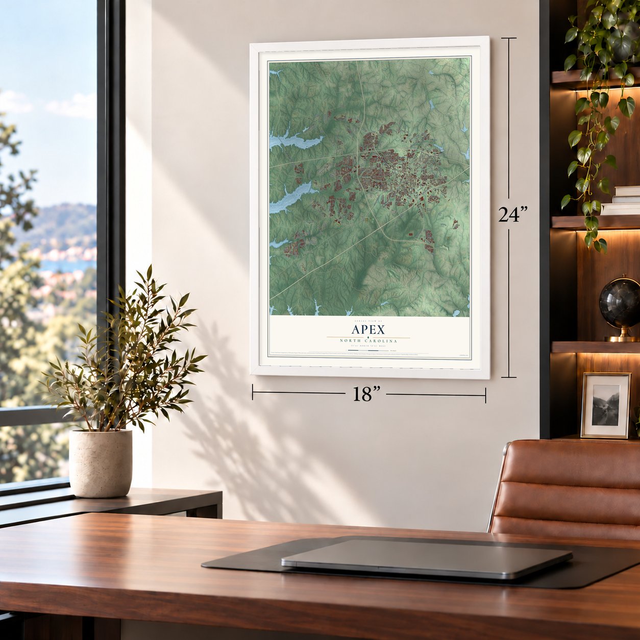

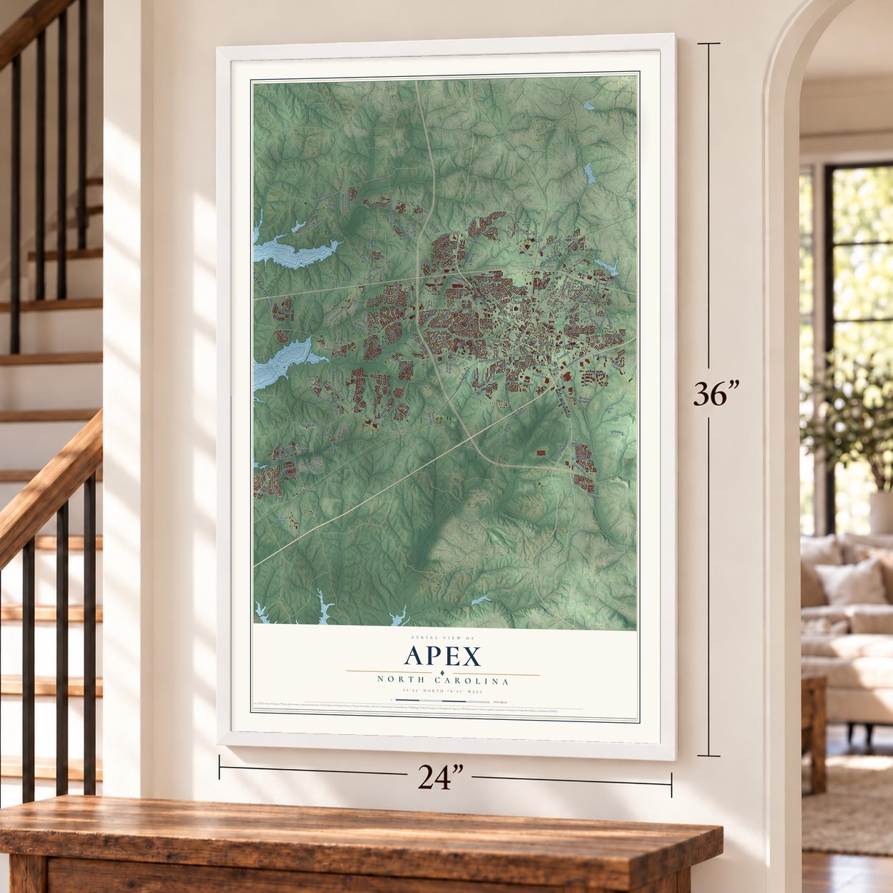

Free U.S. delivery 7 to 10 days after you order
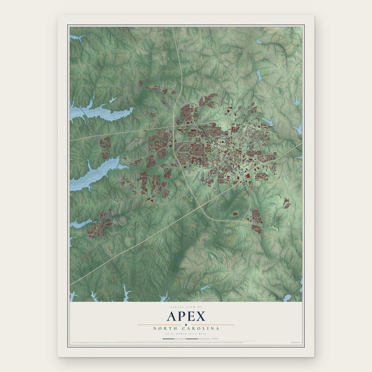
Apex, North Carolina Map Art
Building by building, with labeled streets and shaded relief.
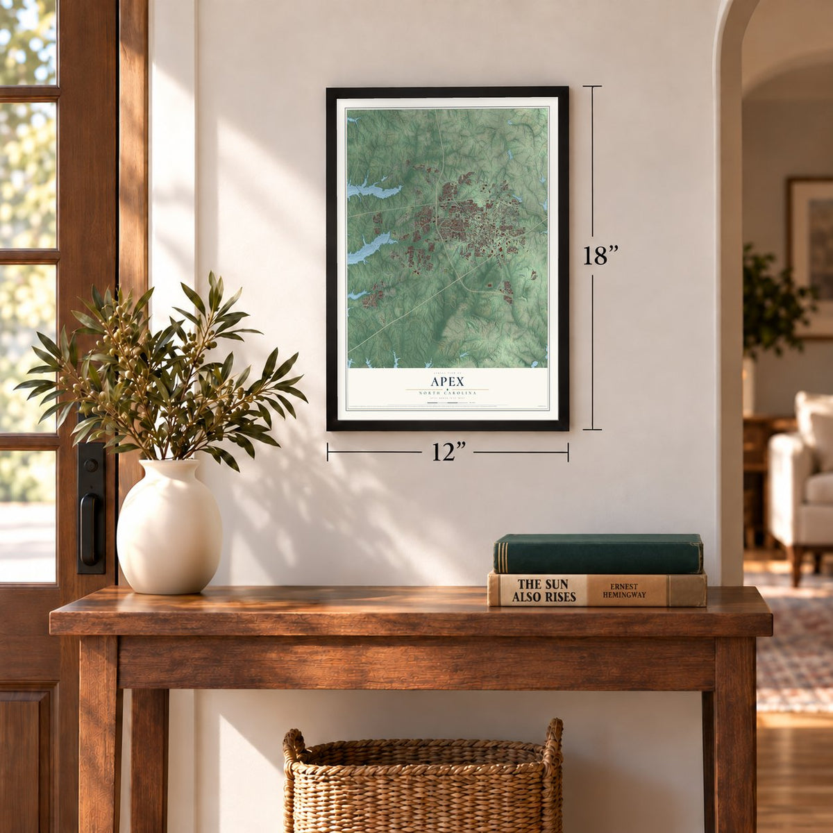
12" x 18" Archival Matte Print
A Map of Home. A Work of Art.
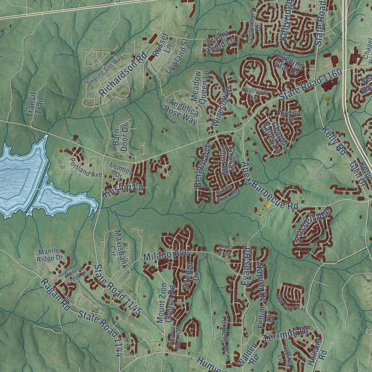
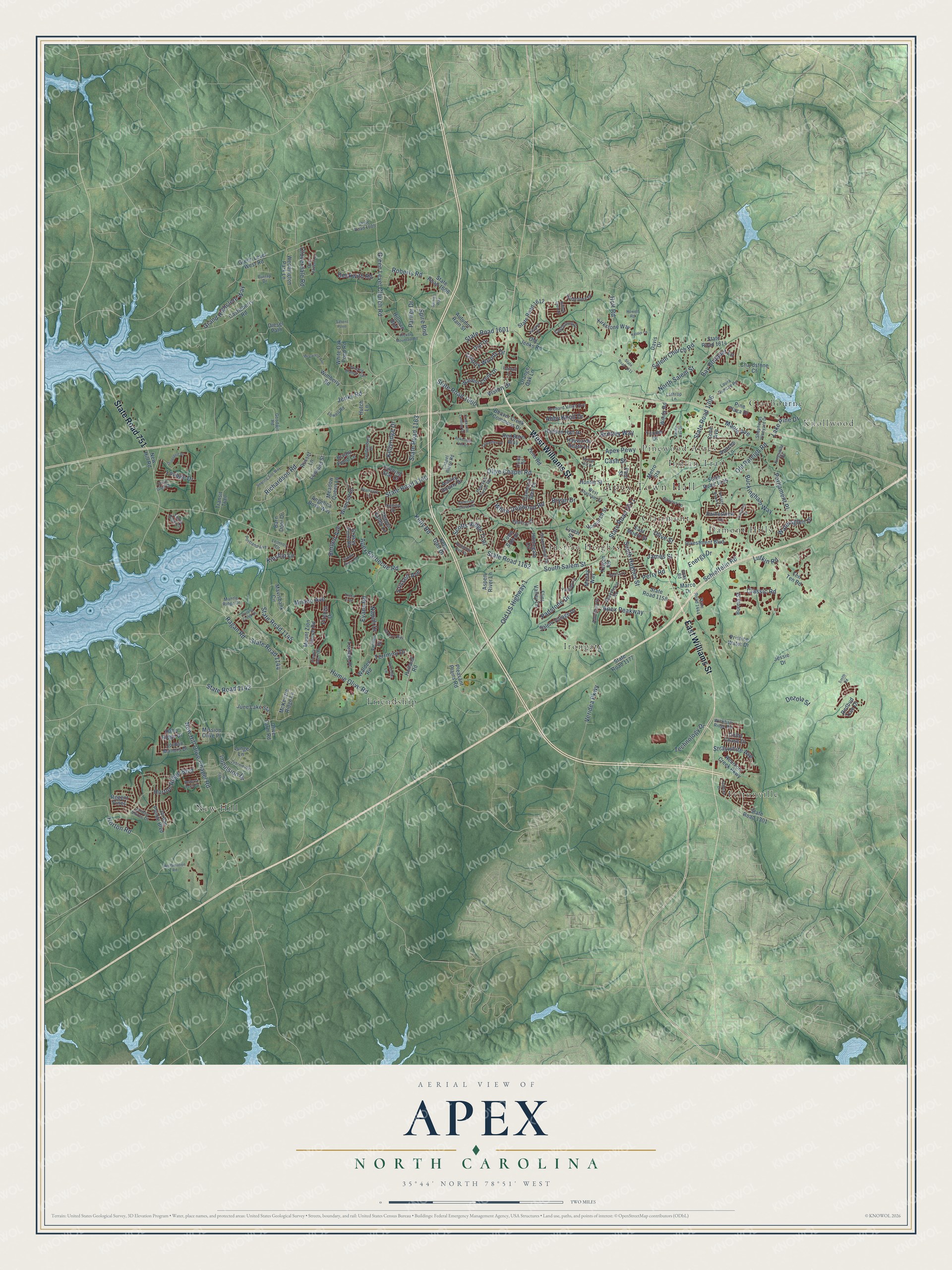
Explore Apex, North Carolina from a whole new perspective. Created using aerial imagery and detailed geographic data, this map captures Apex building by building, with labeled streets, familiar landmarks, and shaded topographical relief that highlights the natural contours of the landscape.
Combining modern data with the timeless character of a vintage atlas, this map is just as interesting up close as it is beautiful on the wall. Whether you grew up in Apex, spent memorable years there, or call it home today, this unique map is a great way to celebrate a place that means something to you. Zoom in on the preview to look for your street, and then order a print to put your memories on the wall.
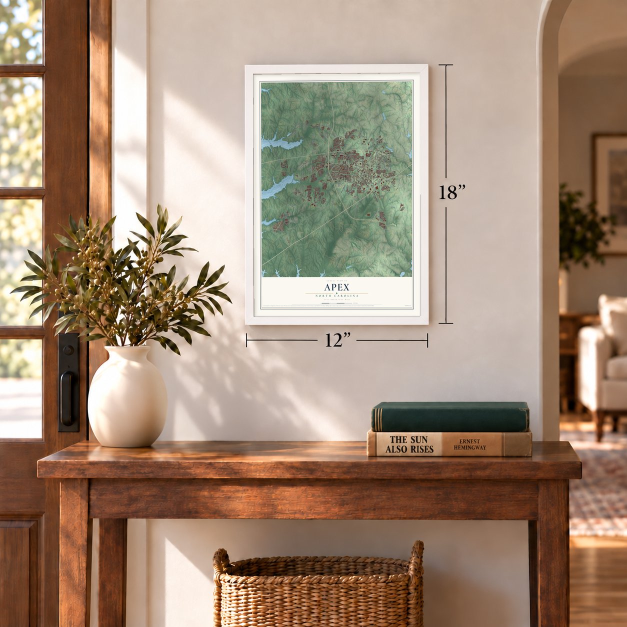
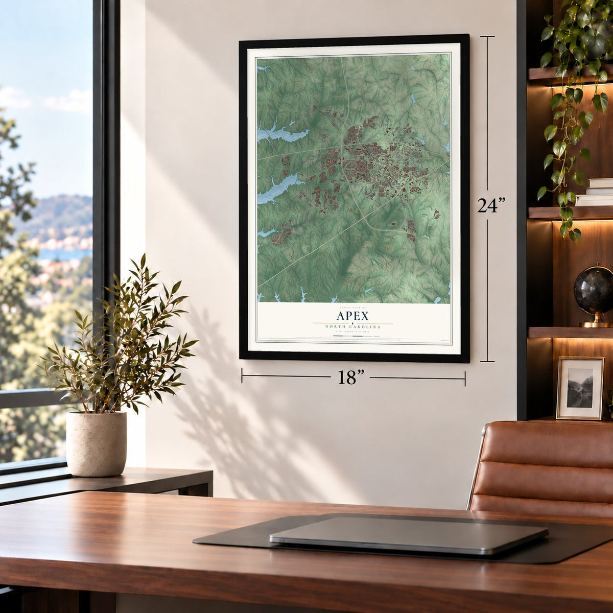
Three ways to hang it
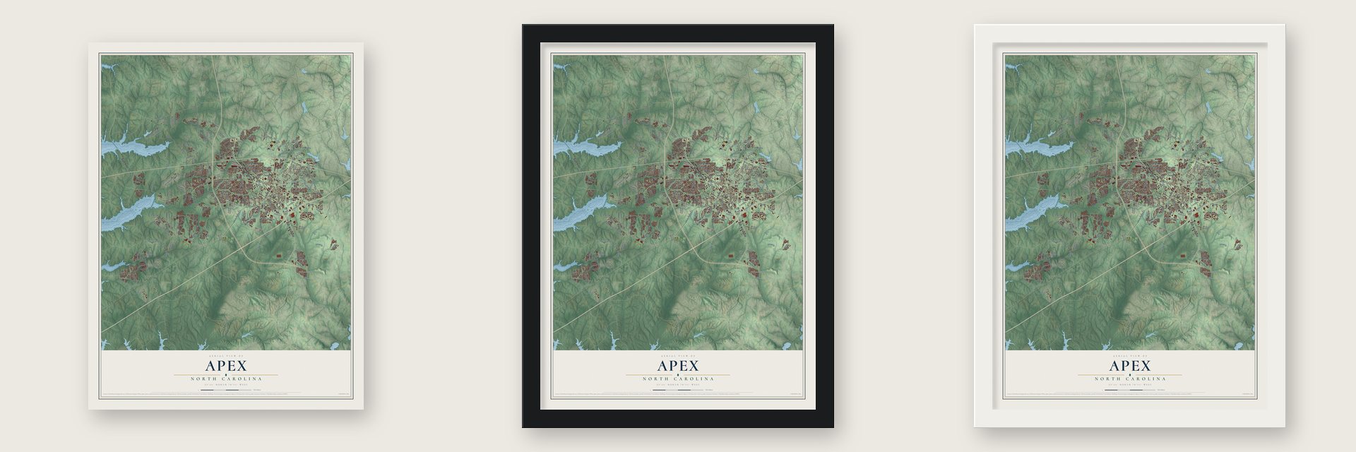
Unframed archival matte, a black wood frame or a white wood frame.
Up close
Geography Worth Displaying
This map was created using accurate cartographic data and authoritative geographic sources, including the U.S. Geological Survey and the Census Bureau. The map brings together terrain, waterways, roads, and building detail. The majority of the streets are labeled, houses are accurately depicted, and the topography is derived from government sources. Combining local data with carefully composed color and shading leads to this beautifully detailed Apex artwork for your wall.
Rather than simply showing street outlines, we’ve included as many of the street names as we could reasonably fit on the map while keeping their names legible. Zoom in on the high resolution preview to see exactly what’s on the map. We truly set out to create a statement piece for anyone who loves Apex. So whether it’s for you, or a gift for someone you love, we hope this map of Apex brings back fond memories.
Read the story behind this map of Apex, North Carolina from 2026.

Find your street
Names on the Apex map
Every name below is printed on this map. Look for your street, your school, the park where you played, or the pond down the road.
Places and landmarks12
- Apex Town Hall
- Clairmont
- Claybourne
- Damont Hills
- Feltonville
- Friendship
- Indian Trail
- Irongate
- Justice Heights
- Knollwood
- New Hill
- Pinewood Acres
Streets and roads232
- East Williams Street
- West Williams Street
- State Road 751
- State Road 1011
- Olive Chapel Road
- State Road 1160
- State Road 1306
- Apex Peakway
- Richardson Road
- Kelly Road
- State Road 1163
- North Salem Street
- Apex Barbecue Road
- State Road 1162
- Horton Ridge Boulevard
- Green Level Church Road
- State Road 1600
- Old US Highway 1
- South Salem Street
- Apex Pewy
- Jenks Road
- State Road 1601
- Humie Olive Road
- State Road 1142
- Schieffelin Road
- James Street
- Old Raleigh Road
- Lufkin Road
- Evans Road
- New Hill Olive Chapel Road
Show all 232 streets
- South Hughes Street
- Milano Avenue
- Holt Road
- Roberts Road
- Ragan Road
- State Road 1144
- White Dogwood Road
- State Road 1145
- Scotts Ridge Trail
- Padstone Drive
- Perry Road
- Salem Church Road
- Buckingham Way
- Kellyridge Drive
- Kinship Lane
- Parlier Drive
- Straywhite Avenue
- Classic Road
- Grand Highclere Way
- Lake Pine Drive
- Cloverdale Road
- Brittley Way
- Olive Street
- Colony Woods Drive
- Terrmini Drive
- Horton Road
- Abby Knoll Drive
- Beckwith Road
- Veridea Parkway
- Parliament Place
- Lovage Drive
- Watersglen Drive
- Energy Drive
- Vision Drive
- Bay Bouquet Lane
- Technology Drive
- Bergen Avenue
- Impulsion Drive
- Bryan Drive
- Spire Bnd
- Frissell Avenue
- Maple Avenue
- Napoli Drive
- Dezola Street
- Cash Street
- State Road 1435
- Wimberly Road
- Beaver Creek Commons Drive
- State Road 1158
- Green Level West Road
- State Road 1612
- Jordan Pointe Boulevard
- State Road 1608
- Hunter Street
- Castleberry Road
- State Road 1614
- Haddon Hall Drive
- Pine Plaza Drive
- Angelica Rose Way
- Tingen Road
- Mavisbank Circle
- Old Jenks Road
- Walden Creek Drive
- Haywards Heath Lane
- White Oak Pond Road
- Pristine Water Drive
- State Road 1177
- Zeno Road
- Apache Lane
- State Road 1301
- Holland Road
- Reunion Creek Parkway
- Pleasant Plains Road
- Town Side Drive
- Investment Boulevard
- Upchurch Street
- Evening Star Drive
- Mission Olive Place
- Olive Farm Road
- McKenzie Ridge Lane
- Flint Valley Lane
- Weddington Park Lane
- Tender Drive
- Salem Village Drive
- Ashley Downs Drive
- Kelly Glen Drive
- Winecott Drive
- Ten Ten Road
- Lynch Street
- Windy Road
- Homegate Circle
- Mount Zion Church Road
- Firenza Drive
- East Moore Street
- June Lake Sta
- Cameron Glen Drive
- Colby Chase Drive
- Cone Avenue
- Kirkstone Way
- Grassy Point Road
- Chardstone Court
- Hutch Lane
- Jordan Manors Drive
- Redbud Tree Drive
- Tordelo Place
- Barn Door Drive
- Lowland Street
- Chapel Valley Lane
- Bryant Pond Lane
- Pate Street
- Rainesview Lane
- Hillman Bnd
- Regent Pines
- Hahn Ridge Drive
- Orange Oak Lane
- Fellini Drive
- Aspen River Lane
- Metro Sta
- Autumn Rain Street
- Dial Drive
- Russet Lane
- Burma Street
- Red Barn Way
- Walden Road
- Meadow Queen Lane
- New Hill Road
- Marco Drive
- Jessie Drive
- Minley Way
- Diesel Path
- Lunge Lane
- Transit Trail
- Davis Drive
- Laura Duncan Road
- State Road 1444
- State Road 1605
- Castleburg Drive
- West Chatham Street
- Shackleton Road
- Lyndenbury Drive
- Sierra Glen Circle
- Jordan Shires Drive
- Grappenhall Drive
- Vatersay Drive
- Orchard Villas Avenue
- Oak Haven Lane
- Olive Glen Drive
- Shepherds Vineyard Drive
- Portland Avenue
- Mantle Ridge Drive
- Lemnos Drive
- Hasbrouck Drive
- Chapel Ridge Road
- Sawcut Lane
- Wickham Ridge Road
- Pearson Farms Road
- Averroe Drive
- Lowell Road
- Yateley Lane
- Kingsway Drive
- Anterbury Drive
- Caley Road
- Vecchio Lane
- Lathrop Lane
- Goodwin Road
- Burlap Drive
- Fantail Lane
- Gilby Road
- Patterson Grove Road
- State Road 1611
- Curling Creek Drive
- Gartrell Way
- Soaring Silo Way
- Vintage Grove Lane
- Creekside Landing Drive
- Mirkwood Avenue
- Pineola Bog Trail
- Parkfield Drive
- Old Byre Way
- Celandine Drive
- Hickory Mountain Road
- Winding Branch Trail
- Kelder Lane
- Jazzy Street
- Zebroid Way
- Dropseed Drive
- Reclamation Road
- Ackerman Hill Drive
- Belterra Point Dt
- Howell Road
- Sparta Lane
- Bungalow Park Drive
- Keokuk Court
- Cabana Drive
- Heathcote Lane
- Saddle River Road
- Winter Hill Drive
- Sutton Glen Drive
- Salient Point
- Fallen Oak Drive
- Smith Road
- Tosca Trail
Names are listed as they appear on the printed map. Zoom into the product photos to find them.
About Apex, North Carolina
Apex is a town of 58,780 people in Wake County, with part of it reaching into Chatham County. Settlers first came in the 1860s, when the local forests yielded turpentine and rosin. In 1869 the Chatham Railroad opened between Chatham County and Raleigh, and its trains stopped at a pond choked with trees and brush to take on water. A settlement called Log Pond grew up around that stop.
Railroad workers called the spot the apex of the grade, because it was believed to be the highest point on the line between Richmond, Virginia, and Jacksonville, Florida. The name stuck, and the town was incorporated in 1873. It became a trading center that sent lumber, tar and tobacco out by rail, and by 1900 it had 349 people. Culverts had drained the old pond away by then.
- Rebuilt after the 1911 fireSeveral fires hit Apex as it grew, and the worst, on June 12, 1911, burned most of the downtown business district. The town rebuilt its center, and that downtown still stands, among the most intact railroad towns in the state. It was named a historic district in 1994.
- PeakFest every MayOn the first Saturday in May, the town closes downtown for PeakFest, where more than 200 vendors sell food and crafts and run rides. The festival plays on the town motto, "The Peak of Good Living," which also gave the Apex Peakway, the loop road around downtown, its name.
- The 2006 evacuationIn October 2006 a chemical explosion and fire at a waste-processing plant forced more than 16,000 residents to leave their homes. Few people were seriously hurt, and families were soon allowed back. A federal court signed off on a $7.85M settlement in 2009, which paid each household $750 and each business $2,200.
- Money's top pick in 2015Growth picked up in the 1950s, and during the 1990s the population quadrupled to over 20,000 as Research Triangle Park drew technology workers to the area. In 2015 Money magazine named Apex the number-one place to live in America.
Keep exploring North Carolina
Apex is one of 951 North Carolina towns we've mapped. Every dot on the map is a print of its own.
The search covers every state, North Carolina first.
Near Apex
Order 2 or more town maps and save 10%. Shown in the size and finish you picked above, so they hang as a set.
- Cary 12" x 18" / Archival Matte Print $39.99
- Holly Springs 12" x 18" / Archival Matte Print $39.99
- Morrisville 12" x 18" / Archival Matte Print $39.99


More maps nearby: Seaforth, Carpenter, Mount Vernon, Fuquay-Varina and Governors Village.
The art of mapping a place
How This Map Was Made
Real places. Remarkable detail. Discover the layers that turn geographic data into a map of home.

The view from above
Aerial imagery reveals the character of the land: woodland, open fields, and the patterns of a place.

The shape of the land
Elevation data brings hills, valleys, and subtle changes in the landscape into view.

The details of home
Roads, waterways, and building footprints come together to make the map feel unmistakably local.

Geography becomes art
Considered color, shading, and typography bring the layers together in a map made for your wall.


Process illustrated with Mendon, Massachusetts. Aerial imagery: USDA NAIP. Terrain: USGS 3D Elevation Program. Map details and finished artwork: KNOWOL.
The Details
About This Print
Choose an archival matte print, or a black or white Ayous wood frame. The archival matte print is unframed.
Select your size and finish above to see the matching product image and price.
Materials & Craftsmanship
A contemporary map with the character of a classic atlas, printed on archival matte paper. Optional frames are made from Ayous wood.
Your printed map does not include the watermark shown in the full-map preview.
Shipping & Delivery
Free shipping within the United States. Every print is made to order in the USA.
Buying a gift? Add a note in your cart and we'll include it. We never put prices in the package.
Prints ship within 2 to 3 business days. Allow 7 to 10 days total from ordering for delivery. Timing may vary during holidays or periods of high order volume.
Read our shipping policy.
Returns and damaged prints
Each print is made to order. Change-of-mind refunds are not available after production.
If your print arrives damaged, misprinted or incorrect, contact support@knowol.com within 30 days of receiving it. Include your order number, photos and a description of the issue.
Read our full refund and replacement policy. For questions about your order, email support@knowol.com.