
Search for another town





Free U.S. delivery 7 to 10 days after you order
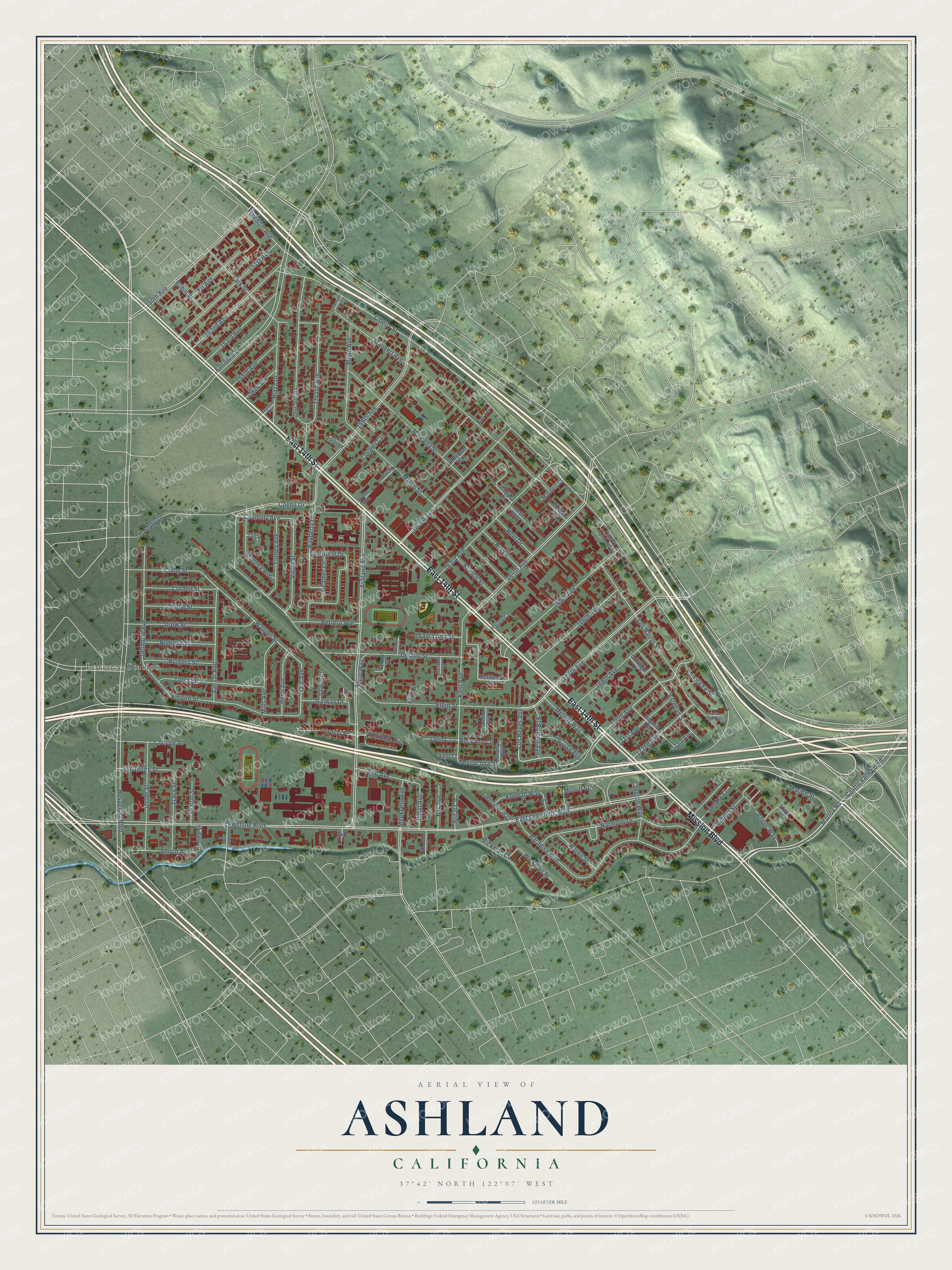
Ashland, California Map Art
Building by building, with labeled streets and shaded relief.
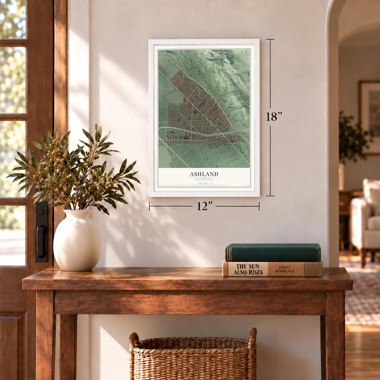
12" x 18" Archival Matte Print
A Map of Home. A Work of Art.
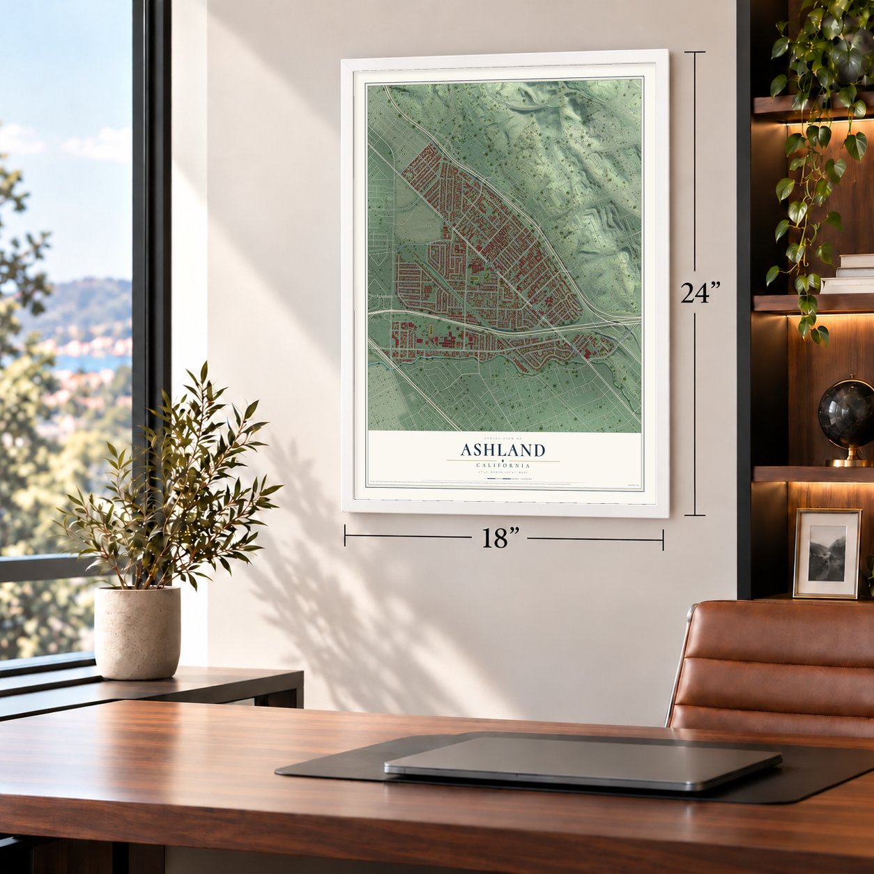
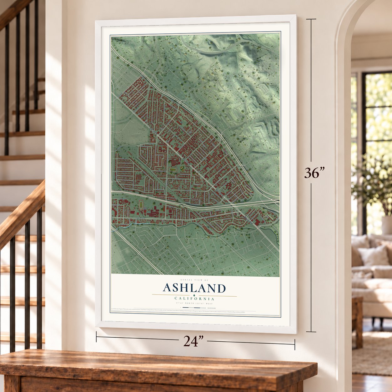
Explore Ashland, California from a whole new perspective. Created using aerial imagery and detailed geographic data, this map captures Ashland building by building, with labeled streets, familiar landmarks, and shaded topographical relief that highlights the natural contours of the landscape.
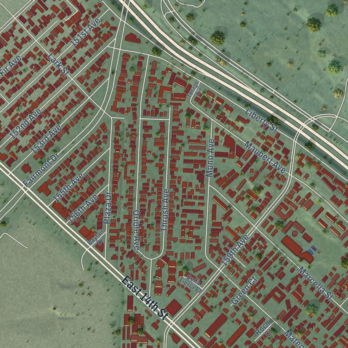
Combining modern data with the timeless character of a vintage atlas, this map is just as interesting up close as it is beautiful on the wall. Whether you grew up in Ashland, spent memorable years there, or call it home today, this unique map is a great way to celebrate a place that means something to you. Zoom in on the preview to look for your street, and then order a print to put your memories on the wall.
Three ways to hang it
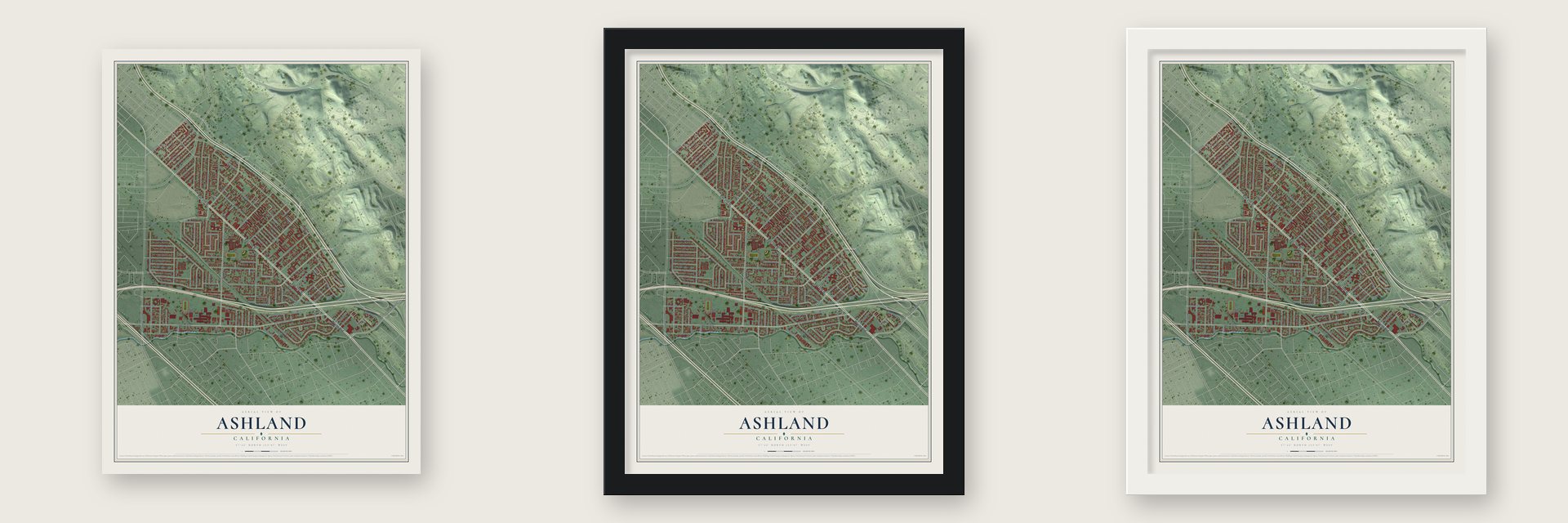
Unframed archival matte, a black wood frame or a white wood frame.
Up close
Geography Worth Displaying
This map was created using accurate cartographic data and authoritative geographic sources, including the U.S. Geological Survey and the Census Bureau. The map brings together terrain, waterways, roads, and building detail. The majority of the streets are labeled, houses are accurately depicted, and the topography is derived from government sources. Combining local data with carefully composed color and shading leads to this beautifully detailed Ashland artwork for your wall.
Rather than simply showing street outlines, we’ve included as many of the street names as we could reasonably fit on the map while keeping their names legible. Zoom in on the high resolution preview to see exactly what’s on the map. We truly set out to create a statement piece for anyone who loves Ashland. So whether it’s for you, or a gift for someone you love, we hope this map of Ashland brings back fond memories.
Read the story behind this map of Ashland, California from 2026.

Find your street
Names on the Ashland map
Every name below is printed on this map. Look for your street, your school, the park where you played, or the pond down the road.
Places and landmarks1
- Lorenzo Station
Streets and roads142
- East 14th Street
- Mission Boulevard
- 170th Avenue
- Elgin Street
- Mattox Road
- Los Reyes Avenue
- East Lewelling Boulevard
- Lewelling Boulevard
- 167th Avenue
- Yale Avenue
- Bevilacqua Street
- Wagner Street
- Freedom Avenue
- Connolly Avenue
- Ashland Avenue
- Liberty Street
- 159th Avenue
- 164th Avenue
- Hesperian Boulevard
- Fairmont Drive
- 150th Avenue
- Maubert Avenue
- 162nd Avenue
- Paradise Boulevard
- Los Banos Street
- Mateo Street
- Dermody Avenue
- Harmony Drive
- 163rd Avenue
- Marcella Street
Show all 142 streets
- Kent Avenue
- Oriole Avenue
- 165th Avenue
- Thrush Avenue
- Delano Street
- Silverleaf Drive
- 151st Avenue
- Empire Street
- Lark Street
- 152nd Avenue
- Drew Street
- 166th Avenue
- Vassar Avenue
- Plaza Drive
- Usher Street
- Tulsa Street
- Meekland Avenue
- 168th Avenue
- 153rd Avenue
- Mono Avenue
- Videll Street
- Heritage Circle
- Bayberry Lane
- Esteban Street
- Melody Way
- Linnea Avenue
- Mooney Avenue
- 172nd Avenue
- Tracy Street
- Coeho Drive
- Mills Avenue
- Galway Drive
- Cornell Street
- Castro Valley Boulevard
- Pomona Street
- Doane Street
- Rutgers Street
- 171st Avenue
- Bertero Avenue
- Albion Avenue
- Ano Avenue
- College Street
- Fir Avenue
- Penn Avenue
- Colby Street
- 155th Avenue
- Gilbert Street
- Crespi Place
- Langton Way
- Sycamore Street
- Wickman Court
- Marion Street
- El Balcon Avenue
- Ria Drive
- Blanco Street
- Helo Drive
- Haven Street
- Morrill Street
- Sandra Court
- Kendall Way
- Heather Lane
- Clinton Avenue
- Wickman Place
- Daryl Avenue
- Santa Fe Street
- Bar Avenue
- Angus Way
- Sharon Street
- Santa Ana Street
- Robin Street
- 156th Avenue
- Alisal Court
- Thornally Drive
- Elgin Way
- Lynn Court
- Roseann Court
- Green Court
- Ronda Street
- Kentwood Lane
- Rogerio Street
- Carriage Lane
- Calypso Court
- Westerman Court
- Liberty Pointe Way
- Maubert Court
- Galway Court
- Gordon Way
- 173rd Avenue
- Emery Court
- Cumora Avenue
- Bevil Way
- Pajaro Court
- Brockton Way
- Ventry Way
- Elgin Court
- Bali Terrace
- Rochi Court
- Kent Court
- Jan Court
- Peshel Court
- 160th Avenue
- Shaw Place
- Tiger Lane
- Genevieve Place
- Via Granada
- Bella Tierra Court
- Deanne Court
- Bayfair Drive
- Ragland Street
- Santa Cruz Way
- Tanager Avenue
- Julia Lane
Names are listed as they appear on the printed map. Zoom into the product photos to find them.
About Ashland, California
Ashland is an unincorporated community of 23,823 people in Alameda County, set in the old Eden Township between San Leandro and Cherryland. Oregon ash trees used to grow thick along San Lorenzo Creek, and the community was named for them. The creek still marks its southern edge.
Work on the Oakland, San Leandro and Haywards Electric Railway started in 1891. By 1892 its cars rolled over 14.3 miles of track on County Road, now East 14th Street and Mission Boulevard, every half hour from 5 a.m. to midnight. Farm crops slowly lost value while land gained it, so owners split their orchards into lots of about an acre, and new neighborhoods like Ashland grew up along the line.
- A park on the trolley lineThe electric railway owned San Lorenzo Grove, an eight-acre park on what is now Tracy Street. People came from across the region for its dance pavilion, bandstand, picnic grounds and ball fields. The park closed in 1917, when its land was planted in apricots, and houses later took the place of the trees.
- A suburb after the warWorld War II brought a wave of newcomers to unincorporated Alameda County. When the war ended, rows of matching tract homes replaced most of the farms, nurseries and greenhouses that were left, and Ashland became the residential suburb it is now. Once the electric railway shut down, residents came to depend on cars.
- Cut by freeways in the 1950sThe Nimitz Freeway, Interstate 880, and Interstate 238 opened in the late 1950s and split Ashland from Mission Boulevard to Hesperian Boulevard. Of the two roads, Interstate 238 has done the most to shape the community.
- Governed by the countyAshland has never become a city, so the Alameda County Board of Supervisors governs it directly. In 2019 the board created the Eden Area Municipal Advisory Council to advise it on Ashland, Cherryland, San Lorenzo and Hayward Acres.
Keep exploring California
Ashland is one of 1,990 California towns we've mapped. Every dot on the map is a print of its own.
The search covers every state, California first.
Near Ashland
Order 2 or more town maps and save 10%. Shown in the size and finish you picked above, so they hang as a set.
- Cherryland 12" x 18" / Archival Matte Print $39.99
- San Lorenzo 12" x 18" / Archival Matte Print $39.99
- San Leandro 12" x 18" / Archival Matte Print $39.99


More maps nearby: Castro Valley, Mulford Gardens, Fairview, Hayward and Brookfield Village.
The art of mapping a place
How This Map Was Made
Real places. Remarkable detail. Discover the layers that turn geographic data into a map of home.

The view from above
Aerial imagery reveals the character of the land: woodland, open fields, and the patterns of a place.

The shape of the land
Elevation data brings hills, valleys, and subtle changes in the landscape into view.

The details of home
Roads, waterways, and building footprints come together to make the map feel unmistakably local.

Geography becomes art
Considered color, shading, and typography bring the layers together in a map made for your wall.


Process illustrated with Mendon, Massachusetts. Aerial imagery: USDA NAIP. Terrain: USGS 3D Elevation Program. Map details and finished artwork: KNOWOL.
The Details
About This Print
Choose an archival matte print, or a black or white Ayous wood frame. The archival matte print is unframed.
Select your size and finish above to see the matching product image and price.
Materials & Craftsmanship
A contemporary map with the character of a classic atlas, printed on archival matte paper. Optional frames are made from Ayous wood.
Your printed map does not include the watermark shown in the full-map preview.
Shipping & Delivery
Free shipping within the United States. Every print is made to order in the USA.
Buying a gift? Add a note in your cart and we'll include it. We never put prices in the package.
Prints ship within 2 to 3 business days. Allow 7 to 10 days total from ordering for delivery. Timing may vary during holidays or periods of high order volume.
Read our shipping policy.
Returns and damaged prints
Each print is made to order. Change-of-mind refunds are not available after production.
If your print arrives damaged, misprinted or incorrect, contact support@knowol.com within 30 days of receiving it. Include your order number, photos and a description of the issue.
Read our full refund and replacement policy. For questions about your order, email support@knowol.com.