
Search for another town


Free U.S. delivery 7 to 10 days after you order
San Lorenzo, California Map Art
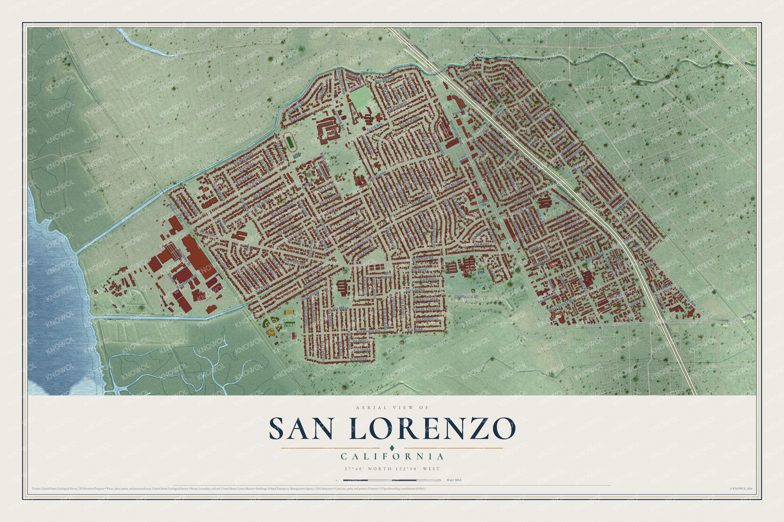
A new map of San Lorenzo, California, made in 2026 and printed to order on thick archival matte paper.
12" x 18" Archival Matte Print
A Map of Home. A Work of Art.
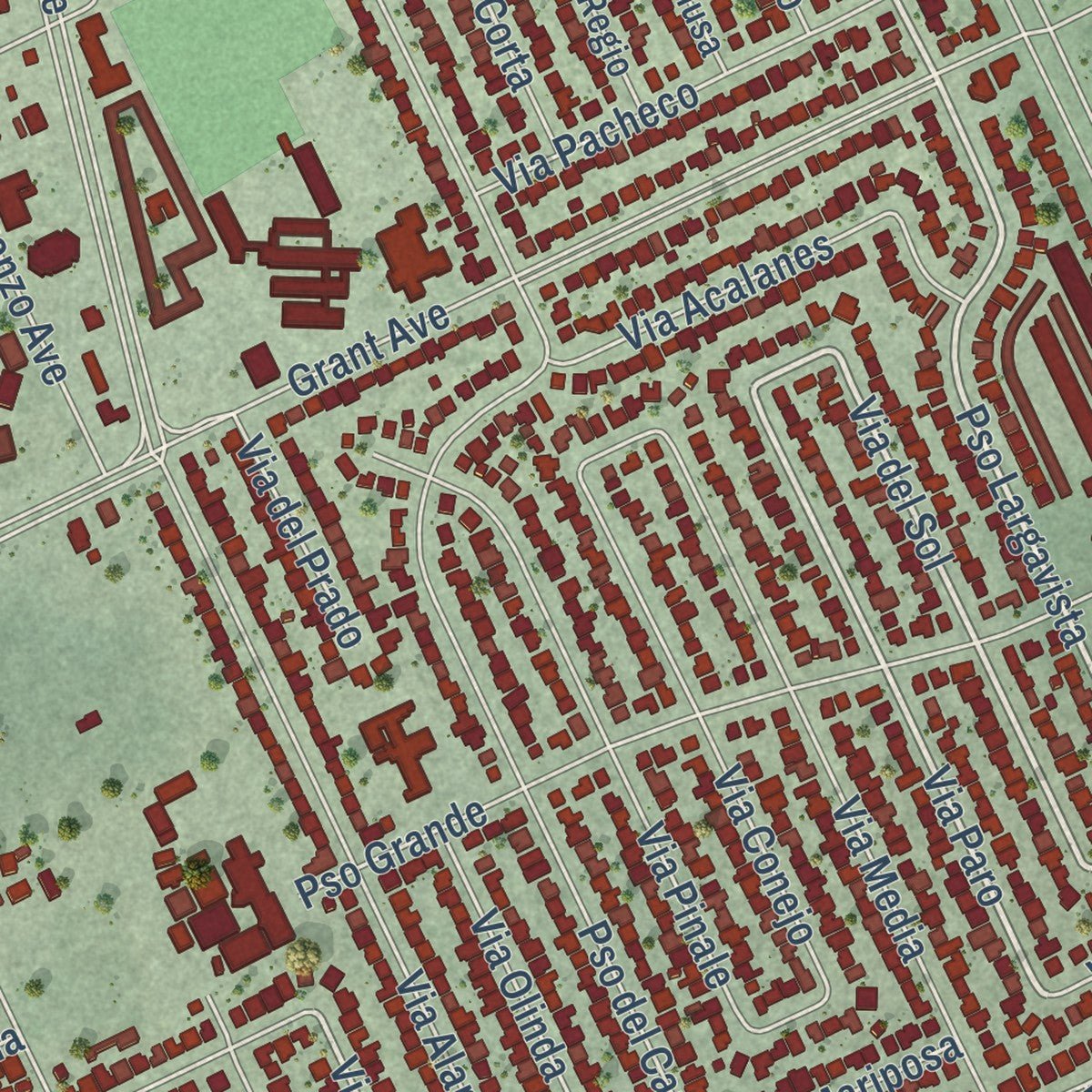
Explore San Lorenzo, California from a whole new perspective. Created using aerial imagery and detailed geographic data, this map captures San Lorenzo building by building, with labeled streets, familiar landmarks, and shaded topographical relief that highlights the natural contours of the landscape.
Combining modern data with the timeless character of a vintage atlas, this map is just as interesting up close as it is beautiful on the wall. Whether you grew up in San Lorenzo, spent memorable years there, or call it home today, this unique map is a great way to celebrate a place that means something to you. Zoom in on the preview to look for your street, and then order a print to put your memories on the wall.
Three ways to hang it

Unframed archival matte, a black wood frame or a white wood frame.
Up close
Geography Worth Displaying
This map was created using accurate cartographic data and authoritative geographic sources, including the U.S. Geological Survey and the Census Bureau. The map brings together terrain, waterways, roads, and building detail. The majority of the streets are labeled, houses are accurately depicted, and the topography is derived from government sources. Combining local data with carefully composed color and shading leads to this beautifully detailed San Lorenzo artwork for your wall.
Rather than simply showing street outlines, we’ve included as many of the street names as we could reasonably fit on the map while keeping their names legible. Zoom in on the high resolution preview to see exactly what’s on the map. We truly set out to create a statement piece for anyone who loves San Lorenzo. So whether it’s for you, or a gift for someone you love, we hope this map of San Lorenzo brings back fond memories.
Read the story behind this map of San Lorenzo, California from 2026.

About San Lorenzo, California
San Lorenzo is an unincorporated community of 29,581 people in Alameda County. It sits on San Lorenzo Creek, between San Leandro and Hayward. Its land was once part of two Mexican land grants. Guillermo Castro got Rancho San Lorenzo in 1841, and José Joaquin Estudillo got Rancho San Leandro in 1842. Squatters built cabins north of the creek in 1847. More came in the Gold Rush and settled on Estudillo's land, along the line between the two ranchos. By 1851 people called the place Squattersville.
The name later changed to San Lorenzo, and a post office opened in 1854. For about a hundred years the area was mostly farms, known for fruit and flowers. The 1939 state guide counted just 500 people here. In 1944 the David D. Bohannon Company began building San Lorenzo Village under a U.S. Navy contract. Its homes had two or three bedrooms and were meant for workers in the East Bay's war plants. It was one of the first planned communities in the country, with land saved for schools, churches, parks and stores. Building went on into the 1950s.
- The California methodBohannon's crews used a new way of building with pre-cut parts. It became known as the "California method." During World War II, San Lorenzo Village was the largest housing project on the West Coast paid for with private money. Later builders used the same method, including at Levittown, Pennsylvania.
- Home of the first Mervyn'sThe San Lorenzo Shopping Center was one of the first shopping centers in the country planned as part of a community. The first Mervyn's Department Store opened there.
- Oysters from Long IslandMany early settlers are buried in San Lorenzo Pioneer Cemetery. Alameda County and the Hayward Area Historical Society take care of it. One of them is Moses Wicks, who brought oysters from Patchogue, Long Island, to San Leandro Bay.
- A school district since 1865The San Lorenzo Unified School District still serves the community. It was founded in 1865, eleven years after the post office opened.
Find your street
Names on the San Lorenzo map
Every name below is printed on this map. Look for your street, your school, the park where you played, or the pond down the road.
Places and landmarks1
- San Lorenzo Park
Streets and roads191
- Pso Largavista
- Via Barrett
- Via Paro
- Via del Sol
- Pso del Rio
- Via Sorrento
- Via Esmond
- Via Granada
- Via Hermana
- Via Sarita
- Via la Jolla
- Via Lupine
- Grant Avenue
- Bockman Road
- Hesperian Boulevard
- Hathaway Avenue
- Pso Grande
- Via Alamitos
- Hacienda Avenue
- Via Manzanas
- Via Chiquita
- Washington Avenue
- Via Arriba
- Via Arroyo
- Via Media
- Pso del Campo
- Via Toledo
- Times Avenue
- Channel Street
- Via Lucas
Show all 191 streets
- Royal Avenue
- West Sunset Boulevard
- Via Amigos
- Via Rancho
- Bandoni Avenue
- Bartlett Avenue
- Via del Rey
- Via Buena Vis
- Phil Drive
- Via Coralla
- Via Cordoba
- Keller Avenue
- Via Lacqua
- Via Catherine
- Via Melina
- Via Segundo
- Worthley Drive
- Via Nueva
- Ricardo Avenue
- Garden Avenue
- Via Harriet
- Via Enrico
- Lorenzo Avenue
- Via Frances
- Via Pinale
- Via Primero
- Via Bregani
- Perkins Drive
- Via Annette
- Via Conejo
- Via Natal
- Via Estrella
- Via Carmen
- Via Descanso
- Via Vis
- Via Escondido
- Nielson Avenue
- Via el Monte
- Via Carreta
- Via Marlin
- Via San Ardo
- Via el Cerrito
- Shirley Avenue
- Via Mesa
- Via Walter
- Via Seco
- Via Susana
- Via Julia
- Via Andeta
- Via Rincon
- Via Honda
- Via Acalanes
- Via Nube
- Clubhouse Drive
- Via Ventana
- Via Toyon
- Via Flores
- Via San Juan
- Solano Avenue
- Via Mariposa
- Via Rivera
- Via Pacheco
- Bengal Avenue
- Robscott Avenue
- Via Pasatiempo
- Via Sonora
- Via Olinda
- Via Aires
- Via Redondo
- Via Valencia
- Via Palma
- Via Dolorosa
- Via Los Trancos
- Via Magdalena
- Via Piedras
- Via Lobos
- Waverly Avenue
- Via Chorro
- Railroad Avenue
- Oxford Street
- Via Coches
- Via Cielo
- Hunter Avenue
- Melrose Avenue
- Via Verde
- Baumann Avenue
- Via Karl
- Via Margarita
- Arbor Avenue
- Via Anacapa
- Via Corta
- Via la Paloma
- Via Sonata
- Via Owen
- Via Milos
- Penny Lane
- Via del Robles
- Bartlett Lane
- Via Esperanza
- Via Vega
- Via Mirabel
- Via Represa
- Peach Drive
- Gribben Avenue
- Via Alamo
- Via Lunado
- Via Perdido
- Ginger Avenue
- Via del Prado
- Via Hermosa
- William Drive
- Via Faisan
- Louette Court
- Post Street
- Via Tovita
- Lucot Street
- Ardis Street
- Duke Court
- Culver Place
- Soto Drive
- Flint Court
- Joss Court
- Yorton Lane
- Via Linares
- Devonwood Way
- Via Colusa
- Via Madera
- West Blossom Way
- Via Lucero
- Via Matero
- Via Hornitos
- Via Helena
- Lansing Way
- Hesperian Court
- Newcomb Street
- Via Vecinos
- Via Regio
- Lupine Way
- Via Teresa
- Via Jose
- Corte Eulalia
- Garden Place
- Via Eduardo
- Quigley Road
- Via Mirlo
- Dell Court
- Via Bolsa
- Eve Court
- Via Diego
- Via Mercado
- Arbor Court
- Via Sevilla
- Boxer Court
- Via Rodriguez
- Mero Street
- Florence Street
- Kentfield Lane
- Ferro Drive
- Via Morella
- Via Poudre
- Lucas Court
Names are listed as they appear on the printed map. Zoom into the product photos to find them.
The art of mapping a place
How This Map Was Made
Real places. Remarkable detail. Discover the layers that turn geographic data into a map of home.

The view from above
Aerial imagery reveals the character of the land: woodland, open fields, and the patterns of a place.

The shape of the land
Elevation data brings hills, valleys, and subtle changes in the landscape into view.

The details of home
Roads, waterways, and building footprints come together to make the map feel unmistakably local.

Geography becomes art
Considered color, shading, and typography bring the layers together in a map made for your wall.


Process illustrated with Mendon, Massachusetts. Aerial imagery: USDA NAIP. Terrain: USGS 3D Elevation Program. Map details and finished artwork: KNOWOL.
The Details
About This Print
Choose an archival matte print, or a black or white Ayous wood frame. The archival matte print is unframed.
Select your size and finish above to see the matching product image and price.
Materials & Craftsmanship
A contemporary map with the character of a classic atlas, printed on archival matte paper. Optional frames are made from Ayous wood.
Your printed map does not include the watermark shown in the full-map preview.
Shipping & Delivery
Free shipping within the United States. Every print is made to order in the USA.
Buying a gift? Add a note in your cart and we'll include it. We never put prices in the package.
Prints ship within 2 to 3 business days. Allow 7 to 10 days total from ordering for delivery. Timing may vary during holidays or periods of high order volume.
Read our shipping policy.
Returns and damaged prints
Each print is made to order. Change-of-mind refunds are not available after production.
If your print arrives damaged, misprinted or incorrect, contact support@knowol.com within 30 days of receiving it. Include your order number, photos and a description of the issue.
Read our full refund and replacement policy. For questions about your order, email support@knowol.com.
Find your town
Looking for another city?
Find a map of home in our California collection, or any town in the country.
Nearby
Maps of towns near San Lorenzo
Know someone from one of these towns? Their map makes a great gift.
 Ashland
, California
From $39.99See the map
 Cherryland
, California
From $39.99See the map
 San Leandro
, California
From $39.99See the map
More maps nearby: Mulford Gardens, Hayward, Castro Valley, Brookfield Village and Fairview.