


Search for another town





Free U.S. delivery 7 to 10 days after you order
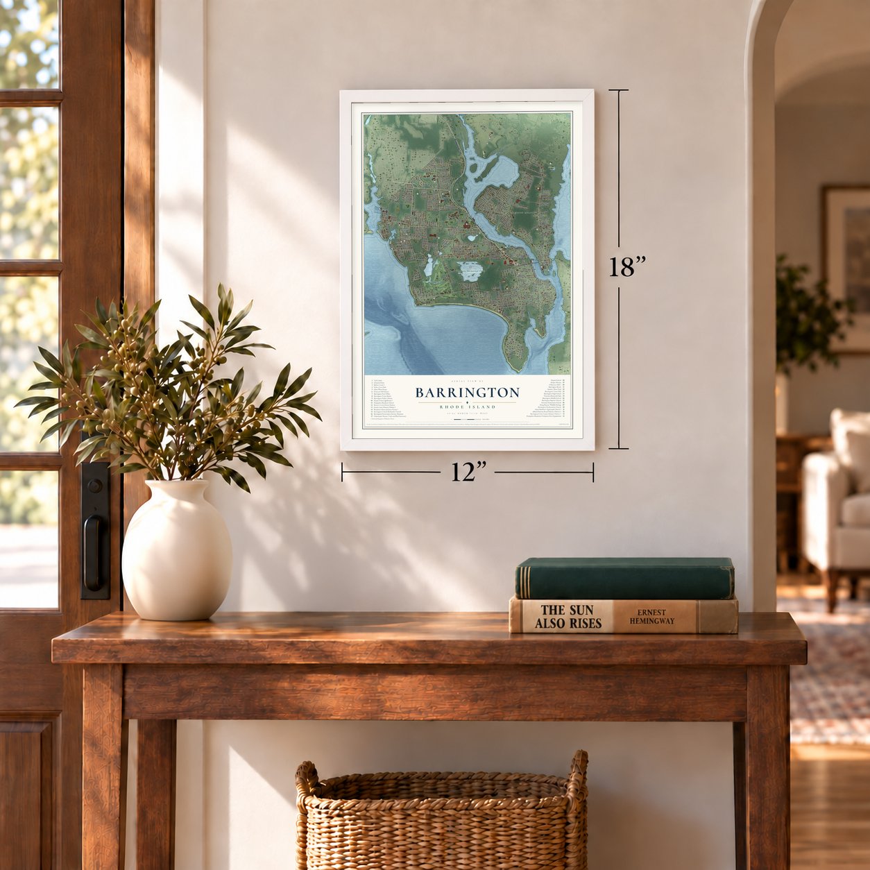
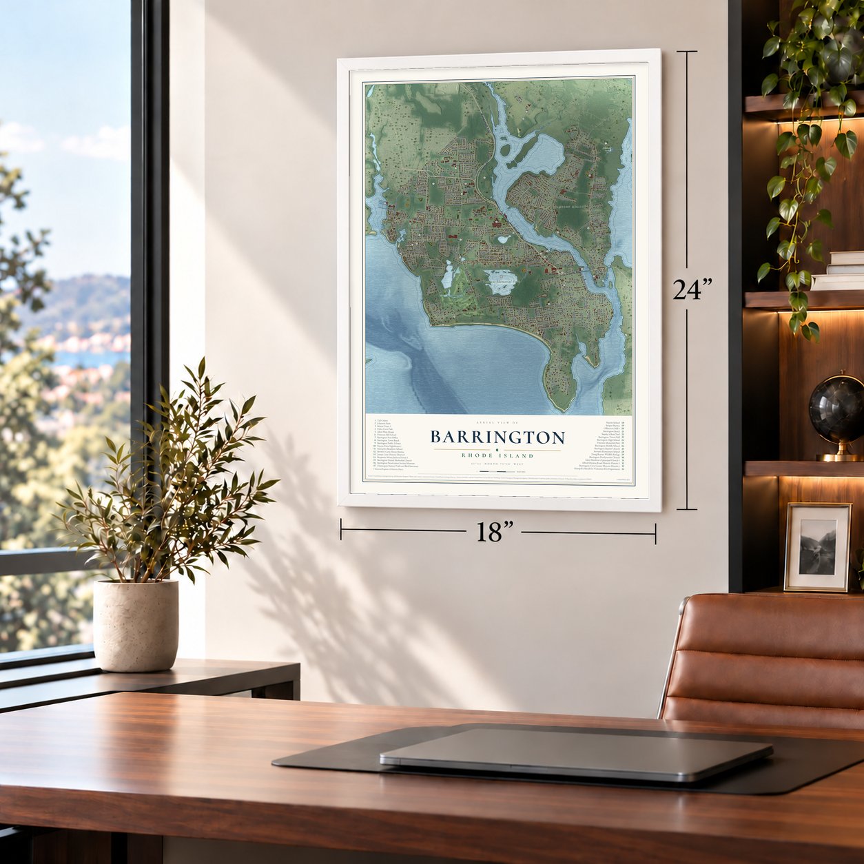
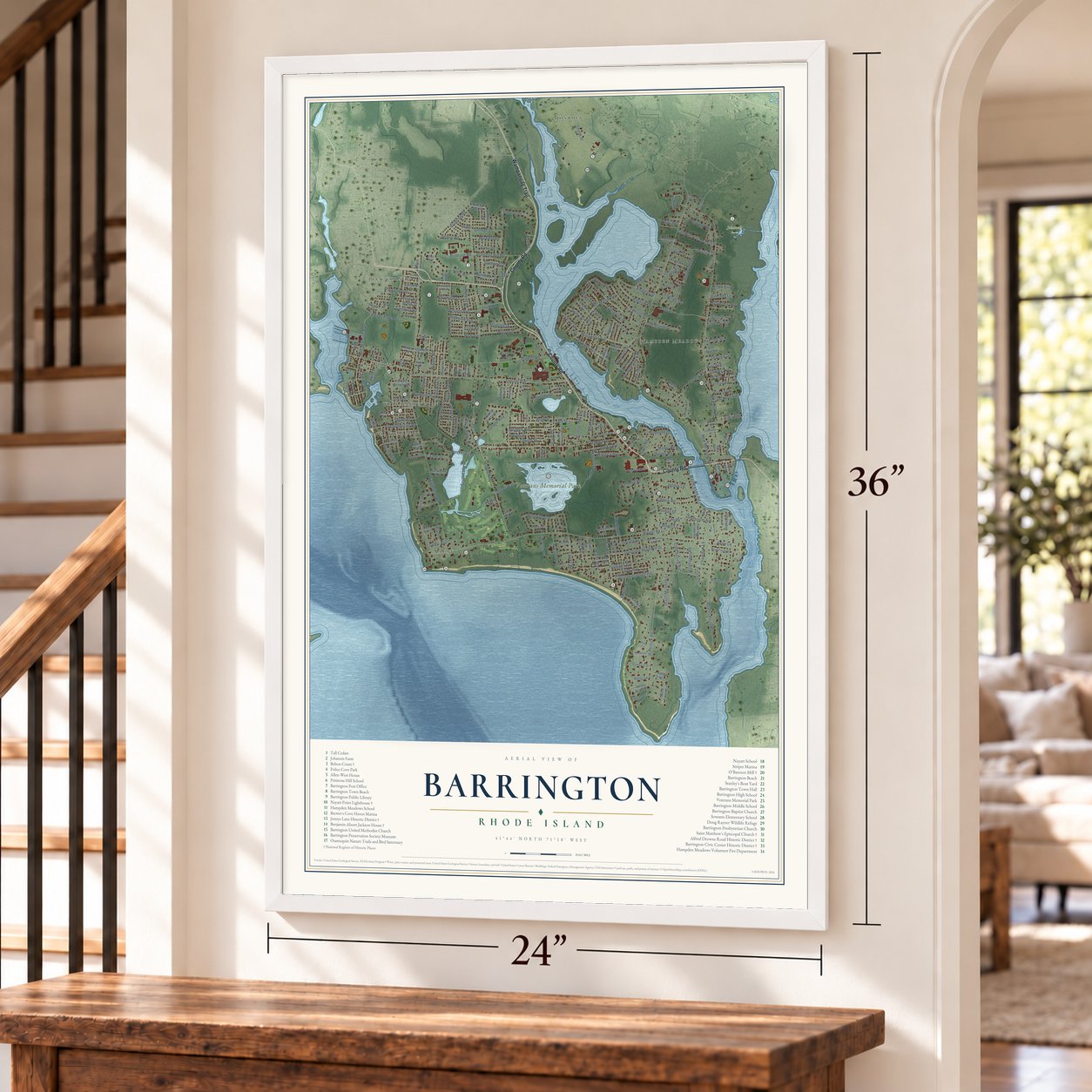
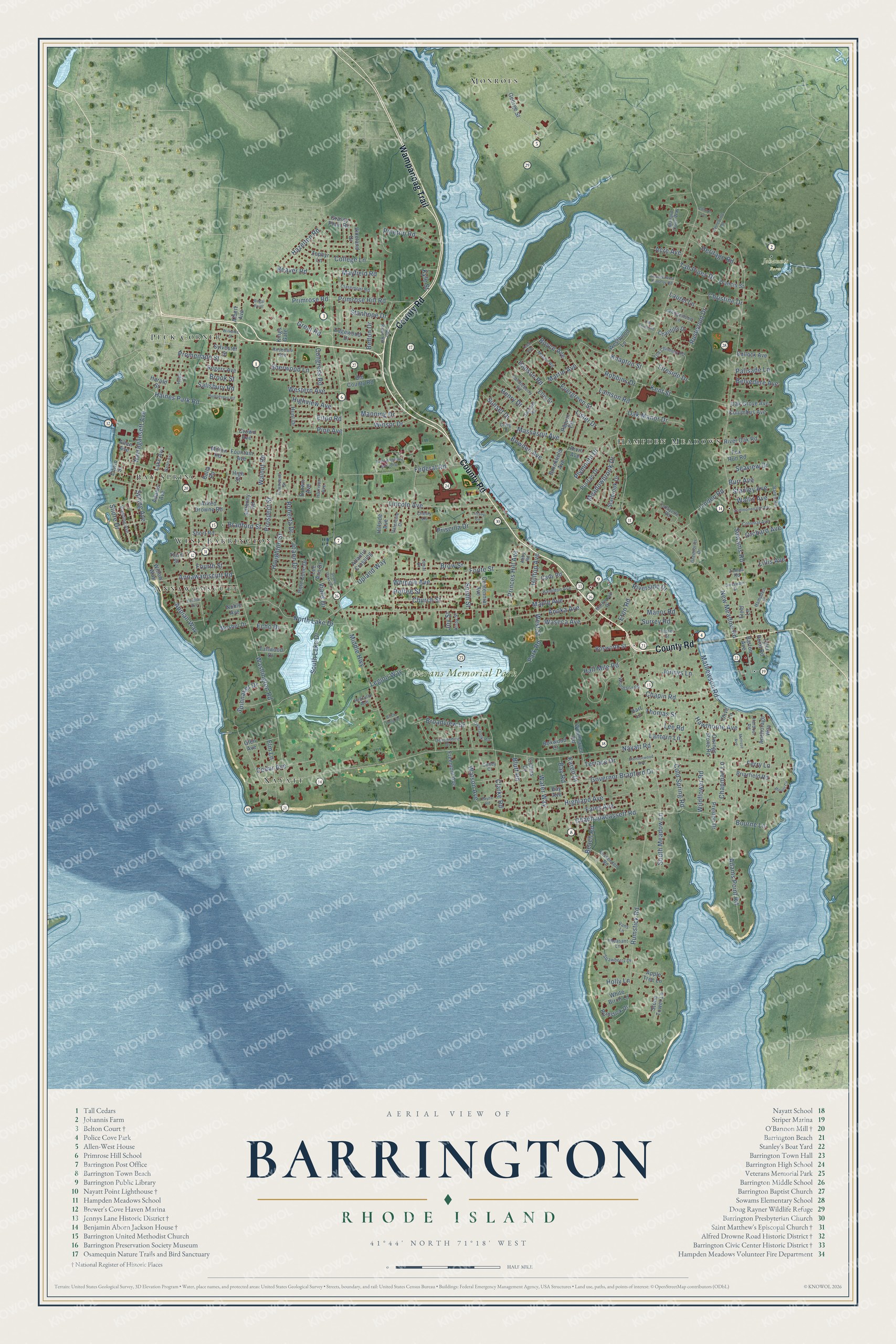
Barrington, Rhode Island Map Art
Building by building, with labeled streets and shaded relief.
12" x 18" Archival Matte Print
A Map of Home. A Work of Art.
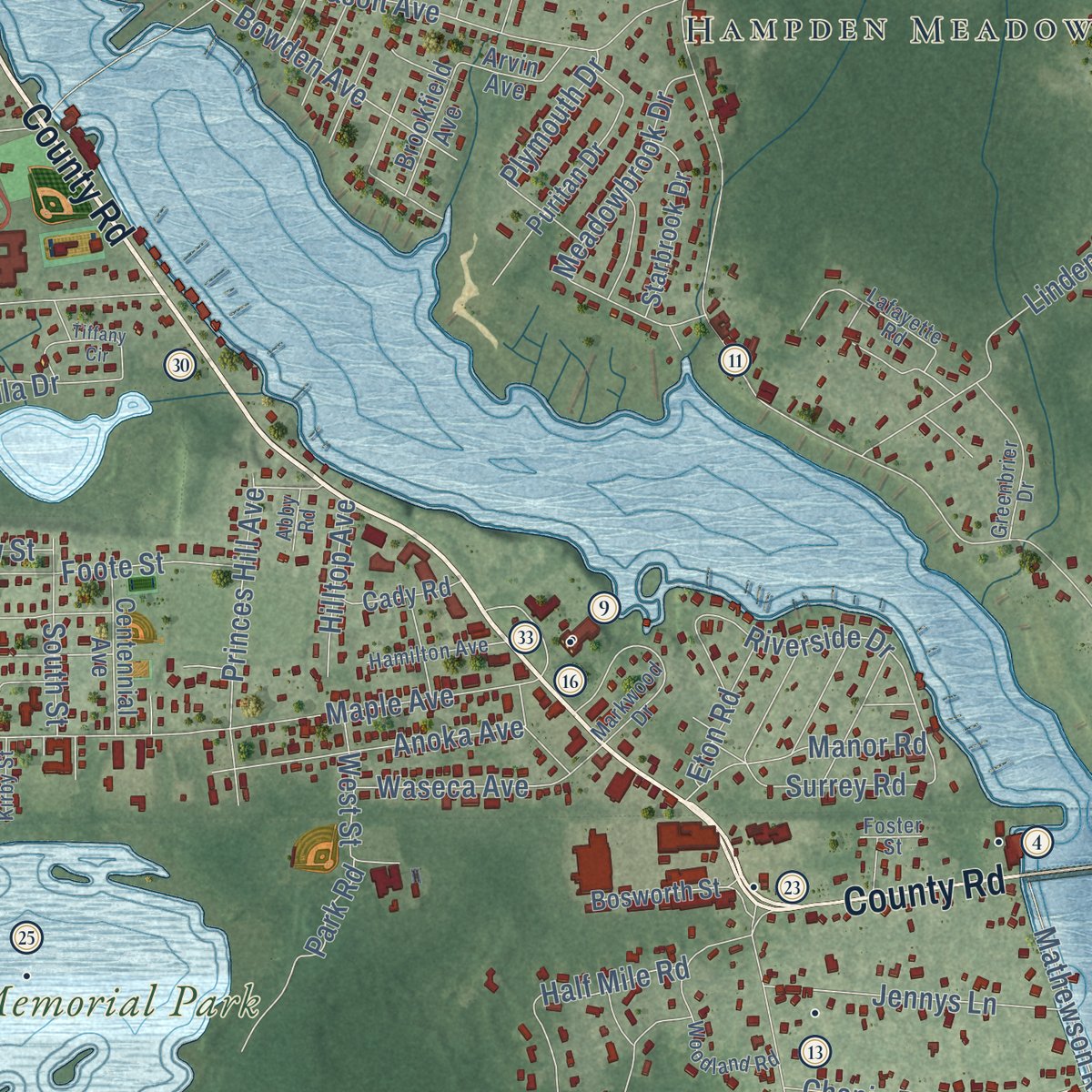
Explore Barrington, Rhode Island from a whole new perspective. Created using aerial imagery and detailed geographic data, this map captures Barrington building by building, with labeled streets, familiar landmarks, and shaded topographical relief that highlights the natural contours of the landscape.
Combining modern data with the timeless character of a vintage atlas, this map is just as interesting up close as it is beautiful on the wall. Whether you grew up in Barrington, spent memorable years there, or call it home today, this unique map is a great way to celebrate a place that means something to you. Zoom in on the preview to look for your street, and then order a print to put your memories on the wall.
Three ways to hang it
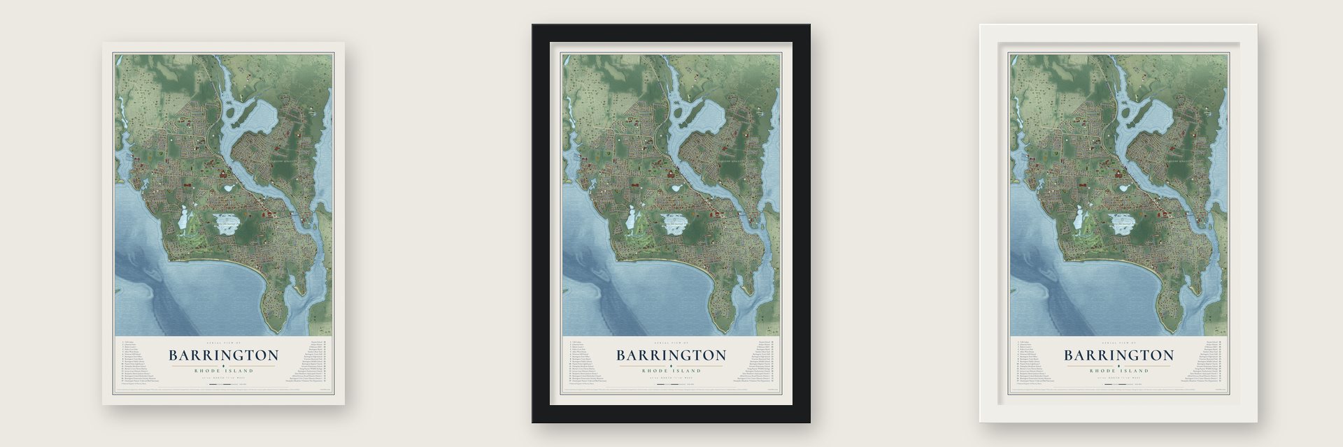
Unframed archival matte, a black wood frame or a white wood frame.
Up close
Geography Worth Displaying
This map was created using accurate cartographic data and authoritative geographic sources, including the U.S. Geological Survey (USGS) and FEMA. The map brings together terrain, waterways, roads, and building detail. The majority of the streets are labeled, houses are accurately depicted, and the topography is derived from government sources. Combining local data with carefully composed color and shading leads to this beautifully detailed Barrington artwork for your wall.
Rather than simply showing street outlines, we’ve included as many of the street names as we could reasonably fit on the map while keeping their names legible. Zoom in on the high resolution preview to see exactly what’s on the map. We truly set out to create a statement piece for anyone who loves Barrington. So whether it’s for you, or a gift for someone you love, we hope this map of Barrington brings back fond memories.
Explore the full map of Barrington, Rhode Island and read about the local places it shows.

Find your street
Names on the Barrington map
Every name below is printed on this map. Look for your street, your school, the park where you played, or the pond down the road.
Places and landmarks9
- Johannis Farm
- Veterans Memorial Park
- Nayatt
- Peck Corner
- Hampden Meadows
- Bay Spring
- Monroes
- Annawomscutt
- West Barrington
Streets and roads262
- County Road
- Wampanoag Trail
- Narragansett Avenue
- Prospect Street
- South Meadow Lane
- Great Road
- Middle Highway
- New Meadow Road
- Nayatt Road
- Washington Road
- Sowams Road
- Rumstick Road
- Lincoln Avenue
- Maple Avenue
- Governor Bradford Drive
- Mathewson Road
- Massasoit Avenue
- Adams Point Road
- Upland Way
- Ferry Lane
- South Lake Drive
- Federal Road
- Walnut Road
- Foote Street
- Half Mile Road
- North Lake Drive
- Highland Avenue
- Riverside Drive
- Broadview Drive
- Kent Street
Show all 262 streets
- Martin Avenue
- Meadowbrook Drive
- Linden Road
- Chachapacassett Road
- College Lane
- Lamson Road
- Houghton Street
- Whipple Avenue
- Roffee Street
- Pinetop Road
- Primrose Hill Road
- Bay Road
- Haines Park Road
- Princes Hill Avenue
- Annawamscutt Road
- Church Street
- Water Way
- Anoka Avenue
- Christine Drive
- Chapin Road
- Heritage Road
- Winsor Drive
- Cedar Avenue
- Robbins Drive
- Jennys Lane
- Hawthorne Avenue
- Hazelton Road
- Bowden Avenue
- Knapton Street
- Sherwood Lane
- Brook Street
- Fales Avenue
- Elm Lane
- Appian Way
- Waseca Avenue
- Clarke Road
- Oak Manor Drive
- Manning Drive
- Primrose Road
- Bluff Road
- Terrace Drive
- Promenade Street
- Beaver Road
- Bradford Street
- Highview Avenue
- Lantern Lane
- Park Road
- Fireside Drive
- Surrey Road
- Spring Avenue
- Joann Drive
- Roberta Drive
- Watson Avenue
- Wildflower Road
- Cold Spring Road
- Western Avenue
- Lee Road
- Mayfield Road
- Pine Avenue
- Shore Drive
- Evergreen Street
- Orchard Avenue
- Vialls Drive
- South Street
- Rustwood Drive
- Belvedere Avenue
- Echo Drive
- Lillis Avenue
- West Street
- Spinnaker Drive
- Congress Road
- Lister Drive
- Stanley Avenue
- Wallis Avenue
- Boyce Avenue
- Seaview Drive
- Hilltop Avenue
- Henry Drive
- Sunset Drive
- Legion Way
- Tall Pines Drive
- Beach Road
- Chapman Lane
- Priscilla Drive
- Eton Road
- Stanhope Drive
- Salisbury Road
- Plymouth Drive
- Laurel Lane
- Belton Drive
- Fourth Street
- Holly Lane
- Palisade Lane
- Thomas Street
- Bourne Lane
- Hanson Road
- Acre Avenue
- Manor Road
- Brow Street
- Karen Drive
- Elton Road
- Burr Avenue
- Kyle Street
- Joy Street
- Grassy Plain Road
- George Street
- Crown Avenue
- Vineland Drive
- Alfred Drowne Road
- Third Street
- Rogers Avenue
- Anchorage Way
- Fountain Avenue
- Old County Road
- Puritan Drive
- Rumstick Drive
- Stone Tower Lane
- Briarfield Road
- Woodhaven Road
- Tyler Point Road
- Anthony Road
- Preston Drive
- Bullock Avenue
- Starbrook Drive
- Bosworth Street
- Atlantic Crossing
- Chantilly Drive
- Centennial Avenue
- Lake Avenue
- Columbus Avenue
- Oak Grove Avenue
- Edgewood Drive
- Barton Avenue
- Freemont Avenue
- Pine Cone Drive
- River Oak Road
- Boxwood Court
- Glen Avenue
- Short Road
- Brookfield Avenue
- Owings Stone Road
- Westwood Lane
- White Birch Lane
- Apple Tree Lane
- Zephyr Lane
- Cady Road
- Paquin Road
- Tallwood Drive
- Adams Avenue
- Hillside Avenue
- Arvin Avenue
- Mosher Drive
- Hunt Drive
- Field Lane
- Francis Street
- Lee Ann Drive
- Sylvester Street
- Albert Avenue
- Fox Run Road
- Ellis Street
- Brown Avenue
- Allen Avenue
- Collins Court
- Bay Avenue
- Kings Gate
- Milton Road
- Edwin Street
- Noble Avenue
- Willow Way
- Harold Street
- High Street
- Olive Lane
- Hart Lane
- Bella Road
- Mallard Cove Way
- Old Chimney Road
- Rosedale Avenue
- Woodland Road
- Markwood Drive
- Townsend Street
- Blanding Avenue
- Colonial Avenue
- Old River Road
- Greenbrier Drive
- Devonshire Drive
- Mason Road
- Valentine Drive
- Wedgewood Lane
- Pheasant Lane
- Hamilton Avenue
- Fessenden Road
- Claremont Road
- Strawberry Drive
- Sachem Road
- Overlook Road
- Candleberry Road
- Lafayette Road
- Baron Road
- Pezzullo Avenue
- Hampden Street
- Harbour Road
- Cherry Lane
- Harrison Avenue
- Kirby Street
- Vans Lane
- Craig Drive
- Zompa Road
- Colley Court
- Abby Road
- Foster Street
- Josal Drive
- Hope Court
- Saint Andrews School Street
- Tiffany Circle
- Melrose Avenue
- Blount Circle
- Commonwealth Avenue
- Central Avenue
- Humphreys Road
- George West Finnerty Road
- Williams Street
- Brentonwood Avenue
- Crossways Street
- Seven Oaks Drive
- Barneyville Road
- Payne Road
- Walsh Avenue
- Teed Avenue
- Old Forge Road
- Brick Pond Drive
- Regal Point
- Connor Lane
Names are listed as they appear on the printed map. Zoom into the product photos to find them.
About Barrington, Rhode Island
Barrington is a town of 17,153 people in Bristol County, on the east side of Narragansett Bay about seven miles southeast of Providence. The Wampanoag held this land, which the Narragansetts knew as Sowams, and in 1653 a group of Plymouth Colony investors bought it from them. Baptists asked to break away from Swansea in 1711, and Barrington became a town of its own in 1717, probably named for Barrington in Somerset, England, home of several settlers. Rhode Island took it over in 1747 and joined it to Warren, but the legislature restored it as a separate town in 1770.
Farming carried the early town, with fields of corn, rye, oats and barley and orchards for apple cider, a valuable trade good. The Congregational church stood in the old southern center, but by 1737 the population was shifting north, where marshes and rich soil supported big farms, and a plan to move the church split the town. The church went north in the end, onto a lot Joshua Bicknell gave on County Road, and taverns, inns and farmhouses grew up around it.
- Clay from Brickyard PondNathaniel Potter founded the Nayatt Brick Company in 1847 to work the deep clay beds at Brickyard Pond, using Mouscochuck Creek as a canal. In 1864 the business took the name Narragansett Brick Company, and from 1890 it competed with the New England Steam Brick Corporation. French-Canadians staffed the first yards, then a few hundred Italians came, and many Barrington families today descend from them. By 1900 the clay was starting to give out, and brickmaking ended by 1930.
- Imitation leather on Bay Spring AvenueIn 1905 George B. Frost opened the Frost Finishing Company at 90 Bay Spring Avenue, one of the first plants to turn out artificial leather in quantity. Treasurer O'Bannon bought Frost out, and the mill, renamed for him, became the world's largest maker of imitation leather. After the company failed in 1926, other owners used the building until the 1970s. It became apartments for older residents in the early 1990s and joined the National Register in 1996 as O'Bannon Mill.
- A light at Nayatt PointOn May 23, 1828, Congress set aside $3,500 for a light to mark the narrow channel running from Nayatt Point to a shoal off Conimicut Point, a guide for ships on the Providence River. The first tower was poorly built, so a brick lighthouse took its place in 1856, next to the keeper's house of 1828. The Nayatt Point Lighthouse joined the National Register in 1988.
- Belton Court's graniteFrederick Stanhope Peck, a businessman and Rhode Island politician, built Belton Court in two campaigns, 1905 to 1906 and 1927 to 1928, from granite cut on his own estate, which once spread over 800 acres. He named it for the Peck family's early home in England and filled it with rare books and manuscripts, including letters of Roger Williams. The mansion later became home to Barrington College, and after it the Zion Bible Institute, which left in 2008.
- Town hall of 1888Stone, Carpenter and Willson of Providence completed Barrington Town Hall on Prince's Hill in 1888. At first it held the town's offices, its library and its high school, and one stone in it is said to be from Plymouth Rock. The Leander R. Peck School, built of red Barrington brick, was a gift to the town from Sarah Gould Peck, honoring her late husband. It opened on September 14, 1917, and is now the Barrington Public Library.
Keep exploring Rhode Island
Barrington is one of 86 Rhode Island towns we've mapped. Every dot on the map is a print of its own.
The search covers every state, Rhode Island first.
Near Barrington
Order 2 or more town maps and save 10%. Shown in the size and finish you picked above, so they hang as a set.
- Nayatt 12" x 18" / Archival Matte Print $39.99
- Hampden Meadows 12" x 18" / Archival Matte Print $39.99
- Warren 12" x 18" / Archival Matte Print $39.99


More maps nearby: Bristol, East Providence, Warwick, Auburn and Elmwood.
The art of mapping a place
How This Map Was Made
Real places. Remarkable detail. Discover the layers that turn geographic data into a map of home.

The view from above
Aerial imagery reveals the character of the land: woodland, open fields, and the patterns of a place.

The shape of the land
Elevation data brings hills, valleys, and subtle changes in the landscape into view.

The details of home
Roads, waterways, and building footprints come together to make the map feel unmistakably local.

Geography becomes art
Considered color, shading, and typography bring the layers together in a map made for your wall.


Process illustrated with Mendon, Massachusetts. Aerial imagery: USDA NAIP. Terrain: USGS 3D Elevation Program. Map details and finished artwork: KNOWOL.
The Details
About This Print
Choose an archival matte print, or a black or white Ayous wood frame. The archival matte print is unframed.
Select your size and finish above to see the matching product image and price.
Materials & Craftsmanship
A contemporary map with the character of a classic atlas, printed on archival matte paper. Optional frames are made from Ayous wood.
Your printed map does not include the watermark shown in the full-map preview.
Shipping & Delivery
Free shipping within the United States. Every print is made to order in the USA.
Buying a gift? Add a note in your cart and we'll include it. We never put prices in the package.
Prints ship within 2 to 3 business days. Allow 7 to 10 days total from ordering for delivery. Timing may vary during holidays or periods of high order volume.
Read our shipping policy.
Returns and damaged prints
Each print is made to order. Change-of-mind refunds are not available after production.
If your print arrives damaged, misprinted or incorrect, contact support@knowol.com within 30 days of receiving it. Include your order number, photos and a description of the issue.
Read our full refund and replacement policy. For questions about your order, email support@knowol.com.