


Search for another town


Free U.S. delivery 7 to 10 days after you order
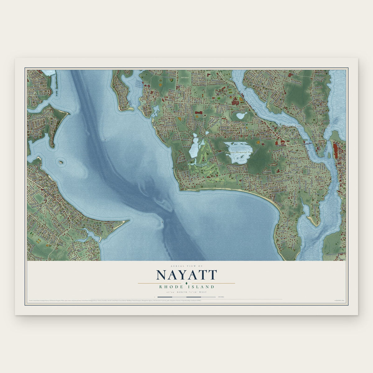
Nayatt, Rhode Island Map Art
Building by building, with labeled streets and shaded relief.
12" x 18" Archival Matte Print
A Map of Home. A Work of Art.
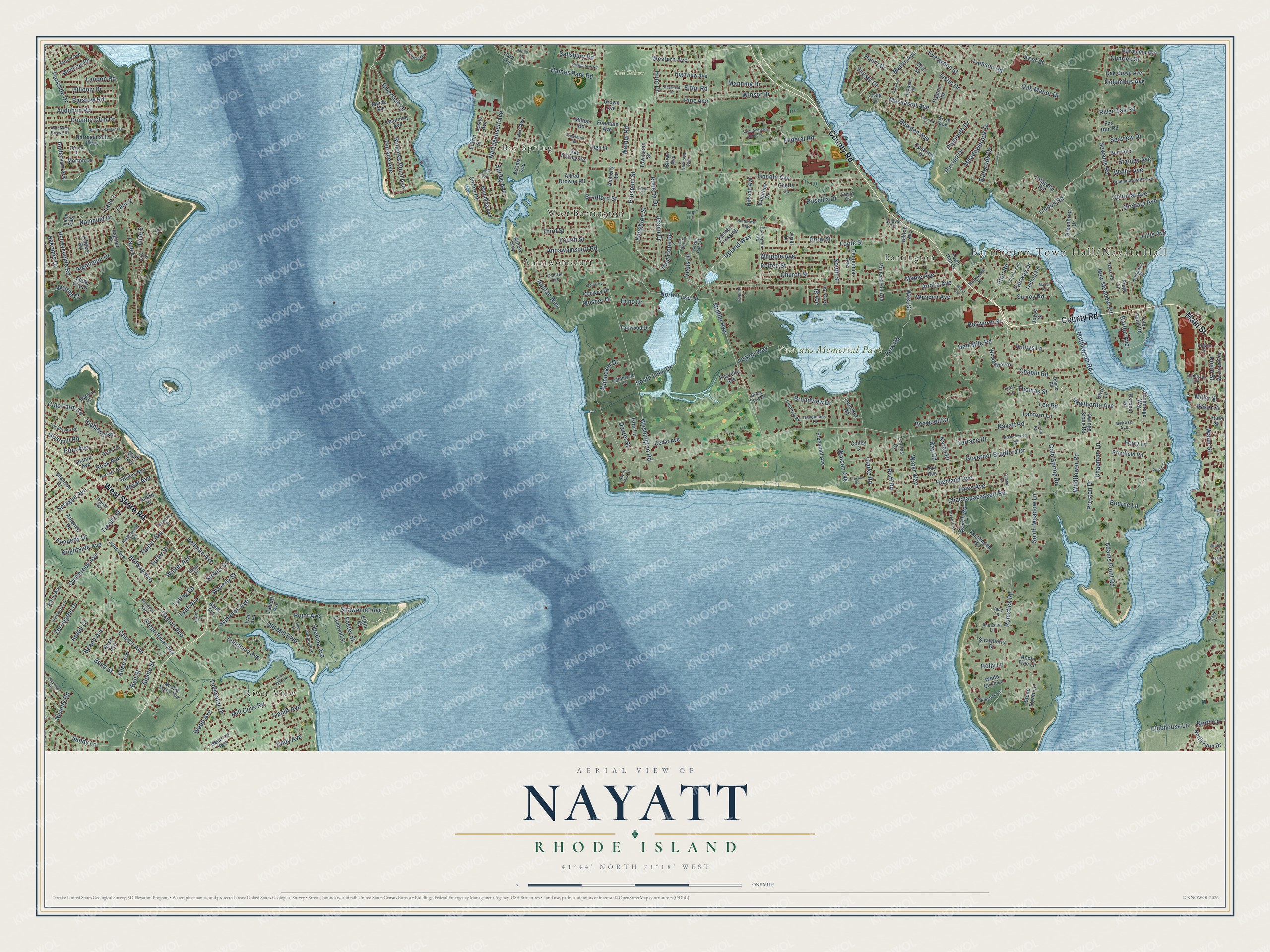
Explore Nayatt, Rhode Island from a whole new perspective. Created using aerial imagery and detailed geographic data, this map captures Nayatt building by building, with labeled streets, familiar landmarks, and shaded topographical relief that highlights the natural contours of the landscape.
Combining modern data with the timeless character of a vintage atlas, this map is just as interesting up close as it is beautiful on the wall. Whether you grew up in Nayatt, spent memorable years there, or call it home today, this unique map is a great way to celebrate a place that means something to you. Zoom in on the preview to look for your street, and then order a print to put your memories on the wall.
Three ways to hang it
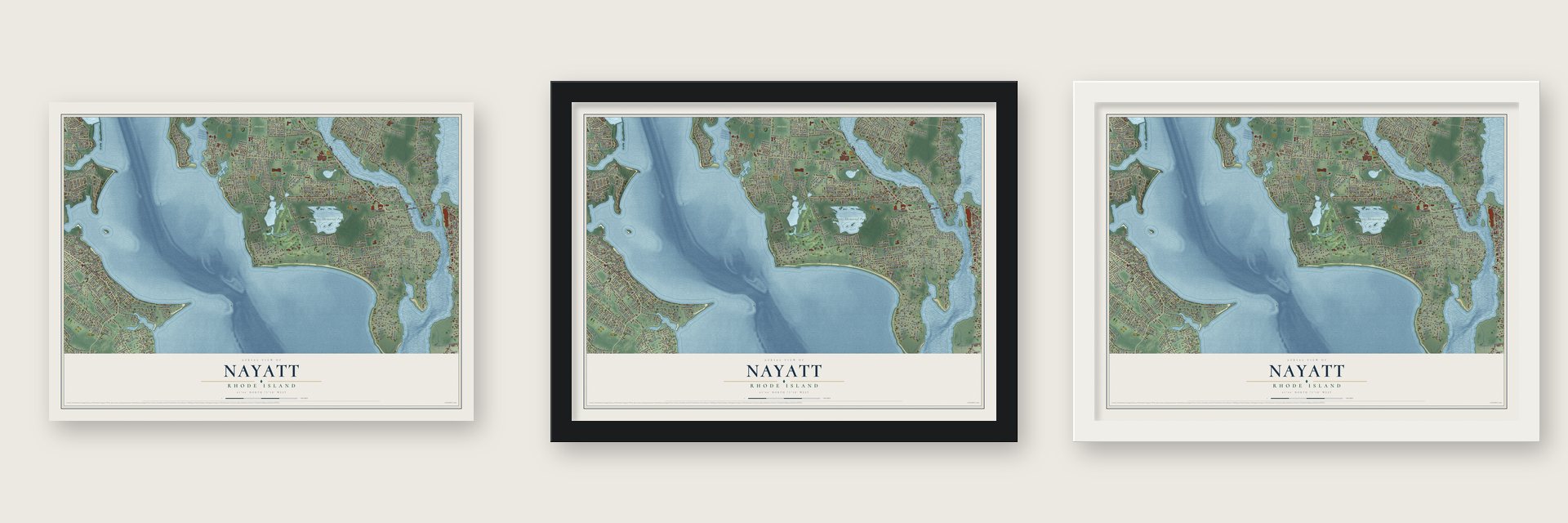
Unframed archival matte, a black wood frame or a white wood frame.
Up close
Geography Worth Displaying
This map was created using accurate cartographic data and authoritative geographic sources, including the U.S. Geological Survey and the Census Bureau. The map brings together terrain, waterways, roads, and building detail. The majority of the streets are labeled, houses are accurately depicted, and the topography is derived from government sources. Combining local data with carefully composed color and shading leads to this beautifully detailed Nayatt artwork for your wall.
Rather than simply showing street outlines, we’ve included as many of the street names as we could reasonably fit on the map while keeping their names legible. Zoom in on the high resolution preview to see exactly what’s on the map. We truly set out to create a statement piece for anyone who loves Nayatt. So whether it’s for you, or a gift for someone you love, we hope this map of Nayatt brings back fond memories.
Read the story behind this map: Detailed Map of Nayatt, Rhode Island.

Find your street
Names on the Nayatt map
Every name below is printed on this map. Look for your street, your school, the park where you played, or the pond down the road.
Places and landmarks7
- Tall Cedars
- Veterans Memorial Park
- River View
- Annawomscutt
- Bay Spring
- West Barrington
- Barrington
Streets and roads347
- County Road
- West Shore Road
- Main Street
- Point Avenue
- Prospect Street
- Hawthorne Avenue
- Eton Avenue
- Anderson Avenue
- Nayatt Road
- Washington Road
- Middle Highway
- Rumstick Road
- New Meadow Road
- Sowams Road
- Lincoln Avenue
- Maple Avenue
- Riverside Drive
- Water Street
- Namquid Drive
- Governor Bradford Drive
- Terrace Avenue
- Mathewson Road
- Beach Avenue
- Massasoit Avenue
- Adams Point Road
- Whipple Avenue
- Shawomet Avenue
- Upland Way
- Bullocks Point Avenue
- Church Avenue
Show all 347 streets
- Narragansett Avenue
- Ferry Lane
- South Lake Drive
- Federal Road
- Bellman Avenue
- Walnut Road
- Parkside Drive
- Foote Street
- Tidewater Drive
- Half Mile Road
- North Lake Drive
- Highland Avenue
- Church Street
- Mill Cove Road
- Broadview Drive
- Kent Street
- Meadowbrook Drive
- Linden Road
- Chachapacassett Road
- Sandy Lane
- Houghton Street
- Roffee Street
- Honeysuckle Road
- Winter Avenue
- Bend Street
- Bay Road
- Haines Park Road
- Country Club Drive
- Old Mill Boulevard
- Annawamscutt Road
- Water Way
- Anoka Avenue
- Chapin Road
- Winsor Drive
- Jennys Lane
- Martin Avenue
- Ardway Avenue
- Audubon Road
- Bowden Avenue
- Green River Avenue
- Clubhouse Lane
- Bradford Street
- Algonquin Drive
- Cole Farm Road
- Lane 4
- Damon Avenue
- Symonds Avenue
- Fales Avenue
- Sprague Avenue
- Elm Lane
- Appian Way
- Waseca Avenue
- Economy Avenue
- Clarke Road
- Oak Manor Drive
- Manning Drive
- Bluff Road
- Lippitt Avenue
- Fairway Drive
- Third Street
- Charles Street
- Terrace Drive
- South Meadow Lane
- Overbrook Avenue
- Union Street
- Puritan Drive
- Landon Road
- Allen Avenue
- Lantern Lane
- Park Road
- Torrington Drive
- Gillooly Drive
- Surrey Road
- Brightside Avenue
- Spring Avenue
- Joann Drive
- Roberta Drive
- Watson Avenue
- Wildflower Road
- Cold Spring Road
- Western Avenue
- Lamson Road
- Lee Road
- Royal Avenue
- Barstow Road
- Preston Drive
- Transit Street
- Miller Street
- Pine Avenue
- Rock Avenue
- Shore Drive
- Evergreen Street
- Cady Avenue
- Orchard Avenue
- Lane 1
- Lane 2
- Vialls Drive
- Starbrook Drive
- South Street
- Echo Drive
- Bosworth Street
- Lillis Avenue
- West Street
- Spinnaker Drive
- Lister Drive
- Stanley Avenue
- Kennedy Drive
- Wallis Avenue
- Seaview Drive
- Spadina Avenue
- Colonial Avenue
- Henry Drive
- Sunset Drive
- Legion Way
- Waverly Street
- North Lane
- Beach Road
- Chapman Lane
- Foster Street
- Webb Avenue
- Priscilla Drive
- Fuller Street
- Eton Road
- Salisbury Road
- Columbus Avenue
- Kristen Court
- Opper Avenue
- Plymouth Drive
- Nakomis Drive
- Highland Road
- Stokes Street
- Fourth Street
- Holly Lane
- Barton Avenue
- Pine Cone Drive
- Gristmill Road
- River Oak Road
- Thomas Street
- Belt Street
- Boxwood Court
- Alpine Street
- Bourne Lane
- Novelty Road
- Loring Road
- Brow Street
- Lyall Avenue
- Mosher Drive
- Lane 5
- Baker Street
- Hunt Drive
- Karen Drive
- Dexter Street
- Elton Road
- Arden Court
- Joy Street
- Crown Avenue
- Leslie Avenue
- Narragansett Parkway
- Alfred Drowne Road
- Bay Spring Avenue
- Princes Hill Avenue
- Woodland Road
- Cedar Avenue
- Aspinet Drive
- Anchorage Way
- June Avenue
- Fountain Avenue
- Highview Avenue
- Stone Tower Lane
- Briarfield Road
- Tyler Point Road
- Anthony Road
- Belvedere Avenue
- Dudley Avenue
- Townsend Street
- Lafayette Road
- Blanding Avenue
- Atlantic Crossing
- Hilltop Avenue
- Greenbrier Drive
- Cedar Bay Drive
- Shannon Drive
- Centennial Avenue
- Lake Avenue
- North Farm Drive
- Winthrop Road
- Warren Avenue
- Oak Grove Avenue
- Valentine Drive
- Freemont Avenue
- Americo Drive
- Telford Road
- Nash Avenue
- Owings Stone Road
- Fessenden Road
- White Birch Lane
- Buena Vista Avenue
- Coldwell Street
- Apple Tree Lane
- Paquin Road
- Tallwood Drive
- Adams Avenue
- Hillside Avenue
- Strawberry Drive
- Beatrice Avenue
- Arvin Avenue
- Bluff Avenue
- Channing Avenue
- Overlook Road
- Field Lane
- Morton Drive
- Town Hall Drive
- Elton Avenue
- Burr Avenue
- Conway Drive
- Fox Run Road
- Lane East
- Myrtle Avenue
- Killdeer Road
- Ellis Street
- Allard Street
- Bush Avenue
- Oxford Avenue
- Pezzullo Avenue
- Brown Avenue
- Opechee Drive
- Collins Court
- Bay Avenue
- Harbour Road
- Cherry Lane
- Milton Road
- Edwin Street
- Kirby Street
- Willow Way
- High Street
- Talcott Avenue
- Elgin Street
- State Street
- Olive Lane
- Craig Drive
- Hart Lane
- Colley Court
- Park Avenue
- Joyce Street
- Josal Drive
- Ivan Avenue
- Tiffany Circle
- Winifred Avenue
- Barrington Avenue
- Markwood Drive
- Rumstick Drive
- Melrose Avenue
- Lockhaven Road
- Commonwealth Avenue
- Harvard Avenue
- Devonshire Drive
- Doane Road
- Ann Mary Brown Drive
- Dundas Avenue
- Carousel Drive
- Maplewood Avenue
- Pheasant Lane
- Poplar Avenue
- Meadow Road
- Marine Avenue
- Lorraine Street
- Central Avenue
- Blake Street
- Lighthouse Lane
- Lane 8
- Glenfield Road
- Lee Ann Drive
- Ferrier Drive
- Agawam Road
- Seven Oaks Drive
- Oxford Street
- Hampden Street
- Company Street
- Dana Road
- Harrison Avenue
- Vans Lane
- Sullivan Terrace
- Brick Pond Drive
- Bowen Street
- Saint Andrews School Street
- River Vue Avenue
- Sweetbriar Road
- Blount Circle
- New Britain Drive
- Latham Avenue
- General Hawkins Drive
- Northwest Psge
- Manor Road
- Bloor Street
- Grant Street
- Stratford Road
- Nayatt Point Court
- Sachem Road
- Elmbrook Drive
- Humphreys Road
- Wood Avenue
- Harold Street
- Brentonwood Avenue
- Payne Road
- Deerfield Drive
- Locust Terrace
- Noble Avenue
- Ronald Road
- Woodbury Street
- Richard Street
- Fairview Circle
- Despirito Lane
- Bridge Street
- Beach Street
- Savoy Street
- Haile Street
- Lane 7
Names are listed as they appear on the printed map. Zoom into the product photos to find them.
About Nayatt, Rhode Island
Sharks were sometimes caught from the wharf at Nayatt Point. A well-run boarding house here took in families from Providence and other places. They came to escape the dust, noise and heavy heat of the city. At this point the river suddenly widens and becomes the bay.
Nayatt's houses did not grow up in a careless, haphazard way. Its villas stood on the most scenic sites, with grounds laid out by a simple plan. The owners of the little peninsula meant it to be a home all year, not only a summer camp.
Keep exploring Rhode Island
Nayatt is one of 86 Rhode Island towns we've mapped. Every dot on the map is a print of its own.
The search covers every state, Rhode Island first.
Near Nayatt
Order 2 or more town maps and save 10%. Shown in the size and finish you picked above, so they hang as a set.
- Barrington 12" x 18" / Archival Matte Print $39.99
- Hampden Meadows 12" x 18" / Archival Matte Print $39.99
- Warren 12" x 18" / Archival Matte Print $39.99


More maps nearby: Warwick, Bristol, East Providence, Auburn and Elmwood.
The art of mapping a place
How This Map Was Made
Real places. Remarkable detail. Discover the layers that turn geographic data into a map of home.

The view from above
Aerial imagery reveals the character of the land: woodland, open fields, and the patterns of a place.

The shape of the land
Elevation data brings hills, valleys, and subtle changes in the landscape into view.

The details of home
Roads, waterways, and building footprints come together to make the map feel unmistakably local.

Geography becomes art
Considered color, shading, and typography bring the layers together in a map made for your wall.


Process illustrated with Mendon, Massachusetts. Aerial imagery: USDA NAIP. Terrain: USGS 3D Elevation Program. Map details and finished artwork: KNOWOL.
The Details
About This Print
Choose an archival matte print, or a black or white Ayous wood frame. The archival matte print is unframed.
Select your size and finish above to see the matching product image and price.
Materials & Craftsmanship
A contemporary map with the character of a classic atlas, printed on archival matte paper. Optional frames are made from Ayous wood.
Your printed map does not include the watermark shown in the full-map preview.
Shipping & Delivery
Free shipping within the United States. Every print is made to order in the USA.
Buying a gift? Add a note in your cart and we'll include it. We never put prices in the package.
Prints ship within 2 to 3 business days. Allow 7 to 10 days total from ordering for delivery. Timing may vary during holidays or periods of high order volume.
Read our shipping policy.
Returns and damaged prints
Each print is made to order. Change-of-mind refunds are not available after production.
If your print arrives damaged, misprinted or incorrect, contact support@knowol.com within 30 days of receiving it. Include your order number, photos and a description of the issue.
Read our full refund and replacement policy. For questions about your order, email support@knowol.com.