


Search for another town





Free U.S. delivery 7 to 10 days after you order
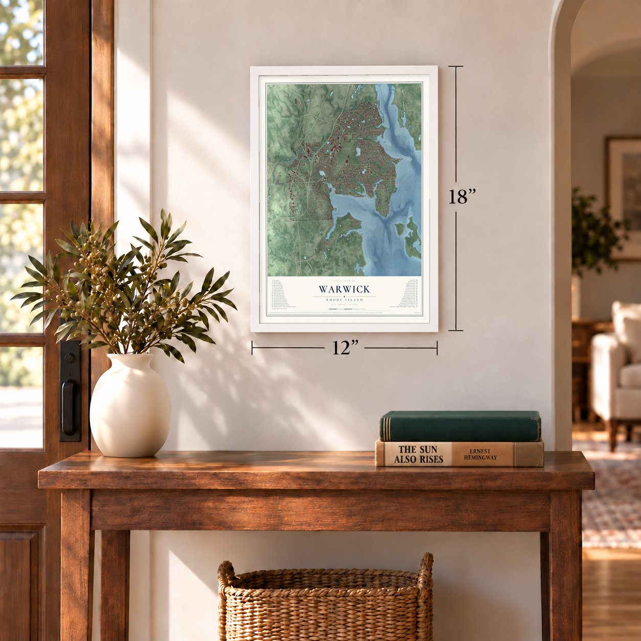
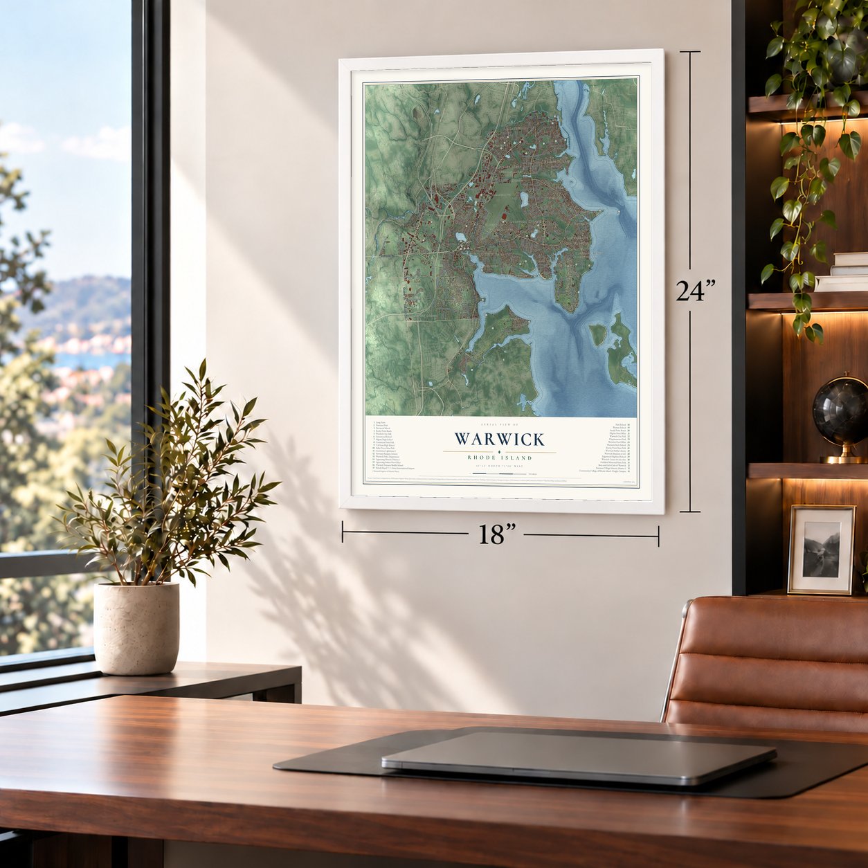
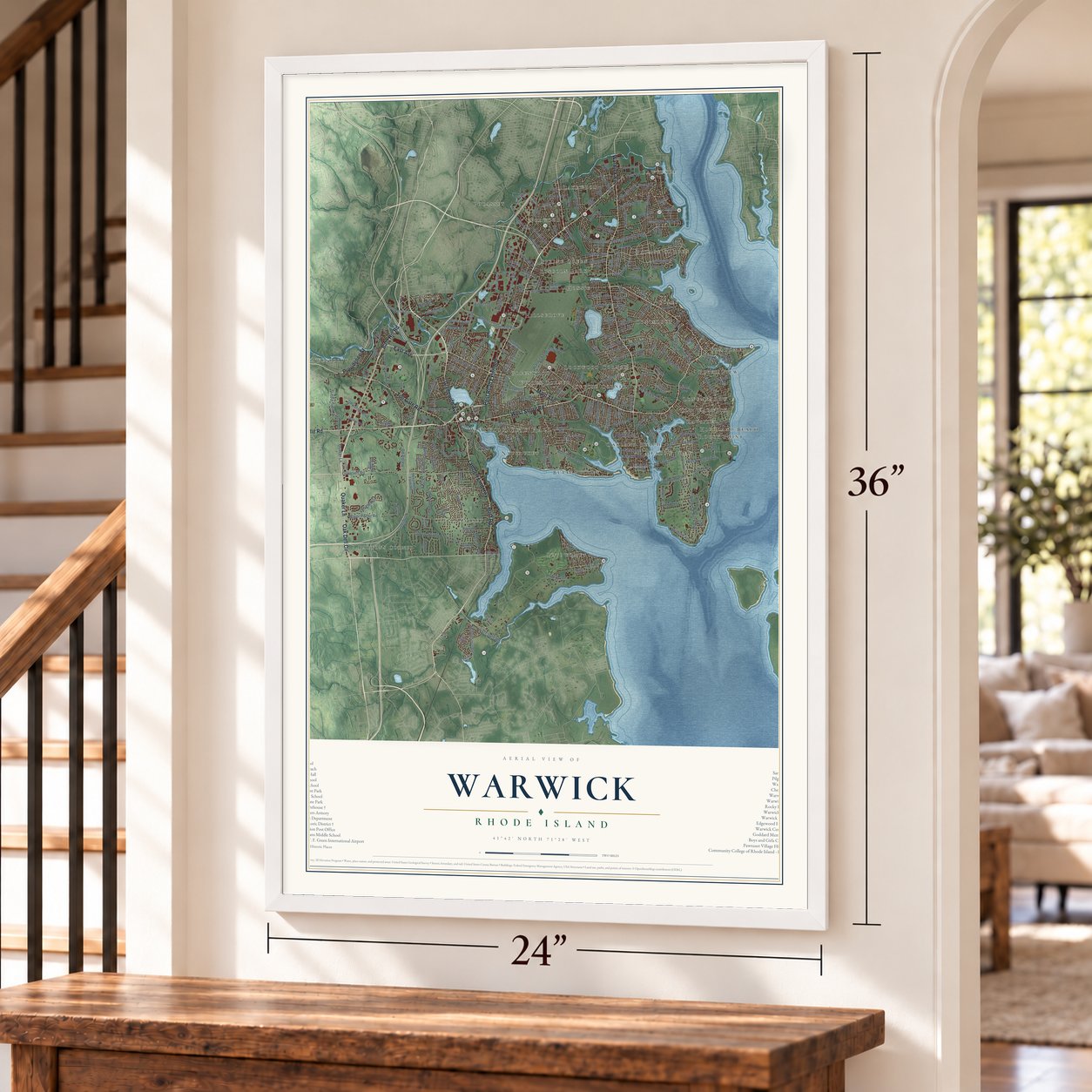
Warwick, Rhode Island Map Art
Building by building, with labeled streets and shaded relief.
12" x 18" Archival Matte Print
A Map of Home. A Work of Art.
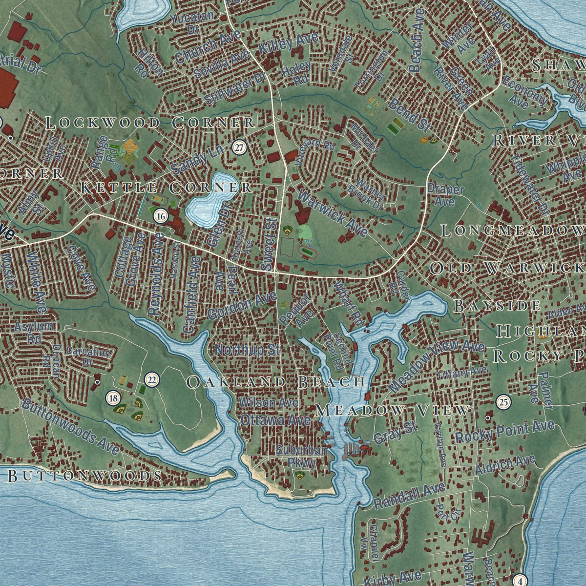
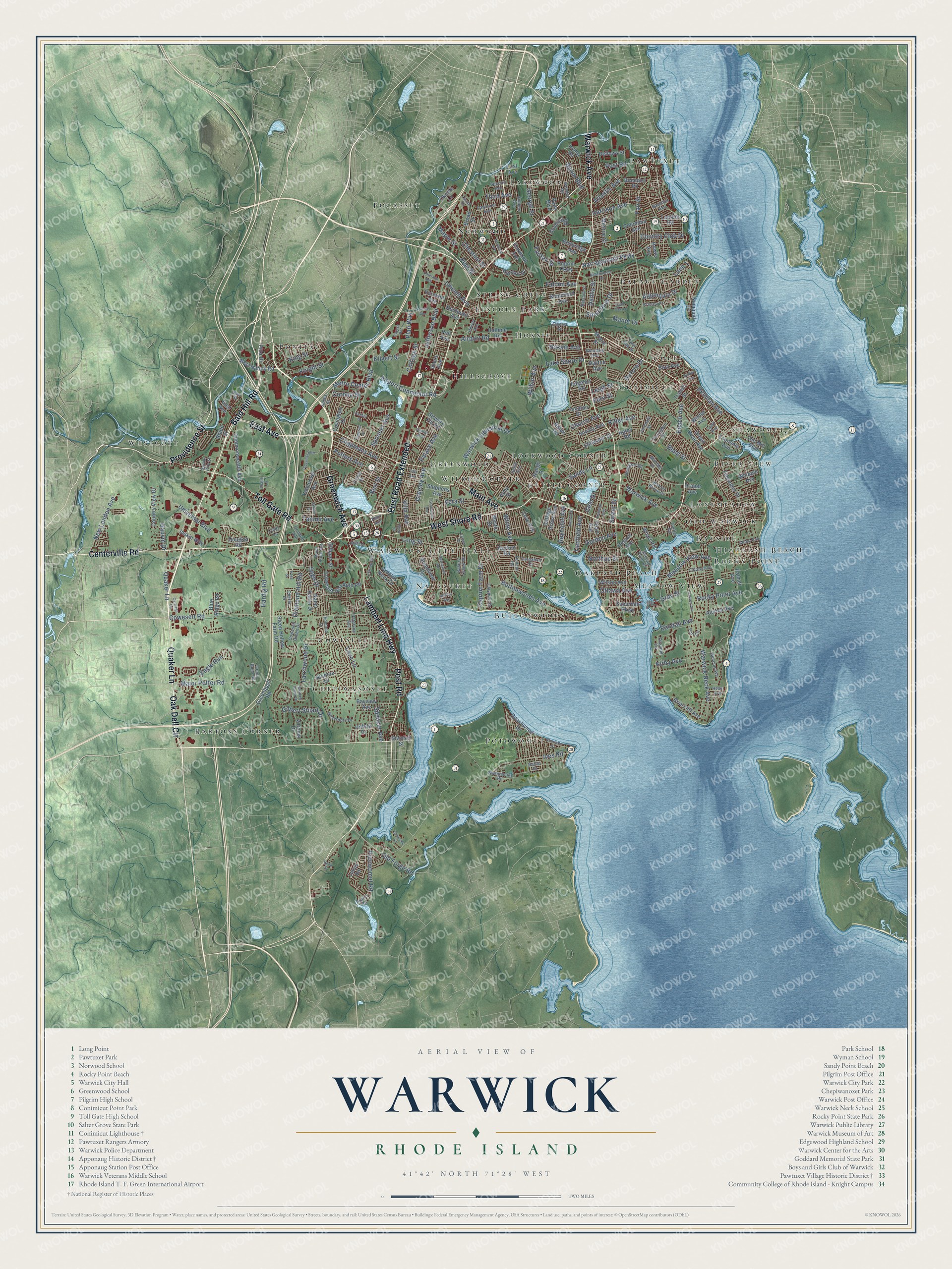
Explore Warwick, Rhode Island from a whole new perspective. Created using aerial imagery and detailed geographic data, this map captures Warwick building by building, with labeled streets, familiar landmarks, and shaded topographical relief that highlights the natural contours of the landscape.
Combining modern data with the timeless character of a vintage atlas, this map is just as interesting up close as it is beautiful on the wall. Whether you grew up in Warwick, spent memorable years there, or call it home today, this unique map is a great way to celebrate a place that means something to you. Zoom in on the preview to look for your street, and then order a print to put your memories on the wall.
Three ways to hang it
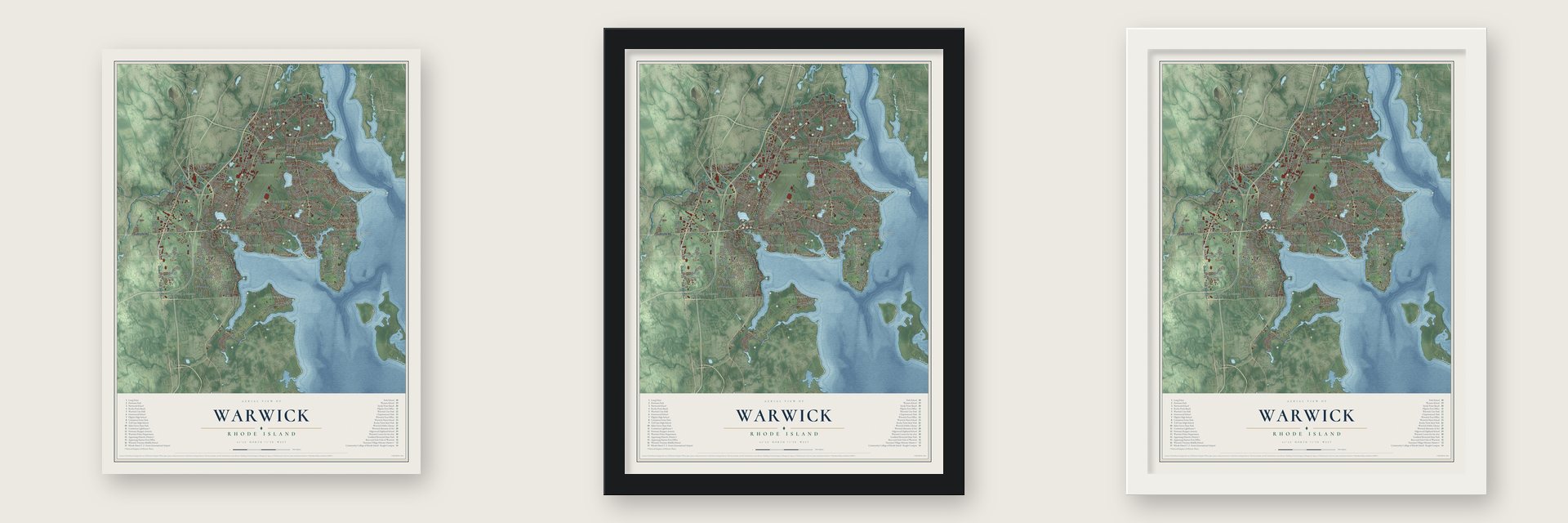
Unframed archival matte, a black wood frame or a white wood frame.
Up close
Geography Worth Displaying
This map was created using accurate cartographic data and authoritative geographic sources, including the U.S. Geological Survey (USGS) and FEMA. The map brings together terrain, waterways, roads, and building detail. The majority of the streets are labeled, houses are accurately depicted, and the topography is derived from government sources. Combining local data with carefully composed color and shading leads to this beautifully detailed Warwick artwork for your wall.
Rather than simply showing street outlines, we’ve included as many of the street names as we could reasonably fit on the map while keeping their names legible. Zoom in on the high resolution preview to see exactly what’s on the map. We truly set out to create a statement piece for anyone who loves Warwick. So whether it’s for you, or a gift for someone you love, we hope this map of Warwick brings back fond memories.
Explore the full map of Warwick, Rhode Island and read about the local places it shows.

Find your street
Names on the Warwick map
Every name below is printed on this map. Look for your street, your school, the park where you played, or the pond down the road.
Places and landmarks33
- Warwick City Hall
- Pawtuxet
- Bartons Corner
- Longmeadow
- Pocasset
- Hillsgrove
- Potowomut
- Oakland Beach
- Coles
- Pontiac
- Cowesett
- Buttonwoods
Show all 33 places
- Westcott
- Greenwood
- Lincoln Park
- Kettle Corner
- Palace Garden
- Wildes Corner
- Shawomet
- Nausauket
- Hoxsie
- Meadow View
- Chepiwanoxet
- Spring Green
- Highland Beach
- Norwood
- Old Warwick
- Lockwood Corner
- Conimicut
- River View
- Lakewood
- Bayside
- Rocky Point
Streets and roads256
- Post Road
- Bald Hill Road
- Lambert Lind Highway
- Centerville Road
- Greenwich Avenue
- Quaker Lane
- Oak Dell Circle
- Providence Street
- Warwick Avenue
- West Shore Road
- Main Avenue
- East Avenue
- Toll Gate Road
- Post Road Extended
- Tanner Avenue
- Metro Center Boulevard
- Cowesett Road
- Major Potter Road
- Jefferson Boulevard
- Kilvert Street
- Airport Connector Road
- Ives Road
- Warwick Neck Avenue
- Narragansett Parkway
- Buttonwoods Avenue
- Sandy Lane
- Church Avenue
- Love Lane
- Airport Road
- New London Avenue
Show all 256 streets
- Rocky Point Avenue
- Old Forge Road
- Long Street
- Fair Street
- Potowomut Road
- Lake Shore Drive
- Gilbert Stuart Drive
- Algonquin Drive
- Warwick Industrial Drive
- Squantum Drive
- Meadow View Avenue
- Diamond Hill Road
- Larchwood Drive
- Atlantic Avenue
- Hardig Road
- Manor Drive
- Beach Avenue
- Knight Street
- Universal Boulevard
- Lincoln Avenue
- Chapmans Avenue
- Fairfax Drive
- Potters Avenue
- Eagle Run
- Randall Avenue
- Byron Boulevard
- Chestnut Street
- Maple Street
- Hoxsie Avenue
- Capron Farm Drive
- Greeley Avenue
- Bellman Avenue
- Spencer Avenue
- Kirby Avenue
- Country Club Drive
- Harrison Avenue
- Palace Avenue
- Burt Street
- George Street
- Canfield Avenue
- Spooner Avenue
- Gordon Avenue
- Reynolds Avenue
- Vera Street
- Killey Avenue
- Dahlia Street
- Ottawa Avenue
- Bend Street
- Cottage Street
- Third Avenue
- Falcon Avenue
- Glen Drive
- Northup Street
- White Avenue
- Pine Street
- Villa Avenue
- Wilbur Avenue
- King Street
- Leigh Street
- Aurora Drive
- Corona Street
- Gauvin Drive
- Sage Drive
- Plan Way
- Sweet Street
- Fern Street
- Gray Street
- Lane 1
- West Natick Road
- Division Street
- Elmwood Avenue
- Puritan Drive
- Namquid Drive
- Commonwealth Avenue
- Tidewater Drive
- Cowesett Hills Apts Road
- Sleep Hollow Farm Road
- Palmer Avenue
- Pequot Avenue
- Arnolds Neck Drive
- Asylum Road
- Varnum Drive
- Suburban Parkway
- Beachwood Drive
- Cove Avenue
- Country View Drive
- Irving Road
- Stillwater Drive
- Draper Avenue
- Columbia Avenue
- Bayview Avenue
- Douglas Road
- Briarcliff Avenue
- Vancouver Avenue
- Monroe Street
- Hilton Road
- Edgehill Road
- Range Road
- Hallene Road
- Aldrich Avenue
- Greenbush Road
- Winter Avenue
- Cottage Grove Avenue
- Lucas Road
- Blanchard Avenue
- Stephens Avenue
- Grandview Drive
- Old Mill Boulevard
- Whipple Avenue
- Cushing Road
- Hilltop Drive
- Pilgrim Parkway
- Sevilla Avenue
- Covington Drive
- Howie Avenue
- Pilla Drive
- Inskip Way
- Wilson Avenue
- Green River Avenue
- Benbridge Avenue
- Gilbane Street
- Bellows Street
- Vermont Avenue
- Yucatan Drive
- Almy Street
- Nanci Karen Drive
- Economy Avenue
- Moore Street
- Benedict Road
- Broad Street
- Wharf Road
- Imera Avenue
- Pearl Avenue
- Eton Avenue
- Landon Road
- Kentucky Avenue
- Blue Ridge Road
- Okeefe Lane
- Dayton Avenue
- Stubtoe Drive
- Transit Street
- Strwbry Fld Road
- First Avenue
- Mystic Drive
- Blade Street
- Haley Road
- Pell Avenue
- Palm Boulevard
- Green Bush Road
- Wendell Road
- Tiffany Avenue
- Channel Vw
- Claypool Drive
- Pawtuxet Avenue
- Warner Brook Drive
- Second Point Road
- Sumner Avenue
- Vineyard Road
- Trinity Street
- Cowesett Green Drive
- Governors Drive
- Edmond Drive
- Twin Oak Drive
- Duncan Road
- Second Avenue
- Wampanoag Road
- Bakers Creek Road
- Beacon Avenue
- Naushon Avenue
- Kristen Court
- Orchard Avenue
- Drum Rock Avenue
- Port Circle
- Torrington Drive
- Elberta Street
- Balsam Street
- Alden Avenue
- Glendale Avenue
- Verndale Street
- Carnation Drive
- Oberlin Drive
- Cindy Lane
- Paterson Avenue
- Dewey Avenue
- Senior City Street
- Uphill Avenue
- Michael Drive
- Austin Road
- Carder Road
- Fisher Avenue
- James Street
- Hess Avenue
- Lavan Street
- Netop Drive
- Lyall Avenue
- Sue Street
- Kent Avenue
- Carriage Drive
- Nausauket Road
- Miantonomo Drive
- Norwood Avenue
- Carlton Avenue
- Haswill Street
- Service Avenue
- Shadow Brook Drive
- Crossings Boulevard
- Charlotte Drive
- Gilbert Street
- Groveland Avenue
- Coveside Court
- Colorado Avenue
- Harrop Avenue
- Halifax Drive
- Apple Tree Lane
- Access Road
- Health Lane
- Taft Avenue
- Dudley Avenue
- Imperial Drive
- Kenneth Avenue
- Larson Drive
- Water Street
- Bond Street
- Walton Avenue
- Brett Court
- Irene Street
Names are listed as they appear on the printed map. Zoom into the product photos to find them.
About Warwick, Rhode Island
Warwick is a city of 82,823 people in Kent County, the third-largest in Rhode Island, and its entire eastern side faces the Providence River, Narragansett Bay or Greenwich Bay. Samuel Gorton bought the Shawomett tract from Miantonomi, a Narragansett sachem, paying 144 fathoms of wampum, and settled there in 1642. The purchase also covered the land that is now Coventry and West Warwick.
Sacononoco and Pumham, two more sachems, said they had never agreed to the sale and placed their land under Massachusetts. In 1643 Massachusetts sent militia to arrest Gorton and his followers, and most of the Gortonists surrendered; only three held out. Gorton sailed to England for a charter and won it with the help of Robert Rich, second Earl of Warwick, so the settlers named their colony Warwick in his honor.
- The Gaspee burned in 1772In 1772 local patriots boarded the Gaspee, a British revenue schooner sent to enforce the Stamp Act and Townshend Acts in Narragansett Bay. Its commander, Lt. Dudingston, was shot and badly wounded, and many count that wound as the Revolution's first blood. The raiders stripped the ship of its cannons and arms and burned it. Since 1965 Warwick and Cranston have held Gaspee Days each June, with a parade and a reenactment at Pawtuxet Park.
- Rocky Point, from 1847Captain William Winslow was serving dinners at Rocky Point by 1847, and his park grew into one of the state's most popular attractions. Crowds rode the Skyliner and the Corkscrew loop coaster, and the Shore Dinner Hall seated more than 4,000 people, who came to eat clam cakes and chowder. Tryouts for the 1936 Olympics were held in the park's salt-water pool.
- The light off Conimicut PointConimicut Point is where the Providence River ends and Narragansett Bay begins. The sparkplug lighthouse off the point went up in the early 1880s on a pneumatic caisson, replacing a light from 1868, and it was among the last acetylene lights changed over to electricity. It joined the National Register in 1988, and the city took it over in 2004.
- Apponaug, place of oystersApponaug sits on a cove of Greenwich Bay, and its name comes from a Narragansett word meaning "place of oysters." It grew into the center of the city, home to Warwick City Hall, the police and fire headquarters and the post office. When the state rerouted traffic through the village in the 1960s, it built a one-way rotary that was supposed to be temporary, and the rotary is still there.
Keep exploring Rhode Island
Warwick is one of 86 Rhode Island towns we've mapped. Every dot on the map is a print of its own.
The search covers every state, Rhode Island first.
Near Warwick
Order 2 or more town maps and save 10%. Shown in the size and finish you picked above, so they hang as a set.
- Nayatt 12" x 18" / Archival Matte Print $39.99
- Auburn 12" x 18" / Archival Matte Print $39.99
- West Warwick 12" x 18" / Archival Matte Print $39.99


More maps nearby: Barrington, Cranston, East Greenwich, Frenchtown and Elmwood.
The art of mapping a place
How This Map Was Made
Real places. Remarkable detail. Discover the layers that turn geographic data into a map of home.

The view from above
Aerial imagery reveals the character of the land: woodland, open fields, and the patterns of a place.

The shape of the land
Elevation data brings hills, valleys, and subtle changes in the landscape into view.

The details of home
Roads, waterways, and building footprints come together to make the map feel unmistakably local.

Geography becomes art
Considered color, shading, and typography bring the layers together in a map made for your wall.


Process illustrated with Mendon, Massachusetts. Aerial imagery: USDA NAIP. Terrain: USGS 3D Elevation Program. Map details and finished artwork: KNOWOL.
The Details
About This Print
Choose an archival matte print, or a black or white Ayous wood frame. The archival matte print is unframed.
Select your size and finish above to see the matching product image and price.
Materials & Craftsmanship
A contemporary map with the character of a classic atlas, printed on archival matte paper. Optional frames are made from Ayous wood.
Your printed map does not include the watermark shown in the full-map preview.
Shipping & Delivery
Free shipping within the United States. Every print is made to order in the USA.
Buying a gift? Add a note in your cart and we'll include it. We never put prices in the package.
Prints ship within 2 to 3 business days. Allow 7 to 10 days total from ordering for delivery. Timing may vary during holidays or periods of high order volume.
Read our shipping policy.
Returns and damaged prints
Each print is made to order. Change-of-mind refunds are not available after production.
If your print arrives damaged, misprinted or incorrect, contact support@knowol.com within 30 days of receiving it. Include your order number, photos and a description of the issue.
Read our full refund and replacement policy. For questions about your order, email support@knowol.com.