
Search for another town





Free U.S. delivery 7 to 10 days after you order
Brooklyn, Connecticut Map Art
Building by building, with labeled streets and shaded relief.
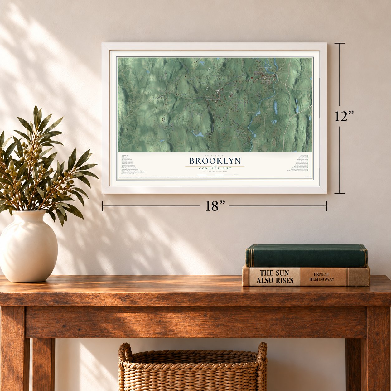
12" x 18" Archival Matte Print
A Map of Home. A Work of Art.
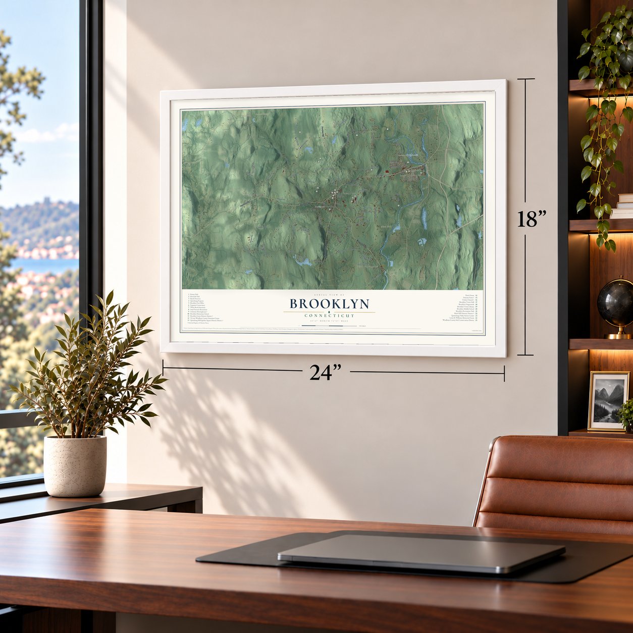
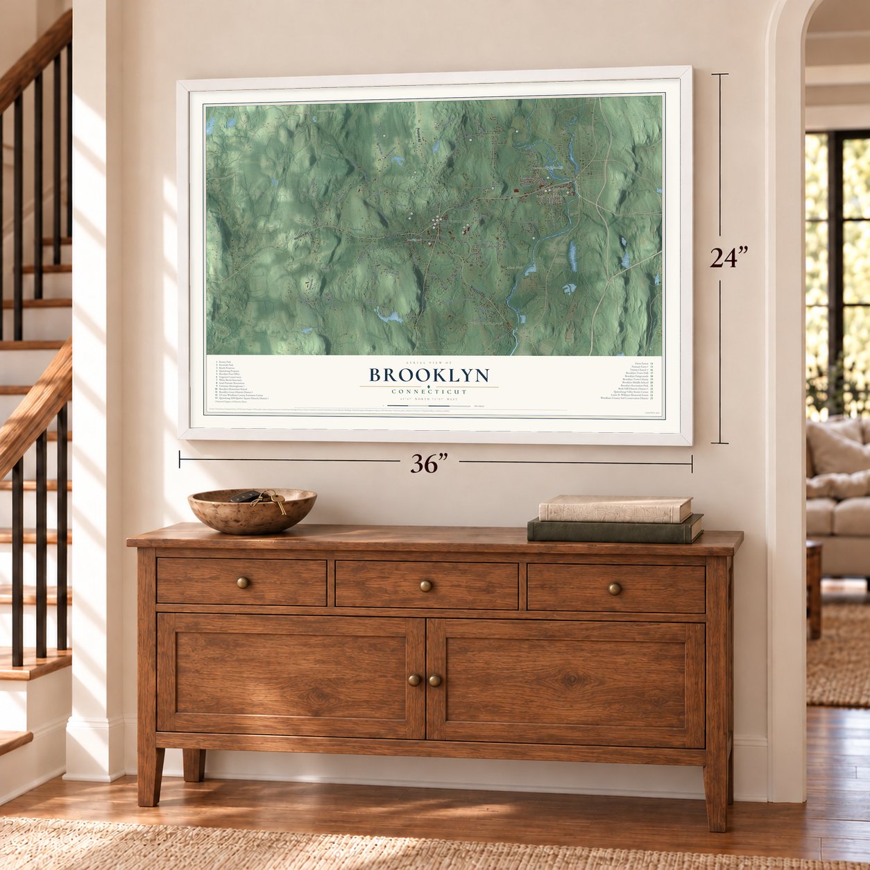
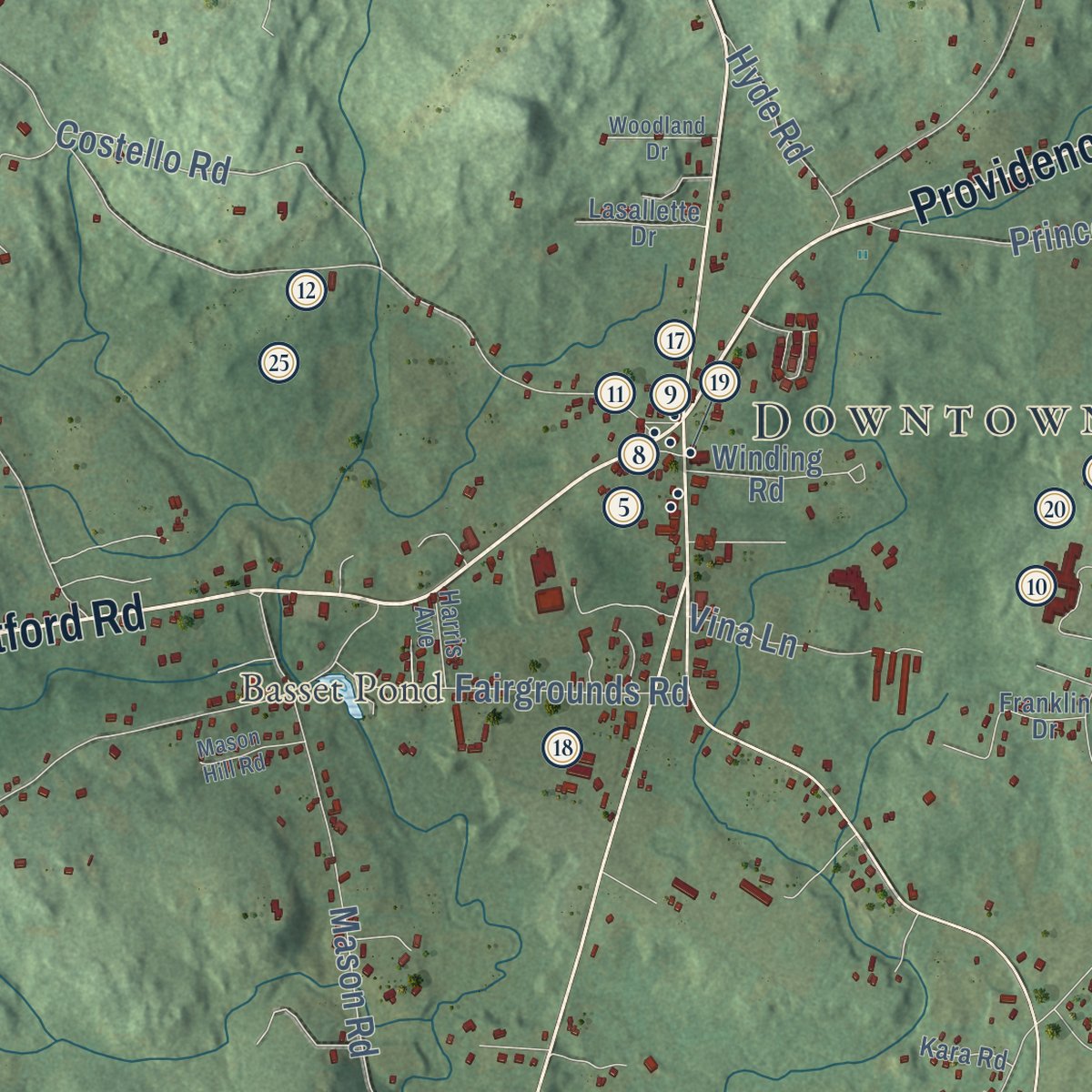
Explore Brooklyn, Connecticut from a whole new perspective. Created using aerial imagery and detailed geographic data, this map captures Brooklyn building by building, with labeled streets, familiar landmarks, and shaded topographical relief that highlights the natural contours of the landscape.
Combining modern data with the timeless character of a vintage atlas, this map is just as interesting up close as it is beautiful on the wall. Whether you grew up in Brooklyn, spent memorable years there, or call it home today, this unique map is a great way to celebrate a place that means something to you. Zoom in on the preview to look for your street, and then order a print to put your memories on the wall.

Three ways to hang it
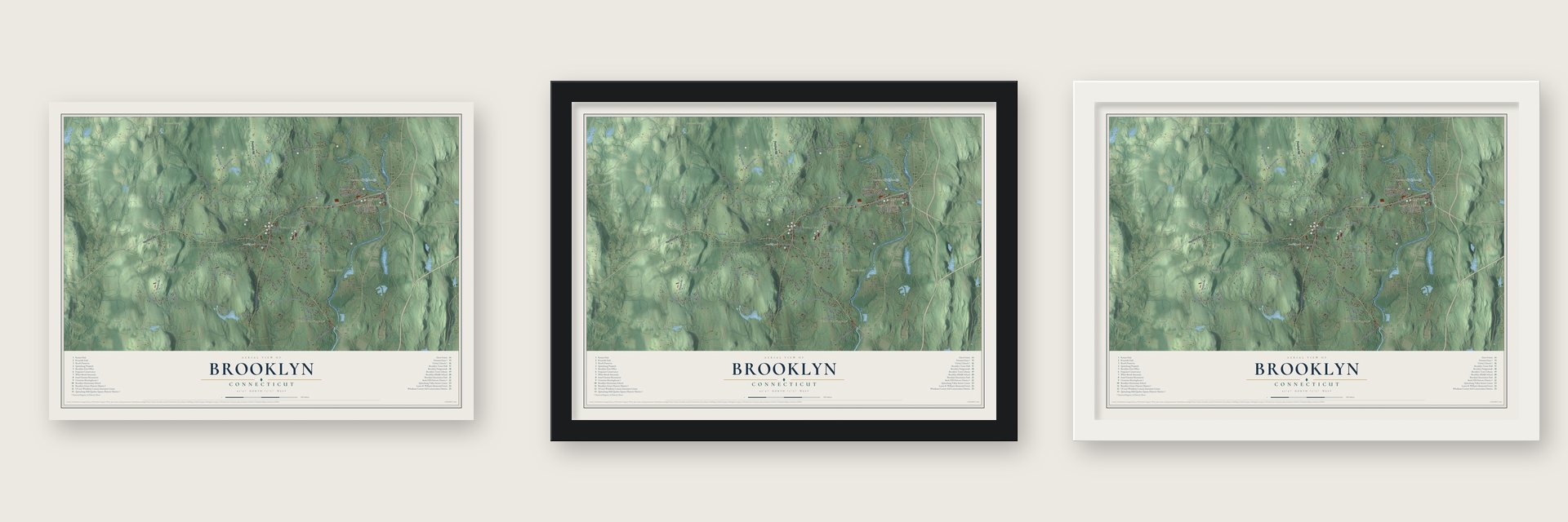
Unframed archival matte, a black wood frame or a white wood frame.
Up close
Geography Worth Displaying
This map was created using accurate cartographic data and authoritative geographic sources, including the U.S. Geological Survey (USGS) and FEMA. The map brings together terrain, waterways, roads, and building detail. The majority of the streets are labeled, houses are accurately depicted, and the topography is derived from government sources. Combining local data with carefully composed color and shading leads to this beautifully detailed Brooklyn artwork for your wall.
Rather than simply showing street outlines, we’ve included as many of the street names as we could reasonably fit on the map while keeping their names legible. Zoom in on the high resolution preview to see exactly what’s on the map. We truly set out to create a statement piece for anyone who loves Brooklyn. So whether it’s for you, or a gift for someone you love, we hope this map of Brooklyn brings back fond memories.
Explore the full map of Brooklyn, Connecticut and read about the local places it shows.

Find your street
Names on the Brooklyn map
Every name below is printed on this map. Look for your street, your school, the park where you played, or the pond down the road.
Places and landmarks11
- Downtown
- Quebec
- East Brooklyn
- Allen Hill
- Alworth Hill
- Barrett Ridge
- Between the Rivers Neck
- Baker Pond
- Basset Pond
- West Wauregan
- Stetson Corner
Streets and roads89
- Hartford Road
- Providence Road
- Pomfret Road
- Canterbury Road
- Wauregan Road
- Preston Road
- Allen Hill Road
- Wolf Den Road
- Windham Road
- Church Street
- South Street
- Stetson Road
- Day Street
- Woodward Road
- Tripp Hollow Road
- Barrett Hill Road
- Gorman Road
- Paradise Drive
- Bailey Woods Road
- Tatnic Road
- Cherry Hill Road
- Beecher Road
- Beechers Road
- Herrick Road
- Brown Road
- Rukstella Road
- Mason Road
- Laurel Hill Road
- Spaulding Road
- Bush Hill Road
Show all 89 streets
- Prince Hill Road
- Darby Road
- Brooklyn Road
- Elliott Road
- Creamery Brook Road
- Tatnic Hill Road
- Ennis Road
- Fitzgerald Road
- Anderson Road
- Fortin Drive
- Costello Road
- Fairgrounds Road
- Grand View Terrace
- Westview Drive
- Valentine Road
- Appell Road
- North Society Road
- Pomfret Landing Road
- Maynard Road
- Sunset Terrace
- Pheasant Lane
- Almada Drive
- Robbins Road
- Bunny Lane
- Vina Lane
- Hyde Road
- Brickyard Road
- Erin Drive
- Brenn Road
- Short Street
- Bass Lane
- Christian Hill Road
- Old Kimball Road
- Malbone Lane
- Winding Road
- Salmon Drive
- River Farm Drive
- Grass Road
- Sunset Drive
- Cote Drive
- South Main Street
- River Walk Drive
- Proulx Street
- Green Drive
- Fairway Drive
- Franklin Drive
- Lasallette Drive
- Francis Lane
- Kara Road
- Harris Avenue
- Hugh Drive
- Elm Street
- Juniper Way
- Bailey Street
- Pappas Boulevard
- Suzanne Lane
- Woodland Drive
- Mason Hill Road
- Plaza Street
Names are listed as they appear on the printed map. Zoom into the product photos to find them.
About Brooklyn, Connecticut
Brooklyn is a town of 8,450 people in Windham County, with the Quinebaug River, once called the Brook Line, along its eastern edge. The Wabaquasset held this land before English families came in the late 1600s, and it began as Mortlake, a manor where Sir John Blackwell planned a colony that never took shape. Governor Jonathan Belcher of Massachusetts bought it from Blackwell's son in 1713, and the tract stayed mostly wild for nearly thirty years.
When settlers asked to become a town in 1728, the upper house refused, because no one wanted to cross a man as powerful as Belcher. The church society went by Mortlake until 1754, when it took the name Brooklyn. In May 1786 Brooklyn finally became a town of its own, made from parts of Canterbury and Pomfret, and its first town meeting was set for June 22.
“this Brooklyn tavern became one of the most noted rendezvous in eastern Connecticut.”
- Putnam's plough in the fieldIsrael Putnam bought 500 acres from Belcher in 1739, raised cattle and sheep, and built the oldest part of his farmhouse on today's Spaulding Road about 1750. In 1767 he moved to the Green and opened a tavern there. When news of Lexington arrived in 1775, he walked away from his plough mid-furrow and set out for Boston still in his work clothes. Putnam Farm joined the National Register in 1982.
- A statue over his gravePutnam died in Brooklyn in 1790 and was laid in an above-ground tomb in the South Cemetery. So many visitors came to the tomb that his remains were eventually taken out of it. The state put up a statue of the general on horseback in 1888, sealing his remains inside its foundation.
- County seat in 1820The Assembly offered in 1819 to give Brooklyn the Windham County courts if the town paid for a court house and jail. Building them cost $6,000, toward which Brooklyn promised $2,500. After their acceptance on July 26, 1820, Brooklyn gained a newspaper, a fire insurance company and, in 1822, the county's first bank. Prudence Crandall stood trial here in 1833, and her night in a condemned murderer's cell earned her sympathy. By 1874 railroad towns drew trade away.
- Malbone's church of 1771When the Congregationalists planned a new meetinghouse, Godfrey Malbone hurried to build an Anglican church first, and he finished Trinity Church in April 1771. It is the oldest surviving Anglican church building in Connecticut and still holds its original box pews, pulpit and reading desk. Trinity Church joined the National Register in 1970.
- The first woman Unitarian ministerThe meetinghouse on the Green went up between 1771 and 1774 and is one of the few church buildings in the state older than the Revolution. Samuel J. May, who stood by Prudence Crandall, preached there, and in 1871 its society ordained Rev. Celia Burleigh, the first woman to become a Unitarian minister. After the 1938 hurricane the building got a new steeple. The Unitarian Meetinghouse joined the National Register in 1972.
Keep exploring Connecticut
Brooklyn is one of 382 Connecticut towns we've mapped. Every dot on the map is a print of its own.
The search covers every state, Connecticut first.
Near Brooklyn
Order 2 or more town maps and save 10%. Shown in the size and finish you picked above, so they hang as a set.
- East Brooklyn 12" x 18" / Archival Matte Print $39.99
- Wauregan 12" x 18" / Archival Matte Print $39.99
- Danielson 12" x 18" / Archival Matte Print $39.99

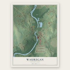
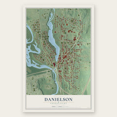
More maps nearby: Dayville, Hampton, Pomfret, Killingly and Moosup.
The art of mapping a place
How This Map Was Made
Real places. Remarkable detail. Discover the layers that turn geographic data into a map of home.

The view from above
Aerial imagery reveals the character of the land: woodland, open fields, and the patterns of a place.

The shape of the land
Elevation data brings hills, valleys, and subtle changes in the landscape into view.

The details of home
Roads, waterways, and building footprints come together to make the map feel unmistakably local.

Geography becomes art
Considered color, shading, and typography bring the layers together in a map made for your wall.


Process illustrated with Mendon, Massachusetts. Aerial imagery: USDA NAIP. Terrain: USGS 3D Elevation Program. Map details and finished artwork: KNOWOL.
The Details
About This Print
Choose an archival matte print, or a black or white Ayous wood frame. The archival matte print is unframed.
Select your size and finish above to see the matching product image and price.
Materials & Craftsmanship
A contemporary map with the character of a classic atlas, printed on archival matte paper. Optional frames are made from Ayous wood.
Your printed map does not include the watermark shown in the full-map preview.
Shipping & Delivery
Free shipping within the United States. Every print is made to order in the USA.
Buying a gift? Add a note in your cart and we'll include it. We never put prices in the package.
Prints ship within 2 to 3 business days. Allow 7 to 10 days total from ordering for delivery. Timing may vary during holidays or periods of high order volume.
Read our shipping policy.
Returns and damaged prints
Each print is made to order. Change-of-mind refunds are not available after production.
If your print arrives damaged, misprinted or incorrect, contact support@knowol.com within 30 days of receiving it. Include your order number, photos and a description of the issue.
Read our full refund and replacement policy. For questions about your order, email support@knowol.com.