
Search for another town





Free U.S. delivery 7 to 10 days after you order
Killingly, Connecticut Map Art
Building by building, with labeled streets and shaded relief.
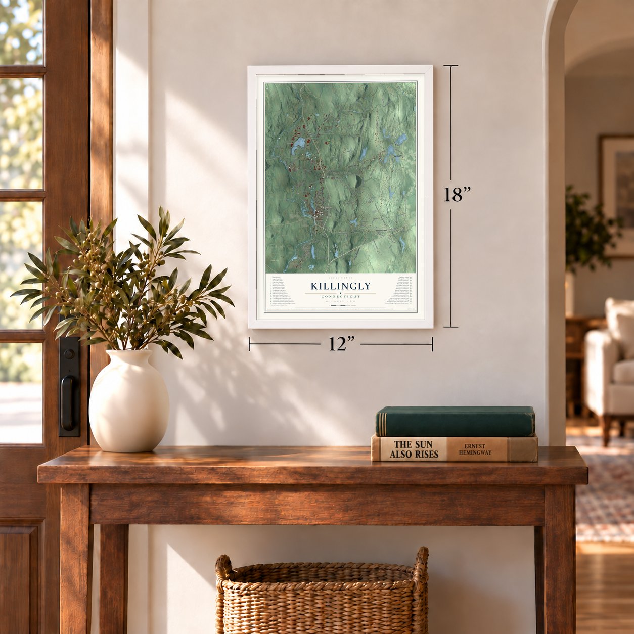
12" x 18" Archival Matte Print
A Map of Home. A Work of Art.
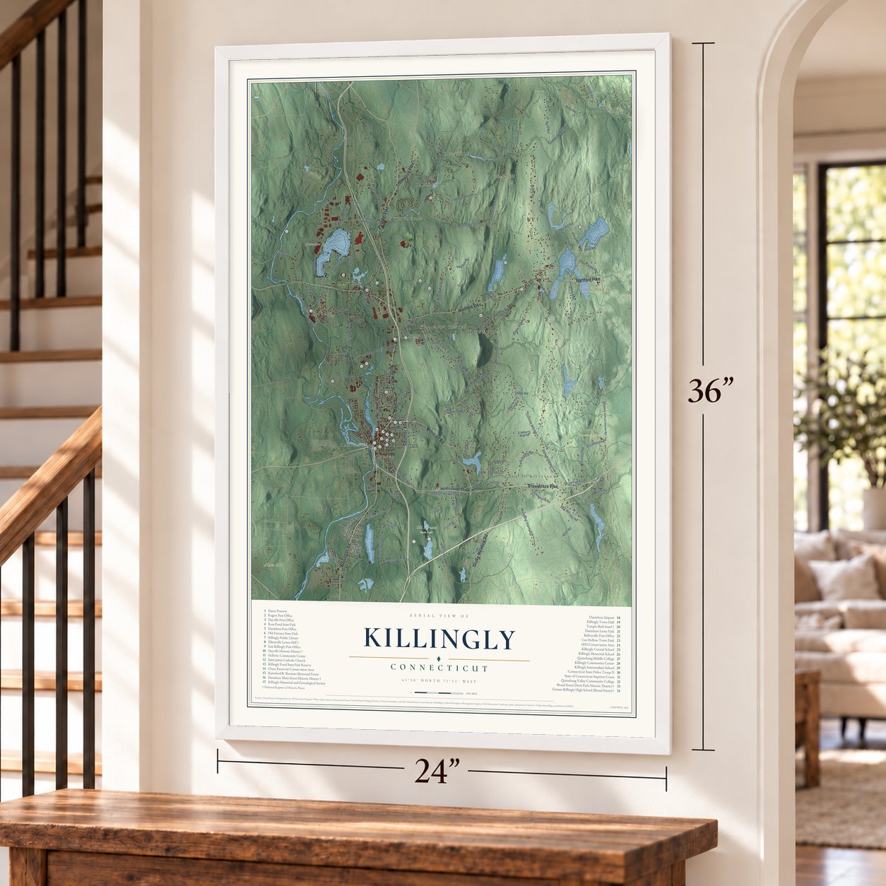
Explore Killingly, Connecticut from a whole new perspective. Created using aerial imagery and detailed geographic data, this map captures Killingly building by building, with labeled streets, familiar landmarks, and shaded topographical relief that highlights the natural contours of the landscape.
Combining modern data with the timeless character of a vintage atlas, this map is just as interesting up close as it is beautiful on the wall. Whether you grew up in Killingly, spent memorable years there, or call it home today, this unique map is a great way to celebrate a place that means something to you. Zoom in on the preview to look for your street, and then order a print to put your memories on the wall.

Three ways to hang it
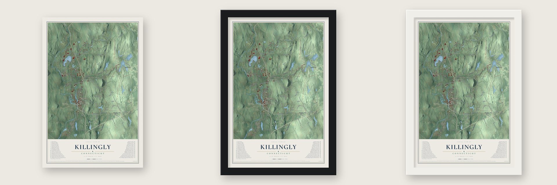
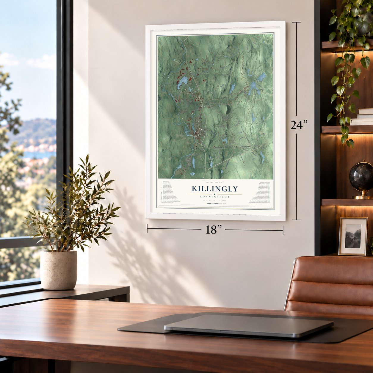
Unframed archival matte, a black wood frame or a white wood frame.
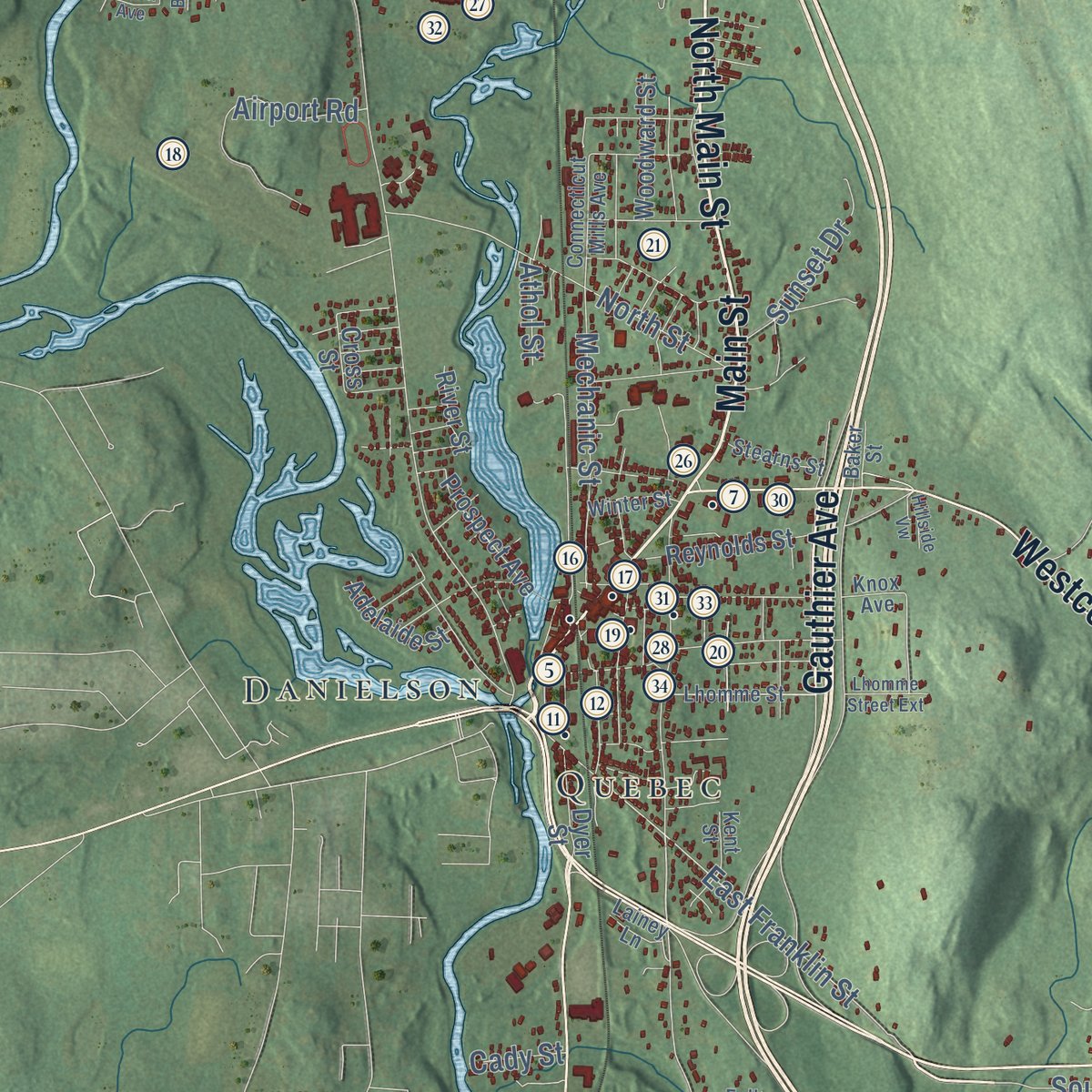
Up close
Geography Worth Displaying
This map was created using accurate cartographic data and authoritative geographic sources, including the U.S. Geological Survey (USGS) and FEMA. The map brings together terrain, waterways, roads, and building detail. The majority of the streets are labeled, houses are accurately depicted, and the topography is derived from government sources. Combining local data with carefully composed color and shading leads to this beautifully detailed Killingly artwork for your wall.
Rather than simply showing street outlines, we’ve included as many of the street names as we could reasonably fit on the map while keeping their names legible. Zoom in on the high resolution preview to see exactly what’s on the map. We truly set out to create a statement piece for anyone who loves Killingly. So whether it’s for you, or a gift for someone you love, we hope this map of Killingly brings back fond memories.
Explore the full map of Killingly, Connecticut and read about the local places it shows.

Find your street
Names on the Killingly map
Every name below is printed on this map. Look for your street, your school, the park where you played, or the pond down the road.
Places and landmarks19
- Downtown
- Pineville
- Allen Hill
- Alva Pond Hill
- Bear Hill
- Acme Pond
- Alexander Lake
- Old Furnace State Park
- Quandoc Conservation Area
- South Killingly
- Rogers
- Danielson
Show all 19 places
- Attawaugan
- Elmville
- Ballouville
- Dayville
- Killingly Center
- Quebec
- East Killingly
Streets and roads152
- Main Street
- Putnam Pike
- Wauregan Road
- Providence Pike
- North Main Street
- Gauthier Avenue
- Hartford Pike
- Westcott Road
- Snake Meadow Road
- Thompson Pike
- Kelly Road
- Green Hollow Road
- Coomer Hill Road
- East Franklin Street
- Cutler Road
- Bailey Hill Road
- Cook Hill Road
- Chestnut Hill Road
- Upper Maple Street
- Valley Road
- North Road
- Maple Street
- Lake Road
- Ledge Road
- Breakneck Hill Road
- Mashentuck Road
- Mason Hill Road
- Bear Hill Road
- River Road
- Slater Hill Road
Show all 152 streets
- Pratt Road
- Ross Road
- Yosemite Valley Road
- Saw Mill Hill Road
- Margaret Henry Road
- Quinns Hill Road
- State Avenue
- Tucker District Road
- Brickhouse Road
- Stone Road
- Tracy Road
- Pond Road
- South Frontage Road
- Terwilleger Road
- Burlingame Road
- Wright Road
- Litchfield Avenue
- Halls Hill Road
- Chicken Farm Road
- Geer Road
- North Street
- Taos Drive
- Country Club Road
- Lafantasie Road
- Roth Road
- Soap Street
- Tillinghast Road
- Griffiths Road
- Louisa Viens Drive
- Pineville Road
- Mechanic Street
- Laurel Drive
- Airport Road
- South Shore Road
- Riley Chase Road
- Dog Hill Road
- Shepard Hill Road
- Chase Road
- Beaman Road
- Hughes Road
- Dam Road
- Viall Road
- David Avenue
- Sunset Drive
- Quinebaug Drive
- Picabo Street
- Steven Street
- Blood Road
- Pike Lane
- Taft Street
- Otis Street
- Davis Street
- Athol Street
- Cady Street
- Williamsville Road
- Attawaugan Crossing Road
- Prospect Avenue
- Cranberry Bog Road
- Shippee School House Road
- North Shore Road
- Rock Avenue
- Ware Road
- Putnam Road
- Pettingill Road
- Reynolds Street
- Hubbard Hill Road
- Dark Lantern Hill Road
- Island Road
- High Street
- Kenneth Drive
- Pine Knolls Drive
- Woodward Street
- Cotton Bridge Road
- Coomer Hill Extended
- Boys Avenue
- Adelaide Street
- Nauset Avenue
- Korpita Road
- Klocek Road
- Dubay Drive
- Red Oak Drive
- Gendreau Drive
- Dyer Street
- Ernest Way
- Henry Road
- Polly Avenue
- Junior Avenue
- Mason Street
- River Street
- Cross Street
- Horse Hill Road
- Weeks Lane
- Carol Avenue
- Foster Street
- Kies Road
- North Frontage Road
- Ballouville Road
- Knox Avenue
- Vezina Drive
- Alexander Park Way
- Lhomme Street
- Edwardsen Street
- Connecticut Mills Avenue
- Stearns Street
- Provost Lane
- Winter Street
- Fall Brook Road
- Welsh Street
- Lens Avenue
- Kent Street
- Baker Street
- Lainey Lane
- Mockingbird Drive
- Brookside Drive
- Ferland Drive
- Pleasant Street
- Birchwood Drive
- Lhomme Street Extension
- Hillside Vw
- Laurel Point Drive
- Forbes Road
- Luzon Avenue
Names are listed as they appear on the printed map. Zoom into the product photos to find them.
About Killingly, Connecticut
Killingly is a town of 17,752 people in Windham County, in Connecticut's northeast corner beside Rhode Island. The land once belonged to the Quinebaug people, and in 1653 John Winthrop the younger received a grant to it. English colonists arrived in 1700 and called their settlement Aspinock. The town became official in May 1708, and when Governor Saltonstall was asked to choose a name, he offered "Kellingly," after his family's lands in Yorkshire; the spelling changed later.
The town grew as a chain of mill villages on the Quinebaug and Five Mile rivers and Whetstone Brook. In 1809 the Danielson brothers, James and Hezekiah, opened a cotton spinning mill, and the village of Danielson began to grow around it. By 1837 John Warner Barber counted 24,428 cotton spindles in town and called Killingly the state's leading maker of cotton goods. By 1840, no other town in Windham County had as many people.
“Killingly's strength lies in her rocks and rivers.”
- A ring found at seaThe Native people knew Alexander's Lake, near Dayville, as Lake Mashapaug. John Warner Barber wrote in 1837 that Nell Alexander, crossing from Scotland, found a gold ring lying on deck that no one claimed. He pawned it for small goods, sold them around Boston and Roxbury, and earned enough to redeem the ring. In time he bought 3,500 acres in Killingly and made his home beside the lake in 1720. His ring passed from one Nell to the next.
- Main Street ran like a riverA stock company built Music Hall in Danielsonville in 1876 for $38,000. It had 800 seats, yet 1,000 people packed in to hear lecturer John B. Gough; it is now the town hall. In February 1886, warm rain on deep snow flooded Main Street, and crowds spent the day watching the Five Mile River pound the iron bridges. When the upper bridge began sinking on one side, Selectman Burlingame had long timbers chained to it, and it held.
- A 175-foot dropWhetstone Brook falls 175 feet in about a mile as it comes down from Chestnut Hill, and in 1889 that stretch powered five mills. The Elliottville Lower Mill, built about 1850 on Peep Toad Road, handled spinning and readied warps for the upper mill run by the same Elliottville company. Its dam, millpond, raceway and stone arch bridge survive too.
- A patent in 1809Mary Dixon Kies was born and lived in South Killingly. In 1809 she received a patent for her way of weaving straw together with silk or thread. No woman in the United States had received a patent before her.
- Built by its membersAfter the Second World War, Holocaust survivors settled around Killingly and joined the Jewish families already living here to start a congregation. Members helped build Temple Beth Israel with their own hands, starting in 1951, and dedicated it in 1961 as one of Connecticut's first Modernist synagogues. Today the building serves as a cultural and historical center.
Keep exploring Connecticut
Killingly is one of 382 Connecticut towns we've mapped. Every dot on the map is a print of its own.
The search covers every state, Connecticut first.
Near Killingly
Order 2 or more town maps and save 10%. Shown in the size and finish you picked above, so they hang as a set.
- Dayville 12" x 18" / Archival Matte Print $39.99
- Danielson 12" x 18" / Archival Matte Print $39.99
- East Brooklyn 12" x 18" / Archival Matte Print $39.99

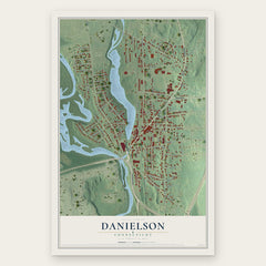

More maps nearby: Putnam, Brooklyn, Wauregan, Pomfret and Moosup.
The art of mapping a place
How This Map Was Made
Real places. Remarkable detail. Discover the layers that turn geographic data into a map of home.

The view from above
Aerial imagery reveals the character of the land: woodland, open fields, and the patterns of a place.

The shape of the land
Elevation data brings hills, valleys, and subtle changes in the landscape into view.

The details of home
Roads, waterways, and building footprints come together to make the map feel unmistakably local.

Geography becomes art
Considered color, shading, and typography bring the layers together in a map made for your wall.


Process illustrated with Mendon, Massachusetts. Aerial imagery: USDA NAIP. Terrain: USGS 3D Elevation Program. Map details and finished artwork: KNOWOL.
The Details
About This Print
Choose an archival matte print, or a black or white Ayous wood frame. The archival matte print is unframed.
Select your size and finish above to see the matching product image and price.
Materials & Craftsmanship
A contemporary map with the character of a classic atlas, printed on archival matte paper. Optional frames are made from Ayous wood.
Your printed map does not include the watermark shown in the full-map preview.
Shipping & Delivery
Free shipping within the United States. Every print is made to order in the USA.
Buying a gift? Add a note in your cart and we'll include it. We never put prices in the package.
Prints ship within 2 to 3 business days. Allow 7 to 10 days total from ordering for delivery. Timing may vary during holidays or periods of high order volume.
Read our shipping policy.
Returns and damaged prints
Each print is made to order. Change-of-mind refunds are not available after production.
If your print arrives damaged, misprinted or incorrect, contact support@knowol.com within 30 days of receiving it. Include your order number, photos and a description of the issue.
Read our full refund and replacement policy. For questions about your order, email support@knowol.com.