
Search for another town




Free U.S. delivery 7 to 10 days after you order
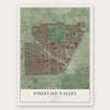
Fountain Valley, California Map Art
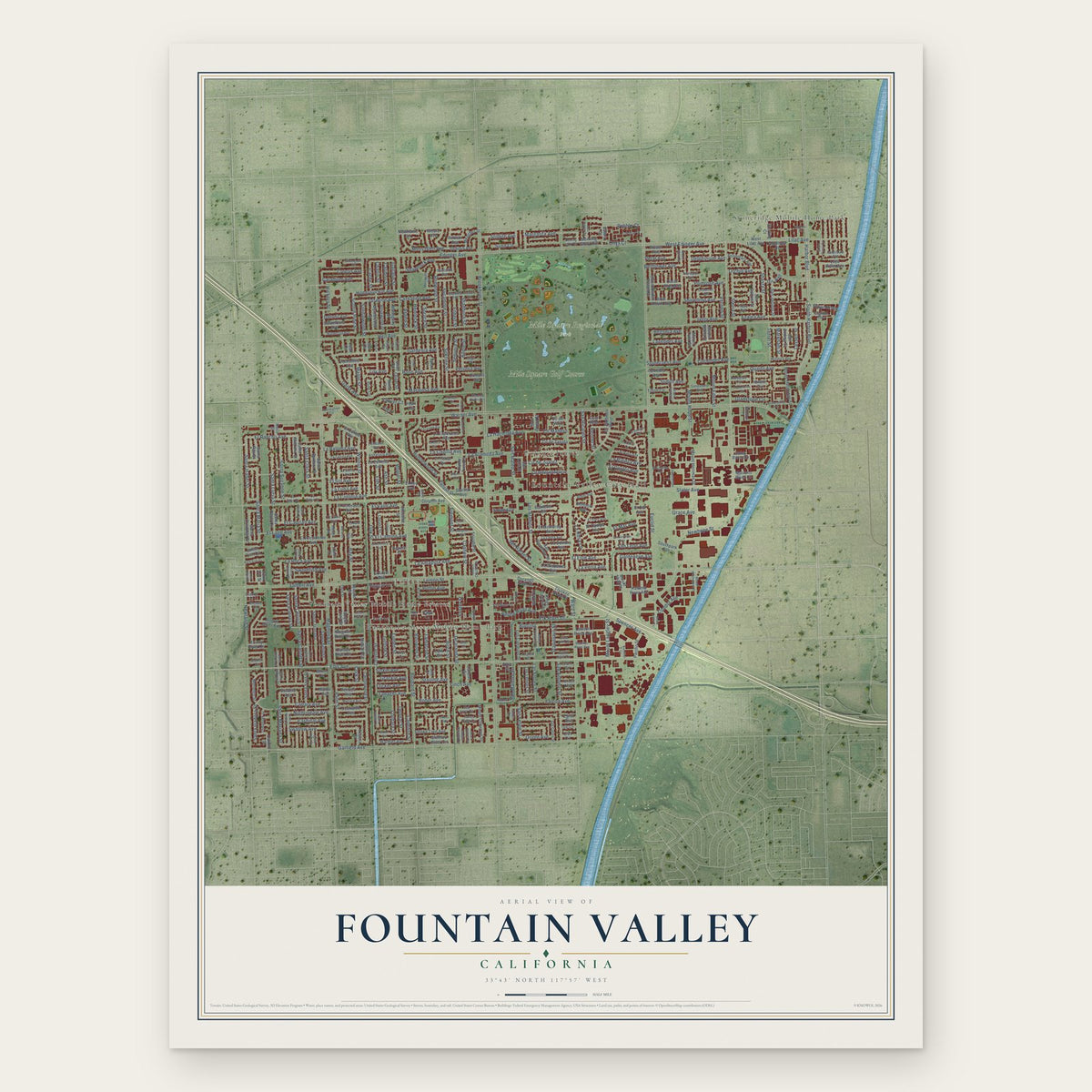
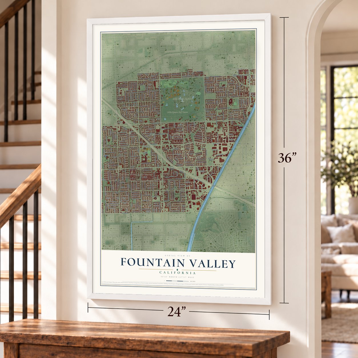
A new map of Fountain Valley, California, made in 2026 and printed to order on thick archival matte paper.
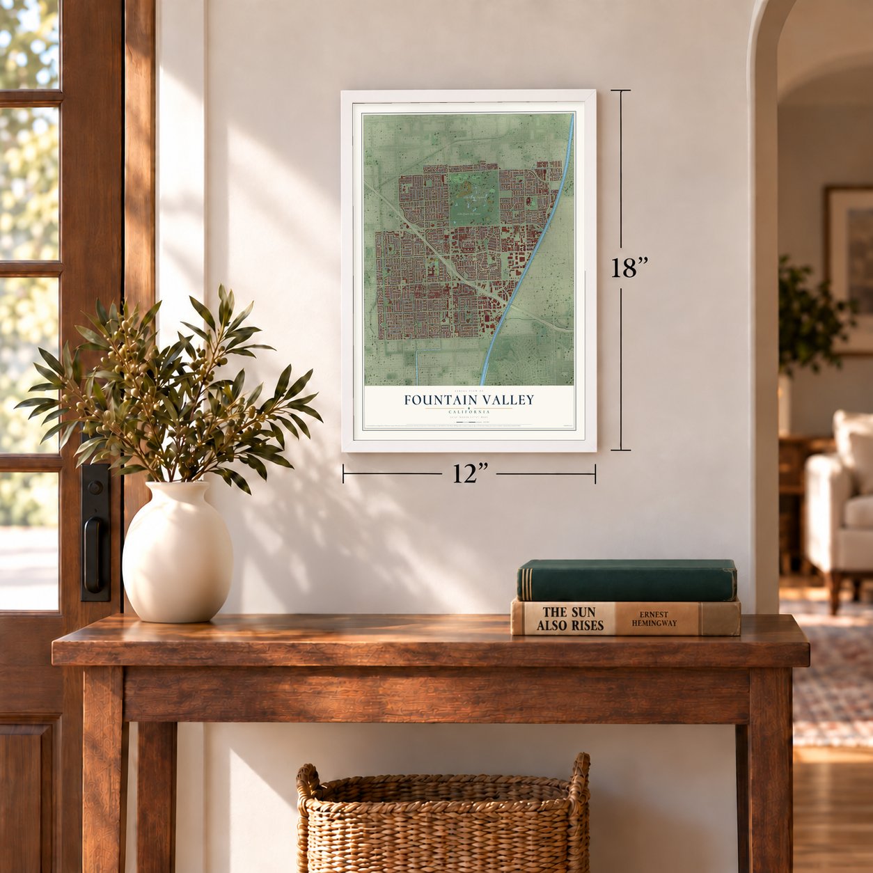
12" x 18" Archival Matte Print
A Map of Home. A Work of Art.
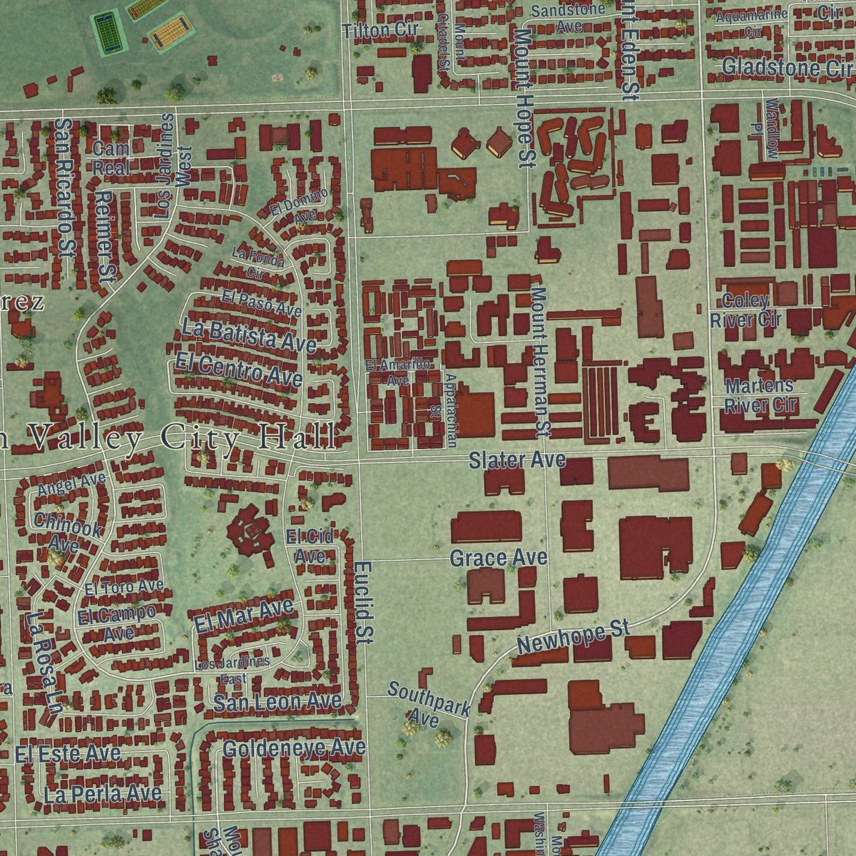
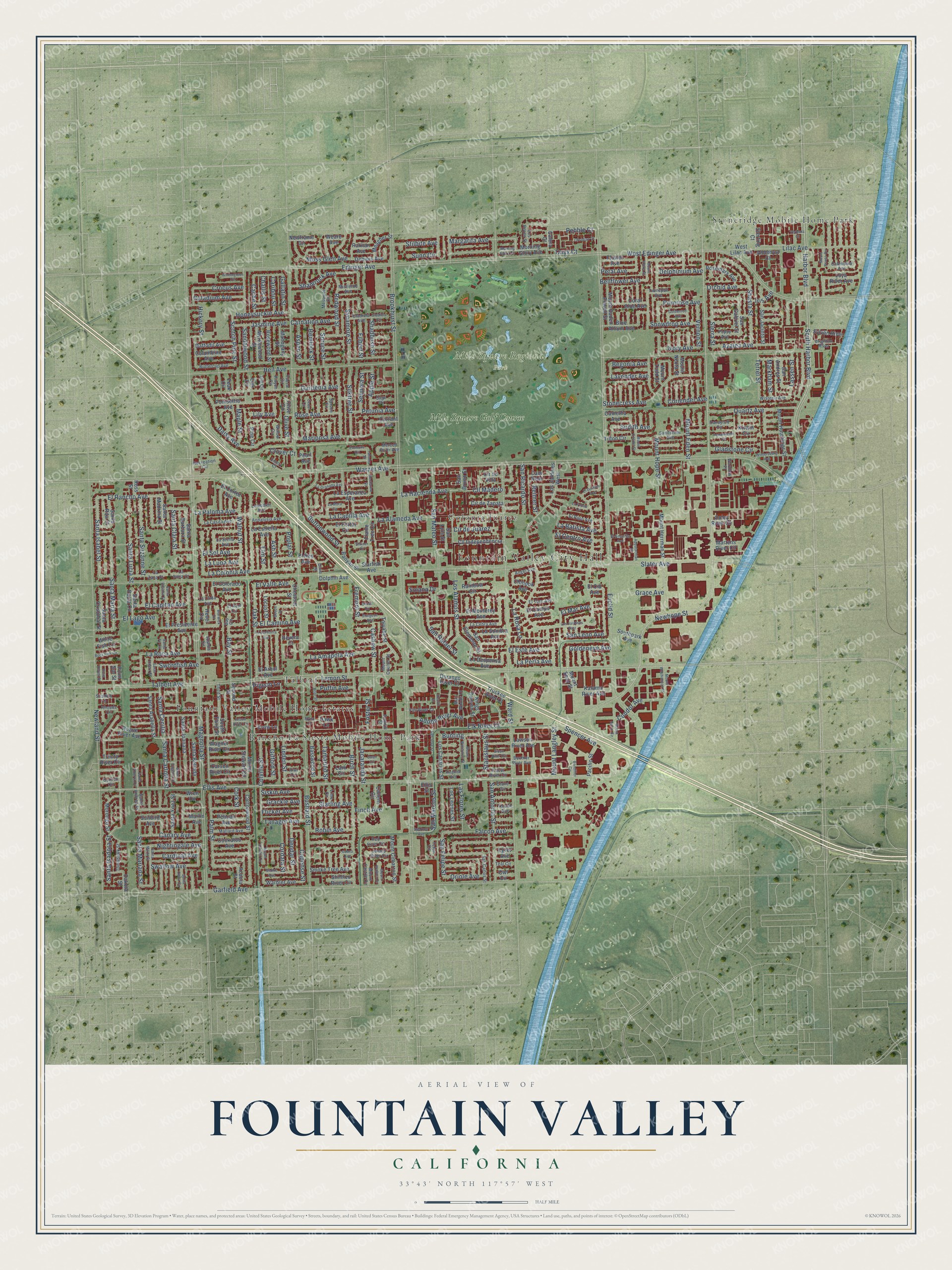
Explore Fountain Valley, California from a whole new perspective. Created using aerial imagery and detailed geographic data, this map captures Fountain Valley building by building, with labeled streets, familiar landmarks, and shaded topographical relief that highlights the natural contours of the landscape.
Combining modern data with the timeless character of a vintage atlas, this map is just as interesting up close as it is beautiful on the wall. Whether you grew up in Fountain Valley, spent memorable years there, or call it home today, this unique map is a great way to celebrate a place that means something to you. Zoom in on the preview to look for your street, and then order a print to put your memories on the wall.
Three ways to hang it
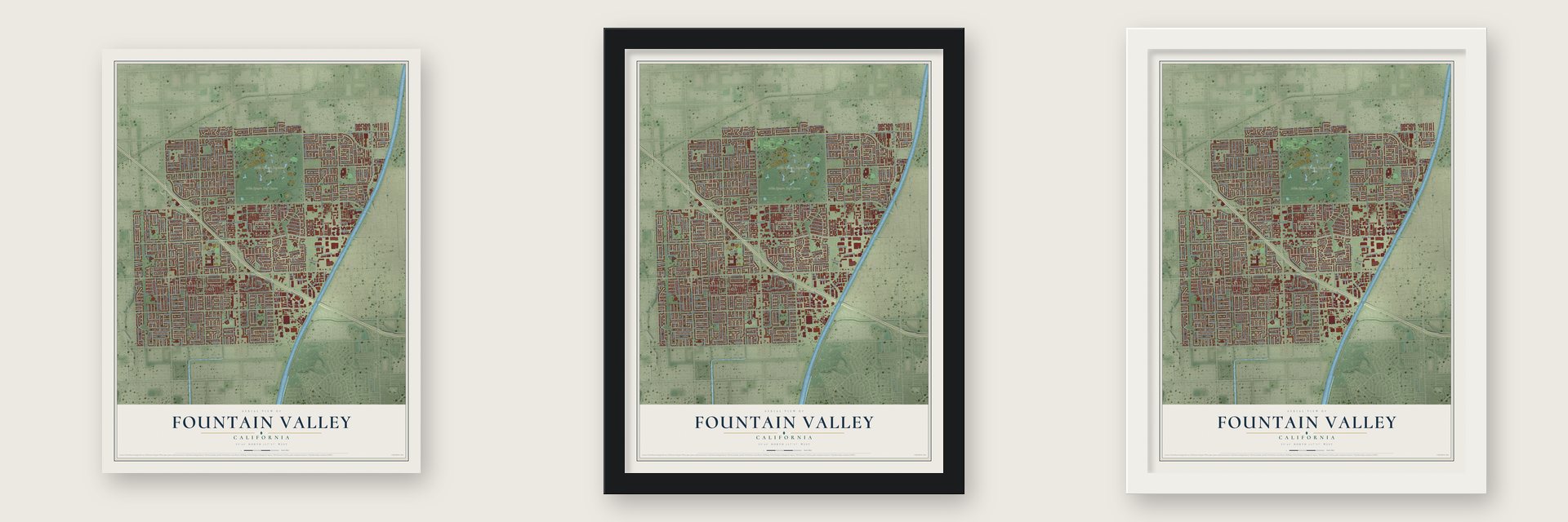
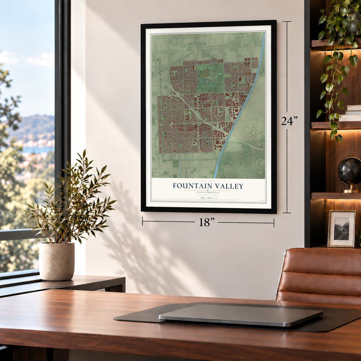
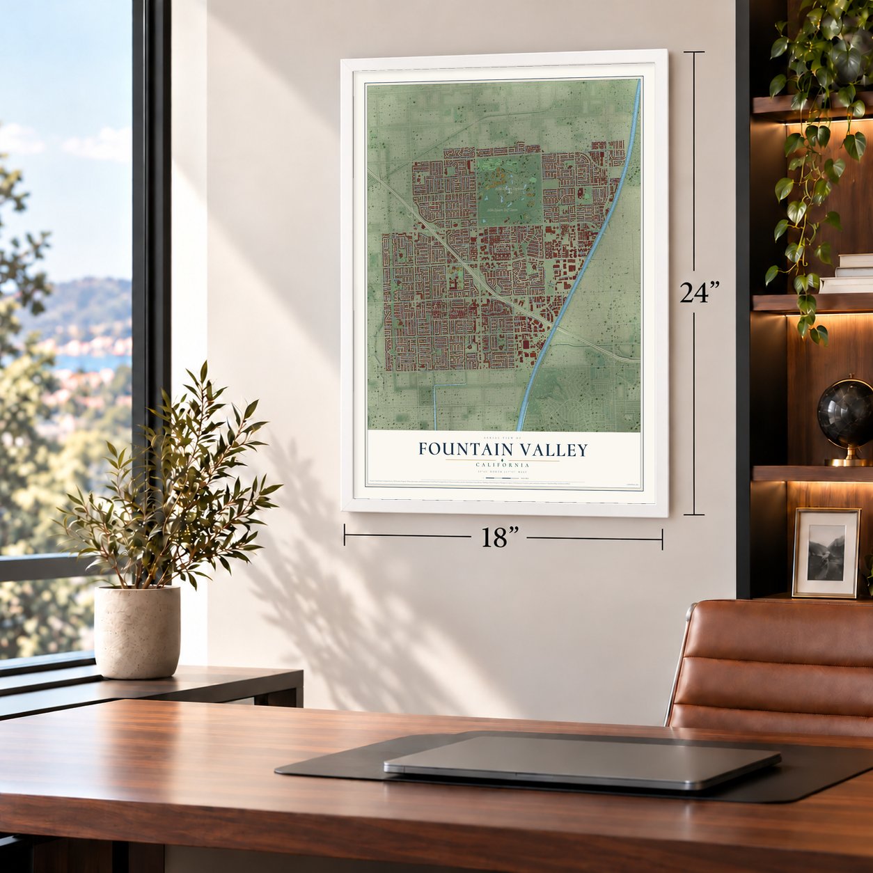
Unframed archival matte, a black wood frame or a white wood frame.
Up close
Geography Worth Displaying
This map was created using accurate cartographic data and authoritative geographic sources, including the U.S. Geological Survey and the Census Bureau. The map brings together terrain, waterways, roads, and building detail. The majority of the streets are labeled, houses are accurately depicted, and the topography is derived from government sources. Combining local data with carefully composed color and shading leads to this beautifully detailed Fountain Valley artwork for your wall.
Rather than simply showing street outlines, we’ve included as many of the street names as we could reasonably fit on the map while keeping their names legible. Zoom in on the high resolution preview to see exactly what’s on the map. We truly set out to create a statement piece for anyone who loves Fountain Valley. So whether it’s for you, or a gift for someone you love, we hope this map of Fountain Valley brings back fond memories.
Read the story behind this map of Fountain Valley, California from 2026.
About Fountain Valley, California
Fountain Valley is a city of 57,047 people in Orange County, with the Santa Ana River along its eastern edge. The Tongva lived here first, and their closest village was Pasbenga. This ground later fell inside Manuel Nieto's grant, Rancho Los Nietos, which covered more than 300,000 acres, and the land passed from Spain to Mexico and then to the United States.
The land was peat and swamp, with water close to the surface, so settlers dug drainage canals through the 1890s before they could farm it. They raised sugar beets, beans, barley and wheat, and farming stayed the main use of the land until large housing tracts spread in the 1960s. The city incorporated in 1957 and took its name from that high water table and its many artesian wells.
- Talbert, or Gospel SwampThomas B. Talbert, born in Piatt County, Illinois, in 1878, moved with his family to Long Beach at 13. Around 1896 the Talberts bought more than 300 acres of peat and swampland here and opened a general store. A settlement grew around it at what is now Talbert and Bushard, also known as Gospel Swamp. A post office opened in 1899, with Thomas as first postmaster. All-Saints Church is the last building left from that time.
- Beets and the Red CarTalbert's farms grew beets for big sugar plants nearby, the Holly Sugar Plant at Huntington Beach and the plant at Delhi, now part of Santa Ana. The Pacific Electric line between Santa Ana and Huntington Beach opened through Talbert on July 5, 1909, running along Bushard Street. Passenger service ended in 1922, and the tracks were pulled up in 1930.
- A city since 1957When Fountain Valley incorporated in 1957, James Kanno became its first mayor, making him one of the earliest Japanese-American mayors anywhere in the mainland United States. After the Fall of Saigon in 1975, many Vietnamese refugees made new homes in the city, above all in the late 1970s and through the 1980s.
- Mile Square Regional ParkThe 640-acre park has a pair of lakes and a pair of 18-hole golf courses, along with sports fields and an urban nature area filled with plants native to California. Each June the city's Summerfest fills the park with a car show, rides, music and booths.
Find your street
Names on the Fountain Valley map
Every name below is printed on this map. Look for your street, your school, the park where you played, or the pond down the road.
Places and landmarks8
- Fountain Valley City Hall
- Mile Square Regional Park
- Colonia Juarez
- Fountain Valley Mobile Home Estates
- Rancho La Siesta Mobile Home Park
- Stoneridge Mobile Home Park
- Talbert
- Mile Square Golf Course
Streets and roads406
- Newhope Street
- South Harbor Boulevard
- El Rancho Avenue
- Santa Cecilia
- Fremont Street
- Onyx Court
- Bunting
- Santa Maria Street
- Santa Isabel Street
- Margarita Avenue
- La Hacienda Avenue
- Pebble Court
- Sudith Avenue
- Brookhurst Street
- Warner Avenue
- Talbert Avenue
- Slater Avenue
- Ellis Avenue
- Edinger Avenue
- Magnolia Street
- Bushard Street
- Euclid Street
- Garfield Avenue
- Ward Street
- Heil Avenue
- Newland Street
- Harbor Boulevard
- Oak Street
- Walnut Street
- West Edinger Avenue
Show all 406 streets
- Redwood Street
- Nightingale Avenue
- Gardenia Avenue
- Daisy Avenue
- Palm Street
- Cardinal Avenue
- San Mateo Street
- Santa Isadora Street
- Stonecress Avenue
- Lilac Avenue
- Elm Street
- La Colonia Avenue
- Santa Mariana Street
- Swallow Avenue
- Shasta Street
- Buttonwood Street
- Los Alamos Street
- San Antonio Street
- Santa Suzanne Street
- Las Flores Street
- La Paloma Avenue
- San Felipe Street
- Mariposa Avenue
- Azalea Avenue
- La Rosa Lane
- Ash Street
- Santa Lucia Street
- Falcon Avenue
- Shamrock Avenue
- Adobe River Avenue
- Silktree Street
- Sycamore Street
- Robin Avenue
- La Amapola Avenue
- Condor Avenue
- San Rafael Street
- La Alameda Avenue
- La Luna Avenue
- Mount Hope Street
- Lemon Street
- La Capilla Avenue
- Sierra Street
- Bay Street
- Foster Street
- Honeysuckle Avenue
- Quartz Avenue
- El Capitan Avenue
- Canary Avenue
- Spruce Street
- La Roca Avenue
- Grace Avenue
- Jasmine Avenue
- Rose Avenue
- Oriole Avenue
- Mount Langley Street
- Cashew Street
- Iris Avenue
- Deodar Street
- Caladium Avenue
- Cordata Street
- Santa Carlotta Street
- Crocus Avenue
- Capense Street
- San Marcos Street
- Moss Glen Avenue
- Snowdrop Avenue
- Scotch Pine Street
- Petunia Avenue
- Lassen Street
- Mount Eden Street
- San Ricardo Street
- Bellflower Avenue
- Apple Street
- Jacaranda Street
- Colville Street
- Swordfish Avenue
- Lavender Avenue
- Birch Street
- Primrose Avenue
- Goldeneye Avenue
- Santa Clara Street
- Carnation Avenue
- Tanager Avenue
- Terrel Street
- Delphinium Avenue
- Hemlock Street
- Sandalwood Street
- Orchid Avenue
- Linden Street
- El Camino Avenue
- Tamarind Street
- Spencer Avenue
- Starling Avenue
- Cír de Juarez
- Stilbite Avenue
- Vernon Street
- El Este Avenue
- La Batista Avenue
- El Lago Avenue
- Gladstone Circle
- Maple Street
- Sequoia Street
- Coriender Avenue
- Shadbush Street
- Ivory Avenue
- Filbert Street
- Stanislaus Street
- El Centro Avenue
- Grackle Avenue
- Puffin Avenue
- Flicker Avenue
- Markham Street
- San Leon Avenue
- Siskin Avenue
- Olive Street
- Aspen Street
- El Sol Avenue
- Gifford Street
- Caribou Street
- La Perla Avenue
- Gallatin Street
- El Valle Avenue
- Begonia Avenue
- Cll Madero
- Cache Street
- Elk River Court
- Petal Avenue
- Clover Court
- El Mar Avenue
- Reimer Street
- Solana Drive
- Sunn Circle
- Hickory Street
- Finch Avenue
- Poplar Street
- Pigeon Lane
- Challis Street
- Lily Avenue
- Cork Street
- Morning Glory Avenue
- Santa Arabella Street
- Toiyabe Street
- Dolphin Avenue
- Santa Madrina Street
- Mount Shay Street
- El Rey Avenue
- Calera Court
- Los Jardines West
- La Esperanza Avenue
- Durango River Court
- Banyan Street
- La Despensa Avenue
- San Gabriel Street
- Amethyst Court
- Sunbird Avenue
- La Estrella Avenue
- El Monterey Avenue
- Poinsettia Avenue
- Santa Barbara Street
- Morongo Street
- Mount Stewart Circle
- Second Street
- Santa Ynez Street
- South Third Street
- Mount Cimarron Street
- Cll Independencia
- Mount Hutchings Street
- Mount Herrman Street
- Los Leones Street
- Los Canarios Street
- Rogue River Avenue
- Debiois Avenue
- San Jacinto Street
- Mount Baden Powell Street
- Smoke Tree Avenue
- Rosemary Avenue
- Lawson River Avenue
- Santa Joanana
- El Presidente Avenue
- Santa Belinda
- Coral Aloe Avenue
- Columbine Avenue
- Daffodil Avenue
- Santa Cristobal Street
- Warbler Avenue
- Myrtlewood Street
- Rosewood Street
- Basswood Street
- Kalama River Avenue
- Flower Avenue
- Cottonwood Street
- Blue Allium Avenue
- Cockatoo Avenue
- Pelican Avenue
- Sylvan River
- El Portal Circle
- Coley River Circle
- Pacific Street
- Cír de Zapata
- Loya River Avenue
- Meagher Street
- La Sombra Avenue
- San Clemente Street
- Ross Street
- West Lilac Avenue
- Mahogany Street
- Rainbow Circle
- Southpark Avenue
- Starfish Avenue
- El Colorado Avenue
- Santa Rita Street
- San Andres Street
- Locust Street
- Martens River Circle
- Santa Paula Circle
- Cam Real
- Camellia Avenue
- Newframe Circle
- San Luis Street
- El Campo Avenue
- Currant Avenue
- Shimizu River Circle
- Kings Canyon Street
- Sterling Court
- El Cortez Avenue
- Mount Todd Street
- San Bruno Street
- White Fish Circle
- Cír de Villa
- Tilton Circle
- Acacia Street
- Trinity River Circle
- Raritan Avenue
- Chinook Avenue
- Chestnut Street
- Flame Tree Circle
- Carson River Circle
- Callens Circle
- Wagner River Circle
- Martin Avenue
- Truckee River Court
- El Arbol Avenue
- Dakota Street
- Mount Neota Street
- Egret Avenue
- Crow Lane
- Pine Circle
- Kirwin Circle
- Revere Court
- Weare Avenue
- Ellis Street
- Hever Circle
- Pearl Avenue
- Lark Circle
- Owl Circle
- Wren Circle
- Teak Circle
- Oak Circle
- El Cid Avenue
- Hawk Lane
- Olive Circle
- Point Sur Street
- Dixie Street
- Calendula Avenue
- La Casita Avenue
- La Stella Avenue
- Third Street
- Sandstone Avenue
- Muir Woods Court
- Buttercup Avenue
- Mallard Avenue
- Andalusia Avenue
- Tomahawk Street
- La Cebra Avenue
- Spruce Circle
- San Carlos Street
- Wisteria Avenue
- El Paso Avenue
- Poppy Avenue
- Fall River Court
- Brighton River
- Recreation Circle
- Red River Circle
- James River Circle
- Los Reyes Street
- Mesquite Circle
- El Toro Avenue
- Gladiola Avenue
- Angel Avenue
- Mount Castile Circle
- Lombardi Avenue
- Candytuft Circle
- Placer River Circle
- Mistletoe Avenue
- Twinspan Avenue
- Mount Coulter Street
- Bechler River Avenue
- Santa Andrea Street
- Merced River Avenue
- Rhoads Circle
- Thrush Avenue
- La Linda Avenue
- Sage Circle
- La Zana Court
- La Dona Court
- Shadow Lane
- Wardlow Place
- Danwill Street
- Joshua Circle
- Crane Circle
- Teal Circle
- Pinyon Circle
- Ostrich Circle
- Emery Court
- Yucca Circle
- Elm Circle
- Lime Circle
- Willow Circle
- El Azul Circle
- Teton Circle
- Kiwi Circle
- Bay Circle
- Mount Hicks Street
- Nectarine Street
- Sturgeon Avenue
- Morning Glory Circle
- Sparrow Avenue
- Los Jardines East
- Wintersburg Avenue
- Santa Marta Street
- Mount Waterman Street
- Mount Baldy Circle
- Cedar Circle
- La Granada Avenue
- Shrike Avenue
- Mount Washington Street
- Myna Lane
- Santa Valera Street
- Rock Fish Circle
- Briar Street
- Obsidian Court
- Appalachian Street
- San Jose Street
- Mount Citadel Street
- Point Reyes Street
- Santa Rosalia Street
- Sioux River Circle
- Wintergreen Circle
- Mount Walton Circle
- El Domino Avenue
- El Amarillo Avenue
- Santa Alberta Circle
- Mount Schelin Circle
- Aquamarine Circle
- Santa Eugenia Street
- Santa Clara Circle
- La Cortinilla Avenue
- Goldenrod Avenue
- Tahoma Street
- Kingbird Avenue
- La Fonda Circle
- Mount Prieto Circle
- Emmons Circle
- Beech Street
- Anson River Circle
- Oscar Circle
- Warwick Circle
- Verbena Court
- Bandilier Circle
- La Mora Circle
- Santa Fe Circle
- Gladiola Circle
- Swan Circle
- Hearth Drive
- Shriner Circle
- Guava Avenue
Names are listed as they appear on the printed map. Zoom into the product photos to find them.
The art of mapping a place
How This Map Was Made
Real places. Remarkable detail. Discover the layers that turn geographic data into a map of home.

The view from above
Aerial imagery reveals the character of the land: woodland, open fields, and the patterns of a place.

The shape of the land
Elevation data brings hills, valleys, and subtle changes in the landscape into view.

The details of home
Roads, waterways, and building footprints come together to make the map feel unmistakably local.

Geography becomes art
Considered color, shading, and typography bring the layers together in a map made for your wall.


Process illustrated with Mendon, Massachusetts. Aerial imagery: USDA NAIP. Terrain: USGS 3D Elevation Program. Map details and finished artwork: KNOWOL.
The Details
About This Print
Choose an archival matte print, or a black or white Ayous wood frame. The archival matte print is unframed.
Select your size and finish above to see the matching product image and price.
Materials & Craftsmanship
A contemporary map with the character of a classic atlas, printed on archival matte paper. Optional frames are made from Ayous wood.
Your printed map does not include the watermark shown in the full-map preview.
Shipping & Delivery
Free shipping within the United States. Every print is made to order in the USA.
Buying a gift? Add a note in your cart and we'll include it. We never put prices in the package.
Prints ship within 2 to 3 business days. Allow 7 to 10 days total from ordering for delivery. Timing may vary during holidays or periods of high order volume.
Read our shipping policy.
Returns and damaged prints
Each print is made to order. Change-of-mind refunds are not available after production.
If your print arrives damaged, misprinted or incorrect, contact support@knowol.com within 30 days of receiving it. Include your order number, photos and a description of the issue.
Read our full refund and replacement policy. For questions about your order, email support@knowol.com.
Find your town
Looking for another city?
Find a map of home in our California collection, or any town in the country.
Nearby
Maps of towns near Fountain Valley
Know someone from one of these towns? Their map makes a great gift.
 Midway City
, California
From $39.99See the map
 Huntington Beach
, California
From $39.99See the map
 Westminster
, California
From $39.99See the map
More maps nearby: Costa Mesa, Santa Ana, Garden Grove, Stanton and Orange.