


Search for another town





Free U.S. delivery 7 to 10 days after you order
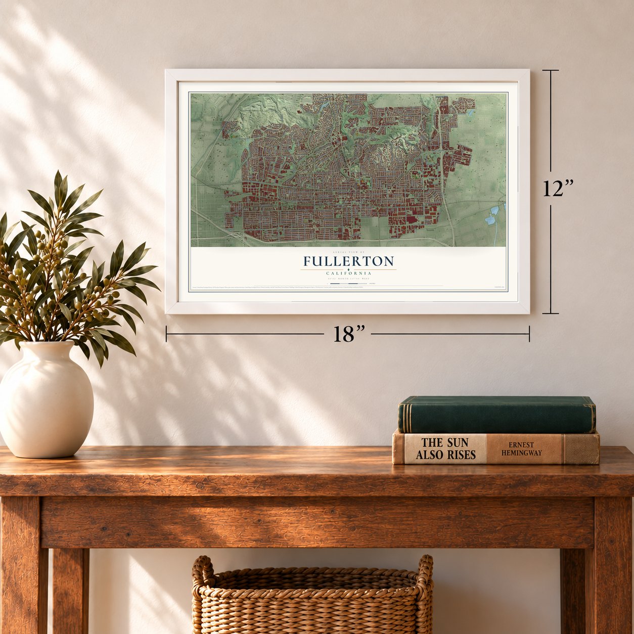
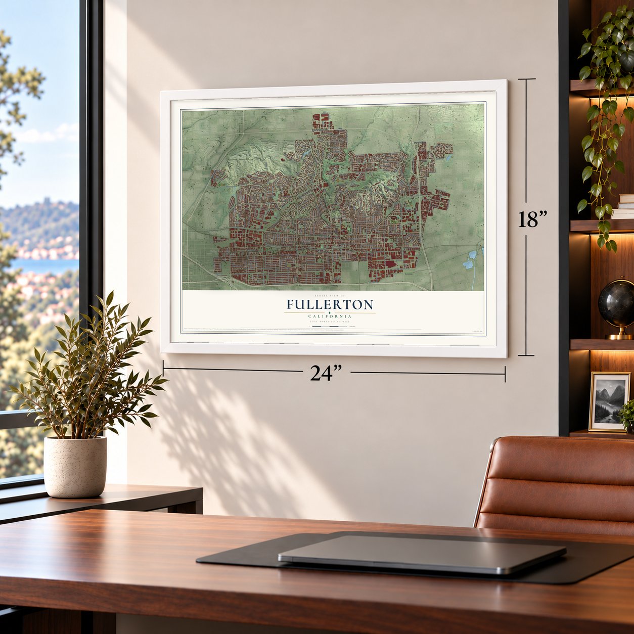
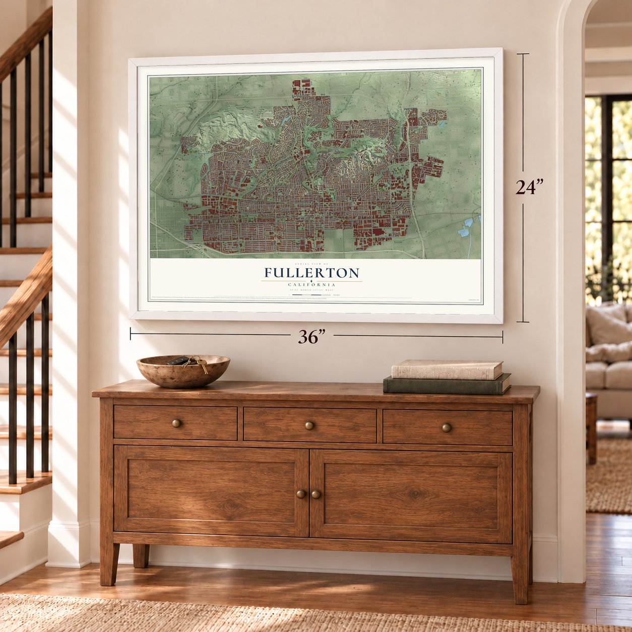
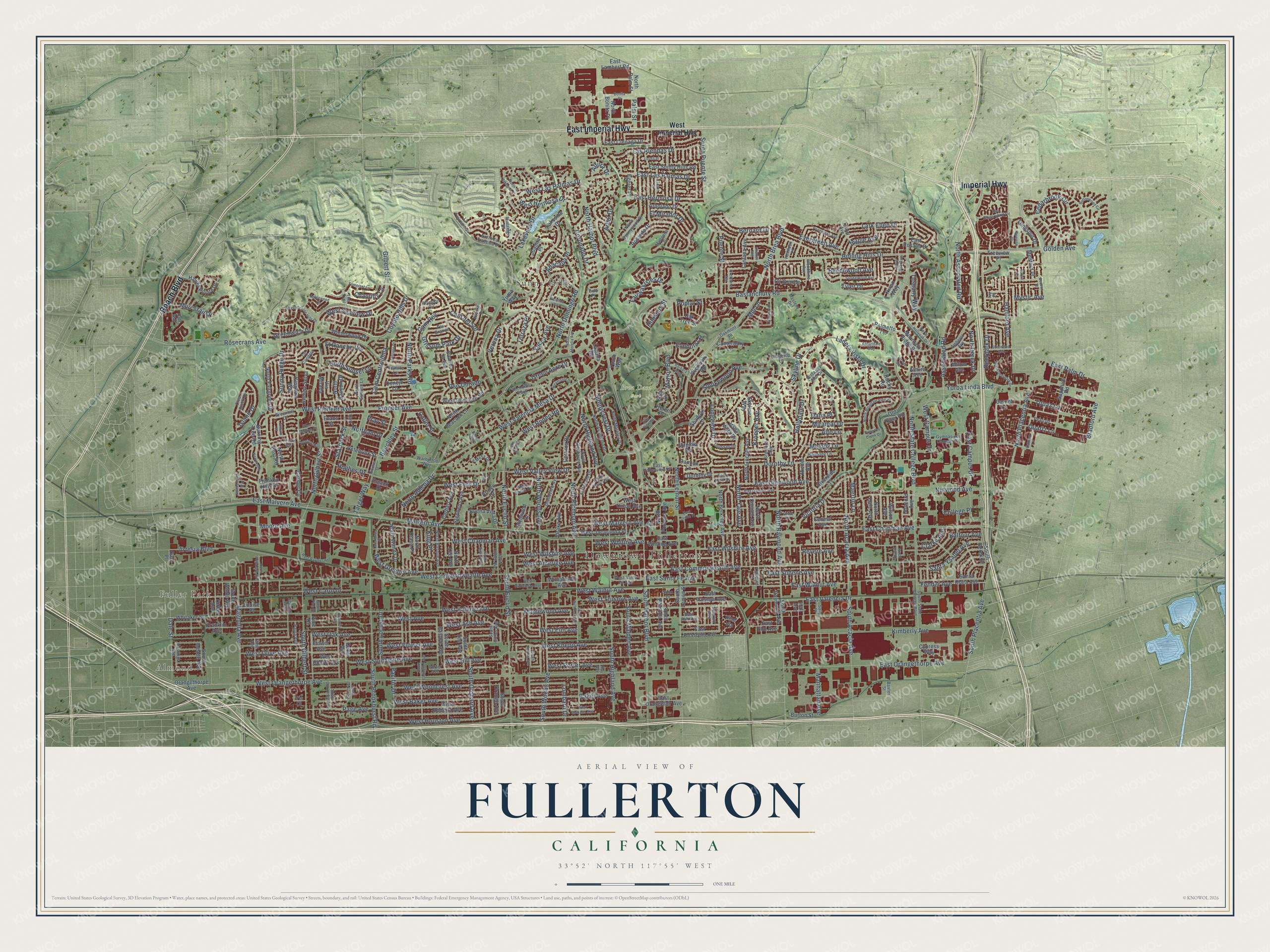
Fullerton, California Map Art
Building by building, with labeled streets and shaded relief.
12" x 18" Archival Matte Print
A Map of Home. A Work of Art.
Explore Fullerton, California from a whole new perspective. Created using aerial imagery and detailed geographic data, this map captures Fullerton building by building, with labeled streets, familiar landmarks, and shaded topographical relief that highlights the natural contours of the landscape.
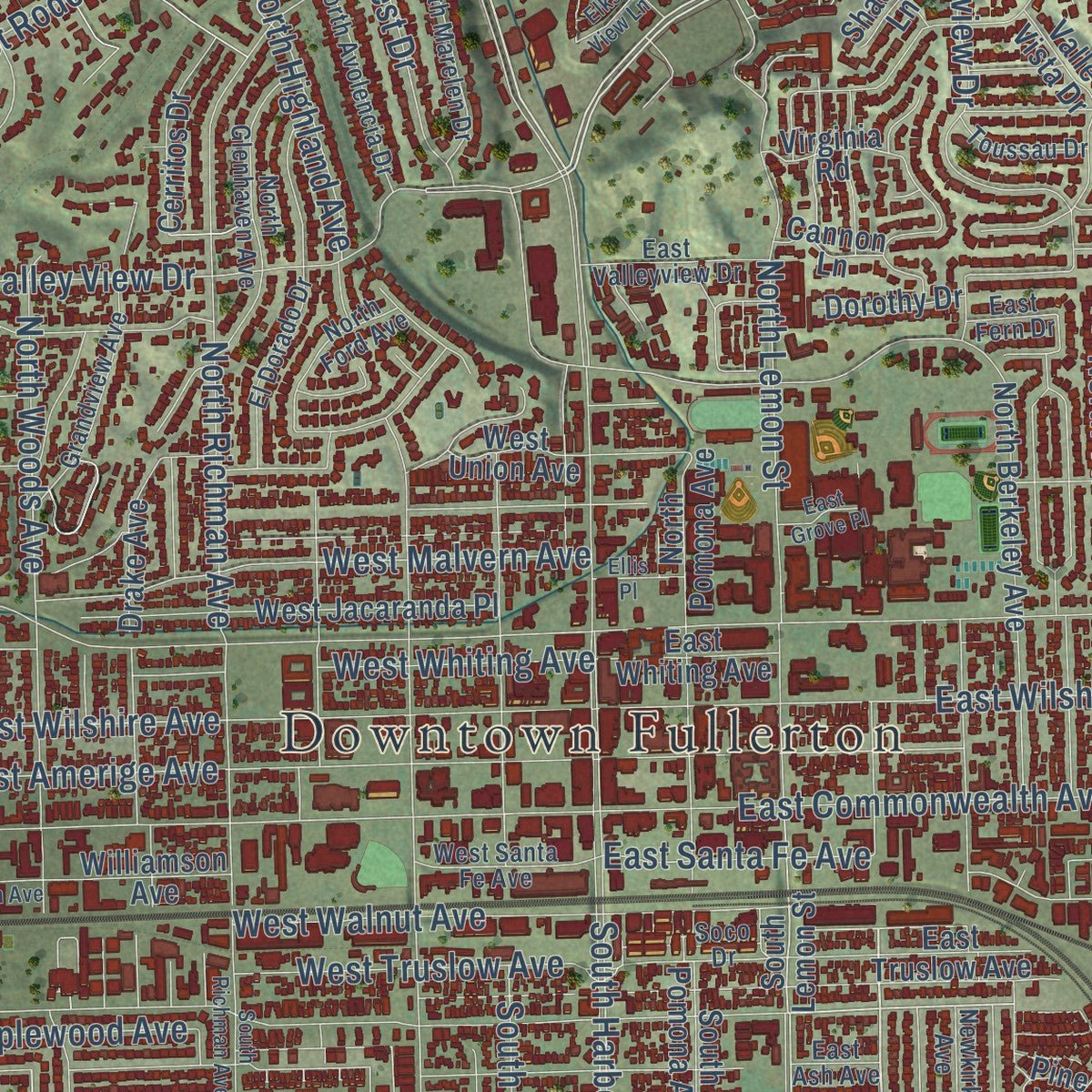
Combining modern data with the timeless character of a vintage atlas, this map is just as interesting up close as it is beautiful on the wall. Whether you grew up in Fullerton, spent memorable years there, or call it home today, this unique map is a great way to celebrate a place that means something to you. Zoom in on the preview to look for your street, and then order a print to put your memories on the wall.
Three ways to hang it
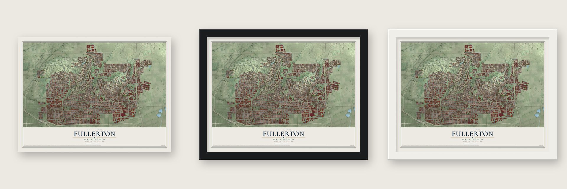
Unframed archival matte, a black wood frame or a white wood frame.
Up close
Geography Worth Displaying
This map was created using accurate cartographic data and authoritative geographic sources, including the U.S. Geological Survey and the Census Bureau. The map brings together terrain, waterways, roads, and building detail. The majority of the streets are labeled, houses are accurately depicted, and the topography is derived from government sources. Combining local data with carefully composed color and shading leads to this beautifully detailed Fullerton artwork for your wall.
Rather than simply showing street outlines, we’ve included as many of the street names as we could reasonably fit on the map while keeping their names legible. Zoom in on the high resolution preview to see exactly what’s on the map. We truly set out to create a statement piece for anyone who loves Fullerton. So whether it’s for you, or a gift for someone you love, we hope this map of Fullerton brings back fond memories.
Read the story behind this map of Fullerton, California from 2026.

Find your street
Names on the Fullerton map
Every name below is printed on this map. Look for your street, your school, the park where you played, or the pond down the road.
Places and landmarks5
- Downtown Fullerton
- Almond
- Fuller Park
- Brea Dam Park
- Sunny Hills
Streets and roads408
- Beach Boulevard
- East Imperial Highway
- Imperial Highway
- North Harbor Boulevard
- North Brea Boulevard
- Dorothy Lane
- Victoria Drive
- West Campus Drive
- East Campus Drive
- Rolling Hills Drive
- East Valencia Drive
- West Valencia Mesa Drive
- West Chapman Avenue
- Deerpark Drive
- North Associated Road
- South Placentia Avenue
- East Las Palmas Drive
- Marion Boulevard
- Bradford Avenue
- Hibiscus Street
- Bastanchury Road
- North State College Boulevard
- West Orangethorpe Avenue
- West Commonwealth Avenue
- West Valencia Drive
- East Chapman Avenue
- North Euclid Street
- Yorba Linda Boulevard
- North Gilbert Street
- Nutwood Avenue
Show all 408 streets
- South Harbor Boulevard
- Rosecrans Avenue
- Malvern Avenue
- East Commonwealth Avenue
- West Ash Avenue
- West Avenue
- West Houston Avenue
- North Raymond Avenue
- West Oak Avenue
- West Valley View Drive
- East Wilshire Avenue
- West Olive Avenue
- East Walnut Avenue
- West Hill Avenue
- North Lemon Street
- Magnolia Avenue
- North Acacia Avenue
- North Placentia Avenue
- East Orangethorpe Avenue
- West Southgate Avenue
- West Baker Avenue
- Skyline Drive
- Sunny Ridge Drive
- Kimberly Avenue
- West Fern Drive
- West Amerige Avenue
- West Porter Avenue
- North Richman Avenue
- North Domingo Road
- West Flower Avenue
- West Wilshire Avenue
- West Elm Avenue
- Terraza Place
- South Euclid Street
- North Highland Avenue
- Ladera Vista Drive
- South Highland Avenue
- South Brookhurst Road
- West Las Palmas Drive
- South Gilbert Street
- East Malvern Avenue
- West Woodcrest Avenue
- East Santa Fe Avenue
- South Acacia Avenue
- Artesia Boulevard
- Cam del Sol
- South Woods Avenue
- Beechwood Avenue
- West Knepp Avenue
- El Mirador Drive
- Evergreen Avenue
- Melody Lane
- West Pioneer Avenue
- West Carol Drive
- East Hermosa Drive
- West Walnut Avenue
- Miramar Drive
- Cedarbrook Circle
- Sunnycrest Drive
- Las Riendas Drive
- Coyote Hills Drive
- Longview Drive
- Lark Ellen Drive
- Lakeview Drive
- North Woods Avenue
- Pioneer Avenue
- East Glenwood Avenue
- North Parks Road
- Coronado Drive
- Pacific Drive
- North Adlena Drive
- Muir Trail Drive
- Hughes Drive
- North Yale Avenue
- North Sunset Lane
- Starbuck Street
- West Malvern Avenue
- Hollydale Drive
- Hartford Avenue
- El Rancho Vis
- Puente Street
- Maple Avenue
- South Orchard Avenue
- Smokewood Avenue
- West Hermosa Drive
- Cam Rey
- West Gregory Avenue
- South Puente Street
- East Sudene Avenue
- Balfour Avenue
- Santa Ysabel Avenue
- Cam Centroloma
- Fender Avenue
- West Truslow Avenue
- West Whiting Avenue
- Topaz Lane
- South Malden Avenue
- Dale Street
- Associated Road
- Pso Dorado
- Verona Drive
- East Palm Drive
- Moore Avenue
- Fairway Isles Drive
- Maplewood Avenue
- Quartz Lane
- Dana Place
- Kroeger Avenue
- West Rodeo Road
- South Locust Drive
- Yucca Avenue
- Benchley Street
- Bernard Drive
- Golden Avenue
- Catlin Street
- West Seaview Drive
- Revere Avenue
- Island Drive
- Tuscany Way
- Tyler Drive
- Anacapa Place
- Gilbert Street
- Grissom Park Drive
- Manhattan Avenue
- North Derek Drive
- Greenwich Drive
- Target Way
- Mystic Avenue
- Maertin Lane
- Green Acre Drive
- Chantilly Lane
- Arbol Drive
- Northam Drive
- Palm Street
- Clarke Avenue
- Lombard Drive
- Elmhurst Place
- Baker Avenue
- Alto Lane
- Mill Lane
- Altura Drive
- Page Avenue
- College Place
- King Place
- Poplar Street
- Pray Street
- West Imperial Highway
- East Lambert Road
- Old River Road
- South Lemon Street
- Lantana Avenue
- West Roberta Avenue
- North Berkeley Avenue
- South Basque Avenue
- Burning Tree Road
- North Lincoln Avenue
- Arbolado Drive
- North Hale Avenue
- East Elm Avenue
- West Jacaranda Place
- West Cherry Avenue
- Virginia Road
- South Pomona Avenue
- Concord Avenue
- East Truslow Avenue
- North Cornell Avenue
- Riverside Drive
- East Rosalia Drive
- East Whiting Avenue
- East Rosslynn Avenue
- East Cienaga Drive
- South Raymond Avenue
- Riedel Avenue
- Via Mirada
- North Pomona Avenue
- Drake Avenue
- Central Avenue
- Conejo Lane
- Garnet Lane
- Orangethorpe Avenue
- Hawks Pointe Drive
- Sapphire Road
- Santa Clara Avenue
- Franklin Avenue
- Mountain Ridge Drive
- North Canyon Drive
- Williamson Avenue
- Camino la Vis
- Carhart Avenue
- South Orange Avenue
- East Sunny Hills Road
- South Derek Drive
- West Union Avenue
- Pine Via
- North Wanda Drive
- South Lee Avenue
- North Fairgreen Drive
- West Domingo Road
- South Meade Avenue
- Palmetto Terrace
- North Bonita Place
- Rosarita Drive
- Avenue Selva
- North Post Road
- Shadow Lane
- Kingham Way
- Winterwood Drive
- Lakeside Drive
- Stephens Avenue
- Valle Vista Drive
- Buena Vista Drive
- Longspur Drive
- Treeview Place
- Carmel Circle
- Cerritos Drive
- Burton Street
- Hetebrink Street
- East Orangefair Avenue
- Evans Street
- Cll Grande
- North Lee Avenue
- Medford Place
- Whitaker Street
- North Palm Street
- South Waldo Avenue
- Turner Avenue
- North Peacock Lane
- Pine Drive
- Louise Place
- Wilson Avenue
- Franklin Hills Drive
- Milton Avenue
- Glenwood Drive
- Cypress Way
- Canterbury Lane
- Skyline Way
- Cusick Drive
- Arroyo Drive
- Dorothy Drive
- Helen Drive
- Overlook Road
- Flower Avenue
- North Diana Place
- Egerer Place
- Laguna Road
- Nixon Way
- Cannon Lane
- Oak Tree Street
- Yuma Way
- Elsa Drive
- Juanita Place
- Youth Way
- Cedar Avenue
- Almira Avenue
- Iris Court
- Rocky Road
- Hall Avenue
- Dale Place
- Warburton Way
- Hastings Avenue
- South State College Boulevard
- Gymnasium Campus Drive
- East Union Avenue
- Richman Knoll
- North Ford Avenue
- East Ash Avenue
- Harmony Lane
- North Glenhaven Avenue
- North Avolencia Drive
- North Sunnywood Drive
- Amherst Avenue
- Porter Avenue
- North Marelen Drive
- Stanford Avenue
- North Basque Avenue
- Live Oak Avenue
- Grandview Avenue
- Cameo Lane
- La Mesa Drive
- Jensen Way
- South Citrus Avenue
- El Dorado Drive
- Celeste Lane
- Clear Creek Drive
- West Santa Fe Avenue
- East Valleyview Drive
- South Courtney Avenue
- East Fern Drive
- Pso Grande
- North Sunrise Lane
- Atherton Circle
- West Barris Drive
- Hemlock Place
- Oakmont Place
- North La Travesia Drive
- Toussau Drive
- Pearl Drive
- Ridgetop Lane
- La Travesia Drive
- Madonna Drive
- Greenhill Drive
- Nicolas Drive
- Paula Avenue
- Vista del Mar Drive
- Laurel Avenue
- Soco Drive
- Woodbine Avenue
- Cll Candela
- Vine Avenue
- Lido Place
- Flintridge Drive
- The Trail
- Linwood Place
- Newkirk Avenue
- Masters Drive
- Colt Way
- Sally Place
- Baxter Street
- Fern Drive
- Ivy Place
- Ray Avenue
- West Maxzim Avenue
- South Richman Avenue
- North Mountain View Place
- East Gingerwood Circle
- South Eadington Avenue
- South Pine Drive
- Fullerton Creek Drive
- West Raymer Avenue
- Threewoods Lane
- West Williamson Avenue
- Ponderosa Avenue
- Sandalwood Avenue
- Courtney Avenue
- Jacaranda Place
- Buttonwood Circle
- Catalina Road
- South Cedar Avenue
- Fullerton Hills
- Northampton Way
- Grove Place
- Applewood Circle
- Firethorne Avenue
- Barbara Boulevard
- Sherwood Avenue
- Somerset Lane
- South Adams Avenue
- North Orange Avenue
- North Deerpark Drive
- Newcastle Lane
- West Coyote Hills Drive
- Miramonte Drive
- North Morelia Avenue
- Teton Drive
- North Hermosa Place
- Sparrow Drive
- Nicolas Street
- Beacon Street
- North Pritchard Avenue
- North Sweet Avenue
- East Grove Place
- Trieste Way
- North Hollyoak Drive
- Bonita Place
- North Lillie Avenue
- Serrano Place
- Salem Place
- West Daphne Place
- Annandale Way
- Ellis Place
- Charles Avenue
- Vis del Sol
- Lovell Place
- Elks View Lane
- Eltham Place
- Alta Vista Drive
- Mesa del Sol
- Raitt Lane
Names are listed as they appear on the printed map. Zoom into the product photos to find them.
About Fullerton, California
Fullerton is a city of 143,617 people in northern Orange County. Brothers George and Edward Amerige came west from Malden, Massachusetts, in 1886, bought 430 acres and became the city's founders. The town was founded in 1887 and named for George H. Fullerton, head of the Pacific Land and Improvement Company, a Santa Fe subsidiary, who had helped win the railroad's right of way through the site. Fullerton was incorporated as a city in 1904.
Charles Chapman bought an orange orchard on the east side of town in 1894. He promoted the Valencia orange from his Santa Ysabel Ranch, and the variety suited the local climate so well that Fullerton came to have more orange groves than any other city in the country. Walnuts and avocados thrived as well. Oil from the Brea-Olinda field, first drilled in 1880, gave the town its first real boom, which peaked in the 1920s.
“The Valencia was the prize citrus product of Fullerton and Orange County and helped make Fullerton the city it is today.”
- Portolá camped here in 1769The first Europeans came through in 1769 with Gaspar de Portolá's Spanish expedition, bound north for Monterey. Father Juan Crespi's diary shows the party made camp on July 29 near today's Laguna Lake, in the Sunny Hills area. Long before that, the Tongva lived here, and Hutuknga, one of the largest villages in their world, stood along the Santa Ana River.
- The Bernals' fight in 1943In 1943 Alex and Esther Bernal bought a house in a Fullerton neighborhood whose covenants barred sales to Mexicans. Intruders broke in and threw their belongings into the street, fifty neighbors signed a petition to remove them, and the Bernals were sued for causing the neighborhood "irreparable injury." Lawyer David C. Marcus defended them in Doss v. Bernal and won, one of the first successful challenges to such covenants in the country, and the case drew national attention.
- The Telecaster in 1949Leo Fender developed the Telecaster in 1949, the first solid-body electric guitar to sell well, and his company also made the Stratocaster, the Precision Bass and the Twin Reverb amplifier. He sold the company to CBS in 1965, and guitars were made at the Fullerton plant until 1985. In 1980 Fender teamed up again with his first partner, George Fullerton, to start G&L Guitars, built in Fender's old CLF Research factory in town.
- Spanish style in the boom yearsOil boom builders favored Spanish Colonial Revival and Italian Renaissance designs. Frank K. Benchley's Muckenthaler House went up in 1924, the Fox Fullerton Theatre in 1925, and the Plummer Auditorium, whose clock tower is the city's chief landmark, in 1930. Harold Muckenthaler gave his family's estate to the city in 1965. Now the Muckenthaler Cultural Center, it holds galleries and a theater group. The house joined the National Register in 1980.
- Two colleges in one cityFullerton College has stood at Chapman Avenue and Lemon Street since 1913. As veterans moved in after World War II, state lawmakers approved a new school, Orange County State College, in 1957. Its first classes met in Fullerton high schools in 1959, and in 1963 it moved to its campus on State College Boulevard. After several name changes it became California State University, Fullerton.
Keep exploring California
Fullerton is one of 1,990 California towns we've mapped. Every dot on the map is a print of its own.
The search covers every state, California first.
Near Fullerton
Order 2 or more town maps and save 10%. Shown in the size and finish you picked above, so they hang as a set.
- La Habra 12" x 18" / Archival Matte Print $39.99
- East La Mirada 12" x 18" / Archival Matte Print $39.99
- Placentia 12" x 18" / Archival Matte Print $39.99


More maps nearby: East Whittier, Brea, La Mirada, Buena Park and La Habra Heights.
The art of mapping a place
How This Map Was Made
Real places. Remarkable detail. Discover the layers that turn geographic data into a map of home.

The view from above
Aerial imagery reveals the character of the land: woodland, open fields, and the patterns of a place.

The shape of the land
Elevation data brings hills, valleys, and subtle changes in the landscape into view.

The details of home
Roads, waterways, and building footprints come together to make the map feel unmistakably local.

Geography becomes art
Considered color, shading, and typography bring the layers together in a map made for your wall.


Process illustrated with Mendon, Massachusetts. Aerial imagery: USDA NAIP. Terrain: USGS 3D Elevation Program. Map details and finished artwork: KNOWOL.
The Details
About This Print
Choose an archival matte print, or a black or white Ayous wood frame. The archival matte print is unframed.
Select your size and finish above to see the matching product image and price.
Materials & Craftsmanship
A contemporary map with the character of a classic atlas, printed on archival matte paper. Optional frames are made from Ayous wood.
Your printed map does not include the watermark shown in the full-map preview.
Shipping & Delivery
Free shipping within the United States. Every print is made to order in the USA.
Buying a gift? Add a note in your cart and we'll include it. We never put prices in the package.
Prints ship within 2 to 3 business days. Allow 7 to 10 days total from ordering for delivery. Timing may vary during holidays or periods of high order volume.
Read our shipping policy.
Returns and damaged prints
Each print is made to order. Change-of-mind refunds are not available after production.
If your print arrives damaged, misprinted or incorrect, contact support@knowol.com within 30 days of receiving it. Include your order number, photos and a description of the issue.
Read our full refund and replacement policy. For questions about your order, email support@knowol.com.