
Search for another town





Free U.S. delivery 7 to 10 days after you order
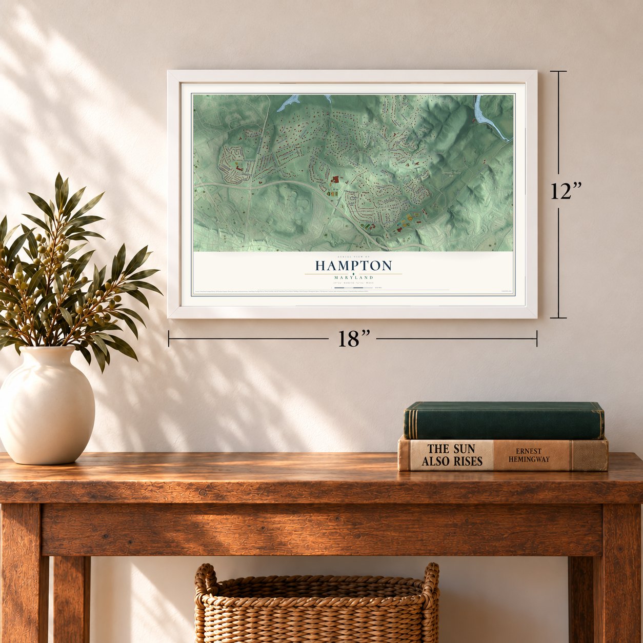
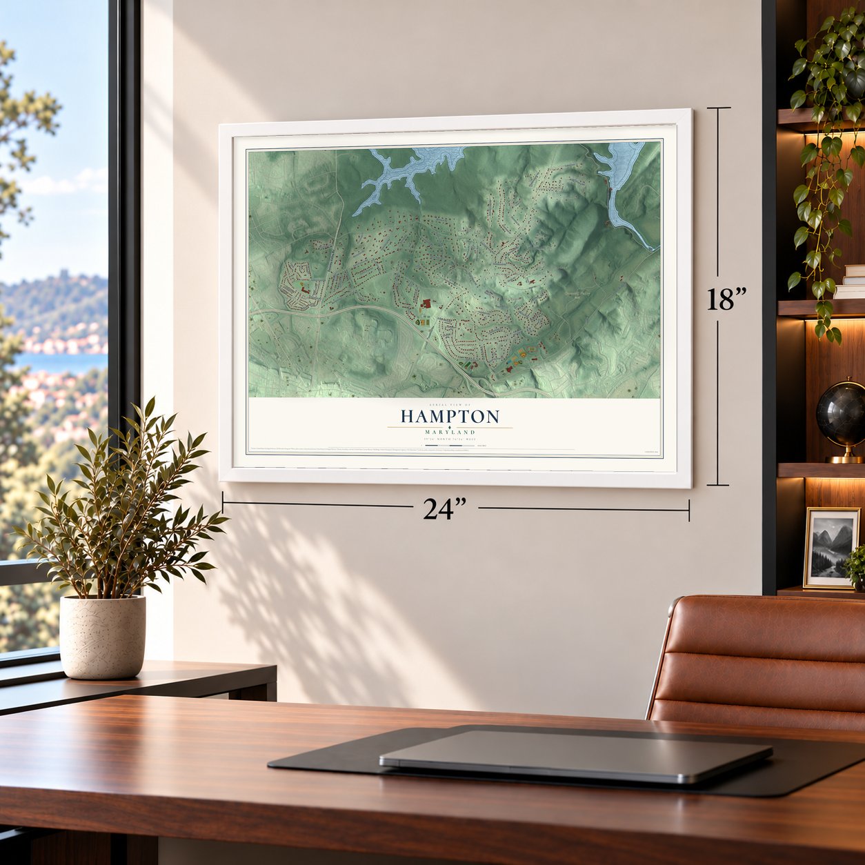
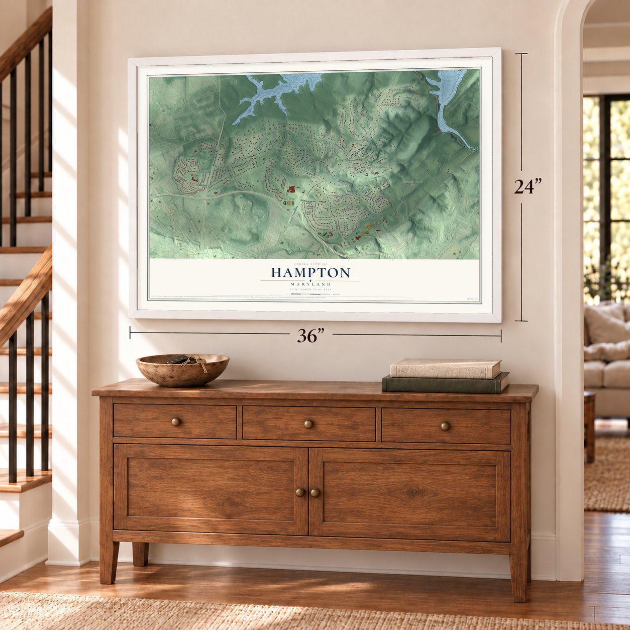
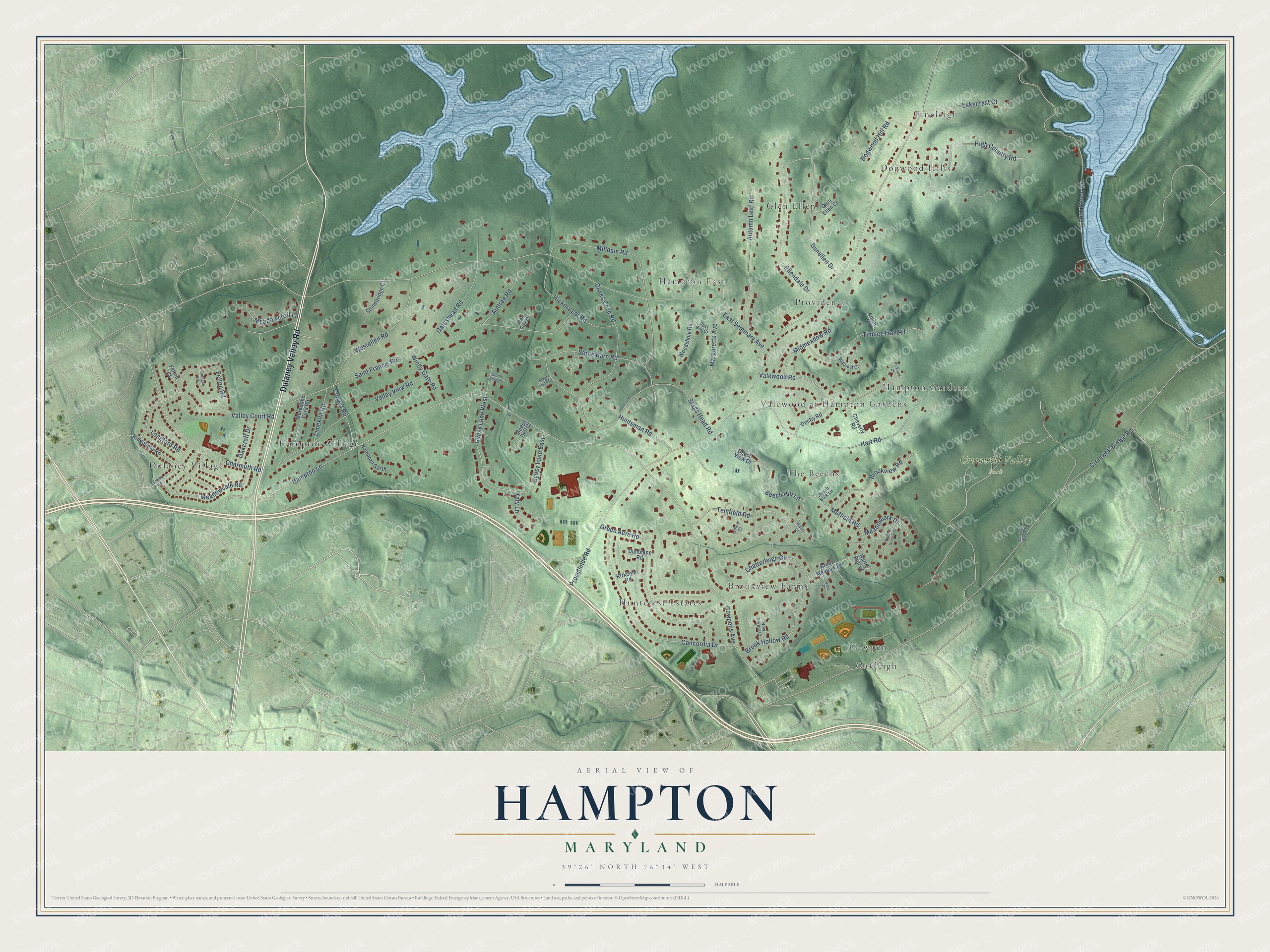
Hampton, Maryland Map Art
Building by building, with labeled streets and shaded relief.
12" x 18" Archival Matte Print
A Map of Home. A Work of Art.
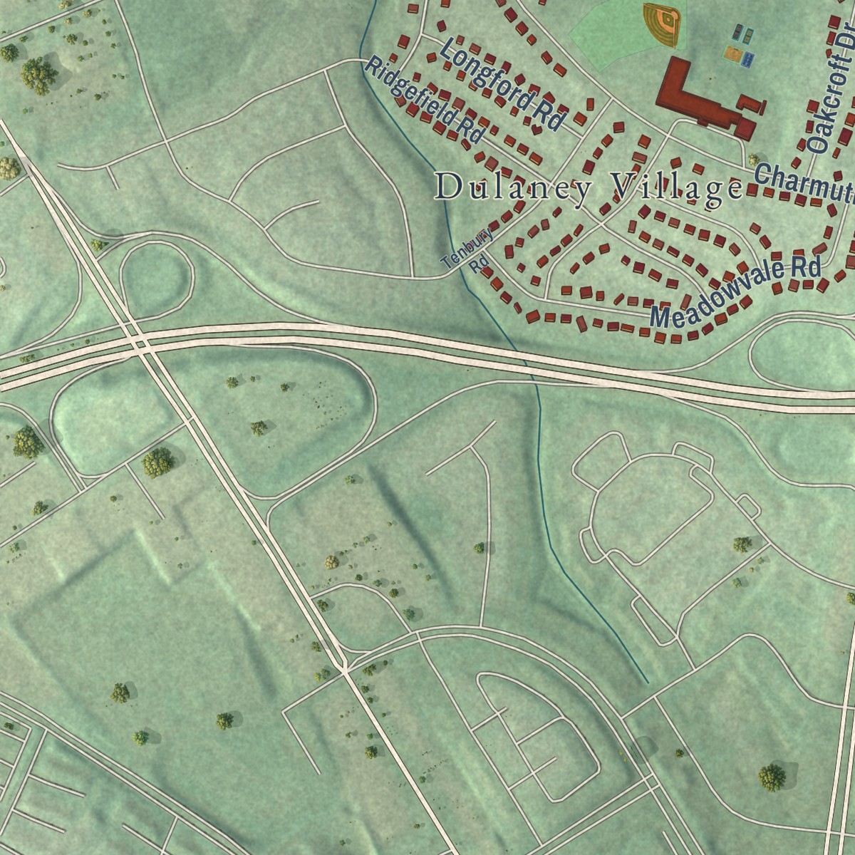
Explore Hampton, Maryland from a whole new perspective. Created using aerial imagery and detailed geographic data, this map captures Hampton building by building, with labeled streets, familiar landmarks, and shaded topographical relief that highlights the natural contours of the landscape.
Combining modern data with the timeless character of a vintage atlas, this map is just as interesting up close as it is beautiful on the wall. Whether you grew up in Hampton, spent memorable years there, or call it home today, this unique map is a great way to celebrate a place that means something to you. Zoom in on the preview to look for your street, and then order a print to put your memories on the wall.
Three ways to hang it
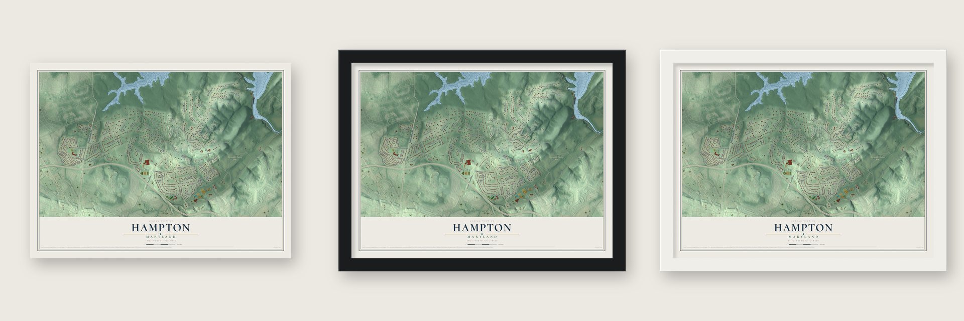
Unframed archival matte, a black wood frame or a white wood frame.
Up close
Geography Worth Displaying
This map was created using accurate cartographic data and authoritative geographic sources, including the U.S. Geological Survey and the Census Bureau. The map brings together terrain, waterways, roads, and building detail. The majority of the streets are labeled, houses are accurately depicted, and the topography is derived from government sources. Combining local data with carefully composed color and shading leads to this beautifully detailed Hampton artwork for your wall.
Rather than simply showing street outlines, we’ve included as many of the street names as we could reasonably fit on the map while keeping their names legible. Zoom in on the high resolution preview to see exactly what’s on the map. We truly set out to create a statement piece for anyone who loves Hampton. So whether it’s for you, or a gift for someone you love, we hope this map of Hampton brings back fond memories.
Read the story behind this map of Hampton, Maryland from 2026.
Find your street
Names on the Hampton map
Every name below is printed on this map. Look for your street, your school, the park where you played, or the pond down the road.
Places and landmarks15
- Cromwell Valley Park
- Dulaney Village
- Huntcrest Estates
- Glen Ellen
- The Beechs
- Hampton East
- Oakleigh
- Dogwood Hills
- Hampton Village
- Providence
- Valewood at Hampton Gardens
- Brookview Farms
Show all 15 places
- Pineleigh
- Hampton Gardens
- Cowpen
Streets and roads82
- Dulaney Valley Road
- Hampton Lane
- Cowpens Avenue
- Providence Road
- Cromwell Bridge Road
- East Seminary Avenue
- Loch Raven Drive
- Saint Francis Road
- Stags Head Road
- Hart Road
- Milldam Road
- Concordia Drive
- Valley View Road
- Green Acre Road
- Metfield Road
- Stone Barn Road
- Ellendale Drive
- Charmuth Road
- Felton Road
- Valewood Road
- Dunellen Drive
- Autumn Leaf Road
- Westellen Road
- Doves Cove Road
- Timber Trail Road
- Gateshead Road
- Gypsy Lane West
- Margarette Avenue
- Hickory Lot Road
- Temfield Road
Show all 82 streets
- High Country Road
- Brook Hollow Road
- Meadowvale Road
- Brookview Road
- Valley Court Road
- Chatterleigh Circle
- Beech Hill Lane
- Huntsman Road
- Aintree Road
- Lakecrest Court
- Gypsy Lane East
- Midmeadow Road
- Dogwood Hill Road
- Culvert Road
- Meadowlark Drive
- Windy Gate Road
- Limekiln Road
- Oakcroft Drive
- Meadowcroft Lane
- Longford Road
- Katy Lane
- Brook Meadow Drive
- Ridgefield Road
- Denby Road
- Merediths Ford Road
- Hampton Garth
- Cheverly Road
- Stonebridge Court
- Woodshole Road
- Amiel Court
- Beech View Court
- Dunblane Road
- Kirkcolm Road
- Glen Ellen Court
- Sleepy Dell Court
- Harts Run Court
- Felton Court
- Red Fox Court
- Beech Bark Lane
- Linlow Court
- Post Boy Court
- Midcrest Court
- New Forest Court
- Tenbury Road
- Ruffed Grouse Court
- Drake Court
- Doragen Court
- Carriage Walk Court
- Pickford Court
- Stags Head Court
- Stone Barn Court
- Waller Court
Names are listed as they appear on the printed map. Zoom into the product photos to find them.
About Hampton, Maryland
Hampton is a community of 5,180 people in Baltimore County, just north of Baltimore. Susquehannock Indians once followed a trail across this land that later became Joppa Road. The ground was part of a 1695 land grant to a relative of Lord Baltimore, and on April 2, 1745, his heirs sold it to a man who traded goods and grew tobacco, Col. Charles Ridgely.
Captain Charles Ridgely grew rich selling iron to the American army during the Revolution, and between 1783 and 1790 he built Hampton Mansion on the family land. Later Ridgelys farmed the estate for generations. In 1929 the last master of Hampton, John Ridgely Jr., set up the Hampton Development Company and started selling off parcels, and the modern neighborhood grew up around the old house.
- Among the grandest housesHampton Mansion ranked with the largest and most ornate homes put up anywhere in the country before 1850. It was also the first National Park Service property picked for the quality of its architecture.
- A historic site since 1948The Ridgely family held on to the mansion until 1948. That year the house and the final 43 acres of the estate became a National Historic Site, and the family sold them to a trust formed to preserve them. The National Park Service later took them over and runs them today.
- Terraces, orchards and horsesBelow the mansion, the Ridgelys carved terraced gardens into the slope, a job that has been cited as perhaps the biggest earth-moving project in 18th-century America. The family also kept apple orchards, bred thoroughbred race horses and kept quarters for enslaved workers on the land.
- A spire and a saved woodsTowson United Methodist Church finished its Georgian-style sanctuary in Hampton in 1958, with a 235-foot spire on 16 acres. In 2008 the church planned to sell 5 wooded acres for senior housing, which needed a zoning change to 16 units per acre. The Hampton Improvement Association objected, and the church dropped the plan to stay a good neighbor. The woods now hold a walking path, open to the public in daylight.
Keep exploring Maryland
Hampton is one of 881 Maryland towns we've mapped. Every dot on the map is a print of its own.
The search covers every state, Maryland first.
Near Hampton
Order 2 or more town maps and save 10%. Shown in the size and finish you picked above, so they hang as a set.
- Timonium 12" x 18" / Archival Matte Print $39.99
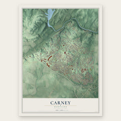
- Carney 12" x 18" / Archival Matte Print $39.99
- Lutherville 12" x 18" / Archival Matte Print $39.99
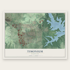

More maps nearby: Parkville, Towson, Idlewood, Mt Pleasant Park and North Harford Road.
The art of mapping a place
How This Map Was Made
Real places. Remarkable detail. Discover the layers that turn geographic data into a map of home.

The view from above
Aerial imagery reveals the character of the land: woodland, open fields, and the patterns of a place.

The shape of the land
Elevation data brings hills, valleys, and subtle changes in the landscape into view.

The details of home
Roads, waterways, and building footprints come together to make the map feel unmistakably local.

Geography becomes art
Considered color, shading, and typography bring the layers together in a map made for your wall.


Process illustrated with Mendon, Massachusetts. Aerial imagery: USDA NAIP. Terrain: USGS 3D Elevation Program. Map details and finished artwork: KNOWOL.
The Details
About This Print
Choose an archival matte print, or a black or white Ayous wood frame. The archival matte print is unframed.
Select your size and finish above to see the matching product image and price.
Materials & Craftsmanship
A contemporary map with the character of a classic atlas, printed on archival matte paper. Optional frames are made from Ayous wood.
Your printed map does not include the watermark shown in the full-map preview.
Shipping & Delivery
Free shipping within the United States. Every print is made to order in the USA.
Buying a gift? Add a note in your cart and we'll include it. We never put prices in the package.
Prints ship within 2 to 3 business days. Allow 7 to 10 days total from ordering for delivery. Timing may vary during holidays or periods of high order volume.
Read our shipping policy.
Returns and damaged prints
Each print is made to order. Change-of-mind refunds are not available after production.
If your print arrives damaged, misprinted or incorrect, contact support@knowol.com within 30 days of receiving it. Include your order number, photos and a description of the issue.
Read our full refund and replacement policy. For questions about your order, email support@knowol.com.