
Search for another town


Free U.S. delivery 7 to 10 days after you order
Timonium, Maryland Map Art
Building by building, with labeled streets and shaded relief.
12" x 18" Archival Matte Print
A Map of Home. A Work of Art.
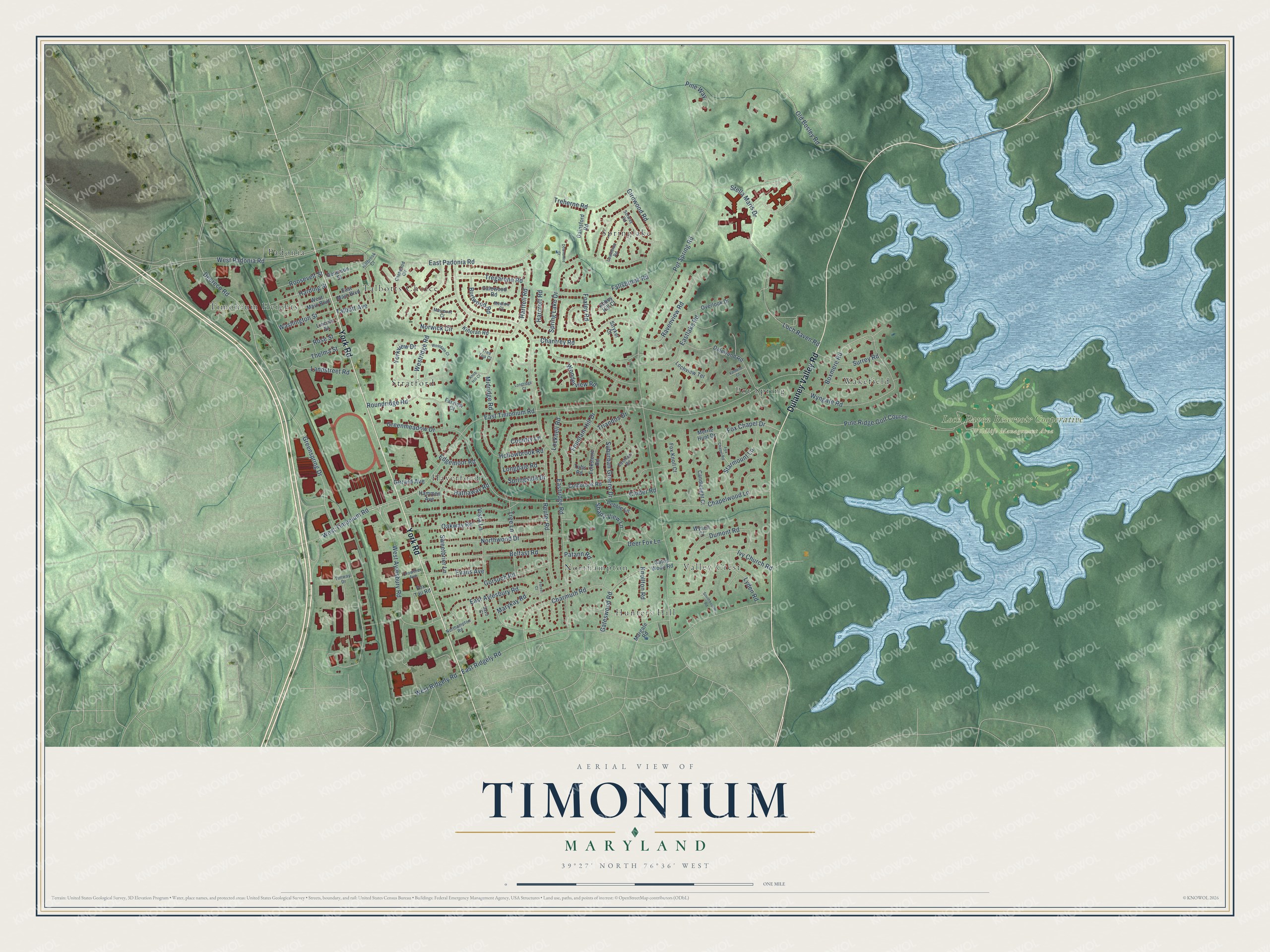
Explore Timonium, Maryland from a whole new perspective. Created using aerial imagery and detailed geographic data, this map captures Timonium building by building, with labeled streets, familiar landmarks, and shaded topographical relief that highlights the natural contours of the landscape.
Combining modern data with the timeless character of a vintage atlas, this map is just as interesting up close as it is beautiful on the wall. Whether you grew up in Timonium, spent memorable years there, or call it home today, this unique map is a great way to celebrate a place that means something to you. Zoom in on the preview to look for your street, and then order a print to put your memories on the wall.
Three ways to hang it
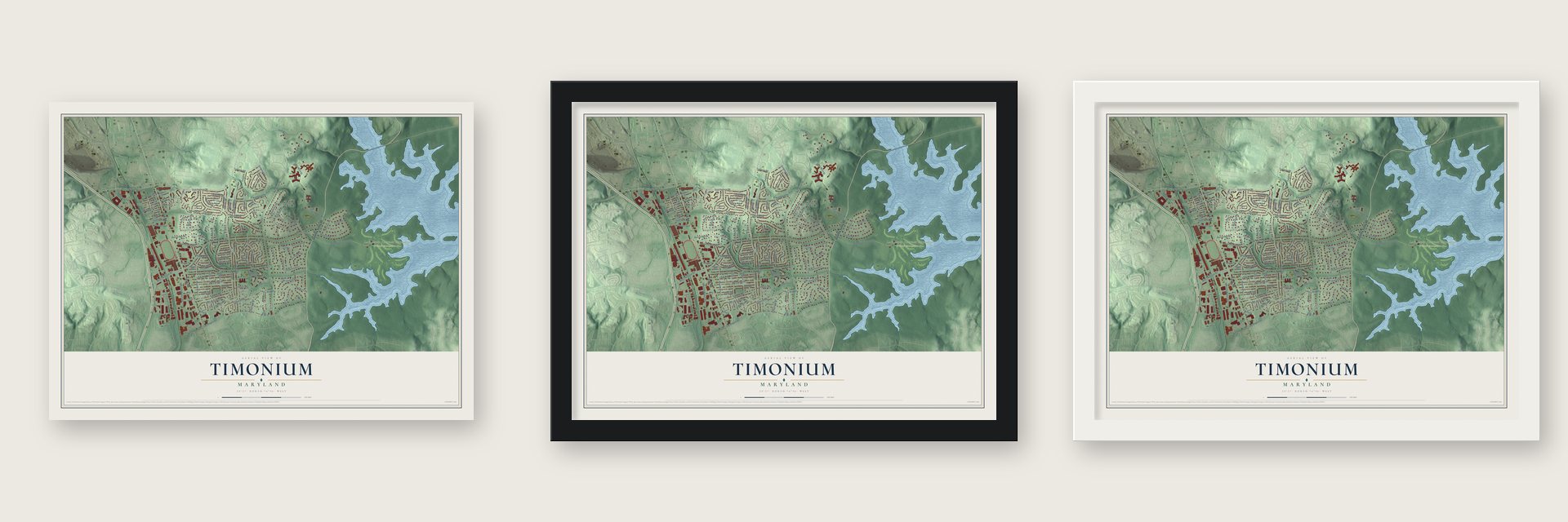
Unframed archival matte, a black wood frame or a white wood frame.
Up close
Geography Worth Displaying
This map was created using accurate cartographic data and authoritative geographic sources, including the U.S. Geological Survey and the Census Bureau. The map brings together terrain, waterways, roads, and building detail. The majority of the streets are labeled, houses are accurately depicted, and the topography is derived from government sources. Combining local data with carefully composed color and shading leads to this beautifully detailed Timonium artwork for your wall.
Rather than simply showing street outlines, we’ve included as many of the street names as we could reasonably fit on the map while keeping their names legible. Zoom in on the high resolution preview to see exactly what’s on the map. We truly set out to create a statement piece for anyone who loves Timonium. So whether it’s for you, or a gift for someone you love, we hope this map of Timonium brings back fond memories.
Read the story behind this map of Timonium, Maryland from 2026.

Find your street
Names on the Timonium map
Every name below is printed on this map. Look for your street, your school, the park where you played, or the pond down the road.
Places and landmarks13
- Loch Raven Reservoir Cooperative Wildlife Management Area
- Timonium Heights
- Hunters Hill
- Springlake
- Pot Spring
- Haverford
- Valley Crest
- Stratford
- Wakefield
- Padonia
- Northampton
- Talbotts Choice
Show all 13 places
- Pine Ridge Golf Course
Streets and roads126
- Dulaney Valley Road
- York Road
- East Padonia Road
- Deereco Road
- Greenspring Drive
- Pot Spring Road
- East Timonium Road
- Eastridge Road
- East Ridgely Road
- Spring Lake Drive
- Cinder Road
- Loch Raven Road
- Greenmeadow Drive
- West Padonia Road
- Reuter Road
- West Aylesbury Road
- Westridge Road
- Wyngate Road
- Gateswood Road
- Northwood Drive
- Vista Lane
- Oakway Road
- Ivy Church Road
- East Aylesbury Road
- Sweetbrier Lane
- Charmuth Road
- Belfast Road
- Fallsbrook Road
- Suburban Greens Drive
- Chantrey Road
Show all 126 streets
- Springside Drive
- Gorsuch Road
- Old Bosley Road
- Girdwood Road
- Chapelwood Lane
- West Timonium Road
- Dumont Road
- Ravenview Road
- West Ridgely Road
- Midridge Road
- Eastlake Road
- Fox Chapel Drive
- Hollowbrook Road
- Boxmere Road
- Starmount Lane
- Fountain Hill Drive
- Stella Maris Drive
- Treherne Road
- Deer Fox Lane
- Tree Lane
- Yorkview Drive
- Edgemoor Road
- Tregarone Road
- Wonderview Road
- Gerard Avenue
- Norwick Circle
- Hartfell Road
- Landstreet Road
- Surrey Road
- Knollton Road
- Hathaway Road
- Lyden Road
- Roosevelt Street
- Harding Street
- Washington Street
- Evans Avenue
- Shady View Lane
- Foxley Road
- Rose Street
- Roundridge Road
- Thelma Street
- Burlwood Road
- Harcroft Road
- Talbott Avenue
- Longdale Road
- Triandos Drive
- Marykay Road
- Country Lane
- Locknell Road
- Patann Road
- Pine Way
- Gates Wood Road
- Coldbrook Road
- Dalewood Road
- Folkstone Road
- Overlook Drive
- Killoran Road
- Gainsford Road
- Galewood Road
- Margate Road
- Candlelight Court
- Lochview Terrace
- Wynell Court
- Deneison Street
- Pebble Lane
- Fox Knoll Court
- Fox Tail Road
- West Main Boulevard
- East Main Boulevard
- Merrie Hunt Drive
- Hammen Avenue
- Farview Court
- Lincoln Street
- Tufts Road
- Stryker Court
- Abbey Hill Court
- Chetwood Circle
- Eastham Road
- Northampton Road
- Solway Road
- Lawnside Road
- Hillbrook Court
- Crowther Avenue
- Medlow Court
- Maymont Court
- Timway Drive
- Savo Court
- Tree Top Court
- Fox Chapel Road
- Westdale Court
- Southbourne Road
- Downshire Court
- Knob Hill Court
- Valdene Court
- Longridge Court
- Forest Court
Names are listed as they appear on the printed map. Zoom into the product photos to find them.
About Timonium, Maryland
Timonium is a community of 10,458 people in Baltimore County, north of Baltimore along York Road. In the early 1780s a Baltimore merchant, probably Archibald Buchanan, built a house here on an estate of more than 250 acres that was then known as Belle Field. Buchanan was married to Sarah Brooke Lee, whose brother Thomas Sim Lee served as governor of Maryland.
Buchanan died in 1785, and it was apparently his widow who gave the estate its new name, Timonium. According to Wikipedia, she had lost her eyesight and a close friend, and she felt her life had become like Mark Antony's after his defeat at Actium. Antony's Timonium was an unfinished palace on Antirhodos, an island in Alexandria's harbor, and he took his own life there after a false report that Cleopatra had died. The community later took its name from the mansion.
- The area's first official trackAfter the Buchanan family had owned the house for many years, it was sold. Its new owner kept a one-mile racetrack on the property, which is thought to have been the first official track in the area. Horse racing stayed tied to this ground for generations afterward.
- A county fair in 1879In September 1879 the county's Agricultural Society held its first agricultural fair on 37 acres it had leased from the Timonium estate. Horse races were on the program from the start.
- The Maryland State Fair since 1906In 1906 the county's Agricultural Society joined with another group, and the Maryland State Fair found its home at Timonium. The fair still comes every year around Labor Day, on the grounds of the old Timonium Race Course, a track that ranks with Pimlico and Laurel Park in the story of Maryland thoroughbred racing. Grafton Marsh Bosley, a physician and planner, was one of the fair's founders.
Keep exploring Maryland
Timonium is one of 881 Maryland towns we've mapped. Every dot on the map is a print of its own.
The search covers every state, Maryland first.
Near Timonium
Order 2 or more town maps and save 10%. Shown in the size and finish you picked above, so they hang as a set.
- Lutherville 12" x 18" / Archival Matte Print $39.99
- Hampton 12" x 18" / Archival Matte Print $39.99
- Cockeysville 12" x 18" / Archival Matte Print $39.99


More maps nearby: Mays Chapel, Towson, Carney, Parkville and Carroll Manor.
The art of mapping a place
How This Map Was Made
Real places. Remarkable detail. Discover the layers that turn geographic data into a map of home.

The view from above
Aerial imagery reveals the character of the land: woodland, open fields, and the patterns of a place.

The shape of the land
Elevation data brings hills, valleys, and subtle changes in the landscape into view.

The details of home
Roads, waterways, and building footprints come together to make the map feel unmistakably local.

Geography becomes art
Considered color, shading, and typography bring the layers together in a map made for your wall.


Process illustrated with Mendon, Massachusetts. Aerial imagery: USDA NAIP. Terrain: USGS 3D Elevation Program. Map details and finished artwork: KNOWOL.
The Details
About This Print
Choose an archival matte print, or a black or white Ayous wood frame. The archival matte print is unframed.
Select your size and finish above to see the matching product image and price.
Materials & Craftsmanship
A contemporary map with the character of a classic atlas, printed on archival matte paper. Optional frames are made from Ayous wood.
Your printed map does not include the watermark shown in the full-map preview.
Shipping & Delivery
Free shipping within the United States. Every print is made to order in the USA.
Buying a gift? Add a note in your cart and we'll include it. We never put prices in the package.
Prints ship within 2 to 3 business days. Allow 7 to 10 days total from ordering for delivery. Timing may vary during holidays or periods of high order volume.
Read our shipping policy.
Returns and damaged prints
Each print is made to order. Change-of-mind refunds are not available after production.
If your print arrives damaged, misprinted or incorrect, contact support@knowol.com within 30 days of receiving it. Include your order number, photos and a description of the issue.
Read our full refund and replacement policy. For questions about your order, email support@knowol.com.