
Search for another town


Free U.S. delivery 7 to 10 days after you order
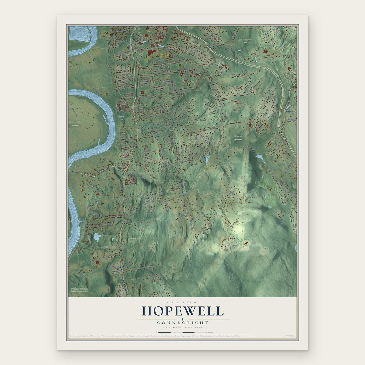
Hopewell, Connecticut Map Art
Building by building, with labeled streets and shaded relief.
12" x 18" Archival Matte Print
A Map of Home. A Work of Art.
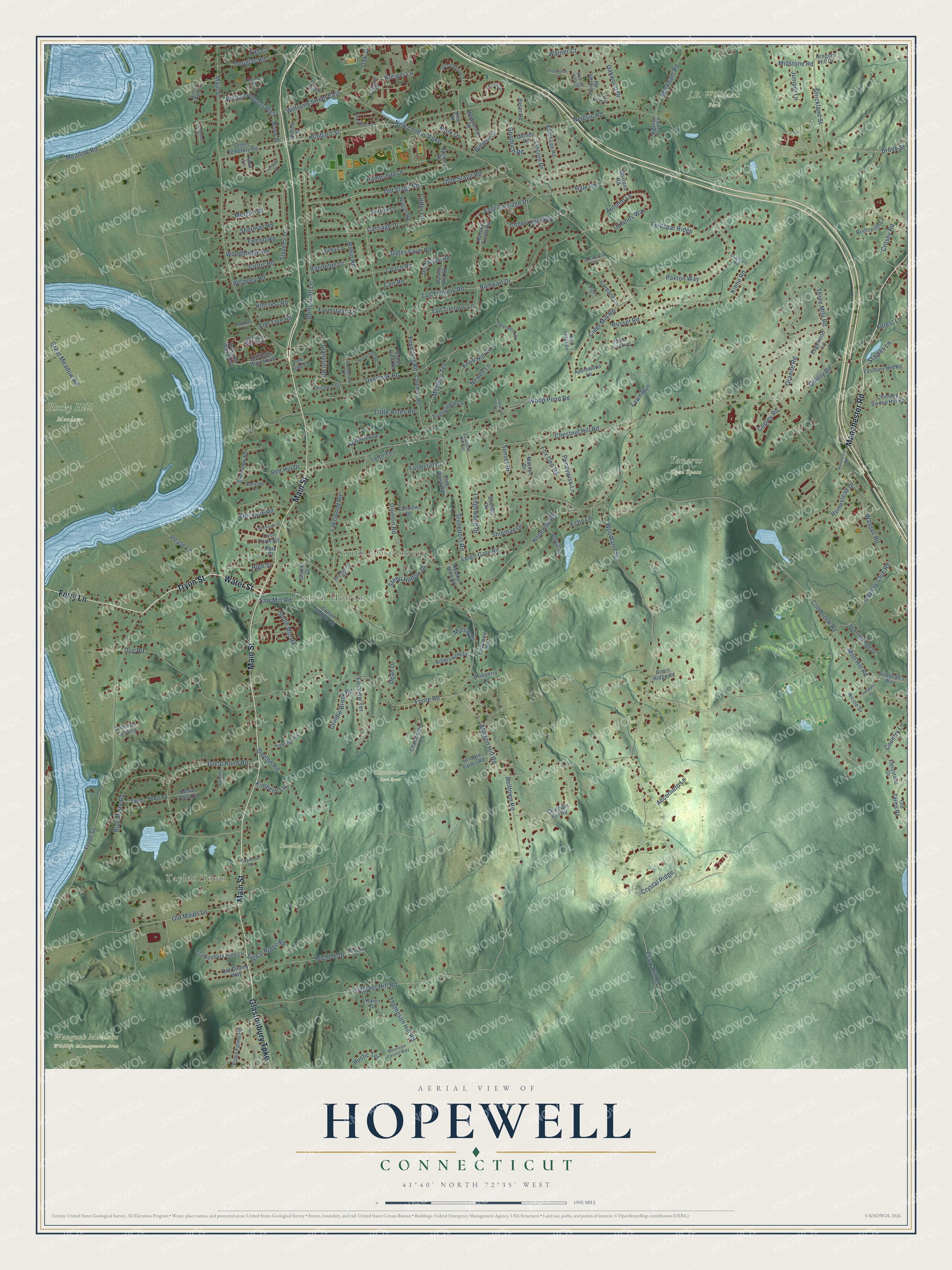
Explore Hopewell, Connecticut from a whole new perspective. Created using aerial imagery and detailed geographic data, this map captures Hopewell building by building, with labeled streets, familiar landmarks, and shaded topographical relief that highlights the natural contours of the landscape.
Combining modern data with the timeless character of a vintage atlas, this map is just as interesting up close as it is beautiful on the wall. Whether you grew up in Hopewell, spent memorable years there, or call it home today, this unique map is a great way to celebrate a place that means something to you. Zoom in on the preview to look for your street, and then order a print to put your memories on the wall.
Three ways to hang it

Unframed archival matte, a black wood frame or a white wood frame.
Up close
Geography Worth Displaying
This map was created using accurate cartographic data and authoritative geographic sources, including the U.S. Geological Survey and the Census Bureau. The map brings together terrain, waterways, roads, and building detail. The majority of the streets are labeled, houses are accurately depicted, and the topography is derived from government sources. Combining local data with carefully composed color and shading leads to this beautifully detailed Hopewell artwork for your wall.
Rather than simply showing street outlines, we’ve included as many of the street names as we could reasonably fit on the map while keeping their names legible. Zoom in on the high resolution preview to see exactly what’s on the map. We truly set out to create a statement piece for anyone who loves Hopewell. So whether it’s for you, or a gift for someone you love, we hope this map of Hopewell brings back fond memories.
Read the story behind this map: Detailed Map of Hopewell, Connecticut.

Find your street
Names on the Hopewell map
Every name below is printed on this map. Look for your street, your school, the park where you played, or the pond down the road.
Places and landmarks10
- Taylor Town
- Cotton Hollow
- South Glastonbury
- Chamberlain Open Space
- Earle Park
- J.B. Williams Park
- Rocky Hill Meadows
- Scoville Tract
- Wangunk Meadows Wildlife Management Area
- Yanaros Open Space
Streets and roads224
- Tryon Street
- Main Street
- Water Street
- Manchester Road
- Glastonbury Turnpike
- Ferry Lane
- Hubbard Street
- High Street
- Rampart Drive
- Great Pond Road
- Uplands Way
- Clark Hill Road
- Stevens Lane
- New London Turnpike
- Neipsic Road
- Hopewell Road
- Chestnut Hill Road
- Matson Hill Road
- Coldbrook Road
- Country Club Road
- Woodland Street
- Isinglass Hill Road
- Tall Timbers Road
- Foote Road
- Overlook Road
- Buttonball Lane
- Three Mile Road
- Great Meadow Road
- Old Maids Lane
- Old Stage Road
Show all 224 streets
- Olde Stage Road
- Founders Road
- Paxton Way
- Dayton Road
- Meadow Road
- Dug Road
- Carriage Drive
- Wood Pond Road
- Farmcliff Drive
- Kinne Road
- Feldspar Ridge
- Sunset Drive
- Michele Drive
- Robin Road
- Cider Mill Road
- Strickland Street
- Stockade Road
- Farmstead Lane
- Wassuc Road
- Mott Hill Road
- Lincoln Drive
- Quarry Road
- Leigh Gate Road
- Bluff Point Road
- Country Lane
- Thompson Hill Road
- Lakewood Road
- South Mill Road
- Little Acres Road
- Hale Road
- Moseley Terrace
- Belltown Road
- Gates Farm Road
- Conestoga Way
- Shipman Drive
- Knob Hill Road
- Hampshire Drive
- Signal Ridge Road
- Homestead Drive
- Wickham Road
- Morgan Drive
- Ledgewood Drive
- Fairview Terrace
- Autumn Lane
- Stonepost Road
- Williams Street East
- Pease Lane
- Oakwood Drive
- Drumlin Road
- Evergreen Lane
- Fawn Run
- Williams Street West
- Douglas Road
- Copley Road
- Crystal Ridge
- Red Hill Drive
- Steep Hollow Drive
- Talcott Road
- Woodbridge Road
- Whapley Road
- Millstone Road
- Curtis Road
- Fox Den Road
- Pennywise Lane
- Goodrich Road
- Hillcrest Road
- Granite Road
- Grindle Brook Road
- Staples Lane
- Stancliff Road
- Sherman Road
- Oak Street
- East Carriage Drive
- Kreiger Lane
- Newell Lane
- Bidwell Street
- Tall Timbers Lane
- Warner Court
- Juniper Lane
- Surrey Lane
- Russet Road
- Mark Drive
- Coach Road
- Randolph Drive
- Saw Mill Road
- Lenti Terrace
- Echo Lane
- Kimberly Lane
- Accornero Lane
- Elm Tree Road
- Cutter Lane
- Dean Drive
- Forest Lane
- Rustic Terrace
- Brook Street
- Crosby Road
- Cart Road
- Murray Drive
- Full Circle
- Hollister Way West
- Hanover Fields Road
- Cotton Hollow Road
- Boulder Circle
- Karen Lee Road
- Chatham Hill Road
- Coleman Road
- Old Farms Road
- Marilyn Drive
- Riverview Road
- Northview Drive
- Chambelain Lane
- Olde Wood Road
- Glastonbury Hunt Lane
- Tryon Farm Road
- Chimney Sweep Hill Road
- Taylor Town Road
- Paley Farms Road
- Eastbury Hill Road
- Hollister Way South
- Fieldstone Drive
- Green Cemetery Road
- Valley View Road
- Bittersweet Lane
- Orchard Lane
- Fairlawn Road
- Old Musket Road
- Wadsworth Street
- Huntingridge Drive
- Karen Drive
- Jeremiah's Way
- Pine Tree Lane
- Purtill Street
- Wagon Road
- Old County Way
- Heather Glen Road
- Edgewood Lane
- Bunker Hill Road
- Kettle Pond Drive
- Bridlepath Lane
- Hopewell Heights
- Hi-Gate Farms Road
- Willieb Street
- Maple Street
- Cortland Lane
- Blueberry Lane
- Fallview Drive
- Park Place
- Roser Road
- Quincy Road
- Sulky Lane
- Applewood Lane
- Acorn Ridge Road
- Duffords Landing
- Montano Road
- Nicole Drive
- Brittany Road
- Gregory Hill Drive
- Glazier Drive
- Knox Lane
- Hollister Way North
- Georgetown Drive
- Southpond Road
- Lenox Drive
- Sherwood Drive
- Mountain Laurel Way
- Willow Green Lane
- Rolling Hills Drive
- Brookfield Drive
- Wickham Road Extension
- Flanagan Drive
- Highridge Road
- Palisade Terrace
- West Ledge Road
- Pippin Drive East
- Scarboro Road
- Raymond Road
- Chestnut Hill Terrace
- Miller Road
- Michelle Drive
- Peach Tree Road
- Hubbard Drive
- Rockhaven Drive
- Trymbulak Lane
- Backland Road
- Canione Road
- Sunny Slope Drive
- Southgate Drive
- Jacques Lane
- Hubbard Run
- Smithbrook Terrace
- Arrowhead Drive
- Westview Lane
- Cotswold Close
- Pilgard Lane
Names are listed as they appear on the printed map. Zoom into the product photos to find them.
Keep exploring Connecticut
Hopewell is one of 382 Connecticut towns we've mapped. Every dot on the map is a print of its own.
The search covers every state, Connecticut first.
Near Hopewell
Order 2 or more town maps and save 10%. Shown in the size and finish you picked above, so they hang as a set.
- Glastonbury 12" x 18" / Archival Matte Print $39.99
- Glastonbury Center 12" x 18" / Archival Matte Print $39.99
- Rocky Hill 12" x 18" / Archival Matte Print $39.99
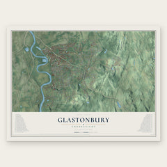


More maps nearby: Portland, Wethersfield, Cromwell, Lake Pocotopaug and Terramuggus.
The art of mapping a place
How This Map Was Made
Real places. Remarkable detail. Discover the layers that turn geographic data into a map of home.

The view from above
Aerial imagery reveals the character of the land: woodland, open fields, and the patterns of a place.

The shape of the land
Elevation data brings hills, valleys, and subtle changes in the landscape into view.

The details of home
Roads, waterways, and building footprints come together to make the map feel unmistakably local.

Geography becomes art
Considered color, shading, and typography bring the layers together in a map made for your wall.


Process illustrated with Mendon, Massachusetts. Aerial imagery: USDA NAIP. Terrain: USGS 3D Elevation Program. Map details and finished artwork: KNOWOL.
The Details
About This Print
Choose an archival matte print, or a black or white Ayous wood frame. The archival matte print is unframed.
Select your size and finish above to see the matching product image and price.
Materials & Craftsmanship
A contemporary map with the character of a classic atlas, printed on archival matte paper. Optional frames are made from Ayous wood.
Your printed map does not include the watermark shown in the full-map preview.
Shipping & Delivery
Free shipping within the United States. Every print is made to order in the USA.
Buying a gift? Add a note in your cart and we'll include it. We never put prices in the package.
Prints ship within 2 to 3 business days. Allow 7 to 10 days total from ordering for delivery. Timing may vary during holidays or periods of high order volume.
Read our shipping policy.
Returns and damaged prints
Each print is made to order. Change-of-mind refunds are not available after production.
If your print arrives damaged, misprinted or incorrect, contact support@knowol.com within 30 days of receiving it. Include your order number, photos and a description of the issue.
Read our full refund and replacement policy. For questions about your order, email support@knowol.com.