
Search for another town

Free U.S. delivery 7 to 10 days after you order
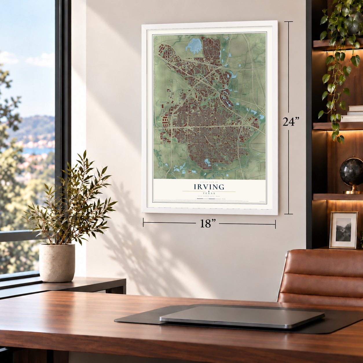
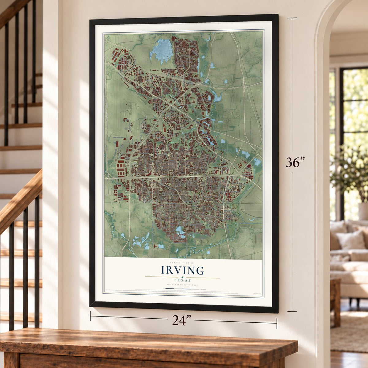
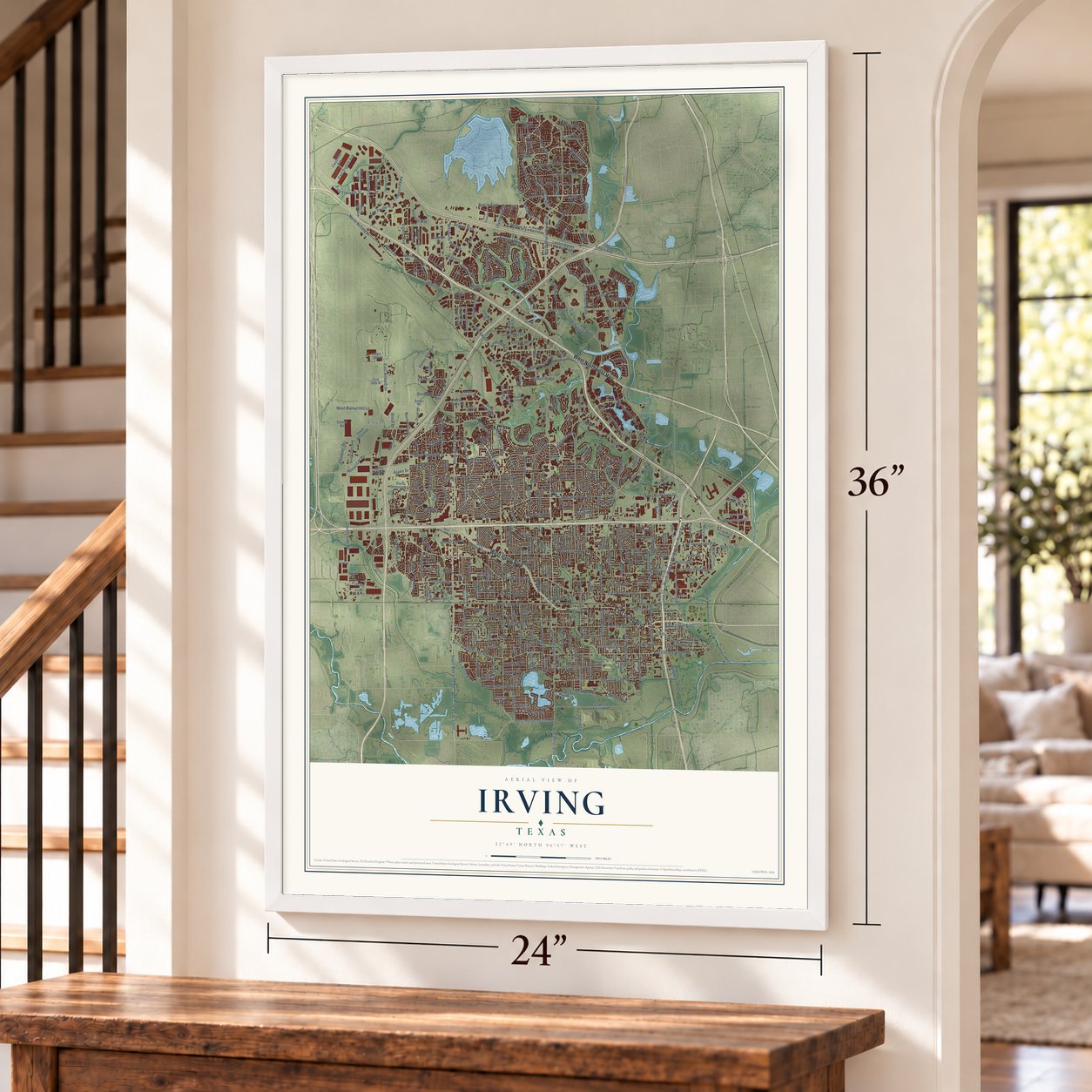
Irving, Texas Map Art
Building by building, with labeled streets and shaded relief.
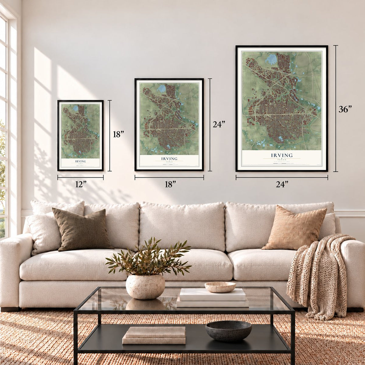
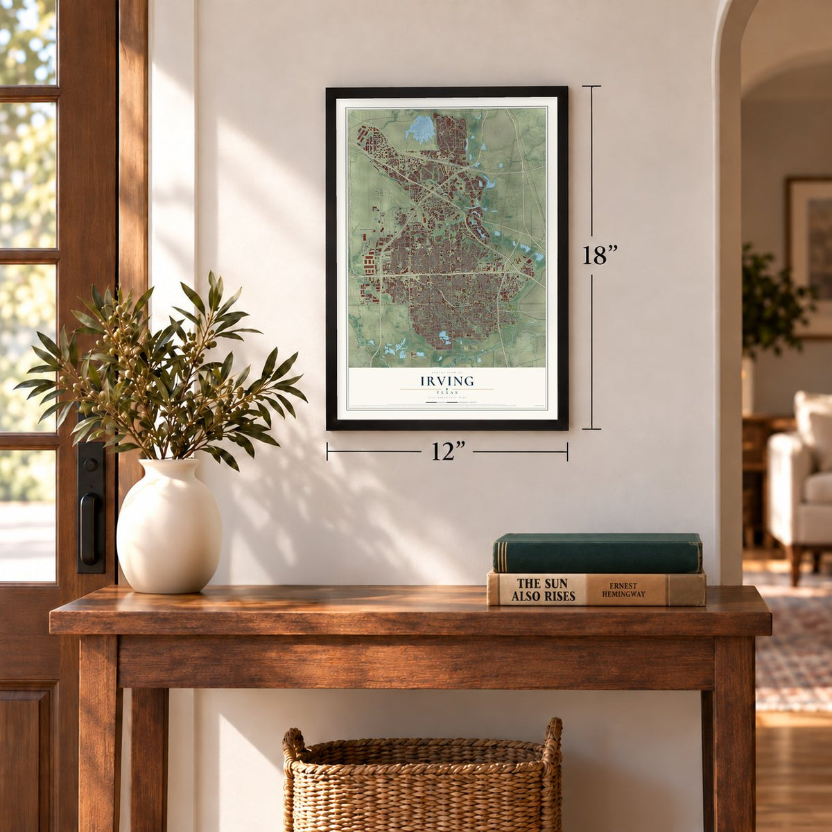
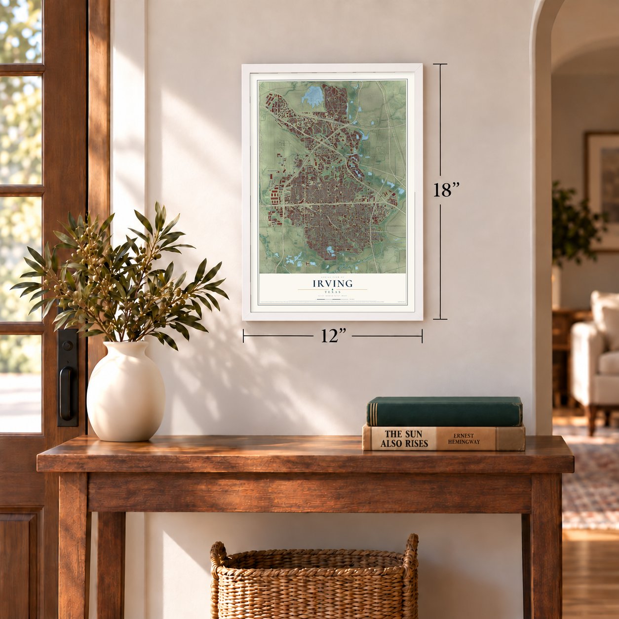
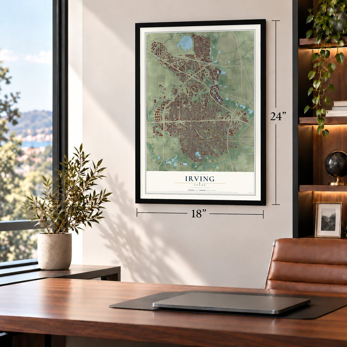
12" x 18" Archival Matte Print
A Map of Home. A Work of Art.
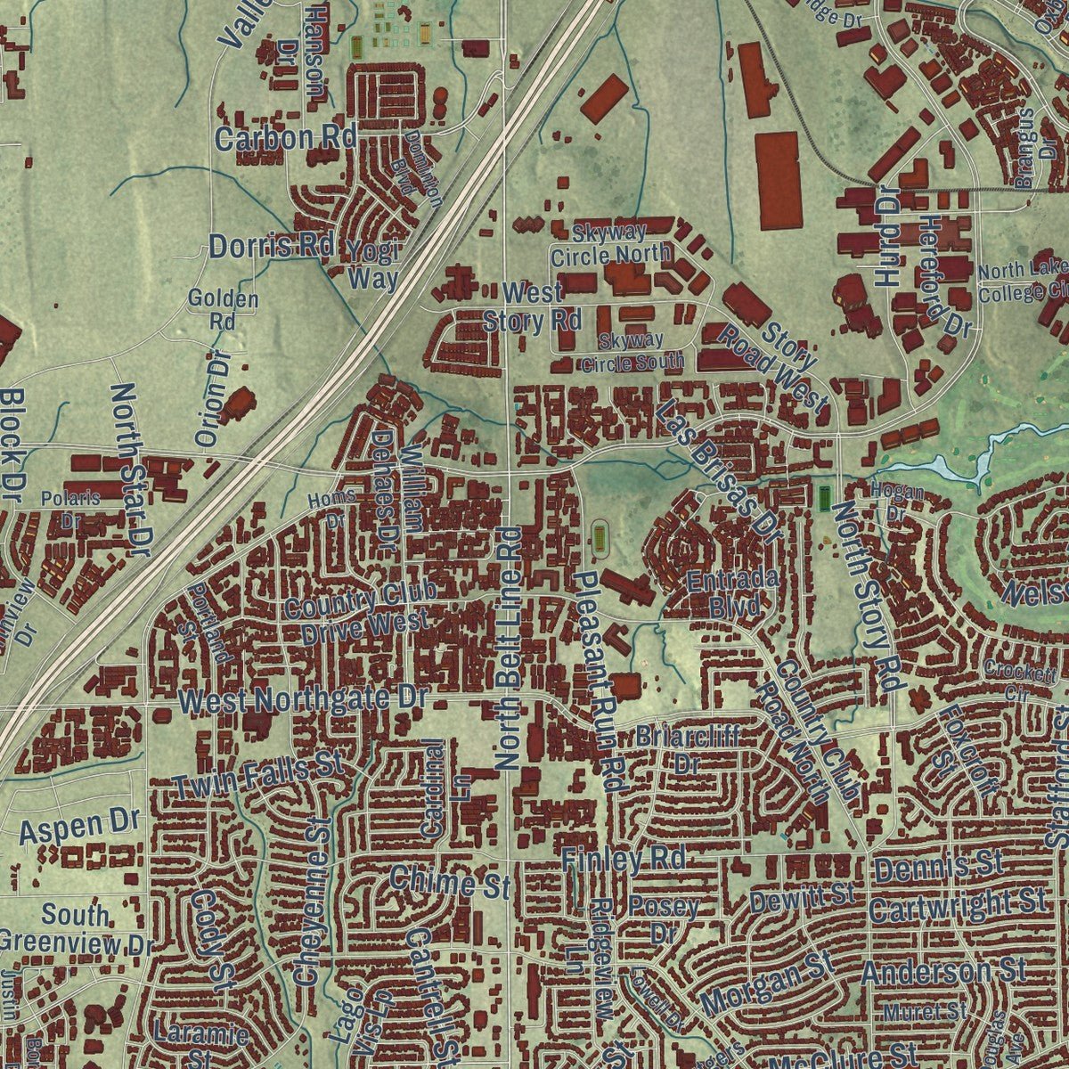
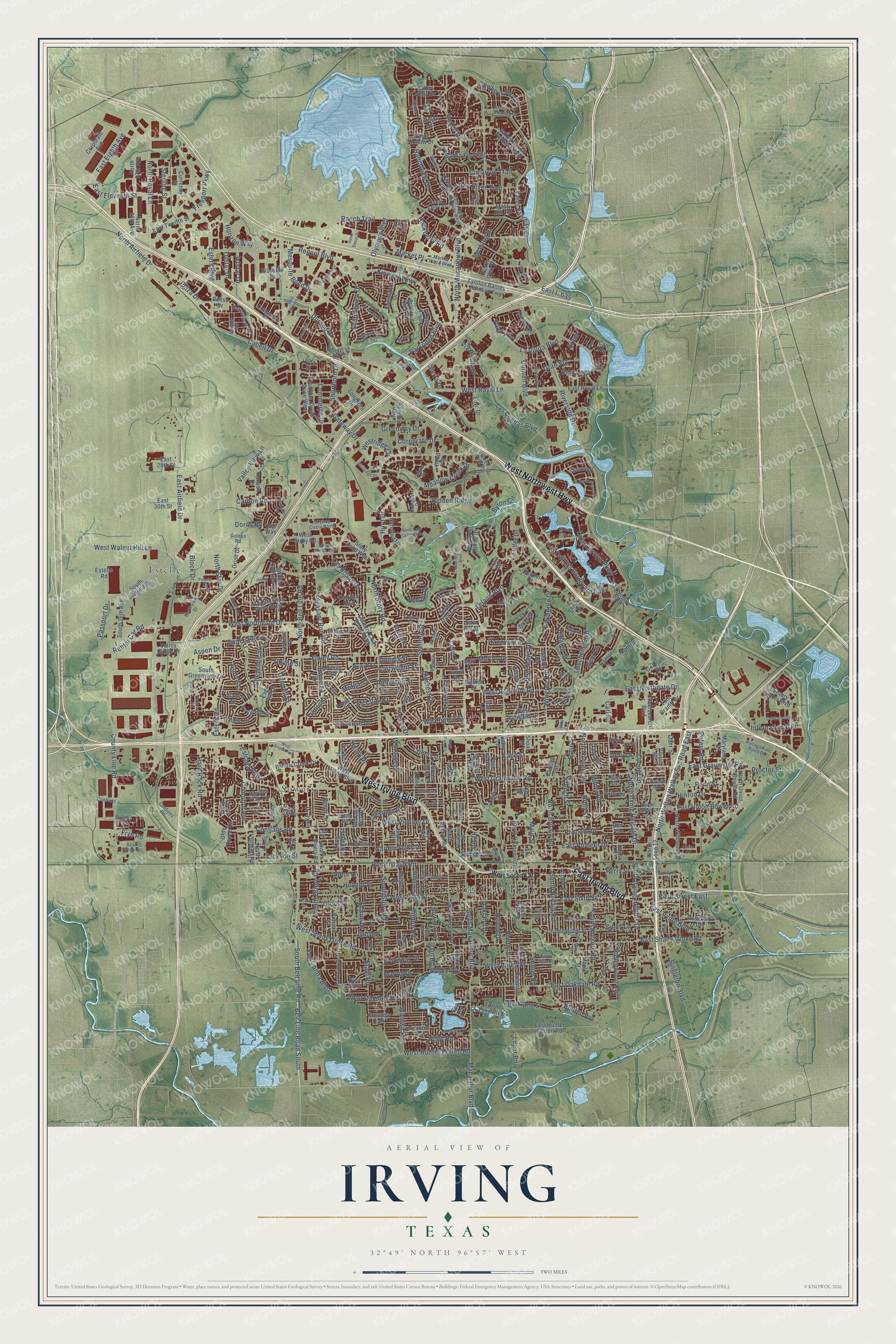
Explore Irving, Texas from a whole new perspective. Created using aerial imagery and detailed geographic data, this map captures Irving building by building, with labeled streets, familiar landmarks, and shaded topographical relief that highlights the natural contours of the landscape.
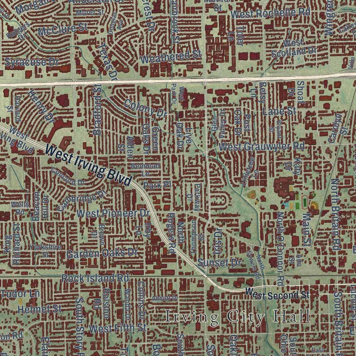
Combining modern data with the timeless character of a vintage atlas, this map is just as interesting up close as it is beautiful on the wall. Whether you grew up in Irving, spent memorable years there, or call it home today, this unique map is a great way to celebrate a place that means something to you. Zoom in on the preview to look for your street, and then order a print to put your memories on the wall.
Three ways to hang it
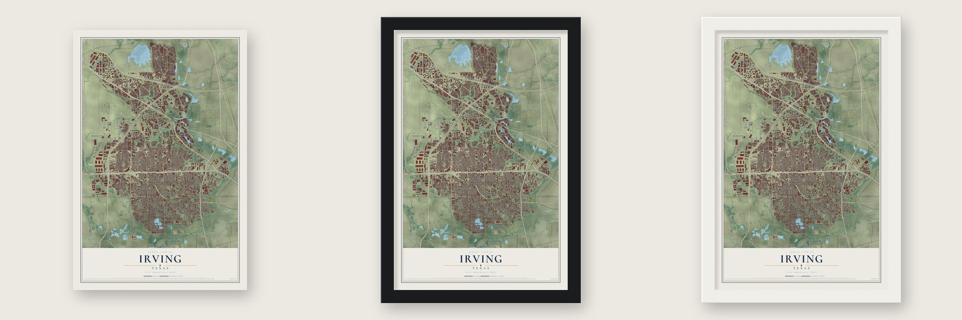
Unframed archival matte, a black wood frame or a white wood frame.
Up close
Geography Worth Displaying
This map was created using accurate cartographic data and authoritative geographic sources, including the U.S. Geological Survey and the Census Bureau. The map brings together terrain, waterways, roads, and building detail. The majority of the streets are labeled, houses are accurately depicted, and the topography is derived from government sources. Combining local data with carefully composed color and shading leads to this beautifully detailed Irving artwork for your wall.
Rather than simply showing street outlines, we’ve included as many of the street names as we could reasonably fit on the map while keeping their names legible. Zoom in on the high resolution preview to see exactly what’s on the map. We truly set out to create a statement piece for anyone who loves Irving. So whether it’s for you, or a gift for someone you love, we hope this map of Irving brings back fond memories.
Find your street
Names on the Irving map
Every name below is printed on this map. Look for your street, your school, the park where you played, or the pond down the road.
Places and landmarks4
- Irving City Hall
- Fritz Park
- Estelle
- Sowers
Streets and roads429
- West Irving Boulevard
- West Northwest Highway
- East Irving Boulevard
- North Belt Line Road
- Regent Boulevard
- South Belt Line Road
- Summitview Drive
- East Oakdale Road
- Belt Line Road South
- East Eleventh Street
- Red River Trail
- East I- 635
- North Macarthur Boulevard
- East Grauwyler Road
- Esters Boulevard
- Hidden Ridge
- North Britain Road
- Riverside Drive
- South Macarthur Boulevard
- Las Colinas Boulevard East
- North Walton Walker Svc Road East
- Carbon Road
- West Walnut Hill Lane
- Valley View Lane
- West Royal Lane
- West Northgate Drive
- West Rochelle Road
- Esters Road
- Ranchview Drive
- North Story Road
Show all 429 streets
- Las Colinas Boulevard
- East Airfield Drive
- West Pioneer Drive
- East Northgate Drive
- Conflans Road
- Ranch Trail
- Kinwest Parkway
- West Hunter Ferrell Road
- West Shady Grove Road
- Parkridge Boulevard
- Rock Island Road
- Finley Road
- Meadow Creek Drive
- East Union Bower Road
- South Story Road
- South Nursery Road
- North Airfield Drive
- Hackberry Road
- Rochelle Boulevard
- East Shady Grove Road
- Cowboys Parkway
- West Grauwyler Road
- East Pioneer Drive
- Cheyenne Street
- La Villita Boulevard
- Freeport Parkway
- Colwell Boulevard
- Rental Car Road
- Singleton Boulevard
- West Oakdale Road
- North Royal Lane
- North Nursery Road
- Cabell Drive
- North Irving Heights Drive
- Cam Lago
- Lake Carolyn Parkway
- Glenwick Lane
- Anderson Street
- Rodeo Drive
- Corporate Drive
- Passport Drive
- Santa Fe Trail
- Gateway Drive
- Balleywood Road
- Byron Circle
- Cartwright Street
- Cimarron Trail
- South Irving Heights Drive
- Horizon Way
- Rusdell Drive
- Lane Street
- Sixth Street East
- Olympus Boulevard
- Wingren Drive
- East Sixth Street
- Pleasant Run Road
- Senter Road
- Carl Road
- Market Place
- Morgan Street
- Wingren Road
- Compton Avenue
- South Britain Road
- Bolden Avenue
- Sterling Street
- Rindie Street
- Gran Via
- Block Drive
- Milner Road
- Stafford Street
- Las Brisas Drive
- South Briery Road
- Plaza Drive
- Etain Road
- Jackson Street
- Leland Boulevard
- Hurd Drive
- Ruby Road
- Helmet Street
- Colony Drive
- Jetstar Drive
- West Vilbig Street
- West Fifth Street
- Hillcrest Drive
- Mesquite Bend Drive
- Hidalgo Street
- County Line Road
- Santa Anita Boulevard
- Elwood Road
- Hard Rock Road
- Hilltop Drive
- Proctor Street
- Markland Street
- Bowman Street
- Lindy Lane
- Greenway Drive
- Tristar Drive
- Frye Road
- Hinton Drive
- Macarthur Boulevard
- East Eighth Avenue
- Darr Street
- Luke Street
- Cooper Drive
- Bradford Street
- Twin Falls Street
- Garden Oaks Drive
- Hanover Lane
- Weathered Street
- International Place
- Fuller Drive
- Syracuse Drive
- Tipton Road
- Bryn Mawr Drive
- Peters Road
- Estrada Parkway
- Cantrell Street
- McClure Street
- Oakland Drive
- Shorthorn Drive
- Commerce Drive
- Henry Drive
- North Star Drive
- McCoy Drive
- French Street
- Perry Street
- Westridge Circle
- Via Positano
- Luper Road
- Tudor Lane
- Dennis Street
- Grove Street
- Woodoak Drive
- Rose Street
- Chime Street
- Dory Lane
- Arbol
- Marvel Drive
- Mustang Drive
- Dorris Road
- Elaine Drive
- Trinity Street
- Aspen Drive
- Nelson Drive
- Paluxy Drive
- Texas Drive
- Dale Place
- Cody Street
- Durand Drive
- Sunset Drive
- Ricci Lane
- Holly Street
- Sierra Drive
- Irvin Road
- Namur
- Bunn Drive
- Penn Street
- Iris Drive
- Main Street
- Valley Ranch Parkway East
- Valley Ranch Parkway
- Cam Rio
- Shoaf Drive
- North Loop 12
- Tom Braniff Drive
- East Royal Lane
- North O'Connor Road
- Century Center Boulevard
- Country Club Drive West
- North 27th Avenue
- Chamberlain Street
- South Airfield Drive
- Love Drive
- North 28th Avenue
- Bradford Pear Drive
- South Rogers Road
- North Rogers Road
- Dewitt Street
- North Wildwood Drive
- Rainier Street
- Maryland Drive
- Campus Circle Drive West
- Willow Creek Drive
- Decker Drive
- East Hunter Ferrell Road
- William Dehaes Drive
- Lucille Street
- West Story Road
- South Travis Circle
- Fountain Drive
- Country Club Road North
- Longhorn Drive
- Rosebud Drive
- Meadow Lark
- Spanish Trail
- Olde Towne Drive
- High Point Drive
- Lyndon Baines Johnson Fwy
- South 26th Avenue
- Cliffside Drive
- Windy Hollow Drive
- Namur Lane
- Cambridge Drive
- Collins Drive
- North Union Bower Road
- East 30th Street
- Luzon Road
- Laramie Street
- Story Road West
- Briarcliff Drive
- Park Grove Drive
- Fairbrook Street
- Ridgeview Lane
- Murl Drive
- North Briery Road
- Irby Lane
- Chemsearch Boulevard
- Betsy Lane
- Beacon Hill Drive
- Lago Vis Lp
- King Richard Street
- Metker Street
- Windsor Ridge Drive
- Gorman Drive
- Sam Hill Street
- East Twelfth Street
- Robinson Street
- Reverchon Drive
- Comal Drive
- Coker Street
- Daisy Lane
- Estelle Road
- Turtle Lake Boulevard
- Teleport Boulevard
- South Greenview Drive
- Alden Street
- Pocatello Street
- Green Oaks Drive
- Valley Vista Drive
- Double Oak Lane
- Sweetgum Drive
- Moss Hill Road
- North Gilbert Road
- Toler Lane
- West Scotland Drive
- Wayside Drive
- Corporate Avenue
- Rolston Road
- Ross Drive
- Hereford Drive
- South Ohio Street
- Cardinal Lane
- Native Oak Lane
- Gentry Road
- Fox Glen Drive
- Patricia Street
- Hanson Drive
- Post Oak Drive
- Cross Bend
- Lena Lane
- Scenic Drive
- Vassar Drive
- Reese Drive
- North Glen Drive
- Fortune Drive
- Currency Street
- Entrada Boulevard
- East 28th Street
- Foxcroft Street
- Valley Ridge Drive
- Ronne Drive
- Bond Street
- Orion Drive
- Posey Drive
- Decker Court
- Live Oak Drive
- Ben Drive
- Robin Road
- Janell Drive
- Maple Street
- Carolyn Street
- Randy Drive
- Park Place
- Katy Drive
- Voirin Road
- Brown Street
- Sea Terrace
- Dillon Trail
- Yogi Way
- Hyde Street
- Pic Drive
- West Second Street
- Valley Ranch Parkway West
- Portland Street
- Market Place Boulevard
- Green Park Drive
- Avenue of Champions
- Skyway Circle North
- Century Circle
- Muret Street
- Trinity View Street
- Belew Street
- Union Bower Court
- Concord Drive
- Oxbow Drive
- Creekside Circle South
- Rutgers Drive
- Northview Drive
- Brangus Drive
- Williams Road
- Brown Drive
- Yorkshire Street
- Wanda Drive
- East 15th Street
- Carver Lane
- Thompson Street
- Limetree Lane
- Recognition Point Drive
- Coldstream Drive
- Glen Valley Drive
- Wells Road
- Windsor Street
- Bear Creek Court
- Lakeside Drive
- Quail Valley
- Harvard Street
- Belmead Lane
- Cedar Valley Drive
- Confians Road
- San Villa Drive
- Conflans
- Pamela Drive
- Casa Drive
- Loma Alta Drive
- Parkway Drive
- Briar Oaks Drive
- Golden Road
- Ouida Road
- Mayo Street
- Ada Street
- Lela Street
- West Airport Fwy
- Mac Arthur Boulevard
- Ridgepoint Drive
- Bent Branch Drive
- Lakeshore Drive
- Skyway Circle South
- Clearspring Drive North
- Douglas Avenue
- Balboa Street
- Franklin Street
- Meyers Road
- Royal Lane
- Edmondson Drive
- Jasmine Lane
- Westridge Drive
- Abbott Drive
- North Sowers Road
- Crockett Circle
- Tenth Street
- North Travis Circle
- Davis Drive
- Brookstone Drive
- North Lake College Circle
- Wilshire Drive
- Polaris Drive
- Allen Street
- Beranger Drive
- Grimes Road
- Mills Lane
- Escena Boulevard
- Mateo Trail
- William Square
- Dominion Boulevard
- East Eighth Street
- Saratoga Way
- Southfork Bend
- Marchant Lane
- Homs Drive
- Sandbar Drive
- Rustic Drive
- Justin Drive
- Western Trail
- Meadow Valley Drive
- Azalea Trail
- Lowell Drive
- Vanco Drive
- Bryant Street
- West Park Drive
- Home Depot Drive
- Hogan Drive
- Chase Lane
- San Jose Street
- Borama Drive
- Byron Drive
- Colby Court
- La Cima
- La Jolla
- Villa Court
Names are listed as they appear on the printed map. Zoom into the product photos to find them.
About Irving, Texas
Located in Texas, Irving is a city within Dallas County. The 2020 census recorded 256,684 residents.
“The University of Dallas in Irving was founded in 1956, and the North Lake campus of Dallas Community College opened in 1977.”
- 256,684 residentsThe Census Bureau recorded this population in 2020.
- Dallas CountyThis city is part of the county.
- Founded in 1956Historical accounts place Irving's founding in 1956.
- Local schoolsPublic schools here are part of Carrollton-Farmers Branch Independent School District.
Keep exploring Texas
Irving is one of 2,049 Texas towns we've mapped. Every dot on the map is a print of its own.
The search covers every state, Texas first.
Near Irving
Order 2 or more town maps and save 10%. Shown in the size and finish you picked above, so they hang as a set.
- Las Colinas 12" x 18" / Archival Matte Print $39.99
- Valley Ranch 12" x 18" / Archival Matte Print $39.99
- Euless 12" x 18" / Archival Matte Print $39.99
More maps nearby: Farmers Branch, Coppell, Grapevine, Cockrell Hill and Bedford.
The art of mapping a place
How This Map Was Made
Real places. Remarkable detail. Discover the layers that turn geographic data into a map of home.

The view from above
Aerial imagery reveals the character of the land: woodland, open fields, and the patterns of a place.

The shape of the land
Elevation data brings hills, valleys, and subtle changes in the landscape into view.

The details of home
Roads, waterways, and building footprints come together to make the map feel unmistakably local.

Geography becomes art
Considered color, shading, and typography bring the layers together in a map made for your wall.


Process illustrated with Mendon, Massachusetts. Aerial imagery: USDA NAIP. Terrain: USGS 3D Elevation Program. Map details and finished artwork: KNOWOL.
The Details
About This Print
Choose an archival matte print, or a black or white Ayous wood frame. The archival matte print is unframed.
Select your size and finish above to see the matching product image and price.
Materials & Craftsmanship
A contemporary map with the character of a classic atlas, printed on archival matte paper. Optional frames are made from Ayous wood.
Your printed map does not include the watermark shown in the full-map preview.
Shipping & Delivery
Free shipping within the United States. Every print is made to order in the USA.
Buying a gift? Add a note in your cart and we'll include it. We never put prices in the package.
Prints ship within 2 to 3 business days. Allow 7 to 10 days total from ordering for delivery. Timing may vary during holidays or periods of high order volume.
Read our shipping policy.
Returns and damaged prints
Each print is made to order. Change-of-mind refunds are not available after production.
If your print arrives damaged, misprinted or incorrect, contact support@knowol.com within 30 days of receiving it. Include your order number, photos and a description of the issue.
Read our full refund and replacement policy. For questions about your order, email support@knowol.com.