
Search for another town



Free U.S. delivery 7 to 10 days after you order
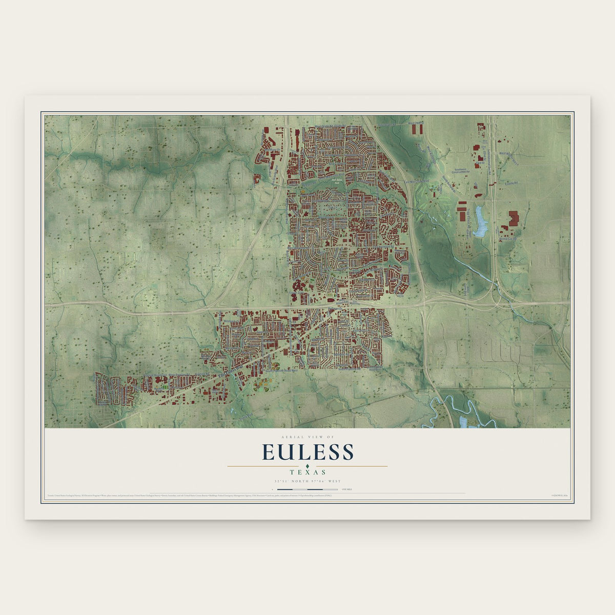
Euless, Texas Map Art
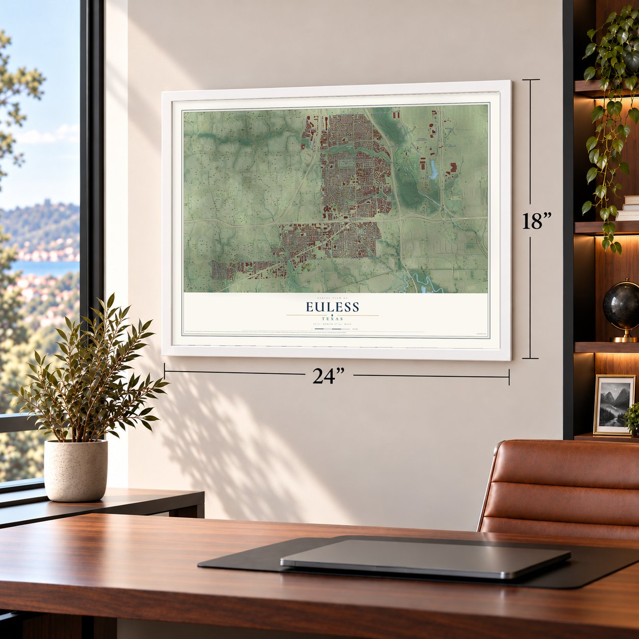
A new map of Euless, Texas, made in 2026 and printed to order on thick archival matte paper.
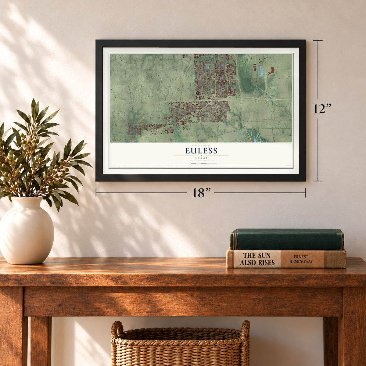
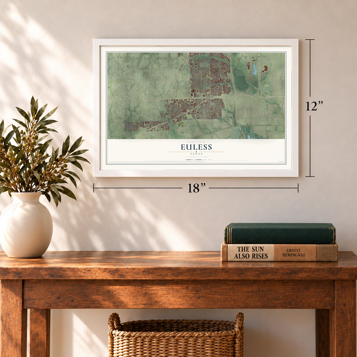
12" x 18" Archival Matte Print
A Map of Home. A Work of Art.
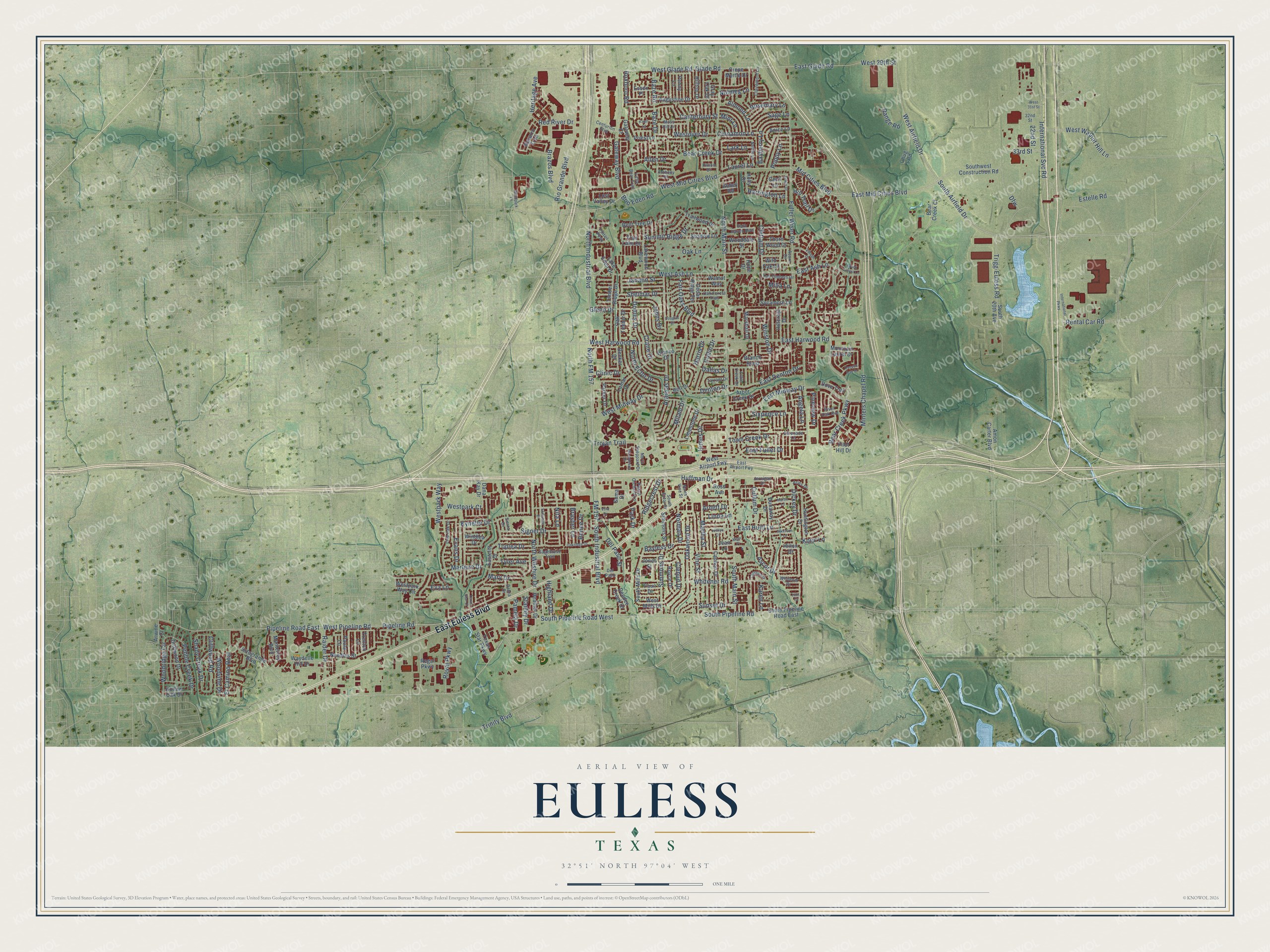
This beautifully detailed map of Euless, Texas was created in 2026 using aerial imagery combined with modern topographical, census, street and landmark data. It's a modern aerial view of Euless in Tarrant County, Texas, that combines modern data with a vintage aesthetic. Zoom in on the preview and look for your block.
Three ways to hang it
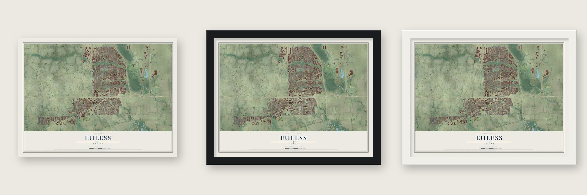
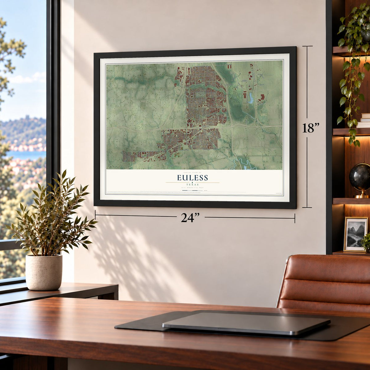
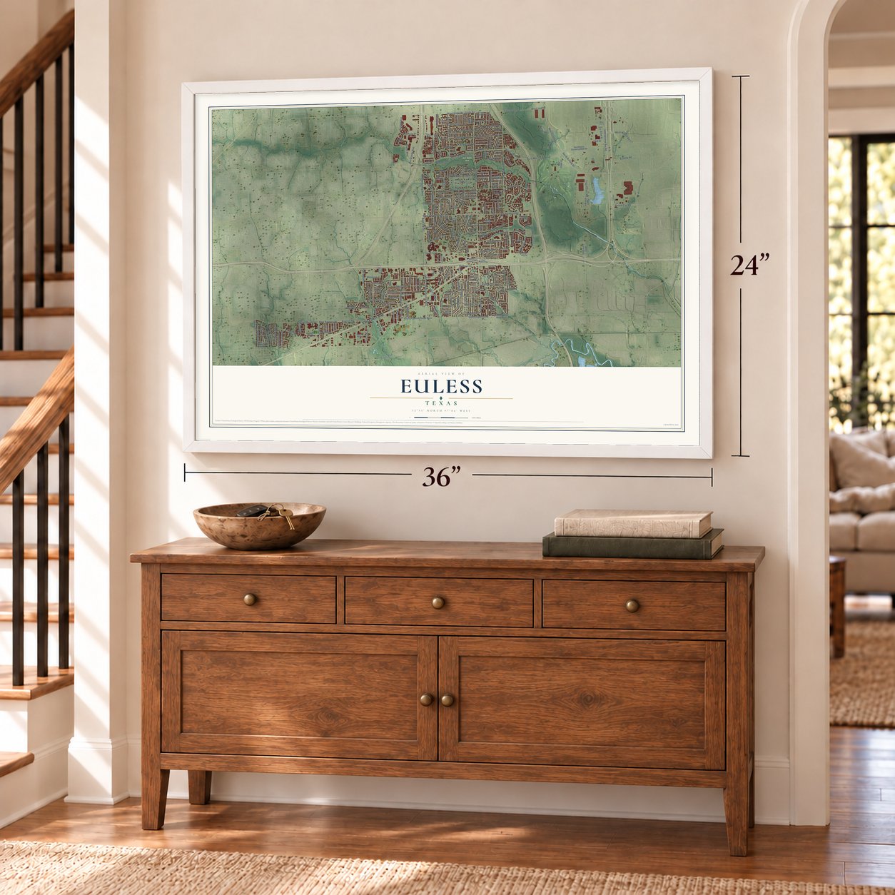
Unframed archival matte, a black wood frame or a white wood frame.
Up close
Real geography. Art worth displaying.
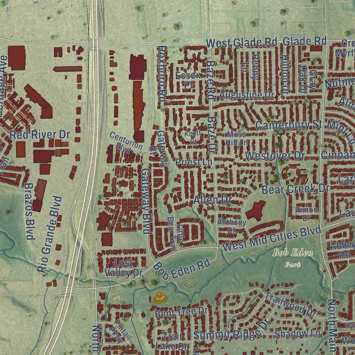
This map was created using accurate cartographic data and authoritative geographic sources, including the U.S. Geological Survey and the Census Bureau. The map brings together terrain, waterways, roads, and building detail. The majority of the streets are labeled, houses are accurately depicted, and the topography is derived from government sources. Combining local data with carefully composed color and shading leads to this beautifully detailed Euless artwork for your wall.
Rather than simply showing street outlines, we’ve included as many of the street names as we could reasonably fit on the map while keeping their names legible. Zoom in on the high resolution preview to see exactly what’s on the map. We truly set out to create a statement piece for anyone who loves Euless. So whether it’s for you, or a gift for someone you love, we hope this map of Euless brings back fond memories.
About Euless, Texas
Euless is a Tarrant County city in the Mid-Cities region between Dallas and Fort Worth, with part of Dallas/Fort Worth International Airport inside its limits. Its roots extend to nineteenth-century settlements near Bear Creek, and the community took the name of Tennessee native Elisha Adam Euless. Transportation, aviation, and postwar growth reshaped the city, whose population reached 61,032 in 2020.
- Early SettlementPioneers led by Isham Crowley reached the meeting of Big Bear and Little Bear creeks by 1845.
- Namesake and Cotton GinElisha Adam and Julia Euless built a home and cotton gin nearby in 1881, and local farmers later named the community for him.
- Cityhood RestoredThe village incorporated in 1951, disincorporated in 1952 amid disputes over water and sewer taxes, and incorporated again in 1953.
- School Integration StruggleBlack parents from Mosier Valley challenged unequal schooling in 1949, while the Hurst-Euless-Bedford district did not desegregate until 1968.
- Airport Era GrowthRoad improvements and Amon Carter Air Field's 1953 opening encouraged growth, and Euless surpassed 4,200 residents by 1960.
Find your street
Names on the Euless map
Every name below is printed on this map. Look for your street, your school, the park where you played, or the pond down the road.
Places and landmarks1
- Bob Eden Park
Streets and roads268
- East Euless Boulevard
- Bear Creek Parkway
- North Main Street
- East Mid Cities Boulevard
- West Airfield Drive
- West Mid Cities Boulevard
- South Main Street
- East Glade Road
- West 29th Street
- West Pipeline Road
- South Pipeline Road West
- North FM 157
- North Industrial Boulevard
- Pipeline Road
- Rental Car Road
- Glade Road
- South Industrial Boulevard
- South Airfield Drive
- Gateway Boulevard
- Winston Drive
- Bob Eden Road
- Harrington Lane
- Pipeline Road East
- Westpark Way
- East Denton Drive
- Chittam Drive
- South Pipeline Road
- International Svc Road
- Fuller Wiser Road
- East Midway Drive
Show all 268 streets
- West Harwood Road
- Minters Chapel Road
- East Ash Lane
- Dfw
- West Glade Road
- North Ector Drive
- East Harwood Road
- Aransas Drive
- Rio Grande Boulevard
- West Midway Drive
- West Ash Lane
- FM 157
- Trigg-Euless Road
- Donley Drive
- Heritage Avenue
- Vine Street
- West Walnut Hill Lane
- Signet Drive
- Denton Drive
- Marlene Drive
- Baze Road
- Kynette Drive
- Brazos Boulevard
- Fair Oaks Boulevard
- Milam Drive
- Oakwood Drive
- Shelmar Drive
- North Wilshire Drive
- Woodvine Drive
- Mid Cities Boulevard
- Baze Drive
- Simmons Drive
- Trinity Boulevard
- Dickey Drive
- Whitener Road
- Glenn Drive
- Toplea Drive
- East Huitt Lane
- Canterbury Street
- 33rd Street
- Oak Lane
- Bear Creek Drive
- Trojan Trail
- El Camino Real
- Clebud Drive
- Royal Parkway
- Crane Drive
- Raider Drive
- Himes Drive
- Martha Street
- Cullum Drive
- Nita Lane
- Bayberry Lane
- Woodridge Circle
- Pebble Creek Drive
- Shady Creek Drive
- Del Paso Street
- Sunset Drive
- Summit Ridge Drive
- East Fuller Drive
- Cliffwood Road
- Collin Drive
- Westover Drive
- Bayless Drive
- Ridgecrest Drive
- Johns Drive
- Rosemary Lane
- Cinnamon Lane
- Town Creek Drive
- Dallas Drive
- Ascot Drive
- Evans Drive
- Red River Drive
- Westpark Court
- Allen Drive
- Sage Lane
- Almond Lane
- Janann Street
- Norman Drive
- Hill Trail Drive
- Stanley Drive
- Range Road
- Estelle Road
- Angela Lane
- Sixpence Lane
- Highland Drive
- Brasher Lane
- Tyler Avenue
- Pamela Drive
- Mary Drive
- Roxboro Road
- Pineview Drive
- 22nd Street
- Karen Lane
- Huffman Drive
- Renee Drive
- Laurel Lane
- Lark Lane
- Nutmeg Lane
- Milla Lane
- Mint Lane
- Linda Lane
- Arnett Drive
- Clinic Drive
- Eva Lane
- Poppy Lane
- Harris Drive
- Park Drive
- Koen Lane
- Southwest Construction Road
- Bear Creek Court
- Westpark Way Circle
- South Pipeline Road East
- Sotogrande Boulevard
- Branch Bend
- Holly Drive
- Priest Lane
- Navarro Trail
- Texas Star Parkway
- Trailwood Drive
- South 20th Avenue
- Cannon Drive
- Eastcliff Drive
- Amon Carter Boulevard
- Dunaway Drive
- Timber Ridge Drive
- Arbor Creek Drive
- Waydelle Hill Drive
- Driftwood Drive
- Lamar Drive
- Windlea Drive
- Needles Street
- Lakewood Boulevard
- Limestone Drive
- South Mills Drive
- Bell Drive
- Bent Tree Drive
- Huntington Drive
- Shadow Lane
- West Airport Fwy
- Cedar Ridge Terrace
- Regal Parkway
- Monterrey Boulevard
- Oak Timber Drive
- Jones Street
- Hillcrest Drive
- Trail Lake Drive
- Simmons Street
- Anice Lane
- Essex Place
- Dove Trail
- Augustine Drive
- Thorn Wood Drive
- Gateway Court
- Ohug 1 Road
- Sycamore Lane
- Royce Drive
- Parker Drive
- Heather Drive
- Deedee Creek Drive
- Blanco Drive
- Marshall Drive
- Penny Lane
- Hilltop Drive
- Wooddale Street
- Arwine Court
- Walnut Way
- Lost Valley Drive
- Paula Lane
- Hollow Oak Drive
- Dana Kay Drive
- Mountain Laurel Drive
- Lake Eden Drive
- Wild Oak Lane
- Faun Drive
- West Mills Drive
- Crepe Myrtle Drive
- Gray Oak Drive
- Suma Drive
- Trenton Lane
- Becker Drive
- Ross Avenue
- Abbey Road
- Pilot Hill Drive
- Cecil Lane
- Hilton Drive
- Jean Lane
- Hope Drive
- Park Haven Boulevard
- Sagebrush Trail
- Live Oak Drive
- Del Paso
- Serenade Lane
- Tall Timbers Drive
- Tarrant Drive
- South Ector Drive
- Clairemont Lane
- Oak Forest Trail
- Moss Hill Lane
- North Sheppard Drive
- East Airport Fwy
- Peach Orchard Lane
- Centurion Boulevard
- Nettle Lane
- Pintail Parkway
- Debra Drive
- Little Bear Trail
- Whitener Drive
- North Vine Street
- Aries Drive
- Little Creek Drive
- Jernigan Drive
- River Oak Avenue
- 32nd Street
- Anthony Drive
- Pinion Drive
- Acorn Drive
- Sierra Drive
- Erwin Drive
- International Parkway
- Village Drive
- Yorkshire Drive
- Martin Lane
- Brook Forest Lane
- Manchester Drive
- Douglas Drive
- Cliffdale Drive
- Oakridge Drive
- Atkerson Lane
- Texas Star Court
- Knott Court
- Canyon Oak Drive
- Woodpark Lane
- Jefflyn Court
- Villa Drive
- West 31st Street
- Main Place
- Flint Court
Names are listed as they appear on the printed map. Zoom into the product photos to find them.
The art of mapping a place
How This Map Was Made
Real places. Remarkable detail. Discover the layers that turn geographic data into a map of home.

The view from above
Aerial imagery reveals the character of the land: woodland, open fields, and the patterns of a place.

The shape of the land
Elevation data brings hills, valleys, and subtle changes in the landscape into view.

The details of home
Roads, waterways, and building footprints come together to make the map feel unmistakably local.

Geography becomes art
Considered color, shading, and typography bring the layers together in a map made for your wall.


Process illustrated with Mendon, Massachusetts. Aerial imagery: USDA NAIP. Terrain: USGS 3D Elevation Program. Map details and finished artwork: KNOWOL.
The Details
About This Print
Choose an archival matte print, or a black or white Ayous wood frame. The archival matte print is unframed.
Select your size and finish above to see the matching product image and price.
Materials & Craftsmanship
A contemporary map with the character of a classic atlas, printed on archival matte paper. Optional frames are made from Ayous wood.
Your printed map does not include the watermark shown in the full-map preview.
Shipping & Delivery
Free shipping within the United States. Every print is made to order in the USA.
Buying a gift? Add a note in your cart and we'll include it. We never put prices in the package.
Prints ship within 2 to 3 business days. Allow 7 to 10 days total from ordering for delivery. Timing may vary during holidays or periods of high order volume.
Read our shipping policy.
Returns and damaged prints
Each print is made to order. Change-of-mind refunds are not available after production.
If your print arrives damaged, misprinted or incorrect, contact support@knowol.com within 30 days of receiving it. Include your order number, photos and a description of the issue.
Read our full refund and replacement policy. For questions about your order, email support@knowol.com.
Find your town
Looking for another city?
Find a map of home in our Texas collection, or any town in the country.
Nearby
Maps of towns near Euless
Know someone from one of these towns? Their map makes a great gift.
 Bedford
, Texas
From $39.99See the map
 Colleyville
, Texas
From $39.99See the map
 Grapevine
, Texas
From $39.99See the map
More maps nearby: Hurst, Irving, North Richland Hills, Southlake and Richland Hills.