
Search for another town


Free U.S. delivery 7 to 10 days after you order
Jurupa Valley, California Map Art
Building by building, with labeled streets and shaded relief.
12" x 18" Archival Matte Print
A Map of Home. A Work of Art.
Explore Jurupa Valley, California from a whole new perspective. Created using aerial imagery and detailed geographic data, this map captures Jurupa Valley building by building, with labeled streets, familiar landmarks, and shaded topographical relief that highlights the natural contours of the landscape.
Combining modern data with the timeless character of a vintage atlas, this map is just as interesting up close as it is beautiful on the wall. Whether you grew up in Jurupa Valley, spent memorable years there, or call it home today, this unique map is a great way to celebrate a place that means something to you. Zoom in on the preview to look for your street, and then order a print to put your memories on the wall.
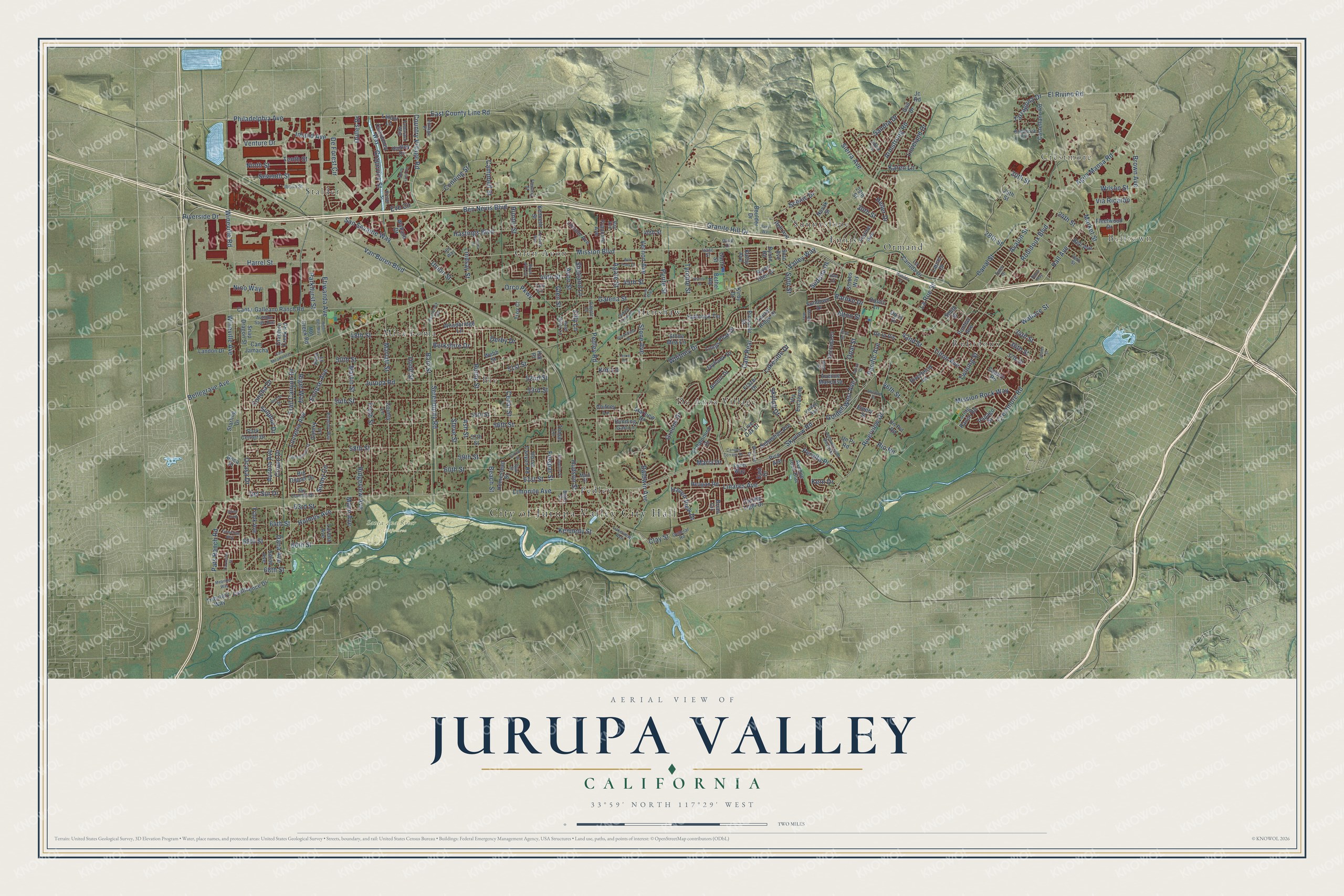
Three ways to hang it

Unframed archival matte, a black wood frame or a white wood frame.
Up close
Geography Worth Displaying
This map was created using accurate cartographic data and authoritative geographic sources, including the U.S. Geological Survey and the Census Bureau. The map brings together terrain, waterways, roads, and building detail. The majority of the streets are labeled, houses are accurately depicted, and the topography is derived from government sources. Combining local data with carefully composed color and shading leads to this beautifully detailed Jurupa Valley artwork for your wall.
Rather than simply showing street outlines, we’ve included as many of the street names as we could reasonably fit on the map while keeping their names legible. Zoom in on the high resolution preview to see exactly what’s on the map. We truly set out to create a statement piece for anyone who loves Jurupa Valley. So whether it’s for you, or a gift for someone you love, we hope this map of Jurupa Valley brings back fond memories.
Read the story behind this map of Jurupa Valley, California from 2026.

Find your street
Names on the Jurupa Valley map
Every name below is printed on this map. Look for your street, your school, the park where you played, or the pond down the road.
Places and landmarks15
- City of Jurupa Valley City Hall
- Crestmore
- Belltown
- Santa Ana River Wildlife Area
- Glen Avon
- Sunnyslope
- Mira Loma
- Stalder
- De Anza Village
- Rubidoux
- Henshaw
- Ormand
Show all 15 places
- Bly
- Ennis
- Pedley
Streets and roads304
- Mission Boulevard
- Philadelphia Avenue
- Riverside Drive
- Hall Avenue
- Country Village Road
- Agua Mansa Road
- 30th Street
- Brown Avenue
- Bellegrave Avenue
- Marlatt Street
- 64th Street
- Market Street
- Wilson Street
- Limonite Avenue
- Van Buren Boulevard
- Jurupa Road
- Etiwanda Avenue
- Granite Hill Drive
- Pedley Road
- Wineville Avenue
- 58th Street
- Rubidoux Boulevard
- Cam Real
- Galena Street
- Riverview Drive
- 54th Street
- 56th Street
- Bain Street
- Felspar Street
- Lakeside Drive
Show all 304 streets
- 63rd Street
- Canal Street
- Avalon Street
- Dodd Street
- Agate Street
- Lucretia Avenue
- Troth Street
- Rutile Street
- Golden West Avenue
- East County Line Road
- Pacific Avenue
- Sierra Avenue
- Holmes Avenue
- 60th Street
- Wallace Street
- 34th Street
- Ben Nevis Boulevard
- Pats Ranch Road
- Armstrong Road
- Crestmore Road
- 36th Street
- Linares Avenue
- Conning Street
- 50th Street
- Opal Street
- Beach Street
- 45th Street
- Hastings Boulevard
- 53rd Street
- Campbell Street
- Steve Street
- Cedar Street
- Ridgeview Avenue
- 65th Street
- Lindsay Street
- Pyrite Street
- Whitney Drive
- San Sevaine Way
- Grapevine Street
- Tyrolite Street
- El Rivino Road
- Baldwin Avenue
- 52nd Street
- 68th Street
- Karen Lane
- 42nd Street
- Sulphur Drive
- Harrel Street
- Serendipity Road
- Clay Street
- De Forest Circle
- 46th Street
- 28th Street
- Valley Way
- Eve Circle
- Dulles Drive
- Skyview Road
- Martin Street
- 48th Street
- Trail Canyon Drive
- Avon Street
- Inland Avenue
- 24th Street
- Venture Drive
- Ash Street
- 59th Street
- Peralta Place
- 61st Street
- 44th Street
- Glen Street
- Hunter Street
- Dana Avenue
- Tenth Street
- Seventh Street
- Mission Rock Way
- Ninth Street
- Vernon Avenue
- Sandra Drive
- Eclipse Avenue
- Hudson Street
- Kennedy Street
- 51st Street
- 20th Street
- Rio Road
- La Rue Street
- Sedona Drive
- Scenic Drive
- Rigel Way
- Union Street
- Crown Drive
- Wineville Road
- Stone Avenue
- Shetland Lane
- Concha Drive
- Ocasa Drive
- Loveland Drive
- Parkhurst Street
- 66th Street
- Tilton Avenue
- Rathke Drive
- Sunny Circle
- Haven View Drive
- Aurora Avenue
- Twining Street
- Tarragona Drive
- Greens Drive
- Berkshire Drive
- Derby Drive
- Skyloft Drive
- Nino Way
- Mann Avenue
- Orco Parkway
- Via Ricardo
- Maria Drive
- Del Sur Drive
- Heller Drive
- Soto Street
- Kern Drive
- Alton Street
- Kim Lane
- Filly Lane
- Chardoney Way
- Hadley Drive
- Cantu-Galleano Ranch Road
- Live Oak Drive
- El Palomino Drive
- Gail Drive
- Pontiac Avenue
- Via Escalante
- Avenue Juan Diaz
- Fleetwood Drive
- Smith Avenue
- Frank Avenue
- 37th Street
- Loring Ranch Road
- Halbrook Terrace
- Estrada Drive
- 55th Street
- La Canada Drive
- Jayhawk Drive
- Graphite Creek Road
- Pico Avenue
- Confluence Drive
- Soto Avenue
- Florine Avenue
- Longs Peak Drive
- Laurel Ridge Drive
- Woodbridge Lane
- 29th Street
- Riverbend Lane
- Frazer Drive
- Rustic Lane
- Capary Road
- Sebastian Avenue
- Lincoln Avenue
- Park Center Drive
- Reagan Road
- River Glen Drive
- Castellano Road
- Lorena Avenue
- De la Vis
- Cam Jamacha
- Big Dipper Drive
- Candle Light Drive
- Laurel Drive
- Francine Avenue
- Landon Drive
- Pala Place
- Stone Mist Circle
- Horse Canyon Road
- Avenue Mariposa
- Galaxy Lane
- Bell Avenue
- Stobbs Way
- Emery Street
- Snap Dragon Street
- Homestead Street
- Boulder Drive
- Un Pvt Road
- Sundown Drive
- Tributary Way
- Hot Creek Road
- Running Gait Lane
- Starview Drive
- East Drive
- Bolero Drive
- County Lane
- Lynn Way
- Novak Street
- Pinnacle Street
- Boca Place
- Latour Lane
- Kenneth Street
- Bethel Road
- Kathy Avenue
- Tomal Lane
- Chifney Lane
- Dell Avenue
- Papago Street
- Wabash Drive
- Byrne Road
- Starling Drive
- Brian Circle
- Un Pr Road
- Kirby Drive
- Troy Court
- 40th Street
- Garth Street
- 57th Street
- Doris Drive
- Webb Street
- Smith Street
- 25th Street
- Jc Road
- Hill Place
- Ermer Street
- Avenue Juan Bautista
- 26th Street
- Bold Ruler Lane
- Lakeview Avenue
- Sky Country Drive
- Baker Street
- Iberia Street
- Valdez Avenue
- Main Street
- Ptolemy Way
- Autumn Sage Avenue
- Tamarack Way
- Andalusia Avenue
- Adele Lane
- Vintage Place
- General Road
- Fleming Street
- Spur Street
- Dapple Lane
- Isaac Street
- Ray Avenue
- Taos Drive
- Olive Court
- Tara Circle
- His Way
- Owl Court
- North Lynn Circle
- Castlerock Road
- Little Dipper Street
- Saddle Creek Drive
- Pinto Street
- Brookfield Drive
- Geyser Drive
- Lone Trail
- Turquoise Way
- Silver Loop
- Meander Way
- Stirrup Street
- Kenneth Way
- Cam Miramontes
- Scheelite Street
- Canyon Terrace Drive
- Helen Bell Way
- Carnelian Street
- Terrie Terrace
- Winncliff Drive
- Wild Pony Drive
- Lorita Street
- Sherry Lane
- Allwood Street
- Royal Pine Circle
- Margie Way
- 43rd Street
- Razor Way
- Humble Street
- Saxon Court
- Beryl Way
- Water Street
Names are listed as they appear on the printed map. Zoom into the product photos to find them.
About Jurupa Valley, California
Jurupa Valley is a city of 105,053 people in Riverside County, on the far side of the Santa Ana River from Riverside. Gabrielino and Serrano people lived here first, and the Gabrieleño called their village Jurungna or Hurungna. Mission San Gabriel Arcángel later ran a rancho here named for that village. After the mission was broken up under the secularization law of 1833, Mexico granted the land as Rancho Jurupa in 1838.
People called the river lands Jurupa Valley by 1887, but no town carried the name until 2011. Voters turned down a city in 1992, when Measure E lost 76% to 24%. On March 8, 2011, a second try passed with 54% of the vote, and a city of about 88,000 people began on July 1, 2011. A state law soon took away millions in vehicle license fees, and in 2014 the city warned it might have to disincorporate. Senate Bill 107, signed in September 2015, cleared many of its debts.
- What Jurupa meansNo one agrees on the meaning of the word. An 1890 history of Southern California said it was a greeting of peace and friendship offered when the first Catholic priest came. In 1902 Father Juan Caballeria traced it to jurumpa, a watering place. Later language studies pointed to juru, the California sagebrush that grows all over the area.
- Jurupa won the name voteThe 1992 ballot that rejected a city also asked what to call it. Jurupa took 40%, ahead of Rancho Jurupa at 23%, West Riverside at 21% and Camino Real at 16%. When the city finally formed in 2011, it carried the Jurupa name.
- California's newest city until 2024When it incorporated, Jurupa Valley was California's 482nd city and Riverside County's 28th. No newer city joined the state until Mountain House, in San Joaquin County, incorporated in 2024.
Keep exploring California
Jurupa Valley is one of 1,990 California towns we've mapped. Every dot on the map is a print of its own.
The search covers every state, California first.
Near Jurupa Valley
Order 2 or more town maps and save 10%. Shown in the size and finish you picked above, so they hang as a set.
- Bloomington 12" x 18" / Archival Matte Print $39.99
- Riverside 12" x 18" / Archival Matte Print $39.99
- Casa Blanca 12" x 18" / Archival Matte Print $39.99
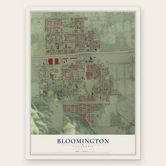

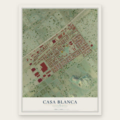
More maps nearby: Arlington, Kaiser, Eastvale, Norco and Fontana.
The art of mapping a place
How This Map Was Made
Real places. Remarkable detail. Discover the layers that turn geographic data into a map of home.

The view from above
Aerial imagery reveals the character of the land: woodland, open fields, and the patterns of a place.

The shape of the land
Elevation data brings hills, valleys, and subtle changes in the landscape into view.

The details of home
Roads, waterways, and building footprints come together to make the map feel unmistakably local.

Geography becomes art
Considered color, shading, and typography bring the layers together in a map made for your wall.


Process illustrated with Mendon, Massachusetts. Aerial imagery: USDA NAIP. Terrain: USGS 3D Elevation Program. Map details and finished artwork: KNOWOL.
The Details
About This Print
Choose an archival matte print, or a black or white Ayous wood frame. The archival matte print is unframed.
Select your size and finish above to see the matching product image and price.
Materials & Craftsmanship
A contemporary map with the character of a classic atlas, printed on archival matte paper. Optional frames are made from Ayous wood.
Your printed map does not include the watermark shown in the full-map preview.
Shipping & Delivery
Free shipping within the United States. Every print is made to order in the USA.
Buying a gift? Add a note in your cart and we'll include it. We never put prices in the package.
Prints ship within 2 to 3 business days. Allow 7 to 10 days total from ordering for delivery. Timing may vary during holidays or periods of high order volume.
Read our shipping policy.
Returns and damaged prints
Each print is made to order. Change-of-mind refunds are not available after production.
If your print arrives damaged, misprinted or incorrect, contact support@knowol.com within 30 days of receiving it. Include your order number, photos and a description of the issue.
Read our full refund and replacement policy. For questions about your order, email support@knowol.com.