


Search for another town





Free U.S. delivery 7 to 10 days after you order
Lisbon, Connecticut Map Art
Building by building, with labeled streets and shaded relief.
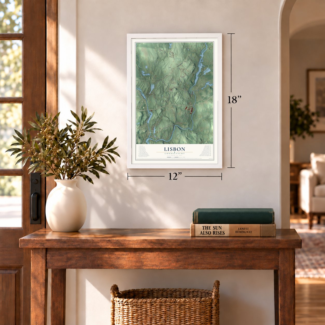
12" x 18" Archival Matte Print
A Map of Home. A Work of Art.
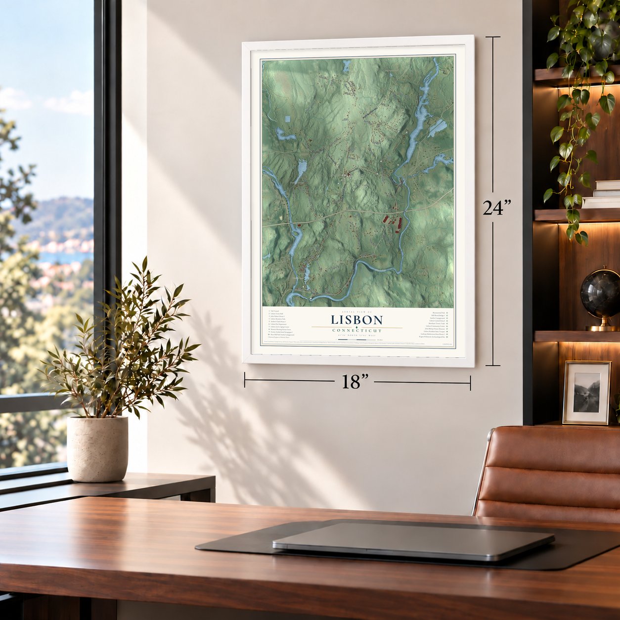
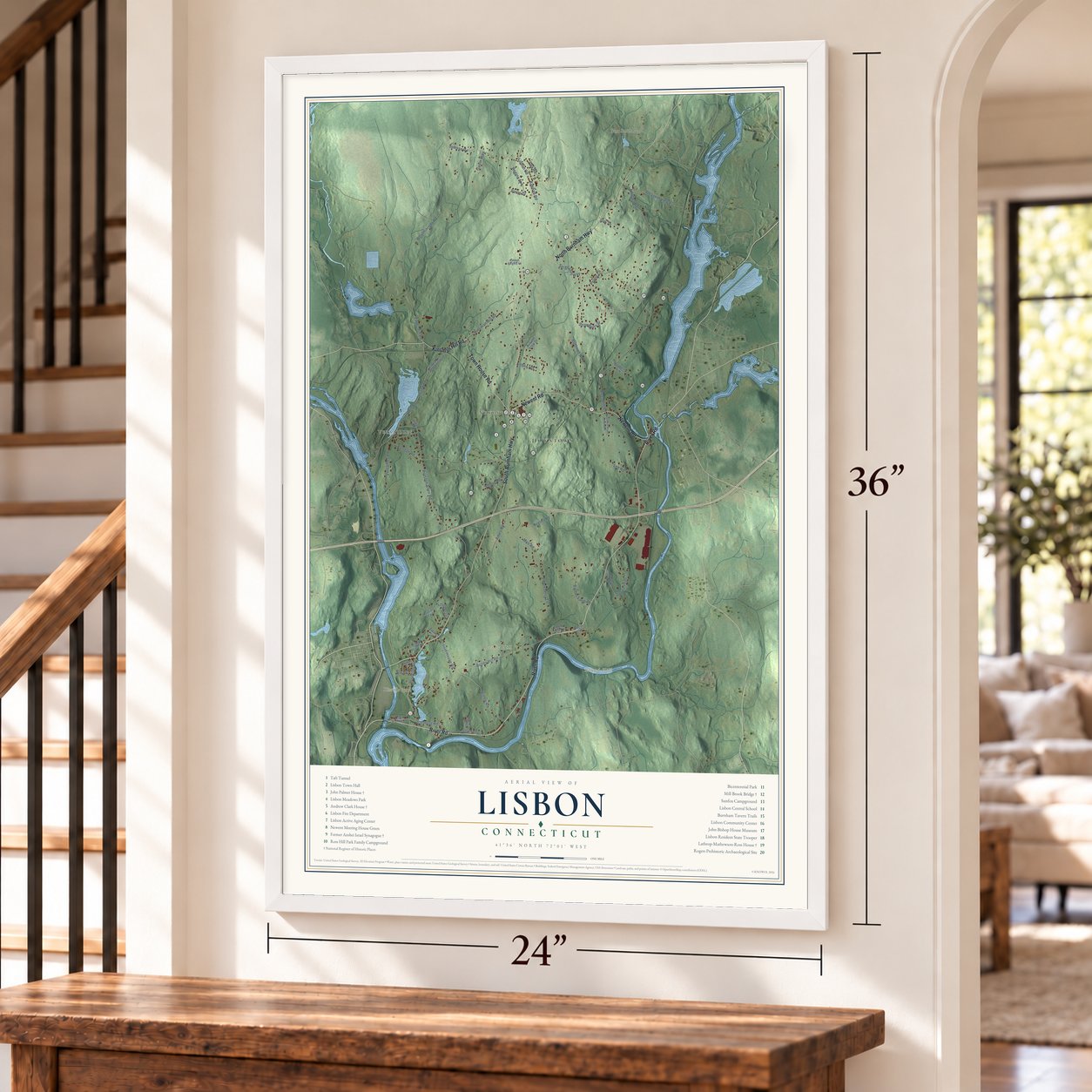
Explore Lisbon, Connecticut from a whole new perspective. Created using aerial imagery and detailed geographic data, this map captures Lisbon building by building, with labeled streets, familiar landmarks, and shaded topographical relief that highlights the natural contours of the landscape.
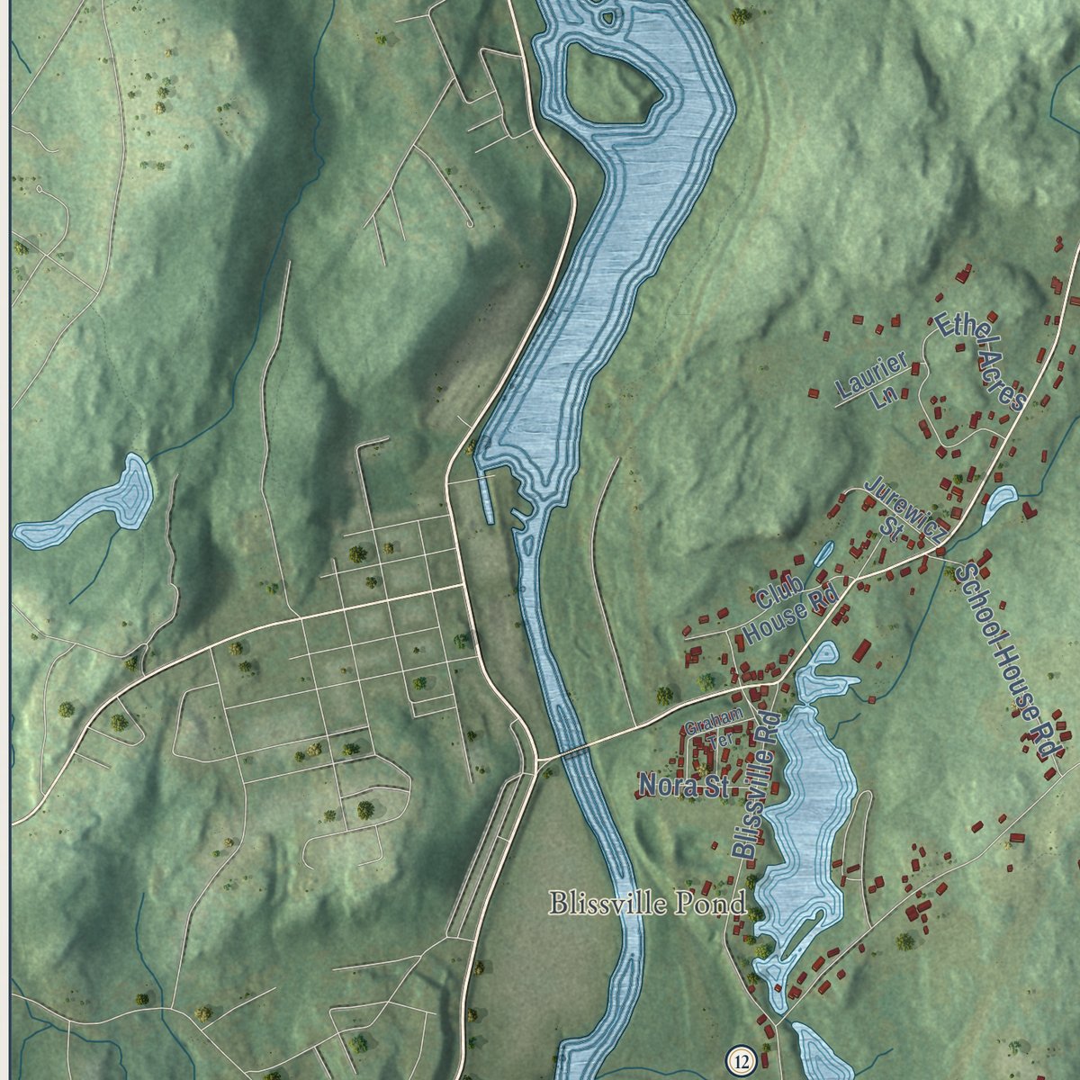
Combining modern data with the timeless character of a vintage atlas, this map is just as interesting up close as it is beautiful on the wall. Whether you grew up in Lisbon, spent memorable years there, or call it home today, this unique map is a great way to celebrate a place that means something to you. Zoom in on the preview to look for your street, and then order a print to put your memories on the wall.

Three ways to hang it
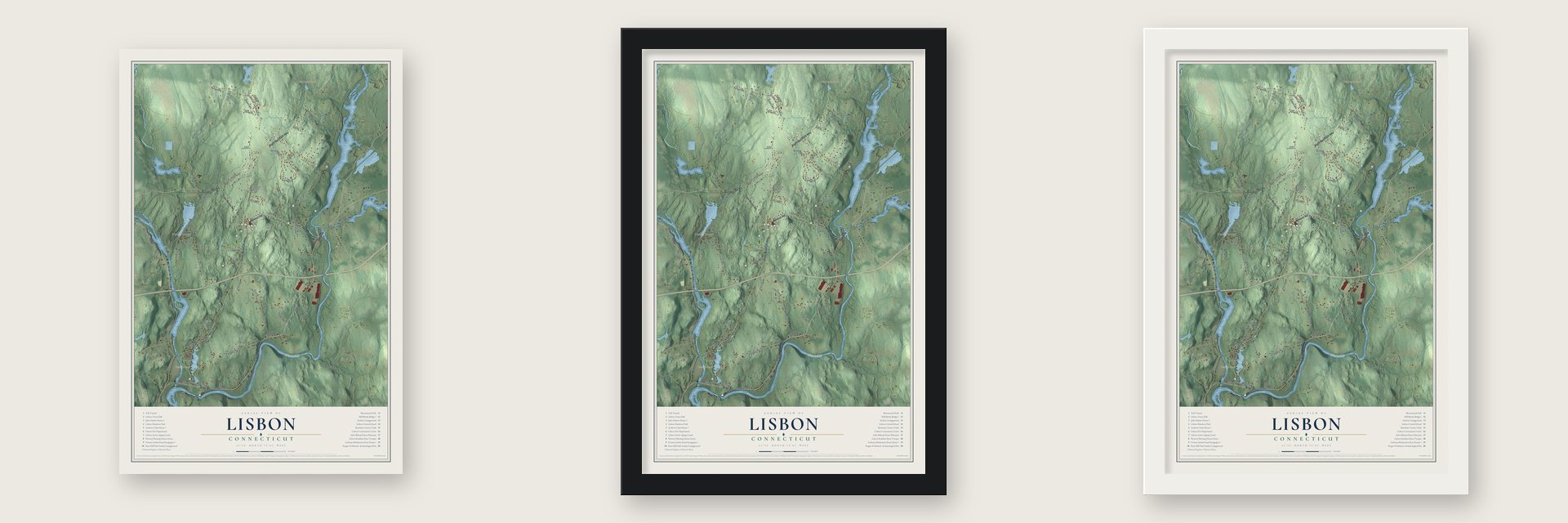
Unframed archival matte, a black wood frame or a white wood frame.
Up close
Geography Worth Displaying
This map was created using accurate cartographic data and authoritative geographic sources, including the U.S. Geological Survey (USGS) and FEMA. The map brings together terrain, waterways, roads, and building detail. The majority of the streets are labeled, houses are accurately depicted, and the topography is derived from government sources. Combining local data with carefully composed color and shading leads to this beautifully detailed Lisbon artwork for your wall.
Rather than simply showing street outlines, we’ve included as many of the street names as we could reasonably fit on the map while keeping their names legible. Zoom in on the high resolution preview to see exactly what’s on the map. We truly set out to create a statement piece for anyone who loves Lisbon. So whether it’s for you, or a gift for someone you love, we hope this map of Lisbon brings back fond memories.
Explore the full map of Lisbon, Connecticut and read about the local places it shows.

Find your street
Names on the Lisbon map
Every name below is printed on this map. Look for your street, your school, the park where you played, or the pond down the road.
Places and landmarks9
- Downtown
- Versailles
- Newent
- Bundy Hill
- Modock Hill
- Ross Hill
- Round Hill
- Blissville Pond
- Burr Smith Pond
Streets and roads60
- Kinsman Hill Road
- North Burnham Highway
- South Burnham Highway
- River Road
- Newent Road
- Town House Road
- Papermill Road
- Inland Road
- Westminister Road
- Paper Mill Road
- Ross Hill Road
- Preston Allen Road
- Mell Road
- Bundy Hill Road
- Kimball Road
- Lisbon Road
- Kendall Road
- Strawberry Street
- Phillips Road
- Pleasent View Cv
- Sullivan Road
- Bushnell Road
- Rimek Road
- Ames Road
- Blissville Road
- Lisbon Heights
- Versailles Road
- Dogwood Drive
- Ethel Acres
- Blueberry Lane
Show all 60 streets
- Sergeants Way
- School House Road
- Nygren Road
- Icehouse Road
- Barber Farm Road
- Regina Avenue
- Rex Road
- Lee Road
- Baron Drive
- Strnad Road
- Gavin Way
- Penny Lane
- Oak Drive
- Nora Street
- Kanahan Road
- Club House Road
- Tunnel Hill Road
- Autumn View Drive
- Allen Road
- Jurewicz Street
- Round Hill Court
- Bayberry Lane
- Laurier Lane
- Kinsman Hill Road Extended
- Lower Blissville Road
- Ross Hill Road Extended
- Kimball Heights Lane
- Round Hill Road
- Tunnel Hill Court
- Graham Terrace
Names are listed as they appear on the printed map. Zoom into the product photos to find them.
About Lisbon, Connecticut
Lisbon is a town of 4,195 people in New London County, on the land where the Quinebaug and Shetucket Rivers meet. Joseph Perkins and his brother Jabez bought a large tract here, long known as Perkins' Crotch, and in 1718 the area became Norwich's northeast parish. It was named Newent in 1722, by tradition after the Perkins family's home in Gloucestershire, England, and in 1723 its church was gathered with Daniel Kirkland as minister.
Newent stayed part of Norwich for decades. In 1786 Newent and Hanover parish were set off together as a new town, which took its name from Lisbon, the capital of Portugal. Farms carried the town, joined in the 1800s by wool and silk factories, and in 1861 parts of Lisbon and Franklin were split off to form Sprague.
“The inhabitants are generally farmers, who are mostly in good circumstances.”
- The hard year of 1727Newent families once crossed the Shetucket by scow or ferry to reach church in Norwich, until a cart bridge was sought at the falls in 1717. The February freshet of 1727 carried that bridge away. Sickness had reached all but one family in 1726, and in the summer of 1727 it touched every household, killing one in six of the men who headed them. Neighbors from other parishes came to bring in the harvest.
- Ebenezer Tracy's Windsor chairsEbenezer Tracy, born in 1744, was a carpenter who opened a shop in Lisbon and became Connecticut's leading Windsor chair maker. His best work, made from 1785 to 1800, includes chairs and settees in the sack-back, fan-back and continuous-bow styles, and collectors prize them today. His sons and sons-in-law kept the trade going, and a book of 1901 noted that many of his chairs were still around.
- A stone arch from the 1790sThe Norwich to Plainfield road was already open in 1717. In 1790 the town improved it with a stone causeway up Bundy Hill. The Mill Brook Bridge, a dry-laid stone arch believed to date from the 1790s, carried that road over Mill Brook and is probably Connecticut's oldest standing stone arch bridge.
- The Taft Tunnel, 1837Crews carved the Taft Tunnel in 1837 so the Norwich and Worcester Railroad could pass the hills along the Quinebaug. Lisbon claims it as the country's first railroad tunnel, and trains of the Providence and Worcester Railroad still run through it.
- A country synagogueFifteen Jewish families from Poland and Russia in Plainfield, Lisbon, Griswold and Jewett City built the Anshei Israel Synagogue on Newent Road in 1936. Harry Rothenberg gave the land and was the first cantor. A Star of David tops the clapboard building's tower, and its raised bimah and ark are original. When membership fell, services came only on holidays, and the town took it over in the 1980s. It joined the National Register in 1995 with 14 other Connecticut synagogues.
Keep exploring Connecticut
Lisbon is one of 382 Connecticut towns we've mapped. Every dot on the map is a print of its own.
The search covers every state, Connecticut first.
Near Lisbon
Order 2 or more town maps and save 10%. Shown in the size and finish you picked above, so they hang as a set.
- Jewett City 12" x 18" / Archival Matte Print $39.99
- Baltic 12" x 18" / Archival Matte Print $39.99
- Sprague 12" x 18" / Archival Matte Print $39.99


More maps nearby: Griswold, Norwich, Preston, Canterbury and Plainfield Village.
The art of mapping a place
How This Map Was Made
Real places. Remarkable detail. Discover the layers that turn geographic data into a map of home.

The view from above
Aerial imagery reveals the character of the land: woodland, open fields, and the patterns of a place.

The shape of the land
Elevation data brings hills, valleys, and subtle changes in the landscape into view.

The details of home
Roads, waterways, and building footprints come together to make the map feel unmistakably local.

Geography becomes art
Considered color, shading, and typography bring the layers together in a map made for your wall.


Process illustrated with Mendon, Massachusetts. Aerial imagery: USDA NAIP. Terrain: USGS 3D Elevation Program. Map details and finished artwork: KNOWOL.
The Details
About This Print
Choose an archival matte print, or a black or white Ayous wood frame. The archival matte print is unframed.
Select your size and finish above to see the matching product image and price.
Materials & Craftsmanship
A contemporary map with the character of a classic atlas, printed on archival matte paper. Optional frames are made from Ayous wood.
Your printed map does not include the watermark shown in the full-map preview.
Shipping & Delivery
Free shipping within the United States. Every print is made to order in the USA.
Buying a gift? Add a note in your cart and we'll include it. We never put prices in the package.
Prints ship within 2 to 3 business days. Allow 7 to 10 days total from ordering for delivery. Timing may vary during holidays or periods of high order volume.
Read our shipping policy.
Returns and damaged prints
Each print is made to order. Change-of-mind refunds are not available after production.
If your print arrives damaged, misprinted or incorrect, contact support@knowol.com within 30 days of receiving it. Include your order number, photos and a description of the issue.
Read our full refund and replacement policy. For questions about your order, email support@knowol.com.