
Search for another town





Free U.S. delivery 7 to 10 days after you order
Canterbury, Connecticut Map Art
Building by building, with labeled streets and shaded relief.
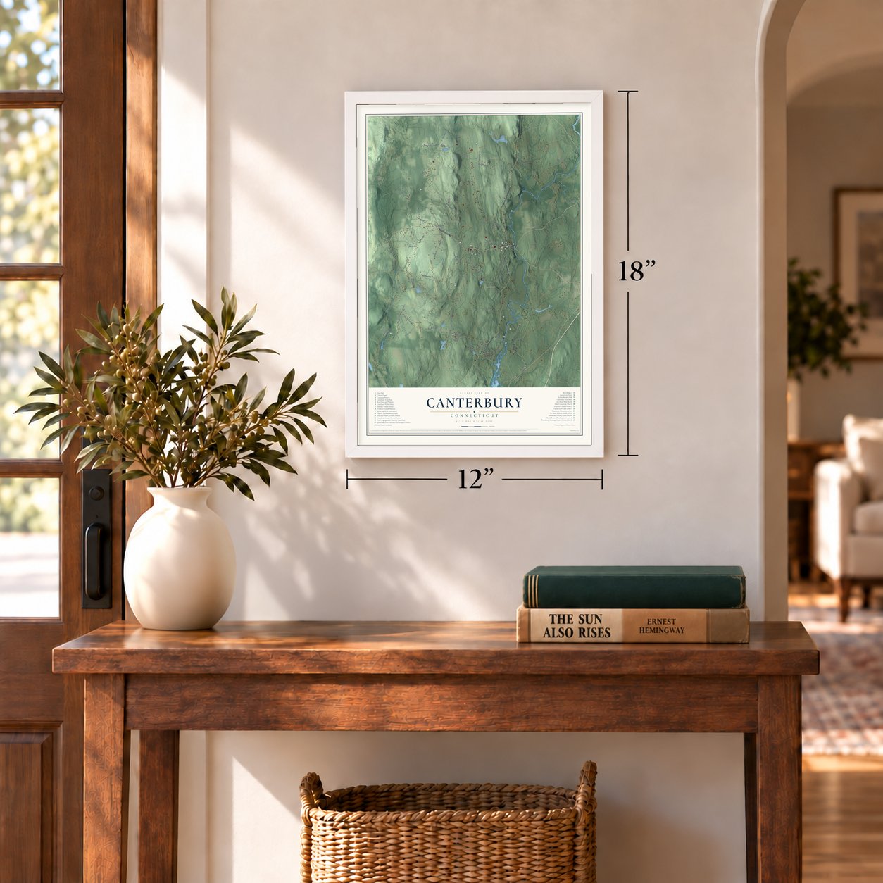
12" x 18" Archival Matte Print
A Map of Home. A Work of Art.
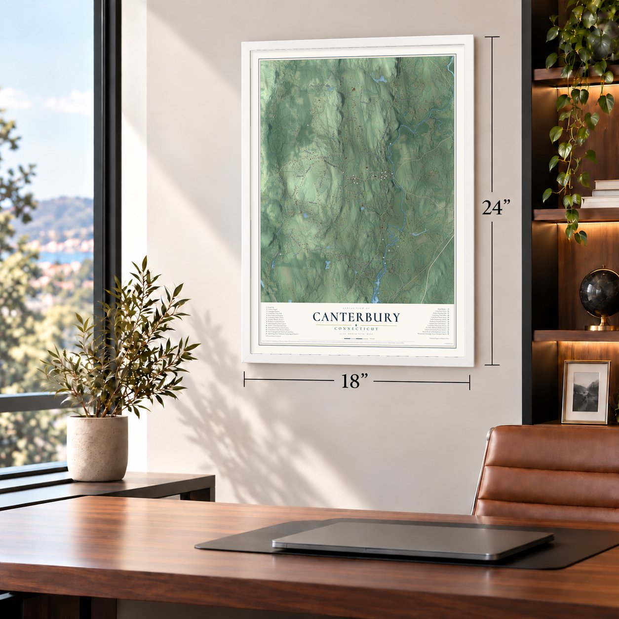
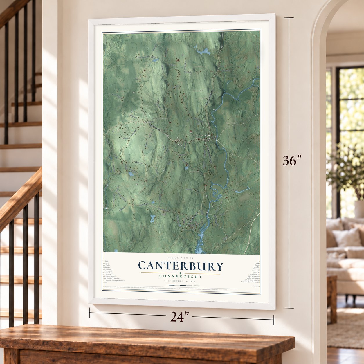
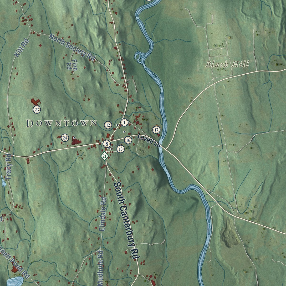
Explore Canterbury, Connecticut from a whole new perspective. Created using aerial imagery and detailed geographic data, this map captures Canterbury building by building, with labeled streets, familiar landmarks, and shaded topographical relief that highlights the natural contours of the landscape.
Combining modern data with the timeless character of a vintage atlas, this map is just as interesting up close as it is beautiful on the wall. Whether you grew up in Canterbury, spent memorable years there, or call it home today, this unique map is a great way to celebrate a place that means something to you. Zoom in on the preview to look for your street, and then order a print to put your memories on the wall.

Three ways to hang it
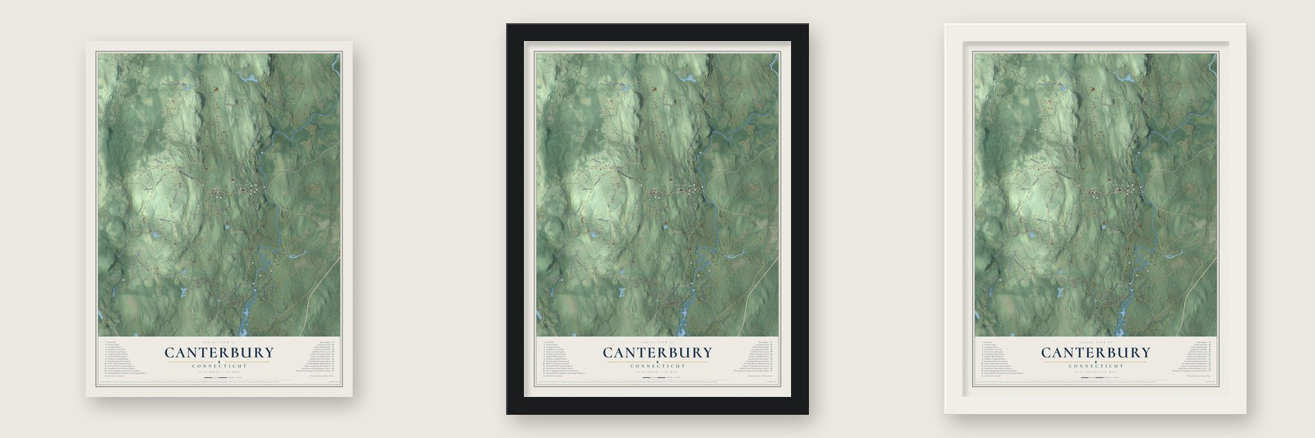
Unframed archival matte, a black wood frame or a white wood frame.
Up close
Geography Worth Displaying
This map was created using accurate cartographic data and authoritative geographic sources, including the U.S. Geological Survey (USGS) and FEMA. The map brings together terrain, waterways, roads, and building detail. The majority of the streets are labeled, houses are accurately depicted, and the topography is derived from government sources. Combining local data with carefully composed color and shading leads to this beautifully detailed Canterbury artwork for your wall.
Rather than simply showing street outlines, we’ve included as many of the street names as we could reasonably fit on the map while keeping their names legible. Zoom in on the high resolution preview to see exactly what’s on the map. We truly set out to create a statement piece for anyone who loves Canterbury. So whether it’s for you, or a gift for someone you love, we hope this map of Canterbury brings back fond memories.
Explore the full map of Canterbury, Connecticut and read about the local places it shows.

Find your street
Names on the Canterbury map
Every name below is printed on this map. Look for your street, your school, the park where you played, or the pond down the road.
Places and landmarks9
- Downtown
- Packer
- Westminster
- Black Hill
- Buck Hill
- Morgan Hill
- North Hill
- Bates Pond
- Bennett Pond
Streets and roads71
- Westminster Road
- South Canterbury Road
- North Canterbury Road
- Butts Bridge Road
- Maple Lane
- Woodchuck Hill Road
- Bates Pond Road
- Hanover Road
- Gay Head Road
- Water Street
- North Society Road
- Lisbon Road
- Brooklyn Road
- Barstow Road
- Bingham Road
- Colburn Road
- Cemetery Road
- Wauregan Road
- Buck Hill Road
- Graff Road
- Bennett Pond Road
- Gooseneck Hill Road
- Kinne Road
- Depot Road
- Packer Road
- Elmdale Road
- John Brook Road
- Goodwin Road
- Kitt Road
- Phinney Lane
Show all 71 streets
- Walker Road
- Miller Road
- Tripp Hollow Road
- Buntz Road
- Corey Road
- Tracy Road
- Francis Bennett Road
- Baldwin Brook Road
- Wright Road
- Marion Lane
- Bopp Road
- Tarbox Road
- Willowbrook Lane
- Ayers Drive
- Kerr Road
- Ulasik Road
- Creasey Road
- Hannover Road
- Willow Lane
- Mudhole Road
- Jimmy Road
- Lisa Lane
- Howe Road
- Emily Lane
- Cross Road
- Raymond Schoolhouse Road
- Hansen Road
- Wright Pond Road
- Bingham Road No 2
- Garosshen Road
- Finn Road
- Liepis Road
- Lovell Lane
- Meadow Lane
- Shagbark Lane
- Hoopers Lane
- Depot Road Extended
- Short Road
- Little River Lane
- Old Hampton Road
- Knollwood Drive
Names are listed as they appear on the printed map. Zoom into the product photos to find them.
About Canterbury, Connecticut
Canterbury is a town of 5,045 people in Windham County, west of the Quinebaug River. English colonists settled here in the 1680s, when the land was called Peagscomsuck and belonged to Plainfield. In 1703 it was split off and named for Canterbury in England. Two years later the town bought three and a half acres from Robert Green for a meetinghouse, and the green has been the center of town ever since.
The General Assembly answered with a Black Law, and Crandall spent a night in jail but kept teaching until a mob forced the school to close in 1834. Connecticut repealed the law in 1838, the town gave her a small pension in 1877, and in 1995 the state named her its official heroine.
“Canterbury Green is a beautiful, restful spot with the old church and lawn situated at the highest pinnacle.”
- Butts Bridge since 1733Samuel Butts arrived from Dorchester in 1706, and in 1733 he built a bridge over the Quinebaug. Ezra Ensworth later put a dam across the river just upstream to run his corn mill. Neighbors rebuilt the bridge in 1760, but the next winter ice pouring over the dam carried it off.
- A lottery for a bridgeThe present steel Butts Bridge, 231 feet long, was built in 1937, after the floods of 1936.
- The church that splitDuring the Great Awakening most church members turned New Light, yet in 1744 the county consociation installed Rev. James Cogswell, the minority's pick. The majority left and organized a Separate church, the colony's first to formally adopt New Light principles. That November the Cleaveland brothers, John and Ebenezer, were expelled from Yale for attending a Separate meeting with their parents.
- Cleveland's namesakeMoses Cleaveland was born in Canterbury in 1754 and practiced law here after he left the army in 1781. In 1796 he headed the party that surveyed the Western Reserve, Connecticut's land in Ohio, and they named their new settlement at the Cuyahoga's mouth for him. That settlement grew into the city of Cleveland. He came back to Canterbury, never returned to Ohio, and is buried here.
- A sea captain's houseIn 1801 Captain John Clark, a ship's captain, bought a house on Route 169 south of the green. With a hip roof, a Palladian window and a gable above the entrance, it shows Canterbury's own building style at its best. Clark is also generally credited with building the house that became Crandall's school. The Capt. John Clark House joined the National Register in 1970.
Keep exploring Connecticut
Canterbury is one of 382 Connecticut towns we've mapped. Every dot on the map is a print of its own.
The search covers every state, Connecticut first.
Near Canterbury
Order 2 or more town maps and save 10%. Shown in the size and finish you picked above, so they hang as a set.
- Scotland 12" x 18" / Archival Matte Print $39.99
- Plainfield Village 12" x 18" / Archival Matte Print $39.99
- Sprague 12" x 18" / Archival Matte Print $39.99


More maps nearby: Plainfield, Jewett City, Wauregan, Lisbon and Hampton.
The art of mapping a place
How This Map Was Made
Real places. Remarkable detail. Discover the layers that turn geographic data into a map of home.

The view from above
Aerial imagery reveals the character of the land: woodland, open fields, and the patterns of a place.

The shape of the land
Elevation data brings hills, valleys, and subtle changes in the landscape into view.

The details of home
Roads, waterways, and building footprints come together to make the map feel unmistakably local.

Geography becomes art
Considered color, shading, and typography bring the layers together in a map made for your wall.


Process illustrated with Mendon, Massachusetts. Aerial imagery: USDA NAIP. Terrain: USGS 3D Elevation Program. Map details and finished artwork: KNOWOL.
The Details
About This Print
Choose an archival matte print, or a black or white Ayous wood frame. The archival matte print is unframed.
Select your size and finish above to see the matching product image and price.
Materials & Craftsmanship
A contemporary map with the character of a classic atlas, printed on archival matte paper. Optional frames are made from Ayous wood.
Your printed map does not include the watermark shown in the full-map preview.
Shipping & Delivery
Free shipping within the United States. Every print is made to order in the USA.
Buying a gift? Add a note in your cart and we'll include it. We never put prices in the package.
Prints ship within 2 to 3 business days. Allow 7 to 10 days total from ordering for delivery. Timing may vary during holidays or periods of high order volume.
Read our shipping policy.
Returns and damaged prints
Each print is made to order. Change-of-mind refunds are not available after production.
If your print arrives damaged, misprinted or incorrect, contact support@knowol.com within 30 days of receiving it. Include your order number, photos and a description of the issue.
Read our full refund and replacement policy. For questions about your order, email support@knowol.com.