
Search for another town





Free U.S. delivery 7 to 10 days after you order
Lorewood Grove, Delaware Map Art
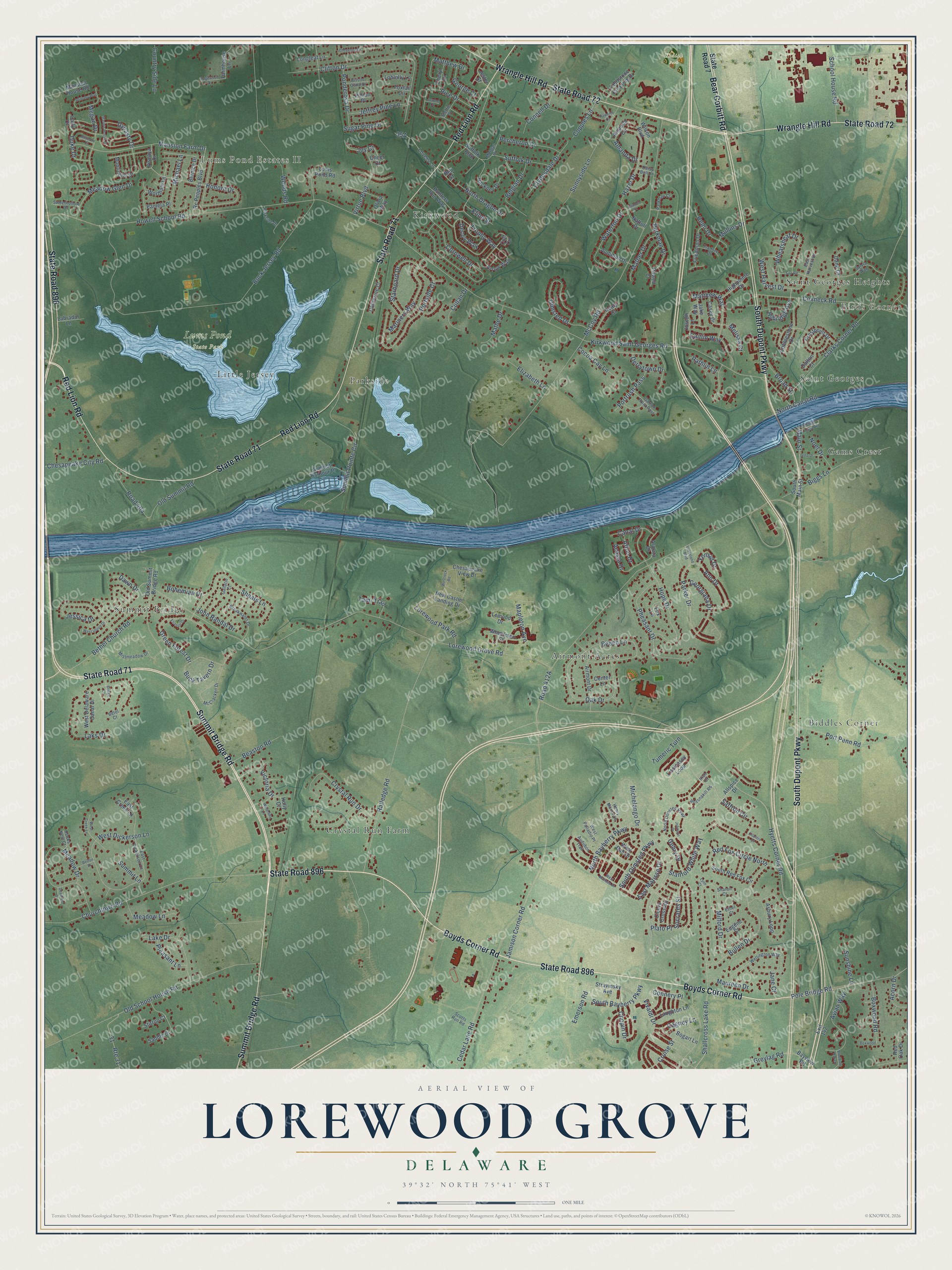
A new map of Lorewood Grove, Delaware, made in 2026 and printed to order on thick archival matte paper.
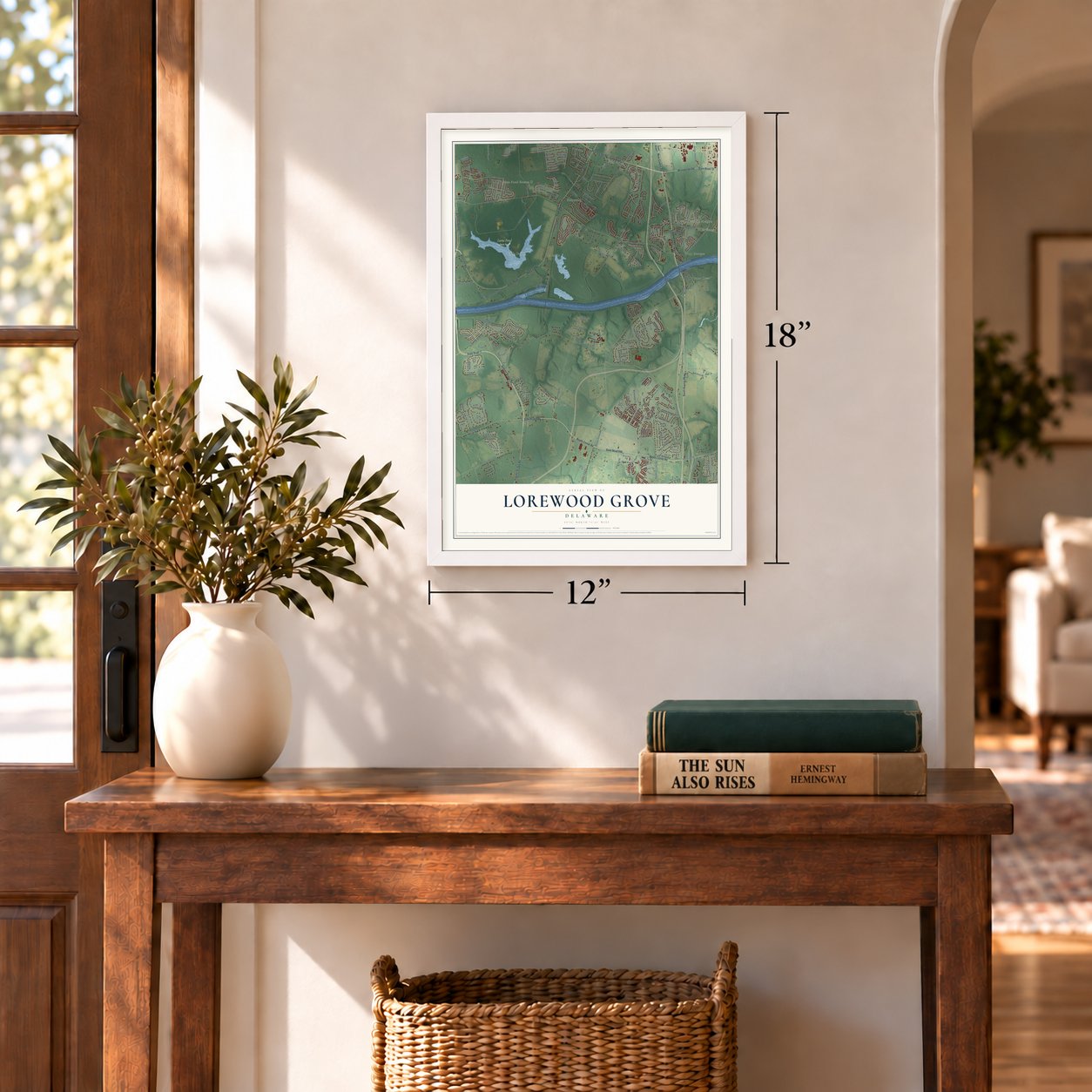
12" x 18" Archival Matte Print
A Map of Home. A Work of Art.
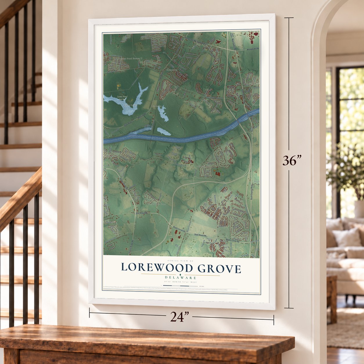
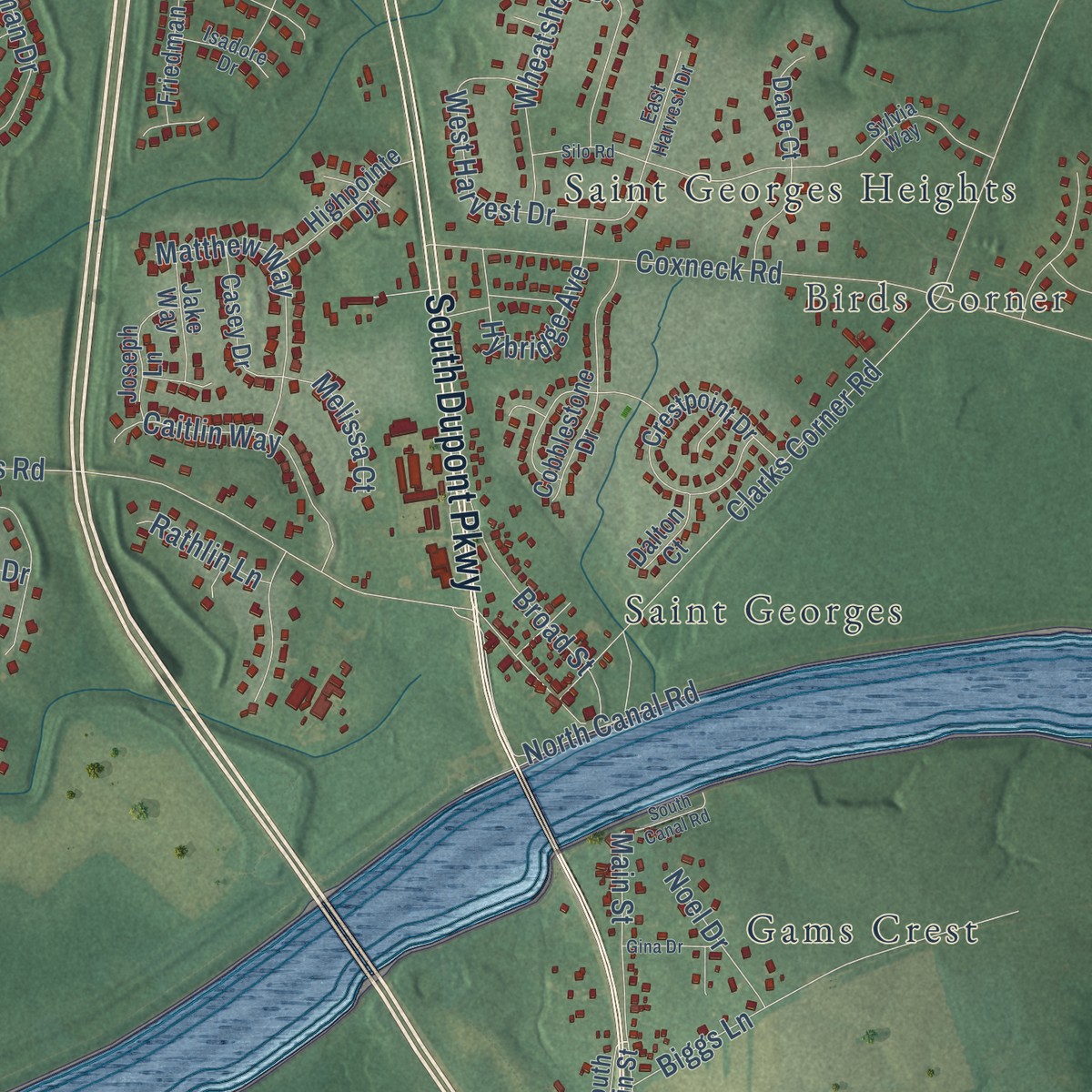
Explore Lorewood Grove, Delaware from a whole new perspective. Created using aerial imagery and detailed geographic data, this map captures Lorewood Grove building by building, with labeled streets, familiar landmarks, and shaded topographical relief that highlights the natural contours of the landscape.
Combining modern data with the timeless character of a vintage atlas, this map is just as interesting up close as it is beautiful on the wall. Whether you grew up in Lorewood Grove, spent memorable years there, or call it home today, this unique map is a great way to celebrate a place that means something to you. Zoom in on the preview to look for your street, and then order a print to put your memories on the wall.
Three ways to hang it
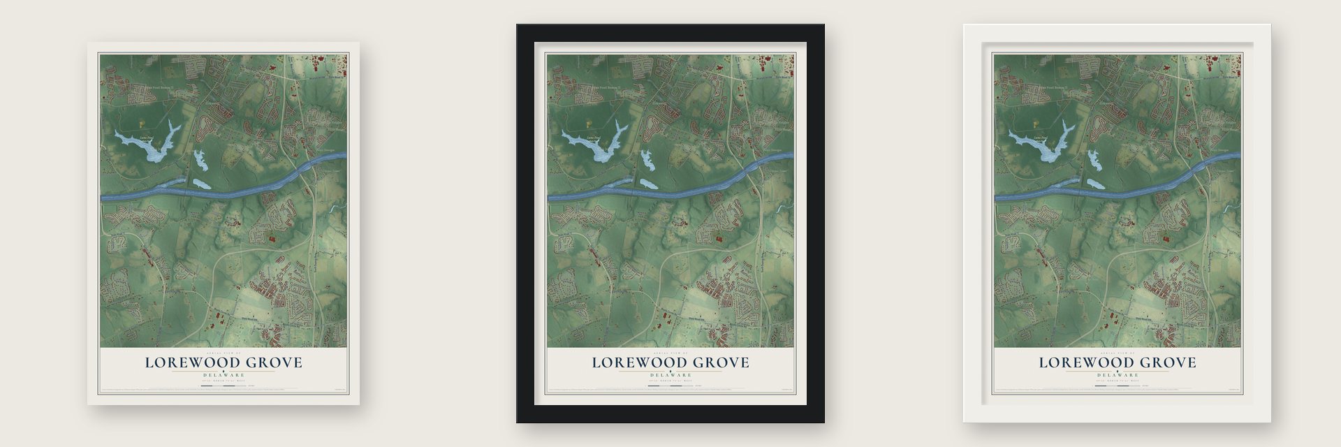
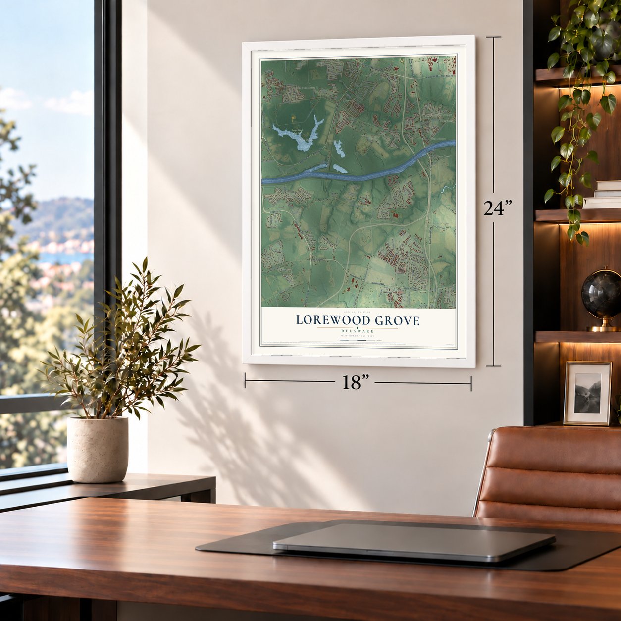
Unframed archival matte, a black wood frame or a white wood frame.
Up close
Geography Worth Displaying
This map was created using accurate cartographic data and authoritative geographic sources, including the U.S. Geological Survey and the Census Bureau. The map brings together terrain, waterways, roads, and building detail. The majority of the streets are labeled, houses are accurately depicted, and the topography is derived from government sources. Combining local data with carefully composed color and shading leads to this beautifully detailed Lorewood Grove artwork for your wall.
Rather than simply showing street outlines, we’ve included as many of the street names as we could reasonably fit on the map while keeping their names legible. Zoom in on the high resolution preview to see exactly what’s on the map. We truly set out to create a statement piece for anyone who loves Lorewood Grove. So whether it’s for you, or a gift for someone you love, we hope this map of Lorewood Grove brings back fond memories.
Read the story behind this map: Detailed Map of Lorewood Grove, Delaware.

Find your street
Names on the Lorewood Grove map
Every name below is printed on this map. Look for your street, your school, the park where you played, or the pond down the road.
Places and landmarks14
- Birds Corner
- Lums Pond Estates II
- Kodiak Park
- Lums Pond State Park
- Crystal Run Farm
- Biddles Corner
- Gams Crest
- Summit Bridge
- Airmont Acres
- Parkside
- Saint Georges Heights
- Kirkwood
Show all 14 places
- Saint Georges
- Little Jersey
Streets and roads276
- State Road 71
- South Dupont Parkway
- State Road 896
- State Road 72
- Wrangle Hill Road
- Summit Bridge Road
- Boyds Corner Road
- Red Lion Road
- Bear Corbitt Road
- Saffron Circle
- Hybridge Avenue
- South Olmsted Parkway
- Trophy Way
- Hyetts Corner Road
- Milford Drive
- Honora Drive
- Lorewood Grove Road
- North Bayberry Parkway
- Kirkwood Saint Georges Road
- McCoy Road
- Howell School Road
- Buck Jersey Road
- Jamison Corner Road
- Ratledge Road
- Old School House Road
- Churchtown Road
- Clarks Corner Road
- Cornwell Drive
- Clifton Drive
- Woods Road
Show all 276 streets
- Summit Pointe Circle
- Coxneck Road
- Bullen Drive
- Portside Court
- West Dickerson Lane
- Meadow Drive
- Mansion Farm Drive
- Sheats Lane
- Oak Drive
- Pheasant Drive
- Parker Drive
- Olmsted Drive
- Main Street
- Jessica Drive
- Cedar Lane Road
- Pole Bridge Road
- Port Penn Road
- Megan Drive
- Bethel Church Road
- Beech Lane
- Sunnyside Lane
- Rice Drive
- Green Forest Drive
- Hope Drive
- Emerson Road
- Crystal Run Drive
- Wheatsheaf Drive
- Michelango Drive
- Shallcross Lake Road
- Plato Place
- Biggs Lane
- Mariners Way
- Waterton Drive
- Buck Tavern Drive
- Hazel Drive
- Avian Way
- North Dragon Drive
- North Canal Road
- Laks Drive
- Lake Drive
- Stanford White Way
- School House Road
- Michael Lane
- Vivaldi Drive
- Ann Drive
- South Bayberry Parkway
- Starboard Drive
- Meadow Glen Drive
- Duke Drive
- Caitlin Way
- Victoria Drive
- Red Fox Circle North
- Belgian Drive
- Georgiana Drive
- West Harvest Drive
- Matthew Way
- Clydesdale Drive
- Virtue Boulevard
- Decoy Way
- Parkman Drive
- Greylag Road
- Matthew Drive
- Broad Street
- East Matisse Drive
- Chesapeake City Road
- Percheron Drive
- Old Summit Road
- Boxwood Road
- Ponderosa Drive
- Route 31
- Cocoa Cay Lane
- Meadow Lane
- Road 404
- Jeffrey Pine Lane
- Lorewood Park Road
- Suffolk Drive
- Connell Drive
- Mapleton Avenue
- Mather Drive
- Cruise Street
- Acasta Drive
- Beaston Road
- Cullan Drive
- Portrush Pass
- Remi Drive
- Sugar Pine Drive
- Tumeric Turn
- Country Side Lane
- Chopin Drive
- Joy Court
- John Randal Drive
- Elizabeth Lane
- Matbe Drive
- Yensid Drive
- Cagney Lane
- Canal Drive
- Socrates Street
- Pleasant Lane
- Sunshine Lane
- Copples Lane
- Mullins Drive
- Dynasty Drive
- Acorn Drive
- George Court
- Maureen Drive
- Tami Trail
- Bohemian Drive
- Derrytown Drive
- Gehry Drive
- Connery Place
- Noel Drive
- Melissa Court
- Afton Drive
- Rathlin Lane
- Kline Street
- Amanda Drive
- Summit Lane
- Dawn Drive
- Jane Court
- State Road 7
- Allspice Drive
- Stravinsky Avenue
- Asbury Loop
- Old Summit Bridge Road
- Crestpoint Drive
- Airmont Drive
- Lissicasey Loop
- Rc Peoples Boulevard
- Arrow Way
- Saddle Drive
- West Delaware Canal Drive
- Monticello Drive
- Cobblestone Drive
- Bernice Drive
- Wortham Lane
- Dane Court
- Hackney Drive
- Suffolk Boulevard
- Lums Pond Road
- New Castle Landing Drive
- Exit 142
- South Red Fox Circle
- Mansion House Road
- East Creek Lane
- Lovers Lane
- Friedman Drive
- Fieldstone Crossing Drive
- Nattull Drive
- Highpointe Drive
- Summit Harbour Place
- Amanda Circle
- Audubon Drive
- Laughton Lane
- Catherine Court
- Casey Drive
- Wheelmen Street
- Hunters Run Way
- Armata Drive
- Healy Court
- Farmhouse Lane
- Holly Court
- Chesapeake View Drive
- Powell Court
- Joseph Lane
- Bogart Lane
- Longleaf Lane
- Jester Street
- Cicero Crossing
- Bayview Road
- Jake Way
- Loblolly Lane
- Cheryl Drive
- Wilson Boulevard
- South Main Street
- Labrador Lane
- Pamela Place
- Stirrup Court
- Eugene Court
- Fox Lane
- Center Lane
- Pinion Place
- Viscaya Drive
- Foxtail Circle
- Red Oak Drive
- West Dali Drive
- Dalton Court
- Lemond Drive
- Carly Court
- Olivia Way
- Cheer Court
- Bell Street
- Colt Circle
- North Olmsted Parkway
- Wellington Way
- East Dickerson Lane
- McCracken Drive
- Mistmeadow Drive
- Audubon Trail
- West Palladio Place
- Sylvia Way
- Rossnakill Road
- East Harvest Drive
- Breakwater Drive
- Morgan Drive
- Steffie Drive
- Garron Point Pass
- Henry Moore Lane
- Sweethollow Drive
- Parkside Drive
- Isadore Drive
- Bristle Cone Drive
- Parkman Court
- Scotts Run Road
- Hawks Nest Court
- Daisy Bell Lane
- Ethel Court
- Gallatin Court
- Sharon Court
- Betel Court
- Irish Court
- West Matisse Drive
- Brittany Way
- Marble House Drive
- Johnson Drive
- Silo Road
- Waterlilly Lane
- West Creek Lane
- Cheyenne Drive
- Westlock Road
- West Union Drive
- Edgewood Drive
- Haworth Court
- South Canal Road
- Gina Drive
- Bluebird Haven
- Berton Place
- Eliason Drive
- Crossland Boulevard
- Deerfield Drive
- Gambel Court
- Boxwood
- Cilantro Court
- Biltmore Court
- Joanne Court
- Bridge Court
- Lynn Court
Names are listed as they appear on the printed map. Zoom into the product photos to find them.
The art of mapping a place
How This Map Was Made
Real places. Remarkable detail. Discover the layers that turn geographic data into a map of home.

The view from above
Aerial imagery reveals the character of the land: woodland, open fields, and the patterns of a place.

The shape of the land
Elevation data brings hills, valleys, and subtle changes in the landscape into view.

The details of home
Roads, waterways, and building footprints come together to make the map feel unmistakably local.

Geography becomes art
Considered color, shading, and typography bring the layers together in a map made for your wall.


Process illustrated with Mendon, Massachusetts. Aerial imagery: USDA NAIP. Terrain: USGS 3D Elevation Program. Map details and finished artwork: KNOWOL.
The Details
About This Print
Choose an archival matte print, or a black or white Ayous wood frame. The archival matte print is unframed.
Select your size and finish above to see the matching product image and price.
Materials & Craftsmanship
A contemporary map with the character of a classic atlas, printed on archival matte paper. Optional frames are made from Ayous wood.
Your printed map does not include the watermark shown in the full-map preview.
Shipping & Delivery
Free shipping within the United States. Every print is made to order in the USA.
Buying a gift? Add a note in your cart and we'll include it. We never put prices in the package.
Prints ship within 2 to 3 business days. Allow 7 to 10 days total from ordering for delivery. Timing may vary during holidays or periods of high order volume.
Read our shipping policy.
Returns and damaged prints
Each print is made to order. Change-of-mind refunds are not available after production.
If your print arrives damaged, misprinted or incorrect, contact support@knowol.com within 30 days of receiving it. Include your order number, photos and a description of the issue.
Read our full refund and replacement policy. For questions about your order, email support@knowol.com.
Find your town
Looking for another city?
Find a map of home in our Delaware collection, or any town in the country.
Nearby
Maps of towns near Lorewood Grove
Know someone from one of these towns? Their map makes a great gift.
 St. Georges
, Delaware
From $39.99See the map
 Glasgow
, Delaware
From $39.99See the map
 Bear
Bear, Delaware
From $39.99See the map
More maps nearby: Delaware City, Port Penn, Odessa, Middletown and Brookside.