
Search for another town


Free U.S. delivery 7 to 10 days after you order
Medway, Massachusetts Map Art
Building by building, with labeled streets and shaded relief.
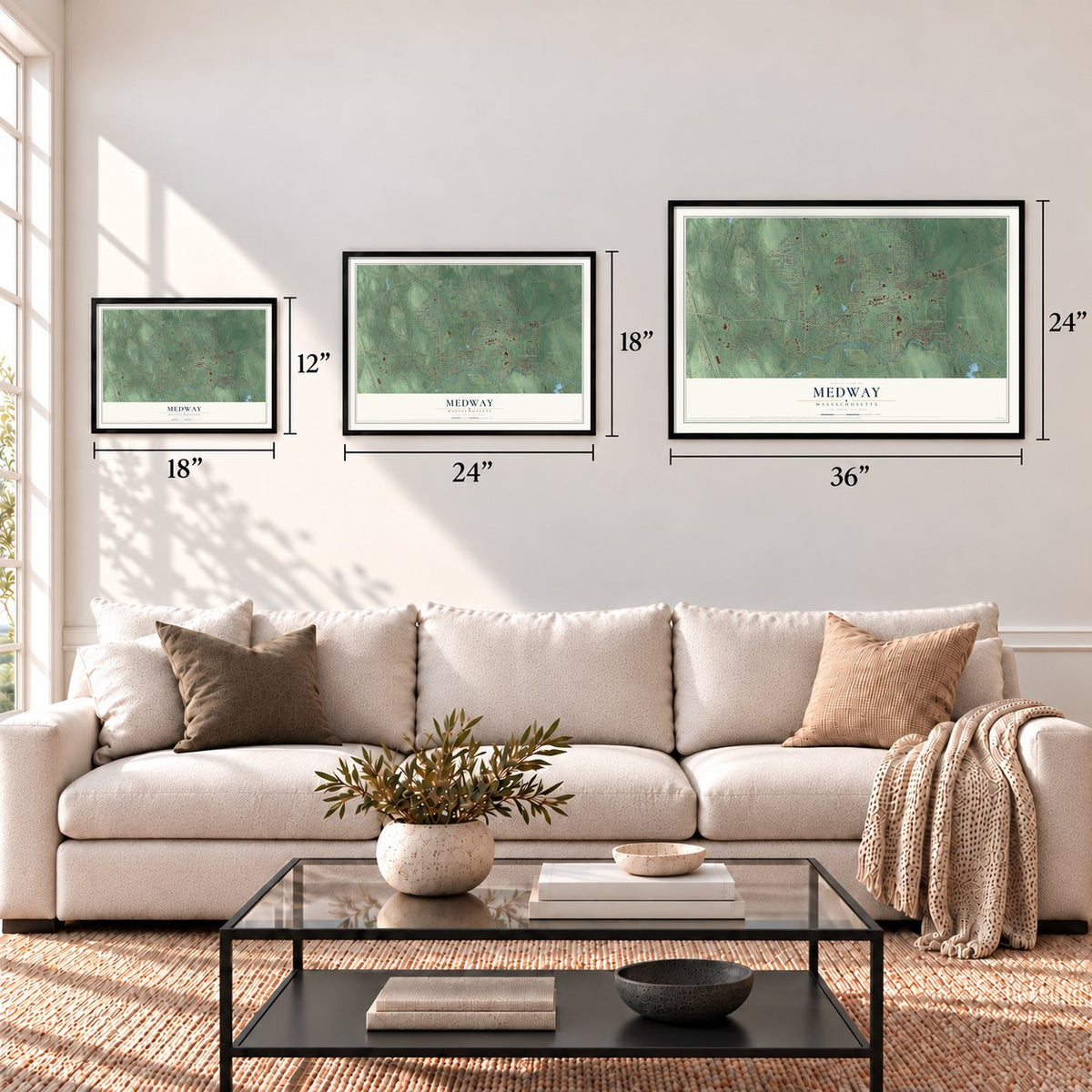
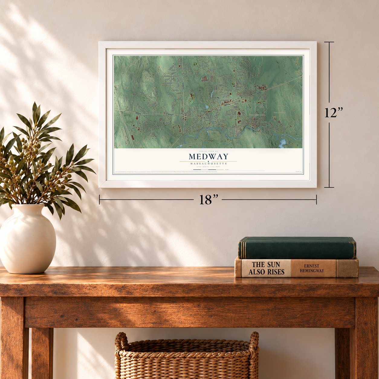
12" x 18" Archival Matte Print
A Map of Home. A Work of Art.
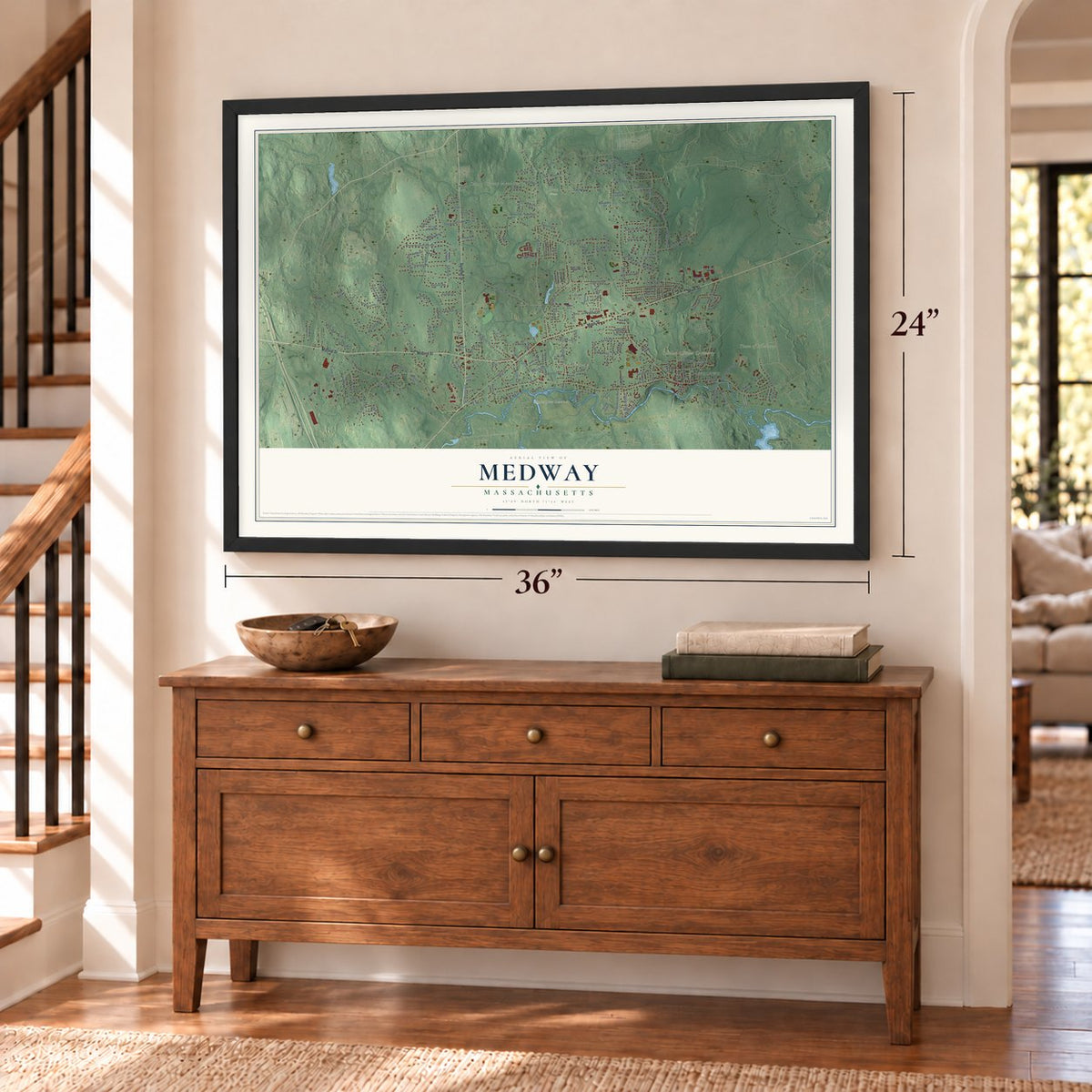
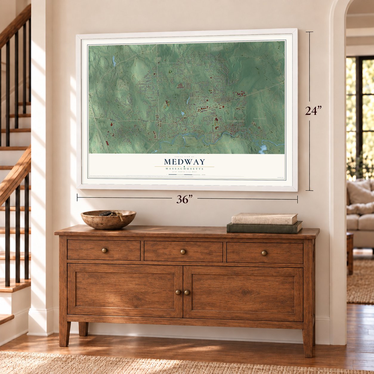
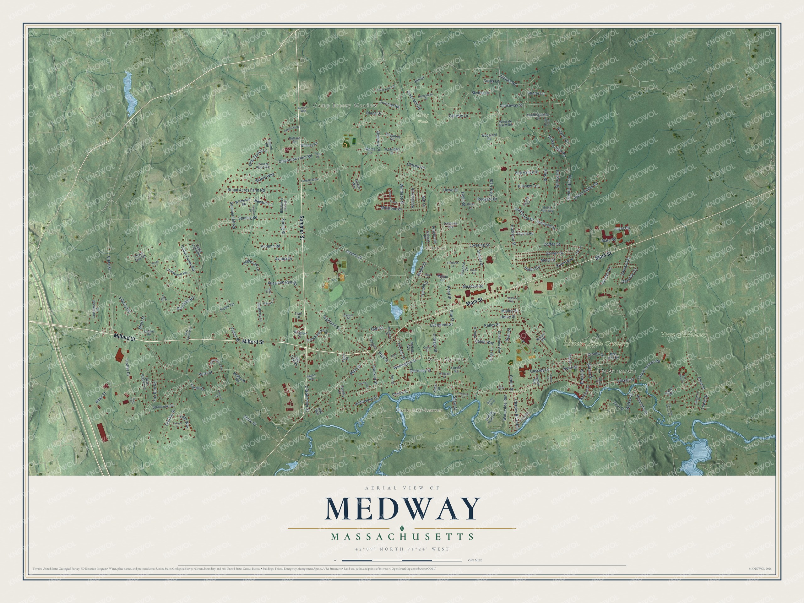
Explore Medway, Massachusetts from a whole new perspective. Created using aerial imagery and detailed geographic data, this map captures Medway building by building, with labeled streets, familiar landmarks, and shaded topographical relief that highlights the natural contours of the landscape.
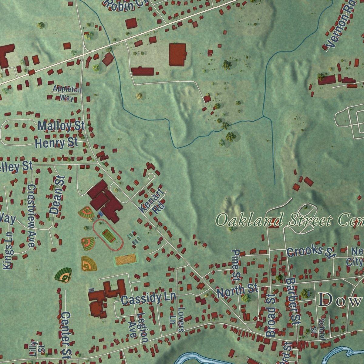
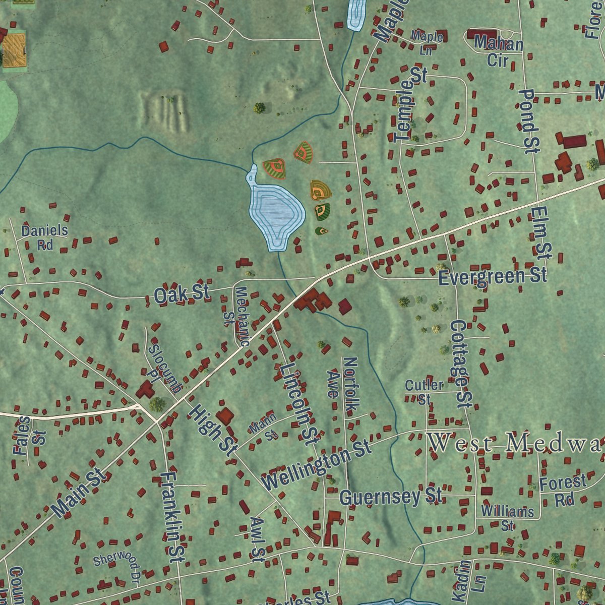
Combining modern data with the timeless character of a vintage atlas, this map is just as interesting up close as it is beautiful on the wall. Whether you grew up in Medway, spent memorable years there, or call it home today, this unique map is a great way to celebrate a place that means something to you. Zoom in on the preview to look for your street, and then order a print to put your memories on the wall.
Three ways to hang it
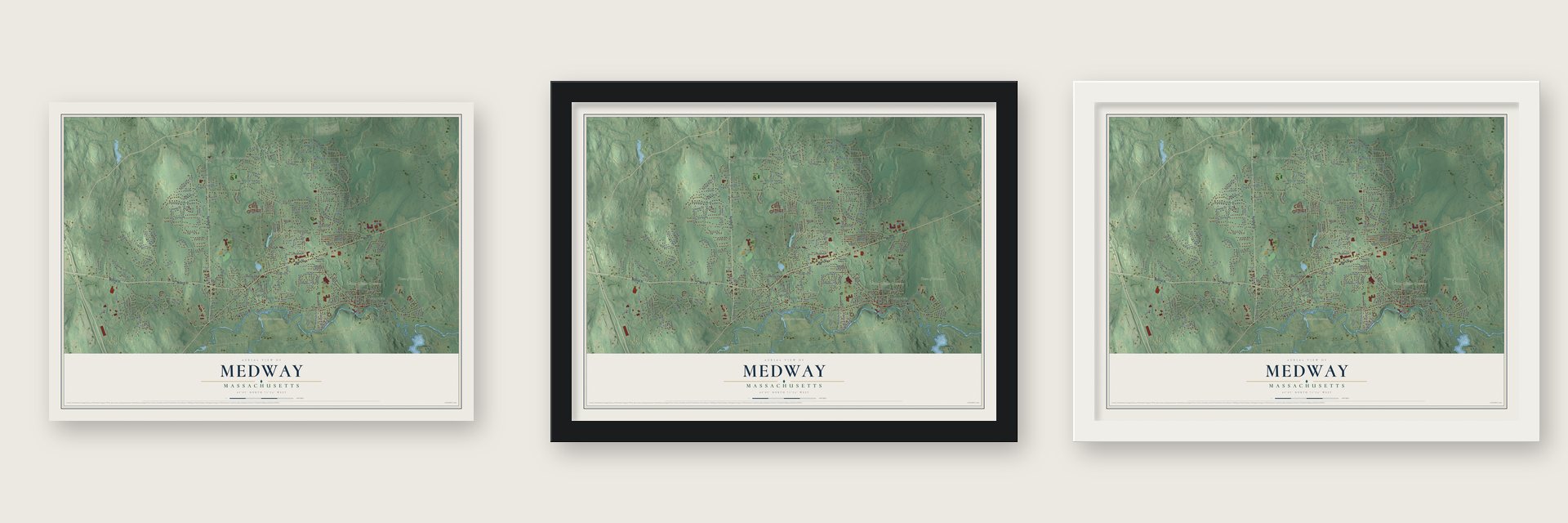
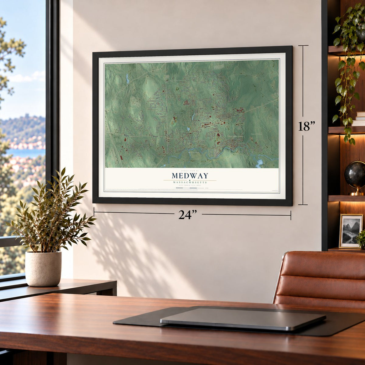
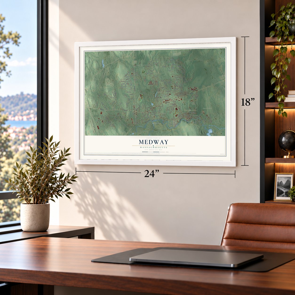
Unframed archival matte, a black wood frame or a white wood frame.
Up close
Geography Worth Displaying
This map was created using accurate cartographic data and authoritative geographic sources, including the U.S. Geological Survey (USGS) and FEMA. The map brings together terrain, waterways, roads, and building detail. The majority of the streets are labeled, houses are accurately depicted, and the topography is derived from government sources. Combining local data with carefully composed color and shading leads to this beautifully detailed Medway artwork for your wall.
Rather than simply showing street outlines, we’ve included as many of the street names as we could reasonably fit on the map while keeping their names legible. Zoom in on the high resolution preview to see exactly what’s on the map. We truly set out to create a statement piece for anyone who loves Medway. So whether it’s for you, or a gift for someone you love, we hope this map of Medway brings back fond memories.
Explore the full map of Medway, Massachusetts and read about the local places it shows.

Find your street
Names on the Medway map
Every name below is printed on this map. Look for your street, your school, the park where you played, or the pond down the road.
Places and landmarks8
- Downtown
- Camp Breezy Meadow
- West Medway
- Charles River Reservoir
- Milk Pond
- Town of Medway
- Oakland Street Cemetery
- Hoag Woods
Streets and roads204
- Summer Street
- Main Street
- Milford Street
- West Street
- Franklin Street
- Evergreen Street
- Winthrop Street
- Cedar Farms Road
- Spring Street
- Village Street
- Holliston Street
- Lovering Street
- Fisher Street
- Oakland Street
- Ellis Street
- Adams Street
- Summer Hill Road
- Coffee Street
- Clark Street
- Alder Street
- Broad Acres Farm Road
- Granite Street
- Fairway Lane
- Highland Street
- Dogwood Lane
- Cottage Street
- Causeway Street
- Stanley Road
- Temple Street
- Ohlson Circle
Show all 204 streets
- Skyline Drive
- Oak Street
- Pond Street
- Stable Way
- Azalea Drive
- Claybrook Farm Road
- Gorwin Drive
- Trotter Drive
- Green Valley Road
- Deerfield Road
- Maple Street
- Howe Street
- Kimberly Drive
- Waterview Drive
- Broken Tree Road
- Broad Street
- Saddle Hill Road
- Autumn Road
- North Street
- Fox Run Road
- Lincoln Street
- Diane Drive
- Olde Surrey Lane
- Dean Street
- Wellington Street
- Hunter Lane
- Spruce Road
- Liberty Road
- Sunset Drive
- Juniper Road
- High Street
- Meryl Street
- Hickory Drive
- Populatic Street
- Hill Street
- Pheasant Run Road
- Walker Street
- Kelley Street
- Sun Valley Drive
- Charles River Road
- Farm Street
- Vernon Road
- Karen Avenue
- Cassidy Lane
- Meadow Road
- Malloy Street
- Oakview Circle
- Waterside Run
- Field Road
- Henry Street
- Gable Way
- Goldenrod Drive
- Guernsey Street
- Redgate Drive
- Crpcd Access Road
- Barber Street
- Tulip Way
- Shaw Street
- Old Summer Street
- Cider Mill Road
- Colonial Road
- Marc Road
- Ash Lane
- Hemlock Drive
- Millstone Drive
- Crooks Street
- Jayar Road
- Center Street
- Hillview Terrace
- Robin Circle
- Newton Lane
- Stone Street
- Fern Path
- Short Street
- Curtis Lane
- Elm Street
- Lewis Drive
- Puddingstone Lane
- Wards Lane
- Willow Pond Circle
- Florence Circle
- Forest Road
- Norfolk Avenue
- Applegate Road
- Crestview Avenue
- Legion Avenue
- Delmar Road
- Kingson Lane
- Pearl Street
- Partridge Street
- Independence Lane
- Kings Lane
- Rockwood Road
- Stallbrook Road
- Mahan Circle
- Priscilla Road
- Villa Drive
- Pine Street
- Iarussi Way
- Laurelwood Lane
- Little Tree Road
- Stephanie Road
- Virginia Road
- Lee Lane
- Wildwood Road
- Millbrook Road
- Whitney Road
- Blueberry Hill Road
- Bayberry Lane
- Cedar Farm Road
- Woodland Road
- Fisher Terrace
- Charles Street
- Wingate Farm Road
- Castle Road
- Sanford Street
- Blue Ribbon Lane
- New City Road
- Stone End Road
- Lovering Heights
- Bullard Circle
- Awl Street
- Country Lane
- Briar Lane
- Summit Road
- Island Road
- Kenart Road
- Trail Drive
- Fales Street
- Kadin Lane
- Rob Way
- Longmeadow Lane
- Carriage House Way
- Lovers Lane
- Alexsandria Drive
- Homestead Drive
- Jasmine Road
- Quail Drive
- Slocumb Place
- Cardinal Circle
- Lakeshore Drive
- Gray Squirrel Drive
- Bridle Path Way
- Mechanic Street
- Williams Street
- Flintlock Lane
- Cutler Street
- Daniels Road
- Marian Way
- Amelia Way
- Fawn Road
- Lilly Street
- Holbrook Street
- Hooksett Circle
- Williamsburg Way
- Cobblestone Drive
- Water Dept Access Road
- Thayer Road
- Daffodil Lane
- School Street
- Nobscot Road
- Riverview Street
- Mann Street
- Wildebrook Road
- Sherwood Drive
- Samoset Circle
- Pine Ridge Drive
- Maple Lane
- Grace Terrace
- Birch Bark Road
- Appleton Way
- Walnut Grove
- Shady Lane
- Lost Hill Drive
Names are listed as they appear on the printed map. Zoom into the product photos to find them.
About Medway, Massachusetts
Medway is a town of 13,115 people in Norfolk County, on the Charles River. Once Medfield became a town in 1651, newcomers moved onto the land across the river to its west, and European settlement there dates to 1657. By 1712 that settlement had grown large enough to petition the General Court, and on October 25, 1713, Medway was incorporated as a farming town of 233 people.
For more than 170 years Medway also included East Medway. The Great Black Swamp sat at the center of the two halves and kept them apart, so each side built its own meeting house and churches. East Medway finally left in 1885 to become the town of Millis, and Medway took the shape it has today.
“From the cotton-mill of Medway, it is said, 'graduated many of the men who were to lay the foundations of Lowell, Manchester, and other manufacturing places, and build for themselves colossal fortunes.'”
- Factory Village on the CharlesNathaniel Whiting arrived from Wrentham in 1711 and built a grist mill at the Charles River falls. In 1805 seven partners, one of them a former Samuel Slater employee named John Blackburn, teamed up to spin cotton there. Their Medway Cotton Manufactory opened in March 1807 with 820 spindles. It burned in 1811 and was running again within the year. An 1812 boom brought a store, two tenements and three more mills, and the place took the name Factory Village.
- The Medway ColonyAlexander Wright, a young Scot making coach lace in Medway since 1820, sailed to Scotland for three carpet looms. He returned with two weavers aboard a storm-battered ship and installed the looms in a small Chicken Brook mill. Pattern designer Peter Lawson later said no carpet works in the United States came before it. Investors bought the business in 1827, and in 1829 almost every worker left for Lowell, where Lawson dubbed them the Medway Colony.
- A Paul Revere bellWest Medway's western precinct formed the Second Church in 1750 and set aside a burying ground, now Evergreen Cemetery's oldest section. In 1814 a new meeting house rose on Rabbit Hill, and the town's 1913 handbook credits Paul Revere with its bell. Rev. Jacob Ide, installed that year, marked fifty years as pastor in 1864.
- Sanford Hall, 1872 to 1911Sanford Hall was dedicated in Medway Village on December 31, 1872. It burned in 1911, and the 10,000-volume Dean Library was lost with it. That same year the town first used its own town water.
Keep exploring Massachusetts
Medway is one of 461 Massachusetts towns we've mapped. Every dot on the map is a print of its own.
The search covers every state, Massachusetts first.
Near Medway
Order 2 or more town maps and save 10%. Shown in the size and finish you picked above, so they hang as a set.
- Holliston 12" x 18" / Archival Matte Print $39.99
- Millis 12" x 18" / Archival Matte Print $39.99
- Milford 12" x 18" / Archival Matte Print $39.99


More maps nearby: Franklin, Hopedale, Norfolk, Bellingham and Sherborn.
The art of mapping a place
How This Map Was Made
Real places. Remarkable detail. Discover the layers that turn geographic data into a map of home.

The view from above
Aerial imagery reveals the character of the land: woodland, open fields, and the patterns of a place.

The shape of the land
Elevation data brings hills, valleys, and subtle changes in the landscape into view.

The details of home
Roads, waterways, and building footprints come together to make the map feel unmistakably local.

Geography becomes art
Considered color, shading, and typography bring the layers together in a map made for your wall.


Process illustrated with Mendon, Massachusetts. Aerial imagery: USDA NAIP. Terrain: USGS 3D Elevation Program. Map details and finished artwork: KNOWOL.
The Details
About This Print
Choose an archival matte print, or a black or white Ayous wood frame. The archival matte print is unframed.
Select your size and finish above to see the matching product image and price.
Materials & Craftsmanship
A contemporary map with the character of a classic atlas, printed on archival matte paper. Optional frames are made from Ayous wood.
Your printed map does not include the watermark shown in the full-map preview.
Shipping & Delivery
Free shipping within the United States. Every print is made to order in the USA.
Buying a gift? Add a note in your cart and we'll include it. We never put prices in the package.
Prints ship within 2 to 3 business days. Allow 7 to 10 days total from ordering for delivery. Timing may vary during holidays or periods of high order volume.
Read our shipping policy.
Returns and damaged prints
Each print is made to order. Change-of-mind refunds are not available after production.
If your print arrives damaged, misprinted or incorrect, contact support@knowol.com within 30 days of receiving it. Include your order number, photos and a description of the issue.
Read our full refund and replacement policy. For questions about your order, email support@knowol.com.