
Search for another town





Free U.S. delivery 7 to 10 days after you order
Montgomery, Illinois Map Art
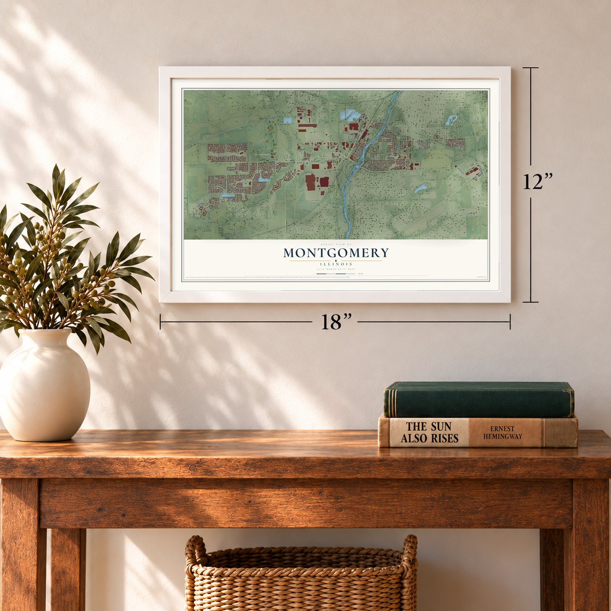
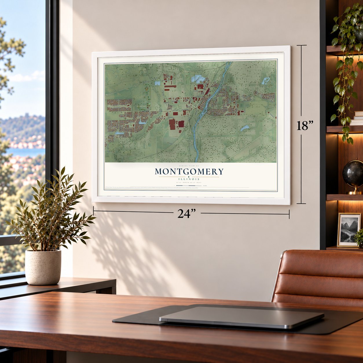
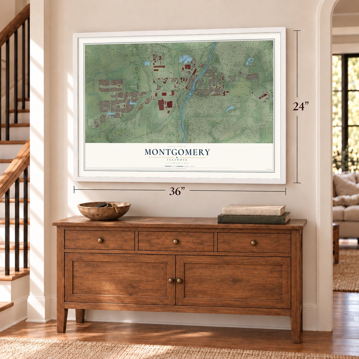
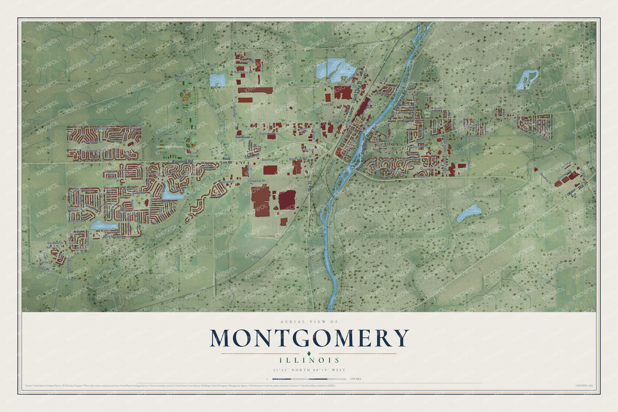
A new map of Montgomery, Illinois, made in 2026 and printed to order on thick archival matte paper.
12" x 18" Archival Matte Print
A Map of Home. A Work of Art.
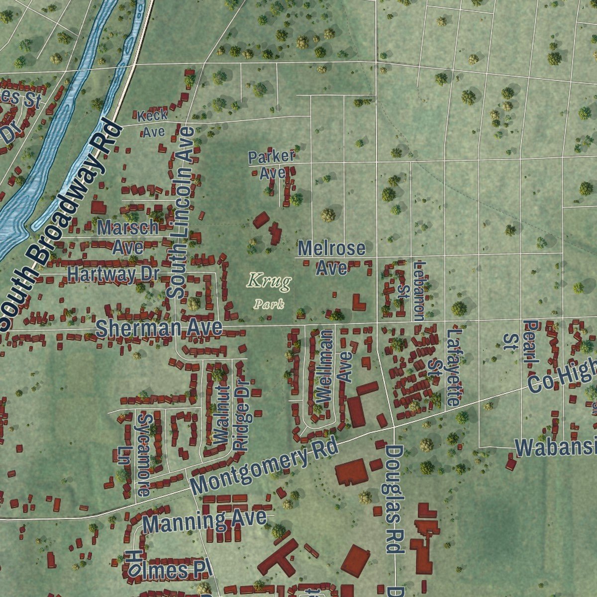
Explore Montgomery, Illinois from a whole new perspective. Created using aerial imagery and detailed geographic data, this map captures Montgomery building by building, with labeled streets, familiar landmarks, and shaded topographical relief that highlights the natural contours of the landscape.
Combining modern data with the timeless character of a vintage atlas, this map is just as interesting up close as it is beautiful on the wall. Whether you grew up in Montgomery, spent memorable years there, or call it home today, this unique map is a great way to celebrate a place that means something to you. Zoom in on the preview to look for your street, and then order a print to put your memories on the wall.
Three ways to hang it
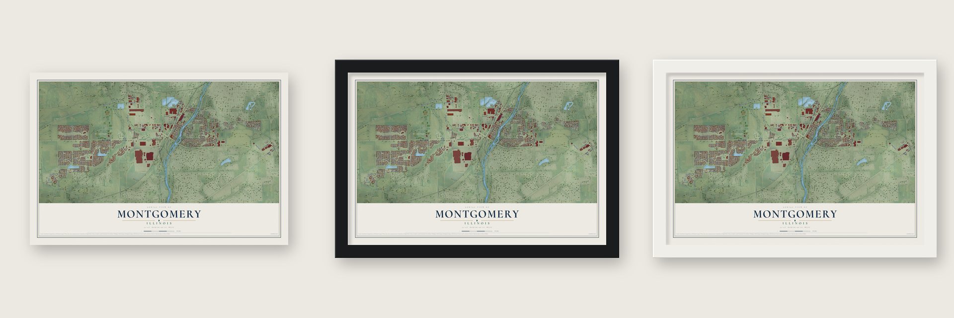
Unframed archival matte, a black wood frame or a white wood frame.
Up close
Geography Worth Displaying
This map was created using accurate cartographic data and authoritative geographic sources, including the U.S. Geological Survey and the Census Bureau. The map brings together terrain, waterways, roads, and building detail. The majority of the streets are labeled, houses are accurately depicted, and the topography is derived from government sources. Combining local data with carefully composed color and shading leads to this beautifully detailed Montgomery artwork for your wall.
Rather than simply showing street outlines, we’ve included as many of the street names as we could reasonably fit on the map while keeping their names legible. Zoom in on the high resolution preview to see exactly what’s on the map. We truly set out to create a statement piece for anyone who loves Montgomery. So whether it’s for you, or a gift for someone you love, we hope this map of Montgomery brings back fond memories.
Read the story behind this map of Montgomery, Illinois from 2026.

About Montgomery, Illinois
Montgomery is a village of 20,262 people on both sides of the Fox River, in Kane and Kendall counties, about 45 miles southwest of Chicago. Jacob Carpenter came from Logan County, Ohio, in November 1832 and was the first European settler in the area. Daniel S. Gray of Montgomery County, New York, came west in the fall of 1835 to visit his brother Nicholas and decided to stay. His family followed, and in the fall of 1836 he built the area's first wooden house, close to the river's west bank.
For several years the settlement was known as Graystown. Gray then talked his neighbors into naming it Montgomery, after the New York county that he and several others had left. He opened a tavern, a store, a warehouse, a foundry and a stone grain mill, and he was planning a factory for stationary engines when he died in October 1855. His heirs kept selling the lots he still owned, and the village was incorporated on February 17, 1858, with his son Ralph Gray as its first village president.
- From 300 to 20,262After it was incorporated, Montgomery stayed at about 300 people for the rest of the 1800s. It grew slowly through most of the twentieth century, and by the 2020 census it had 20,262 residents.
- Factories since 1904Lyon Metal was founded here in 1904 and later took part in the World War II war effort. Western Electric's Montgomery Works on River Street had 1,500 workers making telephone parts in 1962. That plant later became Lucent Technologies and closed in 1995. On the village's southern edge, the Aurora Caterpillar plant has built wheel-loaders since 1959.
- Montgomery Fest in AugustEvery year on the second weekend in August, the village holds Montgomery Fest. It usually has a parade, activities for families and a big fireworks show.
- Miss Chicago and a bowlerCarole Mathews, who was Miss Chicago in 1938, went on to act in The Californians, an NBC western series that ran from 1958 to 1959. The professional ten-pin bowler Sean Rash came here from Colorado and now lives in Montgomery.
Find your street
Names on the Montgomery map
Every name below is printed on this map. Look for your street, your school, the park where you played, or the pond down the road.
Places and landmarks2
- Krug Park
- Stuart Sports Complex
Streets and roads170
- Baseline Road
- Southeast River Road
- South Broadway Road
- Route 34
- South Lake Street
- Route 31
- River Road
- Albright Road
- Briarcliff Road
- Park Drive
- Simon Drive
- County Highway 29
- Orchard Road
- Montgomery Road
- Concord Drive
- Gordon Road
- Aucutt Road
- Simpson Parkway
- Dickson Road
- Jericho Road
- County Highway 24
- Sherman Avenue
- Galena Road
- Ashland Avenue
- Mayfield Drive
- Douglas Avenue
- Douglas Road
- Catepillar Drive
- Lakewood Creek Drive
- Base Line Road
Show all 170 streets
- North River Street
- Prescott Drive
- Knell Road
- Pecos Circle
- Troon Drive
- North Main Street
- Manchester Drive
- Rebecca Circle
- Fairfield Way
- Big Bend Drive
- Caliendo Circle
- Jenna Circle
- Foster Drive
- Adam Avenue
- Shetland Drive
- Odysseus Road
- Goodwin Drive
- Venetian Way
- Heather Lane
- Foxmoor Drive
- South Lincoln Avenue
- Timber Lane Drive
- South River Street
- Fifth Street
- Hartfield Drive
- Park Avenue
- Cornell Avenue
- Whirlaway Lane
- Patterson Road
- Secretariat Lane
- Margaret Drive
- White Rose Drive
- Railroad Street
- Kennedy Drive
- William Drive
- South Railroad Street
- Brian Lane
- Wabansia Avenue
- Rochester Road
- Crown Drive
- Stacy Circle
- Hill Avenue
- Avalon Lane
- Deerpoint Drive
- Red Fox Run
- Millrace Lane
- Manning Avenue
- Ninth
- Patron Lane
- Reading Drive
- Shauna Drive
- Julie Lane
- Riverside Drive
- Amber Drive
- Greenfield Road
- Oakton Road
- Royal Drive
- Claridge Street
- Riley Road
- Ivy Lane
- Holmes Place
- Bohr Avenue
- Carol Place
- North Lake Street
- Ogden Avenue
- Griffin Drive
- Horseman Trail
- Rachell Road
- Thunder Gulch Road
- Riva Ridge Road
- Raymond Drive
- Waverly Way
- Seasons Ridge Boulevard
- Hartway Drive
- Victoria Drive
- Pearl Street
- Winter Hill Circle
- Hamlet Circle
- Deer Run Drive
- Webster Street
- Prairie Crossing Drive
- Kate Drive
- Lakeside Drive
- Faxon Drive
- Galant Fox Circle
- Melrose Avenue
- Oakmont Drive
- Marsch Avenue
- Wellman Avenue
- Walnut Ridge Drive
- Huntington Lane
- Aberdeen Drive
- Countryside Drive
- Second Avenue
- Jacob Lane
- Wick Way
- Geneva Lane
- Stirling Lane
- Sycamore Lane
- Lafayette Street
- Pleasant Place
- Hinckley Street
- James Street
- Crescent Lake Drive
- Garnet Lane
- Sard Avenue
- Juanita Lane
- Light Road
- Bangs Street
- Ness Way
- Gusto Drive
- West Lake Street
- Gaylord Lane
- Amsterdam Circle
- River Bend Road
- Windette Drive
- Mulberry Drive
- Simon Lane
- Ferdinand Lane
- Frances Lane
- Lenox Avenue
- Lebanon Street
- Clay Street
- Chad Lane
- Parker Avenue
- Marbill Farm Road
- Spokane Way
- East Mill Street
- Turnberry Lane
- Talma Street
- White Sands Lane
- Buchanan Lane
- Balmoral Lane
- Scheuring Place
- Keck Avenue
- Iron Leige Lane
- Civic Center Avenue
- Indian Cliffs Lane
- Emma Avenue
- Third Avenue
Names are listed as they appear on the printed map. Zoom into the product photos to find them.
The art of mapping a place
How This Map Was Made
Real places. Remarkable detail. Discover the layers that turn geographic data into a map of home.

The view from above
Aerial imagery reveals the character of the land: woodland, open fields, and the patterns of a place.

The shape of the land
Elevation data brings hills, valleys, and subtle changes in the landscape into view.

The details of home
Roads, waterways, and building footprints come together to make the map feel unmistakably local.

Geography becomes art
Considered color, shading, and typography bring the layers together in a map made for your wall.


Process illustrated with Mendon, Massachusetts. Aerial imagery: USDA NAIP. Terrain: USGS 3D Elevation Program. Map details and finished artwork: KNOWOL.
The Details
About This Print
Choose an archival matte print, or a black or white Ayous wood frame. The archival matte print is unframed.
Select your size and finish above to see the matching product image and price.
Materials & Craftsmanship
A contemporary map with the character of a classic atlas, printed on archival matte paper. Optional frames are made from Ayous wood.
Your printed map does not include the watermark shown in the full-map preview.
Shipping & Delivery
Free shipping within the United States. Every print is made to order in the USA.
Buying a gift? Add a note in your cart and we'll include it. We never put prices in the package.
Prints ship within 2 to 3 business days. Allow 7 to 10 days total from ordering for delivery. Timing may vary during holidays or periods of high order volume.
Read our shipping policy.
Returns and damaged prints
Each print is made to order. Change-of-mind refunds are not available after production.
If your print arrives damaged, misprinted or incorrect, contact support@knowol.com within 30 days of receiving it. Include your order number, photos and a description of the issue.
Read our full refund and replacement policy. For questions about your order, email support@knowol.com.
Find your town
Looking for another city?
Find a map of home in our Illinois collection, or any town in the country.
Nearby
Maps of towns near Montgomery
Know someone from one of these towns? Their map makes a great gift.
 Boulder Hill
, Illinois
From $39.99See the map
 Oswego
, Illinois
From $39.99See the map
 Aurora
, Illinois
From $39.99See the map
More maps nearby: Yorkville, Prestbury, Sugar Grove, North Aurora and Batavia.