
Search for another town





Free U.S. delivery 7 to 10 days after you order
Newark, Delaware Map Art
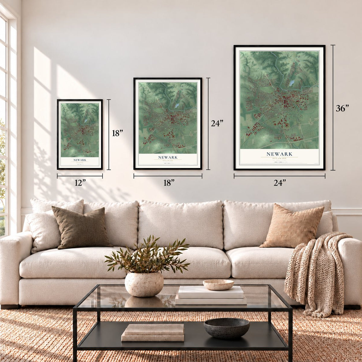
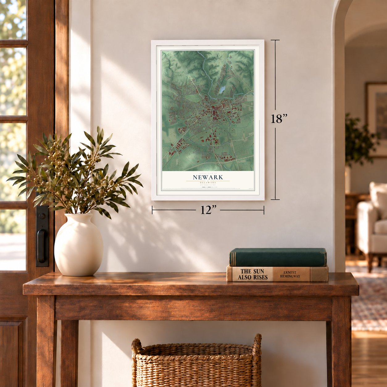
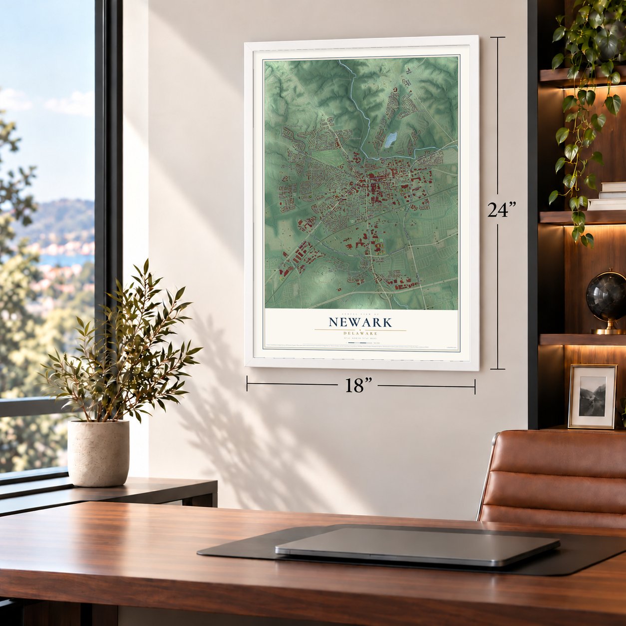
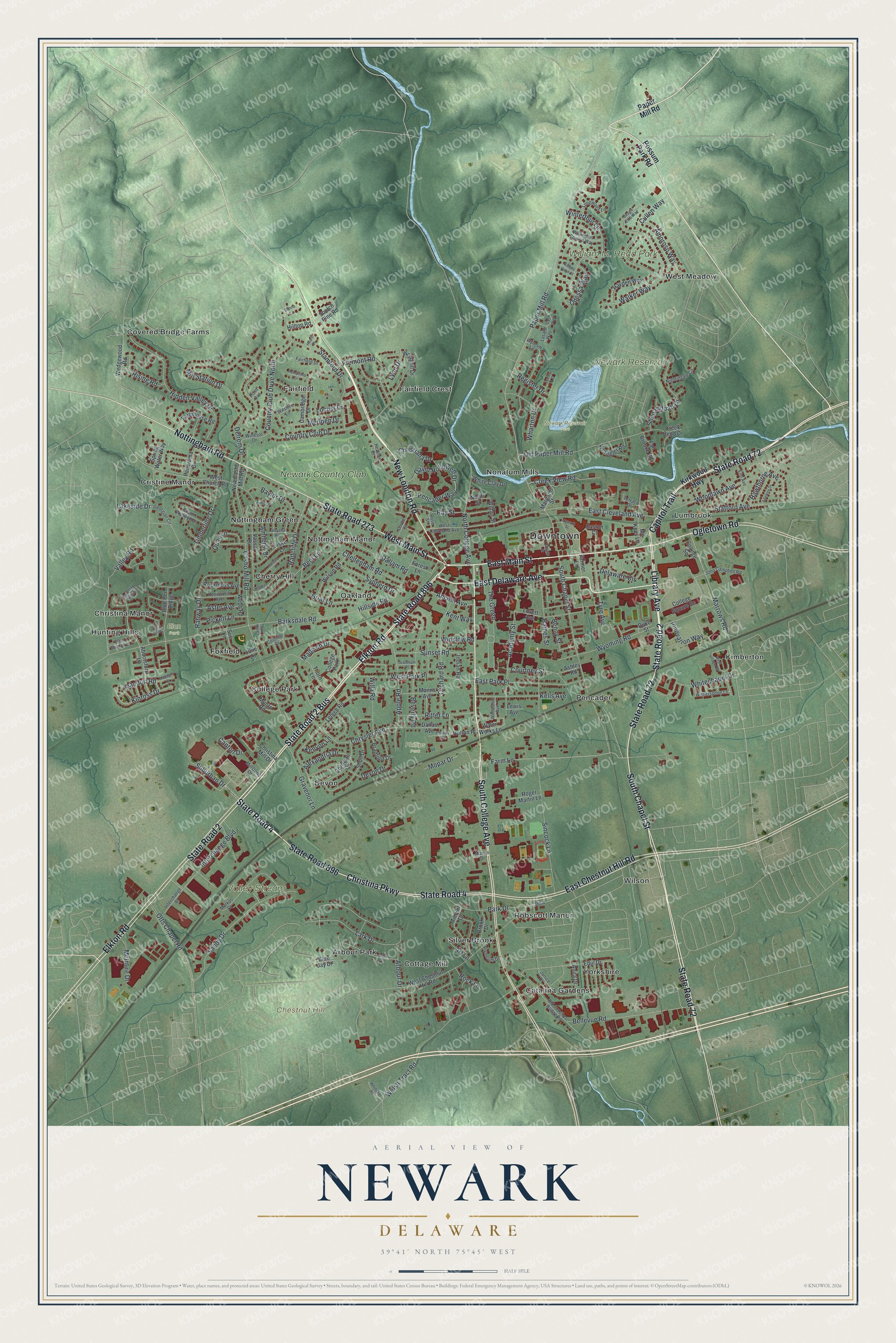
A new map of Newark, Delaware, made in 2026 and printed to order on thick archival matte paper.
12" x 18" Archival Matte Print
A Map of Home. A Work of Art.
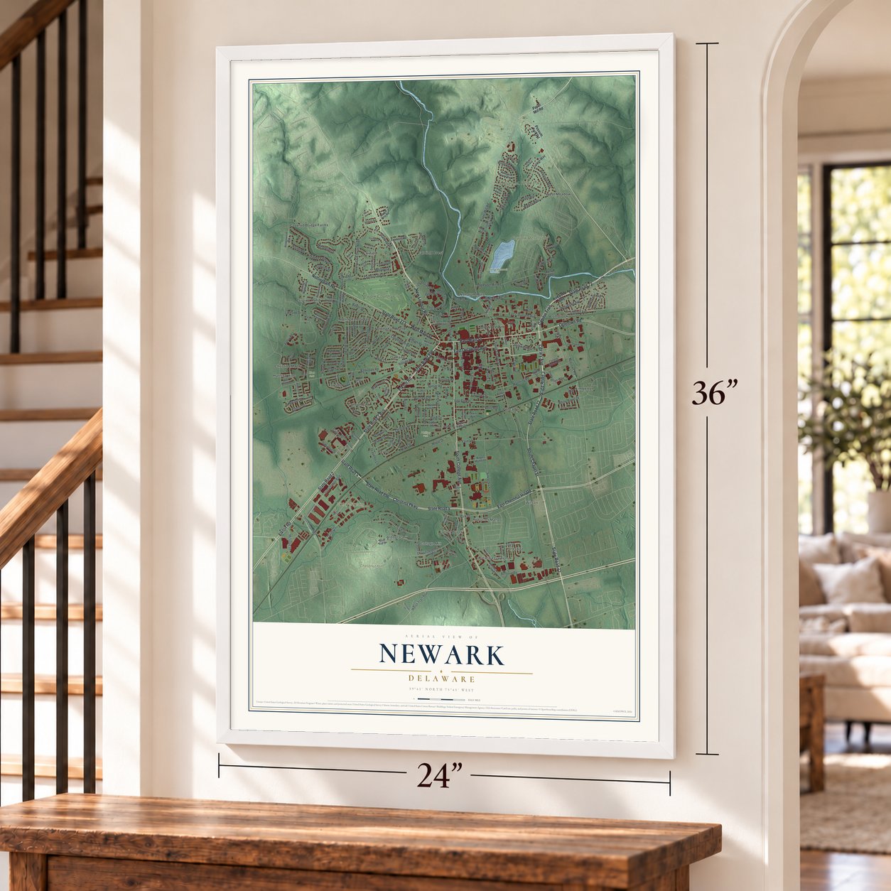
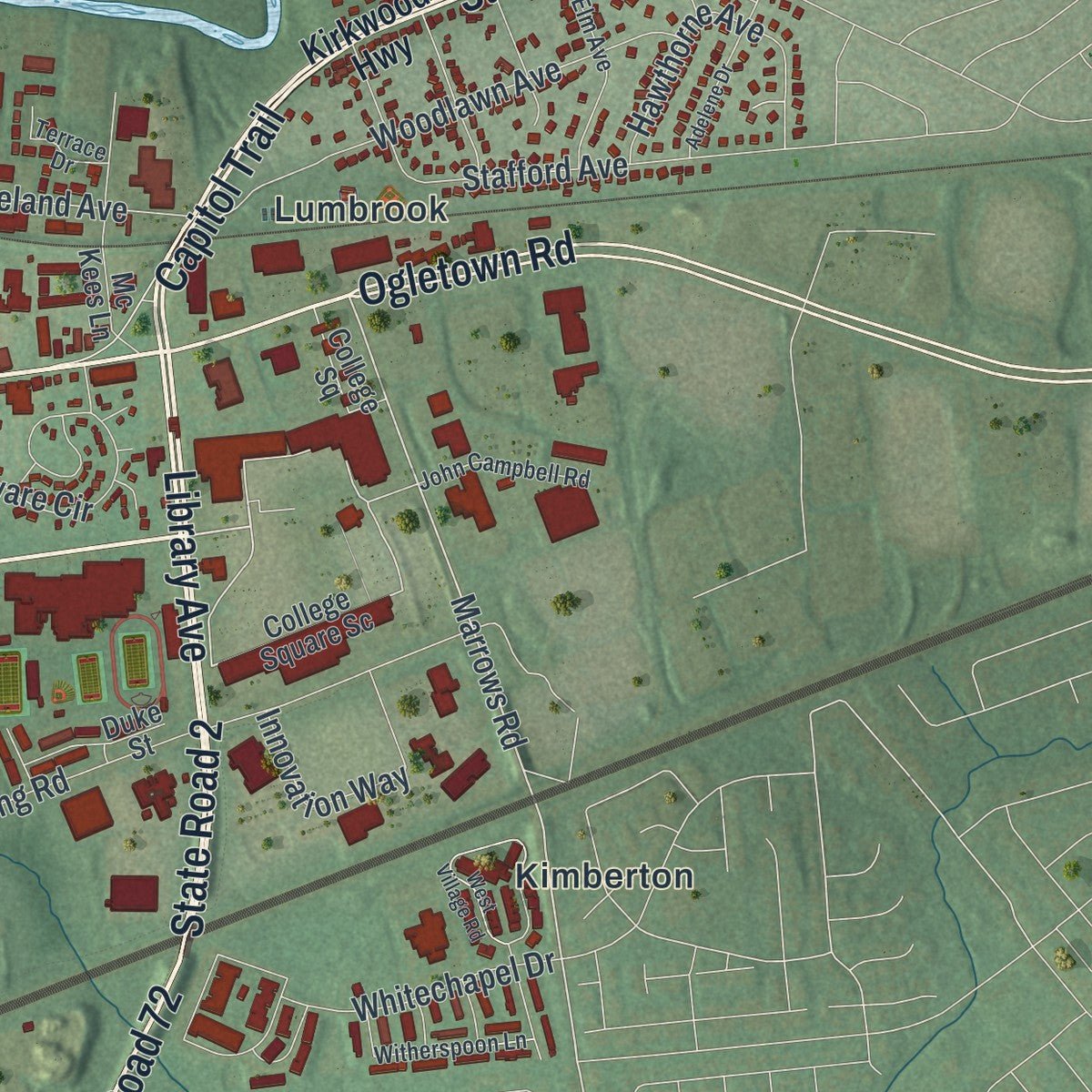
Explore Newark, Delaware from a whole new perspective. Created using aerial imagery and detailed geographic data, this map captures Newark building by building, with labeled streets, familiar landmarks, and shaded topographical relief that highlights the natural contours of the landscape.
Combining modern data with the timeless character of a vintage atlas, this map is just as interesting up close as it is beautiful on the wall. Whether you grew up in Newark, spent memorable years there, or call it home today, this unique map is a great way to celebrate a place that means something to you. Zoom in on the preview to look for your street, and then order a print to put your memories on the wall.
Three ways to hang it
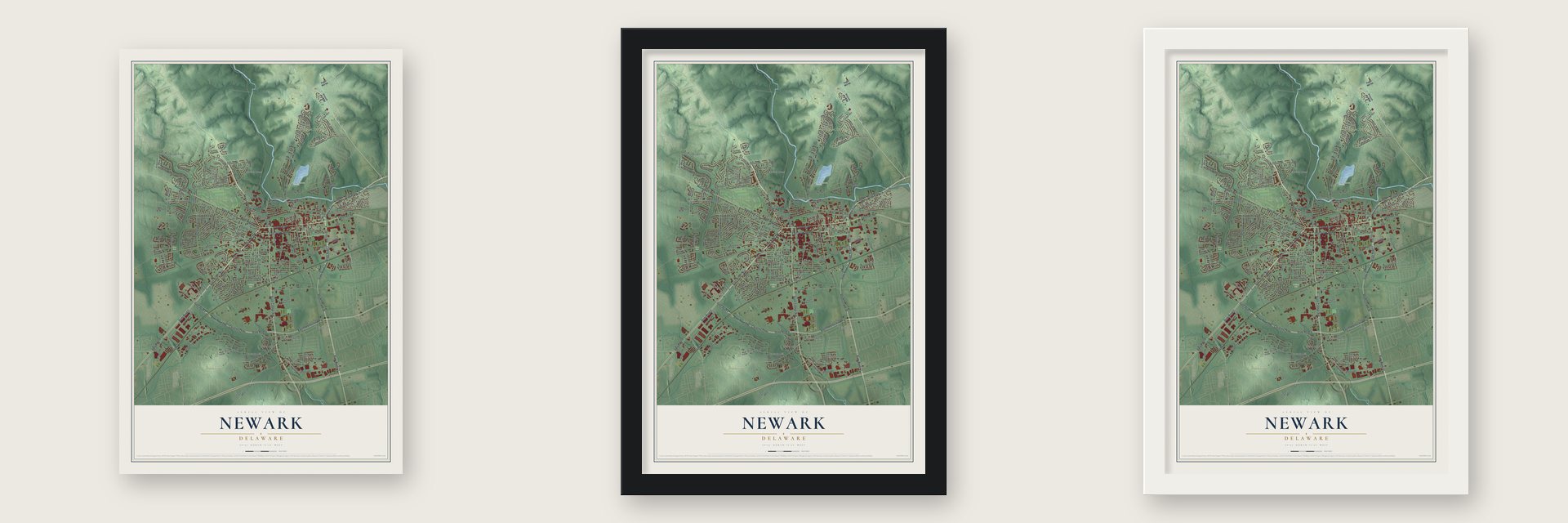
Unframed archival matte, a black wood frame or a white wood frame.
Up close
Geography Worth Displaying
This map was created using accurate cartographic data and authoritative geographic sources, including the U.S. Geological Survey and the Census Bureau. The map brings together terrain, waterways, roads, and building detail. The majority of the streets are labeled, houses are accurately depicted, and the topography is derived from government sources. Combining local data with carefully composed color and shading leads to this beautifully detailed Newark artwork for your wall.
Rather than simply showing street outlines, we’ve included as many of the street names as we could reasonably fit on the map while keeping their names legible. Zoom in on the high resolution preview to see exactly what’s on the map. We truly set out to create a statement piece for anyone who loves Newark. So whether it’s for you, or a gift for someone you love, we hope this map of Newark brings back fond memories.
Read the story behind this map of Newark, Delaware from 2026.
About Newark, Delaware
Newark is a city of 30,601 people in New Castle County, just east of the Maryland line and close to the point where Delaware, Maryland and Pennsylvania meet. Scots-Irish and Welsh settlers founded it in 1694. Before the Revolution, John Aiken kept a tavern and storehouse where two of the main roads of the Delmarva Peninsula crossed. In 1758 King George II gave the town its charter, along with a license to hold a market each week and a fair twice a year for trading farm goods.
During the Revolutionary War, British and American troops fought just outside town at the Battle of Cooch's Bridge. By tradition, it was the first battle where the Stars and Stripes flew. Methodists built Newark's first church in 1812, and the railroad reached the town in 1837.
- From academy to universityFrancis Alison started a grammar school in New London, Pennsylvania, in 1743, and in 1765 it moved to Newark as the Newark Academy. Three of its first graduates, George Read, Thomas McKean and James Smith, signed the Declaration of Independence. The state chartered Newark College in 1833, and a year later the two schools joined as Delaware College. It closed in 1859, reopened eleven years later under the Morrill Act, and was renamed the University of Delaware in 1921.
- America's oldest paper millAround 1798 a paper mill became Newark's first large industry. Later called the Curtis Paper Mill, it ran longer than any other paper mill in the United States, until it shut down in 1997.
- Bob Marley at ChryslerChrysler's Newark Assembly plant opened in 1951. It was first built to make tanks for the U.S. Army and covered 3.4 million square feet. Reggae star Bob Marley worked on its assembly line during a short stay in Delaware in the 1960s. Slow sales of the Durango and Aspen cut its workforce from 2,115 in 2005 to 1,100 in 2008, and the recession closed the plant late that year.
- A home for figure skatersNational, world and Olympic champions from many countries have trained in Newark, at the University of Delaware Figure Skating Club and at The Pond Ice Rink. Johnny Weir, a U.S. figure skating champion, is among the people from Newark.
Find your street
Names on the Newark map
Every name below is printed on this map. Look for your street, your school, the park where you played, or the pond down the road.
Places and landmarks34
- Downtown
- Newark Reservoir
- Valley Stream
- Chestnut Hill
- William M. Redd Park
- Newark Resevoir Park
- Phillips Park
- Elan Park
- Arbour Park
- Catalina Gardens
- Cherry Hill
- Christina Manor
Show all 34 places
- College Park
- Cottage Mill
- Covered Bridge Farms
- Cristine Manor
- Devon
- Fairfield
- Fairfield Crest
- Foxfield
- Hunting Hills
- Kimberton
- Lumbrook
- Nonatum Mills
- Nottingham Green
- Nottingham Manor
- Oakland
- Pencader
- Robscott Manor
- Silver Brook
- West Meadow
- Wilson
- Yorkshire
- Newark Country Club
Streets and roads226
- State Road 896
- State Road 2 Bus
- State Road 273
- State Road 72
- New London Road
- Library Avenue
- East Delaware Avenue
- South College Avenue
- East Main Street
- State Road 2
- South Chapel Street
- Christina Parkway
- State Road 4
- Ogletown Road
- West Main Street
- Capitol Trail
- Elkton Road
- Nottingham Road
- East Chestnut Hill Road
- Suburban Drive
- Paper Mill Road
- Marrows Road
- Fremont Road
- Country Club Drive
- Farm Lane
- Wharton Drive
- Barksdale Road
- Kinross Drive
- East Cleveland Avenue
- Bellevue Road
Show all 226 streets
- Valley Road
- Casho Mill Road
- Mill Station Drive
- The Green
- Otts Chapel Road
- North College Avenue
- Dallam Road
- Arbour Drive
- Wyoming Road
- Academy Street
- Hidden Valley Drive
- Briar Lane
- Sandy Drive
- West Park Place
- Sincock Lane
- Bent Lane
- Orchard Road
- Beverly Road
- David Hollowell Drive
- Pencader Way
- Devon Drive
- Stamford Drive
- Timberline Drive
- Walker Way
- Cheltenham Road
- Cullen Way
- Old Paper Mill Road
- Apple Road
- Winterthur Lane
- Woodlawn Avenue
- East Park Place
- Haines Street
- Welsh Tract Road
- Country Club Drive North
- Rahway Drive
- Lark Drive
- Chrysler Avenue
- Shenandoah Drive
- Hillside Road
- Radcliffe Drive
- Kells Avenue
- Winslow Road
- Stafford Avenue
- Amoroso Way
- Mopar Drive
- Sunset Road
- Park Drive
- Lynn Drive
- Ritter Lane
- Baylor Drive
- Odessa Way
- Hawthorne Avenue
- Creek View Road
- Tyre Avenue
- Meriden Drive
- Alexandria Drive
- Madison Drive
- Gravenor Lane
- Innovation Way
- Sypherd Drive
- Whitechapel Drive
- Interchange Boulevard
- Delaware Circle
- Willa Road
- Christiana Drive
- Amherst Drive
- Delrem Drive
- Macduff Road
- McIntire Drive
- Amstel Avenue
- Ray Street
- Pickett Lane
- Courtney Street
- Rising Road
- Register Drive
- Canton Drive
- Quail Lane
- Aster Avenue
- Locust Drive
- Rock Lane
- Lakeside Drive
- Benny Street
- Kenyon Lane
- Art Lane
- Kent Way
- Possum Park Road
- Kirkwood Highway
- College Square Sc
- Margaret Street
- Lehigh Road
- Christina Mill Drive
- West Chestnut Hill Road
- Vassar Drive
- West Church Road
- Shull Drive
- Cambridge Drive
- Panorama Drive
- Cornwall Drive
- Munro Road
- Scotch Pine Road
- Thorn Lane
- Hayden Way
- Julie Lane
- Dallas Avenue
- Wedgewood Road
- Blue Jay Drive
- Lovett Avenue
- Minquil Drive
- Blue Hen Ridge
- Wilson Road
- Mc Kees Lane
- Water Works Lane
- Farmhouse Road
- Abbotsford Lane
- Brook Drive
- Fiske Lane
- Manns Avenue
- Edjil Drive
- Webb Road
- Bradford Drive
- Rockmoss Avenue
- White Clay Drive
- Duke Street
- Easton Court
- Anita Drive
- Roger Martin Lane
- Wrangler Road
- Sue Lane
- College Square
- New Casho Mill Road
- Creek Bend Drive
- Woodhill Drive
- Fall Brooke Road
- Spring Water Way
- Hilltop Road
- Indian Road
- Holton Place
- Wilbur Street
- Ashley Road
- Forest Lane
- North Street
- Farmer Lane
- Lewis Avenue
- West Cleveland Avenue
- Interchange Bl
- Old Cooches Bridge Road
- Country Hills Drive
- Markus Court
- Georgian Circle
- Willington Square Way
- Janice Drive
- Elm Avenue
- Kenilworth Avenue
- Wilshire Lane
- John Campbell Road
- South Wynwyd Drive
- Corbit Street
- Longwood Lane
- Nightingale Circle
- Fairfield Drive
- Witherspoon Lane
- Colonial Court
- Windsor Drive
- Wyncliff Lane
- Plymouth Drive
- Terrace Drive
- Wollaston Avenue
- Heather Court
- Millstone Drive
- Rose Street
- Lasalle Way
- Marvin Drive
- Point Avenue
- Newark Sc
- Dove Drive
- Beagle Club Way
- Lafayette Road
- Harvard Lane
- West Village Road
- Chickory Way
- Colgate Lane
- Phillips Avenue
- Adelene Drive
- Cook Way
- Choate Street
- Green Meadow Court
- Tufts Lane
- Whittaker Road
- Lynley Lane
- Hempsted Drive
- Grantham Place
- Macduff Court
- Killens Pond Court
- Danna Lane
- Saw Mill Court
- Hearn Place
Names are listed as they appear on the printed map. Zoom into the product photos to find them.
The art of mapping a place
How This Map Was Made
Real places. Remarkable detail. Discover the layers that turn geographic data into a map of home.

The view from above
Aerial imagery reveals the character of the land: woodland, open fields, and the patterns of a place.

The shape of the land
Elevation data brings hills, valleys, and subtle changes in the landscape into view.

The details of home
Roads, waterways, and building footprints come together to make the map feel unmistakably local.

Geography becomes art
Considered color, shading, and typography bring the layers together in a map made for your wall.


Process illustrated with Mendon, Massachusetts. Aerial imagery: USDA NAIP. Terrain: USGS 3D Elevation Program. Map details and finished artwork: KNOWOL.
The Details
About This Print
Choose an archival matte print, or a black or white Ayous wood frame. The archival matte print is unframed.
Select your size and finish above to see the matching product image and price.
Materials & Craftsmanship
A contemporary map with the character of a classic atlas, printed on archival matte paper. Optional frames are made from Ayous wood.
Your printed map does not include the watermark shown in the full-map preview.
Shipping & Delivery
Free shipping within the United States. Every print is made to order in the USA.
Buying a gift? Add a note in your cart and we'll include it. We never put prices in the package.
Prints ship within 2 to 3 business days. Allow 7 to 10 days total from ordering for delivery. Timing may vary during holidays or periods of high order volume.
Read our shipping policy.
Returns and damaged prints
Each print is made to order. Change-of-mind refunds are not available after production.
If your print arrives damaged, misprinted or incorrect, contact support@knowol.com within 30 days of receiving it. Include your order number, photos and a description of the issue.
Read our full refund and replacement policy. For questions about your order, email support@knowol.com.
Find your town
Looking for another city?
Find a map of home in our Delaware collection, or any town in the country.
Nearby
Maps of towns near Newark
Know someone from one of these towns? Their map makes a great gift.
 Brookside
, Delaware
From $39.99See the map
 Pike Creek Valley
, Delaware
From $39.99See the map
 Glasgow
, Delaware
From $39.99See the map
More maps nearby: North Star, Bear, Pike Creek, Hockessin and Newport.