
Search for another town





Free U.S. delivery 7 to 10 days after you order
Wilson, Delaware Map Art
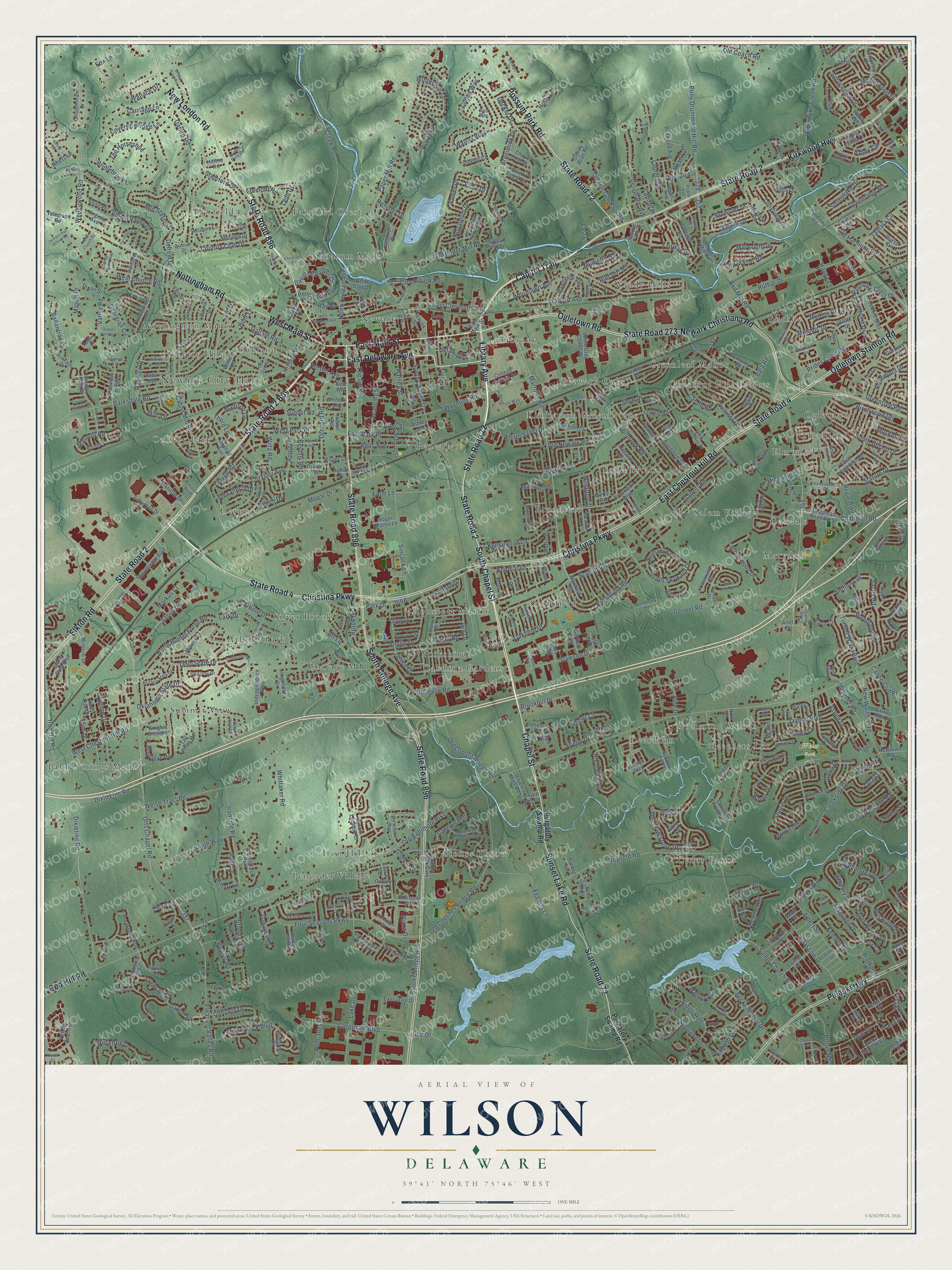
A new map of Wilson, Delaware, made in 2026 and printed to order on thick archival matte paper.
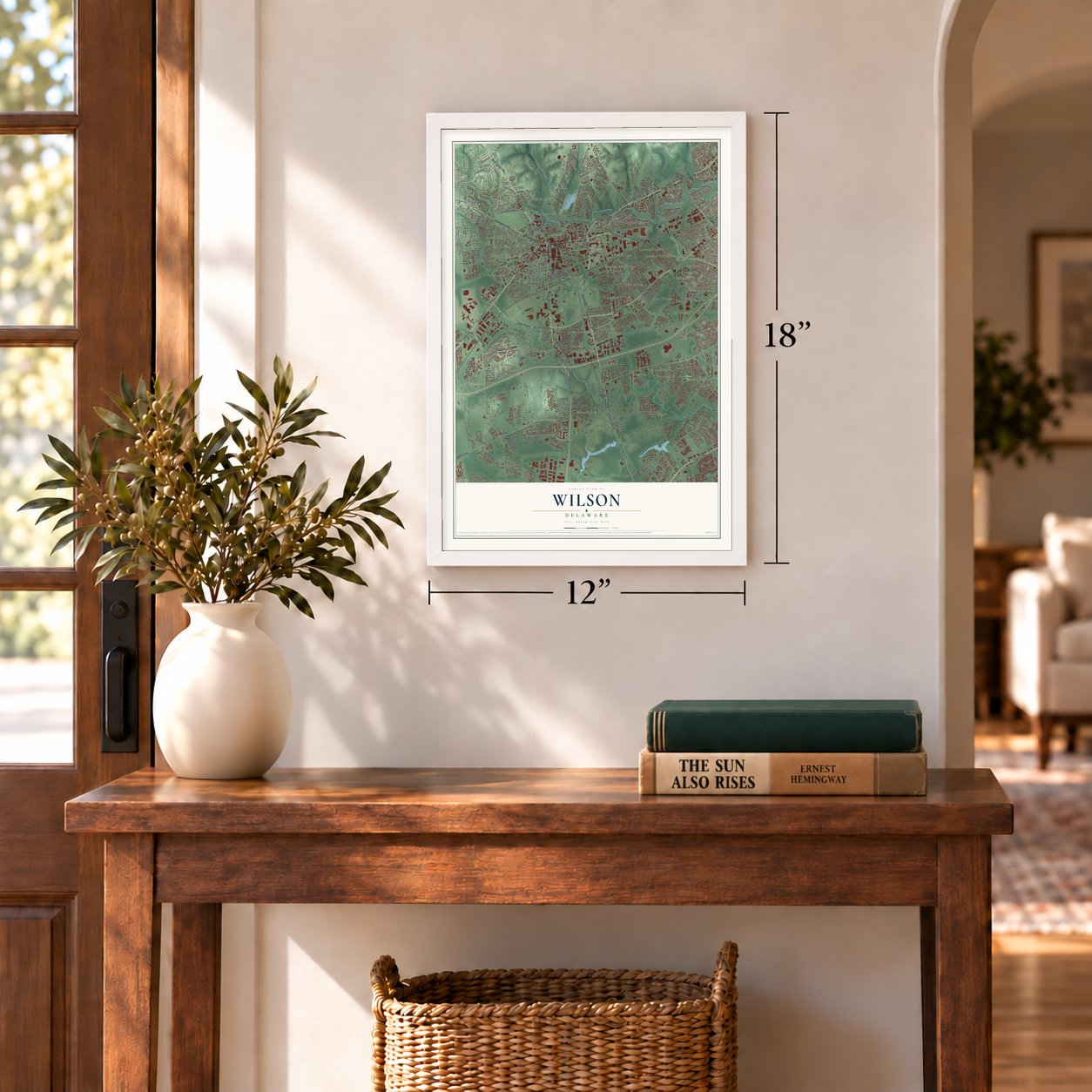
12" x 18" Archival Matte Print
A Map of Home. A Work of Art.
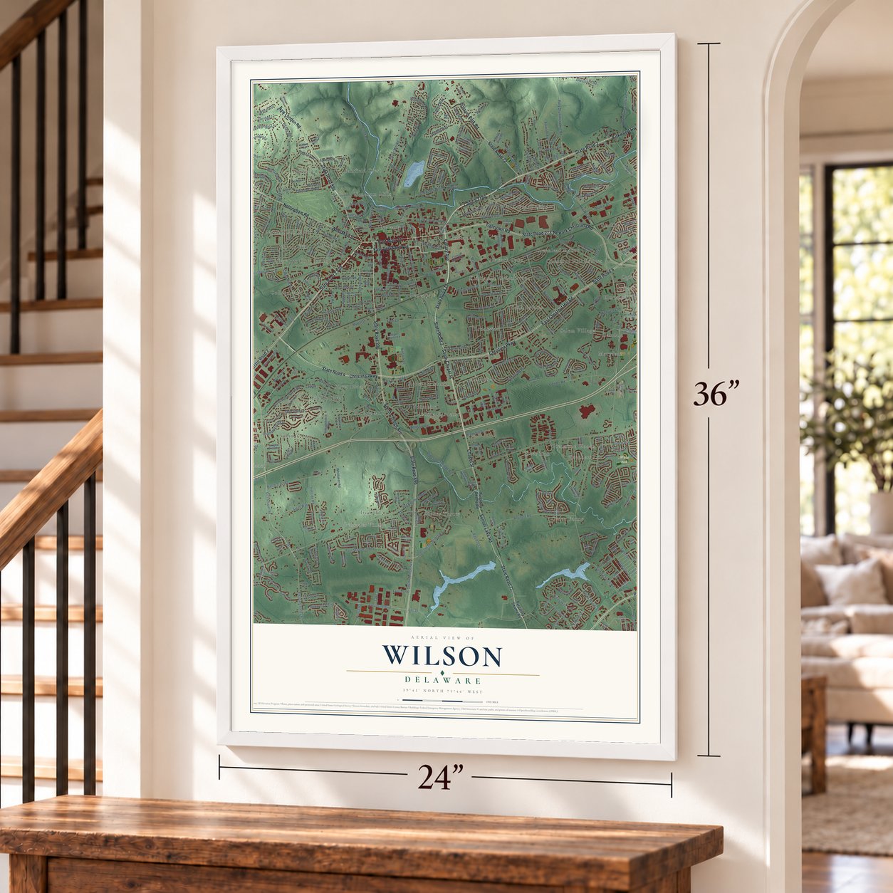
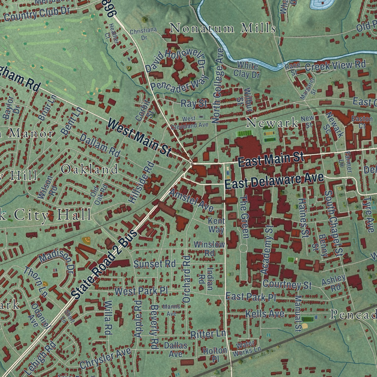
Explore Wilson, Delaware from a whole new perspective. Created using aerial imagery and detailed geographic data, this map captures Wilson building by building, with labeled streets, familiar landmarks, and shaded topographical relief that highlights the natural contours of the landscape.
Combining modern data with the timeless character of a vintage atlas, this map is just as interesting up close as it is beautiful on the wall. Whether you grew up in Wilson, spent memorable years there, or call it home today, this unique map is a great way to celebrate a place that means something to you. Zoom in on the preview to look for your street, and then order a print to put your memories on the wall.
Three ways to hang it
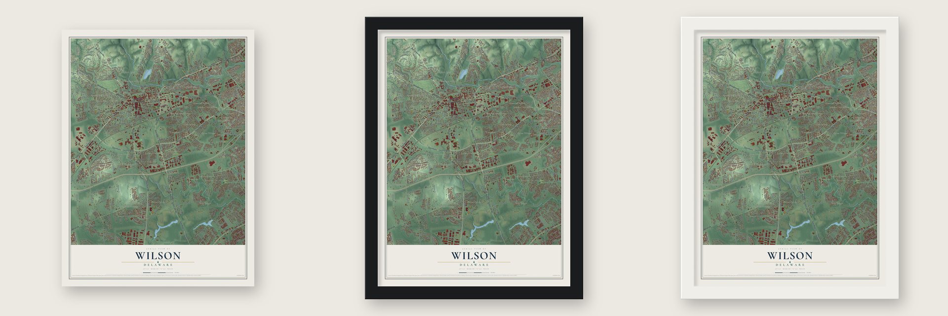
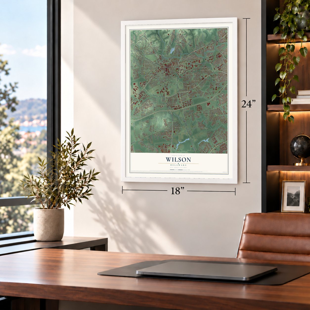
Unframed archival matte, a black wood frame or a white wood frame.
Up close
Geography Worth Displaying
This map was created using accurate cartographic data and authoritative geographic sources, including the U.S. Geological Survey and the Census Bureau. The map brings together terrain, waterways, roads, and building detail. The majority of the streets are labeled, houses are accurately depicted, and the topography is derived from government sources. Combining local data with carefully composed color and shading leads to this beautifully detailed Wilson artwork for your wall.
Rather than simply showing street outlines, we’ve included as many of the street names as we could reasonably fit on the map while keeping their names legible. Zoom in on the high resolution preview to see exactly what’s on the map. We truly set out to create a statement piece for anyone who loves Wilson. So whether it’s for you, or a gift for someone you love, we hope this map of Wilson brings back fond memories.
Read the story behind this map: Detailed Map of Wilson, Delaware.

Find your street
Names on the Wilson map
Every name below is printed on this map. Look for your street, your school, the park where you played, or the pond down the road.
Places and landmarks44
- Newark City Hall
- Weiss Park
- Summit View
- Chestnut Hill Estates
- Fairfield Crest
- Cedar Farms
- Silver Brook
- Stones Throw
- Kimberton
- Marydale
- Palm Springs Manor
- Pencader
Show all 44 places
- Iron Hill
- Deer Run
- Newark
- Ruthby
- Arbour Park
- Devon
- Lumbrook
- Todd Estates
- Brookside
- Windy Hills
- College Park
- Nottingham Manor
- Newark Oaks
- The Elms
- Yorkshire
- Piermont Woods
- Fairfield
- Nonatum Mills
- Cherry Hill
- Greenbridge
- Oakdale
- Catalina Gardens
- Cottage Mill
- Greenleaf Manor
- Robscott Manor
- Ogletown
- Oakland
- Pencader Village
- Elmwood
- Beechers Lot
- Salem Village
- Scottfield
Streets and roads561
- State Road 896
- State Road 72
- State Road 2
- State Road 4
- State Road 273
- Christina Parkway
- State Road 2 Bus
- New London Road
- South Chapel Street
- Ogletown Road
- Library Avenue
- Newark Christiana Road
- East Delaware Avenue
- Capitol Trail
- East Main Street
- West Main Street
- Possum Park Road
- South College Avenue
- East Chestnut Hill Road
- Kirkwood Highway
- Elkton Road
- Sunset Lake Road
- Nottingham Road
- Pulaski Highway
- Ogletown Stanton Road
- Chapel Street
- Red Hill Road
- Marrows Road
- Fremont Road
- Country Club Drive
Show all 561 streets
- Old Harmony Road
- Salem Church Road
- Farm Lane
- Thorn Lane
- Romney Boulevard
- Delaware Circle
- Bartley Road
- Albe Drive
- Fox Lane
- Fantasia Drive
- Old Baltimore Pike
- Otts Chapel Road
- West Chestnut Hill Road
- Welsh Tract Road
- Dixie Line Road
- Paper Mill Road
- Old Cooches Bridge Road
- Wedgewood Road
- Gender Road
- Red Mill Road
- Barksdale Road
- Four Seasons Parkway
- Casho Mill Road
- Wellington Drive
- Creek Road
- Ruthar Drive
- Mill Station Drive
- Old Newark Road
- Jaymar Boulevard
- Reybold Road
- The Green
- Iron Hill Road
- Valley Road
- Scottfield Drive
- Whittaker Road
- Creekside Drive
- Wyoming Road
- Polly Drummond Hill Road
- Pleasant Valley Road
- East Cleveland Avenue
- Aronimink Drive
- North College Avenue
- Dallam Road
- Becks Woods Drive
- Bridlebrook Lane
- Walther Road
- Melodic Drive
- Arbour Drive
- Ironside Road
- Bellevue Road
- Glasgow Drive
- Covered Bridge Lane
- Corporate Boulevard
- Kenmar Drive
- Academy Street
- Darwin Drive
- Lehigh Road
- Hidden Valley Drive
- Brennen Drive
- McCormick Boulevard
- Sandy Drive
- Laurel Avenue
- Upper Pike Creek Road
- Broadfield Road
- Old Coach Road
- South Gerald Drive
- Rosetree Lane
- Aspen Drive
- West Church Road
- West Park Place
- Sincock Lane
- Tamara Circle
- Chaucer Drive
- Bent Lane
- Old Paper Mill Road
- Coopers Drive
- Orchard Road
- North Hunter Forge Road
- Chapman Road
- Dawson Drive
- Augusta Drive
- Old Possum Park Road
- Albert Street
- Beverly Road
- David Hollowell Drive
- Pencader Way
- Devon Drive
- Nonantum Drive
- Stamford Drive
- The Horseshoe
- Walker Way
- Delaplane Avenue
- Oklahoma State Drive
- Cullen Way
- Apple Road
- Eggarts Lane
- Warren Drive
- Ballantrae Drive
- Georgian Circle
- Winterthur Lane
- Stafford Avenue
- Smith Way
- Quail Lane
- Carriage Lane
- Flamingo Drive
- Timber Wood Boulevard
- Kemper Drive
- Brewster Drive
- Woodlawn Avenue
- East Park Place
- Woodland Road
- Kensington Lane
- Decker Drive
- Anglin Drive
- Old Coochs Bridge Road
- Auckland Drive
- Greenridge Road
- Savoy Road
- Haines Street
- Fairway Road
- Rahway Drive
- Three Rivers Drive
- Springlake Drive
- Spruceglen Drive
- Darien Road
- Kildoon Drive
- Garrett Road
- Lark Drive
- Meadowood Drive
- Chrysler Avenue
- Sanford Drive
- Janice Drive
- Shue Drive
- Glencoe Drive
- Hillside Road
- Kells Avenue
- Harmony Crest Drive
- Lake Drive
- Oakfield Drive
- Valley Circle
- Scotland Drive
- Montrose Drive
- Phyllis Drive
- Birchwood Drive
- Stature Drive
- Dixieline Road
- Ohio State Drive
- Millwright Drive
- Porter Road
- Arrowwood Drive
- Mopar Drive
- Rose Circle
- West Flagstone Drive
- Sunset Road
- Heather Road
- Old Manor Road
- Park Drive
- Boyer Drive
- New Walther Road
- Sherin Drive
- South Skyward Drive
- Pencader Drive
- Lynn Drive
- Ritter Lane
- Gypsum Drive
- Gill Drive
- Vanier Drive
- Creek View Road
- Bala Road
- Joan Drive
- Longview Drive
- Tyre Avenue
- Alexandria Drive
- Madison Drive
- Gbc Drive
- Prides Crossing
- Carole Road
- Brookhill Drive
- Rosewood Drive
- Millbrook Road
- Ridge Way
- Greentree Road
- Pollari Circle
- Markus Court
- Cannon Run
- Glyn Drive
- Canoe Club Road
- Stoddard Drive
- Anthony Drive
- Arielle Drive
- Oakview Drive
- Mallboro Drive
- Dalton Drive
- Whitechapel Drive
- Palo Lane
- Julie Lane
- Mason Drive
- Mulberry Road
- Mahopac Drive
- Birchgrove Road
- Plaza Drive
- Willa Road
- Shisler Court
- Danbury Drive
- Delrem Drive
- Macduff Road
- Deasy Drive
- Michaels Lane
- Tinsley Court
- Wallace Drive
- Rhett Lane
- Amstel Avenue
- Ray Street
- Musket Road
- Courtney Street
- Holly Lane
- Brook Drive
- Hillcroft Road
- Godwin Drive
- Regal Boulevard
- Happy Lane
- Barley Drive
- Davis Drive
- Myers Road
- Register Drive
- Canton Drive
- Medley Drive
- Pine Drive
- Elma Drive
- Capitol Place
- Slate Drive
- Entre Lane
- Tami Drive
- Art Lane
- Last Lane
- Purgatory Swamp Road
- Suburban Drive
- College Square Sc
- Durham Court
- Hobart Drive
- Wharton Drive
- Harmony Road
- Cobble Creek Curv
- Brookside Boulevard
- Lynam Lookout Drive
- Briar Lane
- Pebble Beach Drive
- Rockrose Drive
- Saint Regis Drive
- Cheswold Boulevard
- Mercer Drive
- Executive Drive
- Montague Road
- Winsome Way
- Timberline Drive
- Preakness Run
- Vassar Drive
- South Brownleaf Road
- Kenmark Road
- Leader Drive
- Stone Gate Boulevard
- Newark Sc
- Winslow Road
- Vinings Way
- Village Circle
- White Clay Center Drive
- Whitson Drive
- Flint Hill Drive
- Baylor Drive
- Odessa Way
- Lisbeth Road
- Hawthorne Avenue
- Evergreen Drive
- Deerborne Trail
- Independence Way
- Chapel Hill Drive
- Upland Court
- Meriden Drive
- Cordele Road
- Garvey Lane
- Newtown Road
- Tall Pines Road
- Kullen Drive
- Donna Marie Way
- Ilse Drive
- Boxwood Avenue
- Odaniel Avenue
- North Skyward Drive
- Country Hills Drive
- Sweetgrass Run
- Currant Drive
- Darling Street
- Blue Hen Drive
- Manfield Road
- Dallas Avenue
- Miners Lane
- Merry Road
- Alexis Drive
- Interchange Boulevard
- Sentry Lane
- Blue Hen Ridge
- Barrett Run Drive
- Abbey Road
- McCord Drive
- Chestnut Avenue
- Wilson Road
- McIntire Drive
- Marlin Drive
- Mary Court
- McCann Road
- Virginia Avenue
- Norman Drive
- Cornell Drive
- Chippenham Drive
- Kane Drive
- Durso Drive
- Christina Woods Court
- Caynor Court
- Dempsey Drive
- Forsythia Drive
- Chapman Road West
- Watkins Way
- Upper Valley Lane
- White Drive
- Merion Road
- Yew Road
- Aster Avenue
- Manual Street
- Holly Oak Drive
- Gurnsey Drive
- Berry Drive
- Todd Lane
- Wilshire Lane
- Benjamin Drive
- Charles Pointe
- Dayett Mills Road
- Highfield Drive
- Brookmont Drive
- Garfield Way
- Corbit Street
- Dixon Drive
- Marie Court
- White Clay Drive
- Eastwind Court
- Roger Martin Lane
- Benny Street
- Old Red Mill Road
- Sue Lane
- Perth Street
- Creek Bend Drive
- Estes Court
- Knights Crossing
- Peoples Drive
- Gray Boulevard
- Kent Way
- Stoney Brae Road
- Anita Court
- Shea Way
- Timber Drive
- Megan Court
- Hilltop Road
- Indian Road
- Penny Lane
- Garden Lane
- Holton Place
- Alan Drive
- Tyler Way
- Wilbur Street
- Peel Lane
- Hawk Drive
- Ferris Court
- Ashley Road
- Ivory Lane
- Aleph Drive
- Dayett Mill Road
- Pike Place
- Dan Street
- Moir Street
- Pekin Avenue
- Flute Drive
- Sarah Court
- Curry Lane
- Kress Drive
- Adel Drive
- Meredith Way
- Chatham Lane
- South Belttown Drive
- Race Street
- Sandalwood Drive
- Lynch Farm Drive
- McFarland Drive
- Stanley Plaza Boulevard
- Shull Drive
- Diminish Drive
- Colorado Drive
- Summer Park Crescent
- Arizona State Drive
- Panorama Drive
- Old Oak Road
- Meadow Lane
- West Cherokee Drive
- Innovation Way
- Scotch Pine Road
- Kirkcaldy Drive
- Bobby Drive
- Richards Lane
- Thistleberry Drive
- Melrose Place Drive
- Thornhollow Road
- Maple Avenue
- Poplar Avenue
- Water Works Lane
- General Maxwell Court
- Curlew Drive
- Rising Road
- Fiske Lane
- Kinross Drive
- Wilkerdean Drive East
- Meridian Bl
- Ranee Loop
- Post Oak Lane
- West Kyla Marie Drive
- Woodland Run Drive
- Sonant Drive
- Dufferin Drive
- Winterview Way
- Stirling Drive
- Thornhill Drive
- Astro Sc
- Abbey Lane
- Glennwood Drive
- Berwyck Court
- Locust Drive
- Richfield Road
- Persimmon Tree Drive
- Stafford Way
- Keller Road
- Lenape Lane
- Craig David Drive
- Easton Court
- Rock Lane
- Aldershot Drive
- Split Rail Lane
- Syracuse Drive
- Northmark Road
- Glencoe Court
- Lower Valley Lane
- Creekside Court
- Bass Court
- Windsor Drive
- Squirrel Lane
- New Street
- Ingleside Road
- Teal Circle
- Festival Court
- Tulip Tree Lane
- Verdant Circle
- Farmer Lane
- Fox Drive
- Nathan Court
- Kayser Court
- Locke Court
- Mark Court
- Fifth Street
- Bird Way
- Telegraph Road
- Kimberton Drive
- Winterhaven Drive
- Piano Drive
- Interchange Bl
- Shenandoah Drive
- Christina Mill Drive
- Yosemite Drive
- Autumn Horseshoe
- Grand Teton Drive
- Robert Oakes Drive
- Munro Road
- Willow Tree Lane
- Hazlewood Drive
- Shady Drive West
- Christiana Drive
- Amherst Drive
- Banyan Road
- Gumspring Road
- Farmhouse Road
- Abbotsford Lane
- Concord Drive
- Hedgewick Drive
- Ward Lane
- Malvern Avenue
- Manns Avenue
- Commerce Drive
- Bristol Knoll Road
- Webb Road
- West Cleveland Avenue
- Jackson Hall School Road
- Rockmoss Avenue
- Ashley Drive
- Cunane Circle
- Margaret Street
- Pinefield Road
- Bisbee Road
- Queen Anne Drive
- Rustic Drive
- Sundew Road
- Alanrose Court
- Flinthill Drive
- Thatch Court
- Oriole Drive
- Sir Barton Court
- Spring Water Way
- Kitty Lane
- Green Meadow Court
- Kings Bridge Court
- North Church Road
- Mc Millan Way
- Cardiff Close
- Magil Court
- Willow Place
- Heather Court
- Greer Drive
- Cardiff Way
- Tolliver Court
- Giles Court
- Marcus Court
- Sheryl Drive
- Adrian Court
- Eighth Street
- Gull Turn
- Birch Street
- Short Lane
Names are listed as they appear on the printed map. Zoom into the product photos to find them.
The art of mapping a place
How This Map Was Made
Real places. Remarkable detail. Discover the layers that turn geographic data into a map of home.

The view from above
Aerial imagery reveals the character of the land: woodland, open fields, and the patterns of a place.

The shape of the land
Elevation data brings hills, valleys, and subtle changes in the landscape into view.

The details of home
Roads, waterways, and building footprints come together to make the map feel unmistakably local.

Geography becomes art
Considered color, shading, and typography bring the layers together in a map made for your wall.


Process illustrated with Mendon, Massachusetts. Aerial imagery: USDA NAIP. Terrain: USGS 3D Elevation Program. Map details and finished artwork: KNOWOL.
The Details
About This Print
Choose an archival matte print, or a black or white Ayous wood frame. The archival matte print is unframed.
Select your size and finish above to see the matching product image and price.
Materials & Craftsmanship
A contemporary map with the character of a classic atlas, printed on archival matte paper. Optional frames are made from Ayous wood.
Your printed map does not include the watermark shown in the full-map preview.
Shipping & Delivery
Free shipping within the United States. Every print is made to order in the USA.
Buying a gift? Add a note in your cart and we'll include it. We never put prices in the package.
Prints ship within 2 to 3 business days. Allow 7 to 10 days total from ordering for delivery. Timing may vary during holidays or periods of high order volume.
Read our shipping policy.
Returns and damaged prints
Each print is made to order. Change-of-mind refunds are not available after production.
If your print arrives damaged, misprinted or incorrect, contact support@knowol.com within 30 days of receiving it. Include your order number, photos and a description of the issue.
Read our full refund and replacement policy. For questions about your order, email support@knowol.com.
Find your town
Looking for another city?
Find a map of home in our Delaware collection, or any town in the country.
Nearby
Maps of towns near Wilson
Know someone from one of these towns? Their map makes a great gift.
 Newark
, Delaware
From $39.99See the map
 Brookside
, Delaware
From $39.99See the map
 Glasgow
, Delaware
From $39.99See the map
More maps nearby: Bear, Meadowood, Pike Creek Valley, Heritage and Pleasantville.