
Search for another town


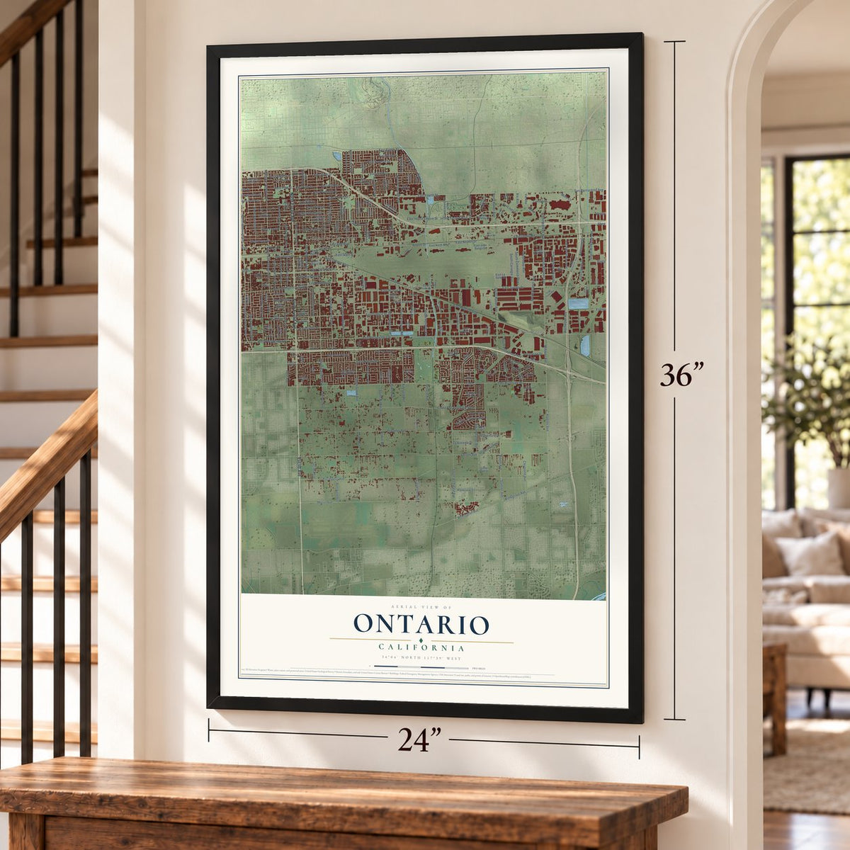
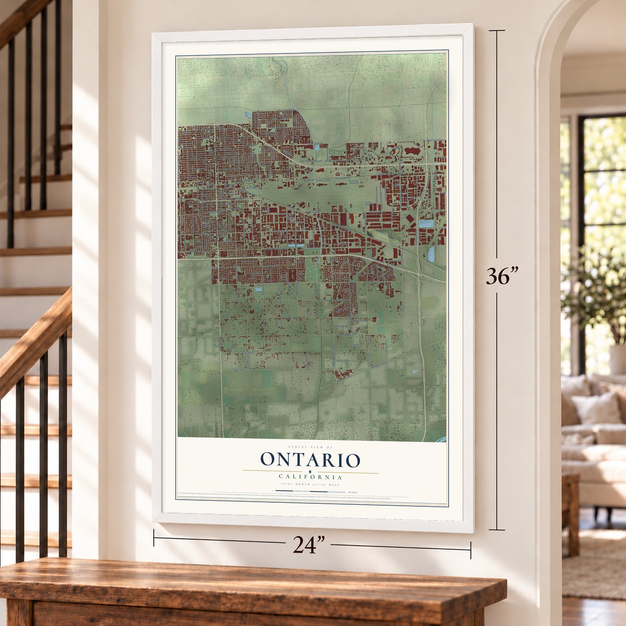

Free U.S. delivery 7 to 10 days after you order
Ontario, California Map Art
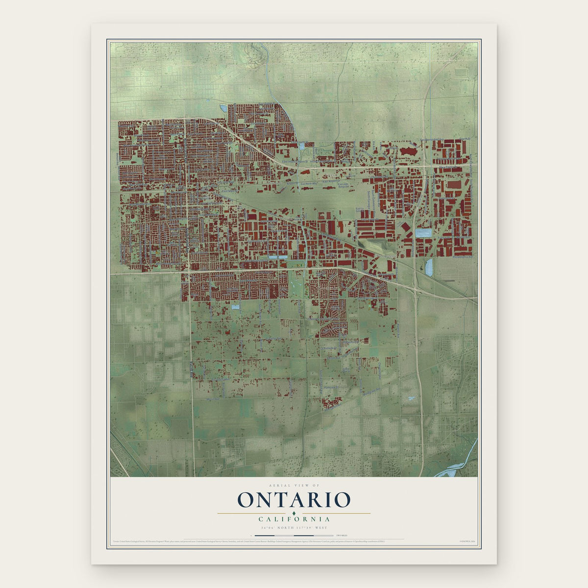
A new map of Ontario, California, made in 2026 and printed to order on thick archival matte paper.
12" x 18" Archival Matte Print
A Map of Home. A Work of Art.
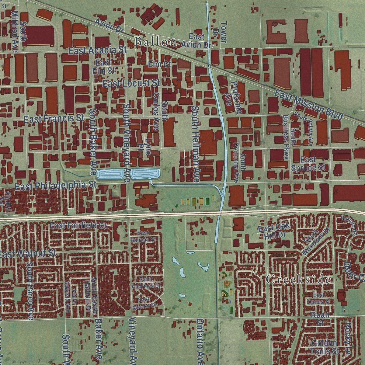
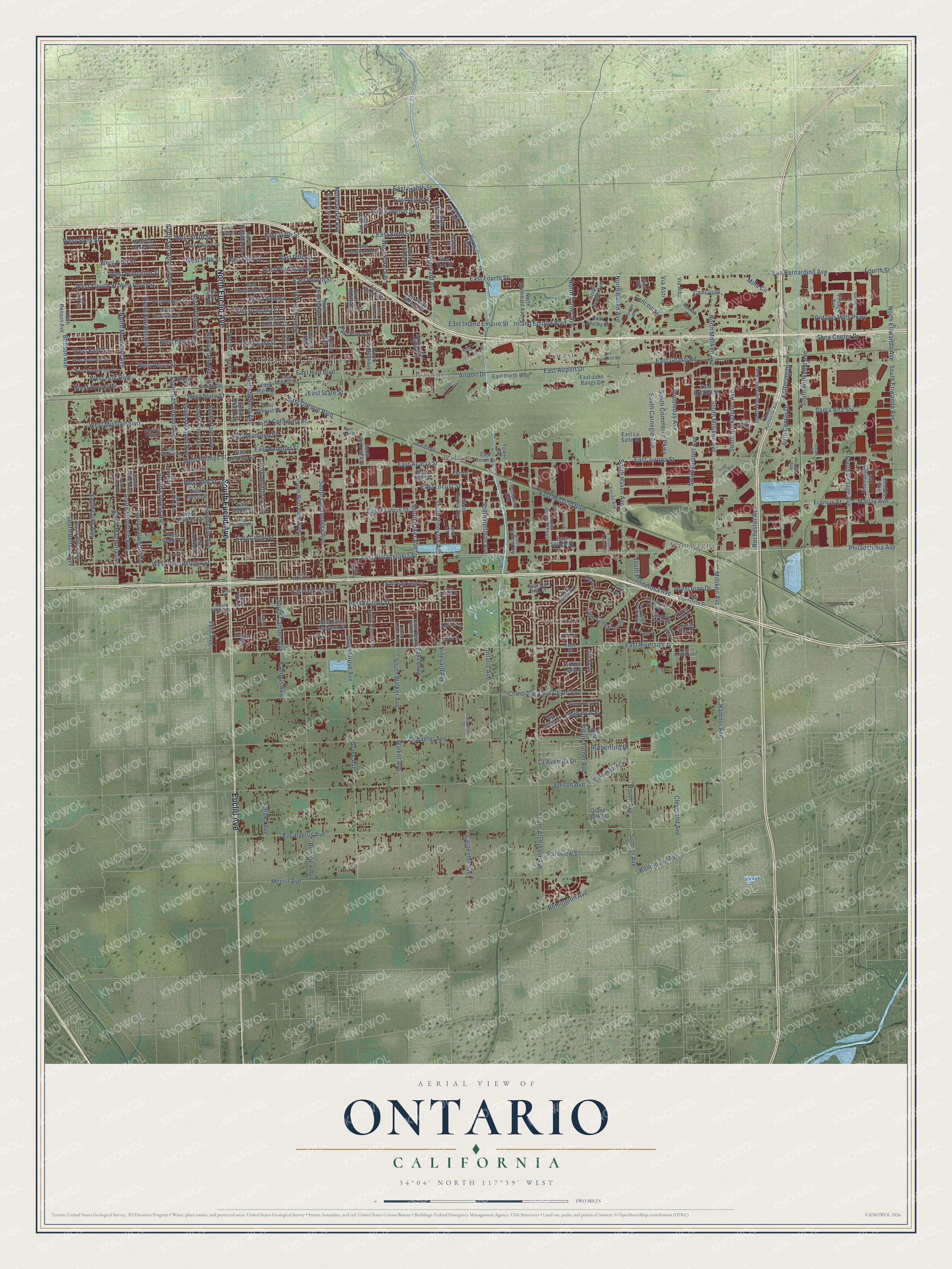
Explore Ontario, California from a whole new perspective. Created using aerial imagery and detailed geographic data, this map captures Ontario building by building, with labeled streets, familiar landmarks, and shaded topographical relief that highlights the natural contours of the landscape.
Combining modern data with the timeless character of a vintage atlas, this map is just as interesting up close as it is beautiful on the wall. Whether you grew up in Ontario, spent memorable years there, or call it home today, this unique map is a great way to celebrate a place that means something to you. Zoom in on the preview to look for your street, and then order a print to put your memories on the wall.
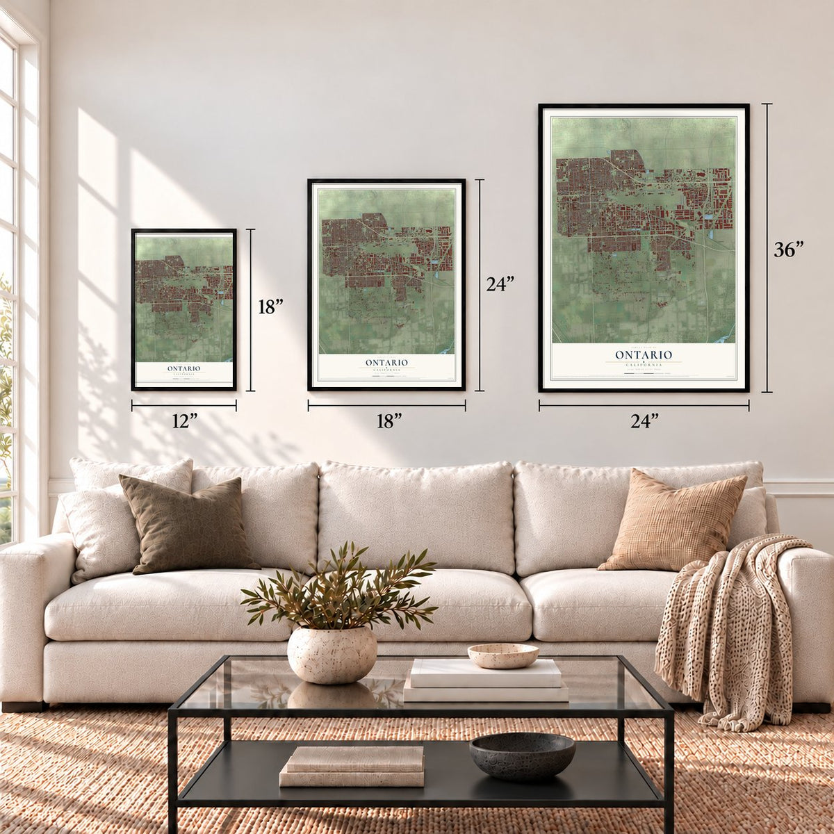
Three ways to hang it
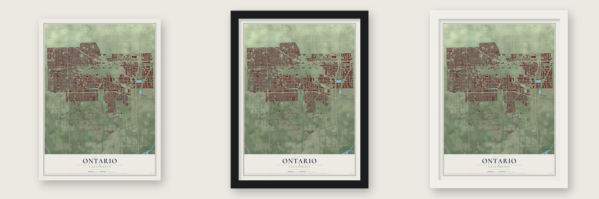
Unframed archival matte, a black wood frame or a white wood frame.
Up close
Geography Worth Displaying
This map was created using accurate cartographic data and authoritative geographic sources, including the U.S. Geological Survey and the Census Bureau. The map brings together terrain, waterways, roads, and building detail. The majority of the streets are labeled, houses are accurately depicted, and the topography is derived from government sources. Combining local data with carefully composed color and shading leads to this beautifully detailed Ontario artwork for your wall.
Rather than simply showing street outlines, we’ve included as many of the street names as we could reasonably fit on the map while keeping their names legible. Zoom in on the high resolution preview to see exactly what’s on the map. We truly set out to create a statement piece for anyone who loves Ontario. So whether it’s for you, or a gift for someone you love, we hope this map of Ontario brings back fond memories.
Read the story behind this map of Ontario, California from 2026.

About Ontario, California
Ontario is a city of 175,265 people in San Bernardino County, about 35 miles east of downtown Los Angeles. In 1881 the Canadian brothers George and William Chaffey bought a piece of Isaias Hellman's Rancho Cucamonga, along with rights to water from Mount San Antonio, and named their new settlement for the province they came from. They carried water from the mountain's foothills to the flat land below, which watered the farms and held back floods, and in October 1882 the San Antonio Water Company was formed as a corporation to manage it.
The brothers called Ontario the Model Colony, a place meant to balance farming with schools, churches and stores, and early deeds banned making or selling alcohol in town. In 1886 the Chaffeys left to build irrigation colonies at Mildura and Renmark in Australia, selling their holdings to the Ontario Land & Improvement Company, led by Charles Frankish. In 1891 the central part of Ontario became an incorporated city, and in 1903 an act of Congress declared it a model colony.
“Thou shalt not Ontario each other”
- Mule cars on Euclid AvenueThe Chaffeys laid out Euclid Avenue with wide lanes and a grassy median. Starting in 1887, the Ontario and San Antonio Heights Railroad Company ran a passenger tram pulled by mules down the middle. Frankish founded the Ontario Electric Company in 1895, and within a year it had taken over the line and swapped the mules for electric cars. Pacific Electric ran the line from 1912 until it shut down in 1928. Euclid Avenue is now on the National Register.
- A fountain for the trainsTo convince visitors that Ontario had plenty of water, the town put a fountain at the Southern Pacific station. It was switched on as passenger trains pulled in and turned off again once they left. The first Chaffey fountain was a plain spigot set inside a circle of white stones. The fancier art nouveau Frankish Fountain later took its place, and it now stands outside the Ontario Museum of History and Art.
- Charles Frankish's first bankIn 1887 he opened the Ontario State Bank, the settlement's first bank. The Frankish Building joined the National Register in 1980, and the Ontario State Bank Block followed in 1982.
- 52 screens on one lotAMC opened AMC Ontario Mills 30, billed as the world's largest theater, on December 13, 1996. Edwards Theaters answered three months later with the Edwards Ontario Palace 22 across the street, putting the nation's most screens, 52, on one shared parking lot. Stanley Durwood of AMC and James Edwards were lifelong rivals.
- Olives since 1894The Graber Olive House opened in Ontario in 1894. No olive packing business in the United States has been running longer.
Find your street
Names on the Ontario map
Every name below is printed on this map. Look for your street, your school, the park where you played, or the pond down the road.
Places and landmarks6
- Ontario City Hall
- Ballou
- Champagne
- Creekside
- Guasti
- Racimo
Streets and roads276
- South Euclid Avenue
- Euclid Avenue
- North Euclid Avenue
- East Fourth Street
- South Grove Avenue
- East Riverside Drive
- East Philadelphia Street
- East Airport Drive
- Fourth Street
- East Fifth Street
- South Milliken Avenue
- Hamner Avenue
- South Fern Avenue
- South San Antonio Avenue
- Philadelphia Avenue
- West Fifth Street
- West Fourth Street
- North San Antonio Avenue
- North Etiwanda Avenue
- North Milliken Avenue
- North Turner Avenue
- Chaparral Street
- Milliken Avenue
- East Francis Street
- East Mission Boulevard
- Edison Avenue
- South Archibald Avenue
- Eucalyptus Avenue
- South Bon View Avenue
- East Jurupa Street
Show all 276 streets
- Schaefer Avenue
- Merrill Avenue
- South Turner Avenue
- East Holt Boulevard
- South Cucamonga Avenue
- East Cedar Street
- Chino Avenue
- Inland Empire Boulevard
- East Walnut Street
- South Campus Avenue
- South Haven Avenue
- South Sultana Avenue
- East Guasti Road
- East Inland Empire Street
- East Sixth Street
- South Vineyard Avenue
- Haven Avenue
- South Mountain Avenue
- South Walker Avenue
- South Baker Avenue
- South Benson Avenue
- South Cypress Avenue
- South Oaks Avenue
- North Grove Avenue
- South Magnolia Avenue
- South Etiwanda Avenue
- North Vineyard Avenue
- San Bernardino Avenue
- Ontario Mills Parkway
- East Locust Street
- South Palmetto Avenue
- Mills Circle
- Concours
- Concourse
- East Princeton Street
- West Mission Boulevard
- West Phillips Street
- West Philadelphia Street
- West Holt Boulevard
- West State Street
- West Sixth Street
- Benson Avenue
- Santa Ana Street
- North Mountain Avenue
- East Granada Court
- Airport Drive
- East Acacia Street
- North Boulder Avenue
- South Vintage Avenue
- East Belmont Street
- Grove Avenue
- East Seventh Street
- South Dupont Avenue
- East Eighth Street
- Plaza Serena
- Remington Avenue
- South Monterey Avenue
- West Vesta Street
- East State Street
- South Wineville Avenue
- East California Street
- North Vine Avenue
- South Vine Avenue
- Deer Creek Loop
- North Allyn Avenue
- West East Street
- South Palm Avenue
- South Hellman Avenue
- West Flora Street
- Carpenter Avenue
- South Commerce Parkway
- West Princeton Street
- South Oakland Avenue
- Auto Center Drive
- Ontario Avenue
- Vineyard Avenue
- East Oak Hill Street
- South Rockefeller Avenue
- Walker Avenue
- Bon View Avenue
- Marlay Avenue
- Sumner Avenue
- North Haven Avenue
- East Maitland Street
- East Ontario Boulevard
- Doubleday Avenue
- Kettering Drive
- West Brooks Street
- East East Street
- East Flora Street
- South Carnegie Avenue
- Francis Street
- Cleveland Avenue
- North Palm Avenue
- East Olive Street
- Parkview Street
- Shea Center Drive
- La Avenida Drive
- Fern Avenue
- South Ponderosa Avenue
- West Elm Street
- Bellegrave Avenue
- Rochester Avenue
- Greystone Drive
- Baker Avenue
- Sultana Avenue
- Campus Avenue
- East Chino Avenue
- Rutherford Drive
- Via Asti
- East Hawthorne Street
- West Francis Street
- North Sultana Avenue
- South Parco Avenue
- West Locust Street
- East Yale Street
- East Rosewood Court
- North Baker Avenue
- West Granada Court
- East El Morado Court
- East Spruce Street
- North Corona Avenue
- East North Way
- South Helen Avenue
- North Cucamonga Avenue
- North Archibald Avenue
- South Plum Avenue
- West La Deney Drive
- East Main Street
- East Sunkist Street
- North Del Norte Avenue
- West Cedar Street
- North Imperial Avenue
- South Carlos Avenue
- East Avion Drive
- East Fairfield Court
- South Wanamaker Avenue
- East Brickell Street
- East Oak Hill Drive
- North Benson Avenue
- North Lemon Avenue
- Ontario Ranch Road
- East Phillips Street
- East Saint Andrews Street
- Champagne Avenue
- North Barranca Avenue
- South Bonita Avenue
- East Maple Street
- North Center Avenue
- South Mildred Avenue
- East Elm Street
- South Pine Avenue
- Proforma Avenue
- Virginia Avenue
- Golden Trails Street
- East John Bangs Drive
- East La Salle Street
- Brooks Street
- East Fresno Street
- East Shelby Street
- East Plaza Serena Court
- Vintage Avenue
- Lantana Street
- Utica Avenue
- Florence Avenue
- Via Alba
- Chablis Avenue
- Rocky Lane
- Merion Street
- Avion Drive
- Carlos Place
- Del Rio Way
- Grand Park Street
- Tower Drive
- Wing Street
- Ferrari Lane
- Roan Street
- Elm Court
- Lynx Place
- Carlton Privado
- North Virginia Avenue
- South Rochester Avenue
- West Hollowell Street
- West Berkeley Court
- North Laurel Avenue
- East Emporia Street
- North Glenn Avenue
- South Proforma Avenue
- South Business Parkway
- West Armsley Square
- West Stonebridge Court
- Black Horse Drive
- West Emporia Street
- North Hacienda Drive
- South Castle Harbour Place
- Big Range Road
- Doral Court
- North Placer Privado Street
- East Brentstone Street
- East Wall Street
- South Woodlark Drive
- South Azalea Avenue
- Montezuma Street
- Sarah Place
- Excise Avenue
- Carpenter Street
- Antler Road
- Antelope Creek Drive
- West Walnut Street
- Mill Creek
- South Plum Lane
- Kline Street
- Hudson Avenue
- Via del Sol
- East Banyan Street
- North Berlyn Avenue
- East Deodar Street
- Old Brookside Road
- South Redwood Avenue
- West Belmont Street
- North Oaks Avenue
- East Dunes Street
- North Lake Avenue
- South Pointe Avenue
- East Lytle Creek Loop North
- West Spruce Street
- East Callaway Drive
- Porsche Way
- Barrington Avenue
- East Skylark Street
- Oak Creek Drive
- South Augusta Avenue
- East Moore Way
- South Toyota Way
- East Grevillea Street
- East Merion Drive
- East Lytle Creek Loop
- Saint Andrews Drive
- East Kern Street
- Buffalo Road
- South Excise Avenue
- Colorado River Road
- East Skylark Drive
- Klamath River Drive
- Pleasant Avenue
- Geyer Court
Names are listed as they appear on the printed map. Zoom into the product photos to find them.
The art of mapping a place
How This Map Was Made
Real places. Remarkable detail. Discover the layers that turn geographic data into a map of home.

The view from above
Aerial imagery reveals the character of the land: woodland, open fields, and the patterns of a place.

The shape of the land
Elevation data brings hills, valleys, and subtle changes in the landscape into view.

The details of home
Roads, waterways, and building footprints come together to make the map feel unmistakably local.

Geography becomes art
Considered color, shading, and typography bring the layers together in a map made for your wall.


Process illustrated with Mendon, Massachusetts. Aerial imagery: USDA NAIP. Terrain: USGS 3D Elevation Program. Map details and finished artwork: KNOWOL.
The Details
About This Print
Choose an archival matte print, or a black or white Ayous wood frame. The archival matte print is unframed.
Select your size and finish above to see the matching product image and price.
Materials & Craftsmanship
A contemporary map with the character of a classic atlas, printed on archival matte paper. Optional frames are made from Ayous wood.
Your printed map does not include the watermark shown in the full-map preview.
Shipping & Delivery
Free shipping within the United States. Every print is made to order in the USA.
Buying a gift? Add a note in your cart and we'll include it. We never put prices in the package.
Prints ship within 2 to 3 business days. Allow 7 to 10 days total from ordering for delivery. Timing may vary during holidays or periods of high order volume.
Read our shipping policy.
Returns and damaged prints
Each print is made to order. Change-of-mind refunds are not available after production.
If your print arrives damaged, misprinted or incorrect, contact support@knowol.com within 30 days of receiving it. Include your order number, photos and a description of the issue.
Read our full refund and replacement policy. For questions about your order, email support@knowol.com.
Find your town
Looking for another city?
Find a map of home in our California collection, or any town in the country.
Nearby
Maps of towns near Ontario
Know someone from one of these towns? Their map makes a great gift.
 Eastvale
, California
From $39.99See the map
 Chino
Chino, California
From $39.99See the map
 Montclair
, California
From $39.99See the map
More maps nearby: Upland, Rancho Cucamonga, Jurupa Valley, Norco and Claremont.