
Search for another town





Free U.S. delivery 7 to 10 days after you order
Pensacola, Florida Map Art
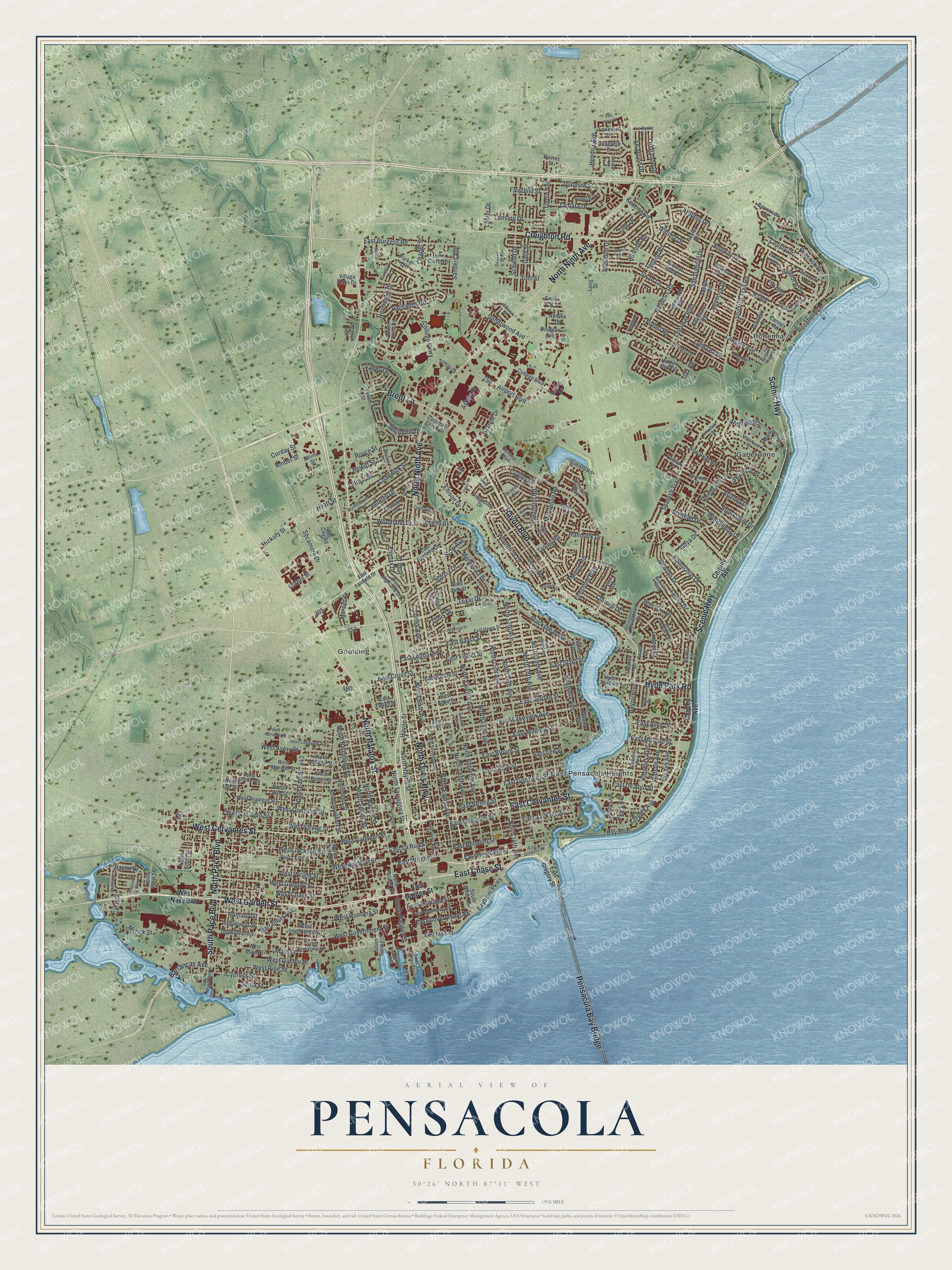
A new map of Pensacola, Florida, made in 2026 and printed to order on thick archival matte paper.
12" x 18" Archival Matte Print
A Map of Home. A Work of Art.
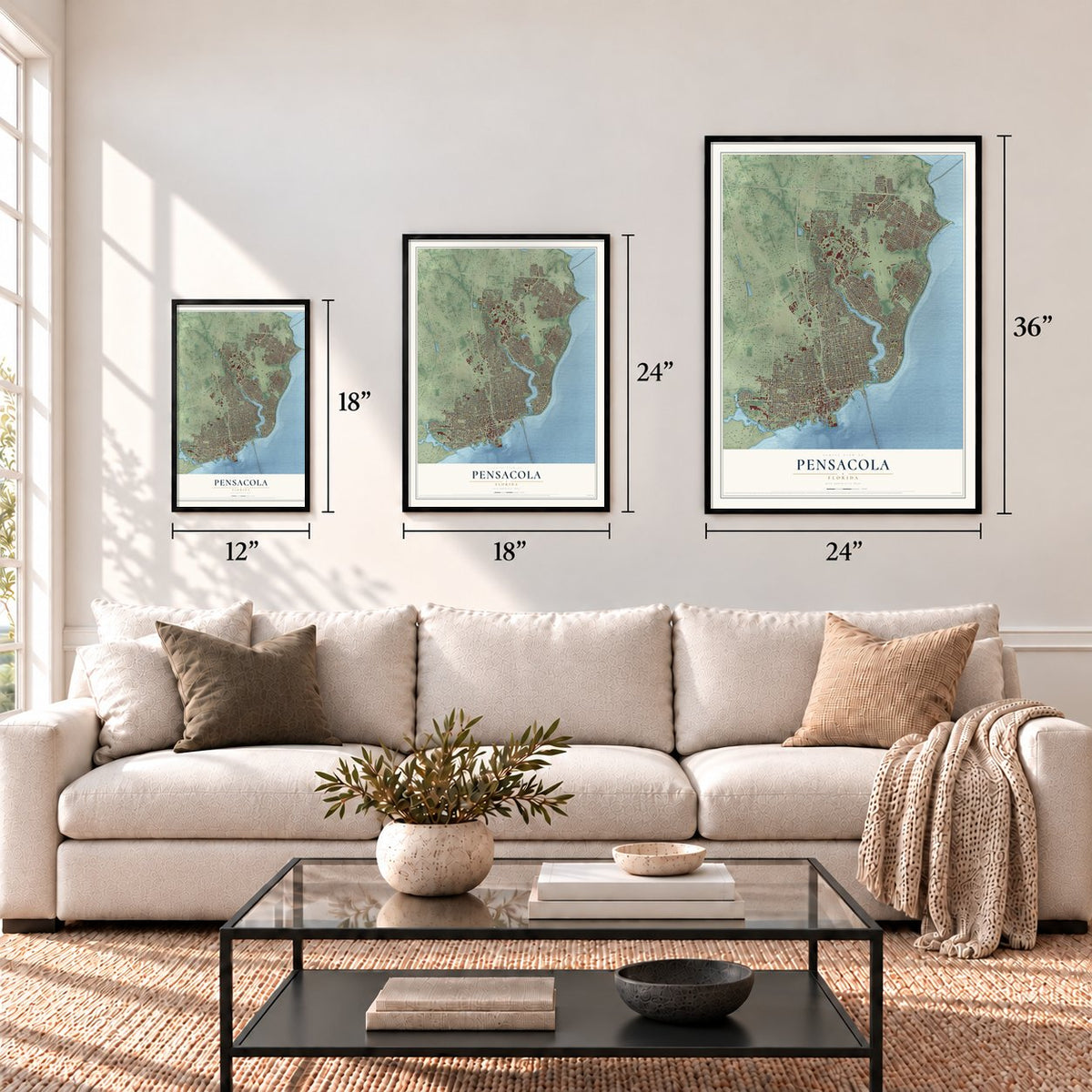
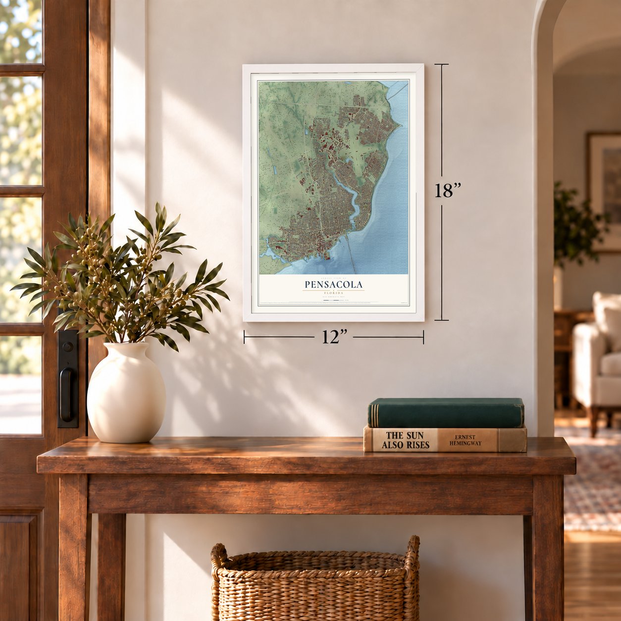
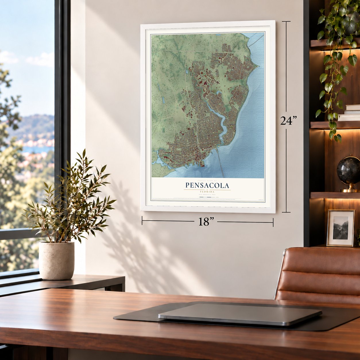
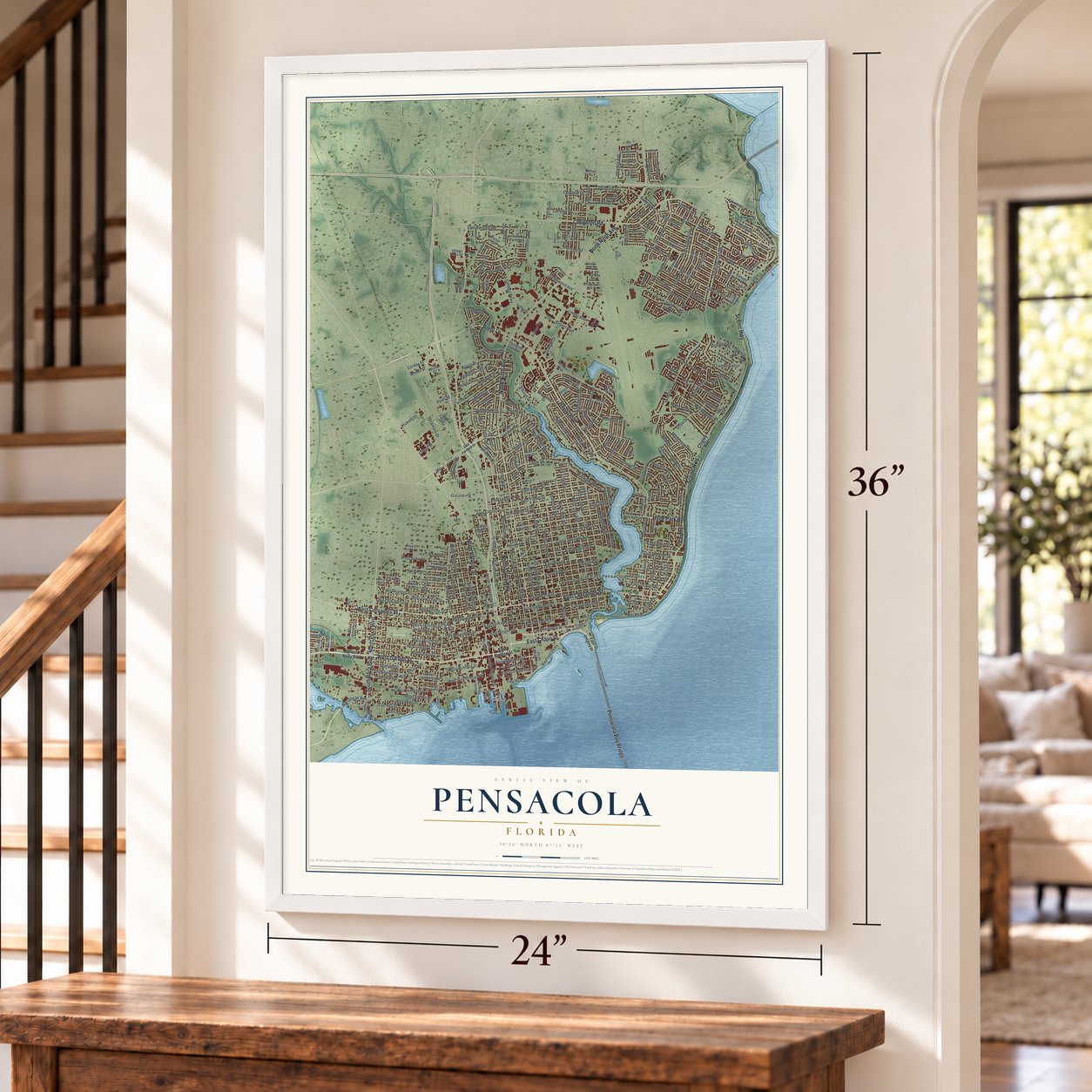
Explore Pensacola, Florida from a whole new perspective. Created using aerial imagery and detailed geographic data, this map captures Pensacola building by building, with labeled streets, familiar landmarks, and shaded topographical relief that highlights the natural contours of the landscape.
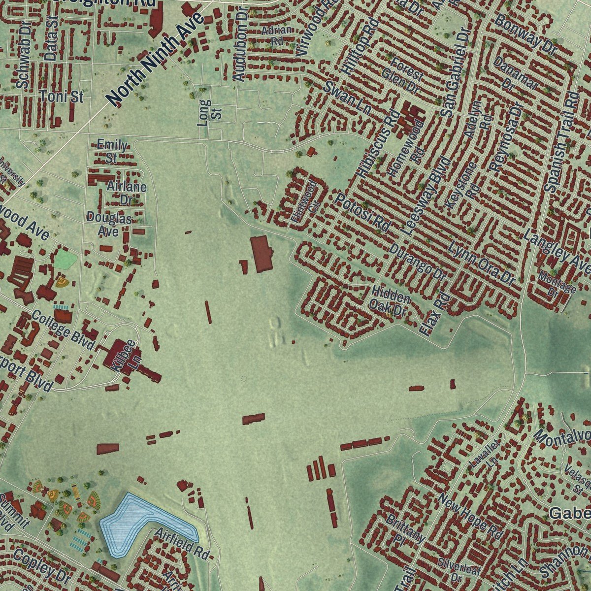
Combining modern data with the timeless character of a vintage atlas, this map is just as interesting up close as it is beautiful on the wall. Whether you grew up in Pensacola, spent memorable years there, or call it home today, this unique map is a great way to celebrate a place that means something to you. Zoom in on the preview to look for your street, and then order a print to put your memories on the wall.
Three ways to hang it
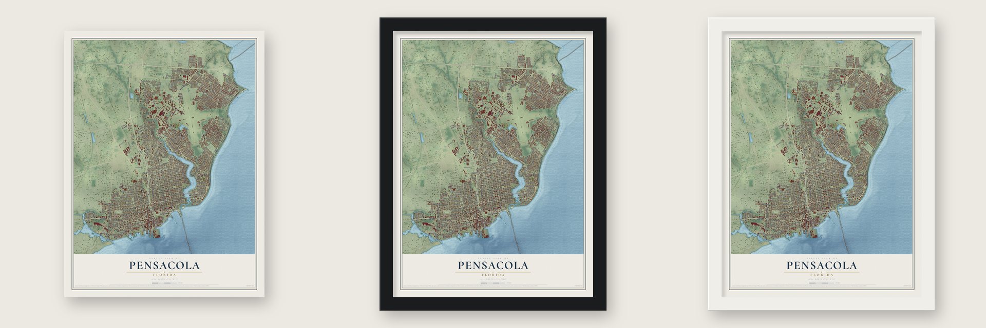
Unframed archival matte, a black wood frame or a white wood frame.
Up close
Geography Worth Displaying
This map was created using accurate cartographic data and authoritative geographic sources, including the U.S. Geological Survey (USGS) and FEMA. The map brings together terrain, waterways, roads, and building detail. The majority of the streets are labeled, houses are accurately depicted, and the topography is derived from government sources. Combining local data with carefully composed color and shading leads to this beautifully detailed Pensacola artwork for your wall.
Rather than simply showing street outlines, we’ve included as many of the street names as we could reasonably fit on the map while keeping their names legible. Zoom in on the high resolution preview to see exactly what’s on the map. We truly set out to create a statement piece for anyone who loves Pensacola. So whether it’s for you, or a gift for someone you love, we hope this map of Pensacola brings back fond memories.
Explore the full map of Pensacola, Florida and read about the local places it shows.

About Pensacola, Florida
Pensacola is a city of 54,312 people on Pensacola Bay, the county seat and only city of Escambia County. It takes its name from the Pensacola people, who spoke a Muskogean language and made their home beside the bay when the Spanish arrived. Tristán de Luna y Arellano sailed in from Veracruz on August 15, 1559, with some 1,500 people on 11 ships. A hurricane on September 19 sank six of the ships and spoiled the supplies. The colony was abandoned in 1561, and the last 50 survivors were carried back to Veracruz. Spain did not return until 1698, when it built a fortified town near present-day Fort Barrancas.
Spain handed Florida to Britain in 1763, and nearly all of the Spanish residents left by ship for Veracruz and Cuba. The British made Pensacola the capital of West Florida, but Spanish troops won it back in the 1781 Siege of Pensacola. American forces captured the city late in the War of 1812 and again in 1818, and Spain gave up Florida in an 1819 treaty. Pensacola became part of the United States in 1821 and was incorporated in 1822. Spain, France, Britain, the United States and the Confederacy all ruled it, so it is called the City of Five Flags.
- Jackson takes over, 1821On July 21, 1821, Andrew Jackson watched in Plaza Ferdinand VII, on Palafox Street, as Spanish colors were lowered and the Stars and Stripes went up. He declared that Pensacola would be the seat of government for the newly created Florida Territory. Today a bust of Jackson stands on the spot where he took his oath as territorial governor. In 1960 the plaza was named a National Historic Landmark.
- Saving Seville SquareIn the early 1960s Mary Turner Rule led local preservationists in founding the Pensacola Heritage Foundation. The group surveyed the old streets around Seville Square, restored the Clara Barkley Dorr House and persuaded the city to restore the square, which had been a parade ground of the British fort along with Plaza Ferdinand VII. Their work paid off when the Pensacola Historic District was designated on September 29, 1970.
- The Saenger Theatre, 1925Downtown's Saenger Theatre, built in the Spanish Baroque style, first opened its doors on April 2, 1925. Bricks salvaged from the old Pensacola Opera House were laid into its lower walls.
- Cradle of Naval AviationIn 1914 the Navy commissioned its first naval air station here, just southwest of today's city limits, and it has remained the largest in the country. Tens of thousands of aviators have trained there, including John Glenn and Neil Armstrong. The station is home to the Blue Angels and the free National Naval Aviation Museum, and Pensacola calls itself the Cradle of Naval Aviation.
Find your street
Names on the Pensacola map
Every name below is printed on this map. Look for your street, your school, the park where you played, or the pond down the road.
Places and landmarks5
- Saint John's Cemetery
- Bohemia
- East Pensacola Heights
- Gaberonne
- Goulding
Streets and roads314
- West Garden Street
- Brent Lane
- East Chase Street
- South Pace Boulevard
- North Palafox Street
- Bayou Boulevard
- North Pace Boulevard
- North Davis Highway
- Pensacola Bay Bridge
- East Cervantes Street
- West Cervantes Street
- North Ninth Avenue
- Scenic Highway
- Creighton Road
- Hyde Park Road
- Bayfront Parkway
- Barrancas Avenue
- South Palafox Street
- Airport Boulevard
- Main Street
- Langley Avenue
- West Romana Street
- Myrick Street
- East Blount Street
- East La Rua Street
- East Romana Street
- Terrasanta
- North Twelfth Avenue
- East Lee Street
- Romana Street
Show all 314 streets
- Wimbledon Drive
- Lansing Drive
- La Jolla
- Chapel Street
- Spanish Trail Road
- Spanish Trail
- East Lakeview Avenue
- North Tenth Avenue
- North 17th Avenue
- North Eleventh Avenue
- North Sixth Avenue
- East Gonzalez Street
- East Mallory Street
- East Lloyd Street
- North 14th Avenue
- North 16th Avenue
- East De Soto Street
- North 13th Avenue
- East Gadsden Street
- North 18th Avenue
- East Avery Street
- West Wright Street
- North Eighth Avenue
- East Jackson Street
- East Jordan Street
- East Cross Street
- East Strong Street
- East Moreno Street
- North Hayne Street
- West Gregory Street
- West Belmont Street
- North 15th Avenue
- West Jackson Street
- West Gadsden Street
- West Chase Street
- North 19th Avenue
- North Baylen Street
- North Tarragona Street
- East Scott Street
- West Strong Street
- North Spring Street
- North East Street
- West De Soto Street
- North Barcelona Street
- East Wright Street
- West Gonzalez Street
- Leesway Boulevard
- East Fisher Street
- Tippin Avenue
- East Belmont Street
- East Leonard Street
- Firestone Boulevard
- Magnolia Avenue
- Hallmark Drive
- East Baars Street
- West Government Street
- Royce Street
- East Burgess Road
- Connell Drive
- Schwab Drive
- Berkley Drive
- West Avery Street
- San Gabriel Drive
- Hilltop Road
- Piedmont Road
- Fairfax Drive
- Keating Road
- Knowles Avenue
- Menendez Drive
- Hermitage Drive
- Woodbine Drive
- Dunmire Street
- Potosi Road
- Springhill Drive
- Bonway Drive
- Perry Avenue
- McClellan Road
- Lynn Ora Drive
- Cypress Street
- Sycamore Drive
- Semoran Drive
- Barcia Drive
- Chadwick Street
- Watson Avenue
- Rothschild Drive
- Grande Drive
- West Gimble Street
- Audubon Drive
- West Pine Street
- Newton Drive
- College Parkway
- Hibiscus Road
- East Heinberg Street
- Palisades Road
- East Government Street
- Goya Drive
- Swan Lane
- Toni Street
- Blackshear Avenue
- Bay Boulevard
- Texar Drive
- Marjean Drive
- Underwood Avenue
- Balmoral Drive
- Askew Drive
- Tronjo Road
- Logan Drive
- Reynosa Drive
- Christy Drive
- Tunis Drive
- Copley Drive
- Woodland Drive
- Arbutus Drive
- Rommitch Lane
- Torres Avenue
- Brookshire Drive
- Flax Road
- Ditmar Street
- Montalvo Drive
- Peacock Drive
- Chipley Avenue
- Oxford Drive
- Tamara Drive
- Sanders Avenue
- Hendrix Avenue
- Shannon Place
- Lanier Drive
- Hewitt Street
- Arizona Drive
- Maule Road
- Ellison Drive
- Rosaflora Lane
- Marcus Drive
- Le Grande Drive
- Hart Drive
- Le Jeune Drive
- Hyatt Street
- Fairchild Street
- Tide Drive
- Winona Drive
- Euclid Street
- Valley Drive
- Hayne Street
- Hickory Street
- Virwood Road
- Bayou Drive
- Lurton Street
- Corday Street
- Stow Avenue
- Sonia Street
- Data Street
- Amber Street
- Cahn Street
- West Navy Boulevard
- East Garden Street
- Summit Boulevard
- College Boulevard
- East Main Street
- North West Street
- Kilbee Lane
- South Spring Street
- East Bobe Street
- East Hatton Street
- East Yonge Street
- West Blount Street
- North Reus Street
- West Brainerd Street
- West Lloyd Street
- West Lee Street
- West Moreno Street
- North De Villiers Street
- West Intendencia Street
- East Fairfield Drive
- West Mallory Street
- Whaley Avenue
- Airfield Road
- Forest Glen Drive
- Dunwody Drive
- Hidden Oak Drive
- John Carroll Drive
- North Coyle Street
- Intendencia Street
- Government Street
- New Hope Road
- Semur Road
- Arriviste Way
- Escalona Avenue
- West Main Street
- Inverness Drive
- North South Street
- Durango Drive
- Van Kirk Avenue
- Baywoods Drive
- Parker Circle
- Danamar Drive
- Yates Avenue
- East 34th Street
- Keystone Road
- Adelyn Road
- Manolete Street
- Airlane Drive
- Azalea Road
- La Mirage
- Lancelot Drive
- Otter Point Road
- Selina Street
- Mc Coy Road
- West Highland Drive
- Brittany Place
- Tyler Avenue
- Canopy Road
- Walton Street
- Dunwoody Drive
- Homewood Road
- Gentian Drive
- Keats Drive
- South Ninth Avenue
- Douglas Avenue
- Dunlieth Place
- Trinity Drive
- Village Oaks Drive
- Carpenter Creek Drive
- Bedevere Drive
- Fleance Drive
- Bluffs Circle
- Emily Street
- Lynell Street
- Long Street
- Raines Street
- East Gregory Street
- Velasquez Street
- Flintwood Circle
- North Seventh Avenue
- West La Rua Street
- East Hernandez Street
- North 20th Avenue
- Pickens Avenue
- West Lakeview Avenue
- East Hayes Street
- South Jefferson Street
- Wynnehurst Street
- Belle Christiane Circle
- Bayview Way
- West Zarragossa Street
- East Intendencia Street
- Stanley Avenue
- Woodcliff Drive
- Conway Drive
- Port Royal Way
- West Godfrey Street
- Clematis Street
- Skyline Drive
- Avenue Marina
- Silverleaf Drive
- Tree Line Drive
- Adrian Road
- Calloway Avenue
- Beacon Road
- Montage Drive
- Lavallet Lane
- La Borde Lane
- Guilford Drive
- Dewrell Square
- North Guillemard Street
- East Anderson Street
- West Hernandez Street
- Aiken Road
- Heyward Drive
- Windwood Drive
- East Olive Road
- Blaze Avenue
- North Stillman Street
- University Street
- Gallahad Road
- Sewell Street
- Warwick Avenue
- Ash Drive
- Villafane Drive
- Pvt Pointe Drive
- Cove Road
- Eleventh Avenue
- Galt Road
- Fairnie Avenue
- Gale Drive
Names are listed as they appear on the printed map. Zoom into the product photos to find them.
The art of mapping a place
How This Map Was Made
Real places. Remarkable detail. Discover the layers that turn geographic data into a map of home.

The view from above
Aerial imagery reveals the character of the land: woodland, open fields, and the patterns of a place.

The shape of the land
Elevation data brings hills, valleys, and subtle changes in the landscape into view.

The details of home
Roads, waterways, and building footprints come together to make the map feel unmistakably local.

Geography becomes art
Considered color, shading, and typography bring the layers together in a map made for your wall.


Process illustrated with Mendon, Massachusetts. Aerial imagery: USDA NAIP. Terrain: USGS 3D Elevation Program. Map details and finished artwork: KNOWOL.
The Details
About This Print
Choose an archival matte print, or a black or white Ayous wood frame. The archival matte print is unframed.
Select your size and finish above to see the matching product image and price.
Materials & Craftsmanship
A contemporary map with the character of a classic atlas, printed on archival matte paper. Optional frames are made from Ayous wood.
Your printed map does not include the watermark shown in the full-map preview.
Shipping & Delivery
Free shipping within the United States. Every print is made to order in the USA.
Buying a gift? Add a note in your cart and we'll include it. We never put prices in the package.
Prints ship within 2 to 3 business days. Allow 7 to 10 days total from ordering for delivery. Timing may vary during holidays or periods of high order volume.
Read our shipping policy.
Returns and damaged prints
Each print is made to order. Change-of-mind refunds are not available after production.
If your print arrives damaged, misprinted or incorrect, contact support@knowol.com within 30 days of receiving it. Include your order number, photos and a description of the issue.
Read our full refund and replacement policy. For questions about your order, email support@knowol.com.
Find your town
Looking for another city?
Find a map of home in our Florida collection, or any town in the country.
Nearby
Maps of towns near Pensacola
Know someone from one of these towns? Their map makes a great gift.
 Goulding
, Florida
From $39.99See the map
 Brent
Brent, Florida
From $39.99See the map
 West Pensacola
, Florida
From $39.99See the map
More maps nearby: Gulf Breeze, Ferry Pass, Garcon Point, Myrtle Grove and Oriole Beach.