
Search for another town




Free U.S. delivery 7 to 10 days after you order
Smithfield, Rhode Island Map Art
Building by building, with labeled streets and shaded relief.
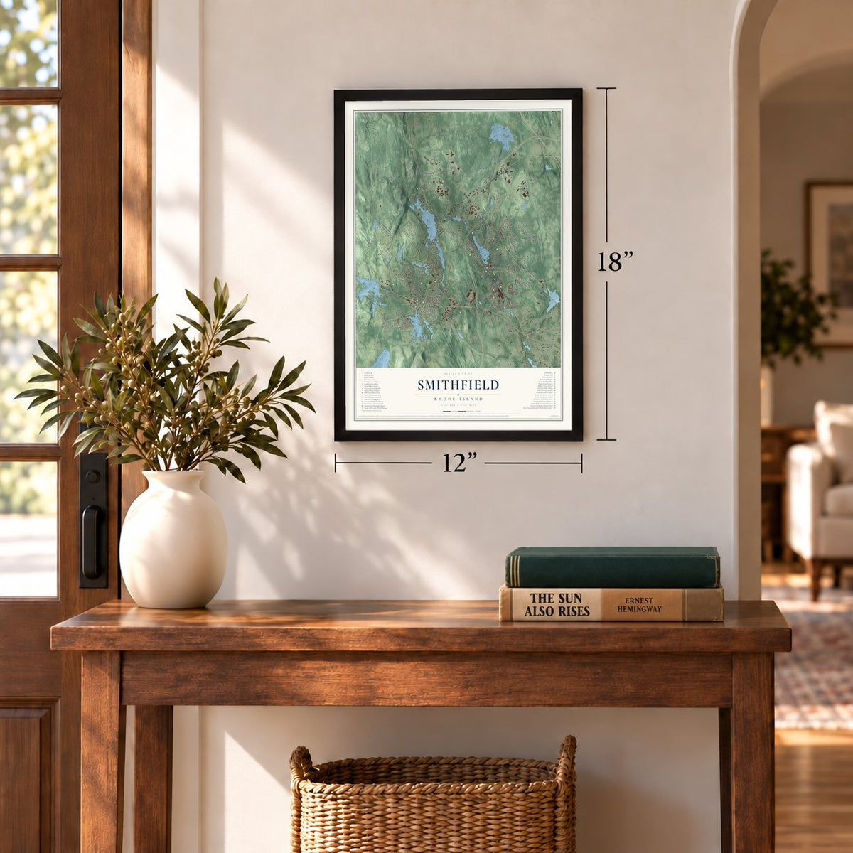
12" x 18" Archival Matte Print
A Map of Home. A Work of Art.
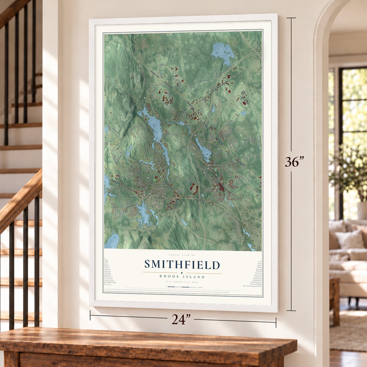
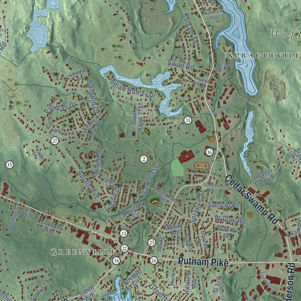
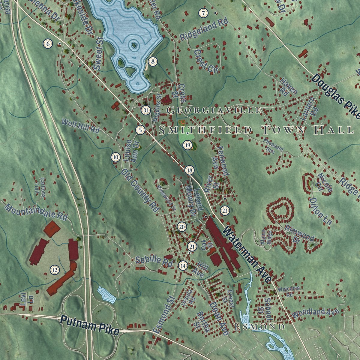
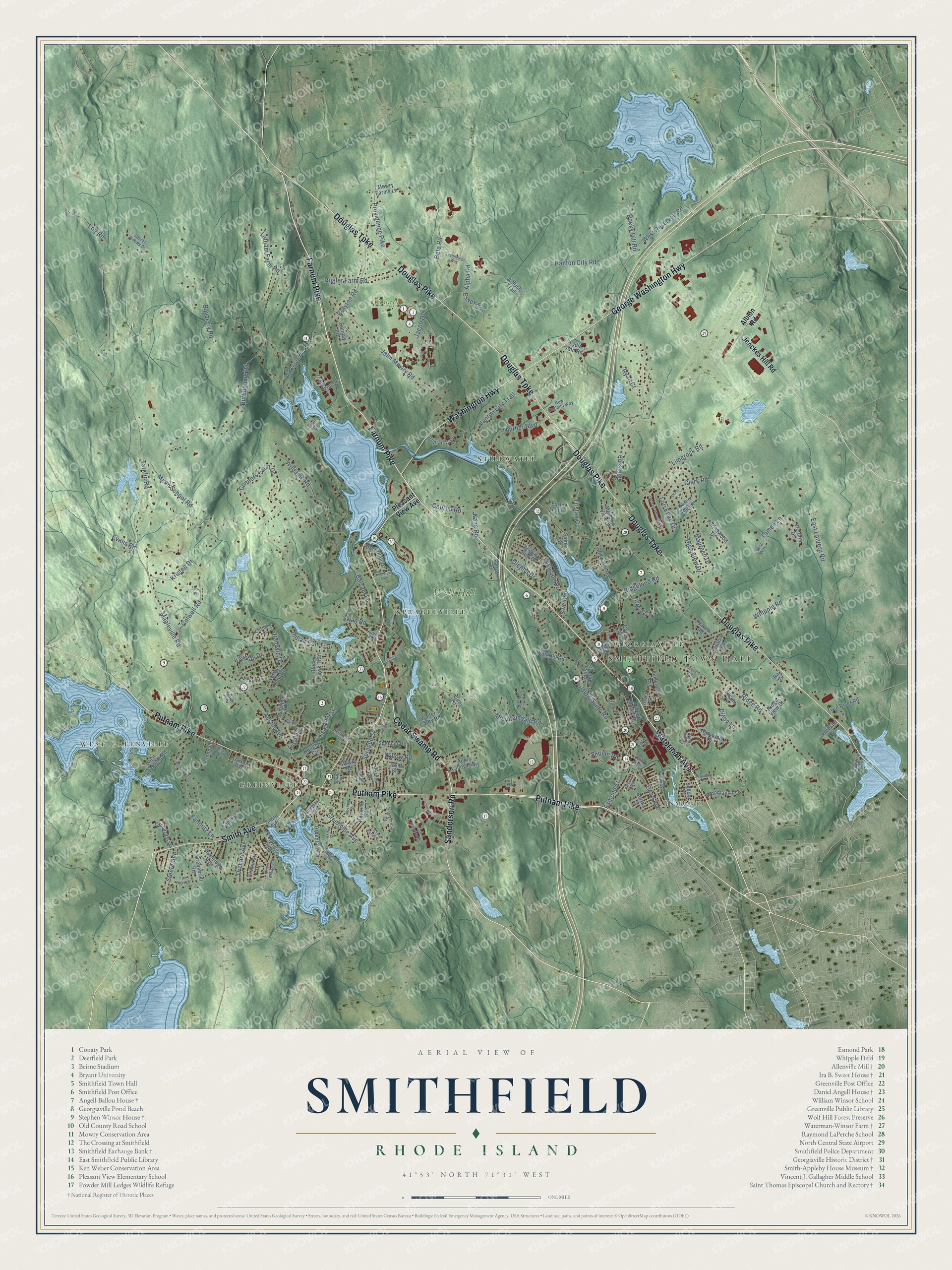
Explore Smithfield, Rhode Island from a whole new perspective. Created using aerial imagery and detailed geographic data, this map captures Smithfield building by building, with labeled streets, familiar landmarks, and shaded topographical relief that highlights the natural contours of the landscape.
Combining modern data with the timeless character of a vintage atlas, this map is just as interesting up close as it is beautiful on the wall. Whether you grew up in Smithfield, spent memorable years there, or call it home today, this unique map is a great way to celebrate a place that means something to you. Zoom in on the preview to look for your street, and then order a print to put your memories on the wall.
Three ways to hang it
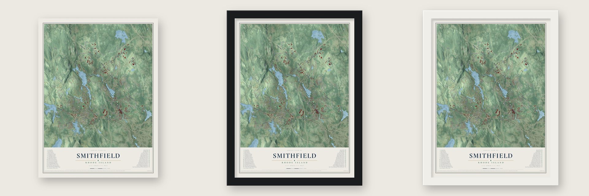
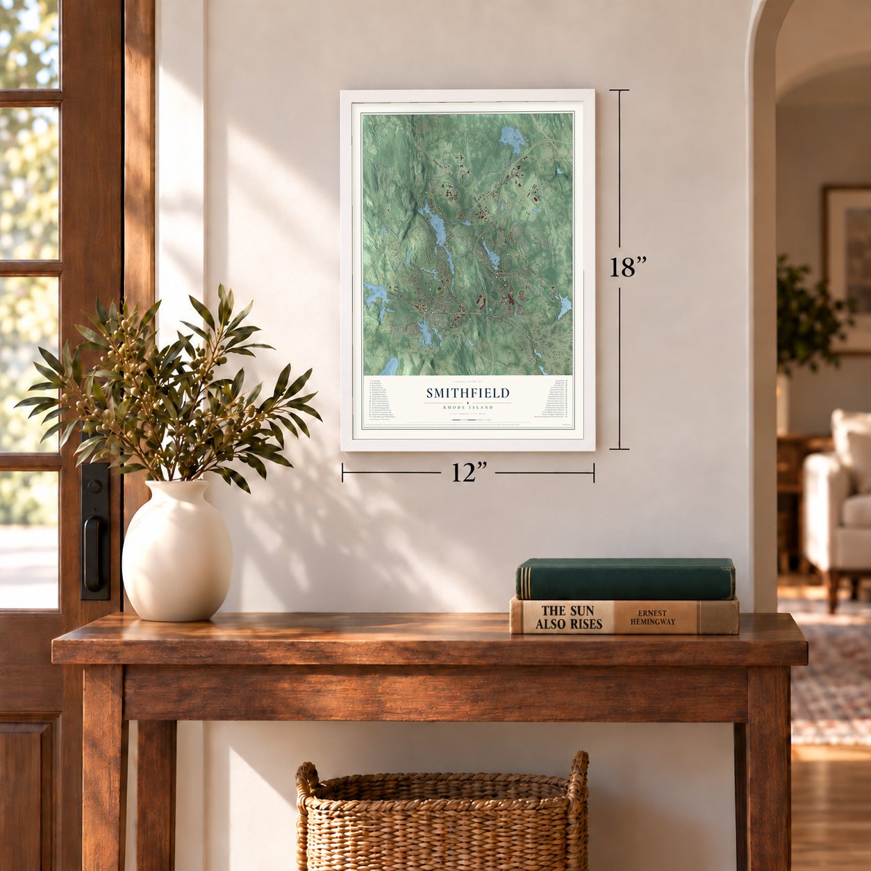
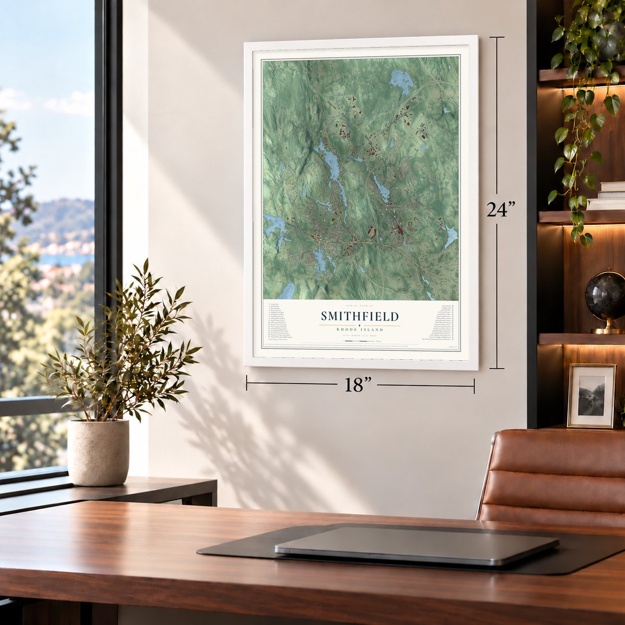
Unframed archival matte, a black wood frame or a white wood frame.
Up close
Geography Worth Displaying
This map was created using accurate cartographic data and authoritative geographic sources, including the U.S. Geological Survey (USGS) and FEMA. The map brings together terrain, waterways, roads, and building detail. The majority of the streets are labeled, houses are accurately depicted, and the topography is derived from government sources. Combining local data with carefully composed color and shading leads to this beautifully detailed Smithfield artwork for your wall.
Rather than simply showing street outlines, we’ve included as many of the street names as we could reasonably fit on the map while keeping their names legible. Zoom in on the high resolution preview to see exactly what’s on the map. We truly set out to create a statement piece for anyone who loves Smithfield. So whether it’s for you, or a gift for someone you love, we hope this map of Smithfield brings back fond memories.
Explore the full map of Smithfield, Rhode Island and read about the local places it shows.

Find your street
Names on the Smithfield map
Every name below is printed on this map. Look for your street, your school, the park where you played, or the pond down the road.
Places and landmarks9
- Smithfield Town Hall
- West Greenville
- Esmond
- Greenville
- Conaty Park
- Wolf Hill
- Stillwater
- Spragueville
- Georgiaville
Streets and roads177
- Douglas Pike
- Farnum Pike
- Waterman Avenue
- Douglas Turnpike
- Putnam Pike
- Sanderson Road
- George Washington Highway
- Washington Highway
- Smith Avenue
- Cedar Swamp Road
- Alpha Road
- Jacob Drive
- Log Road
- Ridge Road
- Harris Road
- Mann School Road
- Mountaindale Road
- Old County Road
- Burlingame Road
- Tarklin Road
- Limerock Road
- Austin Avenue
- West Reservoir Road
- Whipple Road
- Hanton City Road
- Swan Road
- John Mowry Road
- Rocky Hill Road
- Clark Road
- Beta Road
Show all 177 streets
- Mapleville Road
- Brayton Road
- Colwell Road
- Latham Farm Road
- Connors Farm Drive
- Indian Run Trail
- Maureen Drive
- Capron Road
- Fanning Lane
- Williams Road
- Esmond Street
- Greenville Avenue
- Rogler Farm Road
- Lakeside Drive
- Lisa Ann Circle
- Hanton City Trail
- Crest Circle
- Willow Road
- Providence Pike
- Thurber Boulevard
- Sprague Street
- Kristen Drive
- Sebille Road
- Dean Avenue
- Orchard Avenue
- Lori Ellen Drive
- Essex Road
- High View Drive
- Bayberry Road
- Steere Avenue
- Dillon Lane
- Val Jean Drive
- East Lantern Road
- Tristan Court
- Baldwin Drive
- Ridgeland Road
- Balsam Lane
- Tameo Lane
- Glenna Drive
- Evans Road
- Ryan Court
- Sweet Street
- Kane Road
- Lucille Drive
- Albion Road
- Pleasant View Avenue
- Jenckes Hill Road
- West Greenville Road
- Stillwater Road
- Sophia Lane
- Karen Ann Drive
- Lydia Ann Road
- Old Forge Road
- Wolf Hill Road
- Barnes Street
- Greenlake Drive
- Walter Carey Road
- Woodland Avenue
- Coolridge Avenue
- Fenwood Avenue
- Douglas Circle
- Meadow View Drive
- Forestwood Drive
- Greenbrier Road
- Macarthur Drive
- Spencer Road
- Hillcrest Avenue
- Beverly Circle
- School Street
- Appian Way
- Orchard Gate
- Industrial Drive
- Valley View Drive
- Lantern Road
- Louise Ann Drive
- Scenic View Drive
- Twin River Road
- Apple Valley Parkway
- Sturbridge Avenue
- Mowry Farms Lane
- Black Hawk Trail
- Dongay Road
- Leland Mowry Drive
- Webster Lane
- Nicole Circle
- Sidney Street
- Elmhurst Drive
- Lodgepole Lane
- Stony Lane
- River Street
- Vernon Street
- Rimwood Drive
- Cross Street
- Garden Avenue
- Aldrich Trail
- Mowry Road
- Haven Road
- Forte Trail
- Cavalry Drive
- Ridge View Court
- Victoria Drive
- Farrar Lane
- Hill Avenue
- Bertha Street
- Levi Lane
- David Street
- Pine Drive
- Ray Drive
- Maplecrest Drive
- Randall Street
- Aspen Lane
- Cider Lane
- Laurel Woods Drive
- Deerfield Drive
- Ruffstone Road
- Higgins Street
- New England Way
- Laurel Hill Drive
- Cortland Lane
- Oak Street
- Spring Street
- Vera Way
- Ernest Street
- Ursula Road
- Orchard Meadow Drive
- Pheasant Run
- Pinewood Drive
- Roger Williams Drive
- Lark Industrial Drive
- Rosemary Lane
- Factory Pond Circle
- Commerce Street
- Crabapple Lane
- Tunmore Road
- Technology Way
- Richard Street
- Spragueville Road
- Mayfield Street
- Carltons Trail
- Alpine Ridge
- Price Lane
- Hawkins Street
- Fair Oaks Lane
- Riverview Avenue
- Welcome Road
- Battey Drive
- Laura Court
Names are listed as they appear on the printed map. Zoom into the product photos to find them.
About Smithfield, Rhode Island
Smithfield is a town of 22,118 people in Providence County. John Steere and other English settlers started farming here in 1663, when the land still belonged to Providence. In February 1731 the General Assembly set Smithfield apart as its own town, and on March 17 the first town meeting gathered at Captain Richard Whitman's house, where Richard Sayles was chosen town clerk. The name honors John Smith, one of the six men who founded Providence with Roger Williams.
Water power on the Woonasquatucket River later turned the farm town into a mill town. Nine cotton mills were running by 1819, but their water came unevenly, so the Woonasquatucket River Company got a charter to create four reservoirs: Slack, Upper Sprague, Lower Sprague and Waterman. With a steady flow, Smithfield had 20 mills by 1876. Talk of dividing the growing town began as early as 1833, and in 1871 North Smithfield and Lincoln became towns of their own.
- A stone-ender from 1696Elisha Smith, grandson of John Smith "the Miller," built the first part of the Smith-Appleby House in 1696 as a small stone-ender. Over the next century it grew into a saltbox and then a two-and-a-half-story house, doubling once when a second house was dragged over from Johnston and joined to it. Its farm ran to 700 acres with mills and a blacksmith shop. Today the Smithfield Historical Society keeps it as a museum.
- A storehouse, not a millPhillip Allen, who went on to serve Rhode Island as governor and in the U.S. Senate, bought land in Esmond in 1813 and built a mill there. The stone building at 5 Esmond Street served for a while as a post office, and people called it the "Old Allenville Mill" until the National Register survey found it had been the mill's storehouse, the oldest 19th-century company storehouse still standing in the state.
- Maplewood OrchardResolved Waterman, a descendant of Roger Williams, likely helped start the Waterman-Winsor Farm and gathered 600 acres around it. William Waterman Winsor set out seventeen sugar maples in a line in 1863, and the farm came to be called Maplewood Orchard. Near the start of the 20th century, with Thomas Winsor in charge, no orchard in Rhode Island was bigger. The two families held the farm until 1975, when just 1.85 acres remained.
- Quakers on Great RoadIn the early 1700s a Quaker community spread along Great Road through Smithfield. Its members, among them Effingham Capron and Abby Kelley Foster, became leaders in the fight to end slavery. Elizabeth Buffum Chace, a Smithfield native, also campaigned for prison reform and for the rights of women.
- Bryant University since 1971Earl Silas Tupper, the Bryant graduate who founded Tupperware, gave the school 428 acres in Smithfield, and Bryant moved its campus here in 1971, bringing its famous archway along. Much of that ground had been the Emin Homestead and the Captain Joseph Mowry homestead, farmed by the Emin family for three generations.
Keep exploring Rhode Island
Smithfield is one of 85 Rhode Island towns we've mapped. Every dot on the map is a print of its own.
The search covers every state, Rhode Island first.
Near Smithfield
Order 2 or more town maps and save 10%. Shown in the size and finish you picked above, so they hang as a set.
- Greenville 12" x 18" / Archival Matte Print $39.99
- Greystone 12" x 18" / Archival Matte Print $39.99
- Harmony 12" x 18" / Archival Matte Print $39.99
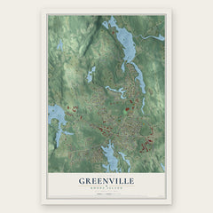


More maps nearby: Lincoln, North Providence, Johnston, North Smithfield and Ashton.
The art of mapping a place
How This Map Was Made
Real places. Remarkable detail. Discover the layers that turn geographic data into a map of home.

The view from above
Aerial imagery reveals the character of the land: woodland, open fields, and the patterns of a place.

The shape of the land
Elevation data brings hills, valleys, and subtle changes in the landscape into view.

The details of home
Roads, waterways, and building footprints come together to make the map feel unmistakably local.

Geography becomes art
Considered color, shading, and typography bring the layers together in a map made for your wall.


Process illustrated with Mendon, Massachusetts. Aerial imagery: USDA NAIP. Terrain: USGS 3D Elevation Program. Map details and finished artwork: KNOWOL.
The Details
About This Print
Choose an archival matte print, or a black or white Ayous wood frame. The archival matte print is unframed.
Select your size and finish above to see the matching product image and price.
Materials & Craftsmanship
A contemporary map with the character of a classic atlas, printed on archival matte paper. Optional frames are made from Ayous wood.
Your printed map does not include the watermark shown in the full-map preview.
Shipping & Delivery
Free shipping within the United States. Every print is made to order in the USA.
Buying a gift? Add a note in your cart and we'll include it. We never put prices in the package.
Prints ship within 2 to 3 business days. Allow 7 to 10 days total from ordering for delivery. Timing may vary during holidays or periods of high order volume.
Read our shipping policy.
Returns and damaged prints
Each print is made to order. Change-of-mind refunds are not available after production.
If your print arrives damaged, misprinted or incorrect, contact support@knowol.com within 30 days of receiving it. Include your order number, photos and a description of the issue.
Read our full refund and replacement policy. For questions about your order, email support@knowol.com.