
Search for another town





Free U.S. delivery 7 to 10 days after you order
Springfield, Virginia Map Art
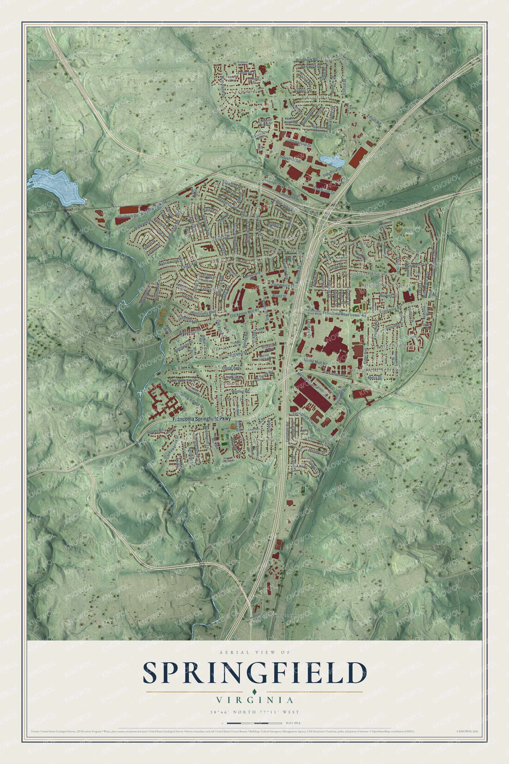
A new map of Springfield, Virginia, made in 2026 and printed to order on thick archival matte paper.
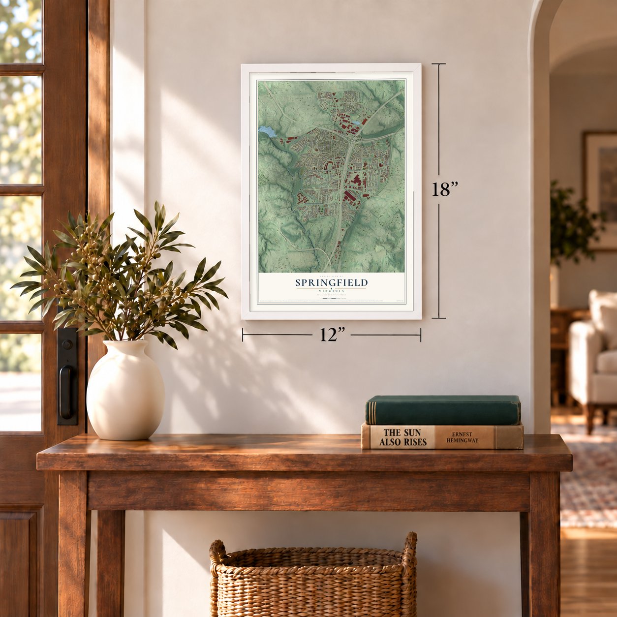
12" x 18" Archival Matte Print
A Map of Home. A Work of Art.
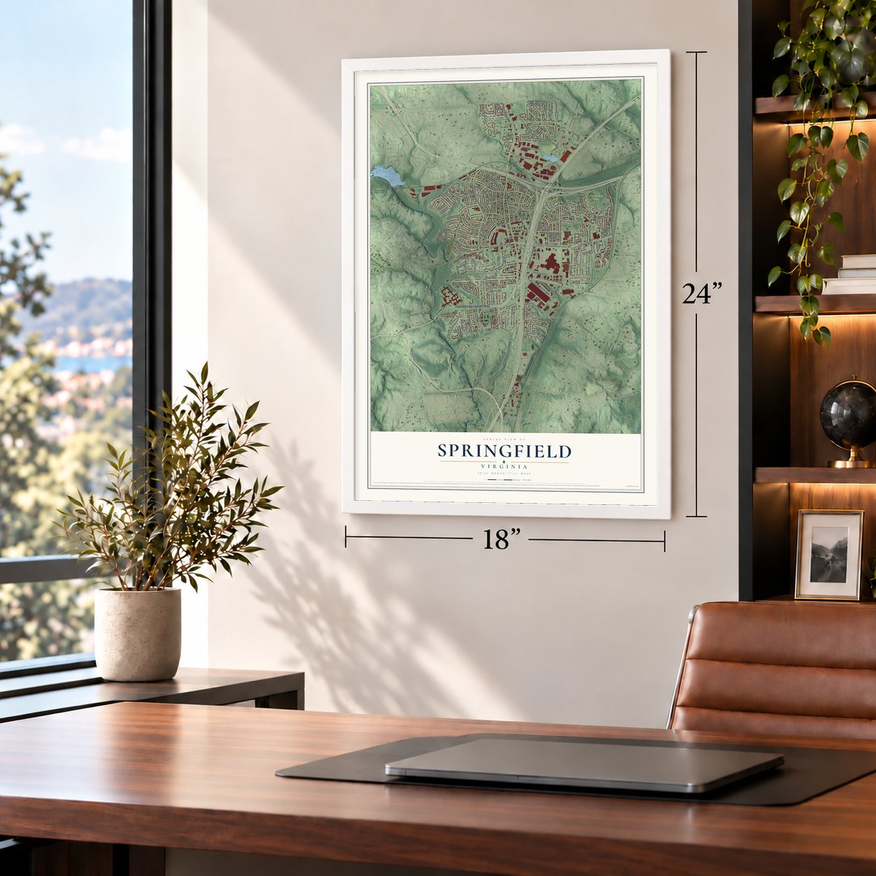
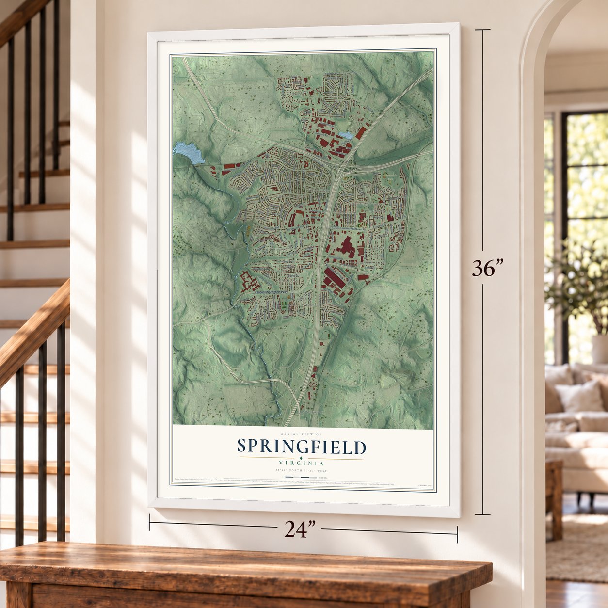
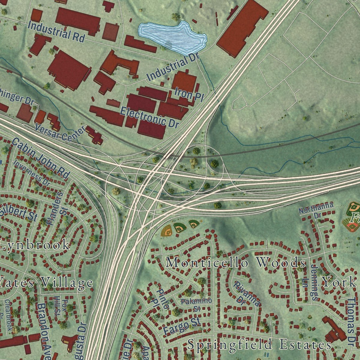
Explore Springfield, Virginia from a whole new perspective. Created using aerial imagery and detailed geographic data, this map captures Springfield building by building, with labeled streets, familiar landmarks, and shaded topographical relief that highlights the natural contours of the landscape.
Combining modern data with the timeless character of a vintage atlas, this map is just as interesting up close as it is beautiful on the wall. Whether you grew up in Springfield, spent memorable years there, or call it home today, this unique map is a great way to celebrate a place that means something to you. Zoom in on the preview to look for your street, and then order a print to put your memories on the wall.
Three ways to hang it
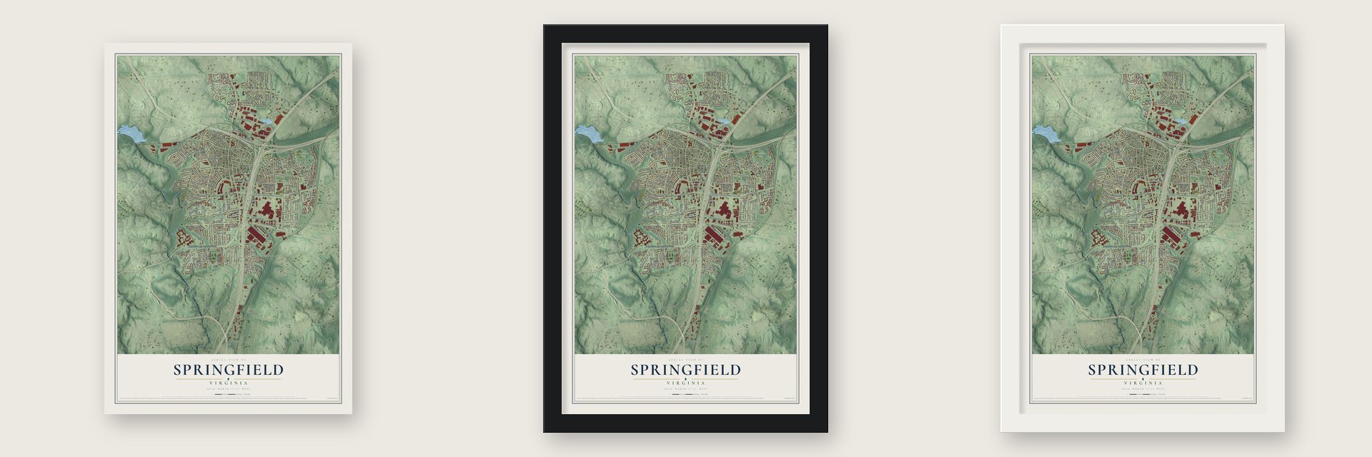
Unframed archival matte, a black wood frame or a white wood frame.
Up close
Geography Worth Displaying
This map was created using accurate cartographic data and authoritative geographic sources, including the U.S. Geological Survey and the Census Bureau. The map brings together terrain, waterways, roads, and building detail. The majority of the streets are labeled, houses are accurately depicted, and the topography is derived from government sources. Combining local data with carefully composed color and shading leads to this beautifully detailed Springfield artwork for your wall.
Rather than simply showing street outlines, we’ve included as many of the street names as we could reasonably fit on the map while keeping their names legible. Zoom in on the high resolution preview to see exactly what’s on the map. We truly set out to create a statement piece for anyone who loves Springfield. So whether it’s for you, or a gift for someone you love, we hope this map of Springfield brings back fond memories.
Read the story behind this map of Springfield, Virginia from 2026.

About Springfield, Virginia
Springfield is a community of 31,339 people in Fairfax County, part of Northern Virginia. It began in 1847 at Daingerfield Station, a stop on the Orange and Alexandria Railroad. The name came from Springfield Farm, the property of Henry Daingerfield, an Alexandria businessman who also served on the railroad's board. From 1866 to 1868 the station also housed a post office, the earliest one to use the Springfield name.
The place stayed a rural crossroads until 1946, when developer Edward Carr began dividing the land into suburban lots beside the new Henry Shirley Highway. Carr judged it the last tract within 12 miles of Washington, D.C., that was easy to reach, and the new neighborhoods filled fast. About 1,000 people lived here in 1950, more than 10,000 by 1960, and over 25,000 by 1970 as North and West Springfield were built.
- Keene's millJames Keene built a saw and grist mill near today's Springfield sometime between 1796 and 1800, and Old Keene Mill Road still carries his name. Area farms relied on it for about sixty years. It shut down after William H. Keene went to prison for killing Lewis Quincy Hall in 1855. Only two mill races are left.
- Moor, Garfield, Corbett, SpringfieldIn 1877 Richard Moore opened a post office he called Moor, a little more than a mile south of the station near Fairfax and Backlick roads. It was renamed Garfield in 1881 for President James A. Garfield, who was assassinated that year. In 1907 Garfield closed, and a station named Corbett, for the landowner, opened back at the depot. Springfield returned for good on June 27, 1910, and Garfield Elementary School keeps the old name.
- Civil War at the stationSoldiers fought a skirmish here on October 3, 1861, and Confederate raiders struck the place on August 3, 1863.
- The mall and the Mixing BowlSpringfield Mall opened between 1973 and 1975 as Northern Virginia's second regional shopping center, after Tysons Corner, and reopened in 2014 as Springfield Town Center. Nearby, the state rebuilt the Springfield Interchange of I-95, I-395 and I-495 from 1999 to 2007 for $676 million. Governor Timothy M. Kaine dedicated it on July 18, 2007.
Find your street
Names on the Springfield map
Every name below is printed on this map. Look for your street, your school, the park where you played, or the pond down the road.
Places and landmarks19
- Franconia Park
- Beverly Forest
- Edsall Park
- Fair Vernon
- Indian Springs
- Leewood
- Loisdale Estates
- Lynbrook
- Monticello Forest
- Monticello Woods
- Newington
- Springfield Estates
Show all 19 places
- Springfield Forest
- Springfield Square
- Springfield Station
- Springvale
- Villa Del-Ray
- Yates Village
- York manor
Streets and roads180
- Franconia Springfield Parkway
- Hooes Road
- Metropolitan Center Drive
- Brandon Avenue
- Loisdale Road
- Backlick Road
- Highland Street
- Franconia Road
- Essex Avenue
- Frontier Drive
- Floyd Avenue
- Commerce Street
- Amherst Avenue
- Edsall Road
- Braddock Road
- Hanover Avenue
- Ridgeway Drive
- Old Keene Mill Road
- Industrial Drive
- Bowie Drive
- Oriole Avenue
- Calamo Street
- Atteentee Road
- Cabin John Road
- Deer Ridge Trail
- Thomas Drive
- Woodland Drive
- Springfield Center Drive
- Montgomery Street
- Meriwether Lane
Show all 180 streets
- Augusta Drive
- Hibbling Avenue
- Layton Drive
- Industrial Road
- Clifton Street
- Bath Street
- South Dinwiddie Street
- Commercial Drive
- Elder Avenue
- Spring Village Drive
- Ruskin Street
- Monticello Boulevard
- Westmore Drive
- Spring Road
- Craig Street
- Brunswick Street
- Electronic Drive
- Spring Mall Road
- Grace Street
- Bostwick Drive
- Julian Street
- Forsythia Street
- Pioneer Drive
- Dana Avenue
- Willowfield Way
- Evanston Road
- Lamar Drive
- Bland Street
- Zekan Lane
- Lackawanna Drive
- Reservoir Road
- Accotink Park Road
- Jerome Street
- Mendota Place
- Neuman Street
- Franconia Road Lower Road
- Bonniemill Lane
- Amelia Street
- Sterling Grove Drive
- Accomac Street
- Gary Street
- Monroe Drive
- Darby Lane
- Spring Summit Road
- Alamo Street
- Anders Terrace
- Abilene Street
- Villa Park Road
- Southern Drive
- Wesley Road
- Dalton Road
- Blacksburg Road
- Melia Street
- Lee Valley Drive
- Hastings Street
- Loisdale Court
- June Street
- Nancemond Street
- Kerr Drive
- Iron Place
- Terry Drive
- Ash Drive
- Fargo Street
- Belinger Court
- Gilpin Drive
- Giles Place
- Burwell Street
- Leebrad Street
- Loretto Street
- Gilbert Street
- Halifax Place
- Joseph Alexander Road
- Gormel Drive
- Greenleaf Street
- Ben Franklin Road
- Hackberry Street
- Exmore Street
- Charlotte Street
- Hopewell Avenue
- Flanders Street
- Versar Center
- Dublin Avenue
- Beverly Park Drive
- Falmouth Street
- Spring Garden Drive
- Grayson Street
- Rivanna Drive
- Middlesex Avenue
- Bethnal Court
- Jennings Lane
- Apache Street
- Front Royal Road
- Seatrend Way
- Rock Island Road
- Havelock Street
- Cumberland Avenue
- Laurel Creek Court
- Lois Drive
- Creek Crest Way
- Robin Road
- Hechinger Drive
- Flora Street
- Wren Drive
- Japonica Street
- Leestone Street
- Leesville Boulevard
- Kedron Street
- Leewood Forest Drive
- Brookfield Plaza
- Steel Mill Drive
- Byron Avenue
- Pinto Place
- Roso Street
- Dunn Court
- Dickenson Street
- Manchester Woods
- Cloud Drive
- Lavender Lane
- Lyles Road
- Healy Drive
- Inverness Drive
- Danville Street
- Inwood Drive
- Kyle's Landing
- Erving Street
- Palamino Street
- Franconia Road West
- Northanna Drive
- Franconia Court
- Doncaster Street
- Utica Street
- Carolina Place
- Fox Hill Street
- Alma Lane
- Newington Road
- Constantine Avenue
- Larrlyn Drive
- Tanager Street
- Simmer Circle
- Braddock Mews Place
- Beverly Lane
- Constance Drive
- Granberry Way
- McWeadon Lane
- Hampton Manor Place
- Clearbrook Drive
- Ellwood Place
- Twin Court
- Mayo Court
- Cory Place
Names are listed as they appear on the printed map. Zoom into the product photos to find them.
The art of mapping a place
How This Map Was Made
Real places. Remarkable detail. Discover the layers that turn geographic data into a map of home.

The view from above
Aerial imagery reveals the character of the land: woodland, open fields, and the patterns of a place.

The shape of the land
Elevation data brings hills, valleys, and subtle changes in the landscape into view.

The details of home
Roads, waterways, and building footprints come together to make the map feel unmistakably local.

Geography becomes art
Considered color, shading, and typography bring the layers together in a map made for your wall.


Process illustrated with Mendon, Massachusetts. Aerial imagery: USDA NAIP. Terrain: USGS 3D Elevation Program. Map details and finished artwork: KNOWOL.
The Details
About This Print
Choose an archival matte print, or a black or white Ayous wood frame. The archival matte print is unframed.
Select your size and finish above to see the matching product image and price.
Materials & Craftsmanship
A contemporary map with the character of a classic atlas, printed on archival matte paper. Optional frames are made from Ayous wood.
Your printed map does not include the watermark shown in the full-map preview.
Shipping & Delivery
Free shipping within the United States. Every print is made to order in the USA.
Buying a gift? Add a note in your cart and we'll include it. We never put prices in the package.
Prints ship within 2 to 3 business days. Allow 7 to 10 days total from ordering for delivery. Timing may vary during holidays or periods of high order volume.
Read our shipping policy.
Returns and damaged prints
Each print is made to order. Change-of-mind refunds are not available after production.
If your print arrives damaged, misprinted or incorrect, contact support@knowol.com within 30 days of receiving it. Include your order number, photos and a description of the issue.
Read our full refund and replacement policy. For questions about your order, email support@knowol.com.
Find your town
Looking for another city?
Find a map of home in our Virginia collection, or any town in the country.
Nearby
Maps of towns near Springfield
Know someone from one of these towns? Their map makes a great gift.
 Franconia
, Virginia
From $39.99See the map
 North Springfield
, Virginia
From $39.99See the map
 West Springfield
, Virginia
From $39.99See the map
More maps nearby: Kingstowne, Newington, Ravensworth, Hayfield and Lincolnia.