
Search for another town





Free U.S. delivery 7 to 10 days after you order
Franconia, Virginia Map Art
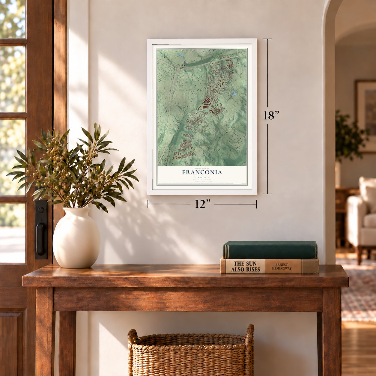
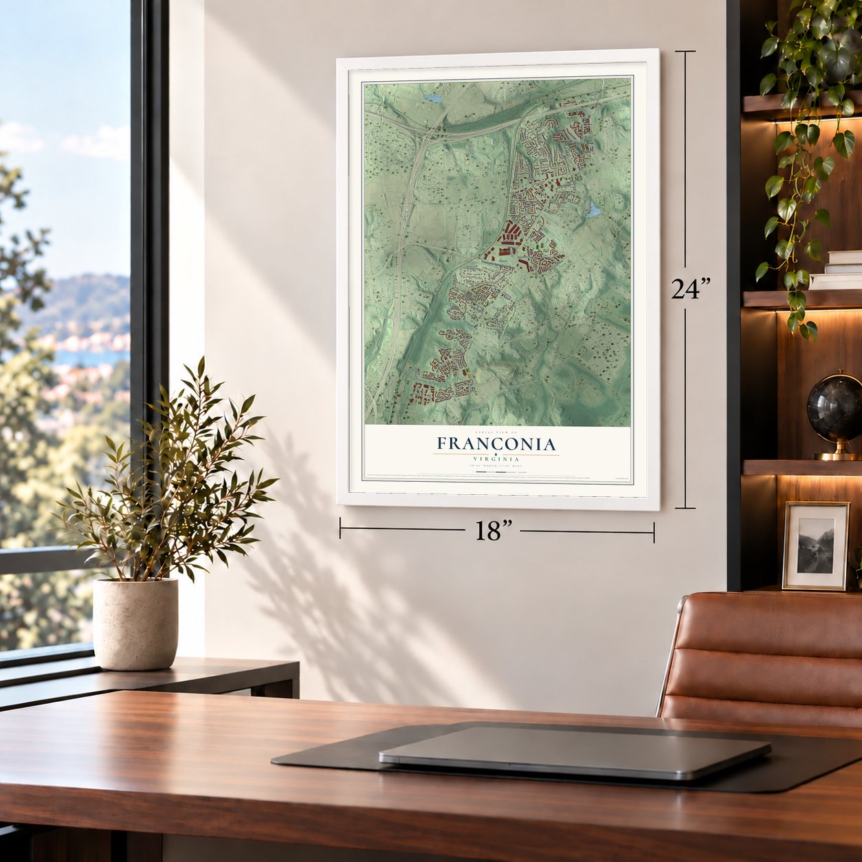
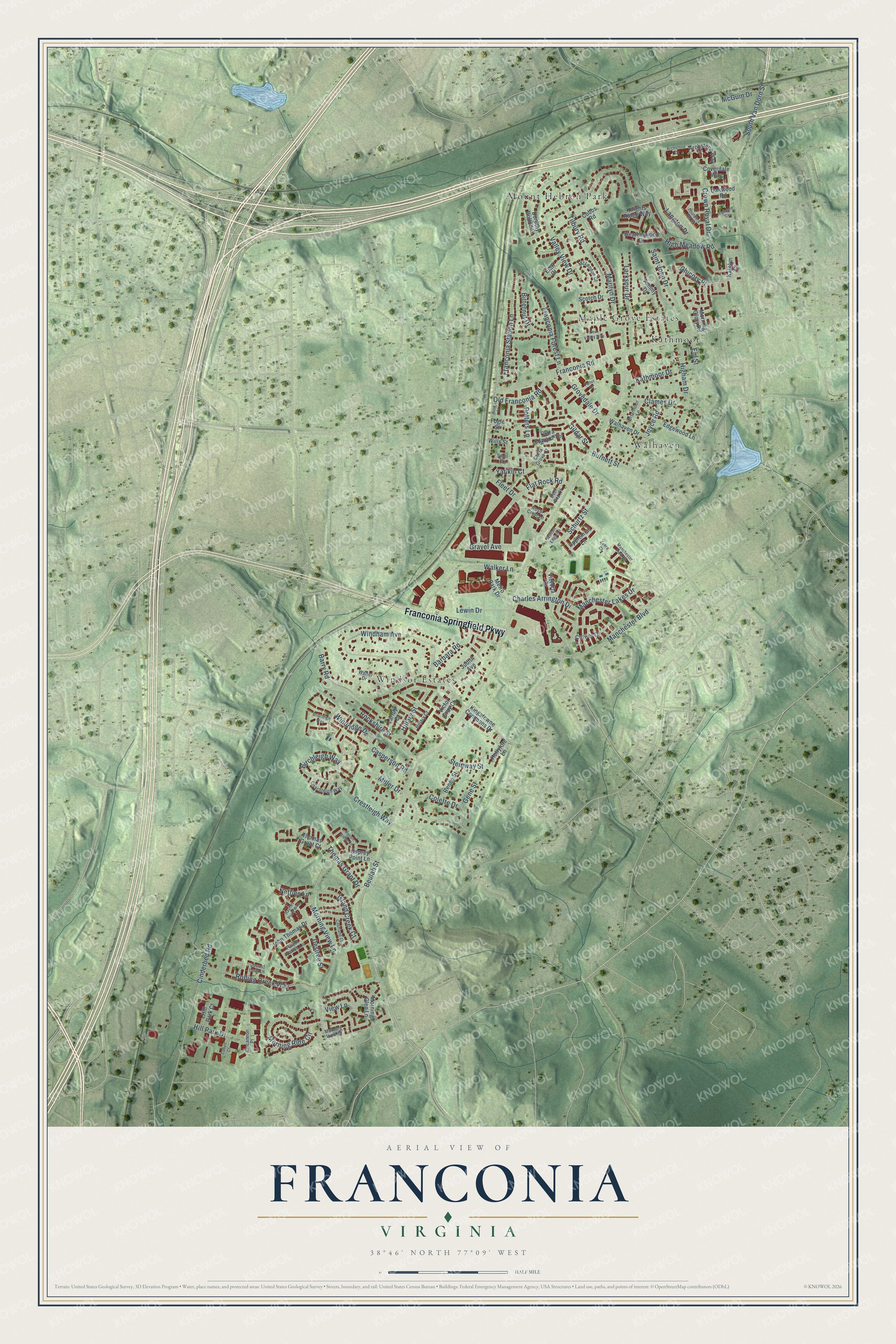
A new map of Franconia, Virginia, made in 2026 and printed to order on thick archival matte paper.
12" x 18" Archival Matte Print
A Map of Home. A Work of Art.
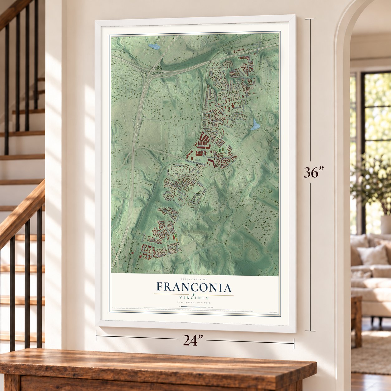
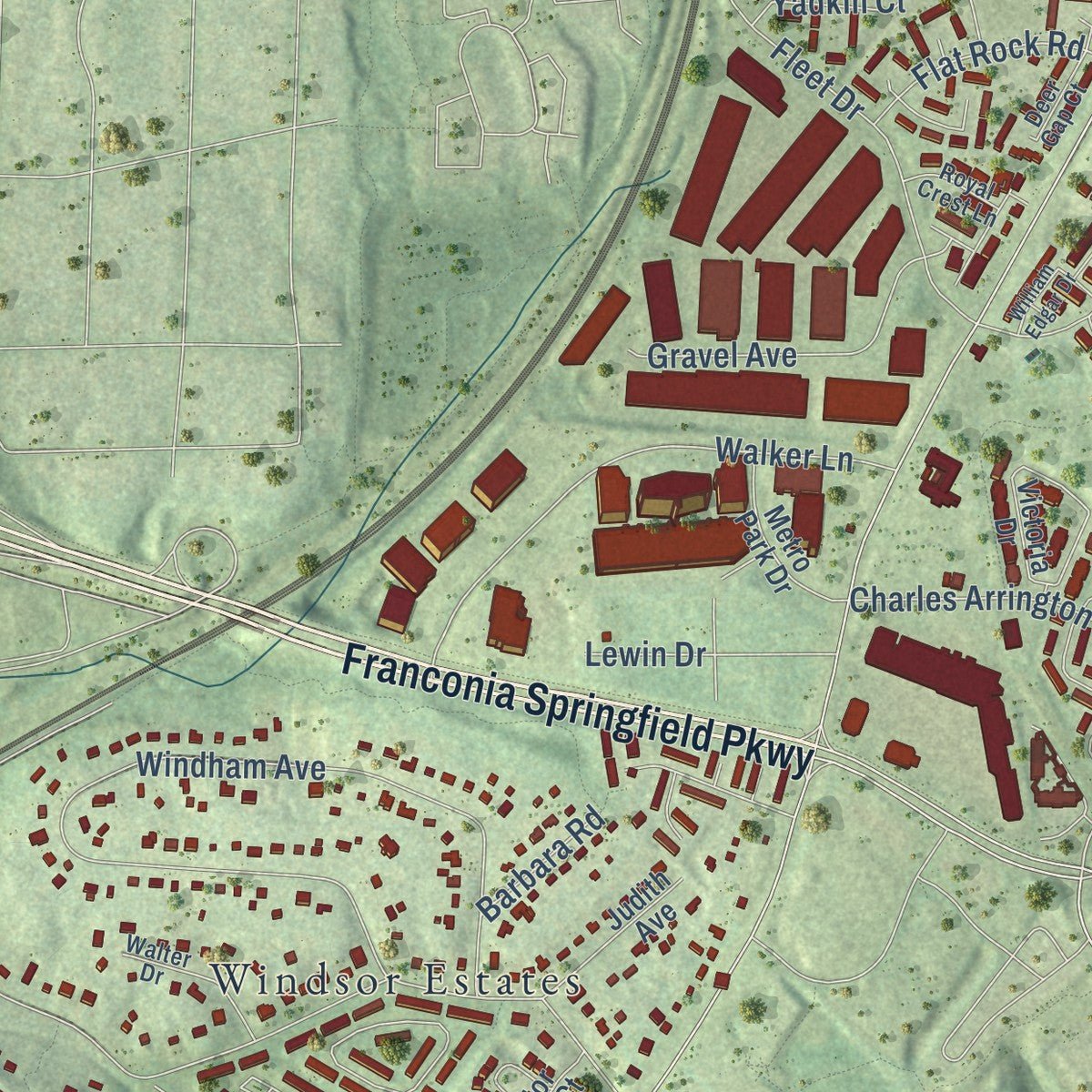
Explore Franconia, Virginia from a whole new perspective. Created using aerial imagery and detailed geographic data, this map captures Franconia building by building, with labeled streets, familiar landmarks, and shaded topographical relief that highlights the natural contours of the landscape.
Combining modern data with the timeless character of a vintage atlas, this map is just as interesting up close as it is beautiful on the wall. Whether you grew up in Franconia, spent memorable years there, or call it home today, this unique map is a great way to celebrate a place that means something to you. Zoom in on the preview to look for your street, and then order a print to put your memories on the wall.
Three ways to hang it
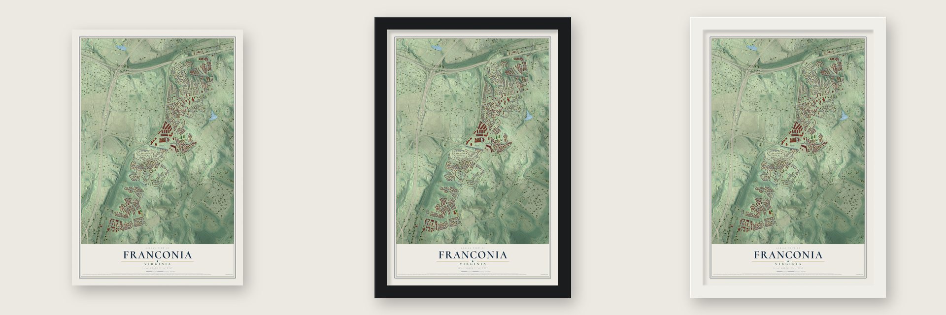
Unframed archival matte, a black wood frame or a white wood frame.
Up close
Geography Worth Displaying
This map was created using accurate cartographic data and authoritative geographic sources, including the U.S. Geological Survey and the Census Bureau. The map brings together terrain, waterways, roads, and building detail. The majority of the streets are labeled, houses are accurately depicted, and the topography is derived from government sources. Combining local data with carefully composed color and shading leads to this beautifully detailed Franconia artwork for your wall.
Rather than simply showing street outlines, we’ve included as many of the street names as we could reasonably fit on the map while keeping their names legible. Zoom in on the high resolution preview to see exactly what’s on the map. We truly set out to create a statement piece for anyone who loves Franconia. So whether it’s for you, or a gift for someone you love, we hope this map of Franconia brings back fond memories.
Read the story behind this map of Franconia, Virginia from 2026.

About Franconia, Virginia
Franconia is a community of 18,943 people in Fairfax County, just southwest of Alexandria. In 1859 William Fowle, an Alexandria merchant, bought a 191-acre tract from Joseph Broders of Oak Grove Farm, and part of that land became Frankhonia Farm. In 1871 his son, Robert Rollins Fowle, sold 18 acres to a railway company for a station, and the station was named for the farm.
The station also housed the Garfield Post Office from 1881 until 1890, then again from 1898 until 1907. After a fire in 1903, the station was rebuilt on the north side of Franconia Road, away from its first spot close to Fleet Drive. Trains stopped there until around 1953. By then the farms around it had begun to give way to the suburb of today, which grew mostly in the 1950s.
- The skirmish at Potter's HillIn January 1862, Confederate Colonel Wade Hampton III led his cavalry across the Occoquan River and past Pohick Church. Near Franconia he met Union cavalry and chased them. A Texas scout warned him that he was riding into an ambush, so he halted and lined up his men on Potter's Hill. Both sides then opened fire, and several men were hurt. One of Hampton's troopers was shot in the face, and the Confederates pulled back across the Occoquan.
- From schoolhouses to a bridgePotter's Hill later held three schoolhouses in turn, and the last one burned in 1932. A chicken farm followed, and then a gravel quarry. Gravel from that quarry helped build the first Woodrow Wilson Bridge. The Hilltop Village Center stands on the hill today.
- Wards Corner burned in 1959Long before the suburbs, tobacco hogsheads were rolled down Franconia Road to the port at Alexandria. For years the heart of the community was Wards Corner, where Franconia Road meets Old Rolling Road. Over a quarter century it added a gas station, a grocery, a bar, a movie theater and a dance hall. A fire in 1959 wiped out all of it.
- Laurel Grove's school and churchFormer slaves organized the Laurel Grove congregation in the 1880s. Its church cemetery and its schoolhouse still stand. In 2008 the Fairfax County History Commission put up a marker honoring the Laurel Grove Colored School.
- Firefighters since 1934The Franconia Volunteer Fire Department formed in 1934 and finished its first firehouse in 1937. The firehouse stood where the Franconia Governmental Center is now. Today the department works from two stations nearby. The center is also home to the Franconia Museum, and the county marker for the old station has stood out front since 2000.
Find your street
Names on the Franconia map
Every name below is printed on this map. Look for your street, your school, the park where you played, or the pond down the road.
Places and landmarks5
- Kathmoor
- Maple Grove Estates
- Mount Hebron Park
- Walhaven
- Windsor Estates
Streets and roads119
- Franconia Springfield Parkway
- Manchester Boulevard
- Manchester Lakes Drive
- Birchleigh Way
- Windridge Drive
- Morning View Lane
- Beulah Street
- Valley View Drive
- Franconia Road
- South Van Dorn Street
- Windham Avenue
- Fleet Drive
- Tilbury Road
- Crestleigh Way
- Barry Road
- Miller Drive
- Cinderbed Road
- Walker Lane
- Morning Ride Circle
- Marilyn Drive
- Clames Drive
- Schurtz Street
- Crown Royal Drive
- Larkspur Drive
- Rolling Creek Way
- Higham Drive
- Saint John Drive
- Gildar Street
- Franconia Station Lane
- Gene Street
Show all 119 streets
- Franconia Forest Lane
- Rockshire Street
- McGuin Drive
- High Meadow Road
- Gravel Avenue
- Joyce Road
- Kathmoor Drive
- Island Creek Court
- Charles Arrington Drive
- View Lane
- Hillary Street
- Grovedale Drive
- Langton Drive
- Old Franconia Road
- Hill Park Drive
- Netties Lane
- Bitternut Drive
- Flat Rock Road
- Thomas Grant Drive
- Lewin Drive
- Desiree Street
- Colette Drive
- Steinway Street
- Yadkin Court
- Casperson Road
- Burnett Street
- Potters Lane
- Chicory Place
- Barbara Road
- Em Street
- Kingstowne Commons Drive
- Archstone Way
- Cobbs Road
- John Thomas Drive
- Tammy Drive
- Victoria Drive
- Coverdale Way
- Edgewood Lane
- Morning Glen Lane
- Osprey Point Lane
- Thomas Grant Court
- Heatherwood Drive
- Metro Park Drive
- Walhaven Drive
- Curtier Drive
- Renee Street
- Victor Gray Court
- Judith Avenue
- Knights Ridge Way
- Clara Edward Terrace
- Wills Street
- Scotch Drive
- Dorothy Bolton Court
- Applemint Lane
- Oakwood Road
- Hollyford Lane
- Larrup Court
- Hill Park Court
- Morning Glory Road
- Katelyn Court
- Elati Court
- Fogle Street
- China Grove Court
- Patent Parish Lane
- Hillary Court
- McLendon Court
- Walter Drive
- Coachleigh Way
- Briarmoor Lane
- Locust Leaf Lane
- Kincannon Place
- Deer Gap Court
- Royal Crest Lane
- Morning View Court
- Sibel Place
- Manchester Park Circle
- Highdale Circle
- Founders Hill Drive
- Haynes Point Way
- Archstone Court
- Parish Glebe Lane
- William Edgar Drive
- Cashland Court
- New Valley Way
- Fuller Court
- Conell Court
- Briarleigh Way
- Nice Place
- Zohra Court
Names are listed as they appear on the printed map. Zoom into the product photos to find them.
The art of mapping a place
How This Map Was Made
Real places. Remarkable detail. Discover the layers that turn geographic data into a map of home.

The view from above
Aerial imagery reveals the character of the land: woodland, open fields, and the patterns of a place.

The shape of the land
Elevation data brings hills, valleys, and subtle changes in the landscape into view.

The details of home
Roads, waterways, and building footprints come together to make the map feel unmistakably local.

Geography becomes art
Considered color, shading, and typography bring the layers together in a map made for your wall.


Process illustrated with Mendon, Massachusetts. Aerial imagery: USDA NAIP. Terrain: USGS 3D Elevation Program. Map details and finished artwork: KNOWOL.
The Details
About This Print
Choose an archival matte print, or a black or white Ayous wood frame. The archival matte print is unframed.
Select your size and finish above to see the matching product image and price.
Materials & Craftsmanship
A contemporary map with the character of a classic atlas, printed on archival matte paper. Optional frames are made from Ayous wood.
Your printed map does not include the watermark shown in the full-map preview.
Shipping & Delivery
Free shipping within the United States. Every print is made to order in the USA.
Buying a gift? Add a note in your cart and we'll include it. We never put prices in the package.
Prints ship within 2 to 3 business days. Allow 7 to 10 days total from ordering for delivery. Timing may vary during holidays or periods of high order volume.
Read our shipping policy.
Returns and damaged prints
Each print is made to order. Change-of-mind refunds are not available after production.
If your print arrives damaged, misprinted or incorrect, contact support@knowol.com within 30 days of receiving it. Include your order number, photos and a description of the issue.
Read our full refund and replacement policy. For questions about your order, email support@knowol.com.
Find your town
Looking for another city?
Find a map of home in our Virginia collection, or any town in the country.
Nearby
Maps of towns near Franconia
Know someone from one of these towns? Their map makes a great gift.
 Kingstowne
, Virginia
From $39.99See the map
 Springfield
, Virginia
From $39.99See the map
 Hayfield
, Virginia
From $39.99See the map
More maps nearby: Newington, Rose Hill, North Springfield, Lincolnia and Groveton.