
Search for another town





Free U.S. delivery 7 to 10 days after you order
Rose Hill, Virginia Map Art
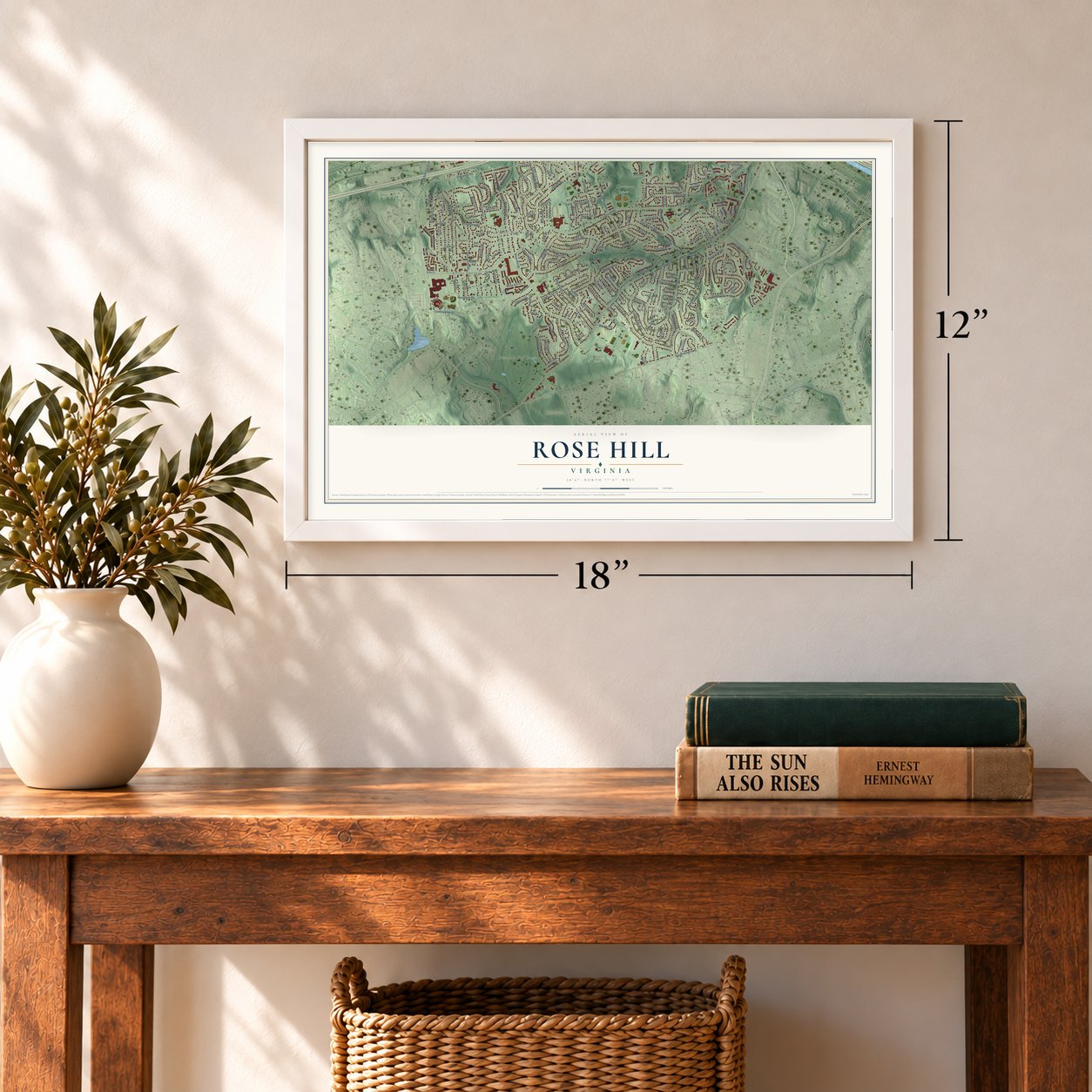
A new map of Rose Hill, Virginia, made in 2026 and printed to order on thick archival matte paper.
12" x 18" Archival Matte Print
A Map of Home. A Work of Art.
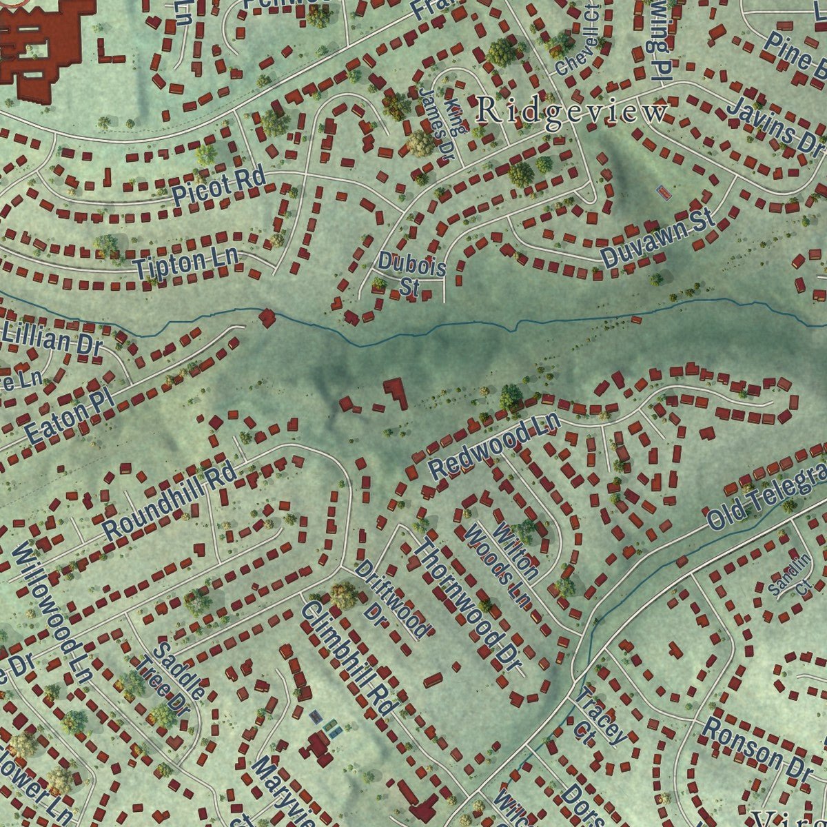
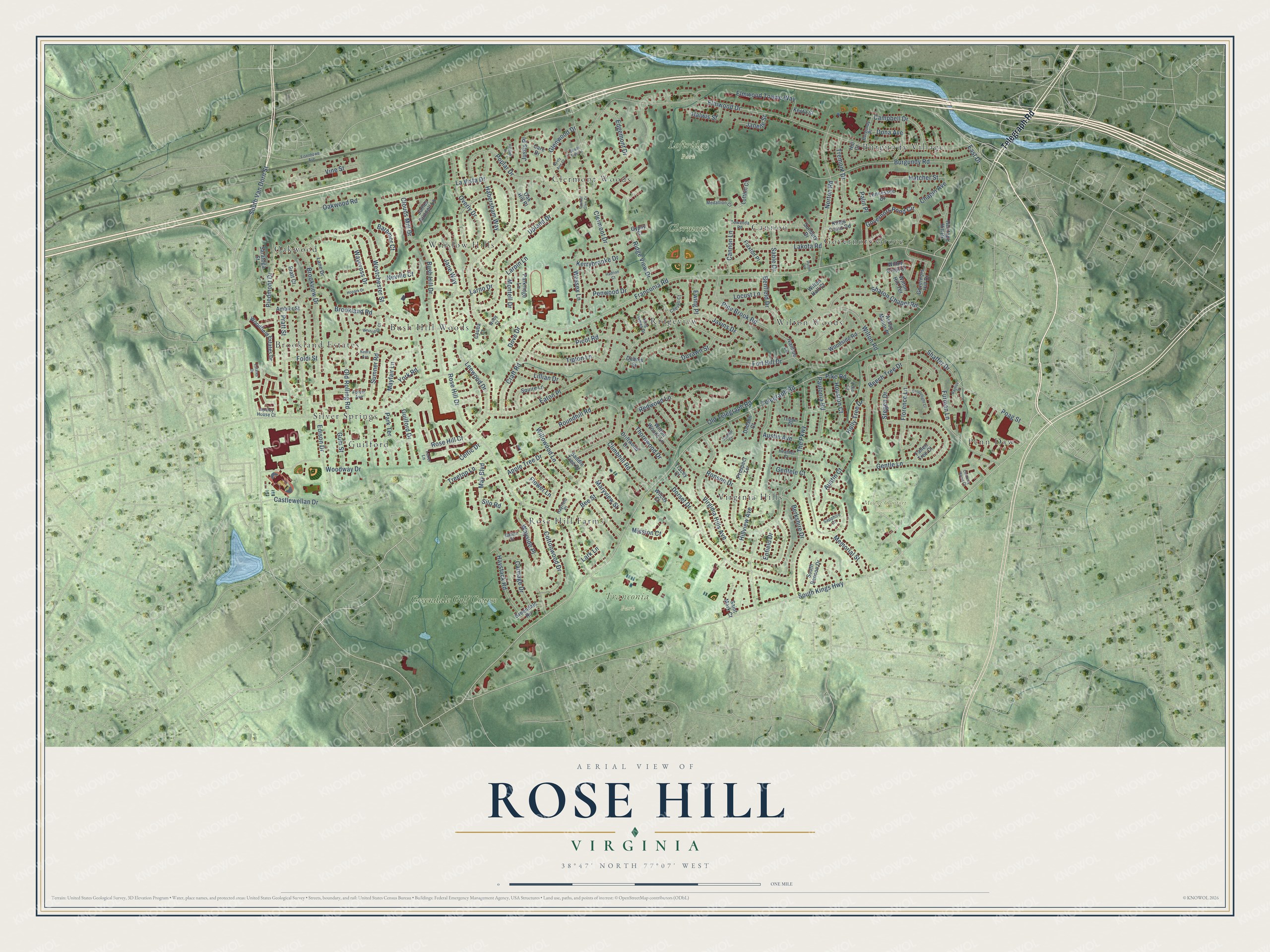
Explore Rose Hill, Virginia from a whole new perspective. Created using aerial imagery and detailed geographic data, this map captures Rose Hill building by building, with labeled streets, familiar landmarks, and shaded topographical relief that highlights the natural contours of the landscape.
Combining modern data with the timeless character of a vintage atlas, this map is just as interesting up close as it is beautiful on the wall. Whether you grew up in Rose Hill, spent memorable years there, or call it home today, this unique map is a great way to celebrate a place that means something to you. Zoom in on the preview to look for your street, and then order a print to put your memories on the wall.
Three ways to hang it
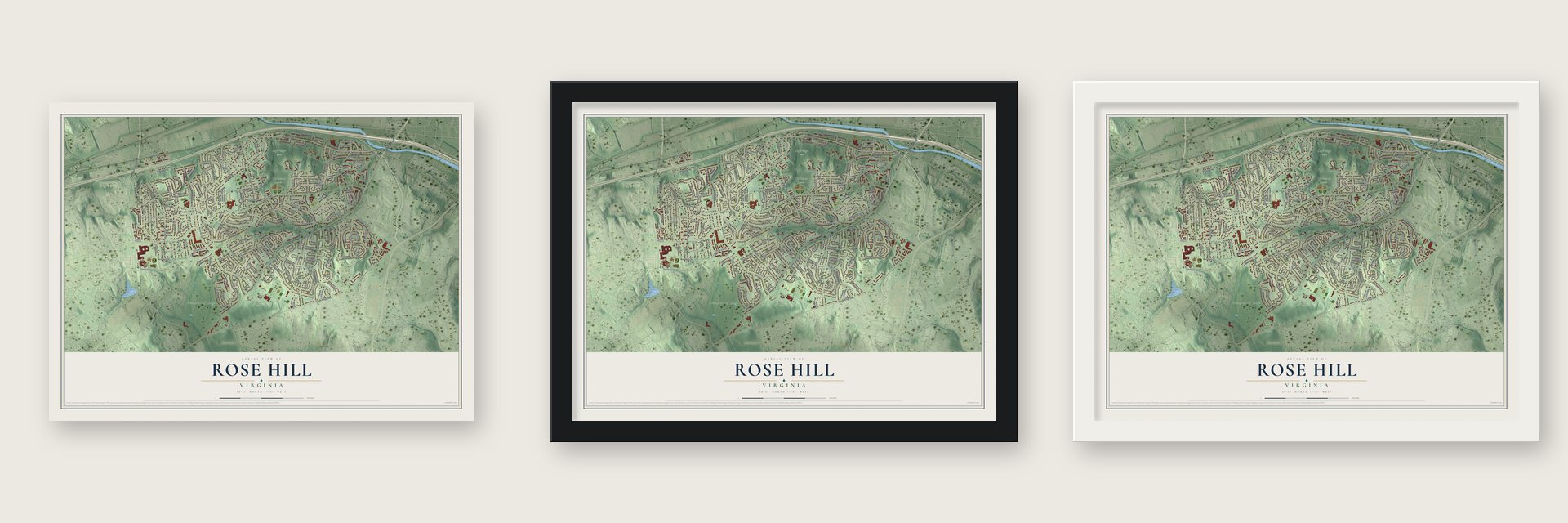
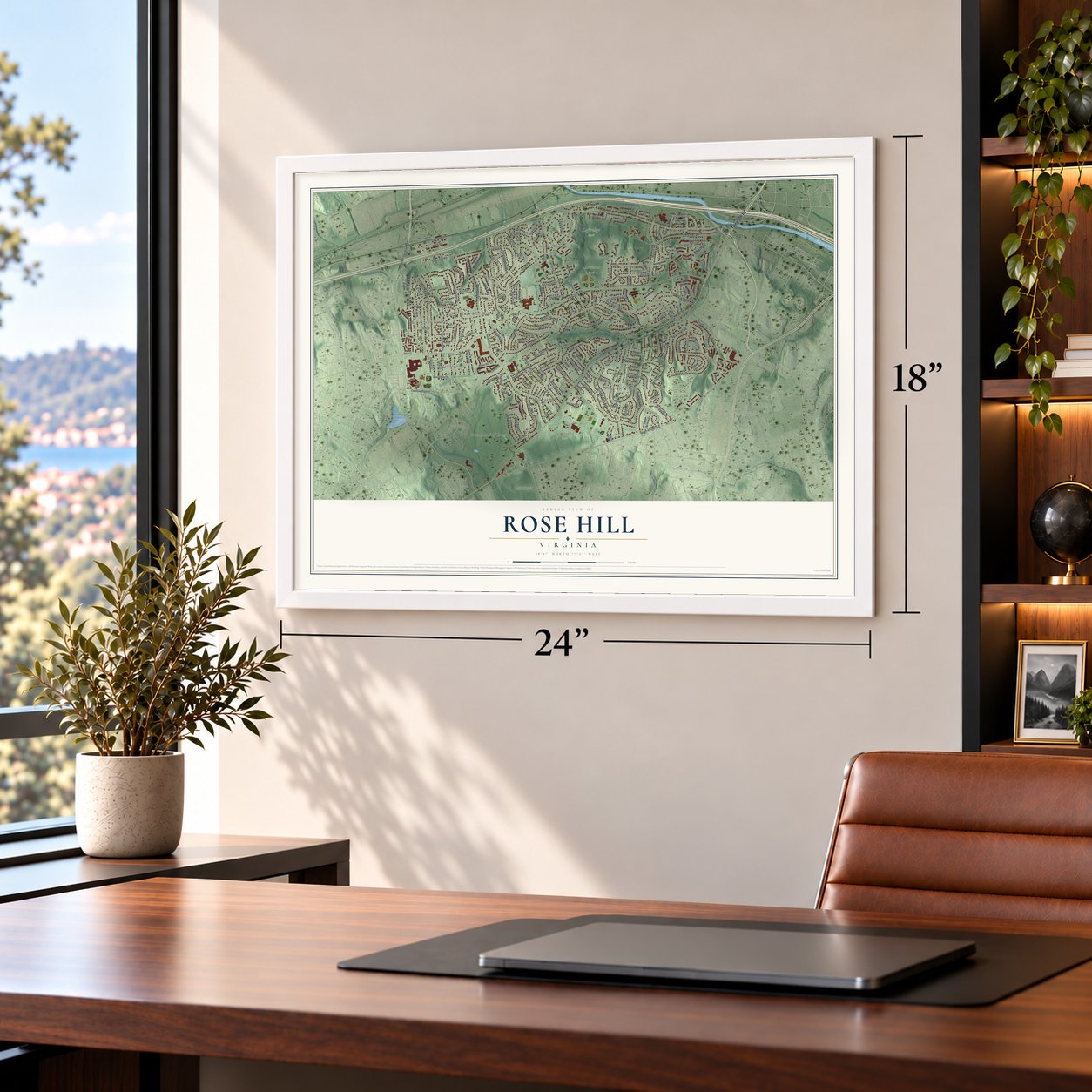
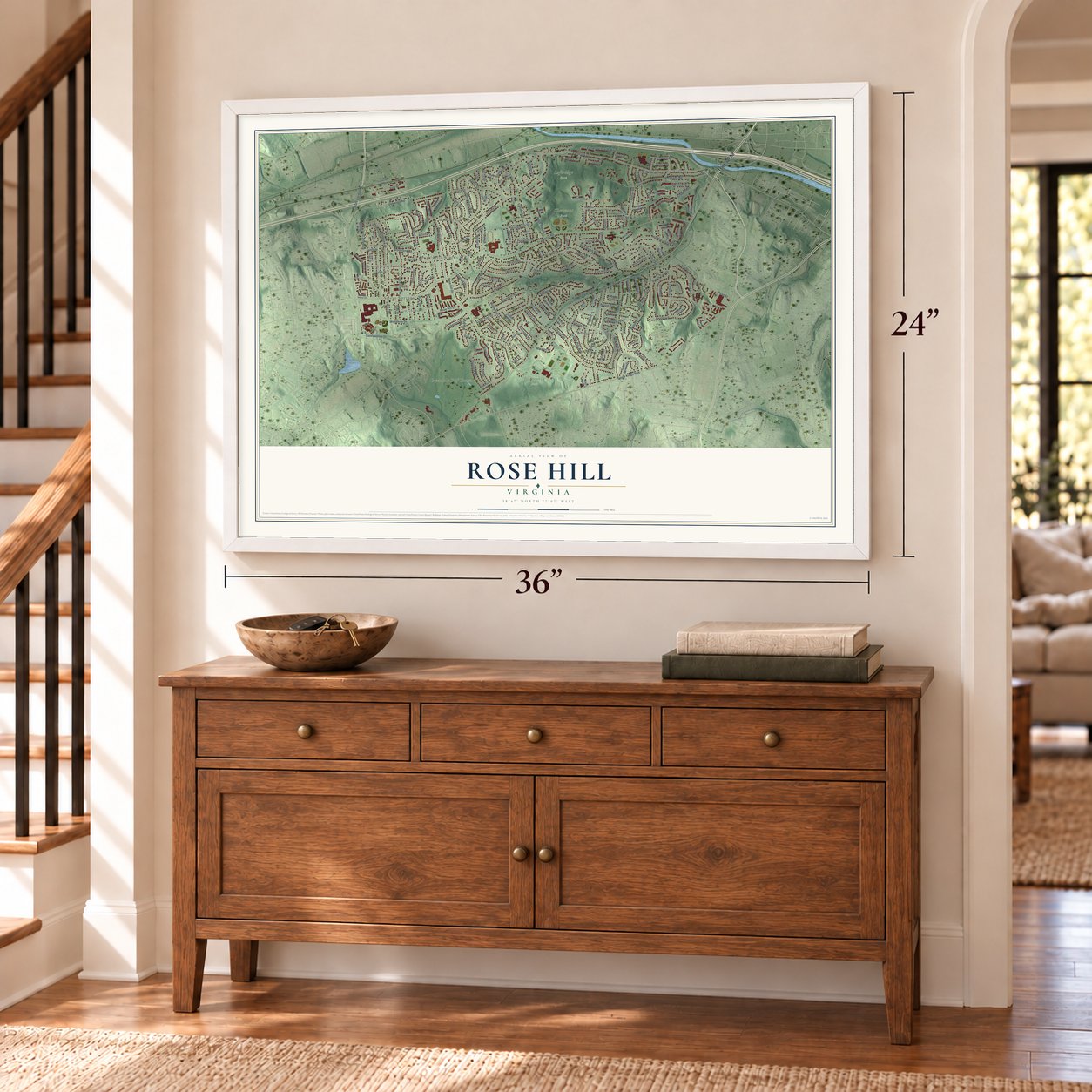
Unframed archival matte, a black wood frame or a white wood frame.
Up close
Geography Worth Displaying
This map was created using accurate cartographic data and authoritative geographic sources, including the U.S. Geological Survey and the Census Bureau. The map brings together terrain, waterways, roads, and building detail. The majority of the streets are labeled, houses are accurately depicted, and the topography is derived from government sources. Combining local data with carefully composed color and shading leads to this beautifully detailed Rose Hill artwork for your wall.
Rather than simply showing street outlines, we’ve included as many of the street names as we could reasonably fit on the map while keeping their names legible. Zoom in on the high resolution preview to see exactly what’s on the map. We truly set out to create a statement piece for anyone who loves Rose Hill. So whether it’s for you, or a gift for someone you love, we hope this map of Rose Hill brings back fond memories.
Read the story behind this map of Rose Hill, Virginia from 2026.

About Rose Hill, Virginia
Rose Hill is a community of 21,045 people in Fairfax County, Virginia. It carries the name of an 18th century plantation called Rose Hill, which Daniel French established on this ground long before any suburban streets were laid out. The modern community took shape on that old plantation land in 1954, and it kept the plantation's name.
- Created in 1954The present community of Rose Hill dates from 1954, when it was created on land that had once belonged to the Rose Hill plantation. The new neighborhood took its name from that 18th century estate.
- Daniel French's plantationDaniel French established the Rose Hill plantation in the 18th century. French was also the builder of Pohick Church, so the man who founded the estate behind the community's name left his mark on Fairfax County in more than one place.
Find your street
Names on the Rose Hill map
Every name below is printed on this map. Look for your street, your school, the park where you played, or the pond down the road.
Places and landmarks20
- Clermont Park
- Franconia Park
- Loftridge Park
- Mount Comfort Cemetery
- Brookland Estates
- Burgundy Village
- Bush Hill Woods
- Cannon
- Clermont Woods
- Governors Grove
- Guilford
- Oakwood
Show all 20 places
- Penn Daw
- Ridgeview
- Rose Hill Farms
- Silver Springs
- Virginia Hills
- Wilton Woods
- Winslow Hills
- Greendale Golf Course
Streets and roads190
- Telegraph Road
- East Drive
- Franconia Road
- South Kings Highway
- South Van Dorn Street
- Elmwood Drive
- La Vista Drive
- Ridge View Drive
- Upland Drive
- Rose Hill Drive
- The Parkway
- Westchester Street
- Virginia Hills Avenue
- Brookland Road
- Clermont Drive
- Burgundy Road
- Old Telegraph Road
- Eaton Place
- Dorset Drive
- Oakwood Road
- Bush Hill Drive
- Javins Drive
- Roundhill Road
- Cottonwood Drive
- Hillview Avenue
- Wilton Road
- Larpin Lane
- Norton Road
- Gentle Lane
- Brookview Drive
Show all 190 streets
- Pratt Street
- Florence Lane
- Willowood Lane
- Apple Tree Drive
- Beech Tree Drive
- Governors Pond Circle
- Poplar Drive
- Jane Way
- Rose Hill Court
- Fort Hill Drive
- Berkshire Drive
- Furman Lane
- Glenwood Drive
- Sharon Chapel Road
- Old Rolling Road
- Habersham Way
- Overly Drive
- Craft Road
- Pine Brook Road
- Vine Street
- Lakota Road
- Picot Road
- Shaffer Drive
- Redwood Lane
- Gentele Court
- Tremont Drive
- Ronson Drive
- Leewood Drive
- Tipton Lane
- Campbell Drive
- Austin Avenue
- Haystack Road
- May Boulevard
- Piedmont Drive
- Mayfair Lane
- Memorial Street
- Elmwood Towne Way
- Duvawn Street
- Carriage Drive
- Sumner Road
- Larno Drive
- Cannon Lane
- Sable Drive
- Climbhill Road
- Castlewellan Drive
- Wayside Place
- Stegen Drive
- Celtic Drive
- Austin Court
- Paulonia Road
- Penwood Drive
- Guilford Drive
- Maryview Street
- Waycross Drive
- Barbmor Court
- Lillian Drive
- Edgemont Drive
- Kerrybrooke Drive
- Gum Street
- Houston Court
- Chapin Avenue
- Hatcher Street
- Clouds Mill Drive
- Flower Lane
- Wessex Lane
- Bee Street
- Thornwood Drive
- Locust Lane
- Woodway Drive
- Neville Court
- Poag Street
- Treetop Lane
- Edison Drive
- Mission Court
- Pike Road
- Halwis Street
- Holly Tree Drive
- Montell Drive
- Park Terrace
- Justis Place
- Janelle Street
- Dona Avenue
- York Road
- Enfield Drive
- Benfield Drive
- Foldi Street
- Ewing Place
- Dove Drive
- Palin Place
- Lark Lane
- Silo Road
- Ivanhoe Lane
- Prospect Terrace
- Woodfield Estates Drive
- Governors Hill Drive
- Squire Lane
- Woodside Road
- Saddle Tree Drive
- Lofthill Court
- Wilton Crest Court
- Wilton Woods Lane
- South Benson Drive
- Tennessee Drive
- Lane Drive
- Sunbury Drive
- Parkridge Lane
- Saint Mark Court
- James Gunnell Lane
- Saratoga Street
- Ashby Manor Place
- Kings Cross Road
- Ambler Street
- Greendale Road
- Heritage Hill Drive
- Wilton Hill Terrace
- Oak Hill Place
- Care Drive
- Driftwood Drive
- Fallen Tree Court
- Flaxton Place
- Dadson Court
- Keota Street
- Wilton Hall Court
- Wilcox Court
- Gypsy Court
- Pratt Court
- Dubois Street
- Cauba Court
- Tracey Court
- Hill Court
- Laker Lane
- Towanda Road
- King James Drive
- Heather Court
- Burgundy Place
- Chevell Court
- Apsley House Court
- Medallion Court
- Basha Court
- Trigger Court
- Sapphire Court
- Hayfield Place
- Forest Avenue
- Wilby Court
- Pike Court
- Hopark Drive
- Candlelight Court
- Chimney Wood Court
- Westridge Court
- Sandlin Court
- Eisenhower Avenue
- Cassel Glen Court
- Hilldale Drive
- Bayliss Place
- Estates Drive
- Nedra Avenue
- Neely Ann Court
- Hadrian Court
- Shade Tree Lane
- Huron Place
Names are listed as they appear on the printed map. Zoom into the product photos to find them.
The art of mapping a place
How This Map Was Made
Real places. Remarkable detail. Discover the layers that turn geographic data into a map of home.

The view from above
Aerial imagery reveals the character of the land: woodland, open fields, and the patterns of a place.

The shape of the land
Elevation data brings hills, valleys, and subtle changes in the landscape into view.

The details of home
Roads, waterways, and building footprints come together to make the map feel unmistakably local.

Geography becomes art
Considered color, shading, and typography bring the layers together in a map made for your wall.


Process illustrated with Mendon, Massachusetts. Aerial imagery: USDA NAIP. Terrain: USGS 3D Elevation Program. Map details and finished artwork: KNOWOL.
The Details
About This Print
Choose an archival matte print, or a black or white Ayous wood frame. The archival matte print is unframed.
Select your size and finish above to see the matching product image and price.
Materials & Craftsmanship
A contemporary map with the character of a classic atlas, printed on archival matte paper. Optional frames are made from Ayous wood.
Your printed map does not include the watermark shown in the full-map preview.
Shipping & Delivery
Free shipping within the United States. Every print is made to order in the USA.
Buying a gift? Add a note in your cart and we'll include it. We never put prices in the package.
Prints ship within 2 to 3 business days. Allow 7 to 10 days total from ordering for delivery. Timing may vary during holidays or periods of high order volume.
Read our shipping policy.
Returns and damaged prints
Each print is made to order. Change-of-mind refunds are not available after production.
If your print arrives damaged, misprinted or incorrect, contact support@knowol.com within 30 days of receiving it. Include your order number, photos and a description of the issue.
Read our full refund and replacement policy. For questions about your order, email support@knowol.com.
Find your town
Looking for another city?
Find a map of home in our Virginia collection, or any town in the country.
Nearby
Maps of towns near Rose Hill
Know someone from one of these towns? Their map makes a great gift.
 Groveton
, Virginia
From $39.99See the map
 Huntington
, Virginia
From $39.99See the map
 Kingstowne
, Virginia
From $39.99See the map
More maps nearby: Hayfield, Alexandria, Hybla Valley, Franconia and Lincolnia.