
Search for another town




Free U.S. delivery 7 to 10 days after you order
Sun City, Arizona Map Art
Building by building, with labeled streets and shaded relief.
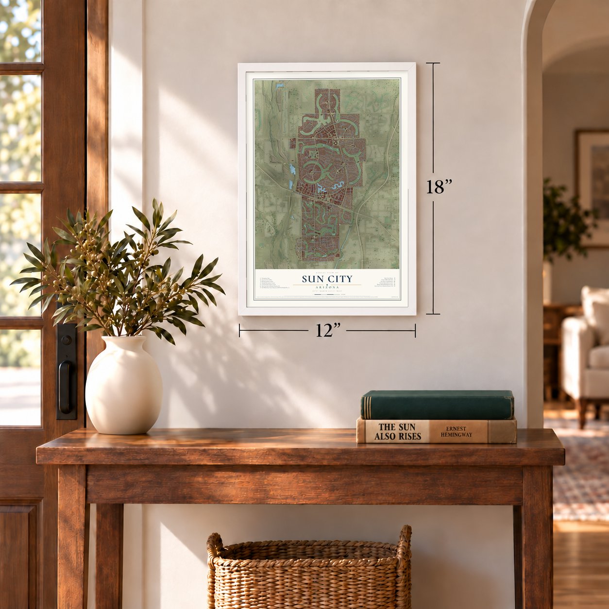
12" x 18" Archival Matte Print
A Map of Home. A Work of Art.
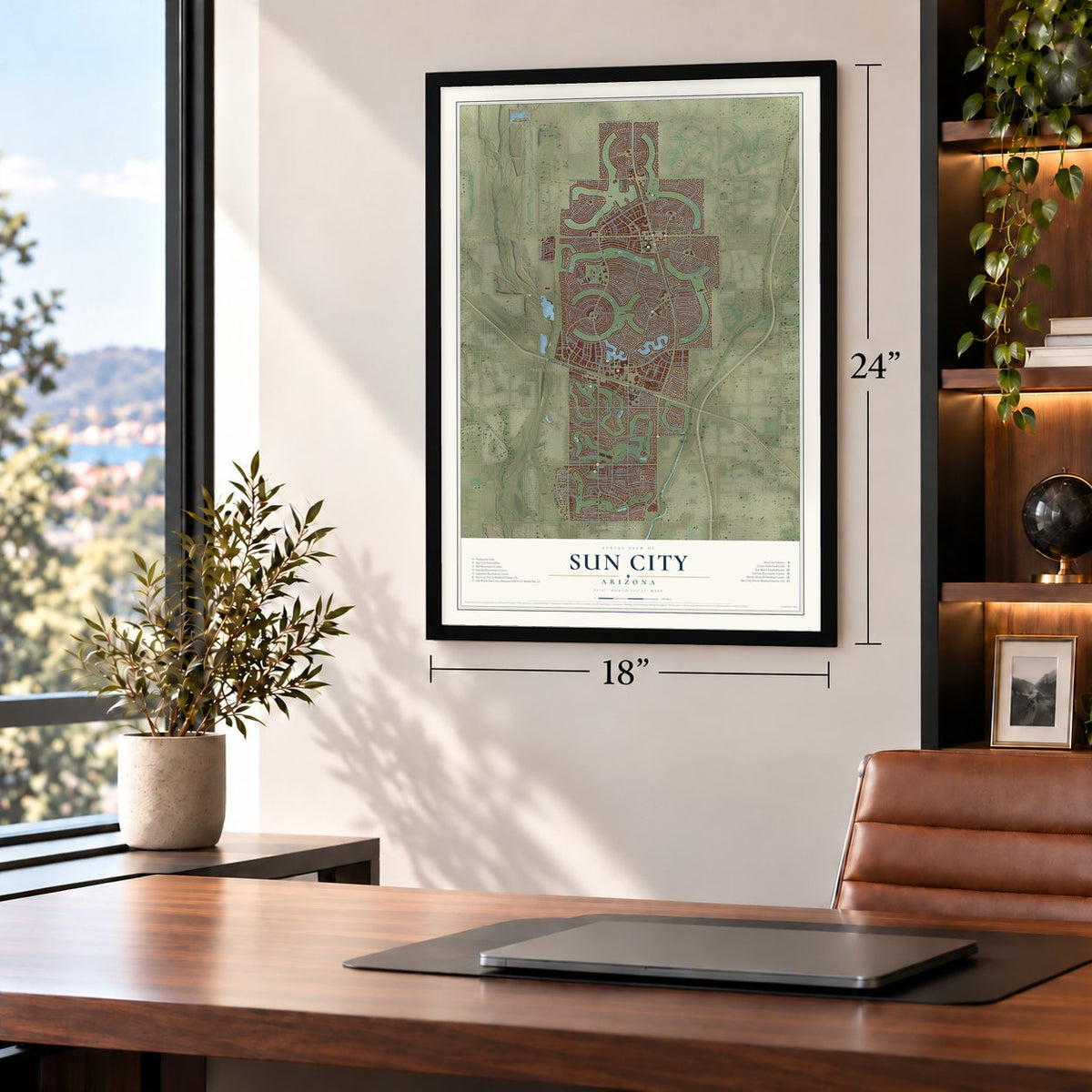
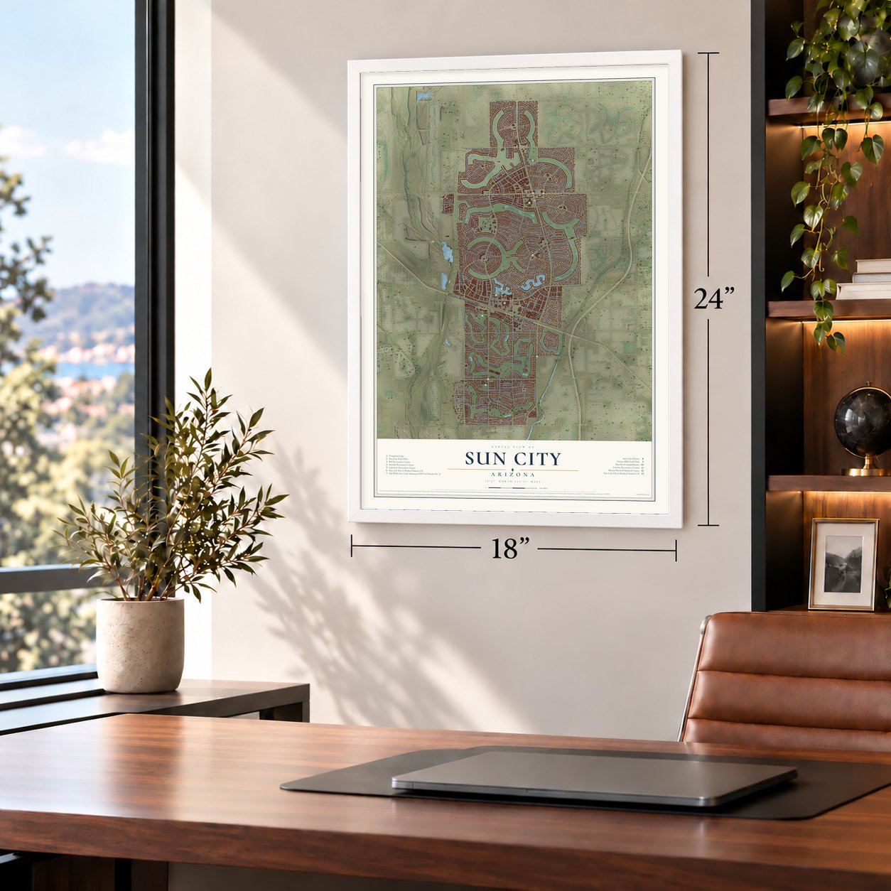
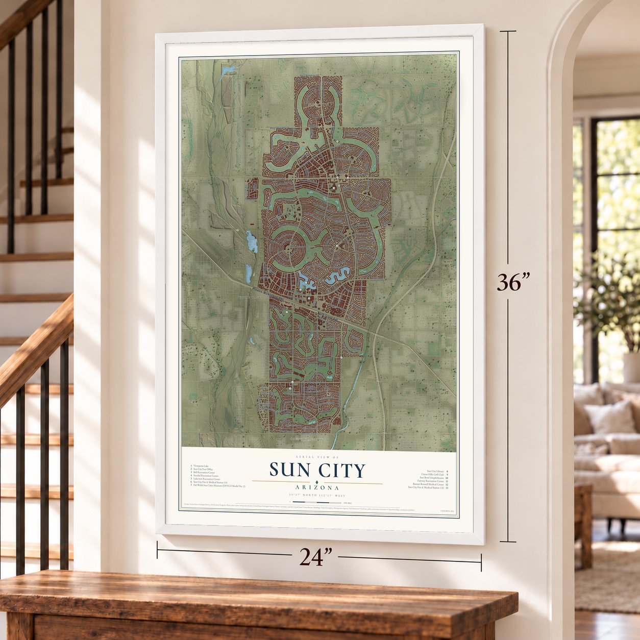
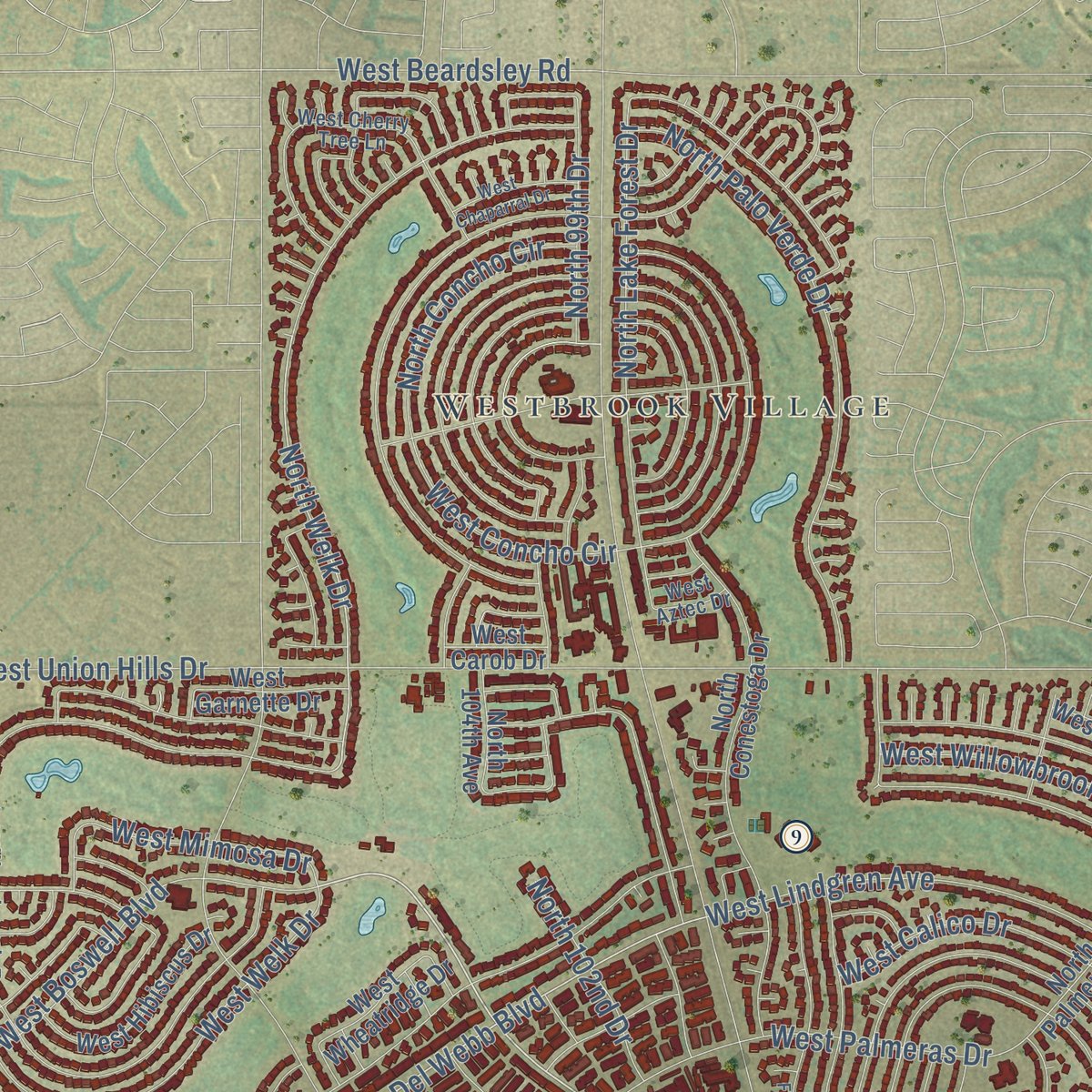
Explore Sun City, Arizona from a whole new perspective. Created using aerial imagery and detailed geographic data, this map captures Sun City building by building, with labeled streets, familiar landmarks, and shaded topographical relief that highlights the natural contours of the landscape.
Combining modern data with the timeless character of a vintage atlas, this map is just as interesting up close as it is beautiful on the wall. Whether you grew up in Sun City, spent memorable years there, or call it home today, this unique map is a great way to celebrate a place that means something to you. Zoom in on the preview to look for your street, and then order a print to put your memories on the wall.

Three ways to hang it
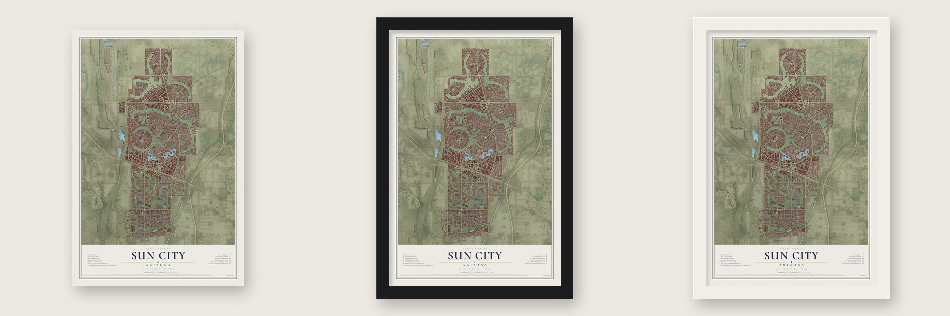
Unframed archival matte, a black wood frame or a white wood frame.
Up close
Geography Worth Displaying
This map was created using accurate cartographic data and authoritative geographic sources, including the U.S. Geological Survey (USGS) and FEMA. The map brings together terrain, waterways, roads, and building detail. The majority of the streets are labeled, houses are accurately depicted, and the topography is derived from government sources. Combining local data with carefully composed color and shading leads to this beautifully detailed Sun City artwork for your wall.
Rather than simply showing street outlines, we’ve included as many of the street names as we could reasonably fit on the map while keeping their names legible. Zoom in on the high resolution preview to see exactly what’s on the map. We truly set out to create a statement piece for anyone who loves Sun City. So whether it’s for you, or a gift for someone you love, we hope this map of Sun City brings back fond memories.
Explore the full map of Sun City, Arizona and read about the local places it shows.
Find your street
Names on the Sun City map
Every name below is printed on this map. Look for your street, your school, the park where you played, or the pond down the road.
Places and landmarks3
- Country Meadows
- Westbrook Village
- White Tanks
Streets and roads181
- North Grand Avenue
- Phoenix-Wickenburg Highway
- North 103rd Avenue
- North Boswell Boulevard
- West Campana Drive
- West Caron Drive
- North 112th Avenue
- North Del Webb Boulevard
- North Welk Drive
- North 102nd Drive
- North Burns Drive
- North 99th Avenue
- West Bell Road
- North 111th Avenue
- North 107th Avenue
- North 105th Avenue
- West Hutton Drive
- North 99th Drive
- West Alabama Avenue
- West Cameo Drive
- North Balboa Drive
- North Lakeforest Drive
- West Union Hills Drive
- West Tropicana Circle
- West Santa Fe Drive
- West Palmeras Drive
- North 109th Avenue
- North Palo Verde Drive
- West Saratoga Circle
- West Cumberland Drive
Show all 181 streets
- West Prairie Hills Circle
- West Pleasant Valley Road
- West Olive Avenue
- West Sun City Boulevard
- West Mountain View Road
- West Burns Drive
- West Peoria Avenue
- North 98th Avenue
- West Willowbrook Drive
- West Pineaire Drive
- West Brookside Drive
- North Agua Fria Drive
- West Roundelay Circle
- West Kingswood Circle
- West Oak Ridge Drive
- West Clair Drive
- West Granada Drive
- North Bolivar Drive
- North Concho Circle
- West Coggins Drive
- West Kelso Drive
- West White Mountain Road
- North Cameo Drive
- West Oakmont Drive
- North Sun Valley Drive
- West El Capitan Circle
- West Bolivar Drive
- West Royal Oak Road
- West Mission Lane
- North Coggins Drive
- West Meade Drive
- West Beardsley Road
- West Desert Rock Drive
- West Riviera Drive
- West Amber Trail
- West Briarwood Circle
- West Talisman Road
- West Audrey Drive
- West Connecticut Avenue
- North Lake Forest Drive
- West Edgewood Drive
- West Boswell Boulevard
- West Salem Drive
- West Sunland Drive
- West Shasta Drive
- West Camelot Circle
- West Welk Drive
- West Lindgren Avenue
- West Pinehurst Drive
- North Country Club Drive
- West Lancaster Drive
- West Hope Drive
- West Mimosa Drive
- West Sierra Dawn Drive
- West Wedgewood Drive
- North McPhee Drive
- West Abbott Avenue
- West Concord Avenue
- 115th Avenue
- North 107th Drive
- West Calico Drive
- West Concho Circle
- West Terrace Lane
- West Thunderbird Boulevard
- North 110th Avenue
- West Loma Blanca Drive
- West Gulf Hills Drive
- West Manzanita Drive
- West Cinnebar Avenue
- West Forrester Drive
- West Deanne Drive
- West Desert Forest Circle
- West Cheryl Drive
- North Conestoga Drive
- West Greenway Road
- West Garnette Drive
- North Augusta Drive
- West Augusta Drive
- North 108th Drive
- West Crosby Drive
- North 106th Avenue
- West Wheatridge Drive
- West El Dorado Drive
- West Snead Drive
- North Rio Vista Drive
- North Newcastle Drive
- North Bowling Green Drive
- North 110th Drive
- West Ironwood Drive
- North 104th Avenue
- West Newport Drive
- West Palmer Drive
- North 103rd Drive
- North Palmeras Lane
- North 100th Avenue
- North 109th Drive
- North Willowbrook Drive
- West Rolling Hills Drive
- West Venturi Drive
- North Calico Drive
- West Denham Drive
- West Hibiscus Drive
- West Hatcher Road
- West Thunderbird Road
- West Twin Oaks Drive
- West Waikiki Drive
- West Carob Drive
- North 114th Drive
- Irish Gold Drive
- North 113th Drive
- North Palm Ridge Drive
- West Arron Drive
- North Meadow Park Drive
- North 101st Avenue
- West Desert Hills Drive
- West Glen Oaks Circle
- West Bright Angel Circle
- North Hacienda Drive
- North Cherry Hills Drive East
- West Bayside Road
- West Cherry Hills Drive West
- West Wrangler Drive
- West Long Hills Drive
- West Shiprock Drive
- West Crestbrook Drive
- North Tan Tara Drive
- West Emerald Drive
- West Wininger Circle
- West Aztec Drive
- North Ridgeview Road
- North Buccaneer Way
- North Blue Ridge Drive
- West Cherry Tree Lane
- North Hawthorn Drive
- West Kolina Lane
- West Camden Avenue
- West Briarwood Circle North
- West Glen Oaks Circle North
- North 105th Drive
- West Pineridge Drive
- West Hidden Valley Circle
- North Foothills Drive
- North Orchard Hills Drive
- West Chaparral Drive
- North 100th Drive
- West Sarabande Circle
- North 102nd Avenue
- North Cedar Drive
- Snead Circle South
- West Fern Drive
- North Pinion Lane
Names are listed as they appear on the printed map. Zoom into the product photos to find them.
About Sun City, Arizona
Sun City is a retirement community of 39,931 people. It lies 16 miles northwest of downtown Phoenix, in Maricopa County. Before Del Webb came, this was farmland around Marinette, a railroad water stop. Two Wisconsin men, R. P. Davie and a partner, each bought 640 acres along the Santa Fe line in 1892 and named the stop after the Wisconsin town they came from. A general store, houses and, in 1912, a post office grew up around it.
In June 1959 the Del E. Webb Development Co. paid over $20 million to James G. Boswell II for 20,000 acres, made up of his ranches at Marinette and Santa Fe. Webb opened his company's first retirement community there on January 1, 1960. Five model homes stood ready, along with a golf course, a recreation center and a shopping center. About 100,000 people came that first weekend, ten times what the planners expected, and Time magazine made it a cover story.
- Sugar beets, cotton and lettuceDavie planted sugar beets in 1918, but the soil could not make them sweet enough. In 1920 he sold out to the Southwest Cotton Company, and in 1936 that company sold the land to J. G. Boswell, who raised cotton and lettuce on it. Marinette later became a ghost town. Its name lives on at the Marinette Recreation Center, and the Del Webb Sun Cities Museum keeps a marker that tells its history.
- A house for a nameWebb first called the project the Marinette Retirement Community. He then held a nationwide contest to name it, with a house as the prize, and picked Sun City. The idea spread across the Sun Belt. Sun City West opened late in the 1970s and Sun City Grand late in the 1990s. Sun City Anthem came next in 1999, and Sun City Festival opened its doors in July 2006.
- The feedlot case of 1972As the new homes spread, smell and flies from a nearby cattle feedlot reached them, and Webb sued. In the 1972 ruling, Spur Industries v. Del E. Webb Development Co., the Arizona Supreme Court found the feedlot a public nuisance that could be shut down. Because Webb had chosen to build beside it, the court ordered Webb to cover the feedlot's losses from moving or closing. First-year law students still study the case in property courses.
- Brewers spring trainingDel Webb built Sun City Stadium, and the Sun City Saints, a women's softball team, opened it by winning a doubleheader on June 17, 1971. The Milwaukee Brewers held spring training there from 1973 to 1985. Two later teams used the park: the Senior Professional Baseball Association's Sun City Rays played there in 1990, and the Arizona Fall League's Mesa Solar Sox in 1992 and 1993. The ballpark came down in 1995.
- A town with no school districtTo hold down taxes, the Sun City Home Owners Association campaigned to keep the community out of every school district. The campaign worked, so children living in Sun City attend schools in the nearby Peoria and Dysart districts.
Keep exploring Arizona
Sun City is one of 528 Arizona towns we've mapped. Every dot on the map is a print of its own.
The search covers every state, Arizona first.
Near Sun City
Order 2 or more town maps and save 10%. Shown in the size and finish you picked above, so they hang as a set.
- Youngtown 12" x 18" / Archival Matte Print $39.99
- El Mirage 12" x 18" / Archival Matte Print $39.99
- Sun City West 12" x 18" / Archival Matte Print $39.99


More maps nearby: Glendale, Litchfield Park, Maryvale, Deer Valley and Surprise.
The art of mapping a place
How This Map Was Made
Real places. Remarkable detail. Discover the layers that turn geographic data into a map of home.

The view from above
Aerial imagery reveals the character of the land: woodland, open fields, and the patterns of a place.

The shape of the land
Elevation data brings hills, valleys, and subtle changes in the landscape into view.

The details of home
Roads, waterways, and building footprints come together to make the map feel unmistakably local.

Geography becomes art
Considered color, shading, and typography bring the layers together in a map made for your wall.


Process illustrated with Mendon, Massachusetts. Aerial imagery: USDA NAIP. Terrain: USGS 3D Elevation Program. Map details and finished artwork: KNOWOL.
The Details
About This Print
Choose an archival matte print, or a black or white Ayous wood frame. The archival matte print is unframed.
Select your size and finish above to see the matching product image and price.
Materials & Craftsmanship
A contemporary map with the character of a classic atlas, printed on archival matte paper. Optional frames are made from Ayous wood.
Your printed map does not include the watermark shown in the full-map preview.
Shipping & Delivery
Free shipping within the United States. Every print is made to order in the USA.
Buying a gift? Add a note in your cart and we'll include it. We never put prices in the package.
Prints ship within 2 to 3 business days. Allow 7 to 10 days total from ordering for delivery. Timing may vary during holidays or periods of high order volume.
Read our shipping policy.
Returns and damaged prints
Each print is made to order. Change-of-mind refunds are not available after production.
If your print arrives damaged, misprinted or incorrect, contact support@knowol.com within 30 days of receiving it. Include your order number, photos and a description of the issue.
Read our full refund and replacement policy. For questions about your order, email support@knowol.com.