
Search for another town






Free U.S. delivery 7 to 10 days after you order
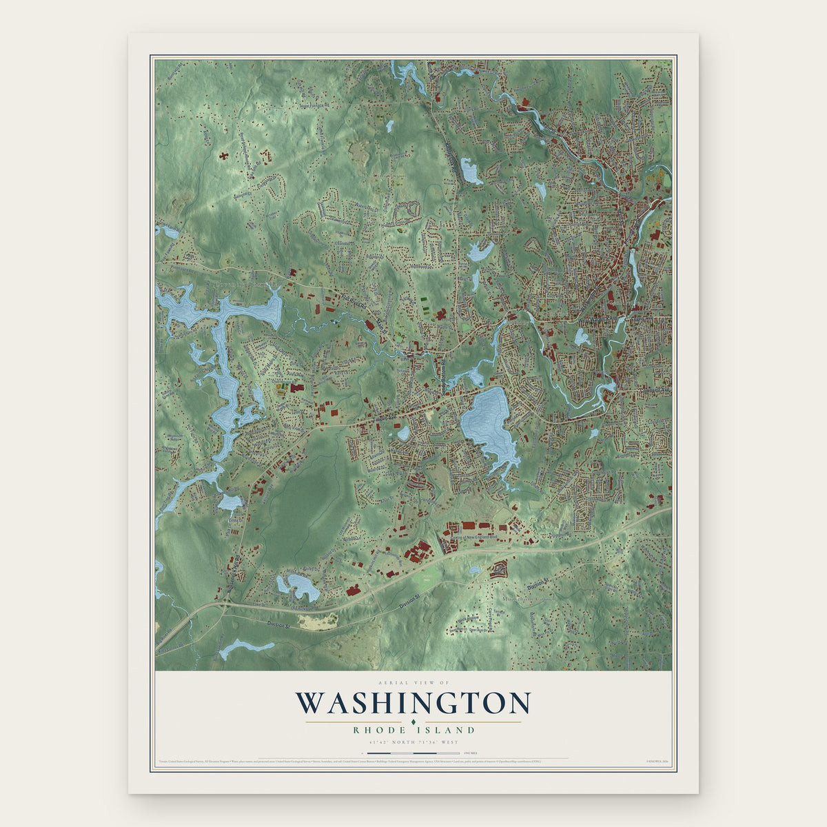
Washington, Rhode Island Map Art
Building by building, with labeled streets and shaded relief.
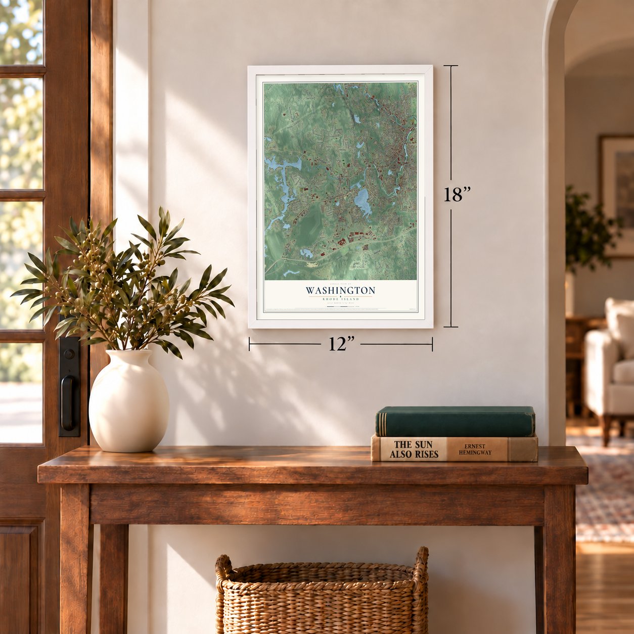
12" x 18" Archival Matte Print
A Map of Home. A Work of Art.
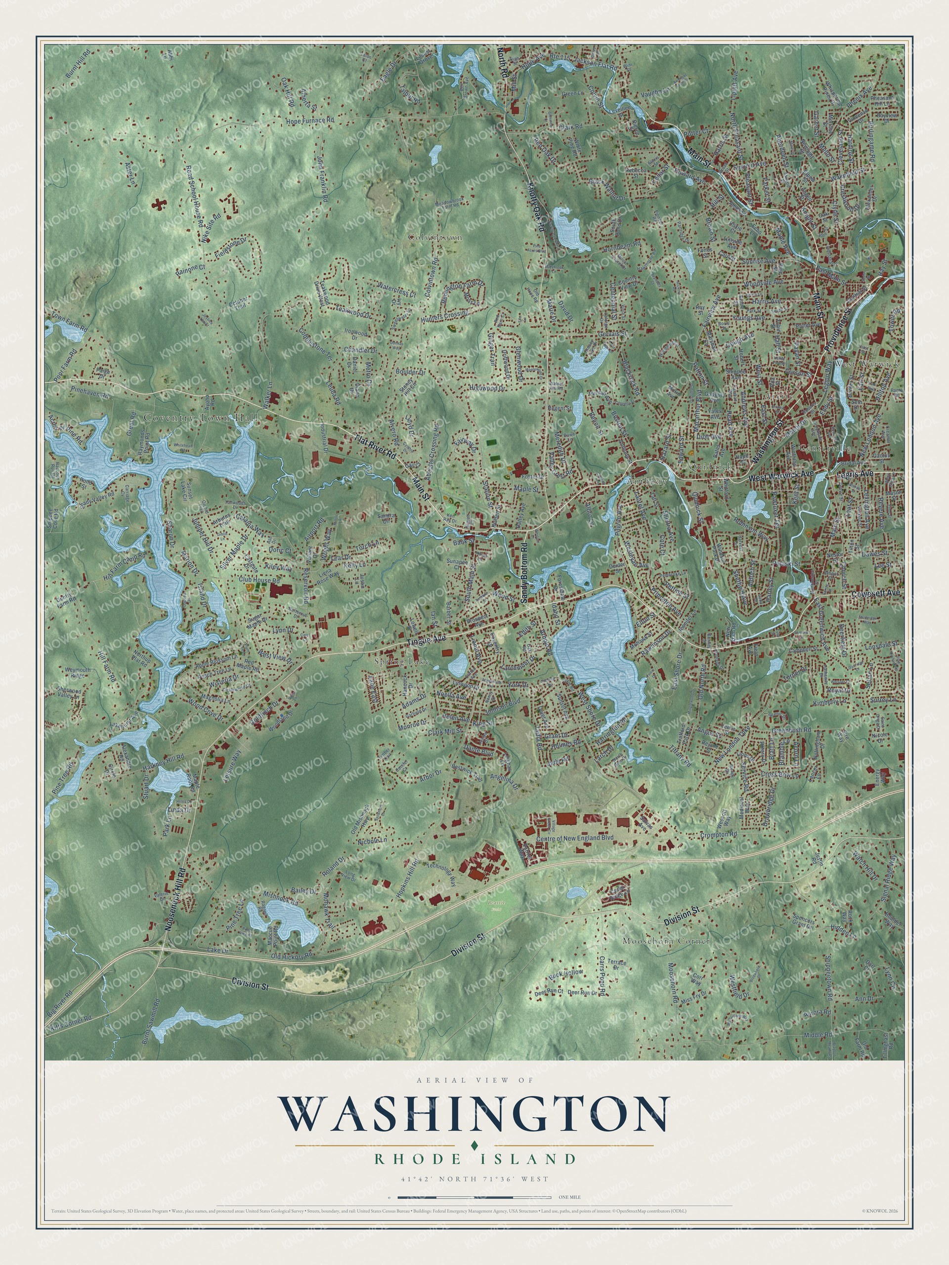
Explore Washington, Rhode Island from a whole new perspective. Created using aerial imagery and detailed geographic data, this map captures Washington building by building, with labeled streets, familiar landmarks, and shaded topographical relief that highlights the natural contours of the landscape.
Combining modern data with the timeless character of a vintage atlas, this map is just as interesting up close as it is beautiful on the wall. Whether you grew up in Washington, spent memorable years there, or call it home today, this unique map is a great way to celebrate a place that means something to you. Zoom in on the preview to look for your street, and then order a print to put your memories on the wall.
Three ways to hang it
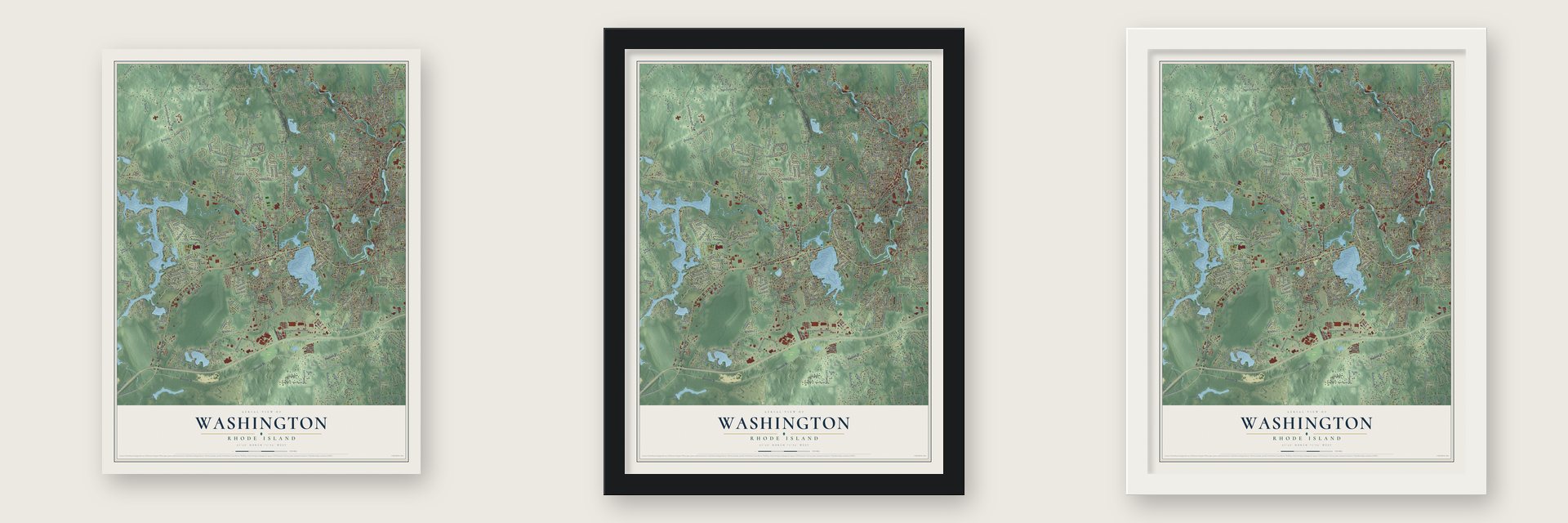
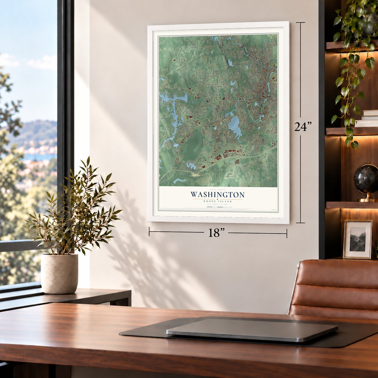
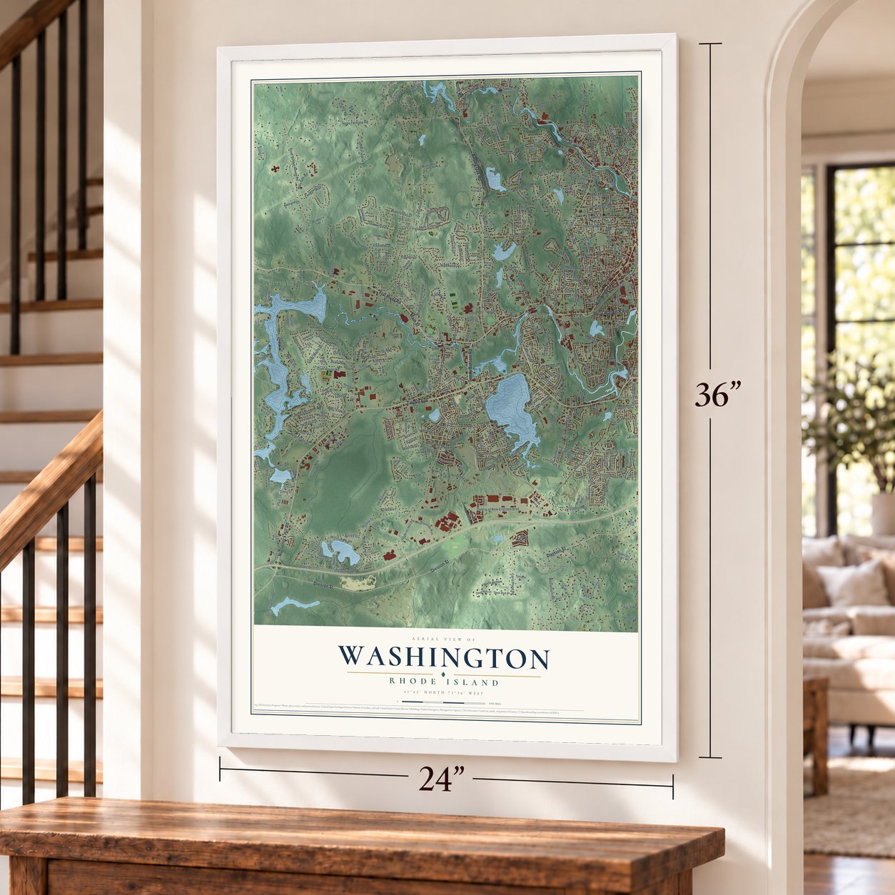
Unframed archival matte, a black wood frame or a white wood frame.
Up close
Geography Worth Displaying
This map was created using accurate cartographic data and authoritative geographic sources, including the U.S. Geological Survey and the Census Bureau. The map brings together terrain, waterways, roads, and building detail. The majority of the streets are labeled, houses are accurately depicted, and the topography is derived from government sources. Combining local data with carefully composed color and shading leads to this beautifully detailed Washington artwork for your wall.
Rather than simply showing street outlines, we’ve included as many of the street names as we could reasonably fit on the map while keeping their names legible. Zoom in on the high resolution preview to see exactly what’s on the map. We truly set out to create a statement piece for anyone who loves Washington. So whether it’s for you, or a gift for someone you love, we hope this map of Washington brings back fond memories.
Read the story behind this map: Detailed Map of Washington, Rhode Island.

Find your street
Names on the Washington map
Every name below is printed on this map. Look for your street, your school, the park where you played, or the pond down the road.
Places and landmarks10
- Coventry Town Hall
- Beattie Field
- West Warwick
- Colvintown
- Anthony
- Spring Lake
- Moosehorn Corner
- Centerville
- Quidnick
- Arctic
Streets and roads509
- Main Street
- Tiogue Avenue
- Providence Street
- Sandy Bottom Road
- Legris Avenue
- Flat River Road
- Division Street
- Nooseneck Hill Road
- Knotty Oak Road
- Washington Street
- West Warwick Avenue
- Cowesett Avenue
- North Road
- Arnold Road
- Hill Farm Camp Road
- Hill Street
- East Main Street
- Legion Way
- Crompton Road
- Arbor Drive
- Hope Avenue
- Sheltra Avenue
- Patton Street
- Centre of New England Boulevard
- New London Turnpike
- Hope Furnace Road
- Hopkins Hill Road
- Colvintown Road
- Mishnock Road
- Middle Road
Show all 509 streets
- Fairview Avenue
- Read School House Road
- Hill Farm Road
- Blackrock Road
- Station Street
- Wood Cove Drive
- Reservoir Road
- Shippeetown Road
- Phenix Avenue
- Carrs Pond Road
- Club House Road
- Teakwood Drive
- Harkney Hill Road
- Howard Avenue
- East Shore Drive
- East Greenwich Avenue
- Wisteria Drive
- New London Avenue
- Read Avenue
- Pulaski Street
- Fieldstone Drive
- Ginger Trail
- Westfield Drive
- South Main Street
- Fairway Drive
- John Franklin Road
- Wakefield Street
- Cobblestone Terrace
- Eagle Drive
- Hunters Crossing
- Lake Drive
- Clark Road
- West Street
- Moosehorn Road
- Pinehaven Road
- Boston Street
- Greenbush Road
- Princeton Avenue
- Pilgrim Avenue
- Town Farm Road
- Walker Lane
- Watch Hill Drive
- Old North Road
- Youngs Avenue
- Gough Avenue
- Macarthur Boulevard
- Tiffany Road
- Colvin Street
- Harris Avenue
- Leuba Road
- Lonsdale Street
- Hornbeam Road
- Highwood Drive
- Summit Avenue
- Kiley Way
- Johnson Boulevard
- Andrews Avenue
- Maple Avenue
- Quidnick Street
- Monroe Drive
- Earl Street
- Woodside Avenue
- Watercress Court
- Burnt Sawmill Road
- Signal Ridge Way
- Clyde Street
- Remington Farm Drive
- Lear Drive
- Pawtuxet Terrace
- Red Oak Drive
- Dante Boulevard
- Route 115
- Gervais Street
- Jackson Flat Road
- Burnt Hill Road
- Revere Avenue
- Burlingame Road
- Clark Mill Street
- Church Street
- Helen Avenue
- Lynn Circle
- York Drive
- Laurel Avenue
- Drawbridge Drive
- Wood Street
- Chandler Drive
- Island Drive
- Linda Drive
- Setian Lane
- Black Walnut Drive
- Mill Street
- Kimberly Lane
- Angelina Drive
- Sharon Drive
- Harley Street
- Wesleyan Avenue
- Goldfinch Drive
- Crestwood Drive
- Airport Road
- Lydia Road
- Harding Street
- Abbotts Crossing Road
- Robinson Way
- West View Drive
- Lippitt Avenue
- Mohawk Trail
- Leisure Way
- Acorn Lane
- Torch Lane
- David Drive
- Silver Maple Drive
- Hazard Street
- Great Road
- Brown Street
- Catalpa Way
- Poor Farm Road
- West Shore Drive
- Doric Court
- Nike Site Road
- Parker Street
- Maple Street
- Sunrise Avenue
- Wright Way
- Juniper Hill Drive
- Deerfield Drive
- Aster Lane
- Talbut Road
- Metro Drive
- Curson Street
- Lexington Avenue
- Cross Bow Lane
- North Pleasant Street
- Kitts Corner Road
- Manor Drive
- Ann Drive
- Rawlinson Drive
- Cedar Street
- Pine Tree Road
- Pine Tree Lane
- Pettine Street
- Benoit Street
- Acres of Pine Road
- Aberdeen Street
- Sheffield Avenue
- Old Hickory Road
- Big River Road
- Oak Hill Road
- Cleveland Street
- Harrington Road
- Edward Street
- Harris Street
- Marie Drive
- Valley Crest Road
- Vaughn Lane
- Roland Drive
- Alvero Road
- Lionel Avenue
- Tower Road
- Bailey Drive
- Buck Hollow
- Hilltop Avenue
- Lloyd Drive
- Marion Drive
- Dawes Street
- Centennial Street
- Angus Street
- Noella Avenue
- Bank Street
- Meredith Drive
- Grant Drive
- Larch Drive
- Pleasant Street
- Knight Street
- Lynn Drive
- Garnet Street
- Bratt Lane
- Surrey Lane
- King Street
- Service Road
- East Street
- Larchmont Drive
- Adams Drive
- Nichole Lane
- Stuart Drive
- Hidden Lane
- Rainone Court
- Glenwood Drive
- Holmes Road
- Park Lane
- Edith Street
- Turner Drive
- Albro Lane
- Payan Street
- Bramble Lane
- Lane East
- Jade Road
- Aldrich Street
- Eddy Street
- Leaf Street
- Lee Street
- Boulder Drive
- Kelly Lane
- Mello Street
- Kent Street
- Potter Court
- Aurora Road
- Alberta Street
- Idaho Street
- Cote Court
- Dion Avenue
- Hall Street
- Royal Drive
- Hay Street
- Elton Street
- Ian Street
- Patriot Way
- Shady Valley Road
- Leveillee Street
- Locust Grove
- Teakwood Drive West
- Sherwood Valley Lane
- Raymonds Point Road
- Ironwood Drive
- Windsor Park Drive
- South Pond Drive
- Miss Fry Drive
- Liena Rose Way
- Magnolia Lane
- Ayoho Road
- Northup Plat Road
- Sugar Maple Drive
- Lakehurst Avenue
- Deer Run Drive
- Woodland Drive
- Sunset Avenue
- Bates Avenue
- Shippee Avenue
- Bridal Avenue
- Pond Street
- Border Street
- Medieval Way
- Nottingham Drive
- Coventry Drive
- Technology Way
- Whispering Pines Drive
- Daniel Drive
- Mohawk Street
- Echo Lane
- Gadoury Avenue
- Ray Street
- Weymouth Ridge
- Marshall Circle
- Cedar Ridge Lane
- Sunset Lake Circle
- Hillside Avenue
- Old Mishnock Highway
- Apple Blossom Lane
- Pheasant Hill Lane
- Taft Street
- Linwood Drive
- Paige Drive
- Ames Street
- Kinne Street
- Oak Street
- Shippee Cove Road
- Peach Tree Lane
- Lowell Street
- Potter Avenue
- Green Lane
- Campbell Street
- Rock Way
- Maple Root Road
- Gentry Farm Road
- Yates Avenue
- Leighas Lane
- Driftwood Drive
- Eastgate Drive
- Pine Street
- Winthrop Avenue
- Spencers Grant Drive
- Hancock Drive
- Stoney Hill Circle
- Arbutus Trail
- Bestwick Trail
- Rotary Drive
- Industrial Drive
- Diane Drive
- Maccue Point Road
- Country View Drive
- Nicole Drive
- White Pine Road
- Boulder Way
- Valiant Drive
- Circle Drive
- Hebert Street
- Rebecca Street
- New Dam Road
- Lemis Street
- Deer Run Court
- Prospect Avenue
- October Trail
- Holden Street
- Lions Drive
- Trafford Park Drive
- Puritan Avenue
- Jennifer Lane
- Sandra Circle
- Alexandre Road
- Sunapee Court
- Angell Street
- Bayview Drive
- Battey Avenue
- Tillinghast Road
- Central Street
- Pierce Street
- Forestdale Drive
- Anthony Street
- Rejane Street
- Alexander Drive
- Terrace Drive
- Newlight Street
- Moss Lane
- Old Farm Road
- Foster Drive
- Tobin Street
- Wescott Way
- Sire Way
- Regent Street
- Barber Street
- Red Maple Road
- Vincenzo Drive
- Whitford Street
- Melrose Street
- Quiet Avenue
- Mason Street
- Energy Way
- Field Avenue
- Cactus Street
- Salvas Avenue
- Lancer Lane
- Hoxie Court
- Gail Court
- Justin Road
- Card Street
- Nestor Street
- Corr Way
- Dexter Street
- Tilton Street
- Abbi Lane
- Justin Lane
- Elbow Street
- Morin Avenue
- Ivy Drive
- Hope Court
- Fones Street
- Rita Street
- Seth Drive
- Darl Court
- Woodmist Circle
- Roberts Street
- Pembroke Lane
- Timber Trail
- Brookside Avenue
- Ben Brown Avenue
- Circlewood Drive
- Centre Street
- Manchester Street
- South Street
- Scenic Drive
- Osprey Drive
- Industrial Lane
- Sweetwater Drive
- Breezy Lake Drive
- Broad Street
- Hathaway Drive
- Viola Street
- Laforge Drive
- Raccoon Run Road
- Atwood Street
- Hawthorne Road
- Meadowbrook Farm Road
- Calahan Way
- Perkins Street
- Vine Street
- Ragnell Road
- Park Street
- Old Hope Road
- Kennedy Drive
- Orchid Trail
- Garfield Drive
- Mount Laurel Drive
- Partridge Drive
- Saint Onge Drive
- Wendy Drive
- Alexis Street
- Ken Ray Drive
- High Street
- School Street
- West Glen Lane
- Nancy Street
- Tallwoods Drive
- Valerie Drive
- Butternut Drive
- Clifton Avenue
- Carriage Cv
- Long View Drive
- North Glen Drive
- Dixie Road
- First Street
- Dawn Lane
- Creamer Avenue
- Oak Road
- Red Barn Court
- Harvest Drive
- Walnut Hill Road
- Pioneer Road
- Doris Street
- Conifer Court
- Newell Court
- Panto Road
- Bonney Street
- Jaclyn Drive
- Kilton Lane
- Talon Court
- Lada Drive
- Wini Street
- Ash Drive
- Park Boulevard
- Valley View Drive
- Helen Drive
- Village Green Circle
- Whitehead Road
- McPartland Way
- Knotty Oak Shrs
- Cynthia Drive
- Doolittle Street
- Pine Orchard Road
- Milton Lane
- Pond View Drive
- Giblin Lane
- Sycamore Drive
- Minglewood Drive
- Maplewood Drive
- Ottawa Street
- Rathbun Street
- Capwell Avenue
- Esmond Street
- Epworth Avenue
- Colonial Road
- Congdon Street
- Junior Street
- Oakridge Drive
- Spring Street
- Peters Lane
- Plum Tree Lane
- Brayton Meadows
- Reynolds Court
- Pond View Court
- Angelwood Road
- Ethel Street
- Awkright Farm Road
- Whisper Court
- Marybrook Lane
- Sturbridge Way
- Brookfield Court
- Pine Acres Boulevard
- Jessica Lee Court
- Hickory Road
- Glenview Court
- Doray Drive
- Tyler Street
- Miller Drive
- Whipple Court
- Ferris Drive
- Bishop Street
- Donnas Way
- Carol Court
- Viero Lane
- Silo Lane
Names are listed as they appear on the printed map. Zoom into the product photos to find them.
Keep exploring Rhode Island
Washington is one of 86 Rhode Island towns we've mapped. Every dot on the map is a print of its own.
The search covers every state, Rhode Island first.
Near Washington
Order 2 or more town maps and save 10%. Shown in the size and finish you picked above, so they hang as a set.
- West Warwick 12" x 18" / Archival Matte Print $39.99
- Hope 12" x 18" / Archival Matte Print $39.99
- East Greenwich 12" x 18" / Archival Matte Print $39.99


More maps nearby: Coventry, Frenchtown, West Greenwich, Cranston and Warwick.
The art of mapping a place
How This Map Was Made
Real places. Remarkable detail. Discover the layers that turn geographic data into a map of home.

The view from above
Aerial imagery reveals the character of the land: woodland, open fields, and the patterns of a place.

The shape of the land
Elevation data brings hills, valleys, and subtle changes in the landscape into view.

The details of home
Roads, waterways, and building footprints come together to make the map feel unmistakably local.

Geography becomes art
Considered color, shading, and typography bring the layers together in a map made for your wall.


Process illustrated with Mendon, Massachusetts. Aerial imagery: USDA NAIP. Terrain: USGS 3D Elevation Program. Map details and finished artwork: KNOWOL.
The Details
About This Print
Choose an archival matte print, or a black or white Ayous wood frame. The archival matte print is unframed.
Select your size and finish above to see the matching product image and price.
Materials & Craftsmanship
A contemporary map with the character of a classic atlas, printed on archival matte paper. Optional frames are made from Ayous wood.
Your printed map does not include the watermark shown in the full-map preview.
Shipping & Delivery
Free shipping within the United States. Every print is made to order in the USA.
Buying a gift? Add a note in your cart and we'll include it. We never put prices in the package.
Prints ship within 2 to 3 business days. Allow 7 to 10 days total from ordering for delivery. Timing may vary during holidays or periods of high order volume.
Read our shipping policy.
Returns and damaged prints
Each print is made to order. Change-of-mind refunds are not available after production.
If your print arrives damaged, misprinted or incorrect, contact support@knowol.com within 30 days of receiving it. Include your order number, photos and a description of the issue.
Read our full refund and replacement policy. For questions about your order, email support@knowol.com.